Category:Ackergill
Jump to navigation
Jump to search
English: Ackergill is a settlement in the Wick, Caithness, in the Highland Council area of Scotland.
human settlement in Highland, Scotland, UK | |||||
| Upload media | |||||
| Instance of | |||||
|---|---|---|---|---|---|
| Location |
| ||||
 | |||||
Media in category "Ackergill"
The following 29 files are in this category, out of 29 total.
-
 A second Ice House, Ackergill Harbour - geograph.org.uk - 575151.jpg 640 × 480; 105 KB
-
 Aberdeen Angus bull - geograph.org.uk - 479253.jpg 640 × 480; 117 KB
-
 Access to Gillfield - geograph.org.uk - 479230.jpg 640 × 480; 118 KB
-
 Access to Lower Gillock farm - geograph.org.uk - 479224.jpg 540 × 384; 52 KB
-
 Ackergill Harbour - geograph.org.uk - 24853.jpg 640 × 480; 71 KB
-
 Ackergill Harbour - geograph.org.uk - 575149.jpg 640 × 480; 73 KB
-
 Ackergill Mains Standing Stone.jpg 480 × 640; 96 KB
-
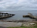
 Ackergillshore slipway - geograph.org.uk - 1428647.jpg 640 × 427; 69 KB
-
 Bungalows at Ackergill - geograph.org.uk - 902873.jpg 640 × 347; 48 KB
-
 Disused filling station - geograph.org.uk - 781941.jpg 640 × 317; 55 KB
-
 Footbridge - geograph.org.uk - 232128.jpg 640 × 480; 113 KB
-
 Harland - geograph.org.uk - 479244.jpg 640 × 480; 118 KB
-
 Hill of Harland - geograph.org.uk - 479243.jpg 537 × 383; 54 KB
-
 Ice House, Ackergill Harbour - geograph.org.uk - 575150.jpg 640 × 480; 110 KB
-
 Memorial at site of Skitten Airfield - geograph.org.uk - 654739.jpg 640 × 480; 79 KB
-
 Milton - geograph.org.uk - 544672.jpg 640 × 480; 88 KB
-
 Number two - geograph.org.uk - 479236.jpg 640 × 480; 114 KB
-
 Operation Freshman memorial - geograph.org.uk - 654746.jpg 640 × 480; 106 KB
-
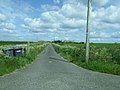
 Path from Ackergill to Girnigoe.jpg 640 × 480; 90 KB
-
 Piebald horse - geograph.org.uk - 479228.jpg 640 × 480; 118 KB
-
 Quad Biking at the Quoys of Reiss - geograph.org.uk - 1749.jpg 548 × 278; 35 KB
-

-
 Sheep and river - geograph.org.uk - 543245.jpg 640 × 480; 71 KB
-
 Sibster Cottages - geograph.org.uk - 479233.jpg 539 × 332; 49 KB
-
 The White Cottage, Gillock - geograph.org.uk - 479238.jpg 640 × 480; 117 KB
-
 Upper Gillock - geograph.org.uk - 479226.jpg 640 × 480; 116 KB
-
 View across Biggins - geograph.org.uk - 479252.jpg 406 × 469; 55 KB
-
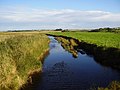 Wick River - geograph.org.uk - 232131.jpg 640 × 480; 88 KB
-
 Dry stone wall - geograph.org.uk - 544657.jpg 640 × 480; 110 KB


