Category:A New and Correct Map of the Whole World (Moll)
Jump to navigation
Jump to search
Media in category "A New and Correct Map of the Whole World (Moll)"
The following 8 files are in this category, out of 8 total.
-
-

-
-
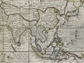
 Moll - A new and correct map of the whole World.png 2,023 × 1,200; 5.32 MB
-
 Moll World Map 1719 Alignment with modern map outline.jpg 9,672 × 5,735; 16.07 MB
-
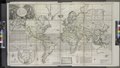
 Moll World Map 1719 master-gmd-gmd3-g3200-g3200-ct007070.jpg 14,576 × 8,827; 52.03 MB
-
 Moll World Map 1719 master-gmd-gmd3-g3200-g3200-mf000001Z Atlantic.jpg 3,447 × 4,317; 4.55 MB
-
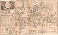
 Moll World Map 1719 master-gmd-gmd3-g3200-g3200-mf000001Z.jpg 14,508 × 8,602; 62.85 MB


Categories:
- Maps by Herman Moll
- Maps with Mercator projection
- 1710s maps of the world
- Island of California on world maps
- Maps connecting Australia and New Guinea
- Maps of the world without Antarctica
- Van Diemen's Land
- Carpentaria
- Maps connecting Hokkaido and Asia
- Company Land
- Staten Island (Pacific)
- Maps of voyages
- Tetragrammaton on maps
- Magnetic field maps of the world
- Maps of trade winds
- Sea of Japan naming dispute
- Lake Chimay
- Terra incognita