Category:21st-century maps of Portugal
Jump to navigation
Jump to search
Countries of Europe: Albania · Armenia‡ · Austria · Azerbaijan‡ · Belarus · Belgium · Bosnia and Herzegovina · Bulgaria · Croatia · Cyprus‡ · Czech Republic · Denmark · Finland · France‡ · Georgia‡ · Germany · Greece · Hungary · Iceland · Republic of Ireland · Italy · Kazakhstan‡ · Lithuania · Luxembourg · Moldova · Montenegro · Netherlands‡ · Norway · Poland · Portugal‡ · Romania · Russia‡ · Serbia · Slovakia · Slovenia · Spain‡ · Sweden · Switzerland · Turkey‡ · Ukraine · United Kingdom
Specific status: Isle of Man
‡: partly located in Europe
Specific status: Isle of Man
‡: partly located in Europe
Subcategories
This category has the following 4 subcategories, out of 4 total.
- 2000s maps of Portugal (44 F)
Media in category "21st-century maps of Portugal"
The following 9 files are in this category, out of 9 total.
-
 Aldeias-extintas-do-concelho-de-Vila-do-Bispo.jpg 663 × 400; 24 KB
-
 CCFL12E.png 1,010 × 669; 181 KB
-
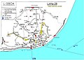 Lisboa Linha 28 NEU3.JPG 1,200 × 861; 150 KB
-
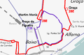
 Maxibombo28E.png 787 × 343; 69 KB
-
 PT-exCCFL(eletricos).svg 5,160 × 2,940; 1.5 MB
-
 Tram 28E and 12E Lisbon 2011.png 2,493 × 1,655; 519 KB
-
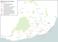
 Tram map Lisbon 2011.png 4,058 × 2,000; 828 KB
-
 Tram tracks map Lisbon.png 3,494 × 2,521; 812 KB
-
 TramCCFLmapa(pt).svg 1,258 × 908; 1.66 MB


.svg)


.svg)