Category:2016 Arizona election maps
Jump to navigation
Jump to search
States of the United States: Arizona · California · Illinois · Iowa · Kentucky · Michigan · New York · North Carolina · Ohio · Pennsylvania · South Carolina
Subcategories
This category has only the following subcategory.
Media in category "2016 Arizona election maps"
The following 11 files are in this category, out of 11 total.
-
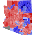 2016 AZ Senate.svg 810 × 810; 5.18 MB
-
 2016 President in AZ.svg 810 × 810; 5.88 MB
-

-
 Arizona 2016 presidential results by county.png 1,337 × 1,324; 640 KB
-
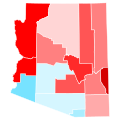
 Arizona County Swing 2016.svg 744 × 744; 155 KB
-
 Arizona County Trend 2016.svg 744 × 744; 155 KB
-

-
 Arizona Presidential Election Results 2016.svg 810 × 810; 17 KB
-

-
 Arizona U.S. Senate Republican primary, 2016.svg 810 × 810; 17 KB
-
 AZ-16-pres-districts.svg 810 × 810; 145 KB


