Category:2015 aerial photographs of Canada
Jump to navigation
Jump to search
Media in category "2015 aerial photographs of Canada"
The following 131 files are in this category, out of 131 total.
-
 2015-09-06 01 Flat terrain coming into Gjoa Haven Airport (YHK).jpg 6,000 × 4,000; 11.95 MB
-
 A clear view of the Canadian side and Goat Island (27861102076).jpg 4,928 × 3,264; 3.97 MB
-

-
 A View of the Frozen Waterways and Tundra as Secretary Kerry Arrives in Iqaluit, Canada.jpg 4,910 × 3,268; 4.18 MB
-
 Aerial view of Dorval Island.jpg 3,979 × 2,652; 2.12 MB
-
 Aerial view of Lac du Chevreuil.jpg 3,981 × 2,654; 3.58 MB
-
 Amherstburg, Ontario (21514585500).jpg 4,000 × 3,000; 2.75 MB
-
 Amherstburg, Ontario (21676451896).jpg 2,950 × 2,210; 2.58 MB
-
 Amherstburg, Ontario (21702556395).jpg 4,000 × 3,000; 3.03 MB
-
 Amherstburg, Ontario (21711771721) (cropped 3-5).jpg 3,300 × 1,980; 1.71 MB
-
 Amherstburg, Ontario (21711771721) (cropped).jpg 3,300 × 1,100; 961 KB
-
 Amherstburg, Ontario (21711771721).jpg 4,000 × 3,000; 2.9 MB
-
 Approaching the Niagara River (27861128816).jpg 4,928 × 3,264; 3.33 MB
-
 As far as the eye can see (16453301680).jpg 2,500 × 1,875; 1.28 MB
-
 BC from the Sky (19065271298).jpg 1,672 × 2,816; 885 KB
-
 Bridge leading from Canada to the USA (27819348811).jpg 4,928 × 3,264; 3.96 MB
-
 British Mountains Vuntut NP.jpg 1,600 × 1,200; 1.72 MB
-
 Burnaby BC Aerial view 2015.jpg 4,928 × 3,264; 8.23 MB
-
 BVSC RESORT OVERVIEW AERIAL lo.jpg 300 × 136; 80 KB
-
 Canadian Coast Guard Ship Griffon breaks ice in Lake Erie 150219-G-ZZ999-006.jpg 1,024 × 768; 287 KB
-
 Canadian side of the Niagara Falls (27794907712).jpg 4,928 × 3,264; 3.91 MB
-
 Caribou in British Mountains.jpg 1,600 × 1,200; 1.82 MB
-
 Central Alberta.JPG 4,912 × 3,264; 5.8 MB
-
 Detroit River Draining Into Lake Erie, Michigan (21691142062).jpg 4,000 × 3,000; 2.85 MB
-
 Downtown Toronto, Ontario (506141) (26317558435).jpg 3,726 × 2,482; 4.07 MB
-
 Edmonton conservatory.jpg 1,280 × 720; 459 KB
-
 Essex County, Ontario (21514674370).jpg 4,000 × 3,000; 2.11 MB
-
 Essex County, Ontario (21514760668).jpg 4,000 × 3,000; 2.21 MB
-
 Exercise Vigilant Shield 16 (7).jpg 4,928 × 3,280; 7.89 MB
-
 Fighting Island, LaSalle, Ontario (21079792884).jpg 3,720 × 2,790; 5.3 MB
-
 Flight from YVR to YKA - (22812778145).jpg 8,080 × 5,387; 21.57 MB
-

-
 Flying over fields- it was pretty hot in there (27617837520).jpg 4,928 × 3,264; 4.15 MB
-
 Foggy Morning Aerial - Leduc AB (28537075683).jpg 1,200 × 800; 651 KB
-
 Fraser Valley Panorama 4.jpg 13,750 × 4,770; 28.87 MB
-
 Galiano Island from above.jpg 3,405 × 2,282; 726 KB
-
 Galiano Island WV banner.jpg 3,405 × 487; 241 KB
-
 Game over- back to base (27861078456).jpg 4,928 × 3,264; 4.55 MB
-
 Holy Sepulchre Catholic Cemetery (20491714812).jpg 2,902 × 1,708; 4.08 MB
-
 Humber College North Campus From The Air - 2.jpg 2,448 × 3,264; 2.2 MB
-
 Inuvik town center.jpg 3,264 × 1,958; 5.56 MB
-
 It took some time to get used to the vertical takeoff! (27283617263).jpg 4,928 × 3,264; 4.64 MB
-
 Knox Church - Waterdown Ontario (20574093956).jpg 3,412 × 2,466; 6.47 MB
-
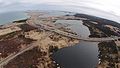
 Lac à Paul Future Mine Site.jpeg 2,816 × 1,880; 1.87 MB
-
 Lake in Old Crow Flats Vuntut NP.jpg 1,600 × 1,200; 2.12 MB
-
 Light Fog and Snow Aerial - Outside Edmonton (29078193531).jpg 2,400 × 1,600; 1.74 MB
-
 Lufa Farms Aerial view of Montreal rooftop greenhouse3zoom.jpg 1,280 × 847; 416 KB
-
 Lévis, Québec - panoramio.jpg 3,636 × 2,101; 1.63 MB
-
 MacDonald Turkey Point Marina.jpeg 2,992 × 1,823; 967 KB
-
 Mississauga Lakeshore (22878577912).jpg 3,990 × 2,241; 4.53 MB
-
 Mississauga Waterfront (23044820826).jpg 3,992 × 2,242; 5.48 MB
-
 Mississauga, Ontario (506137) (26280046956).jpg 3,967 × 2,231; 2.82 MB
-
 Mississauga, Ontario (506138) (26280041426).jpg 3,946 × 2,222; 3.66 MB
-
 Montreal from above Mont Royal.jpg 3,992 × 2,661; 3.78 MB
-
 Montreal – Beauharnois - panoramio.jpg 3,992 × 2,424; 3.39 MB
-
 Nearing St. John's, Nfl (26985015874).jpg 4,608 × 3,456; 3.56 MB
-
 Niagara Falls come into view- Wow! (27617805220).jpg 4,928 × 3,264; 3.95 MB
-
 Niagara Falls- another aerial view (27617814850).jpg 4,928 × 3,264; 4.45 MB
-
 Niagara town on the Canadian side (27283451504).jpg 4,928 × 3,264; 3.94 MB
-
 North of Old Crow Flats.jpg 2,643 × 1,585; 3.17 MB
-
 North Saskatchewan River Foggy Aerial (28534086854).jpg 2,400 × 1,600; 1.03 MB
-
 Northern Alberta Forests Aerial (28534083144).jpg 2,400 × 1,600; 2.67 MB
-
 Not sure if that is Prince Edward Island (27595241215).jpg 4,608 × 3,456; 4.41 MB
-
 Now you see why they sometimes call it the horse shoe falls (27896077725).jpg 4,928 × 3,264; 3.99 MB
-
 ON400sAtON401ewTorontoAerial (27839427733).jpg 1,200 × 1,800; 901 KB
-
 ON401 Exit 357 - Weston Road (28455423675).jpg 1,200 × 800; 651 KB
-
 ON401DixonRoadTorontoAerial (27839419623).jpg 1,200 × 800; 648 KB
-
 ON401ewON404nsInterchangesToronto-Aerial-May2015 (27839429063).jpg 1,200 × 800; 759 KB
-
 ON401nearWestonRoad-FacingSouthAerial (28172578200).jpg 1,200 × 800; 694 KB
-
 ON427sCurveAtYYZlandingAerial (27839426543).jpg 1,200 × 800; 586 KB
-
 Ontario Farmland (18632603183).jpg 1,920 × 1,080; 133 KB
-
 Ontario Highway 407 Construction at Harmony Road.JPG 3,264 × 2,448; 1.2 MB
-
 Peter A. Allard School of Law.jpg 4,928 × 3,280; 11.11 MB
-
 Port of Argentia and adjacent upland property.jpg 4,384 × 2,466; 2.36 MB
-
 Pycon 2015 (17072145577).jpg 1,920 × 2,560; 1.7 MB
-
 Québec - Pont de l'Île-d'Orléans - panoramio (1).jpg 4,000 × 3,000; 2.14 MB
-
 Québec - Pont de l'Île-d'Orléans - panoramio.jpg 4,000 × 3,000; 1.91 MB
-
 Québec - Saint-Pierre-de-l'Île-d'Orléans - panoramio.jpg 4,000 × 3,000; 2.3 MB
-
 Québec City - Aéroport international Jean-Lesage - panoramio.jpg 4,000 × 3,000; 2.3 MB
-
 Québec City - Cap-Rouge Railroad Trestle - panoramio.jpg 4,000 × 2,655; 3.18 MB
-
 Québec City - Institut Universitaire en santé mentale de Québec - panoramio (1).jpg 3,635 × 2,017; 1.69 MB
-
 Québec City - Institut Universitaire en santé mentale de Québec - panoramio.jpg 4,000 × 3,000; 3.89 MB
-
 Québec City - Lac Saint-Augustin – Nord - panoramio.jpg 4,000 × 3,000; 3.03 MB
-
 Québec City - Les Grands-Déserts - panoramio.jpg 4,000 × 3,000; 2.78 MB
-
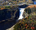 Québec City - Montmorency-Fall - panoramio (1).jpg 3,397 × 2,859; 2.16 MB
-
 Québec City - Syndicat des Employés du Centre Hospitalier St-Augustin - panoramio.jpg 4,000 × 3,000; 2.83 MB
-
 Québec City – Autoroute Felix-Leclerc - Boulevard des Chutes - panoramio.jpg 2,374 × 1,437; 927 KB
-
 Québec City – Centre Vidéotron - panoramio (1).jpg 4,000 × 3,000; 1.64 MB
-
 Rankin Inlet From Air.jpg 3,264 × 2,448; 804 KB
-
 Riverdale (21997753533).jpg 3,482 × 1,469; 2.88 MB
-
 Rogers Centre and CN Tower, Toronto (506142) (26317543735).jpg 1,237 × 1,649; 1.01 MB
-
 Skirting Halifax, I think? (27522606161).jpg 4,608 × 3,456; 4.42 MB
-
 Skylon Tower (21962790880).jpg 1,600 × 1,247; 714 KB
-
 Soaring high above the fields (27861130866).jpg 4,928 × 3,264; 3.91 MB
-
 Source of the Detroit River at Lake St. Clair, Detroit Michigan (21514444320).jpg 3,540 × 2,660; 5.03 MB
-
 STMFIeld.jpg 960 × 522; 56 KB
-
 Stunning views made us forget the cramped interior (27861096366).jpg 4,928 × 3,264; 4.02 MB
-
 Sunset (22630165341).jpg 3,865 × 2,653; 4.92 MB
-
 Sunset above Canada.jpg 6,016 × 4,000; 2.31 MB
-
 Taking off over the delightful greenery around Ottawa (26985063514).jpg 4,608 × 3,456; 3.54 MB
-
 The Centre of the Universe (18536544902).jpg 3,840 × 2,160; 4.47 MB
-
 The Detroit River Between Detroit, Michigan and Windsor, Ontario (21702477435).jpg 3,000 × 4,000; 2.46 MB
-
 The Detroit River Between Detroit, Michigan and Windsor, Ontario (21711721771).jpg 2,950 × 3,940; 6.69 MB
-
 The Gatineau District in the distance.jpg 4,288 × 2,848; 2.95 MB
-
 The Mississaugua Golf and Country Club, Mississauga (506140) (26280052746).jpg 3,037 × 1,904; 2.81 MB
-
 The spray rises up like a dragon (27283772264).jpg 4,928 × 3,264; 3.15 MB
-
 Thunder Bay International Airport (YQT) (25351928376).jpg 5,760 × 3,840; 12.43 MB
-
 To the left is Goat Island- and you can see the Hornblower boat in there! (27617817980).jpg 4,928 × 3,264; 3.91 MB
-
 Toronto (22807829302).jpg 3,985 × 2,238; 6.82 MB
-
 Toronto From The Sky (18883555268).jpg 2,816 × 2,112; 2.83 MB
-
 Toronto From The Sky (19071243795).jpg 2,816 × 2,112; 2.84 MB
-
 Toronto From The Sky (25112368891).jpg 2,816 × 2,112; 4.51 MB
-
 TorontoLesterPearsonAirportAerial-May2015 (28172581550).jpg 1,200 × 800; 561 KB
-
 Upwards Aircraft Sculpture YMM (29122634766).jpg 1,200 × 800; 611 KB
-
 Vineyards and the road we came on (27861133686).jpg 4,928 × 3,264; 4.42 MB
-
 We are almost over the falls now (27283603973).jpg 4,928 × 3,264; 4.09 MB
-
 We are descending, but can't see land at all! (27318215660).jpg 4,608 × 3,456; 2.56 MB
-
 We now fly over the town of Niagara Falls on the Canadian side (27896090585).jpg 4,928 × 3,264; 3.88 MB
-
 We now take a full turn to face the Niagara Falls head-on (27794909592).jpg 4,928 × 3,264; 4.38 MB
-
 Windsor, Ontario (21079796834).jpg 4,000 × 3,000; 2.75 MB
-
 Windsor, Ontario (21514642888).jpg 4,000 × 3,000; 2.67 MB
-
 Windsor, Ontario (21711660971).jpg 4,000 × 3,000; 2.94 MB
-
 Windsor, Ontario (21711728411).jpg 3,590 × 2,690; 4.16 MB
-
 YKA KAMLOOPS AIRPORT FROM 777 F-GSPJ FLIGHT YVR-CDG (18081326575).jpg 3,341 × 2,227; 3.62 MB
-
 Yonge Street Highrises (27839431513).jpg 1,200 × 800; 912 KB
-
 Yonge Street Toronto (28172580350).jpg 1,200 × 1,800; 1.49 MB
-
 YRM ROCKY MOUNTAINS HOUSE AIRPORT FROM 777 F-GSPJ FLIGHT YVR-CDG (17460764433).jpg 3,647 × 2,429; 6.36 MB
-
 YSN AIRPORT SALMON ARM CANADA FROM A330 N853NW DELTA FLIGHT CDG-SEA (17237108515).jpg 3,837 × 2,558; 6.63 MB
-
 Yukon Valley (16453314570).jpg 2,500 × 1,889; 1.23 MB
-
 YVC LA RONGE AIRPORT FROM 777 F-GSPJ FLIGHT YVR-CDG (17893367938).jpg 3,782 × 2,521; 5.82 MB
-
 Île d'Orléans (WV banner).jpg 4,000 × 571; 508 KB
.jpg)
.jpg)


.jpg)
.jpg)
.jpg)
_(cropped_3-5).jpg)
.jpg)
.jpg)
.jpg)
.jpg)
.jpg)


.jpg)


.jpg)
_(26317558435).jpg)

.jpg)
.jpg)
.jpg)
.jpg)
.jpg)
.jpg)
.jpg)
.jpg)

.jpg)
.jpg)


.jpg)
.jpg)


.jpg)


.jpg)
.jpg)
_(26280046956).jpg)
_(26280041426).jpg)


.jpg)
.jpg)
.jpg)
.jpg)

.jpg)
.jpg)
.jpg)
.jpg)
.jpg)
.jpg)
.jpg)
.jpg)
.jpg)
.jpg)
.jpg)


.jpg)
.jpg)


.jpg)


.jpg)


.jpg)

.jpg)
_(26317543735).jpg)
.jpg)
.jpg)
.jpg)
.jpg)

.jpg)
.jpg)

.jpg)
.jpg)
.jpg)
.jpg)

_(26280052746).jpg)
.jpg)
_(25351928376).jpg)
.jpg)
.jpg)
.jpg)
.jpg)
.jpg)
.jpg)
.jpg)
.jpg)
.jpg)
.jpg)
.jpg)
.jpg)
.jpg)
.jpg)
.jpg)
.jpg)
.jpg)
.jpg)
.jpg)
.jpg)
.jpg)
.jpg)
.jpg)
.jpg)
_(cropped).jpg)
.jpg)