Category:2013 aerial photographs of the United States
Jump to navigation
Jump to search
English: 2013 aerial photographs of the United States
Svenska: Flygfotografier från USA 2013
Deutsch: Luftbildfotografien aus die Vereinigte Staaten von Amerika von 2013
Media in category "2013 aerial photographs of the United States"
The following 42 files are in this category, out of 42 total.
-
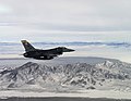 130107-F-VY794-440 (8367057737).jpg 3,038 × 2,348; 2.04 MB
-
 18AZ CAREFREE SKYRANCH AIRPORT FROM FLIGHT TUS-LAS 737 N748SW (10428167376) (2).jpg 1,891 × 1,261; 2.1 MB
-

-
 Niagara Falls from the International Space Station 2013-03-15.jpg 1,024 × 679; 116 KB
-
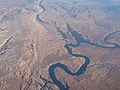
 Abajo Mountains, Utah (9181485304).jpg 4,000 × 3,000; 2.3 MB
-
 Abajo Mountains, Utah (9181486270).jpg 4,000 × 3,000; 2.39 MB
-
 Aerial - Coutts, Alberta & Sweet Grass, MT 01 (10321153895).jpg 4,288 × 2,848; 5.05 MB
-
 Aerial - Coutts, Alberta & Sweet Grass, MT 01 - white balanced (10321201586).jpg 4,288 × 2,848; 7.09 MB
-
 Aerial - near Coutts, Alberta & Sweet Grass, MT 01 (10322406125).jpg 4,288 × 2,848; 3.93 MB
-
 Aerial - near Coutts, Alberta & Sweet Grass, MT 01 - white balanced (10321224294).jpg 4,288 × 2,848; 7.04 MB
-
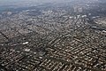 Aerial NYC 1 (36106318683).jpg 2,400 × 1,600; 3.11 MB
-
 Aerial NYC 4 (36080141074).jpg 1,600 × 2,400; 2.76 MB
-
 Arches National Park aerial Fiery Furnace (cropped).jpg 890 × 718; 667 KB
-
 Arches National Park aerial Fiery Furnace.jpg 1,093 × 1,336; 1.43 MB
-
 Arches National Park aerial geology.jpg 1,724 × 1,368; 2.26 MB
-
 Beautiful landing into SFO.jpg 3,264 × 2,448; 2.55 MB
-
 Beaver Dam Mountains Along Arizona-Nevada Border (9181447674).jpg 4,000 × 2,910; 1.59 MB
-
 Belt Railway of Chicago Clearing Yard, Chicago, Illinois (11004306644).jpg 4,000 × 3,000; 2.65 MB
-
-

-

-

-

-

-
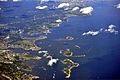
 Bullfrog Bay, Lake Powell, Glen Canyon National Recreation Area, Utah (97065187).jpg 1,600 × 1,200; 894 KB
-
 Canaan Mountain Wilderness Area, Utah-Arizona Border (9181452244).jpg 4,000 × 3,000; 2.44 MB
-
 Cleveland Skyline (12237257276).jpg 1,200 × 800; 571 KB
-
-
 Downtown Cleveland Aerial II (17066692698).jpg 1,200 × 800; 897 KB
-
 Downtown East Minneapolis, 2013 (17219525849).jpg 2,448 × 3,264; 5.53 MB
-
 Flight from Toronto to Boston. Over Boston. - panoramio (3).jpg 3,949 × 2,219; 3.36 MB
-
 Hidden Falls - St Paul, MN - panoramio.jpg 2,316 × 3,244; 3.13 MB
-
 ONT ONTARIO INTL AIRPORT FROM FLIGHT LAS-LAX N516NK A319 (10378086305) (2).jpg 2,490 × 1,660; 2.84 MB
-
 OWI OTTAWA MUNICIPAL AIRPORT FROM FLIGHT CDG-IAH 777 F-GSQM (10351698273).jpg 2,732 × 1,820; 3.32 MB
-
 Porltland, Maine, USA, aerial view.jpg 3,333 × 2,222; 4.09 MB
-
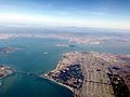
 San Francisco Aerial from the Bay Facing West (49799761517).jpg 3,600 × 2,400; 2.87 MB
-
 Smithfield, Maine Aerial View 2013.JPG 2,367 × 1,536; 1.89 MB
-
 St. Paul, Minnesota (8989949687).jpg 4,000 × 3,000; 2.56 MB
-
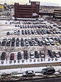
 Surface Parking Lots, Downtown East Minneapolis, Feb. 2013 (23404903724).jpg 2,448 × 2,805; 5.19 MB
-
 Surface Parking, Downtown East Minneapolis, Feb. 2013 (23406014754).jpg 2,418 × 2,932; 4.92 MB
-
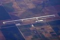
 Westchester County Airport (35145746711).jpg 2,400 × 1,600; 2.12 MB
-
 Withlacoochee Army Airfield Aerial Photograph 2013.jpg 1,123 × 842; 146 KB
.jpg)
_(2).jpg)


.jpg)
.jpg)
.jpg)
.jpg)
.jpg)
.jpg)
.jpg)
.jpg)
.jpg)


.jpg)
.jpg)
.jpg)
.jpg)
.jpg)
.jpg)
.jpg)
.jpg)
.jpg)
.jpg)
.jpg)
.jpg)
.jpg)
.jpg)

_(2).jpg)
.jpg)

.jpg)

.jpg)
.jpg)
.jpg)
.jpg)

.jpg)