Category:2010s maps of Massachusetts
Jump to navigation
Jump to search
States of the United States: Alabama · Alaska · Arizona · Arkansas · California · Colorado · Delaware · Florida · Georgia · Hawaii · Idaho · Indiana · Iowa · Louisiana · Maryland · Massachusetts · Michigan · Missouri · Nebraska · Nevada · New Jersey · New Mexico · New York · North Carolina · Ohio · Oklahoma · Pennsylvania · Tennessee · Utah · Virginia · West Virginia · Wisconsin – Washington, D.C.
Subcategories
This category has the following 4 subcategories, out of 4 total.
- 2010 maps of Massachusetts (23 F)
- 2016 maps of Massachusetts (2 F)
- 2019 maps of Massachusetts (1 F)
B
- 2010s maps of Boston (18 F)
Media in category "2010s maps of Massachusetts"
The following 8 files are in this category, out of 8 total.
-
 2013 Cambridge congress districts.png 1,160 × 727; 267 KB
-
 Boston Marathon route.png 2,984 × 1,325; 6.52 MB
-
 Lowell National Historical Park, Massachusetts LOC 2011589108.jpg 10,140 × 7,143; 11.26 MB
-
 Lowell National Historical Park, Massachusetts LOC 2011589108.tif 10,140 × 7,143; 207.22 MB
-
 MA Public High School District Open Enrollment Status by town.png 2,400 × 1,492; 191 KB
-
 MA Public High School District SAT by town.png 2,400 × 1,492; 196 KB
-
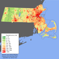 Massachusetts population map.png 600 × 600; 170 KB
-
 NOAA Weather Radio WNG575 Coverage Map.png 725 × 996; 104 KB


