Category:2007 on the London Underground
Jump to navigation
Jump to search
Media in category "2007 on the London Underground"
The following 172 files are in this category, out of 172 total.
-
 1996stock at St JohnsWood.jpg 3,648 × 2,736; 3.89 MB
-
 Pinner tube lifts under construction.jpg 2,136 × 2,848; 2.26 MB
-
 Kew gardens district 2007.jpg 2,592 × 1,944; 1.26 MB
-
 Boston Manor tube station 1.jpg 2,048 × 1,536; 851 KB
-
 Northfields station geograph-3796208-by-Ben-Brooksbank.jpg 2,410 × 1,276; 3.48 MB
-
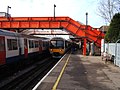
 Warren Street Station and BT Tower.jpg 3,648 × 2,736; 3.92 MB
-
 West Hampstead Station approach geograph-4066431-by-Ben-Brooksbank.jpg 2,395 × 1,425; 4.78 MB
-
 Seven Sisters Station entrance geograph-3996590-by-Ben-Brooksbank.jpg 2,396 × 1,481; 3.8 MB
-
 Seven Sisters Underground Station entrance geograph-3996656-by-Ben-Brooksbank.jpg 2,321 × 1,402; 2.98 MB
-
 Waterloo Station 2007 geograph-4062563-by-Ben-Brooksbank.jpg 2,364 × 1,301; 3.23 MB
-
 West Ham Station platform geograph-4065433-by-Ben-Brooksbank.jpg 2,386 × 1,480; 3.72 MB
-
 Wembley Park Station geograph-4058741-by-Ben-Brooksbank.jpg 2,395 × 1,316; 2.88 MB
-
 Wembley Park Station geograph-4059042-by-Ben-Brooksbank.jpg 2,321 × 1,411; 2.6 MB
-
 South Ruislip LUL Station geograph-4010978-by-Ben-Brooksbank.jpg 2,396 × 1,481; 3.81 MB
-
 St James's Park London Underground Station geograph-3988867-by-Ben-Brooksbank.jpg 2,200 × 1,489; 2.47 MB
-
 Woodford Station approach geograph-4076897-by-Ben-Brooksbank.jpg 2,330 × 1,483; 3.8 MB
-
 Woodford Station platforms geograph-4076870-by-Ben-Brooksbank.jpg 2,332 × 1,274; 4.11 MB
-
 Woodford station, Essex geograph-1911623-by-Dr-Neil-Clifton.jpg 3,456 × 2,304; 5.05 MB
-

-
 Aldgate East Underground Railway Station - geograph.org.uk - 512765.jpg 640 × 557; 106 KB
-
 Aldgate East Underground Station - geograph.org.uk - 527351.jpg 640 × 480; 80 KB
-
 Alperton station, Wembley - geograph.org.uk - 895124.jpg 640 × 480; 134 KB
-
 Amersham station 2007 II.jpg 2,592 × 1,944; 1.29 MB
-

-
-
 Arsenal tube station - geograph.org.uk - 515000.jpg 640 × 409; 107 KB
-
 Bahnsteigtür southwark.jpg 2,272 × 1,704; 1.27 MB
-
 Bakerloo Line Depot, London Road. - geograph.org.uk - 423151.jpg 640 × 480; 134 KB
-
 Bakerloo Line railway in Kenton - geograph.org.uk - 528598.jpg 640 × 480; 121 KB
-

-
 Barkingside stn north.JPG 1,280 × 960; 330 KB
-
 Bond Street Central line Westbound.jpg 3,648 × 2,736; 4.02 MB
-
 Bond Street stn., Central Line, W1 - geograph.org.uk - 949242.jpg 640 × 480; 122 KB
-
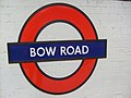 Bow Road Roundel 2007.jpg 640 × 480; 78 KB
-
 Burnk Oak Stn. P1.JPG 640 × 480; 224 KB
-
 Burnt Oak Stn. S.JPG 1,600 × 1,200; 1.06 MB
-
 Central line old and new.JPG 820 × 358; 135 KB
-
 Central Perspective in Tunnel Vision - Flickr - fabbio.jpg 1,951 × 1,301; 1.92 MB
-
 Chiswick Park station - geograph.org.uk - 872298.jpg 640 × 480; 48 KB
-
 Chiswick Park tube station 2.jpg 3,264 × 2,448; 3.17 MB
-
 Chiswick Park tube station.jpg 3,169 × 2,303; 786 KB
-
 Clapham Common Tube Station Platforms - Oct 2007.jpg 1,961 × 1,225; 730 KB
-
 Clapham South tube roundel.jpg 3,648 × 2,736; 4.17 MB
-
 Clock at Maida Vale tube.JPG 1,785 × 2,503; 159 KB
-
 Clock, Willesden Green tube station - geograph.org.uk - 567406.jpg 640 × 480; 91 KB
-
 Cockfosters Tube Depot - geograph.org.uk - 401590.jpg 640 × 480; 88 KB
-
 Cockfosters Tube Depot sidings - geograph.org.uk - 401600.jpg 640 × 480; 90 KB
-
 Covent Garden Station, London.jpg 2,816 × 2,112; 2.75 MB
-
 D78stock Aldgate East.jpg 3,648 × 2,736; 4.06 MB
-
 Dagenham East Underground Station - geograph.org.uk - 673297.jpg 640 × 480; 120 KB
-
 DSCF2381 Packed in (1005732363).jpg 1,600 × 1,200; 578 KB
-
 Earls Court London - panoramio.jpg 2,592 × 1,944; 2.66 MB
-

-
 East Acton station - geograph.org.uk - 679041.jpg 640 × 480; 131 KB
-
 East Acton Tube Station.jpg 1,024 × 760; 827 KB
-
 East Finchley Tube station (geograph 2253115).jpg 1,600 × 1,200; 692 KB
-
 East Finchley2.JPG 1,255 × 927; 969 KB
-
 East Ham Station. - geograph.org.uk - 448184.jpg 640 × 480; 113 KB
-
 Edgware Road stn (Bakerloo line) building (cropped).png 2,257 × 2,200; 14.23 MB
-
 Edgware Road tube Bakerloo Line.jpg 3,648 × 2,736; 4.35 MB
-
 Empty platform (1313056311).jpg 3,872 × 2,592; 6.27 MB
-
 Epping tube station roundel.JPG 2,048 × 1,536; 1.36 MB
-
 EscalatorLights at Westminster.jpg 3,648 × 2,736; 4.08 MB
-

-
 Fairlop roundel.JPG 1,280 × 960; 326 KB
-
 Farringdon Station southbound Thameslink platform geograph-3877475-by-Ben-Brooksbank.jpg 2,394 × 1,557; 2.86 MB
-
 Gants Hill roundel.JPG 960 × 1,280; 357 KB
-
 Gloucester Road Tube Station - geograph.org.uk - 398197.jpg 426 × 640; 122 KB
-
 Going into Service - geograph.org.uk - 441437.jpg 640 × 441; 153 KB
-
 Goodge Street Underground Station - geograph.org.uk - 601569.jpg 640 × 480; 114 KB
-
 Grange Hill stn south.JPG 1,280 × 960; 342 KB
-
 Hainault stn building.JPG 1,280 × 960; 338 KB
-
 Hainault stn roundel.JPG 960 × 1,280; 240 KB
-
 Hainault tube station platforms 2&3 look north.jpg 1,280 × 960; 334 KB
-
 Hanger Lane Station - geograph.org.uk - 316005.jpg 640 × 480; 75 KB
-
 High Street Kensington circle line.jpg 2,592 × 1,944; 1.29 MB
-
 Holland Park station, W11 - geograph.org.uk - 680512.jpg 640 × 480; 36 KB
-
 Holloway Road tube station - geograph.org.uk - 513847.jpg 640 × 480; 128 KB
-
 Jubilee Line Depot, West Ham - geograph.org.uk - 445299.jpg 640 × 480; 93 KB
-
 Just going down to the Bank - geograph.org.uk - 490964.jpg 640 × 480; 70 KB
-
 Kilburn Park tube station2.jpg 1,936 × 1,288; 235 KB
-
 Kilburn station Clock.jpg 3,648 × 2,736; 3.56 MB
-
 Ladbroke Grove station sign - geograph.org.uk - 678688.jpg 640 × 480; 125 KB
-
 Lancaster Gate roundel.JPG 960 × 1,280; 393 KB
-
 Leicester Square tube station logo.jpg 2,272 × 1,704; 646 KB
-
 Leytonstone tube roundel dec 07.jpg 2,272 × 1,704; 1.29 MB
-
 Liverpool Street signal box.jpg 3,648 × 2,736; 4.35 MB
-
 London angel tube middle escalator upwards.jpg 1,200 × 1,600; 318 KB
-
 London Underground sign - geograph.org.uk - 763868.jpg 480 × 640; 78 KB
-

-
 Londra01 flickr.jpg 1,632 × 1,224; 436 KB
-
 Maida Vale Underground Station - geograph.org.uk - 527335.jpg 640 × 480; 93 KB
-

-

-
 Mile End Tube Station 2007.jpg 640 × 480; 82 KB
-
 Morden Tube Station Entrance.jpg 1,600 × 1,200; 329 KB
-
 Morden Tube Station.jpg 1,600 × 1,200; 325 KB
-
 Newbury Park north.JPG 1,280 × 960; 336 KB
-
 Newbury Park roundel.JPG 1,280 × 960; 336 KB
-
 Newbury Park roundel2.JPG 1,280 × 960; 320 KB
-

-
 North Greenwich Station - concourse - geograph.org.uk - 516361.jpg 640 × 480; 112 KB
-
 Northwood Tube.JPG 3,008 × 2,000; 2.27 MB
-
 Notting Hill Gate geograph-3798857-by-Ben-Brooksbank.jpg 2,396 × 1,403; 3.96 MB
-
 Notting Hill Gate Station - geograph.org.uk - 530753.jpg 640 × 480; 117 KB
-
 Oakwood tube station better.jpg 3,264 × 2,448; 3.15 MB
-
-
 Oyster vending machine.jpg 612 × 816; 71 KB
-
 PA220223.JPG 1,600 × 1,200; 535 KB
-
 Paddington Station District Line Eingang.jpg 2,072 × 1,340; 590 KB
-

-
 PBridgePillbox.JPG 3,264 × 2,448; 3.16 MB
-
 Piccadilly Circus Tube Station Logo.jpg 1,944 × 2,592; 434 KB
-

-
 Plaistow Station - geograph.org.uk - 448181.jpg 640 × 480; 98 KB
-
-

-
 Pretty in Pink 2.jpg 333 × 434; 161 KB
-
 Putney Bridge Underground Station - geograph.org.uk - 512314.jpg 640 × 480; 106 KB
-
 Queensway tube station - geograph.org.uk - 1021928.jpg 640 × 480; 177 KB
-
 Rayners Lane station - geograph.org.uk - 830306.jpg 640 × 480; 74 KB
-
 Rayners Lane station.jpg 640 × 427; 57 KB
-
 Redbridge east roundel.JPG 1,280 × 960; 332 KB
-
 Redbridge stn building.JPG 1,280 × 960; 326 KB
-
 Rotherhithe stn roundel.JPG 1,280 × 960; 325 KB
-
 Shadwell station, East London line - geograph.org.uk - 561892.jpg 640 × 427; 92 KB
-
 Shadwell stn roundel.JPG 1,280 × 960; 322 KB
-
 Shepherds Bush station, HandC line - geograph.org.uk - 562064.jpg 640 × 427; 87 KB
-
 South Ealing - panoramio.jpg 2,272 × 1,704; 2.03 MB
-
-
 St John's Wood Underground Station - geograph.org.uk - 549165.jpg 640 × 480; 129 KB
-
 St Pauls tube to street sign.jpg 2,736 × 3,648; 3.77 MB
-
 Stairs (1313086525).jpg 2,592 × 3,872; 4.62 MB
-
 Station clock St Johns Wood.jpg 3,648 × 2,736; 3.65 MB
-
 Sudbury Town station - geograph.org.uk - 945376.jpg 640 × 480; 74 KB
-
 Surrey Quays roundel.JPG 1,280 × 960; 332 KB
-
 Surrey Quays station - geograph.org.uk - 555289.jpg 640 × 427; 99 KB
-
 Surrey Quays station exterior, Southwark - geograph.org.uk - 555340.jpg 640 × 414; 114 KB
-
 Surrey Quays station, East London Line - geograph.org.uk - 555334.jpg 640 × 427; 101 KB
-
 Surrey Quays stn building.JPG 960 × 1,280; 405 KB
-
 TfL Oyster Card Validator.jpg 2,736 × 3,648; 3.78 MB
-

-
 Theydon Bois.JPG 2,048 × 1,536; 1.46 MB
-

-
 Too much information gives a blurry result - Flickr - fabbio.jpg 1,918 × 1,279; 1.93 MB
-
 Tooting Bec escalators.jpg 3,648 × 2,736; 3.89 MB
-
 Tooting Bec tube clock.jpg 3,648 × 2,736; 3.99 MB
-
 Tottenham Hale Victoria line Northbound platform.jpg 3,648 × 2,736; 3.84 MB
-
 Tottenhamstation londonunderground.jpg 2,272 × 1,704; 1.32 MB
-
 Tube (8238121615).jpg 3,872 × 2,592; 9.34 MB
-
 Tube - Flickr - pfig.jpg 1,598 × 1,064; 1.72 MB
-
 Tunnel (1313075891).jpg 3,872 × 2,592; 8.2 MB
-
 Turnham Green station 2007.jpg 2,592 × 1,944; 1.25 MB
-
 Underground Station (1138901479).jpg 3,872 × 2,592; 4.26 MB
-
 Uplighter StJohnsWood.jpg 2,736 × 3,648; 4.08 MB
-
 V Line depot.jpg 3,264 × 1,474; 1.78 MB
-
 Victoria Air Cooling close up.jpg 2,736 × 3,648; 3.83 MB
-
 Victoria Air Cooling.jpg 3,648 × 2,736; 4.02 MB
-
 Victoria Line train leaving depot.jpg 3,264 × 1,321; 1.66 MB
-
 Wanstead roundel.JPG 1,280 × 960; 323 KB
-
 Wapping stn roundel.JPG 1,280 × 960; 324 KB
-

-
 Waterloo jubilee platform.jpg 1,936 × 1,288; 1.31 MB
-
 Way Out sign at Warren Street station (532097082).jpg 1,280 × 960; 97 KB
-
 Way out StJohnsWood.jpg 2,736 × 3,648; 4.05 MB
-
 Wembley Park Station - geograph.org.uk - 456263.jpg 640 × 480; 114 KB
-
 Wembley Park tube station - geograph.org.uk - 604879.jpg 640 × 480; 74 KB
-
 West Brompton, District Line 2007.jpg 640 × 480; 117 KB
-
 West Kensington Station, W14 - geograph.org.uk - 828962.jpg 640 × 480; 114 KB
-
 Whitechapel East London roundel.JPG 1,280 × 960; 326 KB
-
 Whitechapel H&C District roundel.JPG 960 × 1,280; 395 KB
-
 Wimbledon Park station, SW19 - geograph.org.uk - 940364.jpg 606 × 640; 65 KB


.jpg)


.jpg)


_building_(cropped).png)


.jpg)


.jpg)

.jpg)

.jpg)


.jpg)


.jpg)