Category:2004 U.S. presidential election maps, state subdivisions
Jump to navigation
Jump to search
Media in category "2004 U.S. presidential election maps, state subdivisions"
The following 33 files are in this category, out of 33 total.
-
 2004 Democratic Primary Results.svg 959 × 593; 82 KB
-
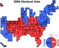
 2004 Electoral Vote (squares).png 1,280 × 1,024; 25 KB
-
 2004 Electoral Vote Cartogram.png 1,280 × 1,024; 25 KB
-
 2004 US elections map electoral votes.png 757 × 492; 40 KB
-
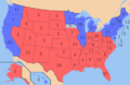
 2004 US elections map.png 800 × 495; 31 KB
-
 2004 us popular vote2.png 2,098 × 1,202; 288 KB
-
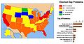
 2004CampaignAttention (edit).png 676 × 840; 107 KB
-
 2004CampaignAttention.png 1,352 × 420; 120 KB
-
 2004DEMPRIMARIES.GIF 640 × 469; 55 KB
-
 2004ElectionControversyMap.jpg 954 × 500; 94 KB
-
 2004US election map.jpg 3,101 × 2,364; 828 KB
-
 2004US election map.svg 959 × 660; 119 KB
-
 Cartogram 2008 red blue.png 628 × 287; 8 KB
-
 Cartogram of 2004 Electoral Vote.png 936 × 749; 22 KB
-
 Cartogram-2004 Electoral Vote.gif 874 × 704; 31 KB
-
 Cartogram-2004 Electoral Vote.PNG 874 × 704; 25 KB
-
 Democratic presidential primary, 2004.svg 959 × 593; 1.34 MB
-
 ElectionPresidentielleE-U2004.png 485 × 316; 40 KB
-
 ElectoralCollege2004-Large.PNG 661 × 442; 125 KB
-
 ElectoralCollege2004.svg 1,020 × 593; 29 KB
-
 Gastner map redblue byarea bystate.png 626 × 391; 46 KB
-
 Gastner map redblue bypopulation bystate.png 711 × 453; 52 KB
-
 Map of USA presidential elections 2004.PNG 280 × 183; 13 KB
-
 Mini-Tuesday 2004.png 904 × 593; 71 KB
-
 Mini-Tuesday 2004.svg 959 × 593; 85 KB
-
 Spending-and-visits.svg 1,100 × 1,480; 291 KB
-
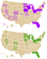
 Swing states, 2004.svg 1,020 × 593; 119 KB
-
 Swingstates2008.png 570 × 374; 18 KB
-
 United States 2004 election maps.png 717 × 449; 131 KB
-
 United States Elections 2004 Electoral College map.png 800 × 495; 29 KB
-
 United States Elections 2004 Electoral College map.svg 959 × 593; 190 KB
-
 US Electoral 2004.svg 1,100 × 593; 63 KB
-
 US presidential election 2004 map.svg 959 × 593; 344 KB

.png)


.png)


