Category:1971 maps of the United States
Jump to navigation
Jump to search
Countries of the Americas: Chile · United States of America
States of the United States: California · Connecticut · Florida · Georgia · Maryland · Massachusetts · North Carolina · Pennsylvania · Rhode Island · Utah
Subcategories
This category has the following 12 subcategories, out of 12 total.
C
- 1971 maps of California (1 F)
- 1971 maps of Connecticut (1 F)
F
- 1971 maps of Florida (2 F)
G
M
- 1971 maps of Maryland (2 F)
- 1971 maps of Massachusetts (2 F)
N
- 1971 maps of North Carolina (2 F)
P
- 1971 maps of Pennsylvania (3 F)
R
- 1971 maps of Rhode Island (1 F)
U
- 1971 maps of Utah (1 F)
Media in category "1971 maps of the United States"
The following 2 files are in this category, out of 2 total.
-
 Acadia National Park and vicinity, Hancock Co., Maine. 1971. LOC 78692599.tif 7,972 × 8,663; 197.59 MB
-
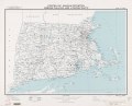 States of Massachusetts, Rhode Island, and Connecticut - base map LOC 2009579047.tif 8,940 × 7,194; 184.01 MB