Category:1967 maps of the United States
Jump to navigation
Jump to search
Subcategories
This category has the following 4 subcategories, out of 4 total.
Media in category "1967 maps of the United States"
The following 16 files are in this category, out of 16 total.
-

-
 1967 data of United States - part 1.jpg 4,303 × 2,895; 2.97 MB
-
 1967 data of United States - part 2.jpg 3,960 × 2,901; 1.36 MB
-
 1967 data of United States - part 3.jpg 3,936 × 2,920; 1.4 MB
-
 National atlas. Indian tribes, cultures & languages - (United States) LOC 95682185.jpg 8,373 × 5,685; 8.98 MB
-
 National atlas. Indian tribes, cultures & languages - (United States) LOC 95682185.tif 8,373 × 5,685; 136.19 MB
-
 Nh covered bridge map display 1967.jpg 2,028 × 3,000; 2.62 MB
-
 Selected cities in California, 1967.jpg 3,912 × 2,888; 2.05 MB
-
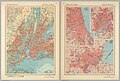 Selected cities in Northeastern USA, 1967.jpg 4,262 × 2,877; 4.95 MB
-
 TCT surveys January 1 1967.jpg 650 × 409; 243 KB
-

-
 United States 1967 - central states.jpg 2,892 × 4,084; 2.82 MB
-
 United States 1967 - eastern states.jpg 2,888 × 4,098; 2.82 MB
-
 United States 1967 - western states.jpg 2,896 × 4,088; 2.59 MB
-
 United States, 1967.jpg 4,048 × 2,892; 2.54 MB
-
 Weather map 1967-01-26-06UTC.jpg 1,001 × 627; 82 KB
.jpg)


_LOC_95682185.jpg)


