Category:1962 United States Senate election maps
Jump to navigation
Jump to search
Media in category "1962 United States Senate election maps"
The following 41 files are in this category, out of 41 total.
-
 1962 Arizona.png 2,000 × 2,332; 215 KB
-
 1962 United States Senate Election in Alabama by County.svg 744 × 744; 329 KB
-
 1962 United States Senate election in Alaska results map by borough.svg 800 × 492; 1.66 MB
-

-
-

-

-
-
 1962 United States Senate election in Hawaii results map by county.svg 1,052 × 614; 2.12 MB
-
-

-

-
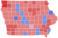 1962 United States Senate election in Iowa results map by county.svg 810 × 532; 31 KB
-

-

-

-

-
 1962 United States Senate Election in Massachusetts by Municipality.svg 810 × 502; 182 KB
-

-
-

-

-
 1962 United States Senate election in New York results map by county.svg 744 × 577; 297 KB
-

-

-
 1962 United States Senate election in Ohio results map by county.svg 810 × 810; 27 KB
-
-

-
 1962 United States Senate election in South Carolina results map by county.svg 2,831 × 2,257; 44 KB
-

-

-

-

-
 1962 United States Senate elections results map.svg 959 × 593; 67 KB
-

-

-
-

-
 Alabama Senate Election Results by County, 1962.png 2,000 × 3,209; 387 KB
-

-
 South Dakota Senate Election Results by County, 1962.svg 243 × 152; 26 KB


