Category:1950s maps of the Philippines
Jump to navigation
Jump to search
Countries of Asia: Afghanistan · People's Republic of China · Egypt‡ · Georgia‡ · India · Indonesia‡ · Iran · Iraq · Israel · Japan · Jordan · Laos · Lebanon · Malaysia · Mongolia · Myanmar · Nepal · Pakistan · Philippines · Russia‡ · Syria · Thailand · Turkey‡ · Vietnam
Limited recognition: Abkhazia‡ · Taiwan · State of Palestine
‡: partly located in Asia
Limited recognition: Abkhazia‡ · Taiwan · State of Palestine
‡: partly located in Asia
- Provinces of the Philippines
- Province-level divisions (independent cities, Metro Manila)
Media in category "1950s maps of the Philippines"
The following 2 files are in this category, out of 2 total.
-
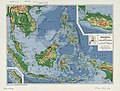 Indonesia and the Philippines LOC 2014589785.jpg 4,095 × 3,104; 2.17 MB
-
 Indonesia and the Philippines LOC 2014589785.tif 4,095 × 3,104; 36.37 MB
