Category:1950s maps of Bulgaria
Jump to navigation
Jump to search
Countries of Europe: Albania · Austria · Belgium · Bulgaria · Denmark · Estonia · Finland · France‡ · Georgia‡ · Germany · Greece · Hungary · Iceland · Republic of Ireland · Italy · Lithuania · Luxembourg · Netherlands‡ · Norway · Poland · Portugal‡ · Romania · Russia‡ · Spain‡ · Sweden · Switzerland · Turkey‡ · Ukraine · United Kingdom
Limited recognition: Abkhazia‡
‡: partly located in Europe
Limited recognition: Abkhazia‡
‡: partly located in Europe
Media in category "1950s maps of Bulgaria"
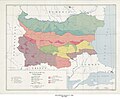
The following 12 files are in this category, out of 12 total.
-
 Bulgaria - DPLA - 3e5da58223a4f40b03d0aec665dfde52.jpg 3,359 × 3,434; 1.29 MB
-
 Bulgaria - DPLA - 409b0c332b42e7083ce35b62a971ce89.jpg 11,992 × 8,837; 9.79 MB
-
 Bulgaria - DPLA - a4e4046f099c516aab49d5cddb9094b5.jpg 3,288 × 3,510; 1.15 MB
-
 Bulgaria - DPLA - b73eda3b5f30cdac2c542282e1e72206.jpg 3,288 × 3,499; 967 KB
-
 Bulgaria - DPLA - dac95753641b108abb88f019a70795d9.jpg 11,991 × 8,837; 9.66 MB
-
 Bulgaria- Population - DPLA - 4e305d849b1af9dfeebc33bb8586c93e.jpg 4,470 × 3,475; 2 MB
-
 Bulgaria Terrain Regions - DPLA - 3463d9cd123bb7e767f9c03d8fc644a1.jpg 8,280 × 6,824; 6.2 MB
-
 Bulgaria - DPLA - de550146b54e0c97bfe03be4e4ff7797.jpg 12,014 × 8,824; 6.26 MB
-
 Town Plan of Sofia - DPLA - ae75f99d06f916742e5803974abbabfb.jpg 9,762 × 8,689; 11.75 MB
-
 Bulgaria, terrain and transportation. LOC 79696292.jpg 9,576 × 6,179; 8.36 MB
-
 Bulgaria, terrain and transportation. LOC 79696292.tif 9,576 × 6,179; 169.29 MB
-
 Bulgaria Agriculture - Land Use - DPLA - 6e2bd1295f834f9693814ae9663a1ac0.jpg 8,184 × 6,484; 7.23 MB


