Category:1944 maps
Jump to navigation
Jump to search
| ← · 1940 · 1941 · 1942 · 1943 · 1944 · 1945 · 1946 · 1947 · 1948 · 1949 · → |
Deutsch: Karten mit Bezug zum Jahr 1944
English: Maps related to the year 1944
Español: Mapas relativos al año 1944
Français : Cartes concernant l’an 1944
Русский: Карты 1944 года
Subcategories
This category has the following 9 subcategories, out of 9 total.
Media in category "1944 maps"
The following 89 files are in this category, out of 89 total.
-

-

-
 1944 Germany Population (30249096763).jpg 2,433 × 3,120; 901 KB
-
 1944 one inch map showing Glen Massey branch railway.jpg 1,129 × 354; 316 KB
-

-
 5303 Vanuatu Melanesia Eromanga Island 500K SE59-4.jpg 6,299 × 6,976; 25.33 MB
-
 A-7 ALG Azeville Airfield.png 584 × 579; 268 KB
-
 A. A. F. special aeronautical chart. Fiji islands - btv1b53189608x.jpg 14,864 × 11,234; 13.65 MB
-
 After Action Report - Fulda - NARA - 100384481 (page 1).jpg 10,530 × 8,492; 22.46 MB
-
 Alton, Alvin & Andrew Islands, Carillon Atoll - NARA - 100359977.jpg 8,292 × 5,892; 3.01 MB
-
 Anthony, Anton & Archibald Islands, Carillon Atoll - NARA - 100359983.jpg 7,892 × 12,113; 3.22 MB
-

-

-
 Azraq (FL197694319 0916587).jpg 11,472 × 14,469; 216.56 MB
-
 Biak Island Operation May-August 1944.jpg 1,999 × 1,412; 3.31 MB
-
 Bp-getto-map.jpg 971 × 653; 373 KB
-
 City Plan - Diffenbach-les-hellimer - DPLA - d2bed6e2a26153ce32e3cb9e8819fe90.jpg 4,604 × 6,590; 1.74 MB
-
 City Plan - Puttelange - DPLA - 9560a935996077a9b347f8abe35ad14b.jpg 8,711 × 6,600; 6.08 MB
-
 City Plan - Sarre Union - DPLA - fbfdad8a9e383b65d212133153368542.jpg 6,649 × 4,448; 4.14 MB
-
 City Plan - Sarreguemines - DPLA - 15b32b26c5acba8934cc6506fcb1189d.jpg 8,722 × 6,600; 6.74 MB
-
 Cobourg Peninsula 1944 map nla.obj-234063743.jpg 5,000 × 3,604; 8.62 MB
-
 Der Nahe Osten. LOC 2013586106.jpg 9,942 × 6,710; 13.12 MB
-
 Der Nahe Osten. LOC 2013586106.tif 9,942 × 6,710; 190.86 MB
-
 Ett Taibe (FL32038257 3808110).jpg 17,319 × 14,618; 348.46 MB
-
 Fortification Point.PNG 1,410 × 2,345; 3.66 MB
-
 French Service géographique de l'armée, Carmel East (FL79322143 3802817).jpg 15,796 × 12,640; 229.94 MB
-
 French Service géographique de l'armée, Carmel west (FL79324118 3803400).jpg 15,692 × 12,416; 204.6 MB
-
 French Service géographique de l'armée, Hadera (FL79324113 3803404).jpg 15,932 × 12,533; 200.93 MB
-
 French Service géographique de l'armée, Mount Tabor (FL79322154 3802825).jpg 15,698 × 12,348; 220.79 MB
-
 Godhavn v2 C501 map sheet.tif 5,544 × 7,390, 2 pages; 117.45 MB
-
 Great Britain army 517 Field Survey Company, Ett Taïbé (FL83894889 4072666).jpg 16,924 × 15,058; 258.08 MB
-
 Great Britain Army, Hebron east (FL27975725 3805124).jpg 12,453 × 14,500; 233.17 MB
-
 Great Britain Geographical Section (War office, General Staff), France (FL35077021 2586255).jpg 14,721 × 18,149; 381.23 MB
-
 Guadalcanal Map, 1944 (6026283464).jpg 3,624 × 2,736; 829 KB
-
 Messtischblatt 4609 Hattingen 193x.jpg 10,328 × 7,948; 16 MB
-
 Irrigation Department, Eretz Israel (FL24942411 2366880).jpg 12,703 × 20,554; 323.64 MB
-
 Isle of Pines to Uen Island 1944 nautical chart.jpg 3,272 × 5,000; 2.47 MB
-
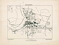
 Henry Kendall plan for Jerusalem 1944.png 4,861 × 6,593; 50.47 MB
-
 Jerusalem Old City - Plan illustrating encroachments (FL165906080 0953874).jpg 6,041 × 7,726; 32.9 MB
-
 Jewish National Fund, ההתישבות החדשה 1936-1944 (FL13733962 3432179).jpg 4,924 × 7,639; 56.44 MB
-
 Jouaiya (FL27979161 3807402).jpg 16,265 × 13,328; 229.43 MB
-
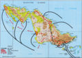
 Location siauliai operation.png 750 × 872; 2.5 MB
-
 Map, water services, Wellcome Veterinary Research Station Wellcome L0038247.jpg 21,261 × 13,033; 73.81 MB
-
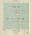
 Maria Atoll cropped from Raivavae 1944 nautical chart.jpg 1,146 × 1,032; 169 KB
-
 New Georgia Island map 1944.jpg 3,090 × 3,654; 1.79 MB
-

-
 Plaquemines Parish Louisiana Empire Area Map 1944.jpg 2,366 × 2,930; 2.2 MB
-

-

-

-
 R. Feige and A. Rosenau, Average rainfall map (FL37803238 2671940).jpg 8,287 × 10,500; 112.79 MB
-
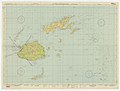
 Raivavae 1944 nautical chart.jpg 7,286 × 5,489; 4.22 MB
-
 Reitetō senkyō yōzu - Shō. 19. 12. matsu made happyō. LOC 2010428024.jpg 11,028 × 14,939; 16.07 MB
-
 Rome2Arno1944.jpg 600 × 953; 241 KB
-
 Rurutu cropped fromRaivavae 1944 nautical chart.jpg 1,074 × 1,278; 225 KB
-
 Survey of Palestine, Abasan (FL28026082 3804833).jpg 12,365 × 14,611; 222.57 MB
-
 Survey of Palestine, Beersheba (FL60507239 3809589).jpg 15,826 × 12,782; 226.1 MB
-
 Survey of Palestine, Beit Affa (FL60915874 3520635).jpg 18,012 × 12,696; 207.25 MB
-
 Survey of Palestine, Bethlehem (FL27975736 3805125).jpg 11,740 × 14,786; 201.59 MB
-
 Survey of Palestine, Central Judæa (FL35058298 2366967).jpg 13,721 × 15,469; 326.17 MB
-
 Survey of Palestine, Gaza (FL60505083 3809018).jpg 15,796 × 12,758; 226.55 MB
-
 Survey of Palestine, Haifa (FL54735254 3808395).jpg 14,522 × 11,627; 224.68 MB
-
 Survey of Palestine, Hebron (FL60505830 3809540).jpg 15,758 × 12,882; 233.16 MB
-
 Survey of Palestine, Jaffa - Tel Aviv 01-map (FL37665483 3926210).jpg 5,645 × 8,230; 59.27 MB
-
 Survey of Palestine, Jaffa - Tel Aviv 02-verso (FL37665484 3926210).jpg 5,714 × 8,273; 59.3 MB
-
 Survey of Palestine, Jerusalem (FL60505030 3808987).jpg 15,010 × 13,048; 221.93 MB
-
 Survey of Palestine, Kh. El. Adas 00-index (FL28026052 3804817).jpg 8,950 × 12,388; 39.52 MB
-
 Survey of Palestine, Kh. El. Adas 01 (FL28026061 3804817).jpg 12,383 × 14,254; 170.37 MB
-
 Survey of Palestine, Khan Yunis (FL28026053 3804827).jpg 12,678 × 14,566; 189.83 MB
-
 Survey of Palestine, Latrun (FL28026346 3805082).jpg 11,176 × 13,606; 196.77 MB
-
 Survey of Palestine, Metulla (FL54735267 3808334).jpg 17,492 × 13,199; 310.53 MB
-
 Survey of Palestine, Nablus (FL60504924 3808663).jpg 15,574 × 12,884; 230.8 MB
-
 Survey of Palestine, Nazareth (FL54739343 3808530).jpg 14,807 × 11,783; 248.06 MB
-
 Survey of Palestine, Palestine (FL25562414 2367660).jpg 15,572 × 22,050; 491.81 MB
-
 Survey of Palestine, Palestine North sheet (FL31740142 3250778).jpg 15,436 × 21,837; 458.34 MB
-
 Survey of Palestine, Palestine of the Crusades (FL51320652 2367013).jpg 12,661 × 18,361; 341.65 MB
-
 Survey of Palestine, Rafah (FL60507265 3809569).jpg 15,858 × 12,810; 233.69 MB
-
 Survey of Palestine, Ramle (FL60505024 3808954).jpg 15,556 × 13,010; 239.59 MB
-
 Survey of Palestine, Safad (FL54735303 3808468).jpg 14,407 × 11,475; 241.3 MB
-
 Survey of Palestine, Yibna (FL60504973 3808682).jpg 15,576 × 12,744; 216.65 MB
-
 Survey of Palestine, Zikhron Ya'aqov (FL54739316 3808474).jpg 13,797 × 11,339; 213.17 MB
-
 Tiwi Melville Bathurst Islands nla.obj-234063639-1.jpg 5,000 × 3,726; 10.86 MB
-
 Totoya.jpg 634 × 633; 66 KB
-
 Town plan of Roma (Rome) LOC map47000177.tif 15,102 × 11,880; 513.3 MB
-
 Tyr (FL27977835 3807304).jpg 16,637 × 13,731; 294.44 MB
-
 Washington and vicinity, Maryland, Virginia, District of Columbia. LOC 87693081.jpg 12,778 × 15,284; 39 MB
-
 Yaroslavl RSHA 1944.jpg 7,206 × 4,799; 6.75 MB
-

-
 Zabqine (FL27977825 3807101).jpg 16,699 × 13,692; 247.94 MB


.jpg)


.jpg)


.jpg)


.jpg)

.jpg)
.jpg)
.jpg)
.jpg)
.jpg)
.jpg)
,_France_(FL35077021_2586255).jpg)
.jpg)

.jpg)


.jpg)
.jpg)
.jpg)


_(cropped).jpg)


.jpg)


.jpg)
.jpg)
.jpg)
.jpg)
.jpg)
.jpg)
.jpg)
.jpg)
.jpg)
.jpg)
.jpg)
.jpg)
.jpg)
.jpg)
.jpg)
.jpg)
.jpg)
.jpg)
.jpg)
.jpg)
.jpg)
.jpg)
.jpg)
.jpg)
.jpg)
.jpg)


.jpg)


.jpg)
.jpg)