Category:1939 maps of Europe
Jump to navigation
Jump to search
Temperate regions: North America · South America · Africa · Europe · Asia · Oceania – Polar regions: – Other regions:
English: 1939 maps of Europe
Español: Mapas de Europa en 1939
Suomi: Euroopan kartat vuodelta 1939
Română: Hărți ale Europei din 1939
Subcategories
This category has the following 10 subcategories, out of 10 total.
C
- 1939 maps of Croatia (6 F)
F
- 1939 maps of France (19 F)
G
L
- 1939 maps of Lithuania (13 F)
M
N
- 1939 maps of Norway (120 F)
P
- 1939 maps of Poland (8 F)
S
- 1939 maps of Switzerland (4 F)
U
- 1939 maps of Ukraine (4 F)
Media in category "1939 maps of Europe"
The following 41 files are in this category, out of 41 total.
-
 1939 Harrison map of Europe.jpg 7,200 × 5,735; 6.94 MB
-
 1939 Ouya Zongtu.jpg 3,510 × 2,717; 1.7 MB
-

-
 Baltic Sea Borderlines 1939 german-it.png 2,528 × 1,965; 458 KB
-
 Baltic Sea Borderlines 1939 german-it2.png 2,528 × 1,965; 348 KB
-
 Baltic Sea Borderlines 1939 german.png 1,516 × 1,178; 66 KB
-
 Banovina Hrvatska kotari.jpg 532 × 498; 125 KB
-

-
 DeutscheLandverluste-HE.svg 730 × 550; 62 KB
-
 Duitsland31081939.png 998 × 896; 151 KB
-

-
 FrenteOrientalAnimado3.gif 1,090 × 1,000; 302 KB
-
 Gdansk Bay Borderlines 1939 blank.png 1,858 × 1,202; 29 KB
-
 Gdansk Bay Borderlines 1939 Chinese.svg 1,339 × 866; 31 KB
-
 Gdansk Bay Borderlines 1939 English-colour.jpg 1,024 × 662; 172 KB
-
 Gdansk Bay Borderlines 1939 English.png 1,858 × 1,202; 35 KB
-
 Gdansk Bay Borderlines 1939 English.svg 1,339 × 866; 49 KB
-
 Gdansk Bay Borderlines 1939 Esperanto.svg 1,339 × 866; 161 KB
-
 Gdansk Bay Borderlines 1939 Français.svg 1,339 × 866; 35 KB
-
 Gdansk Bay Borderlines 1939 German.png 1,858 × 1,202; 35 KB
-
 Gdansk Bay Borderlines 1939 greek.png 1,339 × 866; 93 KB
-
 Gdansk Bay Borderlines 1939 ko.svg 1,339 × 866; 30 KB
-
 Gdansk Bay Borderlines 1939 Polish.png 1,858 × 1,202; 36 KB
-
 Gdansk Bay Borderlines 1939 Welsh.svg 1,339 × 866; 34 KB
-
 Gdansk Bay Borderlines 1939-hu.svg 1,339 × 866; 32 KB
-
 Gdansk Bay Details 1939 english.PNG 1,668 × 1,200; 70 KB
-
 Gdansk Bay Details 1939 german.png 1,668 × 1,200; 39 KB
-
 Germanborders.png 683 × 498; 18 KB
-
 Germanbordershr.JPG 679 × 495; 65 KB
-
 Jan Mayen map by RGS 1939 (cropped).jpg 4,644 × 3,876; 2.02 MB
-
 Jan Mayen map by RGS 1939.jpg 5,791 × 5,256; 2.94 MB
-
 L'Illustration 29 juillet 1939.jpg 632 × 909; 310 KB
-
 Map pigmentation in Europe.png 1,137 × 871; 1.19 MB
-
 Old Europe map in german.jpg 1,453 × 936; 667 KB
-
 Old german map France, Spain and Portugal.jpg 944 × 1,446; 521 KB
-
 Oulun kaupungin asemakartta ympäristöineen 1939.jpg 6,248 × 9,629; 5.94 MB
-
 Pact of Neutral Countries, 1939 proposal.svg 688 × 650; 209 KB
-
 Pigmentation of Hair and Eyes, Coon 1939.png 5,235 × 4,034; 3.6 MB
-
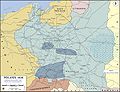 WWII-Poland-1939-communications and industry.jpg 1,280 × 984; 1.15 MB
-
 Геополитический статус стран Северной Европы в 1939.jpg 4,855 × 3,501; 1.2 MB
-
 УЖД Ляскеля на финской карте.jpg 809 × 1,644; 520 KB


_et_d%C3%A9tails_agrandis_du_Front_fran%C3%A7ais_(1_-_700.000_environ),_sp%C3%A9cialement_entre_Rhin_et_Moselle_(1_-_350_000_environ)_-_btv1b53121206w.jpg)


.jpg)


