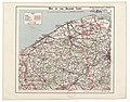
Category:1930s maps of Belgium
Jump to navigation
Jump to search
Countries of Europe: Armenia‡ · Austria · Azerbaijan‡ · Belarus · Belgium · Bosnia and Herzegovina · Bulgaria · Czech Republic · Denmark · Finland · France‡ · Georgia‡ · Germany · Greece · Iceland · Republic of Ireland · Italy · Lithuania · Netherlands‡ · Norway · Poland · Portugal‡ · Romania · Russia‡ · Serbia · Slovakia · Spain‡ · Sweden · Switzerland · Turkey‡ · Ukraine · United Kingdom
‡: partly located in Europe
‡: partly located in Europe
Media in category "1930s maps of Belgium"
The following 6 files are in this category, out of 6 total.
-
 Cables sous-marins France, Algérie, Tunisie - btv1b531583161 (09 of 12).jpg 9,066 × 6,516; 6.38 MB
-
 Belgische Eisenbahnen 1933 Ausschnitt.png 452 × 309; 120 KB
-
 Belgische spoorwegen 1933 versie II.png 2,218 × 1,821; 3.94 MB
-
 Map Belgio 1930 - Touring Club Italiano CART-TRC-06.jpg 5,478 × 4,490; 16.89 MB
-
-
 Railway belgium 1932.jpg 750 × 607; 110 KB
.jpg)


