Category:1910s maps of Germany
Jump to navigation
Jump to search
Countries of Europe: Albania · Armenia‡ · Austria · Azerbaijan‡ · Belarus · Belgium · Bosnia and Herzegovina · Bulgaria · Croatia · Cyprus‡ · Czech Republic · Denmark · Finland · France‡ · Georgia‡ · Germany · Greece · Hungary · Iceland · Republic of Ireland · Italy · Lithuania · Luxembourg · Netherlands‡ · Norway · Poland · Portugal‡ · Romania · Russia‡ · Serbia · Slovakia · Slovenia · Spain‡ · Sweden · Switzerland · Turkey‡ · Ukraine · United Kingdom
Limited recognition: Abkhazia‡
‡: partly located in Europe
Limited recognition: Abkhazia‡
‡: partly located in Europe
Federal states of Germany:
Subcategories
This category has the following 24 subcategories, out of 24 total.
- 1916 maps of Germany (3 F)
B
- 1910s maps of Brandenburg (3 F)
H
- 1910s maps of Hesse (3 F)
L
M
N
R
S
Media in category "1910s maps of Germany"
The following 5 files are in this category, out of 5 total.
-
 Polen BV042512252.jpg 5,047 × 4,393; 2.25 MB
-
 Polen BV042731680.jpg 6,102 × 8,170; 3.67 MB
-
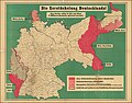 Die Zerstückelung Deutschlands.jpg 20,825 × 16,258; 88.6 MB
-
 Fifty years of Europe, 1870-1919 (1919) (14801428473).jpg 1,692 × 2,866; 660 KB
-
 Polen BV042513852.jpg 9,346 × 9,146; 6.46 MB


_(14801428473).jpg)
