Category:1893 maps of Africa
Jump to navigation
Jump to search
Temperate regions: North America · South America · Africa · Europe · Asia · – Polar regions: – Other regions:
| ← 1890 1891 1892 1893 1894 1895 1896 1897 1898 1899 → |
Media in category "1893 maps of Africa"
The following 56 files are in this category, out of 56 total.
-

-

-
 (Tunisie) - DPLA - eac884f5be7d2bd60da79235671ebf54.jpg 888 × 1,000; 324 KB
-

-
-

-

-

-

-
-

-
 15 of 'Le Sahara. ... Avec 36 cartes et gravures, etc' (11128842764).jpg 876 × 591; 126 KB
-
-

-

-
 1893 French map of Tunis.tif 7,170 × 6,760; 16.6 MB
-
-
 33 of 'Part II. Fourth edition' (11224776396).jpg 1,520 × 2,587; 715 KB
-

-

-
 AFR V4 D110 African territory annexed and claimed by Europeans by 1888.png 4,010 × 2,540; 10.15 MB
-
 AFR V4 D110-111 African territory annexed and claimed by Europeans by 1888.png 4,010 × 5,080; 18.5 MB
-
 AFR V4 D111 African territory annexed and claimed by Europeans by 1888.png 4,010 × 2,540; 8.35 MB
-
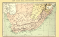 AFR V4 D233 Cape colony Natal and adjacent territories.png 4,016 × 2,606; 9.21 MB
-
 Africa - DPLA - 4476c32510c811b90226359c6c2ebc71.jpg 688 × 1,000; 254 KB
-
 Africa as Divided by Treaty - DPLA - 98951e42e3ebaf15fb1061eb1ba4818f.jpg 803 × 1,000; 170 KB
-
 Afrique - DPLA - 5d7397ea327bcd319aa662662ae53637.jpg 930 × 1,000; 268 KB
-

-

-

-

-

-

-

-

-
 Madagascar - DPLA - 294fa26e936e694710dfb0e4e69aae29.jpg 659 × 1,000; 215 KB
-
 Map of Somaliland by Col. Paget, 1893.jpg 8,372 × 12,148; 31.85 MB
-
 Nordwestliches Africa - DPLA - 11565a0f1d9944243df31ff40cd5b548.jpg 1,000 × 833; 274 KB
-
 Originalkarte des Nord-Ost-Ufers des Nyassa-Sees.png 2,293 × 2,885; 9.42 MB
-

-
 Round the black man's garden (1893) (14773025641).jpg 1,976 × 2,072; 562 KB
-

-

-

-

-

-

-
 Sketch map of Konde Country - DPLA - 9ff267115592f2253ae41f543c00209f.jpg 783 × 1,000; 182 KB
-

-

-

-

-

-

-
 Andree Übersichstkarte von Afrika 1893 UTA.jpg 6,128 × 4,903; 9.57 MB
-
 Meyers leiner Hand-atlas 1893 (73137156).jpg 6,400 × 9,484; 9.9 MB
_-_DPLA_-_6648befd076ce64cd2bb928875bae21d.jpg)
)_-_DPLA_-_ca1ab60679465d346fdcdc03182c2bd6.jpg)
_-_DPLA_-_eac884f5be7d2bd60da79235671ebf54.jpg)
_-_DPLA_-_3afcac02466e7763e815177c68350015.jpg)
)%27_(11221476476).jpg)
.jpg)
.jpg)
.jpg)
.jpg)
.jpg)
.jpg)
.jpg)
%27_(11222432514).jpg)
%27_(11224587936).jpg)
%27_(11221661735).jpg)
.jpg)
.jpg)
.jpg)


_-_lev%C3%A9e_et_dress%C3%A9e_de_1887_%C3%A0_1889_par_le_capitaine_Binger_;_Service..._-_btv1b530278544.jpg)


.jpg)
._1_-_3_000_000_J._Hansen_-_Mission_C._Maistre_-_btv1b53071176p.jpg)


_(14773025641).jpg)

._-_DPLA_-_e9ad96601f1d2dedf4c5d41165983d86.jpg)


.jpg)