Category:1890s maps of London
Jump to navigation
Jump to search
Media in category "1890s maps of London"
The following 95 files are in this category, out of 95 total.
-

-
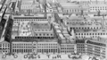
 10 of '(Cook's Handbook for London. With two maps.)' (11202712476).jpg 3,247 × 2,559; 2.29 MB
-
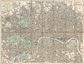 1890 Bacon Traveler's Pocket Map of London, England - Geographicus - London-bacon-1890.jpg 6,000 × 4,598; 11.4 MB
-
-

-
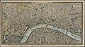 1890s pictorial map of London - London towards the close of the 19th century.jpg 5,000 × 2,792; 12.82 MB
-
 10 of '(Cook's Handbook for London. With two maps.)' (11214099753).jpg 3,233 × 2,510; 2.23 MB
-
 20 of '(Cook's Handbook for London. With two maps.)' (11214050705).jpg 3,202 × 2,505; 2.54 MB
-

-

-

-
 Fulham 1891.png 2,329 × 2,029; 8.63 MB
-
 Herrmann's Furniture Factory, Limehouse.png 2,259 × 1,253; 2.27 MB
-
 Stanford 1891 Chelsea bridges.jpg 700 × 474; 145 KB
-
 Stanford 1891 Chelsea bridges.png 700 × 474; 698 KB
-
 10 of '(Cook's Handbook for London. With two maps.)' (11217841205).jpg 3,207 × 2,472; 2.45 MB
-

-
 1892 Smith's Pocket Map of London, England - Geographicus - London-smith-1892.jpg 5,000 × 3,429; 5.13 MB
-
 20 of '(Cook's Handbook for London. With two maps.)' (11222381265).jpg 3,217 × 2,519; 2.28 MB
-

-
 Meyers leiner Hand-atlas 1893 (73136837).jpg 9,568 × 6,363; 11.28 MB
-
 Meyers leiner Hand-atlas 1893 (73136838).jpg 10,200 × 6,357; 13.39 MB
-
 Meyers leiner Hand-atlas 1893 (73136849).jpg 9,566 × 6,366; 10.96 MB
-
 1893-OS-map.JPG 2,104 × 1,693; 2.19 MB
-
 10 of '(Cook's Handbook for London. With two maps.)' (11228884243).jpg 3,178 × 2,535; 2.43 MB
-
 20 of '(Cook's Handbook for London. With two maps.)' (11229371474).jpg 3,233 × 2,492; 2.34 MB
-
 Britannia Lock, Limehouse Cut, London in 1894.png 1,984 × 1,381; 5.06 MB
-
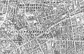 Plan Whitechapel 1894 Chapman.jpg 2,848 × 1,860; 4.39 MB
-

-
 1895 Philip Pocket Map or Plan of London, England - Geographicus - London-philip-1895.jpg 7,000 × 4,984; 13.47 MB
-
 Limehouse basin in 1895 map.jpg 1,931 × 1,294; 569 KB
-
-

-
 10 of '(Cook's Handbook for London. With two maps.)' (11239359096).jpg 3,262 × 2,531; 2.38 MB
-

-

-
 16 of '(Cook's Handbook for London. With two maps.)' (11242184426).jpg 3,191 × 2,433; 2.48 MB
-
 6 of '(Cook's Handbook for London. With two maps.)' (11240560695).jpg 3,248 × 2,503; 2.64 MB
-

-
 The District Railway Miniature Map of London, 1897.png 3,191 × 2,433; 22.25 MB
-
 16 of '(Cook's Handbook for London. With two maps.)' (11245303263).jpg 3,217 × 2,479; 2.55 MB
-
 175 of 'Pitman's Commercial Geography of the World' (11246909124).jpg 1,936 × 1,312; 959 KB
-
 6 of '(Cook's Handbook for London. With two maps.)' (11247236595).jpg 3,206 × 2,399; 2.31 MB
-

-

-
 Limehouse Basin and Cut.png 2,055 × 1,281; 5.14 MB
-
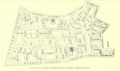 Plan of the parish of St Anne Soho.png 1,259 × 749; 707 KB
-
 The Fenian Barracks.png 1,111 × 1,012; 2.51 MB
-
 156 of 'Pitman's Commercial Geography of the World' (11248987925).jpg 1,936 × 1,325; 594 KB
-
 1899 Edit.png 920 × 896; 1.31 MB
-
 53 of 'The International Geography. ... Edited by H. R. Mill' (11168403595).jpg 1,400 × 665; 300 KB
-
 61 of 'South London ... With ... illustrations' (11165586945).jpg 1,076 × 797; 239 KB
-
 95 of 'South London ... With ... illustrations' (11169663164).jpg 1,125 × 900; 137 KB
-
 Maiden-lane-station.png 239 × 192; 62 KB
-
 1899 Bacon Pocket Plan or Map of London - Geographicus - London-bacon-1899.jpg 6,000 × 4,012; 10.49 MB
-
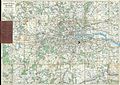
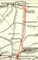
 Railway Map of Central London 1899.png 1,054 × 749; 804 KB
-

-

-

-
 Beckton Gas Works Map 1890s.png 2,466 × 1,104; 3.71 MB
-
 Birds in London (1898) (14732705026).jpg 2,800 × 1,884; 1.52 MB
-
 Broad street branch.png 203 × 316; 24 KB
-
 Composite London 753 Sheets 1896.jpg 43,797 × 42,347; 939.16 MB
-
 Composite London 753 Sheets 1896.tif 16,424 × 15,880; 995.04 MB
-
 Detail from Upper Sydenham 1894 OS map.png 842 × 823; 286 KB
-
 Fresh Wharf to Nicholson's Wharf 1893.jpg 1,058 × 486; 176 KB
-

-
-
-

-

-

-

-

-

-

-
-

-

-
-
 Joseph Rowntree, Public Houses in Central London, 1899, Cornell, CUL PJM 1134 01.jpg 5,578 × 4,725; 3.29 MB
-
 Map of Craigmar Vineyard 1894.jpg 7,008 × 4,960; 2.43 MB
-
 North Greenwich Station OS map 1890s.png 406 × 423; 118 KB
-
 OS Edition2 1895 25inch map of Lordship Lane N17 and N22.png 2,904 × 608; 1.16 MB
-
 Pall Mall (West) 1890s.jpg 1,092 × 507; 355 KB
-
 Piccadilly (South-West) 1890s.jpg 1,710 × 1,008; 917 KB
-
 Piccadilly locations mentioned in Dracula.jpg 1,106 × 844; 503 KB
-

-

-
 The diary of Samuel Pepys (1893) (14598089788).jpg 1,620 × 2,952; 403 KB
-
 The diary of Samuel Pepys (1893) (14784381932).jpg 3,164 × 1,462; 550 KB
-
 Vqpfig2.JPG 474 × 358; 38 KB
-
 Vqpfig2a.JPG 471 × 353; 39 KB
-
 Westbourne Terrace map, Ordnance Survey 1896.jpg 6,229 × 8,957; 20.1 MB
-
 Whitechapel Flower and Dean St.jpg 1,212 × 791; 470 KB
%27_(11218225185).jpg)
%27_(11202712476).jpg)

.jpg)
.jpg)

%27_(11214099753).jpg)
%27_(11214050705).jpg)
%27_(11120959185).jpg)
%27_(11117442866).jpg)
.jpg)


%27_(11217841205).jpg)
%27_(11300242933).jpg)

%27_(11222381265).jpg)
.jpg)
.jpg)
.jpg)
.jpg)

%27_(11228884243).jpg)
%27_(11229371474).jpg)


%27_(11239359096).jpg)
.jpg)
.jpg)
%27_(11242184426).jpg)
%27_(11240560695).jpg)
.jpg)

%27_(11245303263).jpg)
.jpg)
%27_(11247236595).jpg)
%27_(11246809483).jpg)
%27_(11247484403).jpg)


.jpg)

.jpg)
.jpg)
.jpg)


%27_(11231068126).jpg)
%27_(11297472575).jpg)
%27_(11298575275).jpg)

_(14732705026).jpg)


_(14765434615).jpg)
.jpg)
.jpg)
.jpg)
.jpg)
.jpg)
.jpg)
.jpg)
.jpg)
.jpg)
.jpg)
.jpg)
.jpg)


_1890s.jpg)
_1890s.jpg)

.jpg)
_(14598089788).jpg)
_(14784381932).jpg)


.jpg)