Category:1887 maps
Jump to navigation
Jump to search
| ← · 1880 · 1881 · 1882 · 1883 · 1884 · 1885 · 1886 · 1887 · 1888 · 1889 · → |
Deutsch: Karten mit Bezug zum Jahr 1887
English: Maps related to the year 1887
Español: Mapas relativos al año 1887
Français : Cartes concernant l’an 1887
Русский: Карты 1887 года
Subcategories
This category has the following 10 subcategories, out of 10 total.
Media in category "1887 maps"
The following 84 files are in this category, out of 84 total.
-

-
 178 of 'Geographie Générale ... Avec index, etc' (11099225704).jpg 821 × 650; 128 KB
-
 1887 Chart of Raoul Island.png 1,024 × 671; 1.12 MB
-
 204 of 'History of the United States, etc' (11099468216).jpg 841 × 1,096; 229 KB
-
 227 of 'History of the Boers in South Africa ... with three maps' (11188782773).jpg 2,256 × 1,415; 601 KB
-
 2fi683 plan de la gare.jpg 8,448 × 6,011; 1.5 MB
-
 A dictionary of the Bible.. (1887) (14594953738).jpg 1,448 × 1,460; 228 KB
-
 A dictionary of the Bible.. (1887) (14595180150).jpg 2,044 × 3,312; 926 KB
-
 A dictionary of the Bible.. (1887) (14595190740).jpg 2,032 × 3,288; 990 KB
-
 A dictionary of the Bible.. (1887) (14595192110).jpg 1,908 × 3,032; 1.07 MB
-
 A dictionary of the Bible.. (1887) (14595226549).jpg 2,020 × 3,284; 970 KB
-
 A dictionary of the Bible.. (1887) (14758834696).jpg 1,680 × 2,772; 809 KB
-
 A dictionary of the Bible.. (1887) (14779425814).jpg 1,776 × 2,620; 675 KB
-
 A dictionary of the Bible.. (1887) (14781302622).jpg 1,756 × 948; 229 KB
-
 A dictionary of the Bible.. (1887) (14781902895).jpg 3,328 × 2,124; 890 KB
-
 Asia (FL35103487 3892785).jpg 7,363 × 6,063; 62.72 MB
-
 Cowperthwait East 1887.jpg 1,365 × 1,708; 474 KB
-
 Cowperthwait West 1887.jpg 1,365 × 1,708; 485 KB
-

-
 Edward Stanford, The Euphrates Valley (FL13729002 2515029).jpg 8,994 × 6,181; 73.42 MB
-
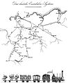 Friedrich List und die erste grosse Eisenbahn 2.jpg 1,683 × 2,064; 422 KB
-
 Frogner kart 1887.jpg 800 × 549; 875 KB
-
 General Post und Strassen Karte des Herzogthums Steyermark 1887.jpg 19,104 × 13,621; 41.76 MB
-
 Guangxi bian guan xing shi lüe tu LOC gm71005015.jpg 15,706 × 7,280; 10.99 MB
-
 Guangxi bian guan xing shi lüe tu LOC gm71005015.tif 15,706 × 7,280; 327.13 MB
-
 Hann Atlas der Meteorologie 9.jpg 1,180 × 962; 434 KB
-
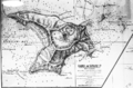
 Hatsburg Indian Territory.jpg 447 × 225; 42 KB
-
 Heilbronn Stadtbauplan 1887.jpg 3,079 × 2,746; 6.84 MB
-
 Honolulu and vicinity LOC 2005625333.jpg 10,656 × 8,200; 12.99 MB
-
 Honolulu and vicinity LOC 2005625333.tif 10,656 × 8,200; 249.99 MB
-
 Huc, Gulot; Cesty missionářské, 1887.JPG 2,528 × 1,391; 1.06 MB
-
 Image from page 230 of "A dictionary of the Bible.." (1887) (14595154277).jpg 1,848 × 1,228; 323 KB
-

-

-
 Insurance Plan of City of London Vol. IV; sheet 76-1 (BL 150287).tiff 3,137 × 3,754; 33.69 MB
-
 Jesse Lyman Hurlbut, Ancient Jerusalem in the New testament period (FL36567372 3908886).jpg 2,445 × 3,286; 3.93 MB
-
 Jesse Lyman Hurlbut, Conquest of Canaan (FL36567353 3908865).jpg 2,493 × 3,283; 4.16 MB
-
 Jesse Lyman Hurlbut, Environs of Jerusalem (FL46962235 3909021).jpg 2,884 × 3,845; 10.44 MB
-
 Jesse Lyman Hurlbut, Journeys of the Patriarchs (FL36567326 3908839).jpg 2,512 × 3,297; 4.94 MB
-

-
 Jesse Lyman Hurlbut, Kingdom of Saul (FL36567364 3908883).jpg 2,440 × 3,200; 3.88 MB
-
 Jesse Lyman Hurlbut, Lands of the Sojourn and wandering (FL36567323 3908840).jpg 2,457 × 3,298; 4.43 MB
-
 Jesse Lyman Hurlbut, Modern Jerusalem (FL36567414 3909020).jpg 2,512 × 3,264; 4.37 MB
-
 Jesse Lyman Hurlbut, Natural features of Jerusalem (FL36567394 3908906).jpg 1,219 × 1,388; 1.04 MB
-
 Jesse Lyman Hurlbut, Palestine among the tribes (FL36567348 3908880).jpg 2,470 × 3,270; 4.18 MB
-
 Jesse Lyman Hurlbut, Palestine as promised and possessed (FL46962206 3908868).jpg 2,798 × 3,822; 9.28 MB
-
 Jesse Lyman Hurlbut, Palestine under the judges (FL36567369 3908882).jpg 2,454 × 3,210; 4.45 MB
-
 Jesse Lyman Hurlbut, Physical map of Palestine (FL36567320 3908835).jpg 2,514 × 3,300; 4.92 MB
-
 Jesse Lyman Hurlbut, The division of Solomon Empire (FL37128433 3909023).jpg 2,386 × 3,209; 3.46 MB
-
 Jesse Lyman Hurlbut, The empire of David and Solomon (FL36567377 3908884).jpg 2,410 × 3,242; 3.75 MB
-
 Jesse Lyman Hurlbut, The kingdom of Herod the great (FL37128438 3909026).jpg 2,457 × 3,215; 4.04 MB
-
 Jesse Lyman Hurlbut, The Old Testament World (FL46962224 3908830).jpg 5,746 × 3,831; 20.36 MB
-
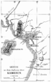 Karte Kamerun Küste 1887 B002a.png 2,090 × 3,392; 2.35 MB
-
 Lancaster, with its rail road connections - 1887. LOC 2004627700.tif 5,560 × 4,876; 77.56 MB
-
 Map of brighton 1850 fullsize by Merrifield.jpg 600 × 445; 113 KB
-
 Map of Dobrudja, 1878-1879.jpg 1,609 × 1,518; 849 KB
-
 Map of Mount Desert Island. LOC 98687166.jpg 15,319 × 19,342; 48.71 MB
-
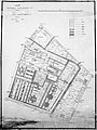
 Map of Olomouc (1887).jpg 2,057 × 2,629; 2.52 MB
-
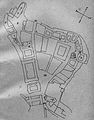
 Map of the Front Palace, 1887, Royal Thai Survey Department.jpg 2,480 × 3,307; 2.84 MB
-
 Mapaquito1887.jpg 1,300 × 896; 1.96 MB
-

-

-
 Palestine (FL37821412 3923126).jpg 8,506 × 13,528; 164.72 MB
-
 Palestine (FL37825758 3923248).jpg 8,854 × 12,710; 167.3 MB
-
 Palestine (FL42861570 3923133).jpg 3,253 × 4,168; 9.42 MB
-
 Palästina (FL33144797 3881662).jpg 6,751 × 10,117; 100.96 MB
-
 Panorama of Jerusalem (FL4542254 3522874).jpg 9,655 × 3,752; 55.76 MB
-
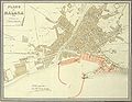 Plano de Málaga 1887.jpeg 2,622 × 2,034; 1.56 MB
-
 PSM V31 D497 Map of the moon.jpg 1,750 × 1,741; 627 KB
-
 Records of stag-hunting on Exmoor (1887) (14766801515).jpg 3,682 × 1,530; 627 KB
-
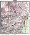 Romania 1887.JPG 4,431 × 5,229; 9.75 MB
-
 Schubring-Akragas-map-1.jpg 1,600 × 1,200; 528 KB
-

-
 Table de Peutinger - Ouest Gaule.png 419 × 538; 589 KB
-
 TabulaPeutingeriana - Gensis.jpg 1,244 × 600; 631 KB
-

-

-

-

-

-

-
 Verhandelingen der Koninklijke Akademie van Wetenschappen BHL39118248.jpg 4,591 × 2,472; 1.32 MB
-
 Zenradō Junten yori Keishōdō Shōgen ni itaru rojōzu LOC 2010360469.jpg 7,067 × 4,546; 4.18 MB
-
 Zenradō Junten yori Keishōdō Shōgen ni itaru rojōzu LOC 2010360469.tif 7,067 × 4,546; 91.92 MB
.jpg)
.jpg)

.jpg)
.jpg)

_(14594953738).jpg)
_(14595180150).jpg)
_(14595190740).jpg)
_(14595192110).jpg)
_(14595226549).jpg)
_(14758834696).jpg)
_(14779425814).jpg)
_(14781302622).jpg)
_(14781902895).jpg)
.jpg)


.jpg)
.jpg)


_(14595154277).jpg)

.jpg)
.jpg)
.jpg)
.jpg)
_(FL36567345_3908845).jpg)
.jpg)
.jpg)
.jpg)
.jpg)
.jpg)
.jpg)
.jpg)
.jpg)
.jpg)
.jpg)
.jpg)
.jpg)


.jpg)


.jpg)
.jpg)
.jpg)
.jpg)


_(14766801515).jpg)


.jpg)


.jpg)
.jpg)
.jpg)


.jpg)