Category:1886 maps of New Hampshire
Jump to navigation
Jump to search
States of the United States: California · Connecticut · Georgia · Hawaii · Illinois · Indiana · Iowa · Kansas · Kentucky · Louisiana · Maine · Maryland · Massachusetts · Michigan · Mississippi · Missouri · Montana · New Hampshire · New Jersey · New Mexico · New York · Ohio · Pennsylvania · Rhode Island · South Carolina · South Dakota · Tennessee · Texas · Utah · Vermont · Virginia · West Virginia · Wisconsin · Wyoming
Puerto Rico
Puerto Rico
| 1883 1884 1885 1886 1887 1888 1889 → |
Media in category "1886 maps of New Hampshire"
The following 10 files are in this category, out of 10 total.
-
 Greenville, N.H. (2674998059).jpg 2,000 × 1,435; 1.95 MB
-
 Greenville, N.H. 1886. LOC 75694688.jpg 6,592 × 4,976; 6.08 MB
-
 Greenville, N.H. 1886. LOC 75694688.tif 6,592 × 4,976; 93.85 MB
-
 Hinsdale, N.H. (2675818976).jpg 2,000 × 1,290; 2.08 MB
-
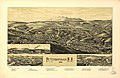
 Milford, N.H. (2675825826).jpg 2,000 × 1,341; 1.73 MB
-
 Milford, N.H. LOC 75694695.jpg 8,112 × 4,832; 7.86 MB
-
 Milford, N.H. LOC 75694695.tif 8,112 × 4,832; 112.14 MB
-
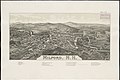
 Peterborough, N.H. (2675831400).jpg 2,000 × 1,257; 1.9 MB
-
 Peterborough, N.H. 1886. LOC 75694698.jpg 8,304 × 5,376; 8.3 MB
-
 Peterborough, N.H. 1886. LOC 75694698.tif 8,304 × 5,376; 127.72 MB
.jpg)

.jpg)
.jpg)

.jpg)
