Category:1870s maps of North Dakota
Jump to navigation
Jump to search
States of the United States: Alabama · Alaska · Arkansas · California · Colorado · Connecticut · Delaware · Florida · Georgia · Hawaii · Idaho · Illinois · Indiana · Iowa · Kansas · Kentucky · Louisiana · Maine · Maryland · Massachusetts · Michigan · Minnesota · Mississippi · Missouri · Montana · Nebraska · Nevada · New Hampshire · New Jersey · New Mexico · New York · North Carolina · North Dakota · Ohio · Oklahoma · Oregon · Pennsylvania · Rhode Island · South Carolina · South Dakota · Tennessee · Texas · Utah · Vermont · Virginia · Washington · West Virginia · Wisconsin · Wyoming – Washington, D.C.
Puerto Rico
Puerto Rico
Media in category "1870s maps of North Dakota"
The following 4 files are in this category, out of 4 total.
-
 1874 Ludlow and Custer Map of The Black Hills - Geographicus - BlackHills-custer-1874.jpg 4,000 × 4,764; 2.78 MB
-
-
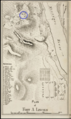
 Military Reservation of Fort Abraham Lincoln.png 1,493 × 2,489; 3.65 MB
-
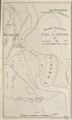
 Military Reservation of Fort Seward.png 1,415 × 2,409; 3.32 MB

_uppermost,_enlarged_and_renamed_Fort_Abraham_Lincoln_in_November,_1872._Indian_scouts_quarters_marked.png)

