Category:1842 maps of Massachusetts
Jump to navigation
Jump to search
States of the United States: Illinois · Kentucky · Louisiana · Maine · Massachusetts · Mississippi · New Mexico · Pennsylvania
| ← 1840 1841 1842 1843 1844 1846 1847 1848 1849 → |
Media in category "1842 maps of Massachusetts"
The following 11 files are in this category, out of 11 total.
-
 1842 USHotel Boston.png 687 × 720; 863 KB
-

-
-
 Boston 1842 BowdoinSquare area.jpg 255 × 269; 102 KB
-
 Boston 1842 PembertonHill area.jpg 245 × 183; 65 KB
-
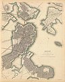
 Boston 1842.jpg 1,005 × 1,226; 341 KB
-
 Boston map 1842 HollisStreet area.jpg 280 × 317; 109 KB
-
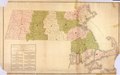
 Massachusetts and Rhode Island (NYPL b13692629-1401783).tiff 6,075 × 5,224; 90.8 MB
-
 Plan of the city of Boston (2675236446).jpg 1,773 × 2,000; 3.07 MB
-
 Warren Bridge - Charlestown-Boston - 1.jpg 5,090 × 6,364; 13.97 MB
-
 Waterfront detail Boston map 1842.jpg 377 × 158; 72 KB


.jpg)

