Category:1829 in Boston
Jump to navigation
Jump to search
Most populous urban areas of the world: Boston [US] · Jakarta [ID] · Kolkata [IN] · London [GB] · Mexico City [MX] · Milan [IT] · Moscow [RU] · New York City [US] · Paris [FR] · Philadelphia [US] · Saint Petersburg [RU] · Toronto [CA] · Washington, D.C. [US]
State capitals of the United States: Boston [MA] · Federal district: Washington, D.C. [DC] · Insular area of the United States
- 100 most populous cities of the United States
- 1–25
- Boston
- New York City
- Philadelphia
- Washington, D.C.
- 26–50
- 51–75
- New Orleans
- 76–100
1829 in Boston
Français : 1829 à Boston
Русский: 1829 год в Бостоне
Media in category "1829 in Boston"
The following 20 files are in this category, out of 20 total.
-
 1829 BedfordSt Boston map byStimpson BPL12254 detail.png 803 × 711; 1.14 MB
-
 1829 books CorinthianHall FederalSt Boston.png 890 × 546; 337 KB
-

-
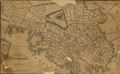 1829 Boston map byCharlesStimpson BPL 12254.png 982 × 607; 1.03 MB
-
 1829 BrattleSt Boston Stimpson BPL12254.png 809 × 713; 1.14 MB
-
 1829 ElmSt map Boston BPL12254.png 800 × 712; 1.12 MB
-
 1829 ExchangeSq Boston map Stimpson.png 441 × 392; 376 KB
-
 1829 HanoverSt Boston Stimpson BPL12254.png 806 × 712; 1.17 MB
-
 1829 Morgan RailRoadCarriage2 AbelBowen.png 734 × 409; 467 KB
-
 1829 WashingtonSt Boston Stimpson BPL12254.png 962 × 578; 1.03 MB
-
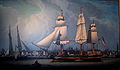
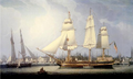 1829 Wharves Boston byRobertSalmon.png 771 × 461; 405 KB
-
 BoylstonSt Boston1829 Stimpson.png 611 × 624; 776 KB
-
 CourtSt Boston1829 Stimpson.png 800 × 711; 1.18 MB
-
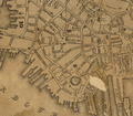 Financial Boston1829 Stimpson.png 809 × 711; 1.17 MB
-
 Map of Boston and its vicinity from actual survey (2674734696).jpg 2,000 × 1,680; 3.21 MB
-
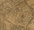 NorthEnd Boston1829 Stimpson.png 812 × 716; 1.2 MB
-

-
 Wharves of Boston by Robert Salmon, 1829 Old State House Museum, Boston, MA - IMG 6794.JPG 2,933 × 1,721; 2.18 MB
-
 TremontHouse ca1829 TremontTheatre Boston.png 672 × 441; 359 KB
-
 WestEnd Boston1829 Stimpson.png 633 × 618; 598 KB


.jpg)


