Category:1801 maps of the United States
Jump to navigation
Jump to search
Subcategories
This category has the following 2 subcategories, out of 2 total.
M
- 1801 maps of Massachusetts (11 F)
Media in category "1801 maps of the United States"
The following 23 files are in this category, out of 23 total.
-
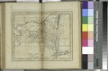
 1801 Michigan.jpg 1,551 × 1,200; 571 KB
-
 1801 Survey of Noddles Island.jpg 800 × 610; 208 KB
-
 7th United States Congress Senators.svg 429 × 543; 17 KB
-
-

-

-
-

-

-
 Delaware - engraved by A. Doolittle, Newhaven. NYPL433673.tiff 2,752 × 4,030; 31.74 MB
-
 Delaware LOC 2018590117.jpg 2,286 × 2,603; 837 KB
-
 Delaware LOC 2018590117.tif 2,286 × 2,603; 17.02 MB
-
 New Jersey - engraved by A. Doolittle, Newhaven. NYPL433670.tiff 2,773 × 4,185; 33.21 MB
-
 New York - W. Barker, sculp. NYPL433672.tiff 4,128 × 2,717; 32.09 MB
-
 New York. LOC 2018590098.jpg 2,711 × 2,169; 735 KB
-
 New York. LOC 2018590098.tif 2,711 × 2,169; 16.82 MB
-
 Maryland (NYPL b15377769-433671).jpg 4,086 × 2,668; 1.93 MB
-
 PlanoNuevaOrleans1801.jpg 800 × 557; 131 KB
-

-
 The state of New York - compiled from the latest surveys - T. Wightman, sc. NYPL434760.tiff 4,752 × 5,179; 70.42 MB
-
 The United States of America - W. Barker sculp., Philadelphia. NYPL433667.tiff 4,269 × 2,773; 33.87 MB
-
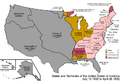 United States 1800-07-10-1802.png 1,000 × 677; 102 KB
-
 Virginia - W. Barker sculp. NYPL433669.tiff 4,192 × 2,759; 33.1 MB


.jpg)

