Category:17th-century maps of Cuba
Jump to navigation
Jump to search
Countries of North America: The Bahamas · Barbados · Canada · Costa Rica · Cuba · Guatemala · Honduras · Jamaica · Mexico · Panama · Saint Kitts and Nevis · Trinidad and Tobago‡ · United States of America‡
Other territories: Bermuda · Greenland · Guadeloupe · Martinique · Puerto Rico
‡: partly located in North America
Other territories: Bermuda · Greenland · Guadeloupe · Martinique · Puerto Rico
‡: partly located in North America
Subcategories
This category has the following 6 subcategories, out of 6 total.
#
- 1650s maps of Cuba (4 F)
- 1670s maps of Cuba (4 F)
- 1690s maps of Cuba (empty)
Media in category "17th-century maps of Cuba"
The following 12 files are in this category, out of 12 total.
-

-
 Verovering vande silver-vloot inde Bay Matanca AD.1628 (BM 1878,0713.2780).jpg 2,500 × 1,373; 888 KB
-
 1646 Carta prima Generale d'America dell India Occidentale e mare de Zur.png 1,524 × 1,254; 2.42 MB
-
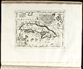
 Atlante Veneto Volume 2 125.jpg 10,464 × 7,157; 7.59 MB
-
 A new chart off the Bahama islands and the Windward passage - btv1b5970856q.jpg 6,480 × 5,072; 4.52 MB
-
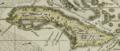 Darlington map of Cuba 1680.png 1,486 × 629; 2.42 MB
-

-
-
 Isola Cuba (8643348138).jpg 800 × 665; 92 KB
-
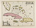
 Map of Cuba, 1685.jpg 606 × 900; 439 KB
-
 Mexico and Central America (8642247407).jpg 670 × 800; 114 KB
-

_de_la_flotte_d%27argent_..._par_le_General_P_P_Heyn_Anno_1628_(BM_1867,1012.395).jpg)
.jpg)


_-_btv1b8596191t.jpg)

.jpg)

.jpg)