Category:1790s maps of Vermont
Jump to navigation
Jump to search
States of the United States: Alaska · Connecticut · Delaware · Florida · Georgia · Indiana · Kentucky · Louisiana · Maryland · Massachusetts · Missouri · New Hampshire · New Jersey · New York · North Carolina · Ohio · Pennsylvania · South Carolina · Tennessee · Vermont – Washington, D.C.
Puerto Rico
Puerto Rico
Media in category "1790s maps of Vermont"
The following 5 files are in this category, out of 5 total.
-
 1794 Vermont gubernatorial election results map by county.png 237 × 447; 7 KB
-
 A map of the state of Vermont LOC 2017586669.jpg 3,649 × 4,637; 2.84 MB
-
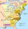 United States land claims and cessions 1782-1802.png 747 × 782; 145 KB
-
 Vermont - from the latest authorities, 1799 LOC 2011589153.tif 2,401 × 2,859; 19.64 MB
-
 Vermont1796.GIF 529 × 603; 7 KB


