Category:1750s maps of Palestine
Jump to navigation
Jump to search
Countries of Asia: People's Republic of China · Egypt‡ · Georgia‡ · India · Indonesia‡ · Iran · Japan · Lebanon · Philippines · Russia‡ · Syria · Turkey‡
Limited recognition: Taiwan · State of Palestine
‡: partly located in Asia
Limited recognition: Taiwan · State of Palestine
‡: partly located in Asia
Media in category "1750s maps of Palestine"
The following 12 files are in this category, out of 12 total.
-
-
-

-

-
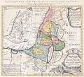
 1759 map Holy Land and 12 Tribes.jpg 2,000 × 1,676; 1.74 MB
-

-
-

-

-

-
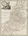
 La Palestine, pour l'Histoire des empereurs romains de M. Crévier. 1750.jpg 4,792 × 5,949; 4.48 MB
-

_-_Geographicus_-_Palestina-homannheirs-1750.jpg)
.jpg)
.jpg)


