Category:1750s maps of Maryland
Jump to navigation
Jump to search
States of the United States: California · Delaware · Florida · Georgia · Kentucky · Louisiana · Maine · Maryland · Massachusetts · Mississippi · New Hampshire · New Jersey · New York · North Carolina · Ohio · Pennsylvania · Rhode Island · South Carolina · Tennessee · Vermont · Virginia
Subcategories
This category has the following 2 subcategories, out of 2 total.
Media in category "1750s maps of Maryland"
The following 10 files are in this category, out of 10 total.
-
-
 Braddock 1755.jpg 907 × 726; 156 KB
-
 Carte de la baye de Chesapeack et pays voisins, LOC 74692504.jpg 4,490 × 2,930; 2.04 MB
-
 Carte de la baye de Chesapeack et pays voisins, LOC 74692504.tif 4,490 × 2,930; 37.64 MB
-
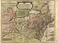
 Carte de la Virginie et du Maryland (4584051818).jpg 2,000 × 1,524; 3.36 MB
-

-
 Cumberland md braddock road.jpg 2,136 × 988; 601 KB
-
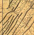 JeffFryDetail.jpg 656 × 677; 102 KB
-
 Kitfry-1-.jpg 15,216 × 9,552; 93.04 MB
-


.jpg)
.jpg)


.jpg)