Category:14th-century church towers in Oxfordshire
Jump to navigation
Jump to search
Ceremonial counties of England: Bedfordshire · Berkshire · Buckinghamshire · Cambridgeshire · Cheshire · Cornwall · Cumbria · Derbyshire · Devon · Dorset · East Sussex · Essex · Gloucestershire · Greater London · Hampshire · Herefordshire · Hertfordshire · Kent · Lancashire · Leicestershire · Lincolnshire · Merseyside · Norfolk · North Yorkshire · Northamptonshire · Nottinghamshire · Oxfordshire · Rutland · Shropshire · Somerset · South Yorkshire · Staffordshire · Suffolk · Surrey · Tyne and Wear · Warwickshire · West Midlands · West Yorkshire · Wiltshire · Worcestershire
City-counties:
Former historic counties:
Other former counties:
City-counties:
Former historic counties:
Other former counties:
Media in category "14th-century church towers in Oxfordshire"
The following 109 files are in this category, out of 109 total.
-

-
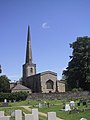
 St Mary's Church, Adderbury - geograph.org.uk - 1138963.jpg 640 × 428; 95 KB
-
 St. Mary's Church, Ardley - geograph.org.uk - 114065.jpg 640 × 481; 71 KB
-
 Ardley church.jpg 640 × 480; 231 KB
-
 Ardley StMary NE.jpg 1,279 × 1,280; 813 KB
-
 Ardley StMary.JPG 3,008 × 2,000; 3.51 MB
-
 Aston Rowant church.jpg 640 × 476; 129 KB
-
 Balscote Church (geograph 4967293).jpg 1,600 × 1,200; 494 KB
-
 Balscote pub.jpg 640 × 480; 105 KB
-
 Church spire at St Mary's, Bloxham - geograph.org.uk - 1461096.jpg 464 × 640; 78 KB
-
 Bloxham Church.png 162 × 298; 93 KB
-
 Spire of St Mary, Broughton.JPG 3,456 × 4,608; 3.27 MB
-
 Broughton church - geograph.org.uk - 801324.jpg 640 × 480; 72 KB
-
 Broughton StMaryV SE 1.jpg 1,280 × 1,280; 780 KB
-
 Broughton StMaryV SE 2.jpg 1,280 × 1,278; 712 KB
-
 Broughton StMaryV south wide.jpg 1,280 × 719; 480 KB
-
 Broughton StMaryV south.jpg 1,279 × 1,280; 760 KB
-
 Broughton StMaryV SSW.jpg 1,268 × 1,280; 759 KB
-
 Chadlington church2.jpg 427 × 640; 68 KB
-
 St Mary's Church, Chesterton - geograph.org.uk - 345196.jpg 640 × 480; 198 KB
-
 St. Mary's, Chesterton.jpg 2,048 × 1,536; 675 KB
-
 Chesterton StMary south.JPG 3,000 × 1,988; 2.26 MB
-
 Chesterton StMary southwest.jpg 1,024 × 1,280; 788 KB
-
 ChurchHanborough SSPeter&Paul SouthEast.JPG 1,995 × 2,660; 1.75 MB
-
 ChurchHanborough SSPeter&Paul SE.jpg 1,237 × 1,280; 665 KB
-
 St Stephen, Clanfield, tower.JPG 1,481 × 1,975; 747 KB
-
 St Stephens Clanfield.jpg 640 × 427; 69 KB
-
 Clanfield StStephen south.jpg 1,280 × 853; 616 KB
-
 Clanfield StStephen southeast.jpg 1,280 × 719; 511 KB
-
 Church of St James the Great, Claydon. - geograph.org.uk - 142336.jpg 640 × 480; 264 KB
-
 Claydon StJamesGt NE.jpg 1,280 × 1,219; 477 KB
-
 Claydon StJamesGt NNE.jpg 1,280 × 1,280; 773 KB
-
 Claydon StJamesGt north.jpg 1,249 × 1,280; 863 KB
-
 Combe Church - geograph.org.uk - 1018056.jpg 426 × 640; 82 KB
-
 Combe StLaurence SE.JPG 2,660 × 1,900; 695 KB
-
 St Mary's Church from the southeast, Cropredy, Oxfordshire.jpg 640 × 480; 108 KB
-
 Church of St John the Baptist, Fifield - geograph.org.uk - 131257.jpg 480 × 640; 177 KB
-
 Fifield church.jpg 640 × 480; 101 KB
-
 Fifield StJohnBaptist.JPG 3,000 × 2,000; 708 KB
-
 Great-Milton-Church.jpg 1,240 × 826; 899 KB
-
 St Mary, Great Milton, Oxon - geograph.org.uk - 1634696.jpg 640 × 501; 69 KB
-
 Great Milton Church, Oxfordshire - geograph.org.uk - 70528.jpg 640 × 480; 225 KB
-
 Great Tew church - geograph.org.uk - 4577.jpg 570 × 456; 115 KB
-
 Great Tew church - geograph.org.uk - 4593.jpg 640 × 480; 80 KB
-
 Great Tew, St Michael's and All Angels Church - geograph.org.uk - 1671286.jpg 2,048 × 1,536; 603 KB
-
 GreatTew StMichael south.JPG 2,895 × 1,930; 777 KB
-
 St Peter's in spring - geograph.org.uk - 435050.jpg 640 × 480; 112 KB
-
 St Peters Church - geograph.org.uk - 1733437.jpg 950 × 1,280; 236 KB
-
 St Peters Church Hook Norton - geograph.org.uk - 69892.jpg 485 × 640; 56 KB
-
 HookNorton StPeter NNW.jpg 1,280 × 1,243; 708 KB
-
 Kiddington Church - geograph.org.uk - 1117915.jpg 426 × 640; 59 KB
-
 Churchyard of St Mary's Kidlington - geograph.org.uk - 1344665.jpg 480 × 640; 111 KB
-
 St Mary's Church, Kidlington - geograph.org.uk - 916310.jpg 480 × 640; 61 KB
-
 St Mary's Church, Kidlington in snow - geograph.org.uk - 1164032.jpg 480 × 640; 58 KB
-

-

-
 Kidlington StMaryTheVirgin south.JPG 2,600 × 1,950; 1.57 MB
-
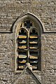 Kidlington StMaryV BelfryOpening.jpg 560 × 839; 432 KB
-
 Kidlington StMaryV SE.jpg 1,280 × 1,280; 741 KB
-
 Kidlington StMaryV south snow.jpg 1,280 × 1,280; 636 KB
-
 Kidlington StMaryV south.jpg 805 × 839; 304 KB
-
 Kidlington StMaryV southwest wide.jpg 1,280 × 831; 630 KB
-
 Kidlington StMaryV southwest.jpg 1,069 × 1,280; 712 KB
-
 Georgian house, Kingham - geograph.org.uk - 899374.jpg 640 × 426; 87 KB
-
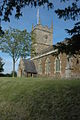
 Kingham Church - geograph.org.uk - 899370.jpg 640 × 426; 64 KB
-
 Kingham church.jpg 640 × 427; 90 KB
-
 St Andrew's church, Kingham - geograph.org.uk - 1635621.jpg 640 × 480; 89 KB
-
 Kingham Church - geograph.org.uk - 899369.jpg 426 × 640; 90 KB
-
 Kingham StAndrew south.jpg 1,024 × 1,280; 687 KB
-
 Kingham StAndrew southeast 6963 (1280x823).jpg 1,280 × 823; 596 KB
-
 Milton StBlaise tower SE.jpg 846 × 1,280; 696 KB
-
 Milton Church with driveway to Manorhouse - geograph.org.uk - 8652.jpg 640 × 479; 197 KB
-
 St Blaise church, Milton - geograph.org.uk - 64067.jpg 640 × 480; 141 KB
-
 Oxford, Canterbury College.JPG 1,944 × 2,592; 581 KB
-
 Scania Plaxton Panther TF61 OXF Oxford HighSt.jpg 1,280 × 1,171; 635 KB
-

-

-
 St Peter In The East on Queens Lane - geograph.org.uk - 1419206.jpg 640 × 427; 77 KB
-
 Queen's Lane, Oxford - geograph.org.uk - 1328277.jpg 640 × 480; 88 KB
-
 Queen's Lane, Oxford - geograph.org.uk - 1328296.jpg 480 × 640; 99 KB
-
 St James, Somerton from East.JPG 2,048 × 1,536; 1.26 MB
-
 St James, Somerton, Oxon - Doorway - geograph.org.uk - 1610279.jpg 425 × 640; 130 KB
-
 St James, Somerton, the tower.JPG 1,536 × 2,048; 1.34 MB
-
 Somerton StJames East.JPG 2,490 × 1,660; 487 KB
-
 Somerton StJames WestDoor.JPG 1,800 × 3,000; 2.7 MB
-
 Somerton StJames WestTower.JPG 2,000 × 3,000; 2.65 MB
-
 SouthNewington StPeterAV north.jpg 1,024 × 1,280; 917 KB
-
 SouthNewington StPeterAV NW.jpg 1,280 × 959; 809 KB
-
 SouthNewington StPeterAV SSE.jpg 1,280 × 1,280; 768 KB
-
 St Peter's Wolvercote, Church of England - geograph.org.uk - 2593385.jpg 683 × 1,024; 204 KB
-
 Standlake StGiles south.jpg 1,280 × 853; 494 KB
-
 St Peter, Stoke Lyne, Oxon - geograph.org.uk - 1634643.jpg 640 × 481; 95 KB
-
 St Peter, Stoke Lyne, Oxon - geograph.org.uk - 1634644.jpg 496 × 640; 94 KB
-
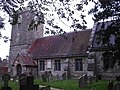
 Stoke Lyne (Oxon) St Peter's Church - geograph.org.uk - 69746.jpg 640 × 480; 129 KB
-
 Holy Trinity Church in West Hendred - geograph.org.uk - 1743684.jpg 1,500 × 980; 317 KB
-
 Holy Trinity, West Hendred - geograph.org.uk - 1547595.jpg 640 × 462; 78 KB
-
 Holy Trinity, West hendred - geograph.org.uk - 1748272.jpg 3,008 × 2,000; 2.48 MB
-
 St. Giles, Wigginton - geograph.org.uk - 120937.jpg 427 × 640; 123 KB
-
 Wigginton Church, St. Giles - geograph.org.uk - 132384.jpg 640 × 426; 132 KB
-
 Wolvercote StPeter Baptistery.jpg 683 × 1,024; 334 KB
-
 Wolvercote StPeter MonumentBall.jpg 768 × 960; 530 KB
-
 Wolvercote StPeter naveW.jpg 683 × 1,024; 314 KB
-
 Wolvercote StPeter southwest.jpg 1,024 × 683; 408 KB
-
 Wolvercote StPeter sundials south.jpg 614 × 1,024; 502 KB
-

-
 Woodeaton HolyRood NaveWest.JPG 2,000 × 3,000; 3.07 MB
-
 Woodeaton HolyRood north-west.JPG 2,590 × 1,850; 1.58 MB
-
 Woodeaton HolyRood north.JPG 2,375 × 1,900; 1.48 MB
-
 Woodeaton HolyRood west.JPG 2,000 × 2,800; 1.99 MB


.jpg)


.jpg)


_St_Peter%27s_Church_-_geograph.org.uk_-_69746.jpg)


