Category:Černá Pole
Jump to navigation
Jump to search
cadastral area in Brno .jpg) Merhautova ulice v Černých Polích  | |||||
| Upload media | |||||
| Instance of | |||||
|---|---|---|---|---|---|
| Location | Brno, Brno-City District, South Moravian Region, Czechia | ||||
| Inception |
| ||||
| Population |
| ||||
| Area |
| ||||
| Elevation above sea level |
| ||||
 | |||||
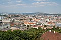
Černá Pole is one of 48 cadastral areas of Brno. It's partitioned between Brno-North, Brno-Center and Brno-Královo Pole city districts.
Subcategories
This category has the following 7 subcategories, out of 7 total.
Media in category "Černá Pole"
The following 3 files are in this category, out of 3 total.
-
 Brno View from Spilberk 134.JPG 3,008 × 2,000; 827 KB
-
 Brno View from Spilberk 135.JPG 3,008 × 2,000; 829 KB
-
 Brno View from Spilberk 140.JPG 3,008 × 2,000; 821 KB


