Category:National Land Image Information
Jump to navigation
Jump to search
注意!/Caution!
日本語: 国土地理院の航空写真や地図を新しく画像をアップロードする際は、「{{GJSTU-2.0|terms=http://www.gsi.go.jp/kikakuchousei/kikakuchousei40182.html|attr=国土地理院 (GSI)}}」のテンプレートを使って下さい。
English: When you upload new aerial photographs and maps of the Geospatial Information Authority of Japan, you should use template "{{GJSTU-2.0|terms=http://www.gsi.go.jp/kikakuchousei/kikakuchousei40182.html|attr=国土地理院 (GSI)}}".

|
The copyright holder of this file, the Ministry of Land, Infrastructure, Transport and Tourism of Japan, allows anyone to use it for any purpose, provided that the copyright holder is properly attributed. Redistribution, derivative work, commercial use, and all other use is permitted. |
Attribution:
Copyright © National Land Image Information (Color Aerial Photographs), Ministry of Land, Infrastructure, Transport and Tourism
|
 |
This image is copyrighted by the Ministry of Land, Infrastructure, Transport and Tourism of Japan. For terms of use, see the stipulation to use of National Land Information (in Japanese) and message from MLIT (in Japanese and English). When you display this image on an article, include the following phrase in the description: "Made based on National Land Image Information (Color Aerial Photographs), Ministry of Land, Infrastructure, Transport and Tourism".
|
Wikimedia category | |||||
| Upload media | |||||
| Instance of | |||||
|---|---|---|---|---|---|
| |||||
Pages in category "National Land Image Information"
The following 4 pages are in this category, out of 4 total.
Media in category "National Land Image Information"
The following 200 files are in this category, out of 6,993 total.
(previous page) (next page)-
 000922 Lake Kuttara aerial.jpg 2,359 × 2,358; 4.9 MB
-
 060305 Overall view of Yokoate Island aerial.jpg 2,370 × 1,335; 2.74 MB
-
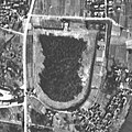
 070429 Oita Kameduka Kofun aerial.jpg 188 × 334; 101 KB
-
 070514 Yasuda Cstl aerial.jpg 766 × 766; 695 KB
-
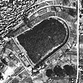
 070727 Shiragayama Kofun aerial.jpg 492 × 492; 296 KB
-
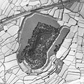
 070818 T Chausuyama Kofun aerial.jpg 454 × 454; 252 KB
-
 071012 Aotsuka Kofun aerial.jpg 359 × 359; 180 KB
-
 080421 Chitose Kurumaduka Kofun aerial.jpg 326 × 326; 188 KB
-
 080504 Sairyou Kofun aerial.jpg 610 × 610; 432 KB
-
 080506 Yanai Chausuyama Kofun aerial.jpg 317 × 422; 204 KB
-
 080515 Hokenoyama Kofun aerial.jpg 279 × 279; 131 KB
-
 080515 Kuroduka Kofun aerial.jpg 450 × 449; 282 KB
-
 080515 Nakayama Otsuka aerial.jpg 267 × 356; 169 KB
-
 080515 Nishiyama Kofun aerial.jpg 686 × 686; 546 KB
-
 080515 Shionjiyama Kofun aerial.jpg 380 × 506; 252 KB
-
 081015 Akiyoshidai aerial.jpg 1,940 × 2,586; 5.4 MB
-
 090418 Amenomiya Kofun Group aerial.jpg 468 × 468; 351 KB
-
 090418 Y Nunooyama Kofun aerial.jpg 285 × 285; 110 KB
-
 090430 Mitsujo Kofun Cluster aerial.jpg 413 × 309; 193 KB
-
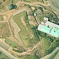
 100425 Tsukayama Kofun aerial.jpg 388 × 388; 192 KB
-
 100501 R Iwaya kofun aerial.jpg 338 × 338; 189 KB
-
 100625 Mori Shougunduka Kofun aerial.jpg 364 × 364; 249 KB
-
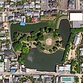
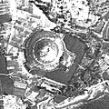
 100927 Shuri Cstl aerial.jpg 920 × 518; 681 KB
-
 111008 Yamadadera aerial.jpg 510 × 510; 384 KB
-
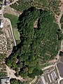
 111009 Maruyama Kofun aerial.jpg 740 × 741; 683 KB
-
 111014 Hekirichi jinya aerial.jpg 905 × 904; 933 KB
-
 111104 Umaduka Kofun aerial.jpg 416 × 416; 247 KB
-
 111126 Ichio Hakayama Kofun aerial.jpg 238 × 238; 106 KB
-
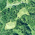
 140712 Oyasuba Kofun group aerial.jpg 229 × 306; 103 KB
-
 141018 Noto Kokubunji Ruins aerial.jpg 406 × 540; 254 KB
-
 160104 Aircraft carrier USS R Reagan in Yokosuka Port.jpg 843 × 1,128; 671 KB
-
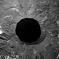
 180117 Central crater of Nishinoshima stereo.jpg 3,968 × 2,640; 9.93 MB
-
 190508 Fujimiduka Kofun group aerial.jpg 388 × 291; 156 KB
-
 190809 Nippon Budokan aerial.jpg 706 × 706; 544 KB
-
 19391206 S14 B30-C4-74 20220708.jpg 1,167 × 1,167; 457 KB
-
 19391206 S14 B30-C4-80 20220701.jpg 1,057 × 1,057; 361 KB
-
 19391206 S14 B30-C5-90 20220705.jpg 1,617 × 1,621; 827 KB
-
 19391206 S14 B30-C5-91 20220706.jpg 1,575 × 1,575; 811 KB
-
 1939年三滝橋周辺.jpg 1,876 × 1,603; 695 KB
-
 1945 Sendai b29 bombing area.jpg 840 × 1,048; 482 KB
-
 1946 Iejima Airfield.png 1,959 × 969; 1.91 MB
-
 1946年の八日市飛行場跡.jpg 1,822 × 1,121; 590 KB
-
 19470222 S22 USA-M74-10.jpg 1,717 × 1,717; 780 KB
-
 19470307 S22 USA-M105-59 20220714.jpg 1,933 × 1,933; 1.12 MB
-
 19470313 S22 USA-M121-40 20220705.jpg 807 × 807; 249 KB
-
 19470322 Toyohama S22 USA-M180-38 20220701.jpg 519 × 519; 113 KB
-
 19480220 Hanshin Muko-oohashi Sta.jpg 674 × 1,000; 181 KB
-
 19480220 Naruo Airfield.jpg 1,485 × 1,530; 824 KB
-
 19480407 S23 USA-R236-No2-10 20220706.jpg 1,493 × 1,493; 1.03 MB
-
 19480407 S23 USA-R236-No2-10 20220708.jpg 1,689 × 1,689; 1.12 MB
-
 19480407 S23 USA-R236-No2-9 20220708.jpg 1,083 × 1,083; 505 KB
-
 19481101 Toyohama S23 USAwide-R423-14 20220701.jpg 1,597 × 1,597; 641 KB
-
 19560130 S31 USA-M25-266 20220706.jpg 3,257 × 3,257; 2.67 MB
-
 19560130 Toyohama S31 USA-M25-237 20220701.jpg 2,085 × 2,085; 995 KB
-
 19560314 Fukuhama S31 USA-M341-2-143 20220623.jpg 2,169 × 2,061; 1.19 MB
-
 19560314 S31 USA-M341-2-123 20220708.jpg 2,333 × 2,333; 1.56 MB
-
 19600512 S35 KU601YZ-C1-54 20220705.jpg 676 × 676; 158 KB
-
 19600512 S35 KU601YZ-C1-64.jpg 1,539 × 1,539; 469 KB
-
 19610506 S36 MKU611-C8A-2 20220708.jpg 1,451 × 1,451; 775 KB
-
 19610506 S36 MKU611-C8A-4 20220708.jpg 2,149 × 2,149; 1.55 MB
-
 19610506 S36 MKU611-C8A-5 20220706.jpg 2,081 × 2,081; 1.48 MB
-
 19610506-13 S36 MKU611-C5B-3 C4A-16 20220713.jpg 2,085 × 2,085; 603 KB
-
 19610509 Toyohama S36 MKU611-C9A-4 20220701.jpg 1,117 × 1,117; 440 KB
-
 19610517 Ama-Rokku01.jpg 1,979 × 1,505; 837 KB
-
 19610619 Hanshin Amagasaki-kaigansen.jpg 810 × 1,290; 297 KB
-
 1961年(昭和36)撮影大阪東南部空中写真(MKK613-C11-216).jpg 4,324 × 3,991; 1.38 MB
-
 1962年森松線全像.png 2,319 × 5,376; 6.19 MB
-
 19640525 S39 MKU641X-C2-12.jpg 2,113 × 2,113; 1.95 MB
-
 19640525 S39 MKU641X-C3-13 20220705.jpg 993 × 993; 491 KB
-
 19640525 S39 MKU641X-C3-13 20220706.jpg 973 × 973; 497 KB
-
 19660613 Hanshin Kuise Renrakusen.jpg 787 × 392; 101 KB
-
 1966年(昭和41年)当時の滑川駅周辺航空写真.jpg 853 × 609; 231 KB
-
 19690428 S44 MKU691X-C3-13 20220706.jpg 1,057 × 1,057; 426 KB
-
 19690428 Toyohama S44 MKU691X-C4-15 20220701.jpg 687 × 687; 118 KB
-
 19690520 S44 MKU691X-C2B-2.jpg 2,289 × 2,289; 1.39 MB
-
 19690615 S44 KU699Y-C9A-1 20220705.jpg 645 × 645; 151 KB
-
 19691029 S44 KU699Y-C8A-6 20220714.jpg 1,553 × 1,553; 597 KB
-
 1970年(昭和45年)当時の東富山駅周辺航空写真.jpg 1,485 × 1,465; 807 KB
-
 19720421 S47 MKU723X-C2-14.jpg 2,489 × 2,489; 1.32 MB
-
 19720421 S47 MKU723X-C3-15 20220706.jpg 1,169 × 1,169; 507 KB
-
 19720421 S47 MKU723X-C3-16 20220705.jpg 1,183 × 1,183; 372 KB
-
 19720421 Toyohama S47 MKU723X-C4-15 20220701.jpg 743 × 743; 154 KB
-
 1974 Shibafuji.jpg 1,273 × 1,837; 857 KB
-
 1975 Kanebo Sumoto.jpg 1,594 × 900; 3.01 MB
-
 1975 shinanta.jpg 986 × 891; 253 KB
-
 19750114 Fukuhama S50 CKU7424-C7B-2 20220623.jpg 2,109 × 2,065; 1.41 MB
-
 19750304 Toyohama S50 CKU747-C42-23 20220701.jpg 1,453 × 1,453; 800 KB
-
 19750314 Hanshin Chibune Taihisen.jpg 914 × 1,207; 438 KB
-
 19750314 Hanshin Hamada Shako.jpg 667 × 722; 160 KB
-
 19751201 S50 KU755Y-C1-7 20220713.jpg 1,295 × 1,295; 389 KB
-
 19751201 S50 KU755Y-C2-5 20220719.jpg 1,029 × 1,029; 209 KB
-
 19751201 S50 KU755Y-C2-6 20220705.jpg 651 × 651; 132 KB
-
 19751201 S50 KU755Y-C2-6 20220708.jpg 677 × 677; 126 KB
-
 1975りんどう湖(那須町).jpg 960 × 1,280; 410 KB
-
 1975南湖(白河市).jpg 1,280 × 960; 322 KB
-
 1975年の全景.jpg 1,880 × 2,720; 2.55 MB
-
 1975御前原城跡(矢板市).jpg 640 × 480; 73 KB
-
 1976下北沢ダム(郡山市).jpg 1,024 × 768; 227 KB
-
 19790523 S54 KU793Y-C7-5 20220713.jpg 1,265 × 1,265; 454 KB
-
 19790523 S54 KU793Y-C8-7 20220706.jpg 615 × 615; 151 KB
-
 19790911 Hanshin Hamada Shako.jpg 532 × 585; 119 KB
-
 19811114 18 S56 CKU811-C11C-3 4 5 C10-2 3.jpg 4,435 × 4,427; 4.36 MB
-
 19811114 18 S56 CKU811-C13-26 27 C15A-29 30 20220719.jpg 1,905 × 1,905; 929 KB
-
 19811114 Fukuhama S56 CKU811-C13-28 20220623.jpg 1,513 × 1,429; 761 KB
-
 19811114 S56 CKU811-C12C-5 20220705.jpg 2,181 × 2,181; 1.68 MB
-
 19811114 S56 CKU811-C13-29 20220708.jpg 1,621 × 1,621; 1 MB
-
 19811114 S56 CKU811-C13-30 20220708.jpg 2,333 × 2,333; 1.66 MB
-
 19811204 Toyohama S56 CKU811-C14-25 20220701.jpg 1,385 × 1,385; 783 KB
-
 19811218 S56 CKU811-C8B-13 14 C9C-2 3 20220713.jpg 2,429 × 2,429; 1.69 MB
-
 19831010 S58 KU832Y-C8-8.jpg 1,275 × 1,275; 626 KB
-
 19831012 S58 KU832Y-C9-5 20220719.jpg 939 × 941; 288 KB
-
 19831012 Toyohama S58 KU832Y-C9-5 20220701.jpg 398 × 398; 55 KB
-
 1984 Shibuya Center Gai.jpg 936 × 572; 752 KB
-
 1985 Nisanzai kofun.jpg 900 × 874; 944 KB
-
 19870920 Fukuhama S62 CKU871-C9B-7 20220623.jpg 1,449 × 1,401; 720 KB
-
 19870920 S62 CKU871-C8B-6 20220705.jpg 2,009 × 2,009; 1.27 MB
-
 19870920 S62 CKU871-C9B-6 20220719.jpg 3,297 × 3,297; 3.14 MB
-
 19870920 S62 CKU871-C9B-8 20220708.jpg 1,493 × 1,493; 754 KB
-
 19870920 Toyohama S62 CKU871-C10-11 20220701.jpg 1,311 × 1,195; 680 KB
-
 19870928 S62 CKU871-C4-2 C5-2 3 20220713.jpg 2,417 × 2,417; 1.54 MB
-
 1989 Akihabara.jpg 1,280 × 1,280; 1.94 MB
-
 1989夢の島.jpg 835 × 885; 546 KB
-
 19900829 H2 KU901X-C6B-2 20220714.jpg 2,317 × 2,317; 1.18 MB
-
 19930515 H5 CKU931X-C1-11 20220713.jpg 2,017 × 2,017; 1.19 MB
-
 19930515 H5 CKU931X-C2-12 20220705.jpg 1,001 × 1,001; 324 KB
-
 19930515 H5 CKU931X-C2-13 20220708.jpg 2,029 × 2,029; 1.44 MB
-
 19930515 H5 CKU931X-C3-15 20220719.jpg 1,553 × 1,553; 690 KB
-
 19930515 Toyohama H5 CKU931X-C3-15 20220701.jpg 632 × 632; 172 KB
-
 19950527 H7 CKU951X-C6-5 20220714.jpg 2,409 × 2,409; 1.45 MB
-
 19981112 H10 CKU981X-C4-10 C5-11 20220714.jpg 1,049 × 1,049; 297 KB
-
 19981112 H10 CKU981X-C5-11 20220713.jpg 1,689 × 1,689; 923 KB
-
 19981112 H10 CKU981X-C6-10 20220719.jpg 1,289 × 1,289; 611 KB
-
 19981112 H10 CKU981X-C6-11 20220708.jpg 607 × 607; 139 KB
-
 19981112 H10 CKU981X-C6-12 20220706.jpg 813 × 813; 280 KB
-
 20010529 H13 CKU20011X-C3-12 20220714.jpg 1,877 × 1,877; 476 KB
-
 20010529 H13 CKU20011X-C3-13 20220713.jpg 1,583 × 1,583; 741 KB
-
 20010529 H13 CKU20011X-C4-12 20220719.jpg 1,227 × 1,313; 431 KB
-
 20010529 H13 CKU20011X-C4-13 20220708.jpg 849 × 849; 256 KB
-
 20010529 H13 CKU20011X-C4-14 20220705.jpg 793 × 793; 187 KB
-
 20010529 H13 CKU20011X-C4-14 20220706.jpg 767 × 767; 191 KB
-
 20030228 H15 KU20027X-C5-6 20220714.jpg 1,917 × 1,917; 1.06 MB
-
 20050321 Fukuhama H17 CKU20041-C24-3387 20220623.jpg 1,549 × 1,541; 773 KB
-
 20050321 Toyohama H17 CKU20041-C24-3384 20220701.jpg 1,449 × 1,449; 881 KB
-
 20060607 Ama Chuo Ryokuchi.jpg 725 × 857; 178 KB
-
 20060607 Amagasaki Unga.jpg 3,079 × 2,607; 10.18 MB
-
 20070727 H19 CKU20073-C28-10 11 12 14 16 C29-8 10 12 14 20220714.jpg 3,681 × 3,681; 4.25 MB
-
 20070727 H19 CKU20073-C29-20 21 20220705.jpg 2,933 × 2,936; 3.38 MB
-
 20070727 H19 CKU20073-C29-22 20220706.jpg 2,817 × 2,817; 4.27 MB
-
 20070727 H19 CKU20073-C31-18 20220708.jpg 2,009 × 2,009; 1.88 MB
-
 20070727 H19 CKU20073-C33-16 18 C34-15 17 20220719.jpg 2,361 × 2,361; 2.55 MB
-
 20070727 Toyohama H19 CKU20073-C35-16 20220701.jpg 1,877 × 1,873; 1.73 MB
-
 20070731 Ama-Rokku01.jpg 2,710 × 3,220; 2.16 MB
-
 20070731 Ama-Rokku02.jpg 742 × 481; 442 KB
-
 200908 Igenoyama Kofun aerial.jpg 361 × 361; 214 KB
-
 201031 Seicho of Dazaifu aerial.jpg 522 × 698; 430 KB
-
 20120926 Amagasai Sangyo High School.jpg 403 × 565; 83 KB
-
 20201005 Fukuhama R2 CKU20201-C25-34 20220623.jpg 1,849 × 1,777; 1.29 MB
-
 20201005 R2 CKU20201-C19-20 22 24 C20-26 29 32 C22-22 26 30 20220713.jpg 2,917 × 2,917; 3.46 MB
-
 20201005 R2 CKU20201-C19-20 22 24 C20-26 29 32 C22-22 26 30 20220714.jpg 4,497 × 4,497; 5.59 MB
-
 20201005 R2 CKU20201-C20-34 38 C21-33 37 38 20220708.jpg 2,797 × 2,797; 3.18 MB
-
 20201005 R2 CKU20201-C21-41 20220704.jpg 2,701 × 2,701; 2.96 MB
-
 20201005 R2 CKU20201-C21-44 20220706.jpg 2,601 × 2,601; 2.96 MB
-
 20201005 R2 CKU20201-C22-43 20220708.jpg 2,782 × 2,781; 2.65 MB
-
 20201005 R2 CKU20201-C24-35 20220708.jpg 1,853 × 1,853; 1.47 MB
-
 20201007 R2 CKU20201-C26-31 35 C27-31 34 20220719.jpg 2,677 × 2,745; 2.64 MB
-
 20201007 Toyohama R2 CKU20201-C28-24 20220701.jpg 1,685 × 1,685; 1.4 MB
-
-

-
 2021, Atami debris flow disaster. An aerial photograph outlining the damage.jpg 3,804 × 2,853; 4.47 MB
-
 2024 Haneda Airport runway collision aerial photo layout.jpg 7,108 × 3,999; 5.67 MB
-
 460215 Battleship Nagato in Yokosuka Port.jpg 512 × 684; 331 KB
-
 461028 M Tenjinyama Kofun aerial.jpg 278 × 279; 99 KB
-
 470519 battleship Haruna.jpg 1,812 × 1,811; 2.54 MB
-
 480107 battleship Ise.jpg 696 × 391; 197 KB
-
 480220 Haze Nisanzai Kofun aerial.jpg 812 × 608; 396 KB
-
 480220 Ichinoyama Kofun aerial.jpg 484 × 484; 225 KB
-
 480220 Maruyama Kofun aerial.jpg 583 × 583; 252 KB
-
 480220 Nakatsuyama kofun aerial.jpg 532 × 532; 273 KB
-
 480220 Shichikanyama Kofun etc aerial.jpg 362 × 362; 112 KB
-
 480901 Otomeyama Kofun aerial.jpg 273 × 273; 123 KB
-
 490708 Ajiyoshi Kofun group aerial.jpg 858 × 642; 413 KB
-
 4ryokaku stereo.jpg 856 × 436; 346 KB
-
 521111 Akitsune & Nishiyama.jpg 852 × 480; 350 KB
-
 530210 Sairyo Kofun aerial.jpg 572 × 572; 293 KB
-
 5ryokaku stereo.jpg 2,620 × 1,272; 3.28 MB
-
 610530 T Shiroyama Kofun aerial.jpg 776 × 776; 579 KB
-
 610606 Urama Chausuyama Kofun aerial.jpg 323 × 322; 127 KB
-
 610930 Southern Ono Basin aerial.jpg 3,020 × 2,416; 2.9 MB
-
 611029 Dairiduka Kofun aerial.jpg 370 × 371; 148 KB
-
 611029 Kujoutuka Kofun aerial.jpg 309 × 309; 102 KB
-
 700501 Ikeda Kofun aerial.jpg 361 × 271; 126 KB
-
 730525 Kenrokuen baseball ground aerial.jpg 682 × 382; 280 KB
-
 741231 Sengenyama kofun aerial.jpg 795 × 794; 909 KB
-
 750107 Expoland aerial.jpg 1,230 × 923; 1.58 MB
-
 750121 Hitachi Mine aerial.jpg 2,307 × 1,727; 4.46 MB
-
 750121 Nanakoshiyama Kofun aerial.jpg 738 × 552; 520 KB
-
 750124 Itasuke Kofun aerial.jpg 712 × 712; 806 KB
-
 750124 Kurohimeyama Kofun aerial.jpg 620 × 464; 411 KB
-
 750130 Ōta Tenjin-yama Kofun aerial.jpg 864 × 864; 1.07 MB
-
 750217 Iwatoyama Kofun aerial.jpg 534 × 401; 353 KB


%E6%92%AE%E5%BD%B1%E5%A4%A7%E9%98%AA%E6%9D%B1%E5%8D%97%E9%83%A8%E7%A9%BA%E4%B8%AD%E5%86%99%E7%9C%9F(MKK613-C11-216).jpg)


.jpg)
.jpg)

.jpg)
.jpg)


.jpg)


