Category:Maps using the standardized SVG county maps of US states
Jump to navigation
Jump to search
This is a tracking category for maps made using maps in Category:Standardized SVG county maps of US states. All such maps should be tagged with the template {{Cb500k map}} which automatically adds them to this category.
Subcategories
This category has only the following subcategory.
~
Media in category "Maps using the standardized SVG county maps of US states"
The following 200 files are in this category, out of 603 total.
(previous page) (next page)-
 1938 United States Senate election in Illinois results map by county.svg 744 × 744; 285 KB
-
 1944 United States Senate election in Illinois results map by county.svg 744 × 744; 285 KB
-

-
 1956 United States Senate election in Ohio results map by county.svg 744 × 744; 213 KB
-
 2004 Montana Initiative 96 results map by county.svg 744 × 442; 443 KB
-
 2006 Idaho Amendment 2 results map by county.svg 744 × 744; 315 KB
-
 2006 Virginia Marriage Amendment results map by county.svg 744 × 344; 736 KB
-
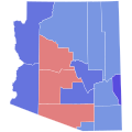
 2008 Arizona Proposition 102 results map by county.svg 744 × 744; 154 KB
-
 2008 Florida Amendment 2 results map by county.svg 744 × 727; 428 KB
-
 2021 New York Proposal 1 results map by county.svg 512 × 397; 130 KB
-
 2021 New York Proposal 2 results map by county.svg 512 × 397; 131 KB
-
 2021 New York Proposal 3 results map by county.svg 512 × 397; 141 KB
-
 2021 New York Proposal 4 results map by county.svg 512 × 397; 141 KB
-
 2021 New York Proposal 5 results map by county.svg 512 × 397; 141 KB
-

-
 2022 Vermont gubernatorial election results map by county.svg 810 × 810; 17 KB
-
 2000 Alabama Amendment 2 results map by county.svg 744 × 744; 330 KB
-

-

-

-
 2006 Alabama Amendment 774 results map by county.svg 744 × 744; 330 KB
-
 2020 Alabama Amendment 1 results map by county.svg 744 × 744; 328 KB
-
 2022 Alabama gubernatorial election results map by county.svg 810 × 810; 43 KB
-
 2022 Alabama Secretary of State election results map by county.svg 744 × 744; 328 KB
-

-
-
 1986 Arizona gubernatorial election results map by county.svg 810 × 810; 17 KB
-
 1990 Arizona gubernatorial election results map by county.svg 810 × 810; 17 KB
-
 1994 Arizona gubernatorial election results map by county.svg 810 × 810; 17 KB
-
 1998 Arizona gubernatorial election results map by county.svg 810 × 810; 17 KB
-

-
 2002 Arizona gubernatorial election results map by county.svg 810 × 810; 17 KB
-

-
 2006 Arizona gubernatorial election results map by county.svg 810 × 810; 17 KB
-
 2010 Arizona gubernatorial election results map by county.svg 810 × 810; 17 KB
-
 2014 Arizona gubernatorial election results map by county.svg 810 × 810; 17 KB
-
 2018 Arizona gubernatorial election results map by county.svg 810 × 810; 17 KB
-
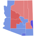
 2020 Arizona Proposition 207 results map by county.svg 744 × 744; 153 KB
-
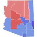
 2020 Arizona Proposition 208 results map by county.svg 744 × 744; 152 KB
-

-
-
 1911 Arizona gubernatorial election results map by county.svg 810 × 810; 18 KB
-
 1918 Arizona gubernatorial election results map by county.svg 810 × 810; 18 KB
-
 1920 Arizona gubernatorial election results map by county.svg 810 × 810; 18 KB
-
 1922 Arizona gubernatorial election results map by county.svg 810 × 810; 18 KB
-
 1924 Arizona gubernatorial election results map by county.svg 810 × 810; 18 KB
-
 1928 Arizona gubernatorial election results map by county.svg 810 × 810; 18 KB
-
 1930 Arizona gubernatorial election results map by county.svg 810 × 810; 18 KB
-
 1932 Arizona gubernatorial election results map by county.svg 810 × 810; 18 KB
-
 1934 Arizona gubernatorial election results map by county.svg 810 × 810; 18 KB
-
 1936 Arizona gubernatorial election results map by county.svg 810 × 810; 18 KB
-
 1938 Arizona gubernatorial election results map by county.svg 810 × 810; 18 KB
-
 1942 Arizona gubernatorial election results map by county.svg 810 × 810; 18 KB
-
 1944 Arizona gubernatorial election results map by county.svg 810 × 810; 18 KB
-
 1950 Arizona gubernatorial election results map by county.svg 810 × 810; 18 KB
-
 1952 Arizona gubernatorial election results map by county.svg 810 × 810; 18 KB
-
 1954 Arizona gubernatorial election results map by county.svg 810 × 810; 18 KB
-
 1956 Arizona gubernatorial election results map by county.svg 810 × 810; 18 KB
-
 1958 Arizona gubernatorial election results map by county.svg 810 × 810; 18 KB
-
 1960 Arizona gubernatorial election results map by county.svg 810 × 810; 18 KB
-
 1962 Arizona gubernatorial election results map by county.svg 810 × 810; 18 KB
-
 1964 Arizona gubernatorial election results map by county.svg 810 × 810; 18 KB
-
 1966 Arizona gubernatorial election results map by county.svg 810 × 810; 18 KB
-
 1968 Arizona gubernatorial election results map by county.svg 810 × 810; 18 KB
-
 1970 Arizona gubernatorial election results map by county.svg 810 × 810; 18 KB
-
 1974 Arizona gubernatorial election results map by county.svg 810 × 810; 18 KB
-
 1978 Arizona gubernatorial election results map by county.svg 810 × 810; 18 KB
-
 1982 Arizona gubernatorial election results map by county.svg 810 × 810; 18 KB
-
 1990 Arkansas Amendment 3 results map by county.svg 744 × 655; 383 KB
-

-
 2004 Arkansas Amendment 3 results map by county.svg 744 × 655; 382 KB
-
 2018 Arkansas Issue 5 results map by county.svg 744 × 655; 382 KB
-
 2022 Arkansas gubernatorial election results map by county.svg 810 × 709; 45 KB
-
 2022 Arkansas Secretary of State election results map by county.svg 810 × 709; 46 KB
-

-

-

-

-
 1998 California Secretary of State election results map by county.svg 744 × 744; 595 KB
-
-
-

-

-
 2002 California Secretary of State election results map by county.svg 744 × 744; 595 KB
-

-
 2004 California Proposition 1A results map by county.svg 744 × 744; 595 KB
-
 2004 California Proposition 59 results map by county.svg 744 × 744; 595 KB
-
 2004 California Proposition 60 results map by county.svg 744 × 744; 595 KB
-
 2004 California Proposition 60A results map by county.svg 744 × 744; 595 KB
-
 2004 California Proposition 61 results map by county.svg 744 × 744; 595 KB
-
 2004 California Proposition 62 results map by county.svg 744 × 744; 595 KB
-
 2004 California Proposition 63 results map by county.svg 744 × 744; 595 KB
-
 2004 California Proposition 64 results map by county.svg 744 × 744; 595 KB
-
 2004 California Proposition 65 results map by county.svg 744 × 744; 595 KB
-
 2004 California Proposition 66 results map by county.svg 744 × 744; 595 KB
-
 2004 California Proposition 67 results map by county.svg 744 × 744; 595 KB
-
 2004 California Proposition 68 results map by county.svg 744 × 744; 595 KB
-
 2004 California Proposition 69 results map by county.svg 744 × 744; 595 KB
-
 2004 California Proposition 70 results map by county.svg 744 × 744; 595 KB
-
 2004 California Proposition 71 results map by county.svg 744 × 744; 595 KB
-
 2004 California Proposition 72 results map by county.svg 744 × 744; 595 KB
-
 2005 California Proposition 73 results map by county.svg 744 × 744; 597 KB
-
 2006 California Proposition 85 results map by county.svg 744 × 744; 595 KB
-
 2008 California Proposition 10 results map by county.svg 744 × 744; 595 KB
-
 2008 California Proposition 11 results map by county.svg 744 × 744; 596 KB
-
 2008 California Proposition 12 results map by county.svg 744 × 744; 595 KB
-
 2008 California Proposition 1A results map by county.svg 744 × 744; 595 KB
-
 2008 California Proposition 2 results map by county.svg 744 × 744; 597 KB
-
 2008 California Proposition 3 results map by county.svg 744 × 744; 595 KB
-
 2008 California Proposition 4 results map by county.svg 744 × 744; 597 KB
-
 2008 California Proposition 5 results map by county.svg 744 × 744; 595 KB
-
 2008 California Proposition 6 results map by county.svg 744 × 744; 595 KB
-
 2008 California Proposition 7 results map by county.svg 744 × 744; 595 KB
-
 2008 California Proposition 9 results map by county.svg 744 × 744; 595 KB
-
 2008 California Proposition 91 results map by county.svg 744 × 744; 595 KB
-
 2008 California Proposition 92 results map by county.svg 744 × 744; 595 KB
-
 2008 California Proposition 93 results map by county.svg 744 × 744; 595 KB
-
 2008 California Proposition 94 results map by county.svg 744 × 744; 595 KB
-
 2008 California Proposition 98 results map by county.svg 744 × 744; 595 KB
-
 2008 California Proposition 99 results map by county.svg 744 × 744; 595 KB
-
 2009 California Proposition 1A results map by county.svg 744 × 744; 595 KB
-
 2009 California Proposition 1B results map by county.svg 744 × 744; 595 KB
-
 2009 California Proposition 1C results map by county.svg 744 × 744; 595 KB
-
 2009 California Proposition 1D results map by county.svg 744 × 744; 595 KB
-
 2009 California Proposition 1E results map by county.svg 744 × 744; 595 KB
-
 2009 California Proposition 1F results map by county.svg 744 × 744; 595 KB
-
 2010 California Proposition 13 results map by county.svg 744 × 744; 595 KB
-
 2010 California Proposition 14 results map by county.svg 744 × 744; 595 KB
-
 2010 California Proposition 15 results map by county.svg 744 × 744; 595 KB
-
 2010 California Proposition 16 results map by county.svg 744 × 744; 595 KB
-
 2010 California Proposition 17 results map by county.svg 744 × 744; 595 KB
-
 2010 California Proposition 19 results map by county.svg 744 × 744; 595 KB
-
 2010 California Proposition 20 results map by county.svg 744 × 744; 595 KB
-
 2010 California Proposition 21 results map by county.svg 744 × 744; 595 KB
-
 2010 California Proposition 22 results map by county.svg 744 × 744; 595 KB
-
 2010 California Proposition 23 results map by county.svg 744 × 744; 595 KB
-
 2010 California Proposition 24 results map by county.svg 744 × 744; 595 KB
-
 2010 California Proposition 25 results map by county.svg 744 × 744; 595 KB
-
 2010 California Proposition 26 results map by county.svg 744 × 744; 595 KB
-
 2010 California Proposition 27 results map by county.svg 744 × 744; 595 KB
-
 2012 California Proposition 28 results map by county.svg 744 × 744; 595 KB
-
 2012 California Proposition 29 results map by county.svg 744 × 744; 595 KB
-
 2012 California Proposition 30 results map by county.svg 744 × 744; 595 KB
-
 2016 California Proposition 51 results map by county.svg 744 × 744; 599 KB
-
 2016 California Proposition 52 results map by county.svg 744 × 744; 599 KB
-
 2016 California Proposition 64 results map by county.svg 744 × 744; 599 KB
-
 2018 California Proposition 8 results map by county.svg 810 × 810; 51 KB
-
 2020 California Proposition 13 results map by county.svg 744 × 744; 595 KB
-
 2020 California Proposition 14 results map by county.svg 744 × 744; 595 KB
-
 2020 California Proposition 15 results map by county.svg 744 × 744; 595 KB
-
 2020 California Proposition 16 results map by county.svg 744 × 744; 595 KB
-
 2020 California Proposition 17 results map by county.svg 744 × 744; 595 KB
-
 2020 California Proposition 18 results map by county.svg 744 × 744; 595 KB
-
 2020 California Proposition 19 results map by county.svg 744 × 744; 595 KB
-
 2020 California Proposition 21 results map by county.svg 744 × 744; 595 KB
-
 2020 California Proposition 22 results map by county.svg 744 × 744; 595 KB
-
 2020 California Proposition 23 results map by county.svg 744 × 744; 595 KB
-
 2020 California Proposition 24 results map by county.svg 744 × 744; 595 KB
-
 2020 California Proposition 25 results map by county.svg 744 × 744; 595 KB
-

-
 2022 California Attorney General election results map by county.svg 810 × 810; 63 KB
-
-
 2022 California gubernatorial election results map by county.svg 810 × 810; 63 KB
-
 2022 California gubernatorial primary election results map by county.svg 621 × 733; 504 KB
-

-

-
 2022 California Proposition 1 results map by county.svg 810 × 810; 63 KB
-
 2022 California Proposition 26 results map by county.svg 744 × 744; 595 KB
-
 2022 California Proposition 27 results map by county.svg 744 × 744; 595 KB
-
 2022 California Proposition 28 results map by county.svg 744 × 744; 595 KB
-
 2022 California Proposition 29 results map by county.svg 744 × 744; 595 KB
-
 2022 California Proposition 30 results map by county.svg 744 × 744; 595 KB
-
 2022 California Proposition 31 results map by county.svg 744 × 744; 595 KB
-
 2022 California State Controller election results map by county.svg 810 × 810; 63 KB
-

-
 2022 California State Treasurer election results map by county.svg 810 × 810; 63 KB
-
-

-
-

-

-
 2024 California Proposition 1 results map by county.svg 810 × 810; 63 KB
-
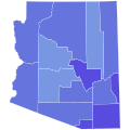
 California county map, cb 500k blank.svg 744 × 744; 588 KB
-
 California Presidential Election Results 2020.svg 744 × 744; 599 KB
-
 2012 Colorado Amendment 64 results map by county.svg 744 × 548; 263 KB
-
 2023 Colorado Proposition HH results map by county.svg 810 × 589; 45 KB
-
-

-
-
 1990 Connecticut gubernatorial election results map by county.svg 810 × 595; 22 KB
-
 1994 Connecticut gubernatorial election results map by county.svg 810 × 595; 22 KB
-

-

-

-
 Delaware Governor Election Results by County, 1940.svg 810 × 810; 6 KB
-
 1886 Florida 1885 Constitution Referendum.png 3,375 × 3,354; 326 KB
-

-

-

-


.svg)
.svg)
.svg)


.svg)

.svg)


.svg)


.svg)
.svg)
.svg)
.svg)

.svg)


.svg)


.svg)
.svg)
.svg)


.svg)


.svg)