Category:SVG labeled maps of administrative divisions of Greece (location map scheme)
Jump to navigation
Jump to search


.svg)


_(Paris_zoom).svg)
.svg)
,_administrative_divisions_-_de_-_colored_(multizoom).svg)
_-_colored.svg)
.svg)
,_administrative_divisions_-_Nmbrs_(multizoom).svg)
,_administrative_divisions_-_de_-_colored.svg)
_-_de_-_colored.svg)

.svg)

.svg)
Media in category "SVG labeled maps of administrative divisions of Greece (location map scheme)"
The following 13 files are in this category, out of 13 total.
-
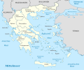
 Greece, administrative divisions - de - colored, Noto font.svg 1,003 × 825; 1.85 MB
-
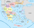
 Greece, administrative divisions - de - colored.svg 1,003 × 825; 1.23 MB
-
 Greece, administrative divisions - de.svg 1,003 × 825; 877 KB
-
 Greece, administrative divisions - el - colored.svg 1,003 × 825; 1.88 MB
-
 Greece, administrative divisions - el - monochrome.svg 1,003 × 825; 1.88 MB
-
 Greece, administrative divisions - en - colored.svg 1,003 × 825; 1.8 MB
-
 Greece, administrative divisions - en - monochrome.svg 1,003 × 825; 1.8 MB
-
 Greece, administrative divisions - es - colored.svg 1,003 × 825; 2.44 MB
-
 Greece, administrative divisions - et - colored.svg 1,003 × 825; 1.34 MB
-
 Greece, administrative divisions - fr - colored.svg 1,003 × 825; 1.84 MB
-
 Greece, administrative divisions - Nmbrs - colored.svg 1,003 × 825; 684 KB
-
 Greece, administrative divisions - Nmbrs.svg 1,003 × 825; 675 KB
-
 Greece, administrative divisions - th - colored.svg 1,003 × 825; 1.97 MB


