Category:Maps showing 13th-century history
Jump to navigation
Jump to search
| Preceded by: 12th century maps |
13th century maps 1201 AD-1300 AD |
Succeeded by: 14th century maps |
Subcategories
This category has the following 25 subcategories, out of 25 total.
- Maps showing the 1230s (3 F)
- Maps showing the 1250s (7 F)
- Maps showing the 1270s (3 F)
A
C
E
L
M
- Maps of the Eighth Crusade (3 F)
- Maps of the Fifth Crusade (4 F)
- Maps of the Ninth Crusade (8 F)
- Maps of the Seventh Crusade (5 F)
- Maps of the Sixth Crusade (4 F)
P
Media in category "Maps showing 13th-century history"
The following 165 files are in this category, out of 165 total.
-
 001 Kievan Rus' Kyivan Rus' Ukraine map 1220 1240.jpg 2,301 × 2,856; 4.69 MB
-
 11 13th century Asia Minor Turkish Invasions.Ellinika.png 1,232 × 599; 664 KB
-
 11 13th century Asia Minor Turkish Invasions.png 1,226 × 549; 641 KB
-
 Sweden 1220.png 720 × 1,000; 139 KB
-
 1250 Mediterranean Sea.PNG 801 × 370; 138 KB
-
 1260MongolConquestsLevant.jpg 1,118 × 1,270; 121 KB
-
 1263 Morze Śródziemne.svg 925 × 424; 703 KB
-
 1263 Mediterranean Sea-ar.svg 925 × 424; 373 KB
-
 1263 Mediterranean Sea-hu.svg 925 × 424; 281 KB
-
 1263 Mediterranean Sea-zh.svg 925 × 424; 239 KB
-
 1263 Mediterranean Sea.svg 925 × 424; 704 KB
-
 488px-Bulgarian-Wallachian-Empire.jpg 488 × 427; 227 KB
-
 Aragonese Crusade.PNG 362 × 283; 30 KB
-
 Aragonese-crusade-ca.svg 682 × 1,169; 1.94 MB
-
 Arctic cultures 900-1500.png 259 × 989; 251 KB
-
 Armenianmeds.gif 699 × 471; 56 KB
-
 Atlas Hermann Haack.jpg 5,694 × 7,211; 6.2 MB
-
 Baltic Tribes c 1200RU.svg 768 × 850; 767 KB
-
 Batalla de Klokotnitsa.png 1,460 × 1,947; 748 KB
-
 Battle of Adrianople (1205)-es.svg 4,007 × 6,066; 490 KB
-
 Battle of Adrianople (1205)-fr.svg 4,007 × 6,066; 487 KB
-
 Battle of Adrianople (1205).png 1,048 × 1,742; 655 KB
-
 Battle of Klokotnitsa-2.png 1,460 × 1,747; 622 KB
-
 Battle of Klokotnitsa.png 1,728 × 2,294; 760 KB
-
 Battle of Trapani, 1266-es.svg 1,624 × 1,780; 929 KB
-
 Battle of Trapani, 1266.svg 1,624 × 1,780; 865 KB
-
 BG-ХІV.jpg 1,280 × 845; 260 KB
-
 Bremen 13.Jh. Dilich 1603-04.jpg 1,820 × 1,240; 1.61 MB
-
 Bremen 13.Jh. Dilich 1604 (Detail).jpg 850 × 595; 441 KB
-
 BG1257-77.jpg 944 × 666; 377 KB
-
 Bulgaria under Boril-es.svg 892 × 731; 930 KB
-
 Bulgaria under Boril-pt.svg 892 × 731; 368 KB
-
 Bulgaria under Boril.png 2,244 × 1,856; 699 KB
-
 Bulgaria under Kaloyan.png 2,434 × 1,696; 1.25 MB
-
 Bulgaria-Ivan Asen 3.png 1,982 × 2,113; 1.13 MB
-
 Bulgaria-Iván Asen-es.svg 1,122 × 1,176; 3.24 MB
-
 Bulgaria-second half of the 13th century.png 1,852 × 1,556; 785 KB
-
 Bulgaria-second half of the 13th centuryV2-pt.svg 3,439 × 2,327; 662 KB
-
 Bulgaria-second half of the 13th centuryV2.svg 529 × 446; 1.35 MB
-
 Bulgarian-Vlach empire since primary sources.png 1,688 × 1,372; 955 KB
-
 Byzanc 1204.png 724 × 589; 393 KB
-
 Byzantine AD1205.jpg 1,200 × 776; 119 KB
-
 Byzantine Empire 1270 historical.png 802 × 372; 65 KB
-
 ByzantineEmpire1265 el.svg 1,708 × 816; 554 KB
-
 ByzantineEmpire1265-el.svg 1,708 × 816; 549 KB
-
 Byzantium1215.jpg 550 × 375; 220 KB
-
 Byzantium1st-crusade ESP.png 550 × 375; 34 KB
-
 Byzantiumforecrusades.PNG 550 × 375; 57 KB
-
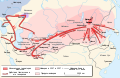
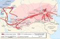
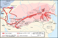
 Campaigns of Ivan Assen II-ar.png 5,165 × 5,503; 5.41 MB
-
 Campaigns of Ivan Assen II.png 2,156 × 2,297; 1.3 MB
-
 Campaigns of tsar Ivan Assen II.jpg 2,156 × 2,297; 1.38 MB
-
 Campaigns of tsar Ivan Assen IIOriginal-es.svg 1,122 × 1,198; 3.7 MB
-
 Carte croisades baltes.png 802 × 603; 78 KB
-

-
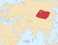
 Caucasus 1206 AD map de alt.svg 1,155 × 898; 4.5 MB
-
 Caucasus 1206 map de.png 3,000 × 2,332; 3.56 MB
-
 Caucasus 1245 AD map de.png 2,995 × 2,329; 3.48 MB
-
 Caucasus 1245 AD map en.png 1,603 × 1,247; 1.29 MB
-
 Caucasus 1245 AD map-es.svg 1,155 × 898; 1.17 MB
-
 Cilician Armenia-ar.svg 2,508 × 1,789; 848 KB
-
 Cilician Armenia-cs.svg 2,508 × 1,789; 654 KB
-
 Cilician Armenia-en.svg 2,508 × 1,789; 713 KB
-
 Cilician Armenia-es.svg 1,458 × 991; 1,001 KB
-
 Cilician Armenia-fr.svg 1,458 × 991; 374 KB
-
 Cilician Armenia-hu.svg 2,508 × 1,789; 642 KB
-
 Cilician Armenia-it.svg 2,508 × 1,789; 671 KB
-
 Cilician Armenia-sv.svg 2,508 × 1,789; 671 KB
-
 Cities in Sweden 1300.png 449 × 601; 452 KB
-
 Conquête Duché Naxos.png 1,500 × 1,500; 1,015 KB
-
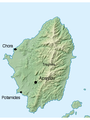
 County of Salona.jpg 1,144 × 900; 434 KB
-
 Croada contra Catalunya.jpg 293 × 216; 10 KB
-
 Cumania (1200) eng.png 1,141 × 500; 166 KB
-
 Cumania (1200) ukr.png 1,141 × 500; 142 KB
-
 Darman and Kudelin.jpg 687 × 624; 226 KB
-
 Duché Naxos.png 730 × 600; 111 KB
-
 English and French holdings 1180-1223.png 800 × 515; 93 KB
-
 Epir1205-1230.png 633 × 596; 37 KB
-
 Epirus 1205 1230.svg 633 × 598; 289 KB
-
 Epirus 1205-1230-en.svg 2,002 × 1,636; 866 KB
-
 Epirus 1205-1230-pt.svg 2,002 × 1,636; 577 KB
-
 Epirus 1205-1230-zh.svg 2,503 × 2,045; 466 KB
-
 Expansion of the Mongol Empire zh-hans.pdf 2,100 × 1,275; 4.21 MB
-
 Expansion of the Mongol Empire zh-hans.svg 992 × 595; 1.06 MB
-
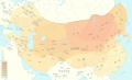
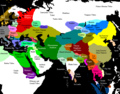
 Expansion of the Mongol Empire.svg 992 × 595; 1.12 MB
-
 Genghis Khan empire-ar.png 1,022 × 663; 290 KB
-
 Genghis Khan empire-en.svg 1,017 × 658; 97 KB
-
 Genghis Khan empire-es.svg 1,017 × 658; 441 KB
-
 Genghis Khan empire-fa.svg 1,017 × 658; 405 KB
-
 Genghis Khan empire-hu.svg 1,017 × 658; 90 KB
-
 Genghis Khan empire-ko.svg 1,017 × 658; 94 KB
-
 Genghis Khan empire-pt.svg 1,017 × 658; 89 KB
-
 Genghis Khan empire-ru.svg 1,017 × 658; 83 KB
-
 Genghis Khan empire-switch.svg 512 × 331; 275 KB
-
 Genghis Khan empire-uz.svg 512 × 331; 275 KB
-
 Genghis Khan empire-zh-hans.svg 1,017 × 658; 89 KB
-
 Gengis Khan empire-de.svg 1,025 × 663; 93 KB
-
 Gengis Khan empire-fr.svg 1,022 × 663; 111 KB
-
 Gengis Khan empire-tr.svg 1,022 × 663; 113 KB
-
 Georgia XII AS.jpg 1,000 × 652; 299 KB
-
 Greece in 1210.svg 3,508 × 2,000; 1.12 MB
-
 Greece in 1210V1.svg 3,509 × 2,000; 1.38 MB
-
 Greece in 1278-es.svg 3,509 × 2,000; 1.36 MB
-
 Greece in 1278-hu.svg 3,509 × 2,000; 518 KB
-
 Greece in 1278.JPG 1,312 × 1,131; 163 KB
-
 Greece in 1278.svg 3,508 × 2,000; 1,014 KB
-
 Gwynedd after the Treaty of Aberconwy 1277 ru.svg 1,054 × 901; 467 KB
-
 Gwynedd after the Treaty of Woodstock 1247 ru.svg 1,054 × 901; 408 KB
-
 History of Russia, IX-XV c.jpg 2,538 × 3,277; 1.4 MB
-
 116IlkanidDomin1256-1335.gif 700 × 475; 57 KB
-
 Iran-ilkhanids.jpg 3,596 × 2,302; 2.01 MB
-
 Jorgat harasm.gif 700 × 579; 73 KB
-
 Karte der alten Herrschaft Lohn.png 2,264 × 1,552; 558 KB
-
 KerkStaat1204.jpg 295 × 347; 38 KB
-
 Kievan Rus in 1237 (ka).svg 1,200 × 1,302; 281 KB
-
 Kyivan Rus' 1220-1240.png 2,301 × 2,856; 6.1 MB
-
 Latinska riket 1204.PNG 358 × 253; 13 KB
-
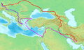
 LevanteMapaBaseV2.svg 2,207 × 1,792; 1.16 MB
-
 Lewes.jpg 747 × 589; 72 KB
-
 Livonian Livs 1250.JPG 3,072 × 4,608; 8.41 MB
-
 Magyarország XII-XIII század második felében.jpg 2,062 × 3,231; 2.7 MB
-
 Mamluks1279.png 955 × 557; 13 KB
-
 Map of Acre in 1291-es.svg 1,460 × 1,441; 290 KB
-
 Map of Acre in 1291.svg 1,460 × 1,441; 50 KB
-
 Map of the Greek and Latin states in southern Greece 1278.jpg 1,541 × 1,546; 643 KB
-
 Mittelmeer-Lander nach dem 4. Kreuzzuge (1204).jpg 3,956 × 1,056; 2.28 MB
-
 Mongol Empire map 2.gif 752 × 591; 165 KB
-
 Naxos.png 270 × 360; 94 KB
-
 NE 1200ad.jpg 1,464 × 1,037; 1.43 MB
-
 Old Bosnia, V. Ćorović.jpg 703 × 818; 181 KB
-
 Old Courland - ru.png 1,679 × 2,629; 638 KB
-
 Old Courland - ru.svg 1,006 × 1,577; 452 KB
-
 Ordine Teutonico 1260.png 5,001 × 4,346; 1.73 MB
-
 Osadnictwo i podboje niemieckie do 1300.gif 488 × 506; 10 KB
-
 Osadnictwo i podboje niemieckie na wschodzie do 1400.png 1,012 × 872; 58 KB
-
 Petachiah.png 656 × 391; 410 KB
-
 Premongol-Kipchak.png 670 × 360; 41 KB
-
 Premongol.png 752 × 590; 31 KB
-
 PremongolEurasia-ar.png 752 × 590; 60 KB
-
 PremongolEurasia.png 752 × 590; 31 KB
-
 Prussian clans 13th century.png 900 × 634; 353 KB
-
 Public Schools Historical Atlas - Europe 13th century.jpg 1,132 × 918; 374 KB
-
 Putovanja Svetog Save.png 1,356 × 1,394; 131 KB
-
 Rasulid 1264.jpg 1,660 × 1,100; 1.15 MB
-
 Rus de Kiev-1237.png 552 × 599; 343 KB
-
 Russian lands to 1250.jpg 2,401 × 2,018; 813 KB
-
 Sava's journeys 1229-1236.jpg 2,500 × 2,011; 391 KB
-
 Scandinavia 1219.gif 1,500 × 1,754; 51 KB
-
 Scandinavia1219.png 1,500 × 1,754; 41 KB
-
 ShepherdByzempire1265-ar.jpg 1,144 × 900; 721 KB
-
 ShepherdByzempire1265-es.svg 2,186 × 1,701; 1.54 MB
-
 SistemamundialdelsigloXIII.png 799 × 599; 125 KB
-
 Castilla 1210.png 600 × 643; 821 KB
-
 State of Cuman-Kipchak (13.) tr.png 2,326 × 1,456; 548 KB
-
 Sweden 1250 cropped.png 381 × 461; 43 KB
-
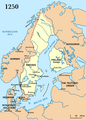 Sweden 1250.png 638 × 890; 99 KB
-
 Swedish Empire Map-es.svg 1,456 × 1,678; 253 KB
-
 Swedish Empire Map-hu.svg 1,456 × 1,678; 192 KB
-
 Teutonic Order 1260-es.svg 1,210 × 1,053; 1.74 MB
-
 The Barony of Cilician Armenia, 1080-1199.gif 699 × 472; 47 KB
-
 V-G Medit Or Sanudo.png 1,368 × 991; 2.23 MB
-
 Vexilographic maps of Pontic littoral by end of 13th-17th century.svg 1,640 × 895; 2.58 MB
-
 Wales after the Treaty of Montgomery 1267 ru.svg 744 × 1,052; 387 KB
-
 World map 1200.jpg 5,000 × 2,605; 826 KB
-
 Династии1пол13века.png 836 × 887; 120 KB
-
 Фото на стінах вежі3.jpg 3,264 × 2,448; 4.01 MB


-es.svg)
-fr.svg)
.png)


.jpg)


.png)


_eng.png)
_ukr.png)


.svg)


_tr.png)


.jpg)