Category:Maps of the world by projection
Jump to navigation
Jump to search
Subcategories
This category has the following 14 subcategories, out of 14 total.
Media in category "Maps of the world by projection"
The following 48 files are in this category, out of 48 total.
-
 Map-Aitoff.jpg 796 × 440; 70 KB
-
 Map-Apianus.jpg 529 × 626; 77 KB
-
 Map-Apollonius.jpg 682 × 399; 62 KB
-
 Armadillo projection SW.JPG 2,068 × 1,184; 754 KB
-
 BlankMap - World - Hellerick polynomial continent-based projection.svg 717 × 477; 1.83 MB
-
 Bonne projection.png 450 × 329; 6 KB
-
 Bottomley projection.png 482 × 283; 6 KB
-
 Map-Braun.jpg 762 × 398; 59 KB
-
 Map-Collignon.jpg 705 × 387; 52 KB
-
 1. GEA (world-map) Atlas.jpg 2,890 × 2,546; 631 KB
-
 Da Vinci-Cahill-Tyler World Map Projection.jpg 846 × 504; 65 KB
-
 Dymaxion Map of the World.png 8,792 × 4,231; 1.87 MB
-
 Dymaxion Projection Antarctic.png 2,560 × 2,560; 933 KB
-
 Dymaxion Projection Asia.png 2,560 × 2,560; 881 KB
-
 Dymaxion Projection Australia.png 2,560 × 2,560; 940 KB
-
 Dymaxion Projection Europe.png 2,560 × 2,560; 935 KB
-
 Dymaxion Projection North America.png 2,560 × 2,560; 688 KB
-
 Dymaxion Projection Oceania.png 2,560 × 2,560; 911 KB
-
 Dymaxion Projection South America.png 2,560 × 2,560; 940 KB
-
 Dymaxion projection.png 2,180 × 1,030; 1.26 MB
-
 Map-Eckert.jpg 720 × 482; 83 KB
-
 Map-Lambert-Gauss.jpg 403 × 406; 42 KB
-
 Gcmsyd.jpg 700 × 700; 140 KB
-
 Geodeticquickplot.gif 240 × 240; 6 KB
-
 Global Map of Oceanic Plate Age by Fabio Crameri.png 2,953 × 1,967; 4.45 MB
-
 Map-Gnomon.jpg 520 × 486; 51 KB
-
 Ancistrus areal.JPG 633 × 274; 24 KB
-
 Map-Hammer.jpg 705 × 387; 62 KB
-
 Hammer retroazimuthal projection front SW.JPG 2,060 × 2,060; 349 KB
-
 Hellerick triaxial boreal projection.svg 301 × 301; 1.07 MB
-
 JPA 418343441 000023.jpg 2,567 × 3,843; 321 KB
-
 JPA 418343441 000024.jpg 2,567 × 3,843; 289 KB
-
 Map-Kavrajsky.jpg 713 × 425; 62 KB
-
 Map-Lambert.jpg 720 × 758; 123 KB
-
 Mercator map - Big Australia.png 354 × 354; 98 KB
-
 Mercator map - Big Japan.png 354 × 354; 95 KB
-
 Mundy.png 1,941 × 1,493; 73 KB
-
 Map-Policonic.jpg 644 × 520; 76 KB
-
 Map-Postel.jpg 327 × 675; 55 KB
-
 Pq-s200-0.4-z-25.png 421 × 421; 80 KB
-
 Projection AuthaGraph.png 2,280 × 990; 2.99 MB
-
 Pst-geo.svg 512 × 258; 133 KB
-
 Map-Ptolemaios.jpg 784 × 504; 86 KB
-
 Roussilhe oblique stereographic projection.svg 422 × 160; 53 KB
-
 Sinusoïdale projectie.PNG 953 × 477; 46 KB
-
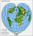 Map-Stabius.jpg 531 × 565; 70 KB
-
 Map-Stereogaph.jpg 660 × 370; 55 KB
-
 Tilted Earth Coastline Equirectangular.svg 2,398 × 1,347; 322 KB


_Atlas.jpg)


