Category:Maps of the history of the Caucasus
Jump to navigation
Jump to search
Subcategories
This category has the following 10 subcategories, out of 10 total.
*
A
C
K
M
O
Media in category "Maps of the history of the Caucasus"
The following 200 files are in this category, out of 237 total.
(previous page) (next page)-
 116IlkanidDomin1256-1335.gif 700 × 475; 57 KB
-
 128TurkomanDomin1378-1502.JPG 700 × 476; 286 KB
-
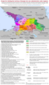
 1897 Gov Stavropol ethno.jpg 974 × 555; 116 KB
-
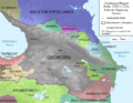
 1992 Georgia war.svg 1,940 × 1,370; 2.06 MB
-
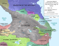
 1992-1993 Georgia war.svg 1,940 × 1,370; 2.15 MB
-
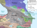
 1993 Georgia war1.svg 1,940 × 1,370; 1.82 MB
-
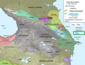
 1993 Georgia war2.svg 1,940 × 1,370; 2.22 MB
-
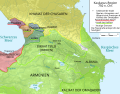
 2021-Amir-Eyvaz-Map-of-the-State-of-Atabegs-of-Azerbaijan-1136-1225.jpg 1,800 × 1,800; 1.74 MB
-
 87EarlyBagratid884-962-ru.svg 2,938 × 1,873; 403 KB
-
 Hazarların düşüşü.png 593 × 447; 67 KB
-
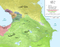
 Administrative Division of the Erivan Khanate in 1828.png 5,000 × 3,000; 1.32 MB
-
 Alania 10 12-es.svg 1,552 × 1,201; 270 KB
-
 Alania 10th–12th c. according to Bzarov.png 1,656 × 1,281; 83 KB
-
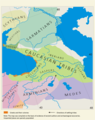
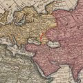
 Ancient countries of Transcaucasia.jpg 2,029 × 1,198; 1.09 MB
-
 Armenia Prior to Muslim Conquest-ar.png 651 × 482; 160 KB
-
 Armenia Throughout History.gif 700 × 525; 38 KB
-
 Armenian Empire 80 BC.png 1,084 × 705; 22 KB
-
 Armenian migration-Tsutsiev 2015.svg 1,328 × 897; 1.21 MB
-
 Armenien 1914.png 2,360 × 1,650; 1,002 KB
-
 Armeno Georgian war situation.png 1,993 × 1,804; 972 KB
-
 Battle of Baku 1918.png 811 × 799; 157 KB
-
 Campaña del Caucaso-HE.png 1,500 × 1,078; 441 KB
-
 Caucasus 1000 map alt de.png 2,990 × 2,324; 3.77 MB
-
 Caucasus 1000 map de alt.svg 1,155 × 898; 4.59 MB
-
 Caucasus 1000 map de.png 2,990 × 2,324; 3.74 MB
-
 Caucasus 1000 map de.svg 1,155 × 898; 4.61 MB
-
 Caucasus 1000 map en.png 1,604 × 1,246; 1.42 MB
-
 Caucasus 1000 map hu.svg 1,155 × 898; 4.59 MB
-
 Caucasus 1060 map alt de.svg 1,155 × 898; 4.54 MB
-
 Caucasus 1060 map alt.svg 1,155 × 898; 4.54 MB
-
 Caucasus 1060 map ar.svg 1,155 × 898; 4.22 MB
-
 Caucasus 1060 map de.svg 1,155 × 898; 4.54 MB
-
 Caucasus 1060 map en.svg 1,155 × 898; 4.1 MB
-
 Caucasus 1060 map es.svg 1,155 × 898; 3.58 MB
-
 Caucasus 1060n map de.png 2,990 × 2,324; 3.57 MB
-
 Caucasus 1090 AC de alt.svg 1,155 × 898; 4.5 MB
-
 Caucasus 1090 AC de.png 2,990 × 2,324; 3.63 MB
-
 Caucasus 1090 AC ka alt.svg 1,155 × 898; 4.51 MB
-
 Caucasus 11 century.svg 1,155 × 898; 4.55 MB
-
 Caucasus 1124 AC de alt.svg 1,155 × 898; 4.5 MB
-
 Caucasus 1124 AC de.png 2,990 × 2,324; 3.56 MB
-
 Caucasus 1124 AC en alt-CotasDeAltitud-es.svg 1,232 × 958; 3.64 MB
-
 Caucasus 1124 AC en alt-Simplificado-es.svg 1,232 × 958; 1.26 MB
-
 Caucasus 1124 AC en alt.svg 1,155 × 898; 4.5 MB
-
 Caucasus 1206 AD map de alt.svg 1,155 × 898; 4.5 MB
-
 Caucasus 1206 map de.png 3,000 × 2,332; 3.56 MB
-
 Caucasus 1213 AD map de.png 3,000 × 2,332; 3.59 MB
-
 Caucasus 1213 AD map de.svg 1,155 × 898; 4.5 MB
-
 Caucasus 1213 AD map en.svg 1,155 × 898; 4.5 MB
-
 Caucasus 1213 AD map es.svg 1,155 × 898; 1.47 MB
-
 Caucasus 1213 AD map ka.svg 1,155 × 898; 4.5 MB
-
 Caucasus 1213 AD map ru.svg 1,155 × 898; 4.5 MB
-
 Caucasus 1245 AD map de.png 2,995 × 2,329; 3.48 MB
-
 Caucasus 1245 AD map en.png 1,603 × 1,247; 1.29 MB
-
 Caucasus 1245 AD map-es.svg 1,155 × 898; 1.17 MB
-
 Caucasus 1311 AD map de alt.svg 1,155 × 898; 4.5 MB
-
 Caucasus 1311 AD map de.png 2,995 × 2,329; 3.38 MB
-
 Caucasus 1311 AD map en.png 1,603 × 1,247; 1.37 MB
-
 Caucasus 1380 map de alt.svg 1,155 × 898; 3.84 MB
-
 Caucasus 1380 map de.png 2,659 × 2,067; 2.27 MB
-
 Caucasus 1380 map en alt.svg 1,155 × 898; 3.84 MB
-
 Caucasus 1380 map en.png 1,603 × 1,246; 936 KB
-
 Caucasus 1405 map de alt.svg 1,155 × 898; 4.48 MB
-
 Caucasus 1405 map de.png 3,000 × 2,332; 3.44 MB
-
 Caucasus 1405 map en.png 1,604 × 1,246; 1.24 MB
-
 Caucasus 1450 map de alt-es.svg 1,155 × 898; 4.26 MB
-
 Caucasus 1450 map de alt.svg 1,155 × 898; 4.48 MB
-
 Caucasus 1450 map de.png 3,000 × 2,332; 3.51 MB
-
 Caucasus 1490 map de alt ka.png 4,888 × 3,828; 4.76 MB
-
 Caucasus 1490 map de alt-es.svg 1,155 × 898; 4.27 MB
-
 Caucasus 1490 map de alt.svg 1,155 × 898; 4.5 MB
-
 Caucasus 1490 map de altSimplified-es.svg 1,155 × 898; 1.31 MB
-
 Caucasus 1490 map de.png 2,995 × 2,329; 3.55 MB
-
 Caucasus 1530 map de alt.svg 1,155 × 898; 4.45 MB
-
 Caucasus 1530 map de.png 3,000 × 2,332; 3.55 MB
-
 Caucasus 1917 ATD project map (cropped).png 5,996 × 4,002; 3.22 MB
-
 Caucasus 1917 ATD project map.png 5,996 × 10,912; 8.43 MB
-
 Caucasus 750n de.png 2,990 × 2,324; 3.63 MB
-
 Caucasus 850 map alt de.png 2,990 × 2,324; 3.66 MB
-
 Caucasus 850 map alt de.svg 1,155 × 898; 4.51 MB
-
 Caucasus 850 map de.png 2,990 × 2,324; 3.68 MB
-
 Caucasus 850 map de.svg 1,155 × 898; 4.51 MB
-
 Caucasus 850 map hu.svg 1,155 × 898; 4.49 MB
-
 Caucasus 900 map alt de.png 2,990 × 2,324; 3.66 MB
-
 Caucasus 900 map alt de.svg 1,155 × 898; 4.56 MB
-
 Caucasus 900 map de.png 2,990 × 2,324; 3.7 MB
-
 Caucasus 900 map de.svg 1,155 × 898; 4.56 MB
-
 Caucasus about year 1124.jpg 847 × 541; 328 KB
-
 Caucasus after Treaty of Gulistan, 1813.png 3,777 × 2,549; 859 KB
-
 Caucasus and Caspian 1160 AD fa.svg 1,155 × 898; 329 KB
-
 Caucasus in 300 AD (Armenian - hy).png 1,127 × 833; 800 KB
-
 Caucasus1991.png 701 × 597; 265 KB
-
 CaucasusRegionMapShowingSiracena.png 1,915 × 1,800; 1.04 MB
-
 Caukcasus 1060 map alt de.png 3,000 × 2,332; 3.63 MB
-
 Chasaren-ar.jpg 1,394 × 1,133; 409 KB
-
 Chasaren.jpg 1,394 × 1,133; 959 KB
-
 David IV map de.png 2,990 × 2,324; 3.32 MB
-
 David IV map-es.svg 1,155 × 898; 1.32 MB
-
 DavidBuilderGeorgia.png 921 × 821; 35 KB
-
 DRG 1918-1921-en.png 3,144 × 7,248; 1.44 MB
-
 DRG 1918-1921-ka.png 3,144 × 8,028; 1.88 MB
-
 DRG 1918-1921-ru.png 3,144 × 7,074; 1.42 MB
-
 DRG-ATD-en.png 3,148 × 5,396; 1.43 MB
-
 DRG-ATD-ka.png 3,148 × 5,916; 1.78 MB
-
 DRG-ATD-ru.png 3,144 × 5,666; 1.49 MB
-
 Duchies of Kingdom of Georgia, XIII c.svg 1,907 × 1,228; 1.38 MB
-
 Duchy of Svaneti, XIII c.svg 1,872 × 944; 1.49 MB
-
 Early caucasus aa.jpg 632 × 966; 277 KB
-
 Earlycaucasus655.jpg 1,180 × 791; 555 KB
-
 Eastern Front 1942-11 to 1943-03--Velikiye Luki hu.svg 1,200 × 1,173; 298 KB
-
 Ethnic Caucasia-en.png 1,200 × 1,519; 382 KB
-
 Ethnic Caucasia-ka.png 1,200 × 1,519; 404 KB
-
 Ethnic Caucasia.PNG 1,200 × 1,519; 266 KB
-
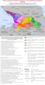
 Ethnographic map of Adygeа (Этнографическая карта Адыгеи, 2010).png 1,936 × 1,856; 524 KB
-
 Expulsion map of the Circassians in 19th century.PNG 491 × 445; 15 KB
-
 File-Caucasus 1245 AD map ar.svg 1,155 × 898; 4.48 MB
-
 File-Caucasus 1245 AD map de.svg 1,155 × 898; 4.45 MB
-
 Ge colxida.png 312 × 250; 14 KB
-
 Geor mong aa.GIF 1,341 × 1,286; 84 KB
-
 Georgia (1089-1125)-es.svg 1,155 × 898; 1.32 MB
-
 Georgia (1089-1125)-fr.svg 1,155 × 898; 1.58 MB
-
 Georgia 1st 2nd centuries AD.svg 1,333 × 1,047; 532 KB
-
 Georgia during the reign of King George V.jpg 1,368 × 1,006; 173 KB
-
 Georgia grey topography (1089-1125)-de.svg 1,155 × 898; 4.49 MB
-
 Georgia map 1762-es.svg 1,607 × 1,157; 622 KB
-
 Georgia map 1762.svg 1,607 × 1,157; 91 KB
-
 Georgia under David Agmashenebeli 1089-1125.svg 831 × 518; 3.73 MB
-
 Georgia XII AS.jpg 1,000 × 652; 299 KB
-
 Georgian empire with tributaries-es.svg 889 × 639; 621 KB
-
 Georgian empire with tributaries-hy.png 1,976 × 1,419; 493 KB
-
 Georgian empire with tributaries.png 1,976 × 1,419; 413 KB
-
 Georgian empire-ka.png 1,974 × 1,418; 426 KB
-
 Georgian empire.png 1,974 × 1,418; 420 KB
-
 Georgian states (830-1020)-fr.svg 1,155 × 898; 1.26 MB
-
 Georgianiberia andersen565.JPG 1,166 × 817; 381 KB
-
 GeorgianKingdomMap.png 800 × 574; 207 KB
-
 Georgië 830-1020.svg 1,244 × 1,090; 521 KB
-
 Greene, Robert. - 1686.jpg 1,200 × 1,200; 371 KB
-
 Gunib storm 1859.svg 640 × 550; 574 KB
-
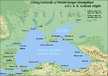 Görög gyarmatok a Fekete-tengernél i e 6 század.svg 1,771 × 1,254; 3.01 MB
-
 Hazarlar.jpg 1,400 × 1,139; 994 KB
-
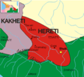 Hereti map 950.png 436 × 402; 293 KB
-
 Hondius, Hendrik, 1597-1651, - 1636.jpg 1,200 × 1,200; 391 KB
-
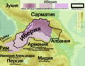 Iberia map ru.png 1,155 × 898; 1.07 MB
-
 Influencedurartu1.PNG 333 × 250; 21 KB
-
 Kabardian principalities.svg 640 × 494; 1.67 MB
-
 Kaukasus 750 map alt de.png 2,990 × 2,324; 3.63 MB
-
 Kaukasus 750n alt de.svg 1,155 × 898; 4.48 MB
-
 Kaukasus 750n alt es.svg 1,232 × 958; 3.55 MB
-
 Kaukasus 750n alt pt.svg 1,155 × 898; 4.45 MB
-
 Kaukasus 750n ar.svg 1,155 × 898; 4.77 MB
-
 Kaukasus 750n de.svg 1,155 × 898; 4.48 MB
-
 Khartli-Kakheti and Imereti-fr.svg 800 × 550; 3.76 MB
-
 Khartli-Kakheti-fr.svg 800 × 550; 3.76 MB
-
 Khartli-Kakheti-he.svg 800 × 550; 3.76 MB
-
 Khartli-Kakheti.svg 800 × 550; 3.73 MB
-
 Khazar map1.PNG 939 × 592; 548 KB
-
 Kubanskaya oblast Eyskii.PNG 1,543 × 1,271; 62 KB
-
 Kubanskaya oblast Kavkazskii.PNG 1,543 × 1,271; 63 KB
-
 Lazica in Late Antiquity-es.svg 1,038 × 935; 1.27 MB
-
 Lazica in Late Antiquity-pt.svg 1,038 × 935; 1.91 MB
-
 Lazica in Late Antiquity-tr.svg 1,038 × 935; 2.2 MB
-
 Map of Georgia 1762.png 2,710 × 2,009; 13.96 MB
-
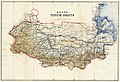 Map of Terek Oblast.jpg 13,654 × 9,345; 37.06 MB
-
 Map of the Caucasus, 740 CE.svg 1,155 × 898; 4.39 MB
-
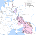
 Map of the Erivan Khanate in 1820.svg 3,748 × 2,188; 2.11 MB
-
 Map of the Georgian Empire in the beginning of the 13th century-en.svg 1,313 × 952; 794 KB
-
 Map of the Georgian Empire in the beginning of the 13th century.svg 1,313 × 952; 882 KB
-
 Map of the Karabakh Khanate 2.svg 1,711 × 1,384; 1.28 MB
-
 Map of the Karabakh Khanate.svg 1,711 × 1,384; 2.31 MB
-
 Map of the Sheikh Mansur Movement between 1785.jpg 1,057 × 760; 122 KB
-
 MapChart Map-3.png 6,480 × 7,480; 2.32 MB
-
 Mid-14th c. Georgia map.svg 1,894 × 1,254; 661 KB
-
 Ossetian expansion.svg 375 × 352; 3.2 MB
-
 Ossetian tribes.png 494 × 899; 47 KB
-
 Political map of the Caucasus and its surroundings between 1795–1801.svg 4,973 × 2,735; 8.94 MB
-
 Political map of the eastern part of the Southern Caucasus between 1795–1801.svg 2,669 × 1,966; 8.89 MB
-
 Pontic-650 hu.png 800 × 883; 162 KB
-
 Pontic-650-nl.PNG 406 × 448; 15 KB
-
 Pontic-650.png 406 × 448; 14 KB
-
 Reichskommissariat Caukasus.png 2,232 × 2,472; 378 KB
-
 Rus Caspian.png 711 × 612; 669 KB
-
 Shaddadid-es.svg 2,938 × 1,873; 2.26 MB
-
 Shaddadid.gif 1,396 × 910; 369 KB
-
 Shirvan and Daghestan in the medieval Islamic era.svg 1,690 × 2,112; 2.95 MB
-
 Skkrayussr1932 (cropped).jpg 779 × 514; 82 KB
-
 Skkrayussr1932.jpg 1,444 × 1,839; 442 KB
-
 SW Caspian.jpg 640 × 360; 227 KB
-
 Tao-Klardschetien Gliederung de.png 1,825 × 1,463; 1.27 MB
-
 Tao-Klardschetien Gliederung de.svg 700 × 500; 4.01 MB
-
 Tao-Klarjeti.svg 770 × 550; 3.74 MB
-

-
 The Administrative Divisions of Safavid Iran in the the South Caucasus.svg 2,646 × 2,540; 9.24 MB
-
 The South Caucasus in the last quarter of the 18th century.svg 942 × 737; 2.45 MB
-
 Transcaucasia XIX 01.png 1,130 × 710; 248 KB
-
 Transcaucasia XIX 02.png 1,129 × 710; 189 KB
-
 Treaty of Batum (hy).svg 512 × 413; 118 KB
-
 Treaty of Batum.png 800 × 551; 145 KB
-
 Turlov Principality (1732).jpg 1,280 × 1,558; 137 KB
-
 Uzunhasanempire.gif 700 × 472; 51 KB


.png)


.png)


.png)


-es.svg)
-fr.svg)


-de.svg)


-fr.svg)


.jpg)


.svg)

.jpg)
