Category:Maps of subdivisions of the United Kingdom
Jump to navigation
Jump to search
Countries of Europe: Albania · Armenia‡ · Austria · Azerbaijan‡ · Belarus · Belgium · Bulgaria · Croatia · Cyprus‡ · Denmark · Estonia · Finland · France‡ · Georgia‡ · Germany · Greece · Hungary · Iceland · Republic of Ireland · Italy · Kazakhstan‡ · Lithuania · Moldova · Montenegro · Poland · Portugal‡ · Russia‡ · Serbia · Slovenia · Spain‡ · Sweden · Switzerland · Turkey‡ · Ukraine · United Kingdom
‡: partly located in Europe
‡: partly located in Europe
Subcategories
This category has the following 15 subcategories, out of 15 total.
#
*
C
R
T
Media in category "Maps of subdivisions of the United Kingdom"
The following 27 files are in this category, out of 27 total.
-
 British Isles - UK & Ireland.png 2,103 × 1,415; 174 KB
-
 Great Britain template.png 290 × 396; 10 KB
-
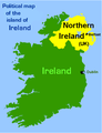 Island-of-Ireland2.PNG 416 × 543; 17 KB
-
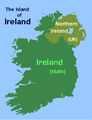 Island-of-Ireland5.PNG 416 × 543; 11 KB
-
 LAndsEndJohnoGroats.png 290 × 396; 12 KB
-
 Map of the administrative geography of the British Isles with postcode areas.jpg 4,208 × 5,056; 4.02 MB
-
 Map of the administrative geography of the British Isles.jpg 4,208 × 5,056; 3.5 MB
-
 Map of the administrative geography of the United Kingdom.png 2,806 × 4,179; 1.06 MB
-
 NationsConstitutivesRU.png 358 × 599; 83 KB
-
 Northern England in England.png 800 × 972; 148 KB
-
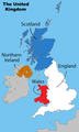
 Northern England-Historic counties.svg 809 × 1,025; 933 KB
-
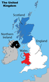
 Northern England.svg 816 × 991; 594 KB
-
 PoliceBTP.PNG 834 × 1,188; 213 KB
-
 Uk parishes.png 1,652 × 2,028; 2.45 MB
-
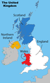
 United Kingdom labelled map1.png 643 × 1,075; 87 KB
-
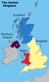
 United Kingdom labelled map11.png 643 × 1,075; 90 KB
-
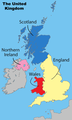
 United Kingdom labelled map12.png 643 × 1,075; 90 KB
-
 United Kingdom labelled map13.png 643 × 1,075; 89 KB
-
 United Kingdom labelled map14.png 643 × 1,075; 85 KB
-
 United Kingdom labelled map15.png 643 × 1,075; 86 KB
-
 United Kingdom labelled map16.png 643 × 1,075; 84 KB
-
 United Kingdom labelled map2.png 643 × 1,075; 87 KB
-
 United Kingdom labelled map3.png 643 × 1,075; 87 KB
-
 United Kingdom labelled map4.png 643 × 1,075; 87 KB
-
 United Kingdom labelled map5.png 643 × 1,075; 87 KB
-
 United Kingdom labelled map6.png 643 × 1,075; 87 KB
-
 United Kingdom labelled map8.png 643 × 1,075; 86 KB


