Category:Maps of Liechtenstein
Jump to navigation
Jump to search
Countries of Europe: Albania · Andorra · Armenia‡ · Austria · Azerbaijan‡ · Belarus · Belgium · Bosnia and Herzegovina · Bulgaria · Croatia · Cyprus‡ · Czech Republic · Denmark · Estonia · Finland · France‡ · Georgia‡ · Germany · Greece · Hungary · Iceland · Republic of Ireland · Italy · Kazakhstan‡ · Latvia · Liechtenstein · Lithuania · Luxembourg · Malta · Moldova · Monaco · Montenegro · Netherlands‡ · North Macedonia · Norway · Poland · Portugal‡ · Romania · Russia‡ · San Marino · Serbia · Slovakia · Slovenia · Spain‡ · Sweden · Switzerland · Turkey‡ · Ukraine · United Kingdom · Vatican City
Specific status: Akrotiri and Dhekelia‡ · Faroe Islands · Gibraltar · Bailiwick of Guernsey · Isle of Man · Jersey · Svalbard – Limited recognition: Abkhazia‡ · Gagauzia · Kosovo · South Ossetia‡ · Transnistria · Northern Cyprus‡ · United Nations Buffer Zone in Cyprus‡
‡: partly located in Europe
Specific status: Akrotiri and Dhekelia‡ · Faroe Islands · Gibraltar · Bailiwick of Guernsey · Isle of Man · Jersey · Svalbard – Limited recognition: Abkhazia‡ · Gagauzia · Kosovo · South Ossetia‡ · Transnistria · Northern Cyprus‡ · United Nations Buffer Zone in Cyprus‡
‡: partly located in Europe
Wikimedia category | |||||
| Upload media | |||||
| Instance of | |||||
|---|---|---|---|---|---|
| Category combines topics | |||||
 | |||||
Subcategories
This category has the following 17 subcategories, out of 17 total.
Pages in category "Maps of Liechtenstein"
This category contains only the following page.
Media in category "Maps of Liechtenstein"
The following 39 files are in this category, out of 39 total.
-
 1115 Säntis.jpg 14,000 × 9,600; 117.64 MB
-
 1116 Feldkirch.jpg 14,000 × 9,600; 102.31 MB
-
 1135 Buchs.jpg 14,000 × 9,600; 112.99 MB
-
 1136 Drei Schwestern.jpg 14,000 × 9,600; 127.47 MB
-
 1155 Sargans.jpg 14,000 × 9,600; 121.66 MB
-
 1156 Schesaplana.jpg 14,000 × 9,600; 130.71 MB
-
 Satellite image of Liechtenstein in September 2002.jpg 81 × 119; 11 KB
-

-
 2018 Liechtenstein Tour de Ski referendum.png 519 × 895; 79 KB
-
 Satellite image of Liechtenstein on Landsat 7.jpg 638 × 1,180; 187 KB
-
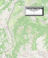
 Karte Liechtenstein.png 472 × 873; 108 KB
-
 AustrianPostLichtenshtein.png 560 × 826; 28 KB
-
 Balzers Heliport.png 917 × 634; 84 KB
-
 Central Eastern Alps.png 905 × 502; 42 KB
-
 CH-Hauptstrasse16-OSM.png 479 × 381; 333 KB
-
 Diplomatic missions of Liechtenstein.png 1,425 × 625; 57 KB
-
 European Microstates Map.png 626 × 408; 82 KB
-
 European Union and five microstates.PNG 481 × 473; 21 KB
-
 FLII Liechtenstein.png 1,228 × 825; 122 KB
-
 Grenze Balzers-SG 1818.jpg 1,088 × 848; 270 KB
-
 Grenzverlauf A-FL.png 800 × 976; 878 KB
-
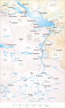 Karte Alpenrhein.png 708 × 1,181; 399 KB
-
 Liechtenstein Europa Strong.png 800 × 700; 157 KB
-
 Liechtenstein GHI Solar-resource-map GlobalSolarAtlas World-Bank-Esmap-Solargis.png 1,842 × 2,716; 575 KB
-
 Liechtenstein Landsat001.jpg 551 × 891; 114 KB
-
 Liechtenstein Population Density, 2000 (5457015371).jpg 2,513 × 3,194; 600 KB
-
 Liechtenstein Population Density, 2000 (6171912443).jpg 2,324 × 3,161; 554 KB
-

-
 Liechtenstein-FamNamen.jpg 1,359 × 2,206; 747 KB
-
 Liechtenstein-road-network.png 1,447 × 2,722; 101 KB
-
 Liechtenstein2021OSMdeutsch.png 3,483 × 4,199; 12.43 MB
-
 Liechtenstein2021OSMenglish.png 3,483 × 4,199; 11.22 MB
-
 Liechtenstein2021OSMespañol.png 3,483 × 4,199; 11.22 MB
-
 Liechtenstein2021OSMfrançais.png 3,483 × 4,199; 12.43 MB
-
 PAT - Liechtenstein.gif 700 × 900; 203 KB
-
 Results of the 2019 Liechtenstein hospital referendum.png 479 × 600; 96 KB
-
 System-drogowy-liechtenstein.png 733 × 924; 209 KB
-
 Wikiolo in Liechtenstein (21).jpg 5,760 × 3,840; 5.88 MB
-
 Wikiolo in Liechtenstein (22).jpg 5,760 × 3,840; 6.06 MB


.jpg)
.jpg)


.jpg)
.jpg)