User talk:Nilfanion/Maps/Historical
< User talk:Nilfanion | Maps
Old Devon maps[edit]


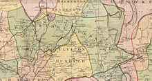
Hi Nilfanion, I am interested and impressed by your project and I'd like to make a few observations. My interest comes from having created stub articles for the Devon hundreds on the English Wikipedia and for Tiverton Rural District. It would be very nice to have maps for all of these, but I see you don't recommend their usage on articles yet. I will follow your progress with interest. Some things which might be of relevance for you are the images linked here and http://www.geog.cam.ac.uk/research/projects/occupations/hundredmapping/ - you might be aware of this project or not - I don't know
Apologies if you are already aware of all of these.--NHSavage (talk) 18:46, 6 August 2012 (UTC)
- Reason I wouldn't recommend usage of the images is that the examples are solely using modern day borders - this is clearly flawed going back in time. I have to be careful how I fix the errors, so I don't cross the line into original research.
- I'm aware of previous projects like the one you mention, their methodology is pretty similar to mine - use parish boundaries, and then interpolate using highest quality mapping available. There's pros and cons here: The big plus is I can produce freely licensed maps which we can then use on Wikipedia. The big con is I'll be duplicating work others have done.
- The other drawback is I'm one person, and this is one task amongst several. Which inevitable means I won't be that fast...--Nilfanion (talk) 21:32, 6 August 2012 (UTC)