User talk:LouisAragon/Archive 1
|
Our first steps tour and our frequently asked questions will help you a lot after registration. They explain how to customize the interface (for example the language), how to upload files and our basic licensing policy (Wikimedia Commons only accepts free content). You don't need technical skills in order to contribute here. Be bold when contributing and assume good faith when interacting with others. This is a wiki. More information is available at the community portal. You may ask questions at the help desk, village pump or on IRC channel #wikimedia-commons (webchat). You can also contact an administrator on their talk page. If you have a specific copyright question, ask at the copyright village pump. |
|
-- Wikimedia Commons Welcome (talk) 10:12, 2 April 2013 (UTC)
 |
File:Shermine-Shahrivar-Prom-Hairstyles.jpg has been marked as a possible copyright violation. Wikimedia Commons only accepts free content—that is, images and other media files that can be used by anyone, for any purpose. Traditional copyright law does not grant these freedoms, and unless noted otherwise, everything you find on the web is copyrighted and not permitted here. For details on what is acceptable, please read Commons:Licensing. You may also find Commons:Copyright rules useful, or you can ask questions about Commons policies at the Commons:Help desk. If you are the copyright holder and the creator of the file, please read Commons:But it's my own work! for tips on how to provide evidence of that.
The file you added has been deleted. If you have written permission from the copyright holder, please have them send us a free license release via COM:VRT. If you believe that the deletion was not in accordance with policy, you may request undeletion. (It is not necessary to request undeletion if using VRT; the file will be automatically restored at the conclusion of the process.) Warning: Wikimedia Commons takes copyright violations very seriously and persistent violators will be blocked from editing.
|
Alan Lorenzo (talk) 01:42, 8 April 2013 (UTC)
|
File:Shermine Sharivar Rome.jpg has been marked as a possible copyright violation. Wikimedia Commons only accepts free content—that is, images and other media files that can be used by anyone, for any purpose. Traditional copyright law does not grant these freedoms, and unless noted otherwise, everything you find on the web is copyrighted and not permitted here. For details on what is acceptable, please read Commons:Licensing. You may also find Commons:Copyright rules useful, or you can ask questions about Commons policies at the Commons:Help desk. If you are the copyright holder and the creator of the file, please read Commons:But it's my own work! for tips on how to provide evidence of that.
The file you added has been deleted. If you have written permission from the copyright holder, please have them send us a free license release via COM:VRT. If you believe that the deletion was not in accordance with policy, you may request undeletion. (It is not necessary to request undeletion if using VRT; the file will be automatically restored at the conclusion of the process.) Warning: Wikimedia Commons takes copyright violations very seriously and persistent violators will be blocked from editing.
|
Jespinos (talk) 01:47, 8 April 2013 (UTC)
This message was added automatically by Nikbot, if you need some help about it please read the text above again and follow the links in it, if you still need help ask at the ![]() → Commons:Help desk in any language you like to use. --Nikbot 18:39, 8 April 2013 (UTC)
→ Commons:Help desk in any language you like to use. --Nikbot 18:39, 8 April 2013 (UTC)
This message was added automatically by Nikbot, if you need some help about it please read the text above again and follow the links in it, if you still need help ask at the ![]() → Commons:Help desk in any language you like to use. --Nikbot 03:57, 22 April 2013 (UTC)
→ Commons:Help desk in any language you like to use. --Nikbot 03:57, 22 April 2013 (UTC)
Maurya Empire, c.250 BCE 2.png[edit]
Why you revert the image Maurya Empire, c.250 BCE 2.png & in which edit you thing hoax ? --Bongan (talk) 11:09, 9 September 2015 (UTC)
- I already left a comment about it here some time ago. Such extent of the empire is unfortunately simply historical hoax. Bests - LouisAragon (talk) 16:33, 13 September 2015 (UTC)
- There are lots of evidence are present in this pages Sandrokottos, Maurya Empire Seleucid Empire show (Gedrosia Balochistan East Iran, Afghanistan Arachosia, Paropamisadae, & Hindu kush region ) under the Muraya emperior rules . If u notice user Avantiputra7 already added a notes in the image page for extent.
- Mountain.
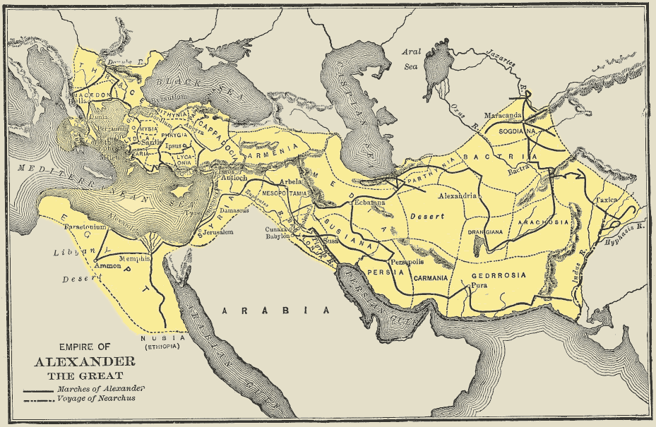
- Mountain Name are taken from this Image Alexander Conquests In India are present already.
- Desert region.
- Desert region are mentioned in alexander Gerdosian desert time & today also present.
- I am re-upload my old edit image with some edit like undo in Afghan area add Arachosia, Paropamisadae, Kambojas, Gandhara & extend to hindu kush region
- There are lots of evidence are present in this pages Sandrokottos, Maurya Empire Seleucid Empire show (Gedrosia Balochistan East Iran, Afghanistan Arachosia, Paropamisadae, & Hindu kush region ) under the Muraya emperior rules . If u notice user Avantiputra7 already added a notes in the image page for extent.
- (google map, Gedrosia, Gedrosia, Alexander Conquests In India, MacedonEmpire)
- Pls when u remove or reverted anything in wiki then pls Drop a note to user talk page --Bongan® →TalkToMe←
- Hello Bongan,
- I see another user has reverted it too. I repeat myself once again; Wikimedia articles and self-made maps are NOT sources, and are thus utterly invalid here. Your example of pre-existing maps do not mention any word of the empire having such extent. This is an example of sourcing;
- Mainstream scholarship asserts that Chandragupta received vast territory west of the Indus, including the Hindu Kush, modern day Afghanistan, and the Balochistan province of Pakistan.[1][2] Archaeologically, concrete indications of Maurya rule, such as the inscriptions of the Edicts of Ashoka, are known as far as Kandhahar in southern Afghanistan.
- Please provide sources that he included all those areas of Afghanistan as well as that weird chunk comprising Gedrosia. Such maps like yours will thus be labeled as hoax, until the contrary is proven. Bests - LouisAragon (talk) 20:31, 24 September 2015 (UTC)
Copyright status: File:Man on horseback.jpg[edit]
| This media may be deleted. |
Thanks for uploading File:Man on horseback.jpg. I notice that the file page either doesn't contain enough information about the license or it contains contradictory information about the license, so the copyright status is unclear.
If you created this file yourself, then you must provide a valid copyright tag. For example, you can tag it with {{self|GFDL|cc-by-sa-all}} to release it under the multi-license GFDL plus Creative Commons Attribution-ShareAlike All-version license or you can tag it with {{PD-self}} to release it into the public domain. (See Commons:Copyright tags for the full list of license tags that you can use.) If you did not create the file yourself or if it is a derivative of another work that is possibly subject to copyright protection, then you must specify where you found it (e.g. usually a link to the web page where you got it), you must provide proof that it has a license that is acceptable for Commons (e.g. usually a link to the terms of use for content from that page), and you must add an appropriate license tag. If you did not create the file yourself and the specific source and license information is not available on the web, you must obtain permission through the VRT system and follow the procedure described there. Note that any unsourced or improperly licensed files will be deleted one week after they have been marked as lacking proper information, as described in criteria for deletion. If you have uploaded other files, please confirm that you have provided the proper information for those files, too. If you have any questions about licenses please ask at Commons:Village pump/Copyright or see our help pages. Thank you. |
Yours sincerely, JuTa 16:49, 30 December 2015 (UTC)
Rv.[edit]
Las reversiones que has hecho en File:Western Asia (orthographic projection).svg y File:South Asia (orthographic projection).svg son incorrectas. Esas imágenes son según las Naciones Unidas (UN) File:South Asia (ed)update.PNG como puedes leer en la descripción de la primera vez que se subieros:
Reverted to version as of 17:39, 25 May 2014. This is the globally worlwide known definition. The definition by the UN is a deviating, almost never used one, and we already have that covered in the article.
Por favor deshaz tus ediciones. Un saludo --Jcfidy (talk) 06:41, 12 May 2017 (UTC)
- Subí nuevas versiones. --Jcfidy (talk) 14:35, 12 May 2017 (UTC)
- @Jcfidy: , Hi. First of all, sorry, but I don't speak Spanish. Second (got some help from Google translate), I'd like to let you know that you're wrong, even with your new "uploads". You see, there is no "UN defintion of South Asia". There is only one UN map published of South Asia made by the official UN cartographic centre, and as you can see Iran is clearly not included. (UN cartographic map)

Official United Nations cartographic map of South Asia.[3]
- @Jcfidy: , Hi. First of all, sorry, but I don't speak Spanish. Second (got some help from Google translate), I'd like to let you know that you're wrong, even with your new "uploads". You see, there is no "UN defintion of South Asia". There is only one UN map published of South Asia made by the official UN cartographic centre, and as you can see Iran is clearly not included. (UN cartographic map)

.svg)
.svg)
update.PNG)
- Almost every single UN subdepartment employs a different definition/naming of regions. Some other UN departments, which further elaborate the point;
- The World Food Programe (WFP) includes Iran in the Middle East.[4]
- The World Health Organisation (WHO) subdepartment puts Iran in the Eastern Mediterranean region.[7]
- The Joint United Nations Programme on HIV/AIDS (UNAIDS) puts Iran in the MENA region.[8]
- So to upload a map saying that the "UN" includes Iran in "South Asia", and to create a separate map which shows West Asia without Iran (which you both did), is unfortunately blatant nonsense. Bests, - LouisAragon (talk) 17:21, 12 May 2017 (UTC)
- Sí, ya me di cuenta de mi error por eso taché lo que te escribí en tu discusión. Muchas gracias por esos enlaces y aclararme mejor mi error. --Jcfidy (talk) 17:30, 12 May 2017 (UTC)
- @Jcfidy: , thanks much for your prompt response. You're welcome. Can you now also delete the two wrong maps you uploaded, just in case someone might erroneously use them in the future?[9][10] Bests and thanks in advance, - LouisAragon (talk) 23:48, 12 May 2017 (UTC)
- Esos dos mapas fueron solicitados en el Taller gráfico de es.Wikipedia y el solicitante tiene intención de solicitar o crear más mapas de ese estilo. Tal vez para evitar equívocos sea mejor asignarles una categoría diferente. Hay que tener en cuenta que esos mapas tampoco son erróneos sino otra interpretación. En todo caso te invioto a debatirlo en el Taller gráfico, yo no voy a hacer uso de esos mapas y me es indiferente que se mantengan o no pero hay otros usuarios que los consideran convenientes. Un saludo --Jcfidy (talk) 06:50, 13 May 2017 (UTC)
- @Jcfidy: , thanks much for your prompt response. You're welcome. Can you now also delete the two wrong maps you uploaded, just in case someone might erroneously use them in the future?[9][10] Bests and thanks in advance, - LouisAragon (talk) 23:48, 12 May 2017 (UTC)
![[9]](https://commons.wikimedia.org/wiki/File:Western_Asia_UN_(orthographic_projection).svg)
![[10]](https://commons.wikimedia.org/wiki/File:South_Asia_UN_(orthographic_projection).svg)
@LouisAragon: Hello, I asked for a map of Souhtern Asia in which Iran is included, because i saw this map

(we can call it "map 1") I don't mind if Iran is in or out Southern Asia, but in case is out, the wrong map is the map 1. What do you recommend?
In my opinion, the best is to have an exact definition of every subregion of the world, and that every country belongs just to one subregion. There are, nowadays, 195 countries in the world, distributed in 22 subregions, as we can see in map 1:
1 Northern America (2 countries)
2 Central America (8 countries)
3 Southern America (12 countries)
4 Caribe (13 countries)
5 Southern Europe (16 countries)
6 Western Europe (8 countries)
7 Eastern Europe (10 countries)
8 Northern Europe (10 countries)
9 Eastern Asia (5 countries)
10 Central Asia (5 countries)
11 Western Asia (18 countries)
12 Southern Asia (9 countries)
13 Southeast Asia (11 countries)
14 Northern Africa (6 countries)
15 Western Africa (16 countries)
16 Eastern Africa (10 countries)
17 Central Africa (17 countries)
18 Southern Africa (5 countries)
19 Australia and New Zealand (2 countries)
20 Melanesia (4 countries)
21 Micronesia (4 countries)
22 Polynesia (4 countries)
I would like to have an article of every these 22 subregions with the pertinent map, that's the reason I asked for a Southern Asia map including Iran. Thank you very much, (my English is not very good, I hope you could understand me) JuanCamacho (talk) 09:06, 13 May 2017 (UTC)
- @JuanCamacho: , hi and thanks for your comment. This "map 1", posted by you, is based on the definition used by one UN subdepartment (the UNSD). All other UN subdepartments, some of which I linked above (UNICEF, UNAIDS, World Bank, WHO, WFP, etc.) including the map by the official UN Cartographic centre (see map above,) don't include it in South Asia. So, the statement that map 1 would be showing the "UN definition of the worlds regions", is completely wrong. Basically every other UN subdeparment employs a different definition and a different naming for the regions of the world. The UN as an organisation (as a whole) does not include Iran in South Asia. Having therefore a self-created map based on 1 UN subdepartment which is contradicted by literally all other UN organisations (and in fact, by basically all other organisations in the world) is pure undue weight.
- Having said that, if you want to use an official UN map, I'd say the best thing would be to use the map published by the UN Cartographic Centre (which I also linked above). This is also the common definition of the region known as South Asia per the utter vast majority of the sources (including non-UN). Hope this made everything a bit more clear for you. Oh, and please don't hesitate to respond to me in Spanish. I noticed that Google Translate gets me quite far. All the best, - LouisAragon (talk) 13:15, 13 May 2017 (UTC)
ok thank you very much, it's clearer now JuanCamacho (talk) 15:46, 13 May 2017 (UTC)
- See my comments here. -- Leoncastro (talk) 16:07, 13 May 2017 (UTC)
OR map[edit]
Hello LouisAragon. I think this map is OR and provocative. Syrian parts should be deleted. Of course, Iran historically has connection with Anatolia and parts of Iraq but we can not say the same thing for Syria. Согдиана (talk) 16:34, 13 December 2017 (UTC)
Indo-European branches map[edit]
Hi again. I think this map needs a minor revision. Balto-Slavic and Italo-Celtic families are shown with different colors, as they are not "one" language today. But Indo-Iranian branch is represented as if it was "one" language. I think there is an inconsistency in the map. For the consistency, Iranian and Indo-Aryan languages should be represented seperately. I don't know how to change the colors. Can you please help? Согдиана (talk) 16:50, 13 December 2017 (UTC)
- ↑ Vincent A. Smith (1998). Ashoka. Asian Educational Services. ISBN 81-206-1303-1.
- ↑ (1919). "The Importance of Hellenism from the Point of View of Indic-Philology". Classical Philology 14 (4): 297–313. DOI:10.1086/360246.
- ↑ United Nations Cartographic Centre Retrieved 18 June 2015