User:Sting/Gallery: Location and locator maps
| My images galleries |
|---|
| Maps: Maps of the world, of seas and about history - Regional maps - Location and locator maps -- go back to my main user page -- |
Welcome in my gallery of location and locator maps. All maps here were created by myself (Eric Gaba, as username Sting).

I authorize anybody to use my photographs, maps or schemes outside the Wikimedia projects (Wikipedia in different languages, Commons, Wikibooks, Wikisource, etc.), on an other Web site or in publications, for commercial or non-commercial use. No written authorization is necessary, as long as you respect the terms of the license under which the image is publicized (especially that I am credited as author, when required), but a message from you on my discussion page with a reply address would be greatly appreciated.
![]() This user is a Wikigraphist from the Atelier graphique to whom you can propose images or maps to improve.
This user is a Wikigraphist from the Atelier graphique to whom you can propose images or maps to improve.
Location maps[edit]
Location maps of France[edit]
-
 Administrative map of France (regions and departements distinguished)
Also : Regions only
Departements only -
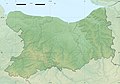
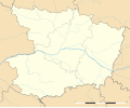
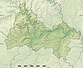
 Physical map of France


Region Alsace  [edit]
-
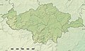
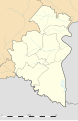
 Administrative map of the region of Alsace
 -
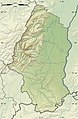
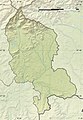
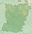
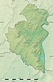
 Physical map of the region of Alsace
 -
 Administrative map of the department of Haut-Rhin
 -
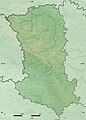
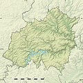
 Physical map of the department of Haut-Rhin
 -
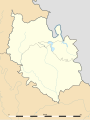
 Administrative map of the department of Bas-Rhin
 -
 Physical map of the department of Bas-Rhin


Region Aquitaine[edit]
Region Auvergne[edit]
Region Bourgogne[edit]
Region Bretagne [edit]
-
 Administrative map of the region of Bretagne
 -
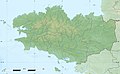 Physical map of the region of Bretagne
 -
 Administrative map of the department of Morbihan
 -
 Physical map of the department of Morbihan
 -
 Administrative map of the department of Finistère
 -
 Physical map of the department of Finistère
 -
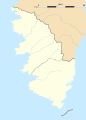
 Administrative map of the department of Côtes-d'Armor
 -
 Physical map of the department of Côtes-d'Armor
 -
 Administrative map of the department of Ille-et-Vilaine
 -
 Physical map of the department of Ille-et-Vilaine


Region Centre[edit]
Region Champagne-Ardenne[edit]
Region Corse [edit]
-
 Administrative map of the region of Corsica
 -
 Physical map of the region of Corsica
 -
 Administrative map of the department of Corse-du-Sud
 -
 Physical map of the department of Corse-du-Sud
 -
 Administrative map of the department of Haute-Corse
 -
 Physical map of the department of Haute-Corse


Region Franche-Comté[edit]
-
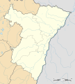
 Administrative map of the department of Territoire de Belfort
 -
 Physical map of the department of Territoire de Belfort


Region Île-de-France [edit]
-
 Administrative map of the region of Île-de-France
 -
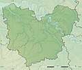
 Physical map of the region of Île-de-France
 -
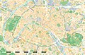
 Administrative map of the city and department of Paris
 -
 Physical map of the city and department of Paris
 -
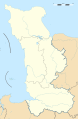
 Land cover map of the city and department of Paris
Also : SVG map -
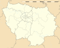
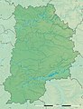
 Administrative map of the department of Seine-et-Marne
 -
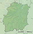
 Physical map of the department of Seine-et-Marne
 -
 Administrative map of the department of Yvelines
 -
 Physical map of the department of Yvelines
 -
 Administrative map of the department of Essonne
 -
 Physical map of the department of Essonne
 -
 Administrative map of the department of Hauts-de-Seine
 -
 Physical map of the department of Hauts-de-Seine
 -
 Administrative map of the department of Seine-Saint-Denis
 -
 Physical map of the department of Seine-Saint-Denis
 -
 Administrative map of the department of Val-de-Marne
 -
 Physical map of the department of Val-de-Marne
 -
 Administrative map of the department of Val-d'Oise
 -
 Physical map of the department of Val-d'Oise


Region Languedoc-Roussillon[edit]
Region Limousin[edit]
Region Lorraine[edit]
Region Midi-Pyrénées[edit]
Region Nord-Pas-de-Calais [edit]
-
 Administrative map of the region of Nord-Pas-de-Calais
 -
 Physical map of the region of Nord-Pas-de-Calais
 -
 Administrative map of the Nord department
 -
 Physical map of the Nord department
 -
 Administrative map of the Pas-de-Calais department
 -
 Physical map of the Pas-de-Calais department


Region Basse-Normandie [edit]
-
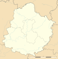
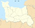 Administrative map of the region of Basse-Normandie
 -
 Physical map of the region of Basse-Normandie
 -
 Administrative map of the department of Calvados
 -
 Physical map of the department of Calvados
 -
 Administrative map of the department of Manche
 -
 Physical map of the department of Manche
 -
 Administrative map of the department of Orne
 -
 Physical map of the department of Orne


Region Haute-Normandie [edit]
-
 Administrative map of the region of Haute-Normandie
 -
 Physical map of the region of Haute-Normandie
 -
 Administrative map of the department of Eure
 -
 Physical map of the department of Eure
 -
 Administrative map of the department of Seine-Maritime
 -
 Physical map of the department of Seine-Maritime


Region Pays de la Loire [edit]
-
 Administrative map of the region of Pays de la Loire
 -
 Physical map of the region of Pays de la Loire
 -

-
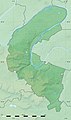
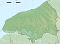
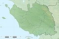
 Physical map of the department of Loire-Atlantique
Also : as in 2008 -
-
 Physical map of the department of Maine-et-Loire
Also : as in 2011 -
 Administrative map of the department of Mayenne
 -
 Physical map of the department of Mayenne
 -
 Administrative map of the department of Sarthe
 -
 Physical map of the department of Sarthe
 -
 Administrative map of the department of Vendée
 -
 Physical map of the department of Vendée


Region Picardie [edit]
-
 Administrative map of the department of Aisne
 -
 Physical map of the department of Aisne
 -
 Administrative map of the department of Oise
 -
 Physical map of the department of Oise
 -
 Administrative map of the department of Somme
 -
 Physical map of the department of Somme


Region Poitou-Charentes [edit]
-
 Administrative map of the region of Poitou-Charentes
 -
 Physical map of the region of Poitou-Charentes
 -
 Administrative map of the department of Charente
 -
 Physical map of the department of Charente
 -
 Administrative map of the department of Charente-Maritime
 -
 Physical map of the department of Charente-Maritime
 -
 Administrative map of the department of Deux-Sèvres
 -
 Physical map of the department of Deux-Sèvres
 -
 Administrative map of the department of Vienne
 -
 Physical map of the department of Vienne


Region Provence-Alpes-Côte d'Azur[edit]
Region Rhône-Alpes[edit]
-
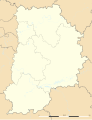
 Administrative map of the department of Savoie
 -
 Physical map of the department of Savoie


Overseas regions and collectivities[edit]
-
 Administrative map of the region and department of Martinique
 -
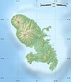 Physical map of the region and department of Martinique
 -
 Administrative map of the region and department of French Guiana
 -
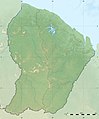 Physical map of the region and department of the French Guiana
 -
 Administrative map of the region and department of Guadeloupe
 -
 Physical map of the region and department of Guadeloupe
 -
 Administrative map of the overseas collectivity of Saint-Martin
 -
 Physical map of the overseas collectivity of Saint-Martin
 -
 Administrative map of the territorial collectivity of New Caledonia (general map)
 -
 Administrative map of New Caledonia (map centered on the main islands)
 -
 Physical map of New Caledonia (map centered on the main islands)
 -
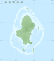
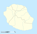 Administrative map of the region and department of Réunion
 -
 Physical map of the region and department of Réunion
 -
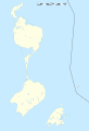
 Administrative map of the overseas collectivity of French Polynesia
 -
 Physical map of the overseas collectivity of French Polynesia
 -
 Administrative map of the overseas collectivity of Saint-Pierre and Miquelon
 -
 Physical map of the overseas collectivity of Saint-Pierre and Miquelon
 -
 Administrative map of the overseas collectivity of Saint-Barthélemy
 -
 Administrative map of Saint-Barthélemy with Quartiers boundaries
 -
 Physical map of Saint-Barthélemy
 -
 Administrative map of the overseas collectivity of Wallis and Futuna
 -
 Administrative map of Wallis Island from the overseas collectivity of Wallis and Futuna
 -
 Physical map of Wallis Island
 -
 Administrative map of Horn Islands (Futuna and Alofi) from the overseas collectivity of Wallis and Futuna
 -
 Physical map of Horn Islands


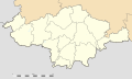
Location maps of Luxembourg[edit]
-
 Administrative map of the canton of Capellen
 -
 Physical map of the canton of Capellen
 -
 Administrative map of the canton of Clervaux
 -
 Physical map of the canton of Clervaux
 -
 Administrative map of the canton of Diekirch
 -
 Physical map of the canton of Diekirch
 -
 Administrative map of the canton of Echternach
 -
 Physical map of the canton of Echternach
 -
 Administrative map of the canton of Esch-sur-Alzette
 -
 Physical map of the canton of Esch-sur-Alzette
 -
 Administrative map of the canton of Grevenmacher
 -
 Physical map of the canton of Grevenmacher
 -
 Administrative map of the canton of Luxembourg
 -
 Physical map of the canton of Luxembourg
 -
 Administrative map of the canton of Mersch
 -
 Physical map of the canton of Mersch
 -
 Administrative map of the canton of Redange
 -
 Physical map of the canton of Redange
 -
 Administrative map of the canton of Remich
 -
 Physical map of the canton of Remich
 -
 Administrative map of the canton of Vianden
 -
 Physical map of the canton of Vianden
 -
 Administrative map of the canton of Wiltz
 -
 Physical map of the canton of Wiltz


Other location maps[edit]
-
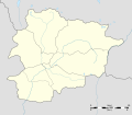 Administrative map of Andorra
 -
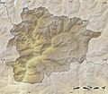 Physical map of Andorra
 -
 Administrative map of Costa Rica
 -
 Physical map of Costa Rica
 -
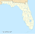
-
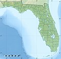 Physical map of Florida
 -
 Administrative map of Vanuatu
 -
 Physical map of Vanuatu
 -

-
 Administrative map of Quebec (conic projection)
 -
 Physical map of Quebec (conic projection)
 -
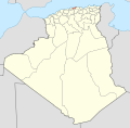
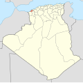
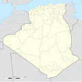 Administrative map of Algeria
 -
 Physical map of Algeria
 -
 Administrative map of Morocco
 -
 Physical map of Morocco
 -
 Physical map of Western Sahara
 -
 Administrative map of Mauritania
 -
 Physical map of Mauritania
 -
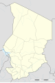 Administrative map of Chad
 -
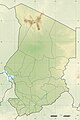 Physical map of Chad
 -
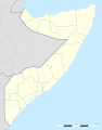 Administrative map of Somalia
 -
 Physical map of Somalia
 -
 Administrative map of Tonga
 -
 Physical map of Tonga
 -
 Physical map of Switzerland
 -
 Physical map of the Republic of Macedonia
 -

-
-
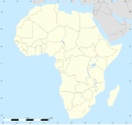
 Physical (elevation) map of Africa
Also: without boundaries -
 Land cover map of Africa
 -
 Physical map of Belgium
 -
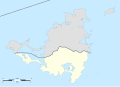 Administrative map of Sint Maarten
 -
 Physical map of Sint Maarten
 -

-
 Physical map of Sweden
 -
 Administrative map of Jan Mayen island (Norway)
 -
 Physical map of Jan Mayen island
 -
 Administrative map of Svalbard archipelago (Norway) (conic projection)
 -
 Physical map of Svalbard archipelago (conic projection)
 -
 Administrative map of Bouvet Island (Norway)
 -
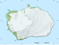 Physical map of Bouvet Island
 -
 Physical map of Japan
 -
 Physical map of Japan with Nansei Islands on a side map
 -
 Physical map of Nansei Islands, Japan


Locator maps[edit]
Locator maps of Algeria[edit]
-
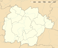
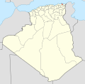
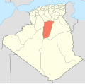
 Blank map of the Provinces of Algeria
 -
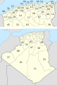 Numbered map of the Provinces
 -
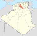
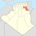
 Locator map of Province: Adrar
 -
 Chlef
Chlef -
 Laghouat
 -
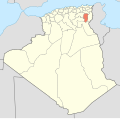
 Oum el Bouaghi
 -
 Batna
Batna -
 Béjaïa
 -
 Biskra
 -
 Béchar
 -
 Blida
Blida -
 Bouïra
 -
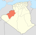
 Tamanrasset
 -
 Tébessa
 -
 Tlemcen
 -
 Tiaret
 -
 Tizi Ouzou
 -
 Algiers
 -
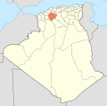
 Djelfa
 -
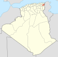
 Jijel
Jijel -
 Sétif
Sétif -
 Saïda
Saïda -
 Skikda
 -
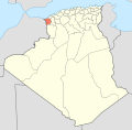
 Sidi Bel Abbès
 -
 Annaba
 -
 Guelma
 -
 Constantine
 -
 Médéa
Médéa -
 Mostaganem
 -
 M'Sila
 -
 Mascara
 -
 Ouargla
 -
 Oran
Oran -
 El Bayadh
 -
 Illizi
 -
 Bordj Bou Arréridj
 -
 Boumerdès
 -
 El Taref
 -
 Tindouf
 -
 Tissemsilt
 -
 El Oued
 -
 Khenchela
 -
 Souk Ahras
 -
 Tipaza
 -
 Mila
Mila -
 Aïn Defla
 -
 Naâma
Naâma -
 Aïn Témouchent
 -
 Ghardaïa
 -
 Relizane

_-_Nmbrs_(geosort)_-_monochrome.svg)


Locator maps of Chad[edit]
-
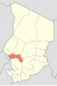
 Numbered map of the Regions of Chad
 -
 Locator map of Region: Batha
 -
 Chari-Baguirmi
 -
 Hadjer-Lamis
 -
 Wadi Fira
 -
 Barh El Gazel
 -
 Borkou
 -
 Ennedi
 -
 Guéra
Guéra -
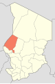 Kanem
Kanem -
 Lac
Lac -
 Logone Occidental
 -
 Logone Oriental
 -
 Mandoul
 -
 Mayo-Kebbi Est
 -
 Mayo-Kebbi Ouest
 -
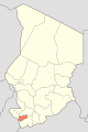
 Moyen-Chari
 -
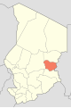 Ouaddaï
 -
 Salamat
 -
 Sila
Sila -
 Tandjilé
 -
 Tibesti
 -
 N'Djamena


Locator maps of France[edit]
-
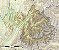
 Locator map of natural region in the Pyrénées-Orientales: Aspres
 -
 Capcir
 -
 Cerdagne
 -
 Conflent
 -
 Corbières catalanes
 -
 Côte Vermeille
 -
 Fenouillèdes
 -
 Massif des Albères
 -
 Plaine du Roussillon
 -
 Ribéral
 -
 Salanque
 -
 Vallespir


