User:Shereth/gallery
Jump to navigation
Jump to search

Mon Jul 09 09:23:03 MST 2007[edit]
-
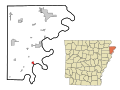
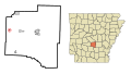
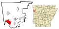
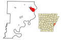 This map shows the incorporated and unincorporated areas in Phillips County, Arkansas, highlighting Helena-West Helena in red. It was created with a custom script with US Census Bureau data and modified with Inkscape.

Thu Jun 21 10:08:45 MST 2007[edit]
-
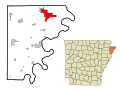
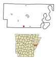
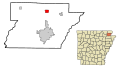
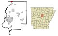
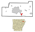
 This map shows the incorporated and unincorporated areas in Stone County, Arkansas, highlighting Mountain_View in red. It was created with a custom script with US Census Bureau data and modified with Inkscape.

Thu Jun 21 09:31:56 MST 2007[edit]
-
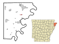
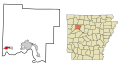
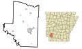
 This map shows the incorporated and unincorporated areas in Pike County, Arkansas, highlighting Antoine in red. It was created with a custom script with US Census Bureau data and modified with Inkscape.
 -
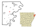
 This map shows the incorporated and unincorporated areas in Pike County, Arkansas, highlighting Daisy in red. It was created with a custom script with US Census Bureau data and modified with Inkscape.
 -
 This map shows the incorporated and unincorporated areas in Pike County, Arkansas, highlighting Delight in red. It was created with a custom script with US Census Bureau data and modified with Inkscape.
 -
 This map shows the incorporated and unincorporated areas in Pike County, Arkansas, highlighting Glenwood in red. It was created with a custom script with US Census Bureau data and modified with Inkscape.
 -
 This map shows the incorporated and unincorporated areas in Pike County, Arkansas, highlighting Murfreesboro in red. It was created with a custom script with US Census Bureau data and modified with Inkscape.


Thu Jun 21 09:25:53 MST 2007[edit]
-
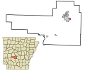
 This map shows the incorporated and unincorporated areas in Perry County, Arkansas, highlighting Adona in red. It was created with a custom script with US Census Bureau data and modified with Inkscape.
 -
 This map shows the incorporated and unincorporated areas in Perry County, Arkansas, highlighting Bigelow in red. It was created with a custom script with US Census Bureau data and modified with Inkscape.
 -
 This map shows the incorporated and unincorporated areas in Perry County, Arkansas, highlighting Casa in red. It was created with a custom script with US Census Bureau data and modified with Inkscape.
 -
 This map shows the incorporated and unincorporated areas in Perry County, Arkansas, highlighting Fourche in red. It was created with a custom script with US Census Bureau data and modified with Inkscape.
 -
 This map shows the incorporated and unincorporated areas in Perry County, Arkansas, highlighting Houston in red. It was created with a custom script with US Census Bureau data and modified with Inkscape.
 -
 This map shows the incorporated and unincorporated areas in Perry County, Arkansas, highlighting Perry in red. It was created with a custom script with US Census Bureau data and modified with Inkscape.
 -
 This map shows the incorporated and unincorporated areas in Perry County, Arkansas, highlighting Perryville in red. It was created with a custom script with US Census Bureau data and modified with Inkscape.


Thu Jun 21 09:17:25 MST 2007[edit]
-
 This map shows the incorporated and unincorporated areas in Montgomery County, Arkansas, highlighting Black_Springs in red. It was created with a custom script with US Census Bureau data and modified with Inkscape.
 -
 This map shows the incorporated and unincorporated areas in Montgomery County, Arkansas, highlighting Mount_Ida in red. It was created with a custom script with US Census Bureau data and modified with Inkscape.
 -
 This map shows the incorporated and unincorporated areas in Montgomery County, Arkansas, highlighting Norman in red. It was created with a custom script with US Census Bureau data and modified with Inkscape.
 -
 This map shows the incorporated and unincorporated areas in Montgomery County, Arkansas, highlighting Oden in red. It was created with a custom script with US Census Bureau data and modified with Inkscape.


Thu Jun 21 09:13:50 MST 2007[edit]
-
 This map shows the incorporated and unincorporated areas in Mississippi County, Arkansas, highlighting Bassett in red. It was created with a custom script with US Census Bureau data and modified with Inkscape.
 -
 This map shows the incorporated and unincorporated areas in Mississippi County, Arkansas, highlighting Birdsong in red. It was created with a custom script with US Census Bureau data and modified with Inkscape.
 -
 This map shows the incorporated and unincorporated areas in Mississippi County, Arkansas, highlighting Blytheville in red. It was created with a custom script with US Census Bureau data and modified with Inkscape.
 -
 This map shows the incorporated and unincorporated areas in Mississippi County, Arkansas, highlighting Burdette in red. It was created with a custom script with US Census Bureau data and modified with Inkscape.
 -
 This map shows the incorporated and unincorporated areas in Mississippi County, Arkansas, highlighting Dell in red. It was created with a custom script with US Census Bureau data and modified with Inkscape.
 -
 This map shows the incorporated and unincorporated areas in Mississippi County, Arkansas, highlighting Dyess in red. It was created with a custom script with US Census Bureau data and modified with Inkscape.
 -
 This map shows the incorporated and unincorporated areas in Mississippi County, Arkansas, highlighting Etowah in red. It was created with a custom script with US Census Bureau data and modified with Inkscape.
 -
 This map shows the incorporated and unincorporated areas in Mississippi County, Arkansas, highlighting Gosnell in red. It was created with a custom script with US Census Bureau data and modified with Inkscape.
 -
 This map shows the incorporated and unincorporated areas in Mississippi County, Arkansas, highlighting Joiner in red. It was created with a custom script with US Census Bureau data and modified with Inkscape.
 -
 This map shows the incorporated and unincorporated areas in Mississippi County, Arkansas, highlighting Keiser in red. It was created with a custom script with US Census Bureau data and modified with Inkscape.
 -
 This map shows the incorporated and unincorporated areas in Mississippi County, Arkansas, highlighting Leachville in red. It was created with a custom script with US Census Bureau data and modified with Inkscape.
 -
 This map shows the incorporated and unincorporated areas in Mississippi County, Arkansas, highlighting Luxora in red. It was created with a custom script with US Census Bureau data and modified with Inkscape.
 -
 This map shows the incorporated and unincorporated areas in Mississippi County, Arkansas, highlighting Manila in red. It was created with a custom script with US Census Bureau data and modified with Inkscape.
 -
 This map shows the incorporated and unincorporated areas in Mississippi County, Arkansas, highlighting Marie in red. It was created with a custom script with US Census Bureau data and modified with Inkscape.
 -
 This map shows the incorporated and unincorporated areas in Mississippi County, Arkansas, highlighting Osceola in red. It was created with a custom script with US Census Bureau data and modified with Inkscape.
 -
 This map shows the incorporated and unincorporated areas in Mississippi County, Arkansas, highlighting Victoria in red. It was created with a custom script with US Census Bureau data and modified with Inkscape.
 -
 This map shows the incorporated and unincorporated areas in Mississippi County, Arkansas, highlighting Wilson in red. It was created with a custom script with US Census Bureau data and modified with Inkscape.


Thu Jun 21 09:07:29 MST 2007[edit]
-
 This map shows the incorporated and unincorporated areas in Marion County, Arkansas, highlighting Bull_Shoals in red. It was created with a custom script with US Census Bureau data and modified with Inkscape.
 -
 This map shows the incorporated and unincorporated areas in Marion County, Arkansas, highlighting Flippin in red. It was created with a custom script with US Census Bureau data and modified with Inkscape.
 -
 This map shows the incorporated and unincorporated areas in Marion County, Arkansas, highlighting Pyatt in red. It was created with a custom script with US Census Bureau data and modified with Inkscape.
 -
 This map shows the incorporated and unincorporated areas in Marion County, Arkansas, highlighting Summit in red. It was created with a custom script with US Census Bureau data and modified with Inkscape.
 -
 This map shows the incorporated and unincorporated areas in Marion County, Arkansas, highlighting Yellville in red. It was created with a custom script with US Census Bureau data and modified with Inkscape.


Wed Jun 20 13:06:56 MST 2007[edit]
-
 This map shows the incorporated and unincorporated areas in Logan County, Arkansas, highlighting Blue_Mountain in red. It was created with a custom script with US Census Bureau data and modified with Inkscape.
 -
 This map shows the incorporated and unincorporated areas in Logan County, Arkansas, highlighting Booneville in red. It was created with a custom script with US Census Bureau data and modified with Inkscape.
 -
 This map shows the incorporated and unincorporated areas in Logan County, Arkansas, highlighting Caulksville in red. It was created with a custom script with US Census Bureau data and modified with Inkscape.
 -
 This map shows the incorporated and unincorporated areas in Logan County, Arkansas, highlighting Magazine in red. It was created with a custom script with US Census Bureau data and modified with Inkscape.
 -
 This map shows the incorporated and unincorporated areas in Logan County, Arkansas, highlighting Morrison_Bluff in red. It was created with a custom script with US Census Bureau data and modified with Inkscape.
 -
 This map shows the incorporated and unincorporated areas in Logan County, Arkansas, highlighting Paris in red. It was created with a custom script with US Census Bureau data and modified with Inkscape.
 -
 This map shows the incorporated and unincorporated areas in Logan County, Arkansas, highlighting Ratcliff in red. It was created with a custom script with US Census Bureau data and modified with Inkscape.
 -
 This map shows the incorporated and unincorporated areas in Logan County, Arkansas, highlighting Scranton in red. It was created with a custom script with US Census Bureau data and modified with Inkscape.
 -
 This map shows the incorporated and unincorporated areas in Logan County, Arkansas, highlighting Subiaco in red. It was created with a custom script with US Census Bureau data and modified with Inkscape.


Wed Jun 20 12:42:11 MST 2007[edit]
-
 This map shows the incorporated and unincorporated areas in Little River County, Arkansas, highlighting Ashdown in red. It was created with a custom script with US Census Bureau data and modified with Inkscape.
 -
 This map shows the incorporated and unincorporated areas in Little River County, Arkansas, highlighting Foreman in red. It was created with a custom script with US Census Bureau data and modified with Inkscape.
 -
 This map shows the incorporated and unincorporated areas in Little River County, Arkansas, highlighting Ogden in red. It was created with a custom script with US Census Bureau data and modified with Inkscape.
 -
 This map shows the incorporated and unincorporated areas in Little River County, Arkansas, highlighting Wilton in red. It was created with a custom script with US Census Bureau data and modified with Inkscape.
 -
 This map shows the incorporated and unincorporated areas in Little River County, Arkansas, highlighting Winthrop in red. It was created with a custom script with US Census Bureau data and modified with Inkscape.


Wed Jun 20 12:39:40 MST 2007[edit]
-
 This map shows the incorporated and unincorporated areas in Lincoln County, Arkansas, highlighting Gould in red. It was created with a custom script with US Census Bureau data and modified with Inkscape.
 -
 This map shows the incorporated and unincorporated areas in Lincoln County, Arkansas, highlighting Grady in red. It was created with a custom script with US Census Bureau data and modified with Inkscape.
 -
 This map shows the incorporated and unincorporated areas in Lincoln County, Arkansas, highlighting Star_City in red. It was created with a custom script with US Census Bureau data and modified with Inkscape.


Wed Jun 20 12:35:51 MST 2007[edit]
-
 This map shows the incorporated and unincorporated areas in Lee County, Arkansas, highlighting Aubrey in red. It was created with a custom script with US Census Bureau data and modified with Inkscape.
 -
 This map shows the incorporated and unincorporated areas in Lee County, Arkansas, highlighting Haynes in red. It was created with a custom script with US Census Bureau data and modified with Inkscape.
 -
 This map shows the incorporated and unincorporated areas in Lee County, Arkansas, highlighting LaGrange in red. It was created with a custom script with US Census Bureau data and modified with Inkscape.
 -
 This map shows the incorporated and unincorporated areas in Lee County, Arkansas, highlighting Marianna in red. It was created with a custom script with US Census Bureau data and modified with Inkscape.
 -
 This map shows the incorporated and unincorporated areas in Lee County, Arkansas, highlighting Moro in red. It was created with a custom script with US Census Bureau data and modified with Inkscape.
 -
 This map shows the incorporated and unincorporated areas in Lee County, Arkansas, highlighting Rondo in red. It was created with a custom script with US Census Bureau data and modified with Inkscape.


Wed Jun 20 12:23:06 MST 2007[edit]
-
 This map shows the incorporated and unincorporated areas in Johnson County, Arkansas, highlighting Clarksville in red. It was created with a custom script with US Census Bureau data and modified with Inkscape.
 -
 This map shows the incorporated and unincorporated areas in Johnson County, Arkansas, highlighting Coal_Hill in red. It was created with a custom script with US Census Bureau data and modified with Inkscape.
 -
 This map shows the incorporated and unincorporated areas in Johnson County, Arkansas, highlighting Hartman in red. It was created with a custom script with US Census Bureau data and modified with Inkscape.
 -
 This map shows the incorporated and unincorporated areas in Johnson County, Arkansas, highlighting Knoxville in red. It was created with a custom script with US Census Bureau data and modified with Inkscape.
 -
 This map shows the incorporated and unincorporated areas in Johnson County, Arkansas, highlighting Lamar in red. It was created with a custom script with US Census Bureau data and modified with Inkscape.


Wed Jun 20 12:19:48 MST 2007[edit]
-
 This map shows the incorporated and unincorporated areas in Jefferson County, Arkansas, highlighting Altheimer in red. It was created with a custom script with US Census Bureau data and modified with Inkscape.
 -
 This map shows the incorporated and unincorporated areas in Jefferson County, Arkansas, highlighting Humphrey in red. It was created with a custom script with US Census Bureau data and modified with Inkscape.
 -
 This map shows the incorporated and unincorporated areas in Jefferson County, Arkansas, highlighting Pine_Bluff in red. It was created with a custom script with US Census Bureau data and modified with Inkscape.
 -
 This map shows the incorporated and unincorporated areas in Jefferson County, Arkansas, highlighting Redfield in red. It was created with a custom script with US Census Bureau data and modified with Inkscape.
 -
 This map shows the incorporated and unincorporated areas in Jefferson County, Arkansas, highlighting Sherrill in red. It was created with a custom script with US Census Bureau data and modified with Inkscape.
 -
 This map shows the incorporated and unincorporated areas in Jefferson County, Arkansas, highlighting Wabbaseka in red. It was created with a custom script with US Census Bureau data and modified with Inkscape.
 -
 This map shows the incorporated and unincorporated areas in Jefferson County, Arkansas, highlighting White_Hall in red. It was created with a custom script with US Census Bureau data and modified with Inkscape.


Wed Jun 20 12:10:12 MST 2007[edit]
-
 This map shows the incorporated and unincorporated areas in Independence County, Arkansas, highlighting Batesville in red. It was created with a custom script with US Census Bureau data and modified with Inkscape.
 -
 This map shows the incorporated and unincorporated areas in Independence County, Arkansas, highlighting Cave_City in red. It was created with a custom script with US Census Bureau data and modified with Inkscape.
 -
 This map shows the incorporated and unincorporated areas in Independence County, Arkansas, highlighting Cushman in red. It was created with a custom script with US Census Bureau data and modified with Inkscape.
 -
 This map shows the incorporated and unincorporated areas in Independence County, Arkansas, highlighting Magness in red. It was created with a custom script with US Census Bureau data and modified with Inkscape.
 -
 This map shows the incorporated and unincorporated areas in Independence County, Arkansas, highlighting Moorefield in red. It was created with a custom script with US Census Bureau data and modified with Inkscape.
 -
 This map shows the incorporated and unincorporated areas in Independence County, Arkansas, highlighting Newark in red. It was created with a custom script with US Census Bureau data and modified with Inkscape.
 -
 This map shows the incorporated and unincorporated areas in Independence County, Arkansas, highlighting Oil_Trough in red. It was created with a custom script with US Census Bureau data and modified with Inkscape.
 -
 This map shows the incorporated and unincorporated areas in Independence County, Arkansas, highlighting Pleasant_Plains in red. It was created with a custom script with US Census Bureau data and modified with Inkscape.
 -
 This map shows the incorporated and unincorporated areas in Independence County, Arkansas, highlighting Sulphur_Rock in red. It was created with a custom script with US Census Bureau data and modified with Inkscape.


Tue Jun 19 14:36:10 MST 2007[edit]
-
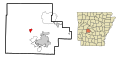
 This map shows the incorporated and unincorporated areas in Hot Spring County, Arkansas, highlighting Donaldson in red. It was created with a custom script with US Census Bureau data and modified with Inkscape.
 -
 This map shows the incorporated and unincorporated areas in Hot Spring County, Arkansas, highlighting Friendship in red. It was created with a custom script with US Census Bureau data and modified with Inkscape.
 -
 This map shows the incorporated and unincorporated areas in Hot Spring County, Arkansas, highlighting Malvern in red. It was created with a custom script with US Census Bureau data and modified with Inkscape.
 -
 This map shows the incorporated and unincorporated areas in Hot Spring County, Arkansas, highlighting Perla in red. It was created with a custom script with US Census Bureau data and modified with Inkscape.
 -
 This map shows the incorporated and unincorporated areas in Hot Spring County, Arkansas, highlighting Rockport in red. It was created with a custom script with US Census Bureau data and modified with Inkscape.


Tue Jun 19 14:25:20 MST 2007[edit]
-
 This map shows the incorporated and unincorporated areas in Hempstead County, Arkansas, highlighting Blevins in red. It was created with a custom script with US Census Bureau data and modified with Inkscape.
 -
 This map shows the incorporated and unincorporated areas in Hempstead County, Arkansas, highlighting Fulton in red. It was created with a custom script with US Census Bureau data and modified with Inkscape.
 -
 This map shows the incorporated and unincorporated areas in Hempstead County, Arkansas, highlighting Hope in red. It was created with a custom script with US Census Bureau data and modified with Inkscape.
 -
 This map shows the incorporated and unincorporated areas in Hempstead County, Arkansas, highlighting McCaskill in red. It was created with a custom script with US Census Bureau data and modified with Inkscape.
 -
 This map shows the incorporated and unincorporated areas in Hempstead County, Arkansas, highlighting McNab in red. It was created with a custom script with US Census Bureau data and modified with Inkscape.
 -
 This map shows the incorporated and unincorporated areas in Hempstead County, Arkansas, highlighting Oakhaven in red. It was created with a custom script with US Census Bureau data and modified with Inkscape.
 -
 This map shows the incorporated and unincorporated areas in Hempstead County, Arkansas, highlighting Ozan in red. It was created with a custom script with US Census Bureau data and modified with Inkscape.
 -
 This map shows the incorporated and unincorporated areas in Hempstead County, Arkansas, highlighting Patmos in red. It was created with a custom script with US Census Bureau data and modified with Inkscape.
 -
 This map shows the incorporated and unincorporated areas in Hempstead County, Arkansas, highlighting Perrytown in red. It was created with a custom script with US Census Bureau data and modified with Inkscape.
 -
 This map shows the incorporated and unincorporated areas in Hempstead County, Arkansas, highlighting Washington in red. It was created with a custom script with US Census Bureau data and modified with Inkscape.


Tue Jun 19 14:18:23 MST 2007[edit]
-
 This map shows the incorporated and unincorporated areas in Greene County, Arkansas, highlighting Delaplaine in red. It was created with a custom script with US Census Bureau data and modified with Inkscape.
 -
 This map shows the incorporated and unincorporated areas in Greene County, Arkansas, highlighting Lafe in red. It was created with a custom script with US Census Bureau data and modified with Inkscape.
 -
 This map shows the incorporated and unincorporated areas in Greene County, Arkansas, highlighting Marmaduke in red. It was created with a custom script with US Census Bureau data and modified with Inkscape.
 -
 This map shows the incorporated and unincorporated areas in Greene County, Arkansas, highlighting Oak_Grove_Heights in red. It was created with a custom script with US Census Bureau data and modified with Inkscape.
 -
 This map shows the incorporated and unincorporated areas in Greene County, Arkansas, highlighting Paragould in red. It was created with a custom script with US Census Bureau data and modified with Inkscape.


Tue Jun 19 14:13:46 MST 2007[edit]
-
 This map shows the incorporated and unincorporated areas in Grant County, Arkansas, highlighting Leola in red. It was created with a custom script with US Census Bureau data and modified with Inkscape.
 -
 This map shows the incorporated and unincorporated areas in Grant County, Arkansas, highlighting Poyen in red. It was created with a custom script with US Census Bureau data and modified with Inkscape.
 -
 This map shows the incorporated and unincorporated areas in Grant County, Arkansas, highlighting Prattsville in red. It was created with a custom script with US Census Bureau data and modified with Inkscape.
 -
 This map shows the incorporated and unincorporated areas in Grant County, Arkansas, highlighting Sheridan in red. It was created with a custom script with US Census Bureau data and modified with Inkscape.
 -
 This map shows the incorporated and unincorporated areas in Grant County, Arkansas, highlighting Tull in red. It was created with a custom script with US Census Bureau data and modified with Inkscape.


Tue Jun 19 14:08:58 MST 2007[edit]
-
 This map shows the incorporated and unincorporated areas in Garland County, Arkansas, highlighting Fountain_Lake in red. It was created with a custom script with US Census Bureau data and modified with Inkscape.
 -
 This map shows the incorporated and unincorporated areas in Garland County, Arkansas, highlighting Hot_Springs in red. It was created with a custom script with US Census Bureau data and modified with Inkscape.
 -
 This map shows the incorporated and unincorporated areas in Garland County, Arkansas, highlighting Hot_Springs_Village in red. It was created with a custom script with US Census Bureau data and modified with Inkscape.
 -
 This map shows the incorporated and unincorporated areas in Garland County, Arkansas, highlighting Lake_Hamilton in red. It was created with a custom script with US Census Bureau data and modified with Inkscape.
 -
 This map shows the incorporated and unincorporated areas in Garland County, Arkansas, highlighting Lonsdale in red. It was created with a custom script with US Census Bureau data and modified with Inkscape.
 -
 This map shows the incorporated and unincorporated areas in Garland County, Arkansas, highlighting Mountain_Pine in red. It was created with a custom script with US Census Bureau data and modified with Inkscape.
 -
 This map shows the incorporated and unincorporated areas in Garland County, Arkansas, highlighting Piney in red. It was created with a custom script with US Census Bureau data and modified with Inkscape.
 -
 This map shows the incorporated and unincorporated areas in Garland County, Arkansas, highlighting Rockwell in red. It was created with a custom script with US Census Bureau data and modified with Inkscape.


Tue Jun 19 13:58:49 MST 2007[edit]
-
 This map shows the incorporated and unincorporated areas in Franklin County, Arkansas, highlighting Altus in red. It was created with a custom script with US Census Bureau data and modified with Inkscape.
 -
 This map shows the incorporated and unincorporated areas in Franklin County, Arkansas, highlighting Branch in red. It was created with a custom script with US Census Bureau data and modified with Inkscape.
 -
 This map shows the incorporated and unincorporated areas in Franklin County, Arkansas, highlighting Charleston in red. It was created with a custom script with US Census Bureau data and modified with Inkscape.
 -
 This map shows the incorporated and unincorporated areas in Franklin County, Arkansas, highlighting Denning in red. It was created with a custom script with US Census Bureau data and modified with Inkscape.
 -
 This map shows the incorporated and unincorporated areas in Franklin County, Arkansas, highlighting Ozark in red. It was created with a custom script with US Census Bureau data and modified with Inkscape.
 -
 This map shows the incorporated and unincorporated areas in Franklin County, Arkansas, highlighting Wiederkehr_Village in red. It was created with a custom script with US Census Bureau data and modified with Inkscape.


Tue Jun 19 13:55:46 MST 2007[edit]
-
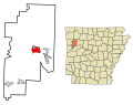
 This map shows the incorporated and unincorporated areas in Faulkner County, Arkansas, highlighting Conway in red. It was created with a custom script with US Census Bureau data and modified with Inkscape.
 -
 This map shows the incorporated and unincorporated areas in Faulkner County, Arkansas, highlighting Damascus in red. It was created with a custom script with US Census Bureau data and modified with Inkscape.
 -
 This map shows the incorporated and unincorporated areas in Faulkner County, Arkansas, highlighting Enola in red. It was created with a custom script with US Census Bureau data and modified with Inkscape.
 -
 This map shows the incorporated and unincorporated areas in Faulkner County, Arkansas, highlighting Greenbrier in red. It was created with a custom script with US Census Bureau data and modified with Inkscape.
 -
 This map shows the incorporated and unincorporated areas in Faulkner County, Arkansas, highlighting Guy in red. It was created with a custom script with US Census Bureau data and modified with Inkscape.
 -
 This map shows the incorporated and unincorporated areas in Faulkner County, Arkansas, highlighting Holland in red. It was created with a custom script with US Census Bureau data and modified with Inkscape.
 -
 This map shows the incorporated and unincorporated areas in Faulkner County, Arkansas, highlighting Mayflower in red. It was created with a custom script with US Census Bureau data and modified with Inkscape.
 -
 This map shows the incorporated and unincorporated areas in Faulkner County, Arkansas, highlighting Mount_Vernon in red. It was created with a custom script with US Census Bureau data and modified with Inkscape.
 -
 This map shows the incorporated and unincorporated areas in Faulkner County, Arkansas, highlighting Twin_Groves in red. It was created with a custom script with US Census Bureau data and modified with Inkscape.
 -
 This map shows the incorporated and unincorporated areas in Faulkner County, Arkansas, highlighting Vilonia in red. It was created with a custom script with US Census Bureau data and modified with Inkscape.
 -
 This map shows the incorporated and unincorporated areas in Faulkner County, Arkansas, highlighting Wooster in red. It was created with a custom script with US Census Bureau data and modified with Inkscape.


Tue Jun 19 13:52:09 MST 2007[edit]
-
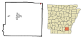
 This map shows the incorporated and unincorporated areas in Drew County, Arkansas, highlighting Jerome in red. It was created with a custom script with US Census Bureau data and modified with Inkscape.
 -
 This map shows the incorporated and unincorporated areas in Drew County, Arkansas, highlighting Monticello in red. It was created with a custom script with US Census Bureau data and modified with Inkscape.
 -
 This map shows the incorporated and unincorporated areas in Drew County, Arkansas, highlighting Tillar in red. It was created with a custom script with US Census Bureau data and modified with Inkscape.
 -
 This map shows the incorporated and unincorporated areas in Drew County, Arkansas, highlighting Wilmar in red. It was created with a custom script with US Census Bureau data and modified with Inkscape.
 -
 This map shows the incorporated and unincorporated areas in Drew County, Arkansas, highlighting Winchester in red. It was created with a custom script with US Census Bureau data and modified with Inkscape.


Tue Jun 19 13:45:56 MST 2007[edit]
-
 This map shows the incorporated and unincorporated areas in Cross County, Arkansas, highlighting Cherry_Valley in red. It was created with a custom script with US Census Bureau data and modified with Inkscape.
 -
 This map shows the incorporated and unincorporated areas in Cross County, Arkansas, highlighting Hickory_Ridge in red. It was created with a custom script with US Census Bureau data and modified with Inkscape.
 -
 This map shows the incorporated and unincorporated areas in Cross County, Arkansas, highlighting Parkin in red. It was created with a custom script with US Census Bureau data and modified with Inkscape.
 -
 This map shows the incorporated and unincorporated areas in Cross County, Arkansas, highlighting Wynne in red. It was created with a custom script with US Census Bureau data and modified with Inkscape.
Tue Jun 19 12:04:44 MST 2007[edit]
-
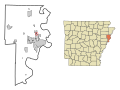
 This map shows the incorporated and unincorporated areas in Crittenden County, Arkansas, highlighting Anthonyville in red. It was created with a custom script with US Census Bureau data and modified with Inkscape.
 -
 This map shows the incorporated and unincorporated areas in Crittenden County, Arkansas, highlighting Crawfordsville in red. It was created with a custom script with US Census Bureau data and modified with Inkscape.
 -
 This map shows the incorporated and unincorporated areas in Crittenden County, Arkansas, highlighting Earle in red. It was created with a custom script with US Census Bureau data and modified with Inkscape.
 -
 This map shows the incorporated and unincorporated areas in Crittenden County, Arkansas, highlighting Edmondson in red. It was created with a custom script with US Census Bureau data and modified with Inkscape.
 -
 This map shows the incorporated and unincorporated areas in Crittenden County, Arkansas, highlighting Gilmore in red. It was created with a custom script with US Census Bureau data and modified with Inkscape.
 -
 This map shows the incorporated and unincorporated areas in Crittenden County, Arkansas, highlighting Horseshoe_Lake in red. It was created with a custom script with US Census Bureau data and modified with Inkscape.
 -
 This map shows the incorporated and unincorporated areas in Crittenden County, Arkansas, highlighting Jennette in red. It was created with a custom script with US Census Bureau data and modified with Inkscape.
 -
 This map shows the incorporated and unincorporated areas in Crittenden County, Arkansas, highlighting Jericho in red. It was created with a custom script with US Census Bureau data and modified with Inkscape.
 -
 This map shows the incorporated and unincorporated areas in Crittenden County, Arkansas, highlighting Marion in red. It was created with a custom script with US Census Bureau data and modified with Inkscape.
 -
 This map shows the incorporated and unincorporated areas in Crittenden County, Arkansas, highlighting Sunset in red. It was created with a custom script with US Census Bureau data and modified with Inkscape.
 -
 This map shows the incorporated and unincorporated areas in Crittenden County, Arkansas, highlighting Turrell in red. It was created with a custom script with US Census Bureau data and modified with Inkscape.
 -
 This map shows the incorporated and unincorporated areas in Crittenden County, Arkansas, highlighting West_Memphis in red. It was created with a custom script with US Census Bureau data and modified with Inkscape.


Tue Jun 19 12:02:03 MST 2007[edit]
-
 This map shows the incorporated and unincorporated areas in Crawford County, Arkansas, highlighting Alma in red. It was created with a custom script with US Census Bureau data and modified with Inkscape.
 -
 This map shows the incorporated and unincorporated areas in Crawford County, Arkansas, highlighting Cedarville in red. It was created with a custom script with US Census Bureau data and modified with Inkscape.
 -
 This map shows the incorporated and unincorporated areas in Crawford County, Arkansas, highlighting Chester in red. It was created with a custom script with US Census Bureau data and modified with Inkscape.
 -
 This map shows the incorporated and unincorporated areas in Crawford County, Arkansas, highlighting Dyer in red. It was created with a custom script with US Census Bureau data and modified with Inkscape.
 -
 This map shows the incorporated and unincorporated areas in Crawford County, Arkansas, highlighting Kibler in red. It was created with a custom script with US Census Bureau data and modified with Inkscape.
 -
 This map shows the incorporated and unincorporated areas in Crawford County, Arkansas, highlighting Mountainburg in red. It was created with a custom script with US Census Bureau data and modified with Inkscape.
 -
 This map shows the incorporated and unincorporated areas in Crawford County, Arkansas, highlighting Mulberry in red. It was created with a custom script with US Census Bureau data and modified with Inkscape.
 -
 This map shows the incorporated and unincorporated areas in Crawford County, Arkansas, highlighting Rudy in red. It was created with a custom script with US Census Bureau data and modified with Inkscape.
 -
 This map shows the incorporated and unincorporated areas in Crawford County, Arkansas, highlighting Van_Buren in red. It was created with a custom script with US Census Bureau data and modified with Inkscape.


Tue Jun 19 11:58:43 MST 2007[edit]
-
 This map shows the incorporated and unincorporated areas in Craighead County, Arkansas, highlighting Bay in red. It was created with a custom script with US Census Bureau data and modified with Inkscape.
 -
 This map shows the incorporated and unincorporated areas in Craighead County, Arkansas, highlighting Black_Oak in red. It was created with a custom script with US Census Bureau data and modified with Inkscape.
 -
 This map shows the incorporated and unincorporated areas in Craighead County, Arkansas, highlighting Bono in red. It was created with a custom script with US Census Bureau data and modified with Inkscape.
 -
 This map shows the incorporated and unincorporated areas in Craighead County, Arkansas, highlighting Brookland in red. It was created with a custom script with US Census Bureau data and modified with Inkscape.
 -
 This map shows the incorporated and unincorporated areas in Craighead County, Arkansas, highlighting Caraway in red. It was created with a custom script with US Census Bureau data and modified with Inkscape.
 -
 This map shows the incorporated and unincorporated areas in Craighead County, Arkansas, highlighting Cash in red. It was created with a custom script with US Census Bureau data and modified with Inkscape.
 -
 This map shows the incorporated and unincorporated areas in Craighead County, Arkansas, highlighting Egypt in red. It was created with a custom script with US Census Bureau data and modified with Inkscape.
 -
 This map shows the incorporated and unincorporated areas in Craighead County, Arkansas, highlighting Jonesboro in red. It was created with a custom script with US Census Bureau data and modified with Inkscape.
 -
 This map shows the incorporated and unincorporated areas in Craighead County, Arkansas, highlighting Lake_City in red. It was created with a custom script with US Census Bureau data and modified with Inkscape.
 -
 This map shows the incorporated and unincorporated areas in Craighead County, Arkansas, highlighting Monette in red. It was created with a custom script with US Census Bureau data and modified with Inkscape.


Tue Jun 19 11:53:22 MST 2007[edit]
-
 This map shows the incorporated and unincorporated areas in Cleveland County, Arkansas, highlighting Kingsland in red. It was created with a custom script with US Census Bureau data and modified with Inkscape.
 -
 This map shows the incorporated and unincorporated areas in Cleveland County, Arkansas, highlighting Rison in red. It was created with a custom script with US Census Bureau data and modified with Inkscape.


Tue Jun 19 11:24:57 MST 2007[edit]
-
 This map shows the incorporated and unincorporated areas in Cleburne County, Arkansas, highlighting Concord in red. It was created with a custom script with US Census Bureau data and modified with Inkscape.
 -
 This map shows the incorporated and unincorporated areas in Cleburne County, Arkansas, highlighting Greers_Ferry in red. It was created with a custom script with US Census Bureau data and modified with Inkscape.
 -
 This map shows the incorporated and unincorporated areas in Cleburne County, Arkansas, highlighting Heber_Springs in red. It was created with a custom script with US Census Bureau data and modified with Inkscape.
 -
 This map shows the incorporated and unincorporated areas in Cleburne County, Arkansas, highlighting Higden in red. It was created with a custom script with US Census Bureau data and modified with Inkscape.
 -
 This map shows the incorporated and unincorporated areas in Cleburne County, Arkansas, highlighting Quitman in red. It was created with a custom script with US Census Bureau data and modified with Inkscape.


Tue Jun 19 10:54:45 MST 2007[edit]
-
 This map shows the incorporated and unincorporated areas in Clay County, Arkansas, highlighting Corning in red. It was created with a custom script with US Census Bureau data and modified with Inkscape.
 -
 This map shows the incorporated and unincorporated areas in Clay County, Arkansas, highlighting Datto in red. It was created with a custom script with US Census Bureau data and modified with Inkscape.
 -
 This map shows the incorporated and unincorporated areas in Clay County, Arkansas, highlighting Greenway in red. It was created with a custom script with US Census Bureau data and modified with Inkscape.
 -
 This map shows the incorporated and unincorporated areas in Clay County, Arkansas, highlighting Knobel in red. It was created with a custom script with US Census Bureau data and modified with Inkscape.
 -
 This map shows the incorporated and unincorporated areas in Clay County, Arkansas, highlighting McDougal in red. It was created with a custom script with US Census Bureau data and modified with Inkscape.
 -
 This map shows the incorporated and unincorporated areas in Clay County, Arkansas, highlighting Nimmons in red. It was created with a custom script with US Census Bureau data and modified with Inkscape.
 -
 This map shows the incorporated and unincorporated areas in Clay County, Arkansas, highlighting Peach_Orchard in red. It was created with a custom script with US Census Bureau data and modified with Inkscape.
 -
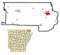 This map shows the incorporated and unincorporated areas in Clay County, Arkansas, highlighting Piggott in red. It was created with a custom script with US Census Bureau data and modified with Inkscape.
 -
 This map shows the incorporated and unincorporated areas in Clay County, Arkansas, highlighting Pollard in red. It was created with a custom script with US Census Bureau data and modified with Inkscape.
 -
 This map shows the incorporated and unincorporated areas in Clay County, Arkansas, highlighting Rector in red. It was created with a custom script with US Census Bureau data and modified with Inkscape.
 -
 This map shows the incorporated and unincorporated areas in Clay County, Arkansas, highlighting St._Francis in red. It was created with a custom script with US Census Bureau data and modified with Inkscape.
 -
 This map shows the incorporated and unincorporated areas in Clay County, Arkansas, highlighting Success in red. It was created with a custom script with US Census Bureau data and modified with Inkscape.


Tue Jun 19 10:51:06 MST 2007[edit]
-
 This map shows the incorporated and unincorporated areas in Clark County, Arkansas, highlighting Amity in red. It was created with a custom script with US Census Bureau data and modified with Inkscape.
 -
 This map shows the incorporated and unincorporated areas in Clark County, Arkansas, highlighting Arkadelphia in red. It was created with a custom script with US Census Bureau data and modified with Inkscape.
 -
 This map shows the incorporated and unincorporated areas in Clark County, Arkansas, highlighting Caddo_Valley in red. It was created with a custom script with US Census Bureau data and modified with Inkscape.
 -
 This map shows the incorporated and unincorporated areas in Clark County, Arkansas, highlighting Gum_Springs in red. It was created with a custom script with US Census Bureau data and modified with Inkscape.
 -
 This map shows the incorporated and unincorporated areas in Clark County, Arkansas, highlighting Gurdon in red. It was created with a custom script with US Census Bureau data and modified with Inkscape.
 -
 This map shows the incorporated and unincorporated areas in Clark County, Arkansas, highlighting Okolona in red. It was created with a custom script with US Census Bureau data and modified with Inkscape.
 -
 This map shows the incorporated and unincorporated areas in Clark County, Arkansas, highlighting Whelen_Springs in red. It was created with a custom script with US Census Bureau data and modified with Inkscape.


Tue Jun 19 10:46:13 MST 2007[edit]
-
 This map shows the incorporated and unincorporated areas in Carroll County, Arkansas, highlighting Alpena in red. It was created with a custom script with US Census Bureau data and modified with Inkscape.
 -
 This map shows the incorporated and unincorporated areas in Carroll County, Arkansas, highlighting Beaver in red. It was created with a custom script with US Census Bureau data and modified with Inkscape.
 -
 This map shows the incorporated and unincorporated areas in Carroll County, Arkansas, highlighting Berryville in red. It was created with a custom script with US Census Bureau data and modified with Inkscape.
 -
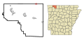 This map shows the incorporated and unincorporated areas in Carroll County, Arkansas, highlighting Blue_Eye in red. It was created with a custom script with US Census Bureau data and modified with Inkscape.
 -
 This map shows the incorporated and unincorporated areas in Carroll County, Arkansas, highlighting Eureka_Springs in red. It was created with a custom script with US Census Bureau data and modified with Inkscape.
 -
 This map shows the incorporated and unincorporated areas in Carroll County, Arkansas, highlighting Green_Forest in red. It was created with a custom script with US Census Bureau data and modified with Inkscape.


Tue Jun 19 10:42:46 MST 2007[edit]
-
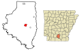 This map shows the incorporated and unincorporated areas in Calhoun County, Arkansas, highlighting Hampton in red. It was created with a custom script with US Census Bureau data and modified with Inkscape.
 -
 This map shows the incorporated and unincorporated areas in Calhoun County, Arkansas, highlighting Harrell in red. It was created with a custom script with US Census Bureau data and modified with Inkscape.
 -
 This map shows the incorporated and unincorporated areas in Calhoun County, Arkansas, highlighting Thornton in red. It was created with a custom script with US Census Bureau data and modified with Inkscape.
 -
 This map shows the incorporated and unincorporated areas in Calhoun County, Arkansas, highlighting Tinsman in red. It was created with a custom script with US Census Bureau data and modified with Inkscape.


Tue Jun 19 10:40:33 MST 2007[edit]
-
 This map shows the incorporated and unincorporated areas in Boone County, Arkansas, highlighting Alpena in red. It was created with a custom script with US Census Bureau data and modified with Inkscape.
 -
 This map shows the incorporated and unincorporated areas in Boone County, Arkansas, highlighting Bellefonte in red. It was created with a custom script with US Census Bureau data and modified with Inkscape.
 -
 This map shows the incorporated and unincorporated areas in Boone County, Arkansas, highlighting Bergman in red. It was created with a custom script with US Census Bureau data and modified with Inkscape.
 -
 This map shows the incorporated and unincorporated areas in Boone County, Arkansas, highlighting Diamond_City in red. It was created with a custom script with US Census Bureau data and modified with Inkscape.
 -
 This map shows the incorporated and unincorporated areas in Boone County, Arkansas, highlighting Everton in red. It was created with a custom script with US Census Bureau data and modified with Inkscape.
 -
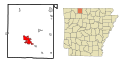 This map shows the incorporated and unincorporated areas in Boone County, Arkansas, highlighting Harrison in red. It was created with a custom script with US Census Bureau data and modified with Inkscape.
 -
 This map shows the incorporated and unincorporated areas in Boone County, Arkansas, highlighting Lead_Hill in red. It was created with a custom script with US Census Bureau data and modified with Inkscape.
 -
 This map shows the incorporated and unincorporated areas in Boone County, Arkansas, highlighting Omaha in red. It was created with a custom script with US Census Bureau data and modified with Inkscape.
 -
 This map shows the incorporated and unincorporated areas in Boone County, Arkansas, highlighting South_Lead_Hill in red. It was created with a custom script with US Census Bureau data and modified with Inkscape.
 -
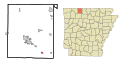 This map shows the incorporated and unincorporated areas in Boone County, Arkansas, highlighting Valley_Springs in red. It was created with a custom script with US Census Bureau data and modified with Inkscape.
 -
 This map shows the incorporated and unincorporated areas in Boone County, Arkansas, highlighting Zinc in red. It was created with a custom script with US Census Bureau data and modified with Inkscape.


Tue Jun 19 10:38:41 MST 2007[edit]
-
 This map shows the incorporated and unincorporated areas in Benton County, Arkansas, highlighting Avoca in red. It was created with a custom script with US Census Bureau data and modified with Inkscape.
 -
 This map shows the incorporated and unincorporated areas in Benton County, Arkansas, highlighting Bella_Vista in red. It was created with a custom script with US Census Bureau data and modified with Inkscape.
 -
 This map shows the incorporated and unincorporated areas in Benton County, Arkansas, highlighting Bentonville in red. It was created with a custom script with US Census Bureau data and modified with Inkscape.
 -
 This map shows the incorporated and unincorporated areas in Benton County, Arkansas, highlighting Bethel_Heights in red. It was created with a custom script with US Census Bureau data and modified with Inkscape.
 -
 This map shows the incorporated and unincorporated areas in Benton County, Arkansas, highlighting Cave_Springs in red. It was created with a custom script with US Census Bureau data and modified with Inkscape.
 -
 This map shows the incorporated and unincorporated areas in Benton County, Arkansas, highlighting Centerton in red. It was created with a custom script with US Census Bureau data and modified with Inkscape.
 -
 This map shows the incorporated and unincorporated areas in Benton County, Arkansas, highlighting Decatur in red. It was created with a custom script with US Census Bureau data and modified with Inkscape.
 -
 This map shows the incorporated and unincorporated areas in Benton County, Arkansas, highlighting Garfield in red. It was created with a custom script with US Census Bureau data and modified with Inkscape.
 -
 This map shows the incorporated and unincorporated areas in Benton County, Arkansas, highlighting Gateway in red. It was created with a custom script with US Census Bureau data and modified with Inkscape.
 -
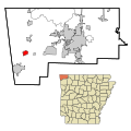 This map shows the incorporated and unincorporated areas in Benton County, Arkansas, highlighting Gentry in red. It was created with a custom script with US Census Bureau data and modified with Inkscape.
 -
 This map shows the incorporated and unincorporated areas in Benton County, Arkansas, highlighting Gravette in red. It was created with a custom script with US Census Bureau data and modified with Inkscape.
 -
 This map shows the incorporated and unincorporated areas in Benton County, Arkansas, highlighting Highfill in red. It was created with a custom script with US Census Bureau data and modified with Inkscape.
 -
 This map shows the incorporated and unincorporated areas in Benton County, Arkansas, highlighting Little_Flock in red. It was created with a custom script with US Census Bureau data and modified with Inkscape.
 -
 This map shows the incorporated and unincorporated areas in Benton County, Arkansas, highlighting Lowell in red. It was created with a custom script with US Census Bureau data and modified with Inkscape.
 -
 This map shows the incorporated and unincorporated areas in Benton County, Arkansas, highlighting Pea_Ridge in red. It was created with a custom script with US Census Bureau data and modified with Inkscape.
 -
 This map shows the incorporated and unincorporated areas in Benton County, Arkansas, highlighting Prairie_Creek in red. It was created with a custom script with US Census Bureau data and modified with Inkscape.
 -
 This map shows the incorporated and unincorporated areas in Benton County, Arkansas, highlighting Rogers in red. It was created with a custom script with US Census Bureau data and modified with Inkscape.
 -
 This map shows the incorporated and unincorporated areas in Benton County, Arkansas, highlighting Siloam_Springs in red. It was created with a custom script with US Census Bureau data and modified with Inkscape.
 -
 This map shows the incorporated and unincorporated areas in Benton County, Arkansas, highlighting Springtown in red. It was created with a custom script with US Census Bureau data and modified with Inkscape.
 -
 This map shows the incorporated and unincorporated areas in Benton County, Arkansas, highlighting Sulphur_Springs in red. It was created with a custom script with US Census Bureau data and modified with Inkscape.


Tue Jun 19 10:33:42 MST 2007[edit]
-
 This map shows the incorporated and unincorporated areas in Ashley County, Arkansas, highlighting Crossett in red. It was created with a custom script with US Census Bureau data and modified with Inkscape.
 -
 This map shows the incorporated and unincorporated areas in Ashley County, Arkansas, highlighting Fountain_Hill in red. It was created with a custom script with US Census Bureau data and modified with Inkscape.
 -
 This map shows the incorporated and unincorporated areas in Ashley County, Arkansas, highlighting Hamburg in red. It was created with a custom script with US Census Bureau data and modified with Inkscape.
 -
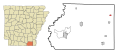 This map shows the incorporated and unincorporated areas in Ashley County, Arkansas, highlighting Montrose in red. It was created with a custom script with US Census Bureau data and modified with Inkscape.
 -
 This map shows the incorporated and unincorporated areas in Ashley County, Arkansas, highlighting North_Crossett in red. It was created with a custom script with US Census Bureau data and modified with Inkscape.
 -
 This map shows the incorporated and unincorporated areas in Ashley County, Arkansas, highlighting Parkdale in red. It was created with a custom script with US Census Bureau data and modified with Inkscape.
 -
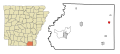 This map shows the incorporated and unincorporated areas in Ashley County, Arkansas, highlighting Portland in red. It was created with a custom script with US Census Bureau data and modified with Inkscape.
 -
 This map shows the incorporated and unincorporated areas in Ashley County, Arkansas, highlighting West_Crossett in red. It was created with a custom script with US Census Bureau data and modified with Inkscape.
 -
 This map shows the incorporated and unincorporated areas in Ashley County, Arkansas, highlighting Wilmot in red. It was created with a custom script with US Census Bureau data and modified with Inkscape.


Tue Jun 12 14:53:51 MST 2007[edit]
-
 This map shows the incorporated and unincorporated areas in Wilcox County, Alabama, highlighting Pine_Hill in red. It was created with a custom script with US Census Bureau data and modified with Inkscape.

Tue Jun 12 14:51:05 MST 2007[edit]
-
 This map shows the incorporated and unincorporated areas in Wilcox County, Alabama, highlighting Camden in red. It was created with a custom script with US Census Bureau data and modified with Inkscape.
 -
 This map shows the incorporated and unincorporated areas in Wilcox County, Alabama, highlighting Pine_Apple in red. It was created with a custom script with US Census Bureau data and modified with Inkscape.
 -
 This map shows the incorporated and unincorporated areas in Wilcox County, Alabama, highlighting Yellow_Bluff in red. It was created with a custom script with US Census Bureau data and modified with Inkscape.


Tue Jun 12 12:38:10 MST 2007[edit]
-
 This map shows the incorporated and unincorporated areas in Randolph County, Alabama, highlighting Roanoke in red. It was created with a custom script with US Census Bureau data and modified with Inkscape.
 -
 This map shows the incorporated and unincorporated areas in Randolph County, Alabama, highlighting Rock_Mills in red. It was created with a custom script with US Census Bureau data and modified with Inkscape.
 -
 This map shows the incorporated and unincorporated areas in Randolph County, Alabama, highlighting Wadley in red. It was created with a custom script with US Census Bureau data and modified with Inkscape.
 -
 This map shows the incorporated and unincorporated areas in Randolph County, Alabama, highlighting Wedowee in red. It was created with a custom script with US Census Bureau data and modified with Inkscape.
 -
 This map shows the incorporated and unincorporated areas in Randolph County, Alabama, highlighting Woodland in red. It was created with a custom script with US Census Bureau data and modified with Inkscape.


Mon Jun 11 15:27:08 MST 2007[edit]


Fri Jun 08 15:00:48 MST 2007[edit]
-
 This map shows the incorporated and unincorporated areas in Lowndes County, Alabama, highlighting Benton in red. It was created with a custom script with US Census Bureau data and modified with Inkscape.
 -
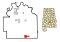 This map shows the incorporated and unincorporated areas in Lowndes County, Alabama, highlighting Fort Deposit in red. It was created with a custom script with US Census Bureau data and modified with Inkscape.
 -
 This map shows the incorporated and unincorporated areas in Lowndes County, Alabama, highlighting Hayneville in red. It was created with a custom script with US Census Bureau data and modified with Inkscape.
 -
 This map shows the incorporated and unincorporated areas in Lowndes County, Alabama, highlighting Lowndesboro in red. It was created with a custom script with US Census Bureau data and modified with Inkscape.
 -
 This map shows the incorporated and unincorporated areas in Lowndes County, Alabama, highlighting Mosses in red. It was created with a custom script with US Census Bureau data and modified with Inkscape.
 -
 This map shows the incorporated and unincorporated areas in Lowndes County, Alabama, highlighting White Hall in red. It was created with a custom script with US Census Bureau data and modified with Inkscape.


Thu Jun 07 16:12:31 MST 2007[edit]
-
 This map shows the incorporated and unincorporated areas in Winston County, Alabama, highlighting Addison in red. It was created with a custom script with US Census Bureau data and modified with Inkscape.
 -
 This map shows the incorporated and unincorporated areas in Winston County, Alabama, highlighting Arley in red. It was created with a custom script with US Census Bureau data and modified with Inkscape.
 -
 This map shows the incorporated and unincorporated areas in Winston County, Alabama, highlighting Double_Springs in red. It was created with a custom script with US Census Bureau data and modified with Inkscape.
 -
 This map shows the incorporated and unincorporated areas in Winston County, Alabama, highlighting Haleyville in red. It was created with a custom script with US Census Bureau data and modified with Inkscape.
 -
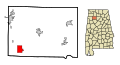 This map shows the incorporated and unincorporated areas in Winston County, Alabama, highlighting Lynn in red. It was created with a custom script with US Census Bureau data and modified with Inkscape.
 -
 This map shows the incorporated and unincorporated areas in Winston County, Alabama, highlighting Natural_Bridge in red. It was created with a custom script with US Census Bureau data and modified with Inkscape.


Thu Jun 07 16:10:19 MST 2007[edit]
-
 This map shows the incorporated and unincorporated areas in Washington County, Alabama, highlighting Chatom in red. It was created with a custom script with US Census Bureau data and modified with Inkscape.
 -
 This map shows the incorporated and unincorporated areas in Washington County, Alabama, highlighting McIntosh in red. It was created with a custom script with US Census Bureau data and modified with Inkscape.
 -
 This map shows the incorporated and unincorporated areas in Washington County, Alabama, highlighting Millry in red. It was created with a custom script with US Census Bureau data and modified with Inkscape.


Thu Jun 07 16:08:35 MST 2007[edit]
-
 This map shows the incorporated and unincorporated areas in Walker County, Alabama, highlighting Carbon_Hill in red. It was created with a custom script with US Census Bureau data and modified with Inkscape.
 -
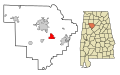 This map shows the incorporated and unincorporated areas in Walker County, Alabama, highlighting Cordova in red. It was created with a custom script with US Census Bureau data and modified with Inkscape.
 -
 This map shows the incorporated and unincorporated areas in Walker County, Alabama, highlighting Dora in red. It was created with a custom script with US Census Bureau data and modified with Inkscape.
 -
 This map shows the incorporated and unincorporated areas in Walker County, Alabama, highlighting Eldridge in red. It was created with a custom script with US Census Bureau data and modified with Inkscape.
 -
 This map shows the incorporated and unincorporated areas in Walker County, Alabama, highlighting Jasper in red. It was created with a custom script with US Census Bureau data and modified with Inkscape.
 -
 This map shows the incorporated and unincorporated areas in Walker County, Alabama, highlighting Kansas in red. It was created with a custom script with US Census Bureau data and modified with Inkscape.
 -
 This map shows the incorporated and unincorporated areas in Walker County, Alabama, highlighting Nauvoo in red. It was created with a custom script with US Census Bureau data and modified with Inkscape.
 -
 This map shows the incorporated and unincorporated areas in Walker County, Alabama, highlighting Oakman in red. It was created with a custom script with US Census Bureau data and modified with Inkscape.
 -
 This map shows the incorporated and unincorporated areas in Walker County, Alabama, highlighting Parrish in red. It was created with a custom script with US Census Bureau data and modified with Inkscape.
 -
 This map shows the incorporated and unincorporated areas in Walker County, Alabama, highlighting Sipsey in red. It was created with a custom script with US Census Bureau data and modified with Inkscape.
 -
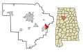 This map shows the incorporated and unincorporated areas in Walker County, Alabama, highlighting Sumiton in red. It was created with a custom script with US Census Bureau data and modified with Inkscape.


Thu Jun 07 16:03:30 MST 2007[edit]
-
 This map shows the incorporated and unincorporated areas in Tuscaloosa County, Alabama, highlighting Brookwood in red. It was created with a custom script with US Census Bureau data and modified with Inkscape.
 -
 This map shows the incorporated and unincorporated areas in Tuscaloosa County, Alabama, highlighting Coaling in red. It was created with a custom script with US Census Bureau data and modified with Inkscape.
 -
 This map shows the incorporated and unincorporated areas in Tuscaloosa County, Alabama, highlighting Coker in red. It was created with a custom script with US Census Bureau data and modified with Inkscape.
 -
 This map shows the incorporated and unincorporated areas in Tuscaloosa County, Alabama, highlighting Holt in red. It was created with a custom script with US Census Bureau data and modified with Inkscape.
 -
 This map shows the incorporated and unincorporated areas in Tuscaloosa County, Alabama, highlighting Lake_View in red. It was created with a custom script with US Census Bureau data and modified with Inkscape.
 -
 This map shows the incorporated and unincorporated areas in Tuscaloosa County, Alabama, highlighting Northport in red. It was created with a custom script with US Census Bureau data and modified with Inkscape.
 -
 This map shows the incorporated and unincorporated areas in Tuscaloosa County, Alabama, highlighting Tuscaloosa in red. It was created with a custom script with US Census Bureau data and modified with Inkscape.
 -
 This map shows the incorporated and unincorporated areas in Tuscaloosa County, Alabama, highlighting Vance in red. It was created with a custom script with US Census Bureau data and modified with Inkscape.


Thu Jun 07 15:58:14 MST 2007[edit]
-
 This map shows the incorporated and unincorporated areas in Tallapoosa County, Alabama, highlighting Alexander_City in red. It was created with a custom script with US Census Bureau data and modified with Inkscape.
 -
 This map shows the incorporated and unincorporated areas in Tallapoosa County, Alabama, highlighting Camp_Hill in red. It was created with a custom script with US Census Bureau data and modified with Inkscape.
 -
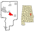 This map shows the incorporated and unincorporated areas in Tallapoosa County, Alabama, highlighting Dadeville in red. It was created with a custom script with US Census Bureau data and modified with Inkscape.
 -
 This map shows the incorporated and unincorporated areas in Tallapoosa County, Alabama, highlighting Daviston in red. It was created with a custom script with US Census Bureau data and modified with Inkscape.
 -
 This map shows the incorporated and unincorporated areas in Tallapoosa County, Alabama, highlighting Goldville in red. It was created with a custom script with US Census Bureau data and modified with Inkscape.
 -
 This map shows the incorporated and unincorporated areas in Tallapoosa County, Alabama, highlighting Jacksons'_Gap in red. It was created with a custom script with US Census Bureau data and modified with Inkscape.
 -
 This map shows the incorporated and unincorporated areas in Tallapoosa County, Alabama, highlighting New_Site in red. It was created with a custom script with US Census Bureau data and modified with Inkscape.
 -
 This map shows the incorporated and unincorporated areas in Tallapoosa County, Alabama, highlighting Tallassee in red. It was created with a custom script with US Census Bureau data and modified with Inkscape.


Thu Jun 07 15:55:53 MST 2007[edit]
-
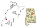 This map shows the incorporated and unincorporated areas in Talladega County, Alabama, highlighting Bon_Air in red. It was created with a custom script with US Census Bureau data and modified with Inkscape.
 -
 This map shows the incorporated and unincorporated areas in Talladega County, Alabama, highlighting Childersburg in red. It was created with a custom script with US Census Bureau data and modified with Inkscape.
 -
 This map shows the incorporated and unincorporated areas in Talladega County, Alabama, highlighting Gantts_Quarry in red. It was created with a custom script with US Census Bureau data and modified with Inkscape.
 -
 This map shows the incorporated and unincorporated areas in Talladega County, Alabama, highlighting Lincoln in red. It was created with a custom script with US Census Bureau data and modified with Inkscape.
 -
 This map shows the incorporated and unincorporated areas in Talladega County, Alabama, highlighting Mignon in red. It was created with a custom script with US Census Bureau data and modified with Inkscape.
 -
 This map shows the incorporated and unincorporated areas in Talladega County, Alabama, highlighting Munford in red. It was created with a custom script with US Census Bureau data and modified with Inkscape.
 -
 This map shows the incorporated and unincorporated areas in Talladega County, Alabama, highlighting Oak_Grove in red. It was created with a custom script with US Census Bureau data and modified with Inkscape.
 -
 This map shows the incorporated and unincorporated areas in Talladega County, Alabama, highlighting Sylacauga in red. It was created with a custom script with US Census Bureau data and modified with Inkscape.
 -
 This map shows the incorporated and unincorporated areas in Talladega County, Alabama, highlighting Talladega in red. It was created with a custom script with US Census Bureau data and modified with Inkscape.
 -
 This map shows the incorporated and unincorporated areas in Talladega County, Alabama, highlighting Talladega_Springs in red. It was created with a custom script with US Census Bureau data and modified with Inkscape.
 -
 This map shows the incorporated and unincorporated areas in Talladega County, Alabama, highlighting Waldo in red. It was created with a custom script with US Census Bureau data and modified with Inkscape.


Thu Jun 07 15:52:41 MST 2007[edit]
-
 This map shows the incorporated and unincorporated areas in Sumter County, Alabama, highlighting Cuba in red. It was created with a custom script with US Census Bureau data and modified with Inkscape.
 -
 This map shows the incorporated and unincorporated areas in Sumter County, Alabama, highlighting Emelle in red. It was created with a custom script with US Census Bureau data and modified with Inkscape.
 -
 This map shows the incorporated and unincorporated areas in Sumter County, Alabama, highlighting Epes in red. It was created with a custom script with US Census Bureau data and modified with Inkscape.
 -
 This map shows the incorporated and unincorporated areas in Sumter County, Alabama, highlighting Gainesville in red. It was created with a custom script with US Census Bureau data and modified with Inkscape.
 -
 This map shows the incorporated and unincorporated areas in Sumter County, Alabama, highlighting Geiger in red. It was created with a custom script with US Census Bureau data and modified with Inkscape.
 -
 This map shows the incorporated and unincorporated areas in Sumter County, Alabama, highlighting Livingston in red. It was created with a custom script with US Census Bureau data and modified with Inkscape.
 -
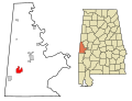 This map shows the incorporated and unincorporated areas in Sumter County, Alabama, highlighting York in red. It was created with a custom script with US Census Bureau data and modified with Inkscape.


Thu Jun 07 15:50:09 MST 2007[edit]
-
 This map shows the incorporated and unincorporated areas in St. Clair County, Alabama, highlighting Ashville in red. It was created with a custom script with US Census Bureau data and modified with Inkscape.
 -
 This map shows the incorporated and unincorporated areas in St. Clair County, Alabama, highlighting Branchville in red. It was created with a custom script with US Census Bureau data and modified with Inkscape.
 -
 This map shows the incorporated and unincorporated areas in St. Clair County, Alabama, highlighting Margaret in red. It was created with a custom script with US Census Bureau data and modified with Inkscape.
 -
 This map shows the incorporated and unincorporated areas in St. Clair County, Alabama, highlighting Moody in red. It was created with a custom script with US Census Bureau data and modified with Inkscape.
 -
 This map shows the incorporated and unincorporated areas in St. Clair County, Alabama, highlighting Odenville in red. It was created with a custom script with US Census Bureau data and modified with Inkscape.
 -
 This map shows the incorporated and unincorporated areas in St. Clair County, Alabama, highlighting Pell_City in red. It was created with a custom script with US Census Bureau data and modified with Inkscape.
 -
 This map shows the incorporated and unincorporated areas in St. Clair County, Alabama, highlighting Ragland in red. It was created with a custom script with US Census Bureau data and modified with Inkscape.
 -
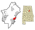 This map shows the incorporated and unincorporated areas in St. Clair County, Alabama, highlighting Riverside in red. It was created with a custom script with US Census Bureau data and modified with Inkscape.
 -
 This map shows the incorporated and unincorporated areas in St. Clair County, Alabama, highlighting Springville in red. It was created with a custom script with US Census Bureau data and modified with Inkscape.
 -
 This map shows the incorporated and unincorporated areas in St. Clair County, Alabama, highlighting Steele in red. It was created with a custom script with US Census Bureau data and modified with Inkscape.


Thu Jun 07 15:46:10 MST 2007[edit]
-
 This map shows the incorporated and unincorporated areas in Shelby County, Alabama, highlighting Alabaster in red. It was created with a custom script with US Census Bureau data and modified with Inkscape.
 -
 This map shows the incorporated and unincorporated areas in Shelby County, Alabama, highlighting Calera in red. It was created with a custom script with US Census Bureau data and modified with Inkscape.
 -
 This map shows the incorporated and unincorporated areas in Shelby County, Alabama, highlighting Chelsea in red. It was created with a custom script with US Census Bureau data and modified with Inkscape.
 -
 This map shows the incorporated and unincorporated areas in Shelby County, Alabama, highlighting Columbiana in red. It was created with a custom script with US Census Bureau data and modified with Inkscape.
 -
 This map shows the incorporated and unincorporated areas in Shelby County, Alabama, highlighting Harpersville in red. It was created with a custom script with US Census Bureau data and modified with Inkscape.
 -
 This map shows the incorporated and unincorporated areas in Shelby County, Alabama, highlighting Helena in red. It was created with a custom script with US Census Bureau data and modified with Inkscape.
 -
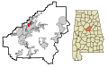 This map shows the incorporated and unincorporated areas in Shelby County, Alabama, highlighting Indian_Springs_Village in red. It was created with a custom script with US Census Bureau data and modified with Inkscape.
 -
 This map shows the incorporated and unincorporated areas in Shelby County, Alabama, highlighting Lake_Purdy in red. It was created with a custom script with US Census Bureau data and modified with Inkscape.
 -
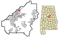 This map shows the incorporated and unincorporated areas in Shelby County, Alabama, highlighting Meadowbrook in red. It was created with a custom script with US Census Bureau data and modified with Inkscape.
 -
 This map shows the incorporated and unincorporated areas in Shelby County, Alabama, highlighting Montevallo in red. It was created with a custom script with US Census Bureau data and modified with Inkscape.
 -
 This map shows the incorporated and unincorporated areas in Shelby County, Alabama, highlighting Pelham in red. It was created with a custom script with US Census Bureau data and modified with Inkscape.
 -
 This map shows the incorporated and unincorporated areas in Shelby County, Alabama, highlighting Vincent in red. It was created with a custom script with US Census Bureau data and modified with Inkscape.
 -
 This map shows the incorporated and unincorporated areas in Shelby County, Alabama, highlighting Wilsonville in red. It was created with a custom script with US Census Bureau data and modified with Inkscape.
 -
 This map shows the incorporated and unincorporated areas in Shelby County, Alabama, highlighting Wilton in red. It was created with a custom script with US Census Bureau data and modified with Inkscape.


Thu Jun 07 15:43:06 MST 2007[edit]
-
 This map shows the incorporated and unincorporated areas in Russell County, Alabama, highlighting Hurtsboro in red. It was created with a custom script with US Census Bureau data and modified with Inkscape.
 -
 This map shows the incorporated and unincorporated areas in Russell County, Alabama, highlighting Ladonia in red. It was created with a custom script with US Census Bureau data and modified with Inkscape.
 -
 This map shows the incorporated and unincorporated areas in Russell County, Alabama, highlighting Phenix_City in red. It was created with a custom script with US Census Bureau data and modified with Inkscape.


Thu Jun 07 15:40:29 MST 2007[edit]
-
 This map shows the incorporated and unincorporated areas in Pike County, Alabama, highlighting Banks in red. It was created with a custom script with US Census Bureau data and modified with Inkscape.
 -
 This map shows the incorporated and unincorporated areas in Pike County, Alabama, highlighting Brundidge in red. It was created with a custom script with US Census Bureau data and modified with Inkscape.
 -
 This map shows the incorporated and unincorporated areas in Pike County, Alabama, highlighting Goshen in red. It was created with a custom script with US Census Bureau data and modified with Inkscape.
 -
 This map shows the incorporated and unincorporated areas in Pike County, Alabama, highlighting Troy in red. It was created with a custom script with US Census Bureau data and modified with Inkscape.


Thu Jun 07 15:38:45 MST 2007[edit]
-
 This map shows the incorporated and unincorporated areas in Pickens County, Alabama, highlighting Aliceville in red. It was created with a custom script with US Census Bureau data and modified with Inkscape.
 -
 This map shows the incorporated and unincorporated areas in Pickens County, Alabama, highlighting Carrollton in red. It was created with a custom script with US Census Bureau data and modified with Inkscape.
 -
 This map shows the incorporated and unincorporated areas in Pickens County, Alabama, highlighting Ethelsville in red. It was created with a custom script with US Census Bureau data and modified with Inkscape.
 -
 This map shows the incorporated and unincorporated areas in Pickens County, Alabama, highlighting Gordo in red. It was created with a custom script with US Census Bureau data and modified with Inkscape.
 -
 This map shows the incorporated and unincorporated areas in Pickens County, Alabama, highlighting Macedonia in red. It was created with a custom script with US Census Bureau data and modified with Inkscape.
 -
 This map shows the incorporated and unincorporated areas in Pickens County, Alabama, highlighting McMullen in red. It was created with a custom script with US Census Bureau data and modified with Inkscape.
 -
 This map shows the incorporated and unincorporated areas in Pickens County, Alabama, highlighting Memphis in red. It was created with a custom script with US Census Bureau data and modified with Inkscape.
 -
 This map shows the incorporated and unincorporated areas in Pickens County, Alabama, highlighting Pickensville in red. It was created with a custom script with US Census Bureau data and modified with Inkscape.
 -
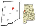 This map shows the incorporated and unincorporated areas in Pickens County, Alabama, highlighting Reform in red. It was created with a custom script with US Census Bureau data and modified with Inkscape.


Thu Jun 07 14:07:45 MST 2007[edit]
-
 This map shows the incorporated and unincorporated areas in Morgan County, Alabama, highlighting Decatur in red. It was created with a custom script with US Census Bureau data and modified with Inkscape.
 -
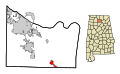 This map shows the incorporated and unincorporated areas in Morgan County, Alabama, highlighting Eva in red. It was created with a custom script with US Census Bureau data and modified with Inkscape.
 -
 This map shows the incorporated and unincorporated areas in Morgan County, Alabama, highlighting Falkville in red. It was created with a custom script with US Census Bureau data and modified with Inkscape.
 -
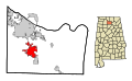 This map shows the incorporated and unincorporated areas in Morgan County, Alabama, highlighting Hartselle in red. It was created with a custom script with US Census Bureau data and modified with Inkscape.
 -
 This map shows the incorporated and unincorporated areas in Morgan County, Alabama, highlighting Priceville in red. It was created with a custom script with US Census Bureau data and modified with Inkscape.
 -
 This map shows the incorporated and unincorporated areas in Morgan County, Alabama, highlighting Somerville in red. It was created with a custom script with US Census Bureau data and modified with Inkscape.
 -
 This map shows the incorporated and unincorporated areas in Morgan County, Alabama, highlighting Trinity in red. It was created with a custom script with US Census Bureau data and modified with Inkscape.


Thu Jun 07 14:06:17 MST 2007[edit]
-
 This map shows the incorporated and unincorporated areas in Montgomery County, Alabama, highlighting Montgomery in red. It was created with a custom script with US Census Bureau data and modified with Inkscape.
 -
 This map shows the incorporated and unincorporated areas in Montgomery County, Alabama, highlighting Pike_Road in red. It was created with a custom script with US Census Bureau data and modified with Inkscape.


Thu Jun 07 14:04:38 MST 2007[edit]
-
 This map shows the incorporated and unincorporated areas in Monroe County, Alabama, highlighting Beatrice in red. It was created with a custom script with US Census Bureau data and modified with Inkscape.
 -
 This map shows the incorporated and unincorporated areas in Monroe County, Alabama, highlighting Excel in red. It was created with a custom script with US Census Bureau data and modified with Inkscape.
 -
 This map shows the incorporated and unincorporated areas in Monroe County, Alabama, highlighting Frisco_City in red. It was created with a custom script with US Census Bureau data and modified with Inkscape.
 -
 This map shows the incorporated and unincorporated areas in Monroe County, Alabama, highlighting Monroeville in red. It was created with a custom script with US Census Bureau data and modified with Inkscape.
 -
 This map shows the incorporated and unincorporated areas in Monroe County, Alabama, highlighting Vredenburgh in red. It was created with a custom script with US Census Bureau data and modified with Inkscape.


Thu Jun 07 10:57:51 MST 2007[edit]
-
 This map shows the incorporated and unincorporated areas in Mobile County, Alabama, highlighting Bayou_La_Batre in red. It was created with a custom script with US Census Bureau data and modified with Inkscape.
 -
 This map shows the incorporated and unincorporated areas in Mobile County, Alabama, highlighting Chickasaw in red. It was created with a custom script with US Census Bureau data and modified with Inkscape.
 -
 This map shows the incorporated and unincorporated areas in Mobile County, Alabama, highlighting Citronelle in red. It was created with a custom script with US Census Bureau data and modified with Inkscape.
 -
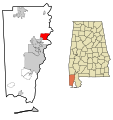 This map shows the incorporated and unincorporated areas in Mobile County, Alabama, highlighting Creola in red. It was created with a custom script with US Census Bureau data and modified with Inkscape.
 -
 This map shows the incorporated and unincorporated areas in Mobile County, Alabama, highlighting Dauphin_Island in red. It was created with a custom script with US Census Bureau data and modified with Inkscape.
 -
 This map shows the incorporated and unincorporated areas in Mobile County, Alabama, highlighting Grand_Bay in red. It was created with a custom script with US Census Bureau data and modified with Inkscape.
 -
 This map shows the incorporated and unincorporated areas in Mobile County, Alabama, highlighting Mobile in red. It was created with a custom script with US Census Bureau data and modified with Inkscape.
 -
 This map shows the incorporated and unincorporated areas in Mobile County, Alabama, highlighting Mount_Vernon in red. It was created with a custom script with US Census Bureau data and modified with Inkscape.
 -
 This map shows the incorporated and unincorporated areas in Mobile County, Alabama, highlighting Prichard in red. It was created with a custom script with US Census Bureau data and modified with Inkscape.
 -
 This map shows the incorporated and unincorporated areas in Mobile County, Alabama, highlighting Saraland in red. It was created with a custom script with US Census Bureau data and modified with Inkscape.
 -
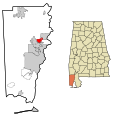 This map shows the incorporated and unincorporated areas in Mobile County, Alabama, highlighting Satsuma in red. It was created with a custom script with US Census Bureau data and modified with Inkscape.
 -
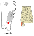 This map shows the incorporated and unincorporated areas in Mobile County, Alabama, highlighting Theodore in red. It was created with a custom script with US Census Bureau data and modified with Inkscape.
 -
 This map shows the incorporated and unincorporated areas in Mobile County, Alabama, highlighting Tillmans_Corner in red. It was created with a custom script with US Census Bureau data and modified with Inkscape.
Thu Jun 07 10:38:37 MST 2007[edit]
-
 This map shows the incorporated and unincorporated areas in Marshall County, Alabama, highlighting Albertville in red. It was created with a custom script with US Census Bureau data and modified with Inkscape.
 -
 This map shows the incorporated and unincorporated areas in Marshall County, Alabama, highlighting Arab in red. It was created with a custom script with US Census Bureau data and modified with Inkscape.
 -
 This map shows the incorporated and unincorporated areas in Marshall County, Alabama, highlighting Boaz in red. It was created with a custom script with US Census Bureau data and modified with Inkscape.
 -
 This map shows the incorporated and unincorporated areas in Marshall County, Alabama, highlighting Douglas in red. It was created with a custom script with US Census Bureau data and modified with Inkscape.
 -
 This map shows the incorporated and unincorporated areas in Marshall County, Alabama, highlighting Grant in red. It was created with a custom script with US Census Bureau data and modified with Inkscape.
 -
 This map shows the incorporated and unincorporated areas in Marshall County, Alabama, highlighting Guntersville in red. It was created with a custom script with US Census Bureau data and modified with Inkscape.
 -
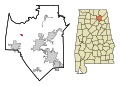 This map shows the incorporated and unincorporated areas in Marshall County, Alabama, highlighting Union_Grove in red. It was created with a custom script with US Census Bureau data and modified with Inkscape.


Thu Jun 07 10:32:53 MST 2007[edit]
-
 This map shows the incorporated and unincorporated areas in Marion County, Alabama, highlighting Bear_Creek in red. It was created with a custom script with US Census Bureau data and modified with Inkscape.
 -
 This map shows the incorporated and unincorporated areas in Marion County, Alabama, highlighting Brilliant in red. It was created with a custom script with US Census Bureau data and modified with Inkscape.
 -
 This map shows the incorporated and unincorporated areas in Marion County, Alabama, highlighting Gu-Win in red. It was created with a custom script with US Census Bureau data and modified with Inkscape.
 -
 This map shows the incorporated and unincorporated areas in Marion County, Alabama, highlighting Guin in red. It was created with a custom script with US Census Bureau data and modified with Inkscape.
 -
 This map shows the incorporated and unincorporated areas in Marion County, Alabama, highlighting Hackleburg in red. It was created with a custom script with US Census Bureau data and modified with Inkscape.
 -
 This map shows the incorporated and unincorporated areas in Marion County, Alabama, highlighting Hamilton in red. It was created with a custom script with US Census Bureau data and modified with Inkscape.
 -
 This map shows the incorporated and unincorporated areas in Marion County, Alabama, highlighting Winfield in red. It was created with a custom script with US Census Bureau data and modified with Inkscape.


Thu Jun 07 10:27:00 MST 2007[edit]
-
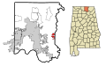 This map shows the incorporated and unincorporated areas in Madison County, Alabama, highlighting Gurley in red. It was created with a custom script with US Census Bureau data and modified with Inkscape.
 -
 This map shows the incorporated and unincorporated areas in Madison County, Alabama, highlighting Harvest in red. It was created with a custom script with US Census Bureau data and modified with Inkscape.
 -
 This map shows the incorporated and unincorporated areas in Madison County, Alabama, highlighting Hazel_Green in red. It was created with a custom script with US Census Bureau data and modified with Inkscape.
 -
 This map shows the incorporated and unincorporated areas in Madison County, Alabama, highlighting Huntsville in red. It was created with a custom script with US Census Bureau data and modified with Inkscape.
 -
 This map shows the incorporated and unincorporated areas in Madison County, Alabama, highlighting Madison in red. It was created with a custom script with US Census Bureau data and modified with Inkscape.
 -
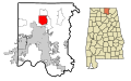 This map shows the incorporated and unincorporated areas in Madison County, Alabama, highlighting Meridianville in red. It was created with a custom script with US Census Bureau data and modified with Inkscape.
 -
 This map shows the incorporated and unincorporated areas in Madison County, Alabama, highlighting Moores_Mill in red. It was created with a custom script with US Census Bureau data and modified with Inkscape.
 -
 This map shows the incorporated and unincorporated areas in Madison County, Alabama, highlighting New_Hope in red. It was created with a custom script with US Census Bureau data and modified with Inkscape.
 -
 This map shows the incorporated and unincorporated areas in Madison County, Alabama, highlighting New_Market in red. It was created with a custom script with US Census Bureau data and modified with Inkscape.
 -
 This map shows the incorporated and unincorporated areas in Madison County, Alabama, highlighting Owens_Cross_Roads in red. It was created with a custom script with US Census Bureau data and modified with Inkscape.
 -
 This map shows the incorporated and unincorporated areas in Madison County, Alabama, highlighting Triana in red. It was created with a custom script with US Census Bureau data and modified with Inkscape.


Thu Jun 07 10:19:34 MST 2007[edit]
-
 This map shows the incorporated and unincorporated areas in Macon County, Alabama, highlighting Franklin in red. It was created with a custom script with US Census Bureau data and modified with Inkscape.
 -
 This map shows the incorporated and unincorporated areas in Macon County, Alabama, highlighting Notasulga in red. It was created with a custom script with US Census Bureau data and modified with Inkscape.
 -
 This map shows the incorporated and unincorporated areas in Macon County, Alabama, highlighting Shorter in red. It was created with a custom script with US Census Bureau data and modified with Inkscape.
 -
 This map shows the incorporated and unincorporated areas in Macon County, Alabama, highlighting Tuskegee in red. It was created with a custom script with US Census Bureau data and modified with Inkscape.


Thu Jun 07 10:16:11 MST 2007[edit]
-
 This map shows the incorporated and unincorporated areas in Limestone County, Alabama, highlighting Ardmore in red. It was created with a custom script with US Census Bureau data and modified with Inkscape.
 -
 This map shows the incorporated and unincorporated areas in Limestone County, Alabama, highlighting Athens in red. It was created with a custom script with US Census Bureau data and modified with Inkscape.
 -
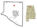 This map shows the incorporated and unincorporated areas in Limestone County, Alabama, highlighting Elkmont in red. It was created with a custom script with US Census Bureau data and modified with Inkscape.
 -
 This map shows the incorporated and unincorporated areas in Limestone County, Alabama, highlighting Lester in red. It was created with a custom script with US Census Bureau data and modified with Inkscape.
 -
 This map shows the incorporated and unincorporated areas in Limestone County, Alabama, highlighting Mooresville in red. It was created with a custom script with US Census Bureau data and modified with Inkscape.


Thu Jun 07 08:24:03 MST 2007[edit]
-
 This map shows the incorporated and unincorporated areas in Lee County, Alabama, highlighting Auburn in red. It was created with a custom script with US Census Bureau data and modified with Inkscape.
 -
 This map shows the incorporated and unincorporated areas in Lee County, Alabama, highlighting Loachapoka in red. It was created with a custom script with US Census Bureau data and modified with Inkscape.
 -
 This map shows the incorporated and unincorporated areas in Lee County, Alabama, highlighting Opelika in red. It was created with a custom script with US Census Bureau data and modified with Inkscape.
 -
 This map shows the incorporated and unincorporated areas in Lee County, Alabama, highlighting Smiths in red. It was created with a custom script with US Census Bureau data and modified with Inkscape.


Thu Jun 07 08:15:09 MST 2007[edit]
-
 This map shows the incorporated and unincorporated areas in Lawrence County, Alabama, highlighting Courtland in red. It was created with a custom script with US Census Bureau data and modified with Inkscape.
 -
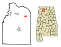 This map shows the incorporated and unincorporated areas in Lawrence County, Alabama, highlighting Hillsboro in red. It was created with a custom script with US Census Bureau data and modified with Inkscape.
 -
 This map shows the incorporated and unincorporated areas in Lawrence County, Alabama, highlighting Moulton in red. It was created with a custom script with US Census Bureau data and modified with Inkscape.
 -
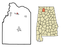 This map shows the incorporated and unincorporated areas in Lawrence County, Alabama, highlighting North_Courtland in red. It was created with a custom script with US Census Bureau data and modified with Inkscape.
 -
 This map shows the incorporated and unincorporated areas in Lawrence County, Alabama, highlighting Town_Creek in red. It was created with a custom script with US Census Bureau data and modified with Inkscape.


Thu Jun 07 08:09:51 MST 2007[edit]
-
 This map shows the incorporated and unincorporated areas in Lauderdale County, Alabama, highlighting Anderson in red. It was created with a custom script with US Census Bureau data and modified with Inkscape.
 -
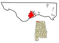 This map shows the incorporated and unincorporated areas in Lauderdale County, Alabama, highlighting Florence in red. It was created with a custom script with US Census Bureau data and modified with Inkscape.
 -
 This map shows the incorporated and unincorporated areas in Lauderdale County, Alabama, highlighting Killen in red. It was created with a custom script with US Census Bureau data and modified with Inkscape.
 -
 This map shows the incorporated and unincorporated areas in Lauderdale County, Alabama, highlighting Lexington in red. It was created with a custom script with US Census Bureau data and modified with Inkscape.
 -
 This map shows the incorporated and unincorporated areas in Lauderdale County, Alabama, highlighting Rogersville in red. It was created with a custom script with US Census Bureau data and modified with Inkscape.
 -
 This map shows the incorporated and unincorporated areas in Lauderdale County, Alabama, highlighting St._Florian in red. It was created with a custom script with US Census Bureau data and modified with Inkscape.
 -
 This map shows the incorporated and unincorporated areas in Lauderdale County, Alabama, highlighting Waterloo in red. It was created with a custom script with US Census Bureau data and modified with Inkscape.


Thu Jun 07 08:05:53 MST 2007[edit]
-
 This map shows the incorporated and unincorporated areas in Lamar County, Alabama, highlighting Beaverton in red. It was created with a custom script with US Census Bureau data and modified with Inkscape.
 -
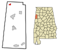 This map shows the incorporated and unincorporated areas in Lamar County, Alabama, highlighting Detroit in red. It was created with a custom script with US Census Bureau data and modified with Inkscape.
 -
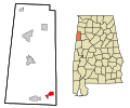 This map shows the incorporated and unincorporated areas in Lamar County, Alabama, highlighting Kennedy in red. It was created with a custom script with US Census Bureau data and modified with Inkscape.
 -
 This map shows the incorporated and unincorporated areas in Lamar County, Alabama, highlighting Millport in red. It was created with a custom script with US Census Bureau data and modified with Inkscape.
 -
 This map shows the incorporated and unincorporated areas in Lamar County, Alabama, highlighting Sulligent in red. It was created with a custom script with US Census Bureau data and modified with Inkscape.
 -
 This map shows the incorporated and unincorporated areas in Lamar County, Alabama, highlighting Vernon in red. It was created with a custom script with US Census Bureau data and modified with Inkscape.


Thu Jun 07 08:03:50 MST 2007[edit]
-
 This map shows the incorporated and unincorporated areas in Jefferson County, Alabama, highlighting Adamsville in red. It was created with a custom script with US Census Bureau data and modified with Inkscape.
 -
 This map shows the incorporated and unincorporated areas in Jefferson County, Alabama, highlighting Argo in red. It was created with a custom script with US Census Bureau data and modified with Inkscape.
 -
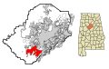 This map shows the incorporated and unincorporated areas in Jefferson County, Alabama, highlighting Bessemer in red. It was created with a custom script with US Census Bureau data and modified with Inkscape.
 -
 This map shows the incorporated and unincorporated areas in Jefferson County, Alabama, highlighting Birmingham in red. It was created with a custom script with US Census Bureau data and modified with Inkscape.
 -
 This map shows the incorporated and unincorporated areas in Jefferson County, Alabama, highlighting Brighton in red. It was created with a custom script with US Census Bureau data and modified with Inkscape.
 -
 This map shows the incorporated and unincorporated areas in Jefferson County, Alabama, highlighting Brookside in red. It was created with a custom script with US Census Bureau data and modified with Inkscape.
 -
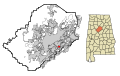 This map shows the incorporated and unincorporated areas in Jefferson County, Alabama, highlighting Cahaba_Heights in red. It was created with a custom script with US Census Bureau data and modified with Inkscape.
 -
 This map shows the incorporated and unincorporated areas in Jefferson County, Alabama, highlighting Cardiff in red. It was created with a custom script with US Census Bureau data and modified with Inkscape.
 -
 This map shows the incorporated and unincorporated areas in Jefferson County, Alabama, highlighting Center_Point in red. It was created with a custom script with US Census Bureau data and modified with Inkscape.
 -
 This map shows the incorporated and unincorporated areas in Jefferson County, Alabama, highlighting Chalkville in red. It was created with a custom script with US Census Bureau data and modified with Inkscape.
 -
 This map shows the incorporated and unincorporated areas in Jefferson County, Alabama, highlighting Clay in red. It was created with a custom script with US Census Bureau data and modified with Inkscape.
 -
 This map shows the incorporated and unincorporated areas in Jefferson County, Alabama, highlighting Concord in red. It was created with a custom script with US Census Bureau data and modified with Inkscape.
 -
 This map shows the incorporated and unincorporated areas in Jefferson County, Alabama, highlighting Edgewater in red. It was created with a custom script with US Census Bureau data and modified with Inkscape.
 -
 This map shows the incorporated and unincorporated areas in Jefferson County, Alabama, highlighting Fairfield in red. It was created with a custom script with US Census Bureau data and modified with Inkscape.
 -
 This map shows the incorporated and unincorporated areas in Jefferson County, Alabama, highlighting Forestdale in red. It was created with a custom script with US Census Bureau data and modified with Inkscape.
 -
 This map shows the incorporated and unincorporated areas in Jefferson County, Alabama, highlighting Fultondale in red. It was created with a custom script with US Census Bureau data and modified with Inkscape.
 -
 This map shows the incorporated and unincorporated areas in Jefferson County, Alabama, highlighting Gardendale in red. It was created with a custom script with US Census Bureau data and modified with Inkscape.
 -
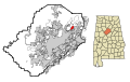 This map shows the incorporated and unincorporated areas in Jefferson County, Alabama, highlighting Grayson_Valley in red. It was created with a custom script with US Census Bureau data and modified with Inkscape.
 -
 This map shows the incorporated and unincorporated areas in Jefferson County, Alabama, highlighting Graysville in red. It was created with a custom script with US Census Bureau data and modified with Inkscape.
 -
 This map shows the incorporated and unincorporated areas in Jefferson County, Alabama, highlighting Homewood in red. It was created with a custom script with US Census Bureau data and modified with Inkscape.
 -
 This map shows the incorporated and unincorporated areas in Jefferson County, Alabama, highlighting Hoover in red. It was created with a custom script with US Census Bureau data and modified with Inkscape.
 -
 This map shows the incorporated and unincorporated areas in Jefferson County, Alabama, highlighting Hueytown in red. It was created with a custom script with US Census Bureau data and modified with Inkscape.
 -
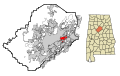 This map shows the incorporated and unincorporated areas in Jefferson County, Alabama, highlighting Irondale in red. It was created with a custom script with US Census Bureau data and modified with Inkscape.
 -
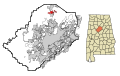 This map shows the incorporated and unincorporated areas in Jefferson County, Alabama, highlighting Kimberly in red. It was created with a custom script with US Census Bureau data and modified with Inkscape.
 -
 This map shows the incorporated and unincorporated areas in Jefferson County, Alabama, highlighting Leeds in red. It was created with a custom script with US Census Bureau data and modified with Inkscape.
 -
 This map shows the incorporated and unincorporated areas in Jefferson County, Alabama, highlighting Lipscomb in red. It was created with a custom script with US Census Bureau data and modified with Inkscape.
 -
 This map shows the incorporated and unincorporated areas in Jefferson County, Alabama, highlighting Maytown in red. It was created with a custom script with US Census Bureau data and modified with Inkscape.
 -
 This map shows the incorporated and unincorporated areas in Jefferson County, Alabama, highlighting McDonald_Chapel in red. It was created with a custom script with US Census Bureau data and modified with Inkscape.
 -
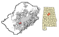 This map shows the incorporated and unincorporated areas in Jefferson County, Alabama, highlighting Midfield in red. It was created with a custom script with US Census Bureau data and modified with Inkscape.
 -
 This map shows the incorporated and unincorporated areas in Jefferson County, Alabama, highlighting Minor in red. It was created with a custom script with US Census Bureau data and modified with Inkscape.
 -
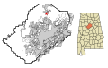 This map shows the incorporated and unincorporated areas in Jefferson County, Alabama, highlighting Morris in red. It was created with a custom script with US Census Bureau data and modified with Inkscape.
 -
 This map shows the incorporated and unincorporated areas in Jefferson County, Alabama, highlighting Mount_Olive in red. It was created with a custom script with US Census Bureau data and modified with Inkscape.
 -
 This map shows the incorporated and unincorporated areas in Jefferson County, Alabama, highlighting Mountain_Brook in red. It was created with a custom script with US Census Bureau data and modified with Inkscape.
 -
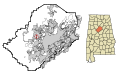 This map shows the incorporated and unincorporated areas in Jefferson County, Alabama, highlighting Mulga in red. It was created with a custom script with US Census Bureau data and modified with Inkscape.
 -
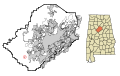 This map shows the incorporated and unincorporated areas in Jefferson County, Alabama, highlighting North_Johns in red. It was created with a custom script with US Census Bureau data and modified with Inkscape.
 -
 This map shows the incorporated and unincorporated areas in Jefferson County, Alabama, highlighting Pinson in red. It was created with a custom script with US Census Bureau data and modified with Inkscape.
 -
 This map shows the incorporated and unincorporated areas in Jefferson County, Alabama, highlighting Pleasant_Grove in red. It was created with a custom script with US Census Bureau data and modified with Inkscape.
 -
 This map shows the incorporated and unincorporated areas in Jefferson County, Alabama, highlighting Rock_Creek in red. It was created with a custom script with US Census Bureau data and modified with Inkscape.
 -
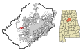 This map shows the incorporated and unincorporated areas in Jefferson County, Alabama, highlighting Sylvan_Springs in red. It was created with a custom script with US Census Bureau data and modified with Inkscape.
 -
 This map shows the incorporated and unincorporated areas in Jefferson County, Alabama, highlighting Trafford in red. It was created with a custom script with US Census Bureau data and modified with Inkscape.
 -
 This map shows the incorporated and unincorporated areas in Jefferson County, Alabama, highlighting Trussville in red. It was created with a custom script with US Census Bureau data and modified with Inkscape.
 -
 This map shows the incorporated and unincorporated areas in Jefferson County, Alabama, highlighting Vestavia_Hills in red. It was created with a custom script with US Census Bureau data and modified with Inkscape.
 -
 This map shows the incorporated and unincorporated areas in Jefferson County, Alabama, highlighting Warrior in red. It was created with a custom script with US Census Bureau data and modified with Inkscape.
 -
 This map shows the incorporated and unincorporated areas in Jefferson County, Alabama, highlighting West_Jefferson in red. It was created with a custom script with US Census Bureau data and modified with Inkscape.


Thu Jun 07 07:52:24 MST 2007[edit]
-
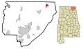 This map shows the incorporated and unincorporated areas in Jackson County, Alabama, highlighting Bridgeport in red. It was created with a custom script with US Census Bureau data and modified with Inkscape.
 -
 This map shows the incorporated and unincorporated areas in Jackson County, Alabama, highlighting Dutton in red. It was created with a custom script with US Census Bureau data and modified with Inkscape.
 -
 This map shows the incorporated and unincorporated areas in Jackson County, Alabama, highlighting Hollywood in red. It was created with a custom script with US Census Bureau data and modified with Inkscape.
 -
 This map shows the incorporated and unincorporated areas in Jackson County, Alabama, highlighting Hytop in red. It was created with a custom script with US Census Bureau data and modified with Inkscape.
 -
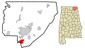 This map shows the incorporated and unincorporated areas in Jackson County, Alabama, highlighting Langston in red. It was created with a custom script with US Census Bureau data and modified with Inkscape.
 -
 This map shows the incorporated and unincorporated areas in Jackson County, Alabama, highlighting Paint_Rock in red. It was created with a custom script with US Census Bureau data and modified with Inkscape.
 -
 This map shows the incorporated and unincorporated areas in Jackson County, Alabama, highlighting Pisgah in red. It was created with a custom script with US Census Bureau data and modified with Inkscape.
 -
 This map shows the incorporated and unincorporated areas in Jackson County, Alabama, highlighting Scottsboro in red. It was created with a custom script with US Census Bureau data and modified with Inkscape.
 -
 This map shows the incorporated and unincorporated areas in Jackson County, Alabama, highlighting Section in red. It was created with a custom script with US Census Bureau data and modified with Inkscape.
 -
 This map shows the incorporated and unincorporated areas in Jackson County, Alabama, highlighting Skyline in red. It was created with a custom script with US Census Bureau data and modified with Inkscape.
 -
 This map shows the incorporated and unincorporated areas in Jackson County, Alabama, highlighting Stevenson in red. It was created with a custom script with US Census Bureau data and modified with Inkscape.
 -
 This map shows the incorporated and unincorporated areas in Jackson County, Alabama, highlighting Woodville in red. It was created with a custom script with US Census Bureau data and modified with Inkscape.


Fri Jun 01 13:15:51 MST 2007[edit]
-
 This map shows the incorporated and unincorporated areas in Greene County, Alabama, highlighting Boligee in red. It was created with a custom script with US Census Bureau data and modified with Inkscape.
 -
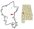 This map shows the incorporated and unincorporated areas in Greene County, Alabama, highlighting Eutaw in red. It was created with a custom script with US Census Bureau data and modified with Inkscape.
 -
 This map shows the incorporated and unincorporated areas in Greene County, Alabama, highlighting Forkland in red. It was created with a custom script with US Census Bureau data and modified with Inkscape.
 -
 This map shows the incorporated and unincorporated areas in Greene County, Alabama, highlighting Union in red. It was created with a custom script with US Census Bureau data and modified with Inkscape.


Tue May 29 14:39:50 MST 2007[edit]
-
 This map shows the incorporated and unincorporated areas in Houston County, Alabama, highlighting Ashford in red. It was created with a custom script with US Census Bureau data and modified with Inkscape.
 -
 This map shows the incorporated and unincorporated areas in Houston County, Alabama, highlighting Avon in red. It was created with a custom script with US Census Bureau data and modified with Inkscape.
 -
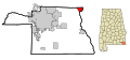 This map shows the incorporated and unincorporated areas in Houston County, Alabama, highlighting Columbia in red. It was created with a custom script with US Census Bureau data and modified with Inkscape.
 -
 This map shows the incorporated and unincorporated areas in Houston County, Alabama, highlighting Cottonwood in red. It was created with a custom script with US Census Bureau data and modified with Inkscape.
 -
 This map shows the incorporated and unincorporated areas in Houston County, Alabama, highlighting Cowarts in red. It was created with a custom script with US Census Bureau data and modified with Inkscape.
 -
 This map shows the incorporated and unincorporated areas in Houston County, Alabama, highlighting Dothan in red. It was created with a custom script with US Census Bureau data and modified with Inkscape.
 -
 This map shows the incorporated and unincorporated areas in Houston County, Alabama, highlighting Gordon in red. It was created with a custom script with US Census Bureau data and modified with Inkscape.
 -
 This map shows the incorporated and unincorporated areas in Houston County, Alabama, highlighting Kinsey in red. It was created with a custom script with US Census Bureau data and modified with Inkscape.
 -
 This map shows the incorporated and unincorporated areas in Houston County, Alabama, highlighting Madrid in red. It was created with a custom script with US Census Bureau data and modified with Inkscape.
 -
 This map shows the incorporated and unincorporated areas in Houston County, Alabama, highlighting Rehobeth in red. It was created with a custom script with US Census Bureau data and modified with Inkscape.
 -
 This map shows the incorporated and unincorporated areas in Houston County, Alabama, highlighting Taylor in red. It was created with a custom script with US Census Bureau data and modified with Inkscape.
 -
 This map shows the incorporated and unincorporated areas in Houston County, Alabama, highlighting Webb in red. It was created with a custom script with US Census Bureau data and modified with Inkscape.


Tue May 29 14:36:27 MST 2007[edit]
-
 This map shows the incorporated and unincorporated areas in Henry County, Alabama, highlighting Abbeville in red. It was created with a custom script with US Census Bureau data and modified with Inkscape.
 -
 This map shows the incorporated and unincorporated areas in Henry County, Alabama, highlighting Haleburg in red. It was created with a custom script with US Census Bureau data and modified with Inkscape.
 -
 This map shows the incorporated and unincorporated areas in Henry County, Alabama, highlighting Headland in red. It was created with a custom script with US Census Bureau data and modified with Inkscape.
 -
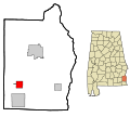 This map shows the incorporated and unincorporated areas in Henry County, Alabama, highlighting Newville in red. It was created with a custom script with US Census Bureau data and modified with Inkscape.


Tue May 29 14:34:44 MST 2007[edit]
-
 This map shows the incorporated and unincorporated areas in Hale County, Alabama, highlighting Akron in red. It was created with a custom script with US Census Bureau data and modified with Inkscape.
 -
 This map shows the incorporated and unincorporated areas in Hale County, Alabama, highlighting Greensboro in red. It was created with a custom script with US Census Bureau data and modified with Inkscape.
 -
 This map shows the incorporated and unincorporated areas in Hale County, Alabama, highlighting Moundville in red. It was created with a custom script with US Census Bureau data and modified with Inkscape.
 -
 This map shows the incorporated and unincorporated areas in Hale County, Alabama, highlighting Newbern in red. It was created with a custom script with US Census Bureau data and modified with Inkscape.


Tue May 29 14:24:48 MST 2007[edit]
-
 This map shows the incorporated and unincorporated areas in Geneva County, Alabama, highlighting Black in red. It was created with a custom script with US Census Bureau data and modified with Inkscape.
 -
 This map shows the incorporated and unincorporated areas in Geneva County, Alabama, highlighting Coffee_Springs in red. It was created with a custom script with US Census Bureau data and modified with Inkscape.
 -
 This map shows the incorporated and unincorporated areas in Geneva County, Alabama, highlighting Eunola in red. It was created with a custom script with US Census Bureau data and modified with Inkscape.
 -
 This map shows the incorporated and unincorporated areas in Geneva County, Alabama, highlighting Geneva in red. It was created with a custom script with US Census Bureau data and modified with Inkscape.
 -
 This map shows the incorporated and unincorporated areas in Geneva County, Alabama, highlighting Hartford in red. It was created with a custom script with US Census Bureau data and modified with Inkscape.
 -
 This map shows the incorporated and unincorporated areas in Geneva County, Alabama, highlighting Malvern in red. It was created with a custom script with US Census Bureau data and modified with Inkscape.
 -
 This map shows the incorporated and unincorporated areas in Geneva County, Alabama, highlighting Samson in red. It was created with a custom script with US Census Bureau data and modified with Inkscape.
 -
 This map shows the incorporated and unincorporated areas in Geneva County, Alabama, highlighting Slocomb in red. It was created with a custom script with US Census Bureau data and modified with Inkscape.
Tue May 29 14:22:57 MST 2007[edit]
-
 This map shows the incorporated and unincorporated areas in Franklin County, Alabama, highlighting Hodges in red. It was created with a custom script with US Census Bureau data and modified with Inkscape.
 -
 This map shows the incorporated and unincorporated areas in Franklin County, Alabama, highlighting Phil_Campbell in red. It was created with a custom script with US Census Bureau data and modified with Inkscape.
 -
 This map shows the incorporated and unincorporated areas in Franklin County, Alabama, highlighting Red_Bay in red. It was created with a custom script with US Census Bureau data and modified with Inkscape.
 -
 This map shows the incorporated and unincorporated areas in Franklin County, Alabama, highlighting Russellville in red. It was created with a custom script with US Census Bureau data and modified with Inkscape.
 -
 This map shows the incorporated and unincorporated areas in Franklin County, Alabama, highlighting Vina in red. It was created with a custom script with US Census Bureau data and modified with Inkscape.


Tue May 29 14:21:26 MST 2007[edit]
-
 This map shows the incorporated and unincorporated areas in Fayette County, Alabama, highlighting Belk in red. It was created with a custom script with US Census Bureau data and modified with Inkscape.
 -
 This map shows the incorporated and unincorporated areas in Fayette County, Alabama, highlighting Berry in red. It was created with a custom script with US Census Bureau data and modified with Inkscape.
 -
 This map shows the incorporated and unincorporated areas in Fayette County, Alabama, highlighting Fayette in red. It was created with a custom script with US Census Bureau data and modified with Inkscape.
 -
 This map shows the incorporated and unincorporated areas in Fayette County, Alabama, highlighting Glen_Allen in red. It was created with a custom script with US Census Bureau data and modified with Inkscape.


Tue May 29 14:15:24 MST 2007[edit]
-
 This map shows the incorporated and unincorporated areas in Etowah County, Alabama, highlighting Altoona in red. It was created with a custom script with US Census Bureau data and modified with Inkscape.
 -
 This map shows the incorporated and unincorporated areas in Etowah County, Alabama, highlighting Attalla in red. It was created with a custom script with US Census Bureau data and modified with Inkscape.
 -
 This map shows the incorporated and unincorporated areas in Etowah County, Alabama, highlighting Gadsden in red. It was created with a custom script with US Census Bureau data and modified with Inkscape.
 -
 This map shows the incorporated and unincorporated areas in Etowah County, Alabama, highlighting Glencoe in red. It was created with a custom script with US Census Bureau data and modified with Inkscape.
 -
 This map shows the incorporated and unincorporated areas in Etowah County, Alabama, highlighting Hokes_Bluff in red. It was created with a custom script with US Census Bureau data and modified with Inkscape.
 -
 This map shows the incorporated and unincorporated areas in Etowah County, Alabama, highlighting Mountainboro in red. It was created with a custom script with US Census Bureau data and modified with Inkscape.
 -
 This map shows the incorporated and unincorporated areas in Etowah County, Alabama, highlighting Rainbow_City in red. It was created with a custom script with US Census Bureau data and modified with Inkscape.
 -
 This map shows the incorporated and unincorporated areas in Etowah County, Alabama, highlighting Reece_City in red. It was created with a custom script with US Census Bureau data and modified with Inkscape.
 -
 This map shows the incorporated and unincorporated areas in Etowah County, Alabama, highlighting Ridgeville in red. It was created with a custom script with US Census Bureau data and modified with Inkscape.
 -
 This map shows the incorporated and unincorporated areas in Etowah County, Alabama, highlighting Sardis_City in red. It was created with a custom script with US Census Bureau data and modified with Inkscape.
 -
 This map shows the incorporated and unincorporated areas in Etowah County, Alabama, highlighting Southside in red. It was created with a custom script with US Census Bureau data and modified with Inkscape.
 -
 This map shows the incorporated and unincorporated areas in Etowah County, Alabama, highlighting Walnut_Grove in red. It was created with a custom script with US Census Bureau data and modified with Inkscape.


Tue May 29 14:12:09 MST 2007[edit]
-
 This map shows the incorporated and unincorporated areas in Escambia County, Alabama, highlighting Atmore in red. It was created with a custom script with US Census Bureau data and modified with Inkscape.
 -
 This map shows the incorporated and unincorporated areas in Escambia County, Alabama, highlighting Brewton in red. It was created with a custom script with US Census Bureau data and modified with Inkscape.
 -
 This map shows the incorporated and unincorporated areas in Escambia County, Alabama, highlighting East_Brewton in red. It was created with a custom script with US Census Bureau data and modified with Inkscape.
 -
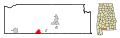 This map shows the incorporated and unincorporated areas in Escambia County, Alabama, highlighting Flomaton in red. It was created with a custom script with US Census Bureau data and modified with Inkscape.
 -
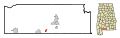 This map shows the incorporated and unincorporated areas in Escambia County, Alabama, highlighting Pollard in red. It was created with a custom script with US Census Bureau data and modified with Inkscape.
 -
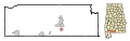 This map shows the incorporated and unincorporated areas in Escambia County, Alabama, highlighting Riverview in red. It was created with a custom script with US Census Bureau data and modified with Inkscape.
Tue May 29 14:10:36 MST 2007[edit]
-
 This map shows the incorporated and unincorporated areas in Elmore County, Alabama, highlighting Blue_Ridge in red. It was created with a custom script with US Census Bureau data and modified with Inkscape.
 -
 This map shows the incorporated and unincorporated areas in Elmore County, Alabama, highlighting Coosada in red. It was created with a custom script with US Census Bureau data and modified with Inkscape.
 -
 This map shows the incorporated and unincorporated areas in Elmore County, Alabama, highlighting Deatsville in red. It was created with a custom script with US Census Bureau data and modified with Inkscape.
 -
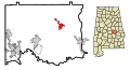 This map shows the incorporated and unincorporated areas in Elmore County, Alabama, highlighting Eclectic in red. It was created with a custom script with US Census Bureau data and modified with Inkscape.
 -
 This map shows the incorporated and unincorporated areas in Elmore County, Alabama, highlighting Elmore in red. It was created with a custom script with US Census Bureau data and modified with Inkscape.
 -
 This map shows the incorporated and unincorporated areas in Elmore County, Alabama, highlighting Millbrook in red. It was created with a custom script with US Census Bureau data and modified with Inkscape.
 -
 This map shows the incorporated and unincorporated areas in Elmore County, Alabama, highlighting Tallassee in red. It was created with a custom script with US Census Bureau data and modified with Inkscape.
 -
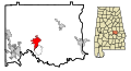 This map shows the incorporated and unincorporated areas in Elmore County, Alabama, highlighting Wetumpka in red. It was created with a custom script with US Census Bureau data and modified with Inkscape.


Tue May 22 13:32:14 MST 2007[edit]
-
 This map shows the incorporated and unincorporated areas in DeKalb County, Alabama, highlighting Collinsville in red. It was created with a custom script with US Census Bureau data and modified with Inkscape.
 -
 This map shows the incorporated and unincorporated areas in DeKalb County, Alabama, highlighting Crossville in red. It was created with a custom script with US Census Bureau data and modified with Inkscape.
 -
 This map shows the incorporated and unincorporated areas in DeKalb County, Alabama, highlighting Fort_Payne in red. It was created with a custom script with US Census Bureau data and modified with Inkscape.
 -
 This map shows the incorporated and unincorporated areas in DeKalb County, Alabama, highlighting Fyffe in red. It was created with a custom script with US Census Bureau data and modified with Inkscape.
 -
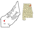 This map shows the incorporated and unincorporated areas in DeKalb County, Alabama, highlighting Geraldine in red. It was created with a custom script with US Census Bureau data and modified with Inkscape.
 -
 This map shows the incorporated and unincorporated areas in DeKalb County, Alabama, highlighting Hammondville in red. It was created with a custom script with US Census Bureau data and modified with Inkscape.
 -
 This map shows the incorporated and unincorporated areas in DeKalb County, Alabama, highlighting Henagar in red. It was created with a custom script with US Census Bureau data and modified with Inkscape.
 -
 This map shows the incorporated and unincorporated areas in DeKalb County, Alabama, highlighting Ider in red. It was created with a custom script with US Census Bureau data and modified with Inkscape.
 -
 This map shows the incorporated and unincorporated areas in DeKalb County, Alabama, highlighting Lakeview in red. It was created with a custom script with US Census Bureau data and modified with Inkscape.
 -
 This map shows the incorporated and unincorporated areas in DeKalb County, Alabama, highlighting Mentone in red. It was created with a custom script with US Census Bureau data and modified with Inkscape.
 -
 This map shows the incorporated and unincorporated areas in DeKalb County, Alabama, highlighting Pine_Ridge in red. It was created with a custom script with US Census Bureau data and modified with Inkscape.
 -
 This map shows the incorporated and unincorporated areas in DeKalb County, Alabama, highlighting Powell in red. It was created with a custom script with US Census Bureau data and modified with Inkscape.
 -
 This map shows the incorporated and unincorporated areas in DeKalb County, Alabama, highlighting Rainsville in red. It was created with a custom script with US Census Bureau data and modified with Inkscape.
 -
 This map shows the incorporated and unincorporated areas in DeKalb County, Alabama, highlighting Shiloh in red. It was created with a custom script with US Census Bureau data and modified with Inkscape.
 -
 This map shows the incorporated and unincorporated areas in DeKalb County, Alabama, highlighting Sylvania in red. It was created with a custom script with US Census Bureau data and modified with Inkscape.
 -
 This map shows the incorporated and unincorporated areas in DeKalb County, Alabama, highlighting Valley_Head in red. It was created with a custom script with US Census Bureau data and modified with Inkscape.


Tue May 22 13:29:18 MST 2007[edit]
-
 This map shows the incorporated and unincorporated areas in Dallas County, Alabama, highlighting Orrville in red. It was created with a custom script with US Census Bureau data and modified with Inkscape.
 -
 This map shows the incorporated and unincorporated areas in Dallas County, Alabama, highlighting Selma in red. It was created with a custom script with US Census Bureau data and modified with Inkscape.


Tue May 22 13:28:33 MST 2007[edit]
-
 This map shows the incorporated and unincorporated areas in Dale County, Alabama, highlighting Ariton in red. It was created with a custom script with US Census Bureau data and modified with Inkscape.
 -
 This map shows the incorporated and unincorporated areas in Dale County, Alabama, highlighting Clayhatchee in red. It was created with a custom script with US Census Bureau data and modified with Inkscape.
 -
 This map shows the incorporated and unincorporated areas in Dale County, Alabama, highlighting Daleville in red. It was created with a custom script with US Census Bureau data and modified with Inkscape.
 -
 This map shows the incorporated and unincorporated areas in Dale County, Alabama, highlighting Grimes in red. It was created with a custom script with US Census Bureau data and modified with Inkscape.
 -
 This map shows the incorporated and unincorporated areas in Dale County, Alabama, highlighting Level_Plains in red. It was created with a custom script with US Census Bureau data and modified with Inkscape.
 -
 This map shows the incorporated and unincorporated areas in Dale County, Alabama, highlighting Midland_City in red. It was created with a custom script with US Census Bureau data and modified with Inkscape.
 -
 This map shows the incorporated and unincorporated areas in Dale County, Alabama, highlighting Napier_Field in red. It was created with a custom script with US Census Bureau data and modified with Inkscape.
 -
 This map shows the incorporated and unincorporated areas in Dale County, Alabama, highlighting Newton in red. It was created with a custom script with US Census Bureau data and modified with Inkscape.
 -
 This map shows the incorporated and unincorporated areas in Dale County, Alabama, highlighting Ozark in red. It was created with a custom script with US Census Bureau data and modified with Inkscape.
 -
 This map shows the incorporated and unincorporated areas in Dale County, Alabama, highlighting Pinckard in red. It was created with a custom script with US Census Bureau data and modified with Inkscape.


Tue May 22 13:26:39 MST 2007[edit]
-
 This map shows the incorporated and unincorporated areas in Cullman County, Alabama, highlighting Baileyton in red. It was created with a custom script with US Census Bureau data and modified with Inkscape.
 -
 This map shows the incorporated and unincorporated areas in Cullman County, Alabama, highlighting Colony in red. It was created with a custom script with US Census Bureau data and modified with Inkscape.
 -
 This map shows the incorporated and unincorporated areas in Cullman County, Alabama, highlighting Cullman in red. It was created with a custom script with US Census Bureau data and modified with Inkscape.
 -
 This map shows the incorporated and unincorporated areas in Cullman County, Alabama, highlighting Dodge_City in red. It was created with a custom script with US Census Bureau data and modified with Inkscape.
 -
 This map shows the incorporated and unincorporated areas in Cullman County, Alabama, highlighting Fairview in red. It was created with a custom script with US Census Bureau data and modified with Inkscape.
 -
 This map shows the incorporated and unincorporated areas in Cullman County, Alabama, highlighting Garden_City in red. It was created with a custom script with US Census Bureau data and modified with Inkscape.
 -
 This map shows the incorporated and unincorporated areas in Cullman County, Alabama, highlighting Good_Hope in red. It was created with a custom script with US Census Bureau data and modified with Inkscape.
 -
 This map shows the incorporated and unincorporated areas in Cullman County, Alabama, highlighting Hanceville in red. It was created with a custom script with US Census Bureau data and modified with Inkscape.
 -
 This map shows the incorporated and unincorporated areas in Cullman County, Alabama, highlighting Holly_Pond in red. It was created with a custom script with US Census Bureau data and modified with Inkscape.
 -
 This map shows the incorporated and unincorporated areas in Cullman County, Alabama, highlighting South_Vinemont in red. It was created with a custom script with US Census Bureau data and modified with Inkscape.
 -
 This map shows the incorporated and unincorporated areas in Cullman County, Alabama, highlighting West_Point in red. It was created with a custom script with US Census Bureau data and modified with Inkscape.


Tue May 22 13:24:12 MST 2007[edit]
-
 This map shows the incorporated and unincorporated areas in Crenshaw County, Alabama, highlighting Brantley in red. It was created with a custom script with US Census Bureau data and modified with Inkscape.
 -
 This map shows the incorporated and unincorporated areas in Crenshaw County, Alabama, highlighting Dozier in red. It was created with a custom script with US Census Bureau data and modified with Inkscape.
 -
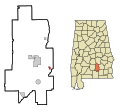 This map shows the incorporated and unincorporated areas in Crenshaw County, Alabama, highlighting Glenwood in red. It was created with a custom script with US Census Bureau data and modified with Inkscape.
 -
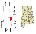 This map shows the incorporated and unincorporated areas in Crenshaw County, Alabama, highlighting Luverne in red. It was created with a custom script with US Census Bureau data and modified with Inkscape.
 -
 This map shows the incorporated and unincorporated areas in Crenshaw County, Alabama, highlighting Petrey in red. It was created with a custom script with US Census Bureau data and modified with Inkscape.
 -
 This map shows the incorporated and unincorporated areas in Crenshaw County, Alabama, highlighting Rutledge in red. It was created with a custom script with US Census Bureau data and modified with Inkscape.


Tue May 22 13:22:53 MST 2007[edit]
-
 This map shows the incorporated and unincorporated areas in Covington County, Alabama, highlighting Andalusia in red. It was created with a custom script with US Census Bureau data and modified with Inkscape.
 -
 This map shows the incorporated and unincorporated areas in Covington County, Alabama, highlighting Babbie in red. It was created with a custom script with US Census Bureau data and modified with Inkscape.
 -
 This map shows the incorporated and unincorporated areas in Covington County, Alabama, highlighting Carolina in red. It was created with a custom script with US Census Bureau data and modified with Inkscape.
 -
 This map shows the incorporated and unincorporated areas in Covington County, Alabama, highlighting Florala in red. It was created with a custom script with US Census Bureau data and modified with Inkscape.
 -
 This map shows the incorporated and unincorporated areas in Covington County, Alabama, highlighting Gantt in red. It was created with a custom script with US Census Bureau data and modified with Inkscape.
 -
 This map shows the incorporated and unincorporated areas in Covington County, Alabama, highlighting Heath in red. It was created with a custom script with US Census Bureau data and modified with Inkscape.
 -
 This map shows the incorporated and unincorporated areas in Covington County, Alabama, highlighting Horn_Hill in red. It was created with a custom script with US Census Bureau data and modified with Inkscape.
 -
 This map shows the incorporated and unincorporated areas in Covington County, Alabama, highlighting Libertyville in red. It was created with a custom script with US Census Bureau data and modified with Inkscape.
 -
 This map shows the incorporated and unincorporated areas in Covington County, Alabama, highlighting Lockhart in red. It was created with a custom script with US Census Bureau data and modified with Inkscape.
 -
 This map shows the incorporated and unincorporated areas in Covington County, Alabama, highlighting Onycha in red. It was created with a custom script with US Census Bureau data and modified with Inkscape.
 -
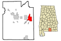 This map shows the incorporated and unincorporated areas in Covington County, Alabama, highlighting Opp in red. It was created with a custom script with US Census Bureau data and modified with Inkscape.
 -
 This map shows the incorporated and unincorporated areas in Covington County, Alabama, highlighting Red_Level in red. It was created with a custom script with US Census Bureau data and modified with Inkscape.
 -
 This map shows the incorporated and unincorporated areas in Covington County, Alabama, highlighting River_Falls in red. It was created with a custom script with US Census Bureau data and modified with Inkscape.
 -
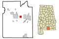 This map shows the incorporated and unincorporated areas in Covington County, Alabama, highlighting Sanford in red. It was created with a custom script with US Census Bureau data and modified with Inkscape.


Tue May 22 13:20:10 MST 2007[edit]
-
 This map shows the incorporated and unincorporated areas in Coosa County, Alabama, highlighting Goodwater in red. It was created with a custom script with US Census Bureau data and modified with Inkscape.
 -
 This map shows the incorporated and unincorporated areas in Coosa County, Alabama, highlighting Rockford in red. It was created with a custom script with US Census Bureau data and modified with Inkscape.


Tue May 22 13:14:19 MST 2007[edit]
-
 This map shows the incorporated and unincorporated areas in Conecuh County, Alabama, highlighting Castleberry in red. It was created with a custom script with US Census Bureau data and modified with Inkscape.
 -
 This map shows the incorporated and unincorporated areas in Conecuh County, Alabama, highlighting Evergreen in red. It was created with a custom script with US Census Bureau data and modified with Inkscape.
 -
 This map shows the incorporated and unincorporated areas in Conecuh County, Alabama, highlighting Repton in red. It was created with a custom script with US Census Bureau data and modified with Inkscape.


Tue May 22 13:13:14 MST 2007[edit]
-
 This map shows the incorporated and unincorporated areas in Colbert County, Alabama, highlighting Cherokee in red. It was created with a custom script with US Census Bureau data and modified with Inkscape.
 -
 This map shows the incorporated and unincorporated areas in Colbert County, Alabama, highlighting Leighton in red. It was created with a custom script with US Census Bureau data and modified with Inkscape.
 -
 This map shows the incorporated and unincorporated areas in Colbert County, Alabama, highlighting Littleville in red. It was created with a custom script with US Census Bureau data and modified with Inkscape.
 -
 This map shows the incorporated and unincorporated areas in Colbert County, Alabama, highlighting Muscle_Shoals in red. It was created with a custom script with US Census Bureau data and modified with Inkscape.
 -
 This map shows the incorporated and unincorporated areas in Colbert County, Alabama, highlighting Sheffield in red. It was created with a custom script with US Census Bureau data and modified with Inkscape.
 -
 This map shows the incorporated and unincorporated areas in Colbert County, Alabama, highlighting Tuscumbia in red. It was created with a custom script with US Census Bureau data and modified with Inkscape.


Tue May 22 13:11:25 MST 2007[edit]
-
 This map shows the incorporated and unincorporated areas in Coffee County, Alabama, highlighting Elba in red. It was created with a custom script with US Census Bureau data and modified with Inkscape.
 -
 This map shows the incorporated and unincorporated areas in Coffee County, Alabama, highlighting Enterprise in red. It was created with a custom script with US Census Bureau data and modified with Inkscape.
 -
 This map shows the incorporated and unincorporated areas in Coffee County, Alabama, highlighting Kinston in red. It was created with a custom script with US Census Bureau data and modified with Inkscape.
 -
 This map shows the incorporated and unincorporated areas in Coffee County, Alabama, highlighting New_Brockton in red. It was created with a custom script with US Census Bureau data and modified with Inkscape.


Tue May 22 13:10:20 MST 2007[edit]
-
 This map shows the incorporated and unincorporated areas in Cleburne County, Alabama, highlighting Edwardsville in red. It was created with a custom script with US Census Bureau data and modified with Inkscape.
 -
 This map shows the incorporated and unincorporated areas in Cleburne County, Alabama, highlighting Fruithurst in red. It was created with a custom script with US Census Bureau data and modified with Inkscape.
 -
 This map shows the incorporated and unincorporated areas in Cleburne County, Alabama, highlighting Heflin in red. It was created with a custom script with US Census Bureau data and modified with Inkscape.
 -
 This map shows the incorporated and unincorporated areas in Cleburne County, Alabama, highlighting Ranburne in red. It was created with a custom script with US Census Bureau data and modified with Inkscape.


Tue May 22 13:09:24 MST 2007[edit]
-
 This map shows the incorporated and unincorporated areas in Clay County, Alabama, highlighting Ashland in red. It was created with a custom script with US Census Bureau data and modified with Inkscape.
 -
 This map shows the incorporated and unincorporated areas in Clay County, Alabama, highlighting Lineville in red. It was created with a custom script with US Census Bureau data and modified with Inkscape.


Tue May 22 13:07:54 MST 2007[edit]
-
 This map shows the incorporated and unincorporated areas in Clarke County, Alabama, highlighting Coffeeville in red. It was created with a custom script with US Census Bureau data and modified with Inkscape.
 -
 This map shows the incorporated and unincorporated areas in Clarke County, Alabama, highlighting Fulton in red. It was created with a custom script with US Census Bureau data and modified with Inkscape.
 -
 This map shows the incorporated and unincorporated areas in Clarke County, Alabama, highlighting Grove_Hill in red. It was created with a custom script with US Census Bureau data and modified with Inkscape.
 -
 This map shows the incorporated and unincorporated areas in Clarke County, Alabama, highlighting Jackson in red. It was created with a custom script with US Census Bureau data and modified with Inkscape.
 -
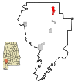 This map shows the incorporated and unincorporated areas in Clarke County, Alabama, highlighting Thomasville in red. It was created with a custom script with US Census Bureau data and modified with Inkscape.


Tue May 22 13:06:58 MST 2007[edit]
-
 This map shows the incorporated and unincorporated areas in Choctaw County, Alabama, highlighting Butler in red. It was created with a custom script with US Census Bureau data and modified with Inkscape.
 -
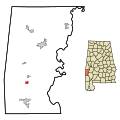 This map shows the incorporated and unincorporated areas in Choctaw County, Alabama, highlighting Gilbertown in red. It was created with a custom script with US Census Bureau data and modified with Inkscape.
 -
 This map shows the incorporated and unincorporated areas in Choctaw County, Alabama, highlighting Lisman in red. It was created with a custom script with US Census Bureau data and modified with Inkscape.
 -
 This map shows the incorporated and unincorporated areas in Choctaw County, Alabama, highlighting Needham in red. It was created with a custom script with US Census Bureau data and modified with Inkscape.
 -
 This map shows the incorporated and unincorporated areas in Choctaw County, Alabama, highlighting Pennington in red. It was created with a custom script with US Census Bureau data and modified with Inkscape.
 -
 This map shows the incorporated and unincorporated areas in Choctaw County, Alabama, highlighting Silas in red. It was created with a custom script with US Census Bureau data and modified with Inkscape.
 -
 This map shows the incorporated and unincorporated areas in Choctaw County, Alabama, highlighting Toxey in red. It was created with a custom script with US Census Bureau data and modified with Inkscape.


Tue May 22 13:04:51 MST 2007[edit]
-
 This map shows the incorporated and unincorporated areas in Chilton County, Alabama, highlighting Clanton in red. It was created with a custom script with US Census Bureau data and modified with Inkscape.
 -
 This map shows the incorporated and unincorporated areas in Chilton County, Alabama, highlighting Jemison in red. It was created with a custom script with US Census Bureau data and modified with Inkscape.
 -
 This map shows the incorporated and unincorporated areas in Chilton County, Alabama, highlighting Maplesville in red. It was created with a custom script with US Census Bureau data and modified with Inkscape.
 -
 This map shows the incorporated and unincorporated areas in Chilton County, Alabama, highlighting Thorsby in red. It was created with a custom script with US Census Bureau data and modified with Inkscape.


Tue May 22 13:03:54 MST 2007[edit]
-
 This map shows the incorporated and unincorporated areas in Cherokee County, Alabama, highlighting Cedar_Bluff in red. It was created with a custom script with US Census Bureau data and modified with Inkscape.
 -
 This map shows the incorporated and unincorporated areas in Cherokee County, Alabama, highlighting Centre in red. It was created with a custom script with US Census Bureau data and modified with Inkscape.
 -
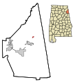 This map shows the incorporated and unincorporated areas in Cherokee County, Alabama, highlighting Gaylesville in red. It was created with a custom script with US Census Bureau data and modified with Inkscape.
 -
 This map shows the incorporated and unincorporated areas in Cherokee County, Alabama, highlighting Leesburg in red. It was created with a custom script with US Census Bureau data and modified with Inkscape.
 -
 This map shows the incorporated and unincorporated areas in Cherokee County, Alabama, highlighting Sand_Rock in red. It was created with a custom script with US Census Bureau data and modified with Inkscape.


Tue May 22 13:02:46 MST 2007[edit]
-
 This map shows the incorporated and unincorporated areas in Chambers County, Alabama, highlighting Five_Points in red. It was created with a custom script with US Census Bureau data and modified with Inkscape.
 -
 This map shows the incorporated and unincorporated areas in Chambers County, Alabama, highlighting Huguley in red. It was created with a custom script with US Census Bureau data and modified with Inkscape.
 -
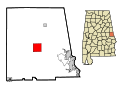 This map shows the incorporated and unincorporated areas in Chambers County, Alabama, highlighting La_Fayette in red. It was created with a custom script with US Census Bureau data and modified with Inkscape.
 -
 This map shows the incorporated and unincorporated areas in Chambers County, Alabama, highlighting Lanett in red. It was created with a custom script with US Census Bureau data and modified with Inkscape.
 -
 This map shows the incorporated and unincorporated areas in Chambers County, Alabama, highlighting Valley in red. It was created with a custom script with US Census Bureau data and modified with Inkscape.
 -
 This map shows the incorporated and unincorporated areas in Chambers County, Alabama, highlighting Waverly in red. It was created with a custom script with US Census Bureau data and modified with Inkscape.


Tue May 22 13:01:28 MST 2007[edit]
-
 This map shows the incorporated and unincorporated areas in Calhoun County, Alabama, highlighting Alexandria in red. It was created with a custom script with US Census Bureau data and modified with Inkscape.
 -
 This map shows the incorporated and unincorporated areas in Calhoun County, Alabama, highlighting Anniston in red. It was created with a custom script with US Census Bureau data and modified with Inkscape.
 -
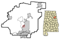 This map shows the incorporated and unincorporated areas in Calhoun County, Alabama, highlighting Blue_Mountain in red. It was created with a custom script with US Census Bureau data and modified with Inkscape.
 -
 This map shows the incorporated and unincorporated areas in Calhoun County, Alabama, highlighting Bynum in red. It was created with a custom script with US Census Bureau data and modified with Inkscape.
 -
 This map shows the incorporated and unincorporated areas in Calhoun County, Alabama, highlighting Hobson_City in red. It was created with a custom script with US Census Bureau data and modified with Inkscape.
 -
 This map shows the incorporated and unincorporated areas in Calhoun County, Alabama, highlighting Jacksonville in red. It was created with a custom script with US Census Bureau data and modified with Inkscape.
 -
 This map shows the incorporated and unincorporated areas in Calhoun County, Alabama, highlighting Ohatchee in red. It was created with a custom script with US Census Bureau data and modified with Inkscape.
 -
 This map shows the incorporated and unincorporated areas in Calhoun County, Alabama, highlighting Oxford in red. It was created with a custom script with US Census Bureau data and modified with Inkscape.
 -
 This map shows the incorporated and unincorporated areas in Calhoun County, Alabama, highlighting Piedmont in red. It was created with a custom script with US Census Bureau data and modified with Inkscape.
 -
 This map shows the incorporated and unincorporated areas in Calhoun County, Alabama, highlighting Saks in red. It was created with a custom script with US Census Bureau data and modified with Inkscape.
 -
 This map shows the incorporated and unincorporated areas in Calhoun County, Alabama, highlighting Weaver in red. It was created with a custom script with US Census Bureau data and modified with Inkscape.


Tue May 22 12:58:19 MST 2007[edit]
-
 This map shows the incorporated and unincorporated areas in Butler County, Alabama, highlighting Georgiana in red. It was created with a custom script with US Census Bureau data and modified with Inkscape.
 -
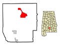 This map shows the incorporated and unincorporated areas in Butler County, Alabama, highlighting Greenville in red. It was created with a custom script with US Census Bureau data and modified with Inkscape.
 -
 This map shows the incorporated and unincorporated areas in Butler County, Alabama, highlighting McKenzie in red. It was created with a custom script with US Census Bureau data and modified with Inkscape.


Tue May 22 12:57:27 MST 2007[edit]
-
 This map shows the incorporated and unincorporated areas in Bullock County, Alabama, highlighting Midway in red. It was created with a custom script with US Census Bureau data and modified with Inkscape.
 -
 This map shows the incorporated and unincorporated areas in Bullock County, Alabama, highlighting Union_Springs in red. It was created with a custom script with US Census Bureau data and modified with Inkscape.


Tue May 22 12:56:46 MST 2007[edit]
-
 This map shows the incorporated and unincorporated areas in Blount County, Alabama, highlighting Allgood in red. It was created with a custom script with US Census Bureau data and modified with Inkscape.
 -
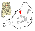 This map shows the incorporated and unincorporated areas in Blount County, Alabama, highlighting Blountsville in red. It was created with a custom script with US Census Bureau data and modified with Inkscape.
 -
 This map shows the incorporated and unincorporated areas in Blount County, Alabama, highlighting Cleveland in red. It was created with a custom script with US Census Bureau data and modified with Inkscape.
 -
 This map shows the incorporated and unincorporated areas in Blount County, Alabama, highlighting County_Line in red. It was created with a custom script with US Census Bureau data and modified with Inkscape.
 -
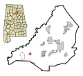 This map shows the incorporated and unincorporated areas in Blount County, Alabama, highlighting Hayden in red. It was created with a custom script with US Census Bureau data and modified with Inkscape.
 -
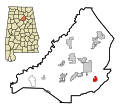 This map shows the incorporated and unincorporated areas in Blount County, Alabama, highlighting Highland_Lake in red. It was created with a custom script with US Census Bureau data and modified with Inkscape.
 -
 This map shows the incorporated and unincorporated areas in Blount County, Alabama, highlighting Locust_Fork in red. It was created with a custom script with US Census Bureau data and modified with Inkscape.
 -
 This map shows the incorporated and unincorporated areas in Blount County, Alabama, highlighting Nectar in red. It was created with a custom script with US Census Bureau data and modified with Inkscape.
 -
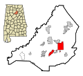 This map shows the incorporated and unincorporated areas in Blount County, Alabama, highlighting Oneonta in red. It was created with a custom script with US Census Bureau data and modified with Inkscape.
 -
 This map shows the incorporated and unincorporated areas in Blount County, Alabama, highlighting Rosa in red. It was created with a custom script with US Census Bureau data and modified with Inkscape.
 -
 This map shows the incorporated and unincorporated areas in Blount County, Alabama, highlighting Smoke_Rise in red. It was created with a custom script with US Census Bureau data and modified with Inkscape.
 -
 This map shows the incorporated and unincorporated areas in Blount County, Alabama, highlighting Snead in red. It was created with a custom script with US Census Bureau data and modified with Inkscape.
 -
 This map shows the incorporated and unincorporated areas in Blount County, Alabama, highlighting Susan_Moore in red. It was created with a custom script with US Census Bureau data and modified with Inkscape.


Tue May 22 12:54:04 MST 2007[edit]
-
 This map shows the incorporated and unincorporated areas in Bibb County, Alabama, highlighting Brent in red. It was created with a custom script with US Census Bureau data and modified with Inkscape.
 -
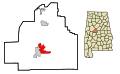 This map shows the incorporated and unincorporated areas in Bibb County, Alabama, highlighting Centreville in red. It was created with a custom script with US Census Bureau data and modified with Inkscape.
 -
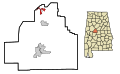 This map shows the incorporated and unincorporated areas in Bibb County, Alabama, highlighting North_Bibb in red. It was created with a custom script with US Census Bureau data and modified with Inkscape.
 -
 This map shows the incorporated and unincorporated areas in Bibb County, Alabama, highlighting West_Blocton in red. It was created with a custom script with US Census Bureau data and modified with Inkscape.


Mon May 21 10:14:16 MST 2007[edit]
-
 This map shows the incorporated and unincorporated areas in Barbour County, Alabama, highlighting Blue Springs in red. It was created with a custom script from US Census bureau data and modified with Inkscape.
 -
 This map shows the incorporated and unincorporated areas in Barbour County, Alabama, highlighting Clayton in red. It was created with a custom script from US Census bureau data and modified with Inkscape.
 -
 This map shows the incorporated and unincorporated areas in Barbour County, Alabama, highlighting Clio in red. It was created with a custom script from US Census bureau data and modified with Inkscape.
 -
 This map shows the incorporated and unincorporated areas in Barbour County, Alabama, highlighting Eufaula in red. It was created with a custom script from US Census bureau data and modified with Inkscape.
 -
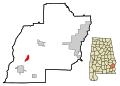 This map shows the incorporated and unincorporated areas in Barbour County, Alabama, highlighting Louisville in red. It was created with a custom script from US Census bureau data and modified with Inkscape.


Mon May 21 10:11:35 MST 2007[edit]
-
 This map shows the incorporated and unincorporated areas in Baldwin County, Alabama, highlighting Bay Minette in red. It was created with a custom script from US Census bureau data and modified with Inkscape.
 -
 This map shows the incorporated and unincorporated areas in Baldwin County, Alabama, highlighting Daphne in red. It was created with a custom script from US Census bureau data and modified with Inkscape.
 -
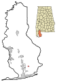 This map shows the incorporated and unincorporated areas in Baldwin County, Alabama, highlighting Elberta in red. It was created with a custom script from US Census bureau data and modified with Inkscape.
 -
 This map shows the incorporated and unincorporated areas in Baldwin County, Alabama, highlighting Fairhope in red. It was created with a custom script from US Census bureau data and modified with Inkscape.
 -
 This map shows the incorporated and unincorporated areas in Baldwin County, Alabama, highlighting Foley in red. It was created with a custom script from US Census bureau data and modified with Inkscape.
 -
 This map shows the incorporated and unincorporated areas in Baldwin County, Alabama, highlighting Gulf Shores in red. It was created with a custom script from US Census bureau data and modified with Inkscape.
 -
 This map shows the incorporated and unincorporated areas in Baldwin County, Alabama, highlighting Loxley in red. It was created with a custom script from US Census bureau data and modified with Inkscape.
 -
 This map shows the incorporated and unincorporated areas in Baldwin County, Alabama, highlighting Orange Beach in red. It was created with a custom script from US Census bureau data and modified with Inkscape.
 -
 This map shows the incorporated and unincorporated areas in Baldwin County, Alabama, highlighting Point Clear in red. It was created with a custom script from US Census bureau data and modified with Inkscape.
 -
 This map shows the incorporated and unincorporated areas in Baldwin County, Alabama, highlighting Robertsdale in red. It was created with a custom script from US Census bureau data and modified with Inkscape.
 -
 This map shows the incorporated and unincorporated areas in Baldwin County, Alabama, highlighting Silverhill in red. It was created with a custom script from US Census bureau data and modified with Inkscape.
 -
 This map shows the incorporated and unincorporated areas in Baldwin County, Alabama, highlighting Spanish Fort in red. It was created with a custom script from US Census bureau data and modified with Inkscape.
 -
 This map shows the incorporated and unincorporated areas in Baldwin County, Alabama, highlighting Summerdale in red. It was created with a custom script from US Census bureau data and modified with Inkscape.


Mon May 21 10:05:32 MST 2007[edit]
-
 This map shows the incorporated and unincorporated areas in Autauga County, Alabama, highlighting Autaugaville in red. It was created with a custom script from US Census bureau data and modified with Inkscape.
 -
 This map shows the incorporated and unincorporated areas in Autauga County, Alabama, highlighting Billingsley in red. It was created with a custom script from US Census bureau data and modified with Inkscape.
 -
 This map shows the incorporated and unincorporated areas in Autauga County, Alabama, highlighting Prattville in red. It was created with a custom script from US Census bureau data and modified with Inkscape.


Mon Apr 30 11:05:19 MST 2007[edit]
-
 This map shows the incorporated and unincorporated areas in Oakland County, Michigan. I created it in Inkscape using data from the US Census Bureau.
 -
 This map shows the incorporated and unincorporated areas in Oakland County, Michigan, highlighting Addison Township in red. I created it in Inkscape using data from the US Census Bureau.
 -
 This map shows the incorporated and unincorporated areas in Oakland County, Michigan, highlighting Auburn Hills in red. I created it in Inkscape using data from the US Census Bureau.
 -
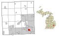 This map shows the incorporated and unincorporated areas in Oakland County, Michigan, highlighting Berkley in red. I created it in Inkscape using data from the US Census Bureau.
 -
 This map shows the incorporated and unincorporated areas in Oakland County, Michigan, highlighting Beverly Hills in red. I created it in Inkscape using data from the US Census Bureau.
 -
 This map shows the incorporated and unincorporated areas in Oakland County, Michigan, highlighting Bingham Farms in red. I created it in Inkscape using data from the US Census Bureau.
 -
 This map shows the incorporated and unincorporated areas in Oakland County, Michigan, highlighting Birmingham in red. I created it in Inkscape using data from the US Census Bureau.
 -
 This map shows the incorporated and unincorporated areas in Oakland County, Michigan, highlighting Bloomfield Hills in red. I created it in Inkscape using data from the US Census Bureau.
 -
 This map shows the incorporated and unincorporated areas in Oakland County, Michigan, highlighting Bloomfield Township in red. I created it in Inkscape using data from the US Census Bureau.
 -
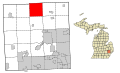 This map shows the incorporated and unincorporated areas in Oakland County, Michigan, highlighting Brandon Township in red. I created it in Inkscape using data from the US Census Bureau.
 -
 This map shows the incorporated and unincorporated areas in Oakland County, Michigan, highlighting Clawson in red. I created it in Inkscape using data from the US Census Bureau.
 -
 This map shows the incorporated and unincorporated areas in Oakland County, Michigan, highlighting Commerce Charter Township in red. I created it in Inkscape using data from the US Census Bureau.
 -
 This map shows the incorporated and unincorporated areas in Oakland County, Michigan, highlighting Farmington in red. I created it in Inkscape using data from the US Census Bureau.
 -
 This map shows the incorporated and unincorporated areas in Oakland County, Michigan, highlighting Farmington Hills in red. I created it in Inkscape using data from the US Census Bureau.
 -
 This map shows the incorporated and unincorporated areas in Oakland County, Michigan, highlighting Ferndale in red. I created it in Inkscape using data from the US Census Bureau.
 -
 This map shows the incorporated and unincorporated areas in Oakland County, Michigan, highlighting Franklin in red. I created it in Inkscape using data from the US Census Bureau.
 -
 This map shows the incorporated and unincorporated areas in Oakland County, Michigan, highlighting Groveland Township in red. I created it in Inkscape using data from the US Census Bureau.
 -
 This map shows the incorporated and unincorporated areas in Oakland County, Michigan, highlighting Hazel Park in red. I created it in Inkscape using data from the US Census Bureau.
 -
 This map shows the incorporated and unincorporated areas in Oakland County, Michigan, highlighting Highland Township in red. I created it in Inkscape using data from the US Census Bureau.
 -
 This map shows the incorporated and unincorporated areas in Oakland County, Michigan, highlighting Holly in red. I created it in Inkscape using data from the US Census Bureau.
 -
 This map shows the incorporated and unincorporated areas in Oakland County, Michigan, highlighting Holly Township in red. I created it in Inkscape using data from the US Census Bureau.
 -
 This map shows the incorporated and unincorporated areas in Oakland County, Michigan, highlighting Huntington Woods in red. I created it in Inkscape using data from the US Census Bureau.
 -
 This map shows the incorporated and unincorporated areas in Oakland County, Michigan, highlighting Independence Charter Township in red. I created it in Inkscape using data from the US Census Bureau.
 -
 This map shows the incorporated and unincorporated areas in Oakland County, Michigan, highlighting Keego Harbor in red. I created it in Inkscape using data from the US Census Bureau.
 -
 This map shows the incorporated and unincorporated areas in Oakland County, Michigan, highlighting Lake Angelus in red. I created it in Inkscape using data from the US Census Bureau.
 -
 This map shows the incorporated and unincorporated areas in Oakland County, Michigan, highlighting Lake Orion in red. I created it in Inkscape using data from the US Census Bureau.
 -
 This map shows the incorporated and unincorporated areas in Oakland County, Michigan, highlighting Lathrup Village in red. I created it in Inkscape using data from the US Census Bureau.
 -
 This map shows the incorporated and unincorporated areas in Oakland County, Michigan, highlighting Leonard in red. I created it in Inkscape using data from the US Census Bureau.
 -
 This map shows the incorporated and unincorporated areas in Oakland County, Michigan, highlighting Lyon Charter Township in red. I created it in Inkscape using data from the US Census Bureau.
 -
 This map shows the incorporated and unincorporated areas in Oakland County, Michigan, highlighting Madison Heights in red. I created it in Inkscape using data from the US Census Bureau.
 -
 This map shows the incorporated and unincorporated areas in Oakland County, Michigan, highlighting Milford Charter Township in red. I created it in Inkscape using data from the US Census Bureau.
 -
 This map shows the incorporated and unincorporated areas in Oakland County, Michigan, highlighting Milford in red. I created it in Inkscape using data from the US Census Bureau.
 -
 This map shows the incorporated and unincorporated areas in Oakland County, Michigan, highlighting Novi in red. I created it in Inkscape using data from the US Census Bureau.
 -
 This map shows the incorporated and unincorporated areas in Oakland County, Michigan, highlighting Novi Township in red. I created it in Inkscape using data from the US Census Bureau.
 -
 This map shows the incorporated and unincorporated areas in Oakland County, Michigan, highlighting Oak Park in red. I created it in Inkscape using data from the US Census Bureau.
 -
 This map shows the incorporated and unincorporated areas in Oakland County, Michigan, highlighting Oakland Charter Township in red. I created it in Inkscape using data from the US Census Bureau.
 -
 This map shows the incorporated and unincorporated areas in Oakland County, Michigan, highlighting Orchard Lake Village in red. I created it in Inkscape using data from the US Census Bureau.
 -
 This map shows the incorporated and unincorporated areas in Oakland County, Michigan, highlighting Orion Charter Township in red. I created it in Inkscape using data from the US Census Bureau.
 -
 This map shows the incorporated and unincorporated areas in Oakland County, Michigan, highlighting Ortonville in red. I created it in Inkscape using data from the US Census Bureau.
 -
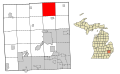 This map shows the incorporated and unincorporated areas in Oakland County, Michigan, highlighting Oxford Charter Township in red. I created it in Inkscape using data from the US Census Bureau.
 -
 This map shows the incorporated and unincorporated areas in Oakland County, Michigan, highlighting Oxford in red. I created it in Inkscape using data from the US Census Bureau.
 -
 This map shows the incorporated and unincorporated areas in Oakland County, Michigan, highlighting Pleasant Ridge in red. I created it in Inkscape using data from the US Census Bureau.
 -
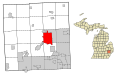 This map shows the incorporated and unincorporated areas in Oakland County, Michigan, highlighting Pontiac in red. I created it in Inkscape using data from the US Census Bureau.
 -
 This map shows the incorporated and unincorporated areas in Oakland County, Michigan, highlighting Rochester in red. I created it in Inkscape using data from the US Census Bureau.
 -
 This map shows the incorporated and unincorporated areas in Oakland County, Michigan, highlighting Rochester Hills in red. I created it in Inkscape using data from the US Census Bureau.
 -
 This map shows the incorporated and unincorporated areas in Oakland County, Michigan, highlighting Rose Township in red. I created it in Inkscape using data from the US Census Bureau.
 -
 This map shows the incorporated and unincorporated areas in Oakland County, Michigan, highlighting Royal Oak Charter Township in red. I created it in Inkscape using data from the US Census Bureau.
 -
 This map shows the incorporated and unincorporated areas in Oakland County, Michigan, highlighting Royal Oak in red. I created it in Inkscape using data from the US Census Bureau.
 -
 This map shows the incorporated and unincorporated areas in Oakland County, Michigan, highlighting South Lyon in red. I created it in Inkscape using data from the US Census Bureau.
 -
 This map shows the incorporated and unincorporated areas in Oakland County, Michigan, highlighting Southfield in red. I created it in Inkscape using data from the US Census Bureau.
 -
 This map shows the incorporated and unincorporated areas in Oakland County, Michigan, highlighting Southfield Township in red. I created it in Inkscape using data from the US Census Bureau.
 -
 This map shows the incorporated and unincorporated areas in Oakland County, Michigan, highlighting Springfield Township in red. I created it in Inkscape using data from the US Census Bureau.
 -
 This map shows the incorporated and unincorporated areas in Oakland County, Michigan, highlighting Sylvan Lake in red. I created it in Inkscape using data from the US Census Bureau.
 -
 This map shows the incorporated and unincorporated areas in Oakland County, Michigan, highlighting Troy in red. I created it in Inkscape using data from the US Census Bureau.
 -
 This map shows the incorporated and unincorporated areas in Oakland County, Michigan, highlighting Walled Lake in red. I created it in Inkscape using data from the US Census Bureau.
 -
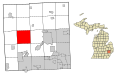 This map shows the incorporated and unincorporated areas in Oakland County, Michigan, highlighting White Lake Township in red. I created it in Inkscape using data from the US Census Bureau.
 -
 This map shows the incorporated and unincorporated areas in Oakland County, Michigan, highlighting Wixom in red. I created it in Inkscape using data from the US Census Bureau.
 -
 This map shows the incorporated and unincorporated areas in Oakland County, Michigan, highlighting Wolverine Lake in red. I created it in Inkscape using data from the US Census Bureau.


Mon Apr 23 12:32:51 MST 2007[edit]
-
 This map shows the incorporated and unincorporated areas in Wayne County, Michigan. I created it in Inkscape using data from the US Census Bureau.
 -
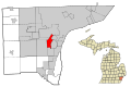 This map shows the incorporated and unincorporated areas in Wayne County, Michigan, highlighting Allen Park in red. I created it in Inkscape using data from the US Census Bureau.
 -
 This map shows the incorporated and unincorporated areas in Wayne County, Michigan, highlighting Belleville in red. I created it in Inkscape using data from the US Census Bureau.
 -
 This map shows the incorporated and unincorporated areas in Wayne County, Michigan, highlighting Brownstown Township in red. I created it in Inkscape using data from the US Census Bureau.
 -
 This map shows the incorporated and unincorporated areas in Wayne County, Michigan, highlighting Canton in red. I created it in Inkscape using data from the US Census Bureau.
 -
 This map shows the incorporated and unincorporated areas in Wayne County, Michigan, highlighting Dearborn Heights in red. I created it in Inkscape using data from the US Census Bureau.
 -
 This map shows the incorporated and unincorporated areas in Wayne County, Michigan, highlighting Dearborn in red. I created it in Inkscape using data from the US Census Bureau.
 -
 This map shows the incorporated and unincorporated areas in Wayne County, Michigan, highlighting Detroit in red. I created it in Inkscape using data from the US Census Bureau.
 -
 This map shows the incorporated and unincorporated areas in Wayne County, Michigan, highlighting Ecorse in red. I created it in Inkscape using data from the US Census Bureau.
 -
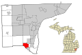 This map shows the incorporated and unincorporated areas in Wayne County, Michigan, highlighting Flat Rock in red. I created it in Inkscape using data from the US Census Bureau.
 -
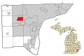 This map shows the incorporated and unincorporated areas in Wayne County, Michigan, highlighting Garden City in red. I created it in Inkscape using data from the US Census Bureau.
 -
 This map shows the incorporated and unincorporated areas in Wayne County, Michigan, highlighting Gibraltar in red. I created it in Inkscape using data from the US Census Bureau.
 -
 This map shows the incorporated and unincorporated areas in Wayne County, Michigan, highlighting Grosse Ile Township in red. I created it in Inkscape using data from the US Census Bureau.
 -
 This map shows the incorporated and unincorporated areas in Wayne County, Michigan, highlighting Grosse Pointe Farms in red. I created it in Inkscape using data from the US Census Bureau.
 -
 This map shows the incorporated and unincorporated areas in Wayne County, Michigan, highlighting Grosse Pointe in red. I created it in Inkscape using data from the US Census Bureau.
 -
 This map shows the incorporated and unincorporated areas in Wayne County, Michigan, highlighting Grosse Pointe Park in red. I created it in Inkscape using data from the US Census Bureau.
 -
 This map shows the incorporated and unincorporated areas in Wayne County, Michigan, highlighting Grosse Pointe Shores in red. I created it in Inkscape using data from the US Census Bureau.
 -
 This map shows the incorporated and unincorporated areas in Wayne County, Michigan, highlighting Grosse Pointe Woods in red. I created it in Inkscape using data from the US Census Bureau.
 -
 This map shows the incorporated and unincorporated areas in Wayne County, Michigan, highlighting Hamtramck in red. I created it in Inkscape using data from the US Census Bureau.
 -
 This map shows the incorporated and unincorporated areas in Wayne County, Michigan, highlighting Harper Woods in red. I created it in Inkscape using data from the US Census Bureau.
 -
 This map shows the incorporated and unincorporated areas in Wayne County, Michigan, highlighting Highland Park in red. I created it in Inkscape using data from the US Census Bureau.
 -
 This map shows the incorporated and unincorporated areas in Wayne County, Michigan, highlighting Huron Charter Township in red. I created it in Inkscape using data from the US Census Bureau.
 -
 This map shows the incorporated and unincorporated areas in Wayne County, Michigan, highlighting Inkster in red. I created it in Inkscape using data from the US Census Bureau.
 -
 This map shows the incorporated and unincorporated areas in Wayne County, Michigan, highlighting Lincoln Park in red. I created it in Inkscape using data from the US Census Bureau.
 -
 This map shows the incorporated and unincorporated areas in Wayne County, Michigan, highlighting Livonia in red. I created it in Inkscape using data from the US Census Bureau.
 -
This map shows the incorporated and unincorporated areas in Wayne County, Michigan, highlighting Melvindale in red. I created it in Inkscape using data from the US Census Bureau.
-
 This map shows the incorporated and unincorporated areas in Wayne County, Michigan, highlighting Northville Charter Township in red. I created it in Inkscape using data from the US Census Bureau.
 -
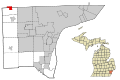 This map shows the incorporated and unincorporated areas in Wayne County, Michigan, highlighting Northville in red. I created it in Inkscape using data from the US Census Bureau.
 -
 This map shows the incorporated and unincorporated areas in Wayne County, Michigan, highlighting Plymouth in red. I created it in Inkscape using data from the US Census Bureau.
 -
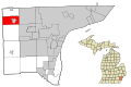 This map shows the incorporated and unincorporated areas in Wayne County, Michigan, highlighting Plymouth Township in red. I created it in Inkscape using data from the US Census Bureau.
 -
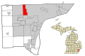 This map shows the incorporated and unincorporated areas in Wayne County, Michigan, highlighting Redford Township in red. I created it in Inkscape using data from the US Census Bureau.
 -
 This map shows the incorporated and unincorporated areas in Wayne County, Michigan, highlighting River Rouge in red. I created it in Inkscape using data from the US Census Bureau.
 -
 This map shows the incorporated and unincorporated areas in Wayne County, Michigan, highlighting Riverview in red. I created it in Inkscape using data from the US Census Bureau.
 -
 This map shows the incorporated and unincorporated areas in Wayne County, Michigan, highlighting Rockwood in red. I created it in Inkscape using data from the US Census Bureau.
 -
 This map shows the incorporated and unincorporated areas in Wayne County, Michigan, highlighting Romulus in red. I created it in Inkscape using data from the US Census Bureau.
 -
 This map shows the incorporated and unincorporated areas in Wayne County, Michigan, highlighting Southgate in red. I created it in Inkscape using data from the US Census Bureau.
 -
 This map shows the incorporated and unincorporated areas in Wayne County, Michigan, highlighting Sumpter Township in red. I created it in Inkscape using data from the US Census Bureau.
 -
 This map shows the incorporated and unincorporated areas in Wayne County, Michigan, highlighting Taylor in red. I created it in Inkscape using data from the US Census Bureau.
 -
 This map shows the incorporated and unincorporated areas in Wayne County, Michigan, highlighting Trenton in red. I created it in Inkscape using data from the US Census Bureau.
 -
 This map shows the incorporated and unincorporated areas in Wayne County, Michigan, highlighting Van Buren Charter Township in red. I created it in Inkscape using data from the US Census Bureau.
 -
 This map shows the incorporated and unincorporated areas in Wayne County, Michigan, highlighting Wayne in red. I created it in Inkscape using data from the US Census Bureau.
 -
 This map shows the incorporated and unincorporated areas in Wayne County, Michigan, highlighting Westland in red. I created it in Inkscape using data from the US Census Bureau.
 -
 This map shows the incorporated and unincorporated areas in Wayne County, Michigan, highlighting Woodhaven in red. I created it in Inkscape using data from the US Census Bureau.
 -
 This map shows the incorporated and unincorporated areas in Wayne County, Michigan, highlighting Wyandotte in red. I created it in Inkscape using data from the US Census Bureau.


Mon Apr 23 11:50:57 MST 2007[edit]
-
 This map shows the incorporated and unincorporated areas in Monroe County, Michigan, highlighting Bedford Township in red. I created it in Inkscape using data from the US Census Bureau.
 -
 This map shows the incorporated and unincorporated areas in Monroe County, Michigan, highlighting Berlin Charter Township in red. I created it in Inkscape using data from the US Census Bureau.
 -
 This map shows the incorporated and unincorporated areas in Monroe County, Michigan, highlighting Carleton in red. I created it in Inkscape using data from the US Census Bureau.
 -
 This map shows the incorporated and unincorporated areas in Monroe County, Michigan, highlighting Detroit Beach in red. I created it in Inkscape using data from the US Census Bureau.
 -
 This map shows the incorporated and unincorporated areas in Monroe County, Michigan, highlighting Dundee in red. I created it in Inkscape using data from the US Census Bureau.
 -
 This map shows the incorporated and unincorporated areas in Monroe County, Michigan, highlighting Dundee Township in red. I created it in Inkscape using data from the US Census Bureau.
 -
 This map shows the incorporated and unincorporated areas in Monroe County, Michigan, highlighting Erie Township in red. I created it in Inkscape using data from the US Census Bureau.
 -
 This map shows the incorporated and unincorporated areas in Monroe County, Michigan, highlighting Estral Beach in red. I created it in Inkscape using data from the US Census Bureau.
 -
 This map shows the incorporated and unincorporated areas in Monroe County, Michigan, highlighting Exeter Township in red. I created it in Inkscape using data from the US Census Bureau.
 -
 This map shows the incorporated and unincorporated areas in Monroe County, Michigan, highlighting Frenchtown Charter Township in red. I created it in Inkscape using data from the US Census Bureau.
 -
 This map shows the incorporated and unincorporated areas in Monroe County, Michigan, highlighting Ida Township in red. I created it in Inkscape using data from the US Census Bureau.
 -
 This map shows the incorporated and unincorporated areas in Monroe County, Michigan, highlighting La Salle Township in red. I created it in Inkscape using data from the US Census Bureau.
 -
 This map shows the incorporated and unincorporated areas in Monroe County, Michigan, highlighting Lambertville in red. I created it in Inkscape using data from the US Census Bureau.
 -
 This map shows the incorporated and unincorporated areas in Monroe County, Michigan, highlighting London Township in red. I created it in Inkscape using data from the US Census Bureau.
 -
 This map shows the incorporated and unincorporated areas in Monroe County, Michigan, highlighting Luna Pier in red. I created it in Inkscape using data from the US Census Bureau.
 -
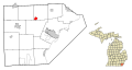 This map shows the incorporated and unincorporated areas in Monroe County, Michigan, highlighting Maybee in red. I created it in Inkscape using data from the US Census Bureau.
 -
 This map shows the incorporated and unincorporated areas in Monroe County, Michigan, highlighting Milan in red. I created it in Inkscape using data from the US Census Bureau.
 -
 This map shows the incorporated and unincorporated areas in Monroe County, Michigan, highlighting Milan Township in red. I created it in Inkscape using data from the US Census Bureau.
 -
 This map shows the incorporated and unincorporated areas in Monroe County, Michigan, highlighting Monroe Charter Township in red. I created it in Inkscape using data from the US Census Bureau.
 -
 This map shows the incorporated and unincorporated areas in Monroe County, Michigan, highlighting Monroe in red. I created it in Inkscape using data from the US Census Bureau.
 -
 This map shows the incorporated and unincorporated areas in Monroe County, Michigan, highlighting Petersburg in red. I created it in Inkscape using data from the US Census Bureau.
 -
 This map shows the incorporated and unincorporated areas in Monroe County, Michigan, highlighting Raisinville in red. I created it in Inkscape using data from the US Census Bureau.
 -
 This map shows the incorporated and unincorporated areas in Monroe County, Michigan, highlighting South Monroe in red. I created it in Inkscape using data from the US Census Bureau.
 -
 This map shows the incorporated and unincorporated areas in Monroe County, Michigan, highlighting South Rockwood in red. I created it in Inkscape using data from the US Census Bureau.
 -
 This map shows the incorporated and unincorporated areas in Monroe County, Michigan, highlighting Stony Point in red. I created it in Inkscape using data from the US Census Bureau.
 -
 This map shows the incorporated and unincorporated areas in Monroe County, Michigan, highlighting Summerfield Township in red. I created it in Inkscape using data from the US Census Bureau.
 -
 This map shows the incorporated and unincorporated areas in Monroe County, Michigan, highlighting Temperance in red. I created it in Inkscape using data from the US Census Bureau.
 -
 This map shows the incorporated and unincorporated areas in Monroe County, Michigan, highlighting West Monroe in red. I created it in Inkscape using data from the US Census Bureau.
 -
 This map shows the incorporated and unincorporated areas in Monroe County, Michigan, highlighting Whiteford Township in red. I created it in Inkscape using data from the US Census Bureau.
 -
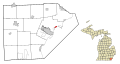 This map shows the incorporated and unincorporated areas in Monroe County, Michigan, highlighting Woodland Beach in red. I created it in Inkscape using data from the US Census Bureau.


Mon Apr 23 11:34:33 MST 2007[edit]
-
 This map shows the incorporated and unincorporated areas in Monroe County, Michigan. I created it in Inkscape using data from the US Census Bureau.
 -
 This map shows the incorporated and unincorporated areas in Monroe County, Michigan, highlighting Ash Township in red. I created it in Inkscape using data from the US Census Bureau.

