User:ShelleyAdams/Old maps of North Carolina
Jump to navigation
Jump to search

|
This user page is under construction, or in the middle of an expansion or major redevelopment that started on 25 September 2017. |
Main category: Old maps of North Carolina
Colonial period[edit]
-
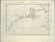 1561
1561 -
 1585–1586
 -
 1591
1591 -
 1630
1630 -
 1671
1671 -
 1676
1676 -
 circa 1709
 -
 1714
1714 -
 1715
1715 -
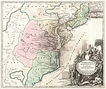
 1732
1732 -
 1736
1736 -
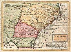
 1737
1737 -
 1738
1738 -
 1746
1746 -
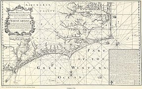
 1747
1747 -
 1755
1755
.jpg)


.jpg)


.jpg)

.jpg)

.jpg)


_-_Geographicus_-_CarolinaGeorgia-bowen-1747.jpg)
.jpg)
Regional maps[edit]
-
 Roanoke Island, 1584
 -
 Edenton, 1769
 -
 Halifax, 1770
 -
 Hillsborough, 1770
 -
 Bute County, 1770
 -
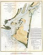
 Cape Fear River, 1770


Revolutionary War period[edit]
North Carolina and surrounding areas during the American Revolutionary War (1775–1783).
-
 1775
1775 -
 1778
1778 -
 1779
1779 -
 1780
1780 -
 1782
1782 -
 Marches of Cornwalis
 -
![Financial relations, 1783 [1910]](https://upload.wikimedia.org/wikipedia/commons/thumb/2/21/The_financial_relations_of_North_Carolina_and_the_Continental_Congress_%281910%29_%2814781228921%29.jpg/334px-The_financial_relations_of_North_Carolina_and_the_Continental_Congress_%281910%29_%2814781228921%29.jpg) Financial relations, 1783 [1910]
Financial relations, 1783 [1910]
.jpg)

.jpg)

.jpg)
.jpg)
![Financial relations, 1783 [1910]](/wiki/File:The_financial_relations_of_North_Carolina_and_the_Continental_Congress_(1910)_(14781228921).jpg)
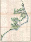
Coastal areas[edit]
-
 Ocracoke Inlet, 1775
 -
 Cape Fear River to Charleston, 1776
 -
 Cape Fear River, 1781

.jpg)
.jpg)
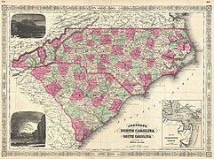
Antebellum period[edit]
Between the American Revolution and Civil War (1783–1861)
-
 1806
1806 -
 1806
1806 -
 1827
1827 -
 1827
1827 -
 1847
1847 -
 1850
1850 -
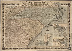
 1853
1853 -
 1854
1854 -
 1855
1855 -
 1856
1856 -
 1860
1860

.jpg)

.jpg)


_and_North_Carolina_-_Geographicus_-_VANC-mitchell-1860.jpg)
Costal areas[edit]
-
 Ocracoke Inlet, 1795
 -
 1801
1801 -
 Railroads, circa 1848
 -
 1853
1853 -
 1853
1853 -
 1855
1855 -
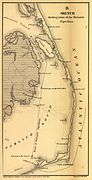
 1857
1857 -
 1857
1857 -
 Railroad, 1858


Civil War[edit]
Main category: Old maps of North Carolina in the American Civil War
North Carolina during the American Civil War (1861–1865)
-
 1861
1861 -
 1861
1861 -
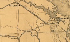
 1862
1862 -
 1863
1863 -
 1864
1864 -
 1864
1864 -
 1865
1865
.jpg)
.jpg)

.jpg)


.jpg)
Regional maps[edit]
-
 Raleigh, 1865
 -
 Sherman's march from Atlanta to Goldsboro
 -
 Campaign Maps, Goldsboro to Aven's Bridge

.jpg)

Costal areas[edit]
-
 1860s
1860s -
 1860s
1860s -
 1860s
1860s -
 Frank Leslie's War Maps, 1861
 -
 Costal areas, 1862
 -
 Cape Fear, Fort Fisher, and Wilmington
_(14761980541).jpg)
_(14782579333).jpg)
_(14782631933).jpg)
.jpg)
.jpg)
_(14784869925).jpg)
Forts[edit]
-
 Fort Anderson, 1865
 -
 Fort Fisher, 1860s
 -
 Fort Fisher, 1865
 -
 Fort Fisher, 1865
 -
 Second Attack upon Fort Fisher


.jpg)


New Bern[edit]
-
 Battle of New Bern, 1862
 -
 Battle of New Bern, 1862
 -
 New Bern, 1864


.jpg)
Roanoke Island, 1862[edit]
-
 Burnside's Expedition
 -
 Battlefield
 -
 Battlefield, with location

_(14762817814).jpg)

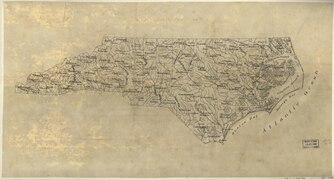
Reconstruction and late nineteenth-century[edit]
Maps from the Reconstruction Era (1865–1877) through the end of the ninteenth-century.
-
 1866
1866 -
 1874
1874 -
 1874
1874 -
 1877
1877 -
 Geology, 1884
 -
 1884
1884 -
 1889
1889 -
 Railroad, 1891
 -
 1893
1893 -
 1896
1896


_(14577375298).jpg)


.jpg)

_(14598252758).jpg)
Costal areas[edit]
-
 1866
1866 -
 1866
1866 -
 1873
1873 -
 1873
1873 -
 1875
1875 -
 1890
1890


_(14773128301).jpg)
Regional maps[edit]
-
 Great Dismal Swamp Canal, 1867
 -
 Raleigh, 1872


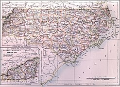
Early twentieth-century[edit]
-
 Railroads, 1900
 -
 1905
1905 -
 1907
1907 -
 1911
1911 -
 Water powers, 1911
 -
 1921
1921


_(14581127279).jpg)

_(1911)_(14762351134).jpg)

Regional maps[edit]
-
 Rocky Mount, 1907
 -
 Western counties, 1911
 -
 Costal fishing areas, 1921
 -
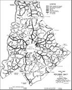 Mecklenburg County, 1923

_(14582746139).jpg)

