User:Mailer diablo/Sengkang
Jump to navigation
Jump to search

Asian Civilisations Museum, Empress Place 
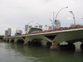
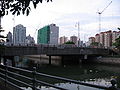
Benjamin Sheares Bridge over Marina Bay. 
Greendale Secondary School in Punggol New Town. 
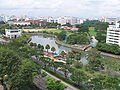
Kallang Basin, showing Singapore Indoor Stadium to the left, the condominiums of Tanjong Rhu in the background, and Nicoll Highway in the foreground. 
Rochor region of Kallang Planning Area, showing Crawford Court Housing Estate in the foreground, Kallang Basin and the condominiums of Tanjong Rhu in the background, Kallang River and Rochor River on the left, Marina Centre on the right, and the Central Business District to the far right. 
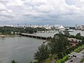
Panoramic view of Marina Bay, showing, from left to right, Marina Centre, Benjamin Sheares Bridge, Marina South and Clifford Pier. 
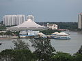
Marina Bay and Marina Centre. 
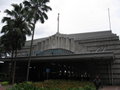
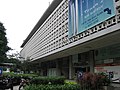
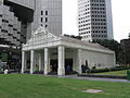
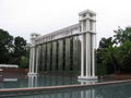
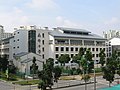
Parliament House, Singapore 
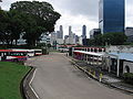
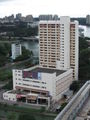
Sengkang Town Centre. The building complexes are, from left to right, Sengkang Community Hub, Compass Point Shopping Centre, Sengkang NEL, LRT and Bus Interchange, and Compass Heights Condominium. 
The following are photos uploaded on the behalf of en:User:Sengkang, from the English Wikipedia. This page is also meant to cross check any missing/damaged uploads, to avoid any loss of data. - Mailer diablo 05:07, 8 January 2006 (UTC)
Message : This is a catalogue of photographs that I have taken of Singapore geographical features, infrastructure and buildings in my leisure time. All images shown may be used anywhere in Wikipedia. Do drop me a note at my talk page if you intend to use them for other purposes. Thanks!
Boon Lay Planning Area[edit]
Jurong Bird Park[edit]
-
 Jurong Bird Park
 -
 Flamingo Lake, Jurong Bird Park
 -
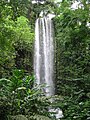 Jurong Falls, Jurong Bird Park
 -
 Lory Loft, Jurong Bird Park
 -
 Lory Loft, Jurong Bird Park
 -
 Lory Loft, Jurong Bird Park
 -
 Pelican Cove, Jurong Bird Park
 -
 Wetlands Waterfalls, Jurong Bird Park


Bukit Merah Planning Area[edit]
Outram[edit]
-
 Police Cantonment Complex
 -
 South Bridge Road Bus Terminal


Singapore General Hospital[edit]
-
 National Cancer Centre
 -
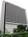
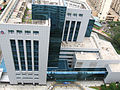
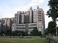
 Singapore General Hospital
 -
 Block 11, Singapore General Hospital
 -
 Bowyer Block, Singapore General Hospital


Central Water Catchment Planning Area[edit]
MacRitchie Reservoir[edit]
-
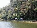 MacRitchie Reservoir

Singapore Zoo[edit]
-
 Singapore Zoo
 -
 Hamadryas Baboons Village, Singapore Zoo
 -
 Hamadryas Baboons Village, Singapore Zoo
 -
 Upper Seletar Reservoir
 -
 Upper Seletar Reservoir
 -
 Upper Seletar Reservoir
 -
 Upper Seletar Reservoir
 -
 Upper Seletar Reservoir


Changi Planning Area[edit]
Singapore Changi Airport[edit]
-
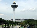
 Singapore Changi Airport, Control Tower
 -
 Singapore Changi Airport, Control Tower
 -
 Singapore Changi Airport, Control Tower
 -
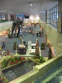
 Singapore Changi Airport, Terminal 1
 -
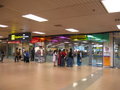
 Singapore Changi Airport, Terminal 1, Arrival Hall
 -
 Singapore Changi Airport, Terminal 1, Departure Hall
 -
 Singapore Changi Airport, Terminal 1, Departure Hall
 -
 Singapore Changi Airport, Terminal 1, Departure Hall
 -
 Singapore Changi Airport, Terminal 1, Departure Hall
 -
 Singapore Changi Airport, Terminal 1, Departure Hall
 -
 Singapore Changi Airport, Terminal 1, Departure Hall
 -
 Singapore Changi Airport, Terminal 1, Departure Hall
 -
 Singapore Changi Airport, Terminal 1, Drop-off foyer
 -
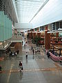
 Singapore Changi Airport, Terminal 1, Transit Lounge
 -
 Singapore Changi Airport, Terminal 1, Transit Lounge
 -
 Singapore Changi Airport, Terminal 1, Viewing Mall
 -
 Singapore Changi Airport, Terminal 1, Viewing Mall
 -
 Singapore Changi Airport, Terminal 1, Viewing Mall
 -
 Singapore Changi Airport, Terminal 1, Viewing Mall, A340 airplane
 -
 Singapore Changi Airport, Terminal 1, Viewing Mall, Emirates airplane
 -
 Singapore Changi Airport, Terminal 1, Viewing Mall, Jetstar Asia Airways airplane
 -
 Singapore Changi Airport, Terminal 1, Viewing Mall, Singapore Airlines airplane
 -
 Singapore Changi Airport, Terminal 2
 -
 Singapore Changi Airport, Terminal 2, Arrival Hall
 -
 Singapore Changi Airport, Terminal 2, Departure Hall
 -
 Singapore Changi Airport, Terminal 2, Departure Hall
 -
 Singapore Changi Airport, Terminal 2, Departure Hall
 -
 Singapore Changi Airport, Terminal 2, Departure Hall
 -
 Singapore Changi Airport, Terminal 2, Departure Hall
 -
 Singapore Changi Airport, Terminal 2, Departure Hall
 -
 Singapore Changi Airport, Terminal 2, Drop-off foyer
 -
 Singapore Changi Airport, Terminal 2, Drop-off foyer
 -
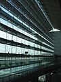
 Singapore Changi Airport, Terminal 2, Glass wall and ceiling
 -
 Singapore Changi Airport, Terminal 2, Glass wall
 -
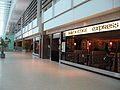 Singapore Changi Airport, Terminal 2, Restaurants
 -
 Singapore Changi Airport, Terminal 2, Sky train terminal
 -
 Singapore Changi Airport, Terminal 2


Downtown Core Planning Area[edit]
Bugis[edit]
-
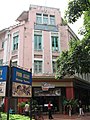
 Bugis Junction
 -
 Parco Bugis Junction Shopping Centre
 -
 The Gateway
 -
 The Gateway
 -
 The Gateway
 -
 The Gateway
 -
 The Gateway
 -
 The Gateway
 -
 The Gateway
 -
 The Gateway
 -
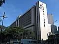
 Hotel Inter-Continental Singapore
 -
 National Library
 -
 National Library
 -
 National Library
 -
 National Library
 -
 National Library
 -
 New 7th Storey Hotel
 -
 Parkview Square
 -
 Parkview Square
 -
 Parkview Square
 -
 Parkview Square
 -
 Crane sculpture at Parkview Square
 -
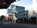
 Purvis Street
 -
 Purvis Street
 -
 Raffles Hospital
 -
 Shaw Tower
 -
 Shaw Tower
 -
 Tan Quee Lan Street


City Hall[edit]
-
 Bras Basah Complex
 -
 Funan Digitalife Mall
 -
 Funan Digitalife Mall
 -
 Raffles City Shopping Centre
 -
 Raffles Hotel
 -
 Raffles Hotel
 -
 Raffles Hotel
 -
 Raffles Hotel
 -
 Raffles Hotel
 -
 Raffles Hotel
 -
 Supreme Court Building
 -
 Swissôtel The Stamford Hotel
 -
 The Treasury Building


Marina Bay[edit]
-
 Marina Bay and Marina Centre
 -
 Marina Bay and Marina Centre
 -
 Marina Bay and Marina Centre
 -
 Marina Bay, Marina Centre and Esplanade Bridge
 -
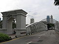
 Benjamin Sheares Bridge
 -
 Change Alley Aerial Plaza
 -
 Change Alley Aerial Plaza
 -
 Clifford Pier
 -
 Clifford Pier
 -
 Clifford Pier
 -
 Clifford Pier
 -
 Clifford Pier
 -
 Clifford Pier
 -
 Customs Harbour Branch
 -
 Esplanade Bridge
 -
 Esplanade Bridge
 -
 Esplanade Bridge
 -
 Esplanade Bridge
 -
 Esplanade Bridge
 -
 Esplanade Bridge
 -
 Esplanade Bridge
 -
 Esplanade Bridge
 -
 Merlion
 -
 Merlion
 -
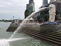 Merlion
 -
 Merlion
 -
 Merlion
 -
 Small Merlion
 -
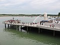 Merlion Park
 -
 One Fullerton
 -
 One Fullerton
 -
 One Fullerton
 -
 One Fullerton
 -
 One Fullerton
 -
 One Fullerton
 -
 One Fullerton
 -
 One Marina Boulevard
 -
 One Marina Boulevard
 -
 Stone Sculptures at One Marina Boulevard
 -
 Stone Sculptures at One Marina Boulevard
 -
 One Raffles Quay, under construction
 -
 Overseas Union House


Marina Centre[edit]
-
 Benjamin Sheares Bridge
 -
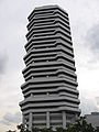
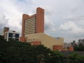
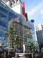
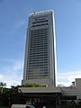
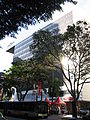
 Centennial Tower
 -
 Centennial Tower
 -
 Centennial Tower
 -
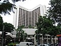
 Conrad International Centennial Hotel
 -
 Conrad International Centennial Hotel
 -
 Conrad International Centennial Hotel
 -
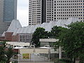
 The Esplanade
 -
 The Esplanade
 -
 The Esplanade
 -
 The Esplanade
 -
 The Esplanade
 -
 The Esplanade
 -
 The Esplanade
 -
 The Esplanade
 -
 The Esplanade
 -
 Library@Esplanade
 -
 Open-air performance pavilion at The Esplanade
 -
 Reflecting pool at The Esplanade
 -
 Marina Mandarin Hotel
 -
 Marina Mandarin Hotel
 -
 Marina Square
 -
 Marina Square
 -
 Marina Square
 -
 Millenia Tower
 -
 Millenia Tower
 -
 Millenia Tower
 -
 Millenia Tower
 -
 Millenia Tower
 -
 Millenia Walk
 -
 Millenia Walk
 -
 Millenia Walk
 -
 Millenia Walk
 -
 Millenia Walk
 -
 Millenia Walk
 -
 Sculptures at Millenia Walk
 -
 Waterfall at Millenia Walk
 -
 The Oriental Hotel
 -
 The Oriental Hotel
 -
 The Pan Pacific Hotel
 -
 The Pan Pacific Hotel
 -
 The Pan Pacific Hotel
 -
 The Pan Pacific Hotel
 -
 The Ritz-Carlton Millenia Hotel
 -
 The Ritz-Carlton Millenia Hotel
 -
 The Ritz-Carlton Millenia Hotel
 -
 The Ritz-Carlton Millenia Hotel
 -
 The Ritz-Carlton Millenia Hotel
 -
 Suntec City Towers
 -
 Suntec City Towers 1 & 2
 -
 Suntec City Towers 3 & 4
 -
 Suntec City Tower 5
 -
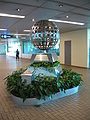
 Fountain of Wealth at Suntec City
 -
 Fountain of Wealth at Suntec City
 -
 Suntec City Mall
 -
 Suntec City Mall
 -
 Suntec City Mall, Entertainment Centre Atrium
 -
 Suntec City Mall, Entertainment Centre Atrium
 -
 Suntec City Mall, Entertainment Centre Atrium
 -
 Suntec Singapore International Convention and Exhibition
 -
 Suntec Singapore International Convention and Exhibition Centre


Raffles Place[edit]
-
 Sculpture at Raffles Place
 -
 Sculpture at Raffles Place
 -
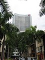
 Skyscrapers at Raffles Place
 -
 AIA Tower
 -
 Asia Insurance Building
 -
 Caltex House
 -
 CGU Insurance Centre
 -
 Change Alley
 -
 Change Alley Overhead Bridge
 -
 Change Alley Overhead Bridge
 -
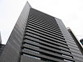
 Hitachi Tower
 -
 HSBC Building
 -
 Maybank Tower
 -
 Ocean Building
 -
 Ocean Building
 -
 Ocean Towers
 -
 OUB Centre
 -
 Raffles Place MRT Interchange Station
 -
 Raffles Place MRT Interchange Station
 -
 Raffles Place MRT Interchange Station
 -
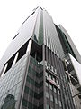
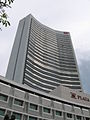
 Republic Plaza
 -
 Republic Plaza
 -
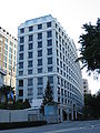
 Singapore Land Tower
 -
 Six Battery Road Building
 -
 Tung Centre


Singapore River[edit]
-
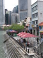
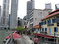
 Singapore River
 -
 Singapore River
 -
 Singapore River
 -
 Anderson Bridge
 -
 Anderson Bridge
 -
 Anderson Bridge
 -
 Anderson Bridge
 -
 Anderson Bridge
 -
 Anderson Bridge
 -
 Anderson Bridge
 -
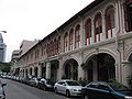
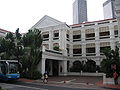
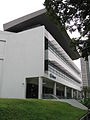
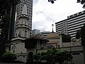
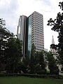
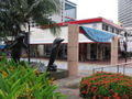
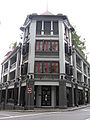
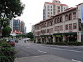
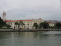 Asian Civilisations Museum, Empress Place
 -
 Bank of China Building
 -
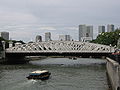
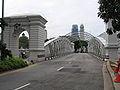
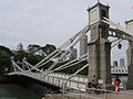
 Cavenagh Bridge
 -
 Cavenagh Bridge
 -
 Cavenagh Bridge
 -
 Cavenagh Bridge
 -
 Cavenagh Bridge
 -
 Cavenagh Bridge
 -
 Cavenagh Bridge
 -
 Sculpture near Cavenagh Bridge
 -
 Sculpture near Cavenagh Bridge
 -
 Sculpture near Cavenagh Bridge
 -
 Sculpture near Cavenagh Bridge
 -
 Sculpture near Cavenagh Bridge
 -
 Elgin Bridge
 -
 Elgin Bridge
 -
 Former Merlion Park
 -
 Former Merlion Park
 -
 The Fullerton Hotel
 -
 The Fullerton Hotel
 -
 The Fullerton Hotel
 -
 The Fullerton Hotel
 -
 The Fullerton Hotel
 -
 The Fullerton Hotel
 -
 The Fullerton Waterboat House
 -
 The Fullerton Waterboat House
 -
 High Street Centre
 -
 High Street Centre
 -
 Maybank Tower
 -
 Maybank Tower and Bank of China Building
 -
 North Boat Quay Promenade
 -
 Parliament House
 -
 Parliament House
 -
 Parliament House
 -
 OCBC Centre
 -
 OCBC Centre
 -
 Six Battery Road Building
 -
 UOB Plaza Towers and OUB Centre Tower
 -
 UOB Plaza Towers
 -
 UOB Plaza Tower One
 -
 UOB Plaza Tower One
 -
 UOB Plaza Tower Two
 -
 UOB Plaza Tower Two and OUB Centre Tower
 -
 UOB Plaza
 -
 Bird Sculpture in front of UOB Plaza


_by_Chong_Fah_Cheong,_Cavenagh_Bridge,_Singapore_-_20051203.jpg)
_by_Aw_Tee_Hong,_Cavenagh_Bridge,_Singapore_-_20051203.jpg)


Geylang[edit]
-
 A-Z Building
 -
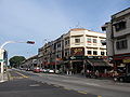
 Geylang Road
 -
 ITE College Central (MacPherson Campus)
 -
 Lorong 11 Geylang
 -
 Manjusri Secondary School
 -
 Paya Lebar Road
 -
 Seng Ong Temple
 -
 Sims Avenue
 -
 Sims Avenue
 -
 Sims Avenue
 -
 Sims Drive Housing Estate


,_Dec_05.JPG)


Hougang[edit]
-
 Hougang Mall Shopping Centre
 -
 Former Hougang South Bus Terminal
 -
 Former Hougang South Bus Terminal
 -
 Former Hougang South Bus Terminal
 -
 Heartland Mall
 -
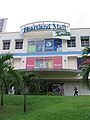 Heartland Mall
 -
 Hougang Street 21
 -
 Paya Lebar Kovan Community Club
 -
 Superbowl Hougang
 -
 Tampines Road


Jurong East Planning Area[edit]
Jurong East Central[edit]
-
 The Enterprise
 -
 IMM Building
 -
 The JTC Summit
 -
 The JTC Summit
 -
 Jurong East MRT Interchange
 -
 Jurong Regional Library


Singapore Science Centre[edit]
-
 Singapore Science Centre
 -
 Kinetic Garden, Singapore Science Centre
 -
 The Observatory, Singapore Science Centre
 -
 Omni-Theatre, Singapore Science Centre
 -
 Waterworks, Singapore Science Centre


Kallang Planning Area[edit]
Geylang[edit]
-
 Former Boon Keng Primary School
 -
 Former Boon Keng Primary School
 -
 Kallang-Paya Lebar Expressway under construction
 -
 Kallang-Paya Lebar Expressway under construction
 -
 Upper Boon Keng Road Housing Estate


Kallang Sports Hub[edit]
-
 National Stadium
 -
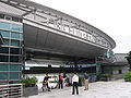
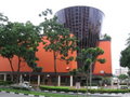
 Singapore Indoor Stadium
 -
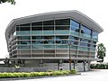
 Singapore Indoor Stadium and Oasis Building


Rochor[edit]
-
 The Concourse
 -
 The Concourse
 -
 The Concourse
 -
 The Concourse
 -
 The Concourse
 -
 Crawford Bridge
 -
 Crawford Court
 -
 Crawford Court
 -
 Crawford Court
 -
 Crawford Court
 -
 Crawford Street
 -
 Eng Cheong Tower
 -
 Golden Mile Complex
 -
 Golden Mile Food Centre
 -
 Golden Mile Tower
 -
 Hajjah Fatimah Mosque
 -
 Hong Wen School
 -
 Immigration & Checkpoints Authority Building
 -
 Immigration & Checkpoints Authority Building
 -
 Immigration & Checkpoints Authority Building
 -
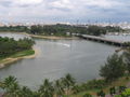
 Kallang Basin
 -
 Kallang Basin
 -
 Kallang River Mouth
 -
 Kallang River Mouth
 -
 Kallang River Mouth
 -
 Kallang River Mouth
 -
 Kallang Road
 -
 Kampong Glam Community Club
 -
 Keypoint
 -
 Kitchener Complex
 -
 Lavender MRT Station
 -
 Merdeka Bridge
 -
 The Plaza
 -
 The Plaza
 -
 The Plaza
 -
 The Plaza
 -
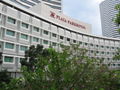 Plaza Parkroyal Hotel
 -
 Rochor River
 -
 St. John Headquarters


Marine Parade Planning Area[edit]
-
 Côte d' Azur
 -
 Grand Mercure Roxy Hotel
 -
 Marine Parade Central and Joo Chiat Road
 -
 Marine Parade Community Building
 -
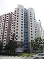
 A typical point block in Marine Parade Housing Estate
 -
 Marine Parade Promenade
 -
 Marine Parade Promenade
 -
 Marine Parade Promenade
 -
 Parkway Centre
 -
 Parkway Centre
 -
 Parkway Parade
 -
 Parkway Parade
 -
 Parkway Parade
 -
 Parkway Parade
 -
 Parkway Parade
 -
 Parkway Parade
 -
 Parkway Parade
 -
 Republic Theatre
 -
 Touchcentre


Museum Planning Area[edit]
-
 Central Fire Station and Civil Defence Heritage Gallery
 -
 House of Tan Yeok Nee
 -
 Istana Park
 -
 Istana Park
 -
 MICA Building
 -
 MICA Building
 -
 MICA Building
 -
 MICA Building
 -
 Park Mall
 -
 Plaza Singapura
 -
 Regency House
 -
 Singapore Shopping Centre
 -
 The Atrium @ Orchard


Fort Canning Hill[edit]
-
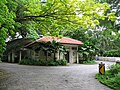
 Fort Canning Park
 -
 The Battle Box, Fort Canning Hill
 -
 The Flagstaff, Fort Canning Hill
 -
 Fort Canning Centre, Fort Canning Hill
 -
 Fort Canning Service Reservoir
 -
 The Gate of Fort Canning, Fort Canning Hill
 -
 The Gate of Fort Canning, Fort Canning Hill
 -
 The Lighthouse, Fort Canning Hill
 -
 Raffles Terrace, Fort Canning Hill
 -
 A sally port on Fort Canning Hill
 -
 The Time Ball, Fort Canning Hill


Newton Planning Area[edit]
-
 Sian Teck Tng Temple

Orchard Planning Area[edit]
-
 Orchard Road, Nov 2005

Somerset[edit]
-
 268 Orchard Road Building
 -
 Central Expressway
 -
 Cineleisure Orchard with reflection of Orchard Building
 -
 Cineleisure Orchard
 -
 Comcentre Building
 -
 Comcentre Building
 -
 Centrepoint Shopping Centre
 -
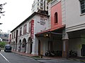
 Crown Prince Hotel
 -
 Cuppage Terrace
 -
 The Heeren
 -
 Holiday Inn Park View Hotel
 -
 Holiday Inn Park View Hotel
 -
 Hotel Grand Central
 -
 Le Meridien Singapore Hotel and Shopping Centre
 -
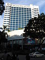
 Meritus Mandarin Hotel
 -
 National Youth Centre
 -
 Orchard Emerald
 -
 Orchard Plaza
 -
 Orchard Point
 -
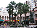
 Peranakan Place
 -
 Singapore Post, Killiney Road Branch
 -
 Singapore Power Building
 -
 StarHub Centre
 -
 Winsland House I
 -
 Winsland House II


Orchard[edit]
-
 The Ascott Singapore
 -
 Delfi Orchard
 -
 Far East Shopping Centre
 -
 Forum The Shopping Mall
 -
 Forum The Shopping Mall
 -
 Hilton Hotel
 -
 Hilton Hotel
 -
 HPL House
 -
 Liat Towers
 -
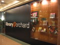 Library@Orchard
 -
 Library@Orchard
 -
 Library@Orchard
 -
 Library@Orchard
 -
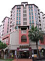
 Lucky Plaza
 -
 Lucky Plaza
 -
 Marriott Hotel
 -
 Marriott Hotel and Tangs Plaza
 -
 Ngee Ann City
 -
 Ngee Ann City
 -
 Ngee Ann City, Takashimaya Square
 -
 Fountain at Ngee Ann City
 -
 Orchard Hotel
 -
 Orchard MRT Station
 -
 Wall mural near Orchard MRT Station
 -
 Orchard Parade Hotel
 -
 Orchard Parade Hotel
 -
 Orchard Parade Hotel
 -
 Orchard Parade Hotel, Manchester United Shop
 -
 Orchard Parade Hotel, Manchester United Shop
 -
 Palais Renaissance
 -
 The Paragon
 -
 Shaw House
 -
 Shaw House
 -
 Wheelock Place
 -
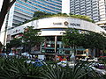
 Wisma Atria
 -
 Wisma Atria
 -
 Wisma Atria
 -
 Wisma Atria


Tanglin[edit]
-
 Le Classique
 -
 Tanglin Shopping Centre
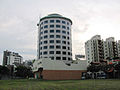


Outram Planning Area[edit]
Chinatown[edit]
-
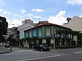
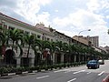
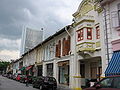
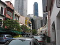
 Bukit Pasoh Road
 -
 Bukit Pasoh Road
 -
 Chinatown Complex
 -
 Entrance to Chinatown NEL Station
 -
 Duxton Plain Park
 -
 Jamae Mosque
 -
 Jamae Mosque
 -
 Jamae Mosque
 -
 Junction of Smith Street and Trengganu Street
 -
 Junction of Smith Street and Trengganu Street
 -
 Keong Saik Road
 -
 Keong Saik Road, Ann Kway Association Building
 -
 Keong Saik Road, Layor Sithi Vinayagar Temple
 -
 Kreta Ayer Road
 -
 Mosque Street
 -
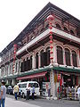
 New Bridge Centre
 -
 New Bridge Road
 -
 Oriental Plaza
 -
 Entrance to Outram Park NEL Interchange
 -
 Pagoda Street
 -
 Chinatown Heritage Centre at Pagoda Street
 -
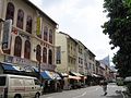 Smith Street
 -
 Smith Street
 -
 Sri Mariamman Temple
 -
 Sri Mariamman Temple
 -
 Sri Mariamman Temple
 -
 Sri Mariamman Temple
 -
 Sri Mariamman Temple
 -
 Sri Mariamman Temple
 -
 Temple Street
 -
 Temple Street
 -
 Teo Hong Road
 -
 Trengganu Street


Tanjong Pagar[edit]
-
 Craig Road
 -
 Craig Road
 -
 Craig Road
 -
 Duxton Hill
 -
 Duxton Hill
 -
 Duxton Hill
 -
 Duxton Hill
 -
 Duxton Road
 -
 Fairfield Methodist Church
 -
 Jinricksha Station
 -
 Jinricksha Station
 -
 Jinricksha Station
 -
 Murray Terrace
 -
 Murray Terrace
 -
 Neil Road
 -
 Peck Seah Street
 -
 Tanjong Pagar Plaza
 -
 Tanjong Pagar Plaza
 -
 Tanjong Pagar Road
 -
 Tanjong Pagar Road
 -
 Tanjong Pagar Road
 -
 Tras Street


Telok Ayer[edit]
-
 Al-Abrar Mosque
 -
 Amoy Street
 -
 Ann Siang Hill Park
 -
 Ann Siang Hill Park
 -
 Ann Siang Hill Park
 -
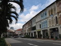
 Ann Siang Road
 -
 Ann Siang Road
 -
 Singapore Chung Hwa Medical Institution
 -
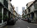
 Erskine Road
 -
 Erskine Road
 -
 Telok Ayer Green Park
 -
 Telok Ayer Green Park
 -
 Telok Ayer Green Park
 -
 Telok Ayer Street
 -
 Telok Ayer Street
 -
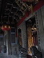
 Thian Hock Keng Temple
 -
 Thian Hock Keng Temple
 -
 Thian Hock Keng Temple
 -
 Thian Hock Keng Temple
 -
 Thian Hock Keng Temple
 -
 Thian Hock Keng Temple
 -
 Thian Hock Keng Temple
 -
 Thian Hock Keng Temple
 -
 Thian Hock Keng Temple
 -
 Thian Hock Keng Temple
 -
 Thian Hock Keng Temple
 -
 Thian Hock Keng Temple
 -
 Thian Hock Keng Temple
 -
 Thian Hock Keng Temple
 -
 Thian Hock Keng Temple
 -
 Thian Hock Keng Temple
 -
 Thian Hock Keng Temple
 -
 Thian Hock Keng Temple


_by_Lim_Leong_Seng,_Telok_Ayer_Green,_Singapore_-_20051231.jpg)


Punggol Planning Area[edit]
Edgedale[edit]
-
-

-

-

-

-

-

-

-

-
-
 Block of flats under construction
 -
 Roof top garden
 -
 Roof top garden
 -
 Stone wall mural
 -
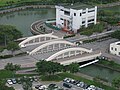
 Coral Edge LRT Station
 -
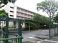
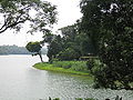
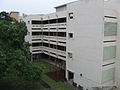
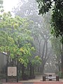
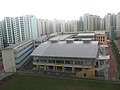
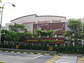
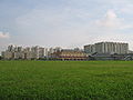
 Greendale Secondary School
 -
 Punggol Plaza
 -
 Punggol Plaza
 -
 Punggol Plaza
 -
 Punggol Plaza


Rochor Planning Area[edit]
Kampong Glam[edit]
-
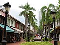 Bussorah Mall
 -
 Bussorah Mall
 -
 Golden Landmark Hotel
 -
 Kandahar Street
 -
 Kandahar Street
 -
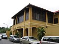
 Malay Heritage Centre, Istana Kampong Glam
 -
 Malay Heritage Centre, Istana Kampong Glam
 -
 Malay Heritage Centre, Istana Kampong Glam
 -
 Malay Heritage Centre, Istana Kampong Glam
 -
 Malay Heritage Centre, Istana Kampong Glam
 -
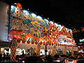
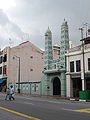
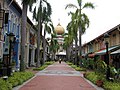
 Sultan Mosque
 -
 Sultan Mosque
 -
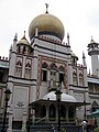 Sultan Mosque


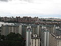
Sengkang Planning Area[edit]
-
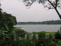
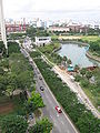
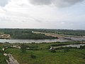 Punggol River
 -
 Sengkang Light Rail Transit viaduct
 -
 Sengkang Light Rail Transit viaduct
 -
 Sengkang Light Rail Transit viaduct
 -
 Sengkang Light Rail Transit viaduct, heading towards Punggol


Anchorvale[edit]
-
 Landmark at Anchorvale
 -
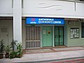 Anchorvale Community Centre
 -
 Anchorvale Court
 -
 Anchorvale Gardens
 -
 Anchorvale Gardens
 -
 Anchorvale Gardens
 -
 Anchorvale Grove
 -
 Anchorvale Place
 -
 Anchorvale Vista
 -
 Chee Hwan Kog Temple
 -
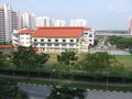
 Nan Chiau Primary School
 -
 Nan Chiau Primary School
 -
 Nan Chiau High School
 -
 Nanyang Thong Hong Siang Tng Temple
 -
 Puat Jit Buddhist Temple
 -
 Sengkang Methodist Church


Compassvale[edit]
-
Wall tile mural at Compassvale
-
 Compassvale Gardens
 -
 Compassvale Haven
 -
 Compassvale Haven
 -
 Compassvale Haven
 -
 Compassvale Lodge
 -
 Compassvale Lodge
 -
 Compassvale Lodge
 -
 Compassvale Lodge
 -
 Compassvale North Gate
 -
 Compassvale Place
 -
 Compassvale Plains
 -
 Compassvale Primary School
 -
 Compassvale Secondary School
 -
 Compassvale South Gate
 -
 Compassvale South Gate
 -
 Compassvale Vista


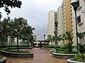
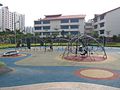
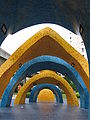
Sengkang Sculpture Park[edit]
-
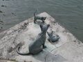
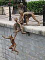
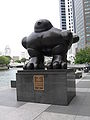
 Sengkang Sculpture Park
 -
 Sengkang Sculpture Park
 -
 Sengkang Sculpture Park
 -
 Sengkang Sculpture Park
 -
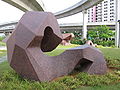 Sengkang Sculpture Park
 -
 Sengkang Sculpture Park
 -
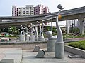 Sengkang Sculpture Park
 -
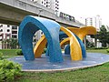 Sengkang Sculpture Park
 -
 Sengkang Sculpture Park
 -
 Sengkang Sculpture Park
 -
 Sengkang Sculpture Park


Fernvale[edit]
-
 Fernvale Neighbourhood

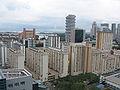
Sengkang Town Centre[edit]
-
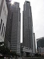
 Sengkang Town Centre
 -
 Sengkang Town Centre and Sengkang East Way
 -
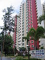
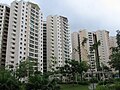
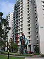
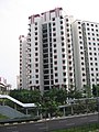
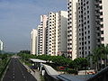
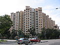
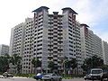
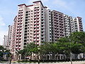
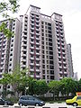
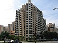
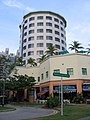
 Compass Heights condominium
 -
 Compass Heights condominium
 -
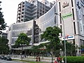
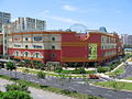 Compass Point Shopping Centre
 -
 Compass Point Shopping Centre
 -
 Wall tile mural at Compass Point Shopping Centre
 -
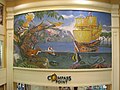
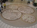 Floor tile mural at Compass Point Shopping Centre
 -
 Sengkang Bus Interchange
 -
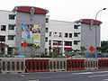
 Sengkang Community Hub
 -
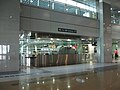 Sengkang North East Line Interchange


Singapore River Planning Area[edit]
Boat Quay[edit]
-
 Boat Quay
 -
 Boat Quay
 -
 Boat Quay
 -
 Boat Quay
 -
 Boat Quay
 -
 Boat Quay
 -
 Boat Quay
 -
 Circular Road
 -
 Junction of Circular Road and Lorong Telok
 -
 Coleman Bridge
 -
 Coleman Bridge
 -
 Elgin Bridge
 -
 Elgin Bridge
 -
 The Riverwalk
 -
 The Riverwalk Apartments


Havelock Road[edit]
-
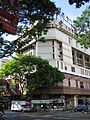
 Copthorne King's Hotel
 -
 Hotel Miramar
 -
 River View Hotel


Robertson Quay[edit]
-
Alkaff Bridge
-
 Clemenceau Bridge
 -
 Gallery Hotel
 -
 Gallery Hotel
 -
 Mohamed Sultan Road
 -
 Mohamed Sultan Road
 -
 Pulau Saigon Bridge
 -
 The Quayside
 -
 The Quayside
 -
 Sculpture at The Quayside
 -
 Robertson Quay
 -
 Robertson Quay Hotel
 -
 Robertson Quay Hotel
 -
 Robertson Walk
 -
 Robertson Walk
 -
 Robertson Walk
 -
 The Singapore Repertory Theatre
 -
 Singapore River, view from Pulau Saigon Bridge
 -
 UE Square Shopping Mall
 -
 UE Square Shopping Mall


