User:Emw/gallery
< User:Emw
Sun Sep 20 23:53:12 EDT 2015[edit]
-
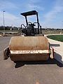
 Ingersoll-Rand SD-70D Pro-Pac road roller. Back and right sides shown. Located on the construction site of The Nokesville School, 12375 Aden Road, Nokesville, Virginia 20181.
 -
 Driver console of an Ingersoll-Rand SD-70D Pro-Pac road roller. Located on the construction site of The Nokesville School, 12375 Aden Road, Nokesville, Virginia 20181.
 -
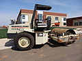
 Front side of an Ingersoll-Rand SD-70D Pro-Pac road roller. Located on the construction site of The Nokesville School, 12375 Aden Road, Nokesville, Virginia 20181.
 -
 Left side of an Ingersoll-Rand SD-70D Pro-Pac road roller. Located on the construction site of The Nokesville School, 12375 Aden Road, Nokesville, Virginia 20181.
 -
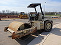
 Right side of an Ingersoll-Rand SD-70D Pro-Pac road roller. Located on the construction site of The Nokesville School, 12375 Aden Road, Nokesville, Virginia 20181.
 -
 John Brawner house ruins at Bristoe Station Battleground. Located at 17674 Main Street, Dumfries, Virginia 22026.
 -
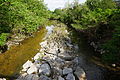
 Kettle Run stream, as viewed when looking east from Aden Road bridge (VA structure ID: 6038).
 -
 Kettle Run stream, as viewed when looking west from Aden Road bridge (VA structure ID: 6038).
 -
 Lee Catches Meade historical marker at Bristoe Station Battleground. Located at 17674 Main Street, Dumfries, Virginia 22026.
 -
 Lee Catches Meade historical marker at Bristoe Station Battleground. Detailed view. Located at 17674 Main Street, Dumfries, Virginia 22026.
 -
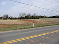
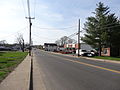 Looking northwest along the road from 12821 Fitzwater Drive, Nokesville, Virginia 20181.
 -
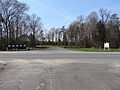
 Looking northwest in Nokesville Community Park, located at 12360 Aden Road, Nokesville, Virginia 20181.
 -
 Looking south along a trail at Bristoe Station Battlefield
 -
 Looking southeast along the road from 12825 Fitzwater Drive, Nokesville, Virginia 20181.
 -
 Looking southeast along the road from 12914 Fitzwater Drive, Nokesville, Virginia 20181.
 -
 Looking southeast along the road from 12919 Fitzwater Drive, Nokesville, Virginia 20181.
 -
 Looking southeast along the road from 12920 Fitzwater Drive, Nokesville, Virginia 20181.
 -
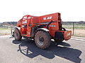 A Lull 944E-42 telescopic forklift. Left and back sides shown. Located at The Nokesville School construction site, 12375 Aden Road, Nokesville, Virginia 20181.
 -
 A Lull 944E-42 telescopic forklift. Left side shown. Located at The Nokesville School construction site, 12375 Aden Road, Nokesville, Virginia 20181.
 -
 A Magnolia liliiflora tree at Bristoe Station Battlefield
 -
 Detail of leaves of a Magnolia liliiflora tree at Bristoe Station Battlefield
 -
 Majors' baseball field at Nokesville Community Park.
 -
 Middle baseball field and building at Nokesville Community Park.
 -
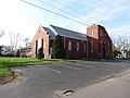
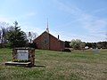
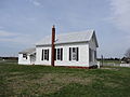
 Original building of Nokesville Chuch of the Brethren. South side of building shown.
 -
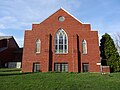
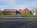
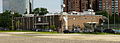
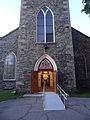
 Nokesville Church of the Brethren.
 -
 Nokesville Church of the Brethren. East entrance shown.
 -
 Nokesville Church of the Brethren. North (back) side of building shown.
 -
 Nokesville Church of the Brethren. North and west sides of building shown.
 -
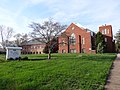
 Nokesville Church of the Brethren. South (front) side of building shown.
 -
 Nokesville Church of the Brethren. South and east sides of building shown.
 -
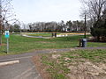
 Nokesville Community Park.
 -
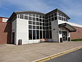
 Nokesville Neighborhood Library, with a stone table in the foreground.
 -
 Nokesville Neighborhood Library
 -
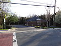
 Nokesville Post Office. North and west (front) sides of building shown.
 -
 Nokesville Post Office. West (front) and south sides of building shown.
 -
 Nokesville Square market
 -
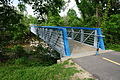
 Nokesville Truss Bridge. Angled view of south and east sides of structure shown.
 -
 Nokesville Truss Bridge. Detailed view of south and east sides of structure shown.
 -
 Nokesville Truss Bridge. Distant view of south and east sides of structure shown.
 -
 Nokesville Truss Bridge. South side of structure shown.
 -
 Nokesville United Methodist Church, detailed view. Southeast (front) and northeast sides of building shown.
 -
 Nokesville United Methodist Church. Southeast (front) and northeast sides of building shown.
 -
 Nokesville United Methodist Church. Southeast (front) and northeast sides of building shown.
 -
 Nokesville Veterinary Clinic
 -
 Nokesville town sign and market
 -
 Painted rocks by each graduating class enrolled at Brentville District High School in spring 2014.
 -
 Panorama of Bristoe Station Battleground
 -
 Park office at Bristoe Station Battleground
 -
 A portable toilet at Nokesville Community Park
 -
 East side of the railroad crossing on Fitzwater Drive, Nokesville, Virginia
 -
 West side of the railroad crossing on Fitzwater Drive, Nokesville, Virginia
 -
 Looking southwest from Fitzwater Drive along railroad tracks in Nokesville, Virginia
 -
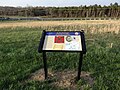
 "Road to the Valley" historical marker at Bristoe Station Battlefield
 -
 Sign for Nokesville Neighborhood Library
 -
 The Nokesville School under construction. South side of west wide shown.
 -
 Old sign reading "The Brentville Tigers Welcome You to Nokesville"
 -
 Panaroma of The Nokesville School while it is under construction
 -
 The Nokesville School, under construction
 -
 The Nokesville School, under construction. Distant southeast side of building shown.
 -
 The Nokesville School, under construction. Northeast side of building shown.
 -
 The Nokesville School, under construction. Northwest entrance of building shown.
 -
 The Nokesville School, under construction. Southeast side of building shown.
 -
 Trail and pond at Bristoe Station Battlefield
 -
 USPS mailbox outside Nokesville Post Office
 -
 Underside of Kettle Run stream bridge on Aden Road (VA structure ID: 6038)
 -
 Van of Nokesville Church of the Brethren parked in the church parking lot
 -
 Victory Baptist Church. Northwest (front) and northeast sides of building shown.
 -
 Victory Baptist Church, distant view. Southeast and northeast (front) sides of building shown.
 -
 Victory Baptist Church. Northeast (front) side of building shown.
 -
 Victory Baptist Church. Southeast and northeast (front) sides of building shown.
 -
 "Welcome to Nokesville" sign
 -
 Windows in a crate at The Nokesville School construction site.
 -
 Wooden palisade fence at Bristoe Station Battlefield


_side;_Nokesville,_VA;_2014-04-13.jpg)

_side;_Nokesville,_VA;_2014-04-13.jpg)


_sides;_Nokesville,_VA;_2014-04-13.jpg)
_and_south_sides;_Nokesville,_VA;_2014-04-13.jpg)


_and_northeast_sides;_Nokesville,_VA;_2014-04-13.jpg)
_and_northeast_sides;_Nokesville,_VA;_2014-04-13.jpg)
_side;_Nokesville,_VA;_2014-04-13.jpg)


_and_northeast_sides;_Nokesville,_VA;_2014-04-13.jpg)
_sides;_Nokesville,_VA;_2014-04-13.jpg)

_sides;_Nokesville,_VA;_2014-04-13.jpg)


Sun Sep 20 14:18:36 EDT 2015[edit]
-
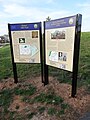
 Bristoe Station Battlefield historical markers on Bristow Road (SR 619). Located at 17674 Main Street, Dumfries, Virginia 22026.
 -
 Company and information signs at the construction site of the Nokesville School. Located at 12375 Aden Road, Nokesville, Virginia 20181.
 -
 "Confederate Cemeteries" historical marker at Bristoe Station Battleground. Located at 17674 Main Street, Dumfries, Virginia 22026.
 -
 Cornerstone of Nokesville Church of the Brethren (1895 - 1948). Located at 13002 Fitzwater Drive, Nokesville, Virginia 20181.
 -
 Cows on a farm near Fleetwood Drive and Asbury Ridge Court, Nokesville, Virginia.
 -
 A crucifix on the grounds of Victory Baptist Church. Located at 12650 Aden Road, Nokesville, Virginia 20181.
 -
 A crucifix and its surroundings on the grounds of Victory Baptist Church. Located at 12650 Aden Road, Nokesville, Virginia 20181.
 -
 An empty artificial lake at the construction site of The Nokesville School. Detailed view. Located at 12375 Aden Road, Nokesville, Virginia 20181.
 -
 An empty artificial lake at the construction site of The Nokesville School. Located at 12375 Aden Road, Nokesville, Virginia 20181.
 -
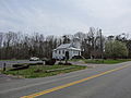
 Entrance of Nokesville Community Park, located at 12360 Aden Road, Nokesville, Virginia 20181.
 -
 A farm near Fleetwood Drive and Asbury Ridge Court, Nokesville, Virginia 20181.
 -
 A fiber optic cable marker, with surroundings. Located near 12551 Aden Road, Nokesville, Virginia 20181.
 -
 A fiber optic cable marker. Located near 12551 Aden Road, Nokesville, Virginia 20181.
 -
 A horse riding trail sign in Nokesville Community Park. Located at 12360 Aden Road, Nokesville, Virginia 20181.
 -
 "In the Footsteps of North Carolina" historical marker at Bristoe Station Battleground. Located at 17674 Main Street, Dumfries, Virginia 22026.
 -
 "In the Footsteps of North Carolina" historical marker at Bristoe Station Battleground. Detailed view. Located at 17674 Main Street, Dumfries, Virginia 22026.


Sun Sep 20 11:59:24 EDT 2015[edit]
-
 Asbury United Methodist Church, located at 14113 Fleetwood Drive, Nokesville, Virginia 20181. Detailed view. North and west (front) sides of building shown.
 -
 Asbury United Methodist Church, located at 14113 Fleetwood Drive, Nokesville, Virginia 20181. North and west (front) sides of building shown.
 -
 Asbury United Methodist Church, located at 14113 Fleetwood Drive, Nokesville, Virginia 20181. West (front) side of building shown.
 -
 Baseball field at Brentville District High School, located at 12109 Aden Rd, Nokesville, Virginia 20181.
 -
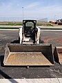
 Bobcat S220 Turbo skid-steer loader. Front and left sides shown. Located at The Nokesville School construction site, 12375 Aden Road, Nokesville, Virginia 20181.
 -
 Bobcat S220 Turbo skid-steer loader. Front side shown. Located at The Nokesville School construction site, 12375 Aden Road, Nokesville, Virginia 20181.
 -
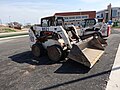 Bobcat S220 Turbo skid-steer loader. Right and front sides shown. Located at The Nokesville School construction site, 12375 Aden Road, Nokesville, Virginia 20181.
 -
 Bobcat T630 compact track loader. Back side shown. Located at The Nokesville School construction site, 12375 Aden Road, Nokesville, Virginia 20181.
 -
 Bobcat T630 compact track loader. Back side shown. Located at The Nokesville School construction site, 12375 Aden Road, Nokesville, Virginia 20181.
 -
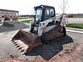
 Bobcat T630 compact track loader. Front side shown. Located at The Nokesville School construction site, 12375 Aden Road, Nokesville, Virginia 20181.
 -
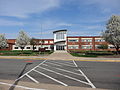
 Brentville District High School, located at 12109 Aden Road, Nokesville, Virginia 20181. North and west (front) sides of building shown.
 -
 Brentville District High School, located at 12109 Aden Road, Nokesville, Virginia 20181. West (front) and south sides of building shown.
 -
 Brentville District High School, located at 12109 Aden Road, Nokesville, Virginia 20181. North entrance on west side of building shown.
 -
 Brentville District High School, located at 12109 Aden Road, Nokesville, Virginia 20181. South entrance on west side of building shown.
 -
 Sign for Brentville District High School, located at 12109 Aden Road, Nokesville, Virginia 20181.
 -
 Bristoe Station Battlefield Heritage Park. Distant view. Located at 17674 Main Street, Dumfries, Virginia 22026.
 -
 Bristoe Station Battlefield Heritage Park. Located at 17674 Main Street, Dumfries, Virginia 22026.
 -
 "Battle of Bristoe Station", Virginia state historical marker G 20. Located at 17674 Main Street, Dumfries, Virginia 22026. It reads: G20 BATTLE OF BRISTOE STATION In the autumn of 1863, Gen. Robert E. Lee's Army of Northern Virginia, with Lt. Gen. A. P. Hill's III Corps in the lead, pursused Maj. Gen. George G. Meade's Union army as it withdrew toward Wash- ington. On the afternoon of 14 October, Maj. Gen. Gouverneur K. Warren's II Corps. Meade's rear guard, took a strong defensive position along the railroad embankment to meet an impetuous attack by elements of Hill's corps from the northwest. The Confederates were repulsed with heavy casualties (about 1,300 to Warren's 548), including the loss of an unsupported battery of five guns about 500 yards north. Warren stealthily withdrew after dark to resume his marh to Centerville. About 43 Union and 137 Confederate dead were buried on the field. DEPARTMENT OF HISTORIC RESOURCES, 1994
 -
 "Bristoe Trail 1863" and "Lee's Last Move North" historical markers at Bristoe Station Battleground
_side;_Nokesville,_VA;_2014-04-13.jpg)
_side;_Nokesville,_VA;_2014-04-13.jpg)
_side;_Nokesville,_VA;_2014-04-13.jpg)


_sides;_Nokesville,_VA;_2014-04-13.jpg)
_and_south_sides;_Nokesville,_VA;_2014-04-13.jpg)


Sat Sep 19 22:26:07 EDT 2015[edit]
-
 Aden Grocery store, located at 13717 Aden Rd, Nokesville, Virginia 20181. Southwest and southeast (front) sides of building shown.
 -
 Aden Road, looking south past Kettle Run stream bridge. Located just north of 11304 Aden Road, Nokesville, Virginia 20181. VA Structure ID: 6083.
 -
 Aden Road at Carriage Road, looking toward Victor Baptist Church. Located near 12561 Aden Road, Nokesville, Virginia 20181.
 -
 The Nokesville School, under construction; southwest side. Located at Aden Road at Parkgate Drive, Nokesville, Virginia 20181.
 -
 Artificial lake pump at The Nokesville School construction site. Detailed view. Located at 12375 Aden Road, Nokesville, Virginia 20181.
 -
 Asbury United Methodist Church, located at 14113 Fleetwood Drive, Nokesville, Virginia 20181.
 -
 Asbury United Methodist Church, located at 14113 Fleetwood Drive, Nokesville, Virginia 20181. North side of building shown.
 -
 Asbury United Methodist Church, located at 14113 Fleetwood Drive, Nokesville, Virginia 20181. South side of building shown.
 -
 Asbury United Methodist Church, located at 14113 Fleetwood Drive, Nokesville, Virginia 20181. South side of building shown.
 -
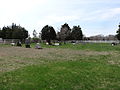 Asbury Church cemetery, located at 14113 Fleetwood Drive, Nokesville, Virginia 20181.
 -
 Historical marker at Asbury United Methodist Church, located at 14113 Fleetwood Drive, Nokesville, Virginia 20181.


_and_north_sides;_Nokesville,_VA;_2014-04-13.jpg)


Mon Sep 14 21:38:07 EDT 2015[edit]
-
 WETA FM studio and administrative offices, located at 3939 Campbell Avenue, Arlington, Virginia 22206. North and west sides of building shown.
 -
 WETA FM studio and administrative offices, located at 3939 Campbell Avenue, Arlington, Virginia 22206. West and south sides of building shown.
 -
 WETA TV studio and production center, located at 3620 South 27th Street, Arlington, Virginia 22206. North and west sides of building shown.
 -
 Windsor at Shirlington Village, an apartment complex located at 3000 South Randolph Street, Arlington, Virginia 22206. Viewed from atop the South Randolph Street garage.


Sun Sep 13 23:56:37 EDT 2015[edit]
-
 Campbell Avenue as viewed from South Arlington Mill Drive, in Shirlington, Arlington, Virginia.
 -
 A sign for The Village at Shirlington, viewed while looking west along Campbell Avenue at its intersection with South Quincy Street in Arlington, Virginia.
 -
 A United States Post Office, located at 2850 South Quincy Street, Arlington, Virginia 22206.
 -
 Vehicles and houses along South Four Mile Run Drive, Court D, Arlington, Virginia 22206. Viewed while looking north from Washington and Old Dominion Trail.
 -
 A sign on Washington and Old Dominion Railroad Trail instructing bicyclists to yield to pedestrians and equestrians, and pedestrians to yield to equestrians. Located near near Court C, South Four Mile Run Drive, Arlington, Virginia 22206.
 -
 Looking east along Washington and Old Dominion Trail near Court D, South Four Mile Run Drive, Arlington, Virginia 22206.
 -
 Looking west along Washington and Old Dominion Trail near Court D, South Four Mile Run Drive, Arlington, Virginia 22206.


Sun Sep 13 18:38:12 EDT 2015[edit]
-
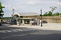 Shirlington Bus Station, viewed from the south. Located at 2975 South Quincy Street, Arlington, Virginia.
 -
 Shirlington Bus Station. Located at 2975 South Quincy Street, Arlington, Virginia.
 -
 Shirlington Bus Station, viewed from the south. A bus is stopped at the station. Located at 2975 South Quincy Street, Arlington, Virginia.
 -
 The main entrance of Signature Theatre, located at 4200 Campbell Avenue, Arlington, Virginia.
 -
 Signature Theatre and Shirlington Library in Shirlington, Arlington, Virginia.
 -
 South Nelson Street footbridge, which crosses Four Mile Run stream near 2800 South Nelson Street, Arlington, Virginia. Viewed from south side, near South Arlington Mill Drive.


Sun Sep 13 17:15:29 EDT 2015[edit]
-
 Elevated view of Shirlington, with the roofs of buildings lining Campbell Avenue in the foreground. Looking north from South Randolph Street parking garage.
 -
 Elevated view of Shirlington, looking north from South Randolph Street parking garage. In view are satellites for the WETA TV and Production Center, and Interstate 395.
 -
 A Map of The Village at Shirlington, located at the southeast corner of the intersection of Campbell Avenue and South Randolph Street, Arlington, VA.
 -
 An open air corridor separating two retail complexes on the north of Campbell Avenue. Located immediately west of 4029 Campbell Avenue, Arlington, VA, looking north.
 -
 A parking meter on the east side of South Randolph Street, across the street from AMC Loews Shirlington.
 -
 Detail of a spout of an internal rain gutter on a wall. Located on the west side of the inlet of 4115 Campbell Avenue, Arlington, VA 22206.
 -
 Spout of an internal rain gutter on a wall. Located on the west side of the inlet of 4115 Campbell Avenue, Arlington, VA 22206.
 -
 A recycling trash bin for plastic bottles and aluminum cans, located about 15 meters northwest of the Four Mile Run. Visible in the background is the South Nelson Street footbridge near 2800 South Nelson Street, Arlington, Virginia.


Sun Sep 13 15:40:32 EDT 2015[edit]
-
 A large arch at Shirlington Village Condominium, located at 2720 South Arlington Mill Drive, Arlington, VA 22206. Viewed from near 4250 Campbell Avenue, looking west.

Wed May 21 23:55:39 EDT 2014[edit]
-
 Buildings of the Arlington Street People's Assistance Network (A-SPAN) and Arlington Food Assistance Network (AFAN). Located at 2708 South Nelson Street, Arlington, VA 22206.
 -
 Buildings of the Arlington Street People's Assistance Network (A-SPAN) and Arlington Food Assistance Network (AFAN). Located at 2708 South Nelson Street, Arlington, Virginia.
 -
 AMC Loews Shirlington 7 Theatre, viewed at an angle from the south. Located at 2772 South Randolph Street, Arlington, Virginia.
 -
 AMC Loews Shirlington 7 Theatre, located at 2772 South Randolph Street, Arlington, Virginia.
 -
 A truck of the Arlington Food Assistance Center. Located at 2708 South Nelson Street, Arlington, Virginia.
 -
 A sign reading "Need Workers? Busca Trabajadores?" and directing inquirers to the nearby Shirlington Employment and Education Center (SEEC) at 2701 South Nelson Street in Arlington, Virginia.
 -
 A political campaign sign for Lavern Chatman, a candidate in the Democratic primary for Virginia’s 8th Congressional District. James P. Moran (D), the district's US Representative since 1991, announced that he would retire on January 15, 2014.
 -
 Looking northeasterly along Campbell Avenue at South Randolph Street in Arlington, Virginia.
 -
 Parking garage located at 4280 Campbell Avenue, Arlington, Virginia. A side of the Shirlington Library is at left.
 -
 A bicycle and map of the Capital Bikeshare program. Located near 2899 South Arlington Mill Drive, Arlington, Virginia.
 -
 Angled view of an empty dock for a bicycle in the Capital Bikeshare. Located near 2899 South Arlington Mill Drive, Arlington, Virginia.
 -
 An empty dock for a bicycle in the Capital Bikeshare. Located near 2899 South Arlington Mill Drive, Arlington, Virginia.
 -
 A Capital Bikeshare map of Arlington and Alexandria. Located near 2899 South Quincy Street, Arlington, Virginia.
 -
 A Capital Bikeshare map of Arlington and Alexandria. Located near 2899 South Quincy Street, Arlington, Virginia.
 -
 Office building of the Department of Parks, Recreation and Cultural Resources, located at 3700 South Four Mile Run Drive, Arlington, Virginia. East side of building shown.
 -
 A Dogipot litter bag dispenser for pet waste, attached to a trash can. Located near 4250 Campbell Avenue, Arlington, Virginia.
 -
 A plaque containing a short biography of Edmund Douglas Campbell. Located near 4200 Campbell Avenue, Arlington, Virginia. The street was named after Edmund and his wife, Elizabeth.
 -
 A plaque containing a short biography of Elizabeth Pfohl Campbell. Located near 4200 Campbell Avenue, Arlington, Virginia. The street was named after Elizabeth and her husband, Edmund.
 -
 A fountain in the expanded median of a roadway in the center of The Village at Shirlington. Restaurants line both sides of the street. Located near 4036 Campbell Avenue, Arlington, Virginia.
 -
 Looking east along Four Mile Run stream from the South Nelson Street footbridge near 2800 South Nelson Street, Arlington, Virginia.
 -
 Looking west along Four Mile Run stream from the South Nelson Street footbridge near 2800 South Nelson Street, Arlington, Virginia.
 -
 Jennie Dean Park and WETA television studios as viewed from Washington and Old Dominion Trail at the intersection of South Nelson Street and South Four Mile Run Drive in Arlington, Virginia.


Mon Apr 21 23:42:53 EDT 2014[edit]
errors[edit]
- File:Altar_of_Saint_Anne's_Episcopal_Church,_close_zoom;_Lowell,_MA;_2012-05-18.jpg aborted: exists: File:Altar_of_Saint_Anne's_Episcopal_Church,_close_zoom;_Lowell,_MA;_2012-05-18.jpg
- File:Chancel_and_altar_viewed_from_west;_Saint_Anne's_Episcopal_Church;_Lowell,_MA;_2012-05-18.jpg aborted: exists: File:Chancel_and_altar_viewed_from_west;_Saint_Anne's_Episcopal_Church;_Lowell,_MA;_2012-05-18.jpg
-
 Close zoom of the altar of Saint Anne's Episcopal Church. Located at 8 Kirk Street Lowell, Massachusetts.
 -
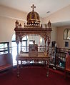
 Chancel and altar of Saint Anne's Episcopal Church, as viewed from west. Located at 8 Kirk Street Lowell, Massachusetts.
 -
 Portrait of Jefferson Bancroft (1803 - 1890), former mayor of Lowell, at Lowell Masonc Temple. Located at 79 Dutton Street, Lowell, Massachusetts.
 -
 Lobby and stairs at Transfiguration Greek Orthodox Church. Located at 25 Friar John Sarantos Way, Lowell, Massachusetts.
 -
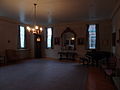
 Lobby of Lowell Masonic Temple. Located at 79 Dutton Street, Lowell, Massachusetts.
 -
 Lobby of Lowell Masonic Temple as viewed through the main entrance. Located at 79 Dutton Street, Lowell, Massachusetts.
 -
 Lobby of Transfiguration Greek Orthodox Church, as viewed from the southeast. Located at 25 Friar John Sarantos Way, Lowell, Massachusetts.
 -
 Looking east on Merrimack Street at twilight, located at 151 Merrimack Street, Lowell, Massachusetts. A sign for the UMass Lowell Downtown Bookstore is visible at upper left and the red neon "SUN" sign of The Sun of Lowell newspaper offices is visible in the background.
 -
 Interior of the lobby of Lowell Masonic Temple. Located at 79 Dutton Street, Lowell, Massachusetts.
 -
 Southwest room in the lower, ground-floor level of Lowell Masonic Temple. Located at 79 Dutton Street, Lowell, Massachusetts.
 -
 The southeast wall of the Grecian Hall on the second floor of Lowell Masonic Temple. Located at 79 Dutton Street, Lowell, Massachusetts.
 -
 Looking northwest in the Grecian Hall on the second floor of Lowell Masonic Temple. Located at 79 Dutton Street, Lowell, Massachusetts.
 -
 The ceiling of the Grecian Hall on the second floor of Lowell Masonic Temple. The ceilling depicts day and night skies and has features for early 20th century lighting effects. Located at 79 Dutton Street, Lowell, Massachusetts.
 -
 A memorial plaque in the lobby of Lowell Masonic Temple. Located at 79 Dutton Street, Lowell, Massachusetts.
 -
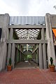
 The main entrance of Lowell Masonic Temple, with doors open for a public showing as part of Doors Open Lowell 2012. Located at 79 Dutton Street, Lowell, Massachusetts.
 -
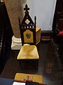 A chair with the name "Luke" embroidered on its upholstery on the west side of the chancel of Saint Anne's Episcopal Church. Located at 8 Kirk Street Lowell, Massachusetts.
 -
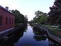 Merrimack Canal viewed from the bridge at Middlesex Street in Lowell, Massachusetts. Moody Street Feeder Gatehouse is visible at left; Lucy Larcom Park at right.
 -
 Merrimack Street at night; located near 151 Merrimack Street, Lowell, Massachusetts
 -
 The northeast room on the first floor of Lowell Masonic Temple. NorthLocated at 79 Dutton Street, Lowell, Massachusetts.
 -
 An old photograph of Saint Anne's Episcopal Church, on display inside the church. Located at 8 Kirk Street Lowell, Massachusetts.
 -
 The original lock and key to the front door of Saint Anne's Episcopal Church, on display in the church sanctuary as part of Doors Open Lowell 2012. Located at 8 Kirk Street Lowell, Massachusetts.
 -
 An ornate table at the lobby of Transfiguration Greek Orthodox Church. Located at 25 Friar John Sarantos Way, Lowell, Massachusetts.
 -
 A portrait of Greek Orthodox Church patriarchs on display in the lobby of Transfiguration Greek Orthodox Church. Located at 25 Friar John Sarantos Way, Lowell, Massachusetts.
 -
 Interior of Pawtucket Gatehouse, in the middle facing southeast. Located near the southeast end of the O'Donnell Bridge in Lowell, Massachusetts.
 -
 Interior of Pawtucket Gatehouse, in the northwest end facing southeast. Located near the southeast end of the O'Donnell Bridge in Lowell, Massachusetts.
 -
 Interior of Pawtucket Gatehouse, in the northwest side facing southeast. Located near the southeast end of the O'Donnell Bridge in Lowell, Massachusetts.
 -
 Interior of Pawtucket Gatehouse, in the southeast side facing northwest. Located near the southeast end of the O'Donnell Bridge in Lowell, Massachusetts.
 -
 A portrait of Jesus Christ on an ornate table in the lobby of Transfiguration Greek Orthodox Church. Located at 25 Friar John Sarantos Way, Lowell, Massachusetts.
 -
 A pre-1892 photograph of Saint Anne's Episcopal Church, on display in the church as part of Doors Open Lowell 2012. Located at 8 Kirk Street Lowell, Massachusetts.
 -
 Side entrance of a pulpit on the west side of the sanctuary of Saint Anne's Episcopal Church. Located at 8 Kirk Street Lowell, Massachusetts.
 -
 A plaque listing rectors of Saint Anne's Episcopal Church in the church sanctuary. Located at 8 Kirk Street Lowell, Massachusetts.
 -
 A mural of the resurrection of Jesus on the north-southeast sanctuary ceiling of Transfiguration Greek Orthodox Church. Located at 25 Friar John Sarantos Way, Lowell, Massachusetts.
 -
 Portrait of Theodore Edson in Lowell Masonic Temple. Located at 79 Dutton Street, Lowell, Massachusetts.
 -
 Portrait of Theodore Edson, first reverend of Saint Anne's Episcopal Church, on a wall in Lowell Masonic Temple. Saint Anne's is visible through the window at right. Located at 79 Dutton Street, Lowell, Massachusetts.
 -
 The sacristy of Saint Anne's Episcopal Church, with vestments visible within. Located at 8 Kirk Street Lowell, Massachusetts.
 -
 Open front doors of Saint Anne's Episcopal Church. Located at 8 Kirk Street Lowell, Massachusetts.
 -
 Church sign and sign for Doors Open Lowell 2012 at outside Saint Anne's Episcopal Church. Located at 8 Kirk Street Lowell, Massachusetts.
 -
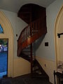 Spiral staircase in the lobby of Saint Anne's Episcopal Church. Located at 8 Kirk Street Lowell, Massachusetts.
 -
 Saint Anne's Episcopal Church; west and south (front) sides shown. Located at 8 Kirk Street Lowell, Massachusetts.
 -
 Looking towards the back (entrance) of the sanctuary of Transfiguration Greek Orthodox Church. Located at 25 Friar John Sarantos Way, Lowell, Massachusetts.
 -
 The sanctuary of Transfiguration Greek Orthodox Church; looking southwest. Located at 25 Friar John Sarantos Way, Lowell, Massachusetts.
 -
 The sanctuary of Transfiguration Greek Orthodox Church, looking towards the altar. Located at 25 Friar John Sarantos Way, Lowell, Massachusetts.
 -
 A photocopy of the schedule for the dedication ceremony of Lowell Masonic Temple. Located at 79 Dutton Street, Lowell, Massachusetts.
 -
 Baptismal font to the west of the altar at Transfiguration Greek Orthodox Church. Located at 25 Friar John Sarantos Way, Lowell, Massachusetts.
 -
 Baptismal font to the west of the altar at Transfiguration Greek Orthodox Church. Viewed from south. Located at 25 Friar John Sarantos Way, Lowell, Massachusetts.
 -
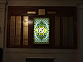
 Stained glass windows on the northwest sanctuary wall of Transfiguration Greek Orthodox Church. Located at 25 Friar John Sarantos Way, Lowell, Massachusetts.
 -
 Stained glass windows on the northwest sanctuary wall of Transfiguration Greek Orthodox Church. Located at 25 Friar John Sarantos Way, Lowell, Massachusetts.
 -
 A stand for candles in the lobby of Transfiguration Greek Orthodox Church. Located at 25 Friar John Sarantos Way, Lowell, Massachusetts.
 -
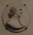 A relief profile of Reverend Theodore Edson, first reverend of Saint Anne's Episcopal Church, in the church sanctuary. Located at 8 Kirk Street Lowell, Massachusetts.


_side;_Lowell,_MA;_2012-05-18.jpg)


_sides;_Lowell,_MA;_2012-05-18.jpg)


Sun Apr 20 10:35:47 EDT 2014[edit]
errors[edit]
- File:Altar_of_Saint_Anne's_Episcopal_Church,_close_zoom;_Lowell,_MA;_2012-05-18.jpg aborted: exists: File:Altar_of_Saint_Anne's_Episcopal_Church,_close_zoom;_Lowell,_MA;_2012-05-18.jpg
- File:Chancel_and_altar_viewed_from_west;_Saint_Anne's_Episcopal_Church;_Lowell,_MA;_2012-05-18.jpg aborted: exists: File:Chancel_and_altar_viewed_from_west;_Saint_Anne's_Episcopal_Church;_Lowell,_MA;_2012-05-18.jpg
-
Close zoom of the altar of Saint Anne's Episcopal Church. Located at 8 Kirk Street Lowell, Massachusetts.
-
Chancel and altar of Saint Anne's Episcopal Church, as viewed from west. Located at 8 Kirk Street Lowell, Massachusetts.
-
 A mural of the baptism of Jesus on the north-northwest sanctuary ceiling of Transfiguration Greek Orthodox Church. Located at 25 Friar John Sarantos Way, Lowell, Massachusetts.
 -
 Stained glass transom window above the main entrance of Saint Anne's Episcopal Church. It reads "Bear ye each others burdens". Located at 8 Kirk Street Lowell, Massachusetts.
 -
 Stained glass window in the transom of the center door to the sanctuary at Saint Anne's Episcopal Church. Located at 8 Kirk Street Lowell, Massachusetts.
 -
 Dedication plaque for Lowell Masonic Temple. It reads: LOWELL MASONIC TEMPLE CORNERSTONE LAID SEPT. 8, 1928 BY M.W. FRANK L. SIMPSON, GRAND MASTER. DEDICATED OCTOBER 8, 1929 BY M.W. HERBERT W. DEAN, GRAND MASTER BUILDING COMMITTEE: M.W. ARTHUR D. PRINCE R.W. HARRY G. POLLARD R.W. FRANK L. WEAVER W. AVERY B. CLARK W. CHARLES E. BARTLETT ARCHITECT BRO. PERLEY F. GILBERT BUILDER BRO. JOHN A. SIMPSON Located at 79 Dutton Street, Lowell, Massachusetts.
 -
 A "Doors Open Lowell" sign outside the entrance of Saint Anne's Episcopal Church. Located at 8 Kirk Street Lowell, Massachusetts.
 -
 An Episcopalian chasuble -- an outer liturgical vestment, a reverend's robe -- in the sacristy of Saint Anne's Episcopal Church. Located at 8 Kirk Street Lowell, Massachusetts.
 -
 The control lever of a canal gate inside Pawtucket Gatehouse. "SHUT" is at left and "OPEN" is at right. Located near the southeast end of the O'Donnell Bridge in Lowell, Massachusetts.
 -
 Looking northeast from a bridge along Hamilton Canal. Located near 271 Jackson Street, Lowell, Massachusetts.
 -
 Looking southwest from a bridge along Hamilton Canal. Located near 271 Jackson Street, Lowell, Massachusetts.
 -
 Portrait of Henry Gilmore Pollard, son of Arthur Gayton Pollard, in the southeast corner room of the Lowell Masonic Temple. Located at 79 Dutton Street, Lowell, Massachusetts.
 -
 An old copy of the Bible on exhibition for Doors Open Lowell in Saint Anne's Episcopal Church. Located at 8 Kirk Street Lowell, Massachusetts.
 -
 Medium zoom of what is likely a stoup, or font, for holy water on the east chancel wall of Saint Anne's Episcopal Church. Located at 8 Kirk Street, Lowell, Massachusetts.
 -
 Likely a stoup, or font, for holy water on the east chancel wall of Saint Anne's Episcopal Church. Located at 8 Kirk Street, Lowell, Massachusetts.
 -
 Close zoom of what is likely a stoup, or font, for holy water on the east chancel wall of Saint Anne's Episcopal Church. Located at 8 Kirk Street, Lowell, Massachusetts.
 -
 A entrance from within the lobby to the sanctuary of Transfiguration Greek Orthodox Church. The engraving above the door reads: ΕΞΕΛΘΕ ΕΙΣ ΤΑΣ ΟΔΨΣ ΚAI ΦΡΑΓΜΨΣ ΚAI ΑΝΑΓΚΑΚΣΟΝ ΕΙΣΕΛΘΕIΝ IΝA ΠΛΗΡΩΘΗ, Ο ΟIKOΣ ΜΨ Located at 25 Friar John Sarantos Way, Lowell, Massachusetts.


Thu Apr 17 23:31:10 EDT 2014[edit]
-
 Copies of Aleppo Shriners News, a newspaper of a local chapter of the Ancient Arabic Order Nobles of the Mystic Shrine. Volume LXVIII, Number 2, March/April 2012. Located in the northeast corner room of the Lowell Masonic Temple at 79 Dutton Street, Lowell, Massachusetts.
 -
 Detailed view of the altar of Transfiguration Greek Orthodox Church. Located at 25 Friar John Sarantos Way, Lowell, Massachusetts.
 -
 The west wall of the chancel at Saint Anne's Episcopal Church, showing a church organ. Located at 8 Kirk Street Lowell, Massachusetts.
 -
Close zoom of the altar of Saint Anne's Episcopal Church. Located at 8 Kirk Street Lowell, Massachusetts.
-
 Close zoom of the altar of Saint Anne's Episcopal Church. Located at 8 Kirk Street Lowell, Massachusetts.
 -
 The altar of Saint Anne's Episcopal Church. Located at 8 Kirk Street Lowell, Massachusetts.
 -
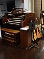 Keyboard of the organ in the chancel of Saint Anne's Episcopal Church. Located at 8 Kirk Street Lowell, Massachusetts.
 -
Chancel and altar of Saint Anne's Episcopal Church, as viewed from west. Located at 8 Kirk Street Lowell, Massachusetts.
-
 A chair with "Andrew" embroidered on the upholstery in the chancel of Saint Anne's Episcopal Church. Located at 8 Kirk Street Lowell, Massachusetts.
 -
 Portrait of Arthur Gayton Pollard (1843-1930) in the southeast corner room of the Lowell Masonic Temple. Located at 79 Dutton Street, Lowell, Massachusetts.


Sun Mar 23 15:06:42 EDT 2014[edit]
errors[edit]
- File:Rose_window,_Holy_Rosary_Church;_Lawrence,_MA;_2011-04-10.jpg aborted: exists: File:Rose_window,_Holy_Rosary_Church;_Lawrence,_MA;_2011-04-10.jpg
- File:Statue_atop_Holy_Rosary_Church;_Lawrence,_MA;_2011-04-10.jpg aborted: exists: File:Statue_atop_Holy_Rosary_Church;_Lawrence,_MA;_2011-04-10.jpg
- File:Stone_Mill,_Massachusetts_Historical_Commission_plaque;_Lawrence,_MA;_2011-04-10.jpg aborted: exists: File:Stone_Mill,_Massachusetts_Historical_Commission_plaque;_Lawrence,_MA;_2011-04-10.jpg
- File:Stone_Mill;_central_column_east_side;_Lawrence,_MA;_2011-04-10.jpg aborted: exists: File:Stone_Mill;_central_column_east_side;_Lawrence,_MA;_2011-04-10.jpg
- File:Stone_Mill;_east_and_north_sides;_Lawrence,_MA;_2011-04-10.jpg aborted: exists: File:Stone_Mill;_east_and_north_sides;_Lawrence,_MA;_2011-04-10.jpg
- File:Stone_Mill;_east_side_south_portion;_Lawrence,_MA;_2011-04-10.jpg aborted: exists: File:Stone_Mill;_east_side_south_portion;_Lawrence,_MA;_2011-04-10.jpg
-
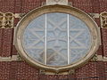 The rose window at the main entrance of Holy Rosary Church, located on the corner of Union Street and Essex Street in Lawrence, Massachusetts.
 -
 Statue atop Holy Rosary Church, located at the corner of Union Street and Essex Street in Lawrence, Massachusetts.
 -
 Stone Mill, Massachusetts Historical Commission plaque. It notes the Stone Mill was built in 1848. Located near 1 Canal Street, Lawrence, Massachusetts.
 -
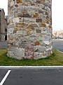
 Central column on the east side of Stone Mill, also known as the Essex Company Machine Shop. Located near 1 Canal Street, Lawrence, Massachusetts.
 -
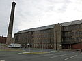
 Stone Mill, also known as Essex Company Machine Shop, located near 1 Canal Street, Lawrence, Massachusetts. East and north sides of building shown.
 -
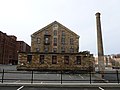
 South portion of the east side of Stone Mill, showing the mill's smoke tower. Located near 1 Canal Street, Lawrence, Massachusetts.
 -
 Stone Mill, located near 15 Union Street, Lawrence, Massachusetts. West and south sides of building shown.
 -
 Stone Mill, located near 15 Union Street, Lawrence, Massachusetts. Central portion of west side shown.
 -
 Stone Mill, located near 15 Union Street, Lawrence, Massachusetts. North portion of west side shown.
 -
 Stone Mill, located near 15 Union Street, Lawrence, Massachusetts. South-central portion of west side shown.
 -
 Stone Mill, located near 15 Union Street, Lawrence, Massachusetts.
 -
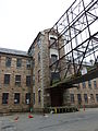 Interface of the skeleton of a raised bridge between Stone Mill and Essex Mills. Located near 15 Union Street, Lawrence, Massachusetts.
 -
 A circular window styled as a globe of Earth on top of the north side of Stone Mill. Located near 15 Union Street, Lawrence, Massachusetts.
 -
 High water mark plaque showing 1936 floodwater crest on the tower of Stone Mill. Located near 1 Canal Street, Lawrence, Massachusetts.
 -
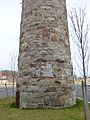
 Tower of the Stone Mill located near 1 Canal Street, Lawrence, Massachusetts. East side of structure shown.
 -
 Base of the tower adjacent to the Stone Mill located near 1 Canal Street, Lawrence, Massachusetts. East side of structure shown.
 -
 Base of the tower adjacent to the Stone Mill located near 1 Canal Street, Lawrence, Massachusetts. North side of structure shown.
 -
 Base of the tower adjacent to the Stone Mill located near 1 Canal Street, Lawrence, Massachusetts. South side of structure shown.
 -
 Base of the tower adjacent to the Stone Mill located near 1 Canal Street, Lawrence, Massachusetts. West side of structure shown.
 -
 Detail of the base of the tower adjacent to the Stone Mill located near 1 Canal Street, Lawrence, Massachusetts. North side of structure shown.
 -
 Stone Mill with Essex Mills in background. Essex Mills is located at 15 Union Street, Lawrence, Massachusetts. East sides of building shown.
 -
 Vigor in Arduis stone plaque on the north side of Holy Rosary Church. Located at the corner of Union Street and Essex Street in Lawrence, Massachusetts.
 -
 Wood Worsted Mills, located near 270 Merrimack Street, Lawrence, Massachusetts. West and south sides of building shown.
 -
 Sign for the Wood Worsted Mills, reading "Worsted Mills". Located near 270 Merrimack Street, Lawrence, Massachusetts.
 -
 Windows on the south side of Wood Worsted Mills. Located near 270 Merrimack Street, Lawrence, Massachusetts. Viewed from atop the McGovern Transportation Center.


Thu Mar 20 23:27:19 EDT 2014[edit]
-
 Placard for the North Canal Bridge Project, a project funded by the City of Lawrence, the Commonwealth of Massachusetts and the US Department of Housing and Urban Development. Located near 1 Canal Street, Lawrence, Massachusetts.
 -
 Looking east along North Canal from the Union Street bridge in Lawrence, Massachusetts.
 -
 A steel bridge over North Canal, as viewed when looking west fromthe Union Street in Lawrence, Massachusetts.
 -
The rose window at the main entrance of Holy Rosary Church, located on the corner of Union Street and Essex Street in Lawrence, Massachusetts.
-
 Detailed view of the north side of the skeleton of the bridge between Stone Mill and Everett Mills. Located near 15 Union Street, Lawrence, Massachusetts.
 -
 North side of the skeleton of the bridge between Stone Mill and Everett Mills. Located near 15 Union Street, Lawrence, Massachusetts.
 -
 South side of the skeleton of the bridge between Stone Mill and Everett Mills. Located near 15 Union Street, Lawrence, Massachusetts.
 -
Statue atop Holy Rosary Church, located at the corner of Union Street and Essex Street in Lawrence, Massachusetts.
-
Stone Mill, Massachusetts Historical Commission plaque. It notes the Stone Mill was built in 1848. Located near 1 Canal Street, Lawrence, Massachusetts.
-
 Main west side entrance of the Stone Mill, showing Massachusetts Historical Commission plaque at left and business tenant list at right. Located near 1 Canal Street, Lawrence, Massachusetts.
 -
Central column on the east side of Stone Mill, also known as the Essex Company Machine Shop. Located near 1 Canal Street, Lawrence, Massachusetts.
-
Stone Mill, also known as Essex Company Machine Shop, located near 1 Canal Street, Lawrence, Massachusetts. East and north sides of building shown.
-
 Stone Mill, east side central portion. Located near 1 Canal Street, Lawrence, Massachusetts.
 -
South portion of the east side of Stone Mill, showing the mill's smoke tower. Located near 1 Canal Street, Lawrence, Massachusetts.
-
 Stone Mill, located near 15 Union Street, Lawrence, Massachusetts. North and west sides of building shown
 -
 Stone Mill, located near 15 Union Street, Lawrence, Massachusetts. North side of building shown.
 -
 Stone Mill, located near 15 Union Street, Lawrence, Massachusetts. South and east sides of building shown.
 -
 Stone Mill, located near 15 Union Street, Lawrence, Massachusetts. South side of building shown.


Thu Mar 20 08:38:00 EDT 2014[edit]
-
 Looking east from atop the McGovern Transportation Center at 211 Merrimack Street, Lawrence, Massachusetts. The Haverhill/Reading MBTA commuter railroad is at right, and Worsted Mills are at left.
 -
 Looking south from atop the McGovern Transportation Center at 211 Merrimack Street, Lawrence, Massachusetts. An industrial complex is in the foreground. In the background are O'Connell South Common and south Lawrence.
 -
 Looking west over North Canal from a bridge, located near 1 Canal Street, Lawrence, Massachusetts. Canal Street is on the left, and Island Street is on the right.
 -
 Looking west over small canal about 1000 feet east of Stone Mill, near 1 Canal Street, Lawrence, Massachusetts. In the background seems to be a junction between this canal and another canal running roughly north-south.
 -
 Detailed view of the west side of Lucchesi Memorial Bridge, located at the intersection of Canal Street and Union Street in Lawrence, Massachusetts. The bridge is Union Street's crossing over North Canal.
 -
 West side of Lucchesi Memorial Bridge, located at the intersection of Canal Street and Union Street in Lawrence, Massachusetts. The bridge is Union Street's crossing over North Canal.
 -
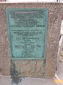 Lucchesi Memorial Bridge dedication plaque, located at the intersection of Canal Street and Union Street in Lawrence, Massachusetts . It reads, in part: DEDICATED TO THE MEMORY OF MARIO LUCCHESI PVT. CO. M. 23 RD INF., 2ND DIV. A. E. F. WHO WAS KILLED IN ACTION JUNE 6, 1918 AT BOURECHES, FRANCE
 -
 McGovern Transportation Center, located at 211 Merrimack Street, Lawrence, Massachusetts. East and north sides of building shown. This is the Lawrence MBTA station.
 -
 McGovern Transportation Center, located at 211 Merrimack Street, Lawrence, Massachusetts. North and west sides of building shown. This is the Lawrence MBTA station.
 -
 McGovern Transportation Center, located at 211 Merrimack Street, Lawrence, Massachusetts. West and south sides of building shown. This is the Lawrence MBTA station.
 -
 McGovern Transportation Center, and the Haverhill/Reading MBTA line. The McGovern building is the Lawrence MBTA station. West and south sides of building shown.


Wed Mar 19 23:46:20 EDT 2014[edit]
-
 The east and north sides of Everett Mills. Located at 15 Union Street, Lawrence, Massachusetts.
 -
 The north portion of the east side of Everett Mills. Located at 15 Union Street, Lawrence, Massachusetts.
 -
 The west side of Everett Mills as viewed from Essex Street. The mills are located at 15 Union Street, Lawrence, Massachusetts.
 -
 A helicopter landing at Lawrence General Hospital. A water tower is visible in the background.
 -
 A helicopter landing at Lawrence General Hospital.
 -
 The main entrance of Holy Rosary Church. Located on the corner of Essex Street and Union Street in Lawrence, Massachusetts.
 -
 The east and north sides of Holy Rosary Church. Located on the corner of Essex Street and Union Street in Lawrence, Massachusetts.
 -
 The north side of Holy Rosary Church. Located on the corner of Essex Street and Union Street in Lawrence, Massachusetts.
 -
 The west side of Lawrence General Hospital, viewed from a distance. The hospital is located at 1 General Street, Lawrence, Massachusetts.


Mon Nov 11 22:15:43 EST 2013[edit]
-
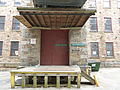 Beneath the interface of Stone Mill and the skeleton of an industrial bridge connecting the building with Everett Mills. Located near 15 Union Street, Lawrence, Massachusetts.
 -
 A water tower labeled "CITY OF LAWRENCE", located adjacent to Storrow Park near 75 High Street, Lawrence, Massachusetts.
 -
 A sign for Corpus Christi Parish, a Catholic Irish Community at Holy Rosary Church. Located on the corner of Essex Street and Union Street in Lawrence, Massachusetts.
 -
 Detail of the banks of North Canal during a period of low water.
 -
 Duck Bridge under repair. The bridge carries Union Street over the Merrimack River. A plaque visible at right indicates the bridge was built in 1888. It reads: BOSTON BRIDGE WORKS --- BUILDERS --- 1888 G.L. VOSE CONSULTING ENGINEER
 -
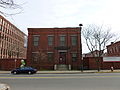 Essex Company Immigrant City Archives, located at 6 Essex Street Lawrence, Massachusetts.
 -
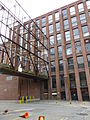 Interface between Everett Mills and the skeleton of an industrial bridge connecting the building with Stone Mill. Located at 15 Union Street, Lawrence, Massachusetts.
 -
 The east side of the central portion of the north building of Everett Mills, located at 15 Union Street, Lawrence, Massachusetts.
 -
 A 'space available' sign on the north side of Everett Mills -- the north building -- advertising 5,000 - 200,000 square feet of available space in the building. Located at 15 Union Street, Lawrence, Massachusetts.
 -
 Detailed view of the central column on the east side of the north building of Everett Mills. Located at 15 Union Street, Lawrence, Massachusetts.


Mon Nov 11 21:14:12 EST 2013[edit]
-
 Ayer Mills clock tower, the world's largest mill clock. Located on the corner of Merrimack Street and South Union Street in Lawrence, Massachusetts.

Mon Nov 11 21:11:15 EST 2013[edit]
-
 The east entrance of one of the Ayer Mills, located on the corner of Merrimack Street and the west side of South Union Street, in Lawrence, Massachusetts. Stone molding above the entrance reads "1909".

Thu Oct 10 18:54:17 EDT 2013[edit]
-
 The Franklin Delano Roosevelt Memorial in Washington, DC, closed during the US goverment shutdown of 2013.
 -
 Detailed view of the Franklin Delano Roosevelt Memorial in Washington, DC, closed during the US goverment shutdown of 2013.
 -
 The Jefferson Memorial in Washington, DC, closed during the US goverment shutdown of 2013.
 -
 The Korean War Memorial in Washington, DC, closed during the US government shutdown of 2013.
 -
 The Lincoln Memorial in Washington, DC, closed during the US government shutdown of 2013.
 -
 The Lincoln Memorial in Washington, DC, closed during the US government shutdown of 2013.
 -
 The Lincoln Memorial in Washington, DC, closed during the US government shutdown of 2013.
 -
 The Lincoln statue behind gates in the Lincoln Memorial in Washington, DC. The memorial was closed during the US government shutdown of 2013.
 -
 The Lincoln Memorial in Washington, DC, closed during the US government shutdown of 2013.
 -
Gates blocking the Martin Luther King, Jr. Memorial in Washington, DC. The memorial was closed during the US government shutdown of 2013.
-
 Gates blocking the north entrance of the Martin Luther King, Jr. Memorial in Washington, DC. The memorial was closed during the US government shutdown of 2013.
 -
 Gates blocking the west entrance of the Martin Luther King, Jr. Memorial in Washington, DC. The memorial was closed during the US government shutdown of 2013.
 -
 The lawn of National Mall with US Capitol in the background. The lawn was gated and closed during the US government shutdown of 2013.
 -
 A National Park Service information booth at the Lincoln Memorial in Washington, DC, closed during the US government shutdown of 2013.
 -
 Gates at the south entrance of the World War II Memorial in Washington, DC. National Park Service personnel can be seen guarding a narrow entrance, granting some limited access.
 -
 Gates blocking the main east entrance of the World War II Memorial in Washington, DC. The memorial was mostly closed during the US government shutdown of 2013.
 -
 The World War II Memorial in Washington, DC, which was mostly closed during the US government shutdown of 2013.
 -
 Gates blocking the north entrance to World War II memorial in Washington, DC. The memorial was mostly closed during the US government shutdown of 2013.
 -
 Gates blocking the north entrance to World War II memorial in Washington, DC. The memorial was mostly closed during the US government shutdown of 2013.
 -
 Gates mostly blocking the east entrance to the main north walkway of the Reflecting Pool in Washington, DC. The area was closed during the US government shutdown of 2013.
 -
 The south walkway along the perimeter of the Reflecting Pool in Washington, DC. The area was closed during the US government shutdown of 2013.
 -
 Gate blocking the east entrance to the Vietnam Veterans Memorial in Washington, DC. The memorial was technically closed during the US government shutdown of 2013, but National Park Service rangers did not enforce access prohibitions in this particular site.
 -
 A gate pushed over at the Washington Monument in Washington, DC. The grounds surrounding the monument were technically closed during the US government shutdown of 2013, but National Park Service rangers did not enforce access prohibitions in this particular site.
 -
 A gate pushed over at the Washington Monument in Washington, DC. The grounds surrounding the monument were technically closed during the US government shutdown of 2013, but National Park Service rangers did not enforce access prohibitions in this particular site.
 -
 The guarded south entrance to the Ellipse in Washington, DC. US Capitol Police enforce partial access restrictions at this site during the US government shutdown of 2013.
 -
 The Jefferson building of the Library of Congress in Washington, DC, closed during the US government shutdown of 2013.
 -
 An angled view of lights for the Washington Monument in Washington, DC
 -
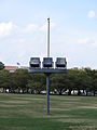 Lights for the Washington Monument in Washington, DC
 -
 The west (back) side of the Lincoln Memorial in Washington, DC, which was closed during the US government shutdown of 2013.
 -
 A view of the National Mall from the US Capitol during the US government shutdown of 2013.
 -
 The partially-gated west entrance to the Vietnam Veterans Memorial in Washington, DC. The memorial was technically closed during the US government shutdown of 2013, but National Park Service rangers did not enforce access prohibitions in this particular site.
 -
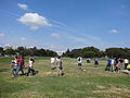 A US Capitol Police officer preventing access to the north portion of the Ellipse in Washington, DC during the US government shutdown of 2013
 -
 A US Capitol Police officer preventing access to the north portion of the Ellipse in Washington, DC during the US government shutdown of 2013
 -
 The Reflecting Pool and Washington Monument in Washington, DC, as viewed from the Lincoln Memorial. The sites were closed during the US government shutdown of 2013
 -
 US Senator Richard Burr's car, a 1974 Volkswagen, parked outside the Russell Senate Office Building in Washington, DC during the US government shutdown of 2013
 -
 US Senator Richard Burr's car, a 1974 Volkswagen, parked outside the Russell Senate Office Building in Washington, DC during the US government shutdown of 2013
 -
 The Arts of Peace, viewed perpendicularly from the beginning of Rock Creek and Potomac Parkway in Washington, DC
 -
 The Arts of War, viewed perpendicularly from the beginning of Arlington Memorial Bridge in Washington, DC
 -
 East side of the US Capitol during the US government shutdown of 2013
 -
 East side of the US Capitol during the US government shutdown of 2013
 -
 West side of the US Capitol during the US government shutdown of 2013
 -
 US Park Police aiding tourists at the Lincoln Memorial in Washington, DC. The memorial was closed during the US government shutdown of 2013.
 -
 A four wheeler of the US Park Police along the southern perimeter of the Lincoln Memorial in Washington, DC
 -
 A vehicle bearing the seal of the Vice President of the United States, parked on 3rd Street NW, Washington, DC during the US government shutdown of 2013
 -
 Visitors passing through a narrow entrance to the World War II Memorial. National Park Service personnel can be seen granting some limited access to the memorial during the US government shutdown of 2013.
 -
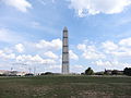 The west side of the Washington Monument in Washington, DC. The monument was scaffolded for repairs caused by an earthquake in 2011.
 -
 The north and west sides of the Washington Monument in Washington, DC. The monument was scaffolded for repairs caused by an earthquake in 2011. An informational plaque described the damage and its ongoing repair.


_side;_Washington,_DC;_2013-10-06.JPG)


Wed Aug 14 23:30:19 EDT 2013[edit]
-
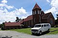 St. Matthew Baptist Church, located at 1164 Clover Road, Clover, Virginia. South and west (front) side of building shown. Henrietta Lacks was a member of this church.
 -
 Saint Matthew Baptist Church Cemetery (formally titled "James E. Green Memorial Gardens") near 1182 Mount Laurel Road, Clover, Virginia -- about 1000 feet from the intersection of Lacks Town Road and Mt Laurel Road. Viewed from east.
 -
 Saint Matthew Baptist Church Cemetery (formally titled "James E. Green Memorial Gardens") near 1182 Mount Laurel Road, Clover, Virginia -- about 1000 feet from the intersection of Lacks Town Road and Mt Laurel Road.
 -
 Gravestone of Stanley L Mosley, Senior. Located in Saint Matthew Baptist Church Cemetery (formally titled "James E. Green Memorial Gardens") near 1182 Mount Laurel Road, Clover, Virginia -- about 1000 feet from the intersection of Lacks Town Road and Mt Laurel Road.
 -
 A field of tobacco plants on a farm on the east side of the intersection between Mt Laurel Rd and Blounts Crossing Trail in Clover, Virginia.
 -
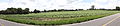 Panoramic view of a field of tobacco on a farm on the east side of the intersection between Mt Laurel Rd and Blounts Crossing Trail in Clover, Virginia.
 -
 Tobacco plants in rows on a farm on the east side of the intersection between Mt Laurel Rd and Blounts Crossing Trail in Clover, Virginia.
 -
 Gravestone of Tony Glenn Lacks (5/28/1965 - 1/16/2003) in Clover Cemetery. Located on Mt Laurel Road in Clover, Virginia about two miles west of that road's intersection with SR 92.
 -
 A tractor driving in a field on the south side of Clover Road (SR 92) in Clover, Virginia about two miles west of the road's crossing with the Roanoke River.
 -
 Train track level crossing on Mt Laurel Road in Clover, Virginia; looking north.
 -
 Train track level crossing on Mt Laurel Road in Clover, Virginia; looking south.
 -
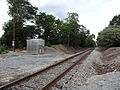 Train track level crossing on Mt Laurel Road in Clover, Virginia
 -
 A Verizon building and communications tower, located at 1005 Mt Laurel Road, Clover, Virginia
 -
 A turkey vulture perched atop communications tower at 1005 Mt Laurel Road, Clover, Virginia
 -
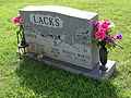 Gravestone of Watt Haley (2/8/1932 - 7/23/2000) and Rosalea Martin Lacks (8/30/1939 - ) in Clover Cemetery. Located on Mt Laurel Road in Clover, Virginia about two miles west of that road's intersection with SR 92.
 -
 Clover welcome sign, located near 216 North Main Street (SR 92), Clover, Virginia The sign reads: Welcome to the Town of Clover 1895
 -
 Detailed view of the west stack of Clover Power Station, located about 1.5 miles east northeast from the intersection of Black Walnut Road (SR 600) and Green Valley Road (SR 778) in Clover, Virginia. Viewed from the Clover Road (SR 92) entrance of the private road to the power plant. This coal power plant is operated by Dominion Virginia Power and went online in 1995.
 -
 The Womack family lot in Clover Baptist Church cemetery, located at 104 East Church Street, Clover, Virginia.
 -
 Zion Grove Baptist Church, located at 1007 Zion Grove Trail, Clover, Virginia. Northeast and northwest (front) sides of building shown.
 -
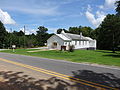 Zion Grove Baptist Church, located at 1007 Zion Grove Trail, Clover, Virginia. Northwest (front) and southwest sides of building shown.
 -
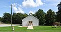 Zion Grove Baptist Church, located at 1007 Zion Grove Trail, Clover, Virginia. Northwest (front) side of building shown.
 -
 A sign for Zion Grove Baptist Church, located at 1007 Zion Grove Trail, Clover, Virginia.
_side,_detailed_view.JPG)


_sides;_Clover,_VA;_2013-07-14.JPG)
_and_southwest_sides;_Clover,_VA;_2013-07-14.JPG)
_side;_Clover,_VA;_2013-07-14.JPG)

Mon Aug 12 23:19:11 EDT 2013[edit]
errors[edit]
- File:Clover_Apostolic_Holiness_Church_sign.JPG aborted: exists: File:Clover_Apostolic_Holiness_Church_sign.JPG
-
 A sign for Clover Apostolic Holiness Church, located at 1049 Mt Laurel Road, Clover, Virginia.
 -
 Lacks Town Road (SR 789) at its intersection with Mt Laurel Road (SR 746). Lackstown is the name of the land that has been held by the (black) Lacks family since they received it from the (white) Lacks family, who had owned the ancestors of the black Lackses when slavery was legal. Henrietta Lacks lived in Lackstown, and is buried in a family cemetery there.
 -
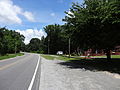 Looking north on Clover Road near Saint Matthew Church in Clover, Virginia.
 -
 Looking south near intersection of Main Street and West Church Street in Clover, Virginia
 -
 Looking south on North Main Street in Clover, Virginia
 -
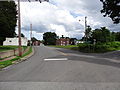 Looking toward Clover center (VA SR 92) from the train tracks on Mt Laurel Road (SR 746) in Clover, Virginia.
 -
 Looking toward town center on Mt Laurel Road (SR 746) in Clover, Virginia.
 -
 Gravestone of MR Womack in Clover Baptist Church cemetery, located at 104 East Church Street, Clover, Virginia.
 -
 A manhole cover of the Virginia Department of Highways (VDH) located near 1073 Mt Laurel Rd, Clover, Virginia.
 -
 A metal shed at a train track level crossing, located near 1000 Mt Laurel Road, Clover, Virginia.
 -
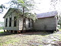 Old building at Bethel Grove Baptist Church cemetery, located near 6292 Mt Laurel Road, Clover, Virginia. East and north (back) sides shown. The building seems like it might have been an old school.
 -
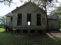 Old building at Bethel Grove Baptist Church cemetery, located near 6292 Mt Laurel Road, Clover, Virginia. East side shown. The building seems like it might have been an old school.
 -
 Old building at Bethel Grove Baptist Church cemetery, located near 6292 Mt Laurel Road, Clover, Virginia. North (back) and west sides shown. The building seems like it might have been an old school.
 -
 Old building at Bethel Grove Baptist Church cemetery, located near 6292 Mt Laurel Road, Clover, Virginia. North (back) side shown. The building seems like it might have been an old school.
 -
 Old building at Bethel Grove Baptist Church cemetery, located near 6292 Mt Laurel Road, Clover, Virginia. South (front) and east sides shown. The building seems like it might have been an old school.
 -
 Old building at Bethel Grove Baptist Church cemetery, located near 6292 Mt Laurel Road, Clover, Virginia. West and south (front) sides shown. The building seems like it might have been an old school.
 -
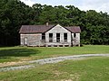 Old building at Bethel Grove Baptist Church cemetery, located near 6292 Mt Laurel Road, Clover, Virginia. West side shown. The building seems like it might have been an old school.
 -
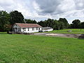 Old buildings near Clover Community Center, located at 1085 Mt Laurel Road, Clover, Virginia. These buildings seem like they might have formerly been schools.
 -
 A pasture immediately south of the intersection of Lacks Town Road (SR 789) and Mt Laurel Road (SR 746) in Clover, Virginia.
 -
 A road to Clover Power Station, viewed from Clover Road (SR 92) in Clover, Virginia. Smoke from the power station stacks can be discerned from background clouds at left. At right are signs for Dominion Virginia Power and Old Dominion Electric Cooperative.
 -
 Rose Lane's Beauty Shop, located at 110 South Main Street in Clover, Virginia. Soda vending machines are visible in the shade at left.
 -
 Rosie's Restaurant, a defunct eatery at the corner of Main Street (SR 92) and West Church Street in Clover, Virginia. East (front) side of building shown.
 -
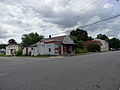 Rosie's Restaurant, a defunct eatery at the corner of Main Street (SR 92) and West Church Street in Clover, Virginia. South and east (front) sides of building shown.
 -
 Rosie's Restaurant, a defunct eatery at the corner of Main Street (SR 92) and West Church Street in Clover, Virginia. North and east (front) sides of building shown.
 -
 The street sign for Lacks Town Road (SR 746), at its intersection with Mt Laurel Road (SR 789). Lackstown is the name of the land that has been held by the (black) Lacks family since they received it from the (white) Lacks family, who had owned the ancestors of the black Lackses when slavery was legal. Henrietta Lacks lived in Lackstown, and is buried in a family cemetery there.
 -
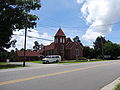 St. Matthew Baptist Church, located at 1164 Clover Road, Clover, Virginia. North and west (front) sides of building shown. Henrietta Lacks was a member of this church.
 -
 St. Matthew Baptist Church, located at 1164 Clover Road, Clover, Virginia. West (front) and south sides shown. Henrietta Lacks was a member of this church.
 -
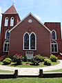 St. Matthew Baptist Church, located at 1164 Clover Road, Clover, Virginia. Detailed view of the west (front) side of the building. Henrietta Lacks was a member of this church.
 -
 St. Matthew Baptist Church, located at 1164 Clover Road, Clover, Virginia. West (front) side of building shown. Henrietta Lacks was a member of this church.


;_Clover,_VA;_2013-07-14.JPG)

_sides;_Clover,_VA;_2013-07-14.JPG)

_and_west_sides;_Clover,_VA;_2013-07-14.JPG)
_side;_Clover,_VA;_2013-07-14.JPG)
_and_east_sides;_Clover,_VA;_2013-07-14.JPG)
_sides;_Clover,_VA;_2013-07-14.JPG)


_side;_Clover,_VA;_2013-07-14.JPG)
_sides;_Clover,_VA;_2013-07-14.JPG)
_sides;_Clover,_VA;_2013-07-14.JPG)

_sides;_Clover,_VA;_2013-07-14.JPG)
_and_south_sides;_Clover,_VA;_2013-07-14.JPG)
_side,_detailed_view;_Clover,_VA;_2013-07-14.JPG)
_side;_Clover,_VA;_2013-07-14.JPG)
Sun Aug 11 20:17:38 EDT 2013[edit]
errors[edit]
- File:Clover_Apostolic_Holiness_Church_sign.JPG aborted: exists: File:Clover_Apostolic_Holiness_Church_sign.JPG
-
A sign for Clover Apostolic Holiness Church, located at 1049 Mt Laurel Road, Clover, Virginia.
-
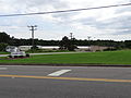 A complex of buildings for Clover Yarns, Inc. Located at 1030 Tanyard Branch Trail, Clover, Virginia.
 -
 The center of Clover, Virginia, near the intersection of South Main Street (SR 92) and Mt Laurel Road (SR 746).
 -
 A water tower in Clover, Virginia, located several meters to the west of Short Street, at the end of Virginia State Route 92.
 -
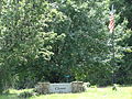 Clover welcome sign and an American flag, located near 216 North Main Street (SR 92), Clover, Virginia. The sign reads: Welcome to the Town of Clover 1895
 -
 Detailed view of a collapsed wooden building among trees. Located at the southwest corner of the intersection of Mt Laurel Road (SR 746) and Blounts Crossing Trail (SR 780).
 -
 A collapsed wooden building among trees. Located at the southwest corner of the intersection of Mt Laurel Road (SR 746) and Blounts Crossing Trail (SR 780).
 -
 Flowers in a basket on a tree in Clover Cemetery. The cemetery is located on Mt Laurel Road in Clover, Virginia about two miles west of that road's intersection with SR 92.
 -
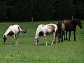 Four horses grazing in a pasture immediately south of the intersection of Lacks Town Road (SR 789) and Mt Laurel Road (SR 746).
 -
 Detailed view of the gravestone of Frank Lacks, Senior (10/10/1913 - 12/23/2003). The epitaph reads: "My Job Is Done!" Located in Saint Matthew Baptist Church cemetery (formally titled "James E. Green Memorial Gardens") near 1182 Mount Laurel Road, Clover, Virginia -- about 1000 feet from the intersection of Lacks Town Road and Mt Laurel Road.
 -
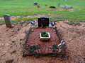 Gravestone of Frank Lacks, Senior (10/10/1913 - 12/23/2003). The epitaph reads: "My Job Is Done!" Located in Saint Matthew Baptist Church cemetery (formally titled "James E. Green Memorial Gardens") near 1182 Mount Laurel Road, Clover, Virginia -- about 1000 feet from the intersection of Lacks Town Road and Mt Laurel Road.
 -
 The Garden family lot in Clover Baptist Church cemetery, located at 104 East Church Street, Clover, Virginia.
 -
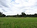 A grass field near 1021 Mount Laurel Road, Clover, Virginia
 -
 Bethel Grove Baptist Church cemetery, located near 6264 Mount Laurel Road, Clover, Virginia.
 -
 A Clover Fire Dept. hazmat wagon beneath a canopy. Located on North Gayle Street, Clover, Virginia.
 -
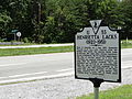 Henrietta Lacks historical marker, with Clover Road in background. The marker is located about 15 meters west of the intersection of James D. Hagood Highway (US 360) and Clover Road (SR 92)/Guill Town Road (SR 720). It reads: U53 HENRIETTA LACKS (1920 - 1951) Born in Roanoke on 1 Aug. 1920, Henrietta Pleasant lived here with relatives after her mother's 1924 death. She married David Lacks in 1941 and, like many other African Americans, moved to Baltimore, Md. for wartime employment. She died of cervical cancer on 4 Oct. 1951. Cell tissue was removed without permission (as usual then) for medical research. Her cells multipled and survived at an extraordinarily high rate, and are renowned worldwide as the "HeLa line," the "gold standard" of cell lines. Jonas Salk developed his polio vaccine with them. Henrietta Lacks, who in death saved countless lives, is buried nearby. Department of Historic Resources, 2010
 -
 Henrietta Lacks historical marker, located about 15 meters west of the intersection of James D. Hagood Highway (US 360) and Clover Road (SR 92)/Guill Town Road (SR 720). It reads: U53 HENRIETTA LACKS (1920 - 1951) Born in Roanoke on 1 Aug. 1920, Henrietta Pleasant lived here with relatives after her mother's 1924 death. She married David Lacks in 1941 and, like many other African Americans, moved to Baltimore, Md. for wartime employment. She died of cervical cancer on 4 Oct. 1951. Cell tissue was removed without permission (as usual then) for medical research. Her cells multipled and survived at an extraordinarily high rate, and are renowned worldwide as the "HeLa line," the "gold standard" of cell lines. Jonas Salk developed his polio vaccine with them. Henrietta Lacks, who in death saved countless lives, is buried nearby. Department of Historic Resources, 2010
 -
 Interior of the old building at Bethel Grove Baptist Church cemetery, located near 6292 Mt Laurel Road, Clover, Virginia. The building seems like it might have been an old school.
 -
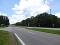 Intersection of US Route 360 and Clover Road (VA SR 92)/Guill Town Road (VA SR 720). The Henrietta Lacks historical marker can be seen in the background at left.
 -
 Jersey barriers blocking the Virginia State Route 92 road to an abandoned bridge over Roanoke River (also known as Staunton River) in Clover, Virginia.


;_Clover,_VA;_2013-07-14.JPG)

Sat Aug 10 23:26:54 EDT 2013[edit]
-
A sign for Clover Apostolic Holiness Church, located at 1049 Mt Laurel Road, Clover, Virginia.
-
 Clover Apostolic Holiness Church, located at 1049 Mt Laurel Road, Clover, Virginia. Southeast and northeast (front) sides; of building shown.
 -
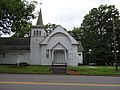 Entrance of Clover Apostolic Holiness Church. Located at 1049 Mt Laurel Road, Clover, Virginia. A small cemetery can be seen in the background at right.
 -
 Clover Baptist Church, located at 104 East Church Street, Clover, Virginia. North (back) and west sides of building shown.
 -
 Clover Baptist Church, located at 104 East Church Street, Clover, Virginia. South (front) and east sides of building shown.
 -
 Clover Baptist Church, located at 104 East Church Street, Clover, Virginia. South (front) side of building shown.
 -
 Clover Baptist Church, located at 104 East Church Street, Clover, Virginia. West and south (front) sides of building shown.
 -
 Clover Baptist Church, located at 104 East Church Street, Clover, Virginia. West side of building shown.
 -
 Clover Baptist Church cemetery, located immediately behind Clover Baptist Church at 104 East Church Street, Clover, Virginia.
 -
 A sign for Clover Baptist Church, located at 104 East Church Street, Clover, Virginia.
 -
 Clover Cemetery, located on Mt Laurel Road in Clover, Virginia about two miles west of that road's intersection with SR 92.
 -
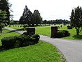 The east entrance of Clover Cemetery. Located on Mt Laurel Road in Clover, Virginia about two miles west of that road's intersection with SR 92.
 -
 Clover Community Center, located at 1085 Mt Laurel Road, Clover, Virginia. East and north (front) sides of building shown. The building was formerly Clover Elementary School.
 -
 Clover Community Center, located at 1085 Mt Laurel Road, Clover, Virginia. East and north (front) sides of building shown. The building was formerly Clover Elementary School.
 -
 Clover Community Center, located at 1085 Mt Laurel Road, Clover, Virginia. West and north (front) sides of building shown. The building was formerly Clover Elementary School.
 -
 Clover Community Center, located at 1085 Mt Laurel Road, Clover, Virginia, and two older buildings at left. East and north (front) sides of building shown. The community center was formerly Clover Elementary School. The two older buildings might have formerly been schools as well.
 -
 Entrance to Clover Community Center, with a sign above the door reading 'CLOVER ELEM SCHOOL'. Located at 1085 Mt Laurel Road, Clover, Virginia. The building was formerly Clover Elementary School.
 -
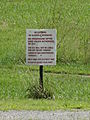 A 'no loitering' sign on the grounds of Clover Community Center. Located at 1085 Mt Laurel Road, Clover, Virginia.
 -
 The Clover Volunteer Fire Department building, and the department's hazmat wagon. Located on North Gayle Street, Clover, Virginia.
 -
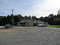 Clover General Store, located at 2237 Clover Road, Clover, Virginia. Southeast (front) and northeast sides of building shown.
 -
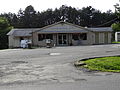 Clover General Store, located at 2237 Clover Road, Clover, Virginia. Southeast (front) side of building shown.
 -
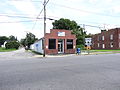 Clover Post Office, located at 101 South Main St, Clover, Virginia. North and west (front) sides of building shown.
 -
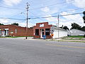 Clover Post Office, located at 101 South Main St, Clover, Virginia. West (front) and south sides of building shown.
 -
 Clover Post Office, located at 101 South Main St, Clover, Virginia. West (front) side of building shown.
 -
 Clover Post Office and Clover Pro Hardware. West (front) and south sides of buildings shown.
 -
 Stacks of Clover Power Station, located about 1.5 miles east northeast from the intersection of Black Walnut Road (SR 600) and Green Valley Road (SR 778) in Clover, Virginia. Viewed from the Clover Road (SR 92) entrance of the private road to the power plant. This coal power plant is operated by Dominion Virginia Power and went online in 1995.
 -
 Stacks of Clover Power Station, located about 1.5 miles east northeast from the intersection of Black Walnut Road (SR 600) and Green Valley Road (SR 778) in Clover, Virginia. Viewed from the Mt Laurel Road (SR 746) near Bethel Grove Baptist Church cemetery. This coal power plant is operated by Dominion Virginia Power and went online in 1995.
 -

-

-
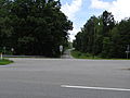 Looking north onto Clover Road (SR 92) at its intersection with James D. Hagood Highway (US 360) in Clover, Virginia
 -
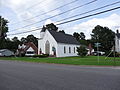 Clover United Methodist Church, located immediately north of the intersection of South Main Street/Clover Road (SR 92) and Mosely Ferry Road (SR T-716). Far view of west (front) and south sides of building shown.
 -
 Clover United Methodist Church, located immediately north of the intersection of South Main Street/Clover Road (SR 92) and Mosely Ferry Road (SR T-716). West (front) and south sides of building shown.
 -
 Clover United Methodist Church, located immediately north of the intersection of South Main Street/Clover Road (SR 92) and Mosely Ferry Road (SR T-716). West (front) side of building shown.
_sides;_Clover,_VA;_2013-07-14.JPG)

_and_west_sides;_Clover,_VA;_2013-07-14.JPG)
_and_east_sides;_Clover,_VA;_2013-07-14.JPG)
_side;_Clover,_VA;_2013-07-14.JPG)
_sides;_Clover,_VA;_2013-07-14.JPG)


_sides;_Clover,_VA;_2013-07-14.JPG)
_side;_Clover,_VA;_2013-07-14.JPG)
_sides;_Clover,_VA;_2013-07-14.JPG)


_and_northeast_sides;_Clover,_VA;_2013-07-14;_Clover,_VA;_2013-07-14.JPG)
_side;_Clover,_VA;_2013-07-14;_Clover,_VA;_2013-07-14.JPG)
_sides;_Clover,_VA;_2013-07-14.JPG)
_and_south_sides;_Clover,_VA;_2013-07-14.JPG)
_side;_Clover,_VA;_2013-07-14.JPG)


_and_south_sides,_far_view;_Clover,_VA;_2013-07-14.JPG)
_and_south_sides;_Clover,_VA;_2013-07-14.JPG)
_side;_Clover,_VA;_2013-07-14.JPG)
Sat Aug 10 20:29:31 EDT 2013[edit]
-
 An abandoned bridge of Virginia State Route 92 passing over Roanoke River (also known as Staunton River). Located in Clover, Virginia.
 -
 An 'Adopt a Highway' sign over showing the sponsorship of Lacks Town Rd by Saint Matthew Baptist Church. Located on Mt. Laurel St near its intersection with Lacks Town Road.
 -
 A basketball stand with a green painting of a clover on the backboard. Located behind the Clover Community Center, formerly Clover Elementary School, at 1085 Mt Laurel Rd, Clover, Virginia.
 -
 Bethel Grove Baptist Church, located on Mt Laurel Rd in Clover, Virginia almost a mile north of the road's intersection with Green Valley Rd. North and west (front) sides of building shown.
 -
 Bethel Grove Baptist Church, located on Mt Laurel Rd in Clover, Virginia almost a mile north of the road's intersection with Green Valley Rd. South and east (back) sides of building shown. Several old gravestones can be seen at right.
 -
 Bethel Grove Baptist Church, located on Mt Laurel Rd in Clover, Virginia almost a mile north of the road's intersection with Green Valley Rd. South side of building shown.
 -
 Bethel Grove Baptist Church, located on Mt Laurel Rd in Clover, Virginia almost a mile north of the road's intersection with Green Valley Rd. West (front) and south sides of building shown.
 -
 Bethel Grove Baptist Church, located on Mt Laurel Rd in Clover, Virginia almost a mile north of the road's intersection with Green Valley Rd. West (front) side of building shown.
 -
 Bethel Grove Baptist Church cemetery, located on Mt Laurel Rd in Clover, Virginia almost a mile north of the road's intersection with Llyod's Mill Rd (SR 780). Viewed from the northeast.
 -
 Bethel Grove Baptist Church cemetery, located on Mt Laurel Rd in Clover, Virginia almost a mile north of the road's intersection with Llyod's Mill Rd (SR 780).
 -
 An old cemetery in the south lawn of Bethel Grove Baptist Church. Located on Mt Laurel Rd in Clover, Virginia almost a mile north of the road's intersection with Green Valley Rd.
 -
 A sign for Bethel Grove Baptist Church, established in 1874. Located on Mt Laurel Rd in Clover, Virginia almost a mile north of the road's intersection with Green Valley Rd.
 -
 The intersection of Blounts Crossing Trail (SR 780) and Mt Laurel Road (SR 746) in Clover, Virginia. A tobacco farm is at left (east) and ruins of an old wooden building are at right (west)
 -
 Carols Beauty and Barber Shop, located at 112 North Main Street, Clover, Virginia.
 -
 A church van for Saint Matthew Baptist Church, located at or near 1158 Clover Rd (SR 92), Clover, Virginia. The van is a Ford Club Wagon (third generation).
 -
 Clover Apostolic Holiness Church, near 1027 Mt Laurel Road, Clover, Virginia. Northeast (front) and northwest sides of building shown.


_sides;_Clover,_VA;_2013-07-14.JPG)
_sides;_Clover,_VA;_2013-07-14.jpg)

_and_south_sides;_Clover,_VA;_2013-07-14.JPG)
_side;_2013-07-14;_Clover,_VA;_2013-07-14.JPG)


_and_northwest_sides;_Clover,_VA;_2013-07-14.JPG)
Sat Jan 26 16:44:48 EST 2013[edit]
-
 A media van from NBC News on the southwest US Capitol lawn, two days before the 2013 Presidential Inauguration.
 -
 People at the gates of the US Capitol two days before the 2013 Presidential Inauguration.
 -
 Stacks of protective covering for grass on the National Mall, two days before 2013 US Presidential Inauguration preparations
 -
 The US Capitol two days before 2013 Presidential Inauguration,with protective covering for National Mall grass in the foreground
 -
 The US Capitol two days before the public 2013 Presidential Inauguration
 -
 Workers installing protective covering over National Mall grass, two days before the 2013 US Presidenital Inauguration
 -
 Workers installing protective covering over National Mall grass, two days before the 2013 US Presidenital Inauguration


Sat Jan 26 14:08:03 EST 2013[edit]
-
 Close view of anti-abortion protester Rives Grogan perched high in a tree on the south lawn of the west face of the US Capitol during the 2013 US Presidential Inauguration. Viewed from First St SW just south of the midpoint between Peace Circle and Garfield Circle, Washington, DC.
 -
 Medium-range view of anti-abortion protester Rives Grogan perched high in a tree on the south lawn of the west face of the US Capitol during the 2013 US Presidential Inauguration. Viewed from First St SW just south of the midpoint between Peace Circle and Garfield Circle, Washington, DC.
 -
 Distant view of anti-abortion protester Rives Grogan perched high in a tree on the south lawn of the west face of the US Capitol during the 2013 US Presidential Inauguration. Viewed from First St SW just south of the midpoint between Peace Circle and Garfield Circle, Washington, DC.
 -
 People at the 2013 US Presidential Inauguration, with the US Capitol in the background. Viewed from First St SW just south of the midpoint between Peace Circle and Garfield Circle, Washington, DC.
 -
 The US Capitol viewed from Pennsylvania Ave and First St NW during the 2013 US Presidential Inauguration.
 -
 A crowd of people immediately northwest of the intersection between Pennsylvania Ave. and First St. NW during the 2013 US Presidential Inauguration.
 -
 A crowd of people waiting to go through the security tents operated by the Transportation Security Administration at the Orange Gate of the Capitol area during the 2013 US Presidential Inauguration. Taken near the intersection of First St. NW and Louisiana Ave. NW.
 -
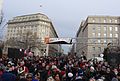 A crowd of people walking south toward the Orange Gate to get into the US Capitol area during the 2013 US Presidential Inauguration. Taken on First St. NW between C St. NW and Louisiana Ave. NW.
 -
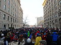 A crowd of people walking south toward the Orange Gate to get into the US Capitol area during the 2013 US Presidential Inauguration. Taken on First St. NW between D St. NW and C St. NW.
 -
 A sign directing ticket holders for the 2013 US Presidential Inauguration toward their color-coded destination areas around the Capitol. Located at the intersection of Columbus Circle Northeast and Louisiana Avenue NE, Washington, DC.
 -
 An SUV of the Federal Protective Service in southwest Washington, DC immediately after the 2013 US Presidential Inauguration.
 -
 US Army humvees immediately outside Union Station in Washington, DC during the 2013 US Presidential Inauguration.
 -
 Obverse side of a ticket to the 2013 US Presidential Inauguration Ceremonies
 -
 Reverse side of a ticket to the 2013 US Presidential Inauguration Ceremonies
 -
 Myrlie Evers-Williams delivering the invocation at the 2013 US Presidential Inauguration. Viewed from First St. SW just south of the midpoint between Peace Circle and Garfield Circle, Washington, DC.
 -
 A crowd of people entering Orange Gate of the Capitol area during the 2013 US Presidential Inauguration, with a row of white security tents operated by the Transportation Security Administration in the background. Taken near the intersection of First St. NW and Louisiana Ave. NW.
 -
 A placard listing prohibited items from the 2013 US Presidential Inauguration. Posted on the gate surrounding the perimeter of the US Capitol area.
 -
 Sasha and Malia Obama walking onto the inaugural platform during the 2013 US Presidential Inauguration. Viewed from First St. SW just south of the midpoint between Peace Circle and Garfield Circle, Washington, DC.
 -
 Teamsters headquarters and television media during the 2013 US Presidential Inauguration. Taken at the intersection of D St. NW and Lousiana Ave. NW.
 -
 Four members of the US Capitol Police at gates near the US Botanic Gardens during the 2013 US Presidential Inauguration.
 -
 US Capitol Police on bicycles during a corner, with police dog in background. Taken at the corner of C St NE and First St NE, Washington, DC.
 -
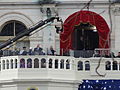 Senator Charles Schumer, Democrat from New York, speaking at the 2013 US Presidential Inauguration. Viewed from First St. SW just south of the midpoint between Peace Circle and Garfield Circle, Washington, DC.
 -
 Senator Lamar Alexandar, Republican from Tennessee, speaking at the 2013 US Presidential Inauguration. Viewed from First St. SW just south of the midpoint between Peace Circle and Garfield Circle, Washington, DC.
 -
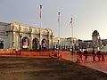 The front of Union Station during the 2013 US Presidential Inauguration
 -
 DC Fire Department ladder truck 10 on First St. SW between Maryland Ave. SW and Independence Ave. SW during the 2013 US Presidential Inauguration.


_speaking_at_2013_US_Presidential_Inauguration.JPG)
_speaking_at_2013_US_Presidential_Inauguration.JPG)


Tue Sep 18 22:26:35 EDT 2012[edit]
-
 Technical engineering drawing titled 'Apparatus Used in Gauging the Water at the Tremont Turbine' on display in the Tremont Yard basement of Jeanne D'Arc Credit Union Headquarters. The drawings are of the Tremont turbine made by James B. Francis, who experimented on the turbines in Tremont Yard in the late 19th century. Located near 1 Fremont Place, Lowell, Massachusetts.
 -
 Detailed view of a technical engineering drawing titled 'Apparatus Used in the Experiments on the Tremont Turbine' on display in the Tremont Yard basement of Jeanne D'Arc Credit Union Headquarters. The drawings are of the Tremont turbine made by James B. Francis, who experimented on the turbines in Tremont Yard in the late 19th century. Located near 1 Fremont Place, Lowell, Massachusetts.
 -
 Technical engineering drawing titled 'Apparatus Used in the Experiments on the Tremont Turbine' on display in the Tremont Yard basement of Jeanne D'Arc Credit Union Headquarters. The drawings are of the Tremont turbine made by James B. Francis, who experimented on the turbines in Tremont Yard in the late 19th century. Located near 1 Fremont Place, Lowell, Massachusetts.
 -
 Technical engineering drawing titled 'Hydro-Electric Plant at Merrimack Manufacturing Company, Tremont side' on display in the Tremont Yard basement of Jeanne D'Arc Credit Union Headquarters. The drawings are of the Tremont turbine made by James B. Francis, who experimented on the turbines in Tremont Yard in the late 19th century. Located near 1 Fremont Place, Lowell, Massachusetts.
 -
 'Keepers of the Gate' historical plaque. Located beside Tremont Gatehouse near 271 Father Morrisette Boulevard, Lowell, Massachusetts.
 -
 An old photograph labeled 'Northern Canal looking downstream from Cabot Street March 15 1927'. Located at Jean D'Arc Credit Union Headquarters near 1 Fremont Place, Lowell, Massachusetts.
 -
 'Quiet as the Grave' historical plaque, with Western Canal and then Wannalancit Mill in the background. Located across the canal from nearby 610 Suffolk Street, Lowell, Massachusetts.
 -
 Detailed view of 'Quiet as the Grave' historical plaque, with Western Canal and then Wannalancit Mill in the background. Located across the canal from nearby 610 Suffolk Street, Lowell, Massachusetts.
 -
 Monument titled 'The Worker' at the intersection of Market Street and Shattuck Street in Lowell, Massachusetts. East (front) side of monument shown.
 -
 Monument titled 'The Worker' at the intersection of Market Street and Shattuck Street in Lowell, Massachusetts. North side of monument shown. Markets Mills, formerly a building of the Lowell Manufacturing Company, is visible in the background.
 -
 Monument titled 'The Worker' at the intersection of Market Street and Shattuck Street in Lowell, Massachusetts. West side of monument shown.
 -
 An old photograph showing generators likely powered by Tremont turbines in Tremont Yard, on display in the Tremont Yard basement of Jeanne D'Arc Credit Union Headquarters. The caption at the bottom of the photograph reads "#3117 THREE OF THE FOUR GENERATORS IN THE TREMONT WHEEL HOUSE OF MILL NO. 2. JAN 19 1929." Located near 1 Fremont Place, Lowell, Massachusetts.


Mon Sep 03 15:06:58 EDT 2012[edit]
-
 A sign reading 'Welcome to Lowell, All American City' located near 240 Central Street, Lowell, Massachusetts. A restored Boston and Maine Railroad depot is visible in the background.
 -
 'Working the Water' historical plaque near Pawtucket Gatehouse, describing the work needed to operate Lowell's canals and the work of Pawtucket Gatehouse gatekeeper Daniel Brooks. The object pictured at the right of the plaque is a turbine within the Pawtucket Gatehouse. Located near the southeast end of O'Donnell Bridge in Lowell, Massachusetts.
 -
 End of the Hamilton Canal, located near 50 Jackson Street, Lowell, Massachusetts. The small Hamilton Wasteway Gatehouse is visible at left.
 -
 The final section of the Hamilton Canal, located near 50 Jackson Street, Lowell, Massachusetts.
 -
 The west side entrance of Hamilton Mill, located near 165 Jackson Street, Lowell, Massachusetts.
 -
 Mill 7 of the Hamilton Manufacturing Company, completed in 1920. Located at 27 Jackson Street, Lowell, Massachusetts.
 -
 Hamilton Mill 6, built in 1881, and the Hamilton Wasteway Gatehouse. Located near 50 Jackson Street, Lowell, Massachusetts. North and east sides of buildings shown.
 -
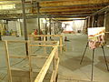 Interior of Hamilton Mill 6, built in 1881, being renovated for use as the Lowell Community Health Center.
 -
 The entrance of a Hamilton Mill viewed from the interior, looking south toward Jackson Street.
 -
 The exterior of Hamilton Mill 6 undergoing some renovation as it is prepared to be the Lowell Community Health Center.
 -
 Hamilton Wasteway Gatehouse, located on the east end of Hamilton Mill 6 at the end of the Hamilton Canal, near 50 Jackson Street, Lowell, Massachusetts. South and east sides of building shown.
 -
 Hamilton Wasteway Gatehouse, located on the east end of Hamilton Mill 6 at the end of the Hamilton Canal, near 50 Jackson Street, Lowell, Massachusetts. South side of building shown, with Hamilton Canal terminating beneath.
 -
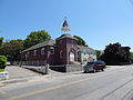 Iglesia Arca de Refugio, a Hispanic Pentecostal church located at 60 Lawrence Street, Lowell, Massachusetts. North and west (front) sides of building shown, with a church bus visible in the foreground.
 -
 Iglesia Arca de Refugio, a Hispanic Pentecostal church located at 60 Lawrence Street, Lowell, Massachusetts. West (front) and south sides of building shown, with a church bus visible at left.
 -
 Iglesia Arca de Refugio, a Hispanic Pentecostal church located at 60 Lawrence Street, Lowell, Massachusetts. West (front) side of building shown, with a church bus visible in the foreground.
 -
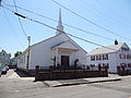 Igreja Adventista do Setimo Dia, a Portuguese Seventh Day Adventist church located at 211 Charles Street, Lowell, Massachusetts. East and north (front) sides of building shown.
 -
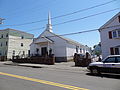 Igreja Adventista do Setimo Dia, a Portuguese Seventh Day Adventist church located at 211 Charles Street, Lowell, Massachusetts. North (front) and south sides of building shown.
 -
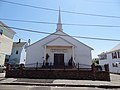 Igreja Adventista do Setimo Dia, a Portuguese Seventh Day Adventist church located at 211 Charles Street, Lowell, Massachusetts. North (front) side of building shown.
 -
 Kearney Bridge, Holy Trinity Church and, visible in the background, the main tower of Lowell City Hall. Kearney Bridge passes of the Lowell Canal System's Western Canal.
 -
 Dedication plaque for Kearney Bridge. The bridge was dedicated on December 3, 1963 and is named after Stephen J. Kearney, who was Lowell's city engineer for 51 years.
 -
 A connection overpassing Hamilton Canal between Hamilton Mill 6 and the Hamilton mill that abuts Jackson Street. Located near 165 Jackson Street, Lowell, Massachusetts.


;_east_and_south_sides;_Lowell,_MA;_2012-05-19.JPG)


_sides;_Lowell,_MA;_2012-05-19.JPG)
_and_south_sides;_Lowell,_MA;_2012-05-19.JPG)
_side;_Lowell,_MA;_2012-05-19.JPG)
_sides;_Lowell,_MA;_2012-05-19.JPG)
_and_south_sides;_Lowell,_MA;_2012-05-19.JPG)
_side;_Lowell,_MA;_2012-05-19.JPG)


Mon Sep 03 00:18:56 EDT 2012[edit]
-
 The beginning of the Northern Canal. Located at the southeast end of the O'Donnell Bridge in Lowell, Massachusetts.
 -
 Looking southeast along O'Donnell Bridge in Lowell, Massachusetts. The Pawtucket Gatehouse is visible just right of the bridge, and the Franco American School is visible in the background slightly to the left of the image's center.
 -
 Looking north toward the O'Donnell bridge at the intersection of School Street and Pawtucket Street in Lowell, Massachusetts. The Franco American School is visible at right.
 -
 A National Historic Mechanical Engineering Landmark plaque for the Pawtucket Gatehouse hydraulic turbine. Granted in 1983 by the American Society of Mechanical Engineers. Located on the northwest side of the Pawtucket Gatehouse near the southeast end of the O'Donnell Bridge in Lowell, Massachusetts. The plaque reads: NATIONAL HISTORIC MECHANICAL ENGINEERING LANDMARK PAWTUCKET GATEHOUSE HYDRAULIC TURBINE 1847 THE FIRST FRANCIS INWARD-FLOW WATER TURBINE PLACED IN SERVICE AND THE OLDEST IN EXISTENCE. THE FRANCIS TURBINE, DEVELOPED FROM THE HOWD, IS THE MOST WIDELY USED TURBINE IN SITUATIONS INVOLVING MEDIUM HEAD AND LARGE FLOW RATES. THIS TURBINE WAS DESIGNED TO LIFT, BY MEANS OF A BELT DRIVE, THE TEN HEAD GATES IN THE PAWTUCKET GATEHOUSE, WHICH CONTROL THE FLOW OF WATER FROM THE MERRIMACK RIVER INTO THE NORTHERN CANAL OF THE LOWELL HYDRAULIC CANAL SYSTEM. IT WAS USED UNTIL 1923, WHEN SUPERSEDED BY ELECTRIC-MOTOR DRIVE. DESIGNER AND INVENTOR: JAMES B. FRANCIS (1815-1892), CHIEF ENGINEER OF THE PROPRIETORS OF LOCKS AND CANALSFROM 1837 TO 1885. THE AMERICAN SOCIETY OF MECHANICAL ENGINEERS - 1985
 -
 National Park Service North Canal Walkway sign. Located near the southeast end of the O'Donnell Bridge in Lowell, Massachusetts
 -
 National Register of Historic Places plaque for Gatekeeper's House. Located adjacent to the Pawtucket Gatehouse at the southeast end of the O'Donnell Bridge in Lowell, Massachusetts.
 -
 O'Donnell Bridge dedication plaque, located at the northwest end of the O'Donnell Bridge at the intersection of Varnum Avenue and Mammoth Road in Lowell, Massachusetts.
 -
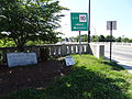 The stone dedication monument for the O'Donnell Bridge. Located at the northwest end of the O'Donnell Bridge at the intersection of Varnum Avenue and Mammoth Road in Lowell, Massachusetts.
 -
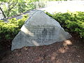 Detail of a memorial to Passaconnaway, a Native American leader of the Pennacook tribe (also known as the Merrimack or Pawtucket). The memorial reads: MEMORIAL TO PASSACONNAWAY CHIEF OF PAWTUCKET INDIANS NEAR THIS SPOT IN 1648 HE ACCEPTED CHRISTIANITY UNDER THE PREACHING OF JOHN ELIOT PRESENTED BY MOLLY VARNUM CHAPTER D A R GIVEN TO THE CITY OF LOWELL JUNE 11, 1935
 -
 A panorama of Pawtucket Falls and the Pawtucket Gatehouse. Located near the southeast end of the O'Donnell Bridge in Lowell, Massachusetts.
 -
 Pawtucket Falls viewed from the O'Donnell Bridge at intersection of School Street and Varnum Avenue. Located at the northwest end of the O'Donnell Bridge in Lowell, Massachusetts.
 -
 Pawtucket Falls viewed from the O'Donnell Bridge near the Pawtucket Gatehouse. Located near the southeast end of the O'Donnell Bridge in Lowell, Massachusetts.
 -
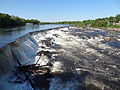 Pawtucket Falls viewed from the northeast side of the Pawtucket Gatehouse. Located near the southeast end of the O'Donnell Bridge in Lowell, Massachusetts.
 -
 Pawtucket Gatehouse and Pawtucket Falls viewed from near 49 Varnum Avenue, Lowell, Massachusetts. A Great Blue Heron (Ardea herodias) is visible in the half bottom of the photograph, just left of center. The Franco American School and, slightly to the right, the Spalding House can be discerned in the background.
 -
 Pawtucket Gatehouse, O'Donnell Bridge, Pawtucket Congregational Church and a 'Working the Water' historical plaque. Located near the the southeast end of the O'Donnell Bridge in Lowell, Massachusetts.
 -
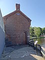 The entrance on the northwest side of the Pawtucket Gatehouse. The wall at the left is O'Donnell Bridge. Located near the the southeast end of the O'Donnell Bridge in Lowell, Massachusetts.
 -
 The entrance on the southeast side of the Pawtucket Gatehouse. Located near the the southeast end of the O'Donnell Bridge in Lowell, Massachusetts.
 -
 The northwest side of Pawtucket Gatehouse viewed at a perpendicular angle. Located near the the southeast end of the O'Donnell Bridge in Lowell, Massachusetts.
 -
 The southeast and northeast sides of the Pawtucket Gatehouse. Located near the the southeast end of the O'Donnell Bridge in Lowell, Massachusetts.
 -
 The southwest and southeast sides of the Pawtucket Gatehouse. Located near the the southeast end of the O'Donnell Bridge in Lowell, Massachusetts.
 -
 Detailed view of the swing-gated underpass of the very beginning of the Northern Canal of the Lowell Canal System, which is adjacent to the Pawtucket Gatehouse and runs beneath the O'Donnell Bridge. Located near the the southeast end of the O'Donnell Bridge in Lowell, Massachusetts.
 -
 The Pawtucket Gatehouse and O'Donnell Bridge viewed from the southeast. Located near the the southeast end of the O'Donnell Bridge in Lowell, Massachusetts.
 -
 A historical plaque on the southeast side of the Pawtucket Gatehouse. Located near the the southeast end of the O'Donnell Bridge in Lowell, Massachusetts.
 -
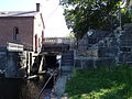 The swing-gated underpass of the O'Donnell Bridge, running adjacent to the Pawtucket Gatehouse. This is where the Merrimack River gets diverted into the Northern Canal of the Lowell Canal System. Located near the the southeast end of the O'Donnell Bridge in Lowell, Massachusetts.
 -
 Pawtucket Gatehouse underpass of O'Donnell Bridge, as viewed from water level. Northeast side shown. Located near the the southeast end of the O'Donnell Bridge in Lowell, Massachusetts.
 -
 Pawtucket Gatehouse underpass of O'Donnell Bridge, viewed from water level; southwest side. Located near the the southeast end of the O'Donnell Bridge in Lowell, Massachusetts.
 -
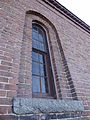 A window on the southwest side of the Pawtucket Gatehouse. Located near the the southeast end of the O'Donnell Bridge in Lowell, Massachusetts.
 -
 Pawtucket Pharmacy, located at the intersection of Pawtucket Street and School Street in Lowell, Massachusetts.
 -
 The Pawtucketville War Memorial, dedicated on May 30, 1951. Located near the intersection of Varnum Avenue and Mammoth Road in Lowell, Massachusetts.
 -
 The northeast side of the Spalding House. Located at 383 Pawtucket Street, Lowell, Massachusetts.
 -
 The northwest (back) side of the Spalding House. Located at 383 Pawtucket Street, Lowell, Massachusetts.
 -
 The northwest (back) side of the Spalding House, as viewed from the back walkway. Located at 383 Pawtucket Street, Lowell, Massachusetts.
 -
 The southeast (front) side of the Spalding House. Located at 383 Pawtucket Street, Lowell, Massachusetts.
 -
 The Spalding House; southwest and southeast (front) sides shown. Located at 383 Pawtucket Street, Lowell, Massachusetts.
 -
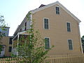 The southwest side of the Spalding House. Located at 383 Pawtucket Street, Lowell, Massachusetts.
 -
 Entrance to and sign for the Spalding House. Located at 383 Pawtucket Street, Lowell, Massachusetts.
 -
 Trash caught against the southwest side of the Pawtucket Gatehouse, caught by the current of the Merrimack River. Located near the southeast end of the O'Donnell Bridge in Lowell, Massachusetts.


_side;_Lowell,_MA;_2012-05-19.JPG)
_side_from_walkway;_Lowell,_MA;_2012-05-19.JPG)
_side;_Lowell,_MA;_2012-05-19.JPG)
_sides;_Lowell,_MA;_2012-05-19.JPG)


Sun Sep 02 15:44:57 EDT 2012[edit]
-
 'Damming the Merrimack' historical plaque at Pawtucket Gatehouse. Located on the northwest side of the Pawtucket Gatehouse, near the southeast end of the O'Donnell Bridge in Lowell, Massachusetts.
 -
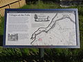 'Villages at the Falls' historical plaque outside the Spalding House. Located at 383 Pawtucket Street, Lowell, Massachusetts.
 -
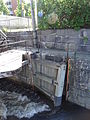 An engraving reading "1852" with a small symbol to its left on the entrance of the Pawtucket Gatehouse swing-gated underpass of the O'Donnell Bridge. Located on the southeast end of the O'Donnell Bridge in Lowell, Massachusetts.
 -
 Looking north on Mammoth Road. Pawtucket Congregational Church is clearly visible. Taken at that intersection of Varnum Avenue and Mammoth Road in Lowell, Massachusetts.
 -
 The brick and cement ceiling of Pawtucket Gatehouse swing-gated underpass of O'Donnell Bridge. Viewed from the northeast. This is the beginning of the Lowell Canal System's Northern Canal. Located beneath the southeast end of the O'Donnell Bridge in Lowell, Massachusetts.
 -
 The brick and cement ceiling of Pawtucket Gatehouse swing-gated underpass of O'Donnell Bridge. Viewed from the southwest. This is the beginning of the Lowell Canal System's Northern Canal. Located beneath the southeast end of the O'Donnell Bridge in Lowell, Massachusetts.
 -
 Detail of the 'Damming the Merrimack' historical plaque at Pawtucket Gatehouse. Located on the northwest side of the Pawtucket Gatehouse, near the southeast end of the O'Donnell Bridge in Lowell, Massachusetts.
 -
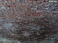 Detail of the brick portion of the ceiling of Pawtucket Gatehouse's swing-gated underpass of O'Donnell Bridge. Located beneath the southeast end of the O'Donnell Bridge in Lowell, Massachusetts.
 -
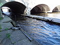 Detail of downstream gates of Pawtucket Gatehouse swing-gated underpass of O'Donnell Bridge. This is the beginning of the Lowell Canal System's Northern Canal. Located at the southeast end of the O'Donnell Bridge in Lowell, Massachusetts.
 -
 East side of O'Donnell Bridge viewed from water level. This is the beginning of the Lowell Canal System's Northern Canal. Located at the southeast end of the O'Donnell Bridge in Lowell, Massachusetts.
 -
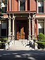 The front entrance of the Franco American School. Located at 357 Pawtucket Street, Lowell, Massachusetts.
 -
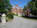 The Franco American School; southeast (front) and northeast sides of building shown. Located at 357 Pawtucket Street, Lowell, Massachusetts.
 -
 The Franco American School; southeast (front) side of building shown. Located at 357 Pawtucket Street, Lowell, Massachusetts.
 -
 The Franco American School; detailed view of southwest and southeast (front) shown. Located at 357 Pawtucket Street, Lowell, Massachusetts.
 -
 The Franco American School; southwest and southeast (front) sides shown. Located at 357 Pawtucket Street, Lowell, Massachusetts.
 -
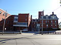 Franco American School; southwest side shown. Located at 357 Pawtucket Street, Lowell, Massachusetts.
 -
 The column capitals of the front entrance of the Franco American School. Located at 357 Pawtucket Street, Lowell, Massachusetts.
 -
 A sculptural flourish styling on a column at the front entrance of the Franco American School. Located at 357 Pawtucket Street, Lowell, Massachusetts.
 -
 Sign for the Franco American School. Located at 357 Pawtucket Street, Lowell, Massachusetts.
 -
 Franco American School viewed from across Pawtucket Street; southeast (front) side shown. Located at 357 Pawtucket Street, Lowell, Massachusetts.
 -
 Gatekeeper's House; northeast (front) side shown. Located at the southeast end of the O'Donnell Bridge in Lowell, Massachusetts.
 -
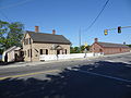 Gatekeeper's House and Pawtucket Gatehouse; southeast and northeast (front) sides shown. Located at the southeast end of the O'Donnell Bridge in Lowell, Massachusetts.
 -
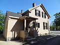 Gatekeeper's House and Pawtucket Gatehouse; southwest and southeast sides shown. Located at the southeast end of the O'Donnell Bridge in Lowell, Massachusetts.
 -
 Anterior view of a Great Blue Heron (Ardea herodias) hunting for fish at Pawtucket Falls in Lowell, Massachusetts.
 -
 A Great Blue Heron (Ardea herodias) in mid stride while hunting for fish at Pawtucket Falls in Lowell, Massachusetts.
 -
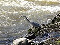 Side view of a Great Blue Heron (Ardea herodias) hunting for fish at Pawtucket Falls in Lowell, Massachusetts.


_and_northeast_sides;_Lowell,_MA;_2012-05-19.JPG)
_side;_Lowell,_MA;_2012-05-19.JPG)
_sides,_detail;_Lowell,_MA;_2012-05-19.JPG)
_sides;_Lowell,_MA;_2012-05-19.JPG)


_side;_Lowell,_MA;_2012-05-19.JPG)
_side;_Lowell,_MA;_2012-05-19.JPG)


Sat Sep 01 17:34:37 EDT 2012[edit]
-
 A stained glass window depicting the scene from Matthew 28:5-6 in which Mary Magdelene and two other women are told "He Is Risen" by an angel at Jesus's empty tomb. Located on the southeastern wall of the sanctuary of Pawtucket Congregational Church at 15 Mammoth Road, Lowell, Massachusetts. From the source linked below: "The Biblical images depicted in the four smaller windows beneath are a red cross with jeweled yellow points; water from a flowing rock; an open Bible with a lamb resting on it; and a golden crown with multi-colored jewels." More information: 2011 National Registry Nomination for Pawtucket Congregational Church
 -
 From the source linked below: "Additional stained glass windows appear in the Ladies’ Parlor and the chapel. In the Ladies’ Parlor is the third largest window in the church, donated by Christian Endeavor, the congregation’s young people’s organization in 1898. This window, located on the Mammoth Road elevation, depicts in the center panel the head of Christ; above is the text In My Father’s House Are Many Mansions. A symbol containing the letters CE for Christian Endeavor appears in two places on this window." Located on the southwestern wall of the Ladies' Parlor of Pawtucket Congregational Church at 15 Mammoth Road, Lowell, Massachusetts. More information: 2011 National Registry Nomination for Pawtucket Congregational Church
 -
 From the source linked below: "On the Mammoth Road elevation is The Good Shepard , illustrating Jesus carrying a lost sheep in a richly detailed landscape. The window is also known as the Mother’s Window; centered beneath the window is a marble memorial plaque inscribed with the names of mothers who lost children. The smaller memorial windows, on the same level as the plaque, depict Biblical images (from left to right): a cluster of golden fig blossoms (Parable of the Fig Tree), clusters of purple grapes (Parable of the Vine and the Branches), the Ark of the Covenant, and a white dove (coming of the Holy Spirit)." Located on the southwestern wall of the sanctuary of Pawtucket Congregational Church at 15 Mammoth Road, Lowell, Massachusetts. More information: 2011 National Registry Nomination for Pawtucket Congregational Church
 -
 The chancel and organ of Pawtucket Congregational Church, on the northeast wall of the sanctuary. A temporary extension to the chancel to make space for a play was almost complete at the time of this photograph; the extension is missing its center piece. Located at 15 Mammoth Road, Lowell, Massachusetts.
 -
 The back side of the church bell of Pawtucket Congregational Church. The bell is from the Revere Company and inscribed with the number 112; it was made in 1822. Taken from top level of the tower on the south side of the church. Located at 15 Mammoth Road, Lowell, Massachusetts.
 -
 The front side of the church bell of Pawtucket Congregational Church. The bell is from the Revere Company and inscribed with the number 112; it was made in 1822. Taken from top level of the tower on the south side of the church. Located at 15 Mammoth Road, Lowell, Massachusetts.
 -
 Detail of the front of the church bell of Pawtucket Congregational Church. The bell is from the Revere Company and inscribed with the number 112; it was made in 1822. Taken from top level of the tower on the south side of the church. Located at 15 Mammoth Road, Lowell, Massachusetts.
 -
 Looking up within bell chamber of south steeple tower of Pawtucket Congregational Church. Located at 15 Mammoth Road, Lowell, Massachusetts.
 -
 The National Register of Historic Places plaque for Pawtucket Congregational Church. The plaque reads: Pawtucket Congregational Church Established 1711 - Erected 1898 on site of 1797 church HAS BEEN PLACED ON THE NATIONAL REGISTER OF HISTORIC PLACES BY THE UNITED STATES DEPARTMENT OF THE INTERIOR 2007
 -
 The main entrance of Pawtucket Congregational Church. Southeast side of building shown.
 -
 The south steeple tower of Pawtucket Congregational Church. Southwest side of building shown.
 -
 Pawtucket Congregational Church, located at 15 Mammoth Road, Lowell, Massachusetts. Southwest and northwest (back) sides of building shown.
 -
 Pawtucket Congregational Church, located at 15 Mammoth Road, Lowell, Massachusetts. Southwest and southeast (front) sides of building shown, as from from across Varnum Avenue.
 -
 Pawtucket Congregational Church, located at 15 Mammoth Road, Lowell, Massachusetts. Southwest and southeast (front) sides of building shown.
 -
 Pawtucket Congregational Church, located at 15 Mammoth Road, Lowell, Massachusetts. Southwest side of building shown.
 -
 The sign of Pawtucket Congregational Church, located at 15 Mammoth Road, Lowell, Massachusetts.


_sides;_Lowell,_Massachusetts;_2012-05-19.JPG)
_sides_viewed_from_across_Varnum_Avenue;_Lowell,_Massachusetts;_2012-05-19.JPG)
_sides;_Lowell,_Massachusetts;_2012-05-19.JPG)


Mon Jul 16 03:59:13 EDT 2012[edit]
-
 A crowd of Wikimedians getting breakfast during a break between sessions at Wikimania 2012. Located in the cafeteria of the Marvin Center at George Washington University in Washington, DC.
 -
 Richard Boly, Director of the US State Department's Office of eDiplomacy, delivering an official greeting from the Department of State during the opening ceremony of Wikimania 2012. Located in the Lisner Auditorium of George Washington University in Washington, DC.
 -
 A sign language interpreter translating David Ferriero's speech at closing ceremony of Wikimania 2012. Located in the Lisner Auditorium of George Washington University in Washington, DC.


Mon Jul 16 03:48:09 EDT 2012[edit]
errors[edit]
- File:Richard_Boly;_Department_of_State_Greeting;_Wikimania_2012.JPG empty-file
- File:Sign_language_interpreter_translating_David_Ferriero's_speech_at_closing_ceremony;_Wikimania_2012 badfilename
- File:Friday_breakfast_crowd;_Wikimania_2012.JPG empty-file
-
 A full room of attendees of Erik Möller's presentation on 'The purpose-driven social network - Supporting WikiProjects with technology' at Wikimania 2012. Located in the Grand Ballroom of the Marvin Center at George Washington University in Washington, DC.
 -
 Brandon Harris unveiling a new user interface for content curation in a presentation by a panel of Wikimedia Foundation staff on 'Engaging editors on Wikipedia' at Wikimania 2012. Located in Room 310 of the Marvin Center at George Washington University in Washington, DC.
 -
 Brandon Harris answering questions in his presentation on 'The Athena Project: Wikipedia in 2015' at Wikimania 2012. Located in the Grand Ballroom of the Marvin Center at George Washington University in Washington, DC.
 -
 Brandon Harris presenting a new user interface for content curation in his presentation on 'The Athena Project: Wikipedia in 2015' at Wikimania 2012. Located in the Grand Ballroom of the Marvin Center at George Washington University in Washington, DC.
 -
 David Ferriero, 10th Archivist of the United States, delivery the closing plenary of Wikimania 2012. Located in the Lisner Auditorium at George Washington University in Washington, DC.
 -
 Erik Möller speaking about a visual redesign of WikiProject main pages in his presentation on 'The purpose-driven social network: Supporting WikiProjects with technology' at Wikimania 2012.
 -
 Erik Möller speaking social graphs and interest graphs in his presentation on 'The purpose-driven social network: Supporting WikiProjects with technology' at Wikimania 2012.
 -
 People associated with the Wikimedia Foundation at the closing ceremony of Wikimania 2012.
 -
 Howie Fung beginning a presentation on 'Engaging editors on Wikipedia' at Wikimania 2012. Located in room 310 of the Marvin Center at George Washington University in Washington, DC.
 -
 James Hare thanking partners and collaborators during the opening ceremony of Wikimania 2012. Located in the Lisner Auditorium of George Washington University in Washington, DC.
 -
 Wikipedians and other Wikimedians on laptops during the closing ceremony of Wikimania 2012. Located in the Lisner Auditorium of George Washington University in Washington, DC.
 -
 Mary Gardiner beginning the opening ceremony's keynote speech on 'Fostering diversity: not a boring chore, a critical opportunity' at Wikimania 2012. Located in the Lisner Auditorium of George Washington University in Washington, DC.
 -
 Nicholas Bashour and James Hare announcing that Wikimania 2012 had "Nearly 1,400 registered attendees". Located in the Lisner Auditorium of George Washington University in Washington, DC.
 -
 The organizing committee of Wikimania 2013, Hong Kong assembled together at the closing ceremony of Wikimania 2012. Located in the Lisner Auditorium of George Washington University in Washington, DC.
 -
 A panel of Wikimedia Foundation staff for the 'Engaging editors on Wikipedia' presentation at Wikimania 2012. From left to right: Oliver Keyes, Brandon Harris, Karyn Gladstone, Fabrice Florin and Howie Fung. Located in room 310 of the Marvin Center of George Washington University in Washington, DC.
 -
Richard Boly, Director of the US State Department's Office of eDiplomacy, delivering an official greeting from the Department of State during the opening ceremony of Wikimania 2012. Located in the Lisner Auditorium of George Washington University in Washington, DC.
-
 A sign language interpreter at the closing ceremony of Wikimania 2012. Located in the Lisner Auditorium of George Washington University in Washington, DC.
 -
Sign language interpreter translating David Ferriero's speech at the closing ceremony of Wikimania 2012. Located in the Lisner Auditorium of George Washington University in Washington, DC.
-
 Nicholas Bashour thanking Katie Filbert during Wikimania 2012's closing ceremony for her work in helping to organize the event. Located in the Lisner Auditorium of George Washington University in Washington, DC.
 -
A crowd of Wikimedians getting breakfast during a break between sessions at Wikimania 2012. Located in the cafeteria of the Marvin Center at George Washington University in Washington, DC.
-
 A view from the back of the crowd of the Wikimania 2012 group shot of all attendees taken immediately after the closing ceremony.
 -

-
 A side angle view of the Wikimania 2012 group shot of all attendees taken immediately after the closing ceremony. Taken about 15-30 seconds after the last professional photograph taken from the ladder.


Tue May 22 01:33:43 EDT 2012[edit]
-
 A stained glass window in Saint Patrick Church depicting "Saint Patrick Teaching the Chieftains at Tara". This stained is the main window on the front of the church. Located at 284 Suffolk Street, Lowell, Massachusetts.
 -
 A stained glass window in Saint Patrick Church depicting a shepherd, situated on the east wall of the narthex of Saint Patrick Church. Located at 284 Suffolk Street, Lowell, Massachusetts.
 -
 A side altar of Jesus appearing to a nun in Saint Patrick Church. Located at 284 Suffolk Street, Lowell, Massachusetts.
 -
 A side altar of Virgin Mary appearing to a monk in Saint Patrick Church in Saint Patrick Church. Located at 284 Suffolk Street, Lowell, Massachusetts.
 -
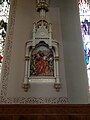 "Simon of Cyrene helps Jesus to carry the cross", station 5 of the Stations of the Cross. Located in Saint Patrick Church at 284 Suffolk Street, Lowell, Massachusetts.
 -
 The south thirds of the narthex of Saint Patrick Church. Located at 284 Suffolk Street, Lowell, Massachusetts.
 -
 The interior of the the south wall of Saint Patrick Church. The stained glass windows depict several of the Glorious Mysteries of the Rosary. Between the windows are several Stations of the Cross. Located at 284 Suffolk Street, Lowell, Massachusetts.
 -
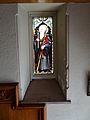 A stained glass window on south side of east wall of narthex of Saint Patrick Church. Located at 284 Suffolk Street, Lowell, Massachusetts.
 -
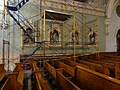 Stations of the cross XI through XIV in Saint Patrick Church behind scaffolding. (The scaffolding is for repair work being done on the stained glass window above these stations.) Located at 284 Suffolk Street, Lowell, Massachusetts.
 -
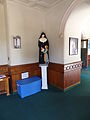 A statue of a nun and a child, and a food donation container, in the narthex of Saint Patrick Church. The nun's text is in French. The food donation container has text in both English and Spanish.
 -
 The steeple of Saint Patrick Church. It is Gothic Revival in architectural style. Located at 284 Suffolk Street, Lowell, Massachusetts.
 -
 A stained glass window in Saint Patrick Church depicting "The Annunciation", one of the five Joyful Mysteries of the Roman Catholic rosary. Located at 284 Suffolk Street, Lowell, Massachusetts.
 -
 A stained glass window in Saint Patrick Church depicting "The Ascension of Jesus Christ", one of the five Glorious Mysteries of the Roman Catholic rosary. Located at 284 Suffolk Street, Lowell, Massachusetts.
 -
 A stained glass window in Saint Patrick Church depicting "The Assumption of Virgin Mary", one of the five Glorious Mysteries of the Roman Catholic rosary. Located at 284 Suffolk Street, Lowell, Massachusetts.
 -
 A stained glass window in Saint Patrick Church depicting "The Carrying of the Cross", one of the five Sorrowful Mysteries of the Roman Catholic rosary. Located at 284 Suffolk Street, Lowell, Massachusetts.
 -
 A stained glass window in Saint Patrick Church depicting "The Coronation of the Virgin Mary", one of the five Glorious Mysteries of the Roman Catholic rosary. Located at 284 Suffolk Street, Lowell, Massachusetts.
 -
 A stained glass window in Saint Patrick Church depicting "The Crowning with Thorns", one of the five Sorrowful Mysteries of the Roman Catholic rosary. Located at 284 Suffolk Street, Lowell, Massachusetts.
 -
 A stained glass window in Saint Patrick Church depicting "The Descent of the Holy Spirit", also known as Pentecost, one of the five Glorious Mysteries of the Roman Catholic rosary. Located at 284 Suffolk Street, Lowell, Massachusetts.
 -
 A stained glass window in Saint Patrick Church depicting "The Resurrection", one of the five Glorious Mysteries of the Roman Catholic rosary. Located at 284 Suffolk Street, Lowell, Massachusetts.
 -
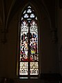 A stained glass window in Saint Patrick Church depicting "The Scourging at the Pillar", one of the five Sorrowful Mysteries of the Roman Catholic rosary. Located at 284 Suffolk Street, Lowell, Massachusetts.
 -
 A stained glass window in Saint Patrick Church depicting "The Resurrection", one of the five Joyful Mysteries of the Roman Catholic rosary. Located at 284 Suffolk Street, Lowell, Massachusetts.
 -
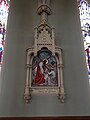 "Veronica wipes the face of Jesus", station 6 of the Stations of the Cross. Located in Saint Patrick Church at 284 Suffolk Street, Lowell, Massachusetts.
 -
 Votive candles in Saint Patrick Church. Located at at 284 Suffolk Street, Lowell, Massachusetts.
 -
 A wall-mounted lamp the the narthex of Saint Peter Church. Located at at 284 Suffolk Street, Lowell, Massachusetts.
;_Lowell,_MA;_2012-05-19.JPG)


Tue May 22 00:22:54 EDT 2012[edit]
-
 A lamp in the north third of the narthex of Saint Patrick Church. Located at 284 Suffolk Street, Lowell, Massachusetts.
 -
 A lamp in the nave of Saint Patrick Church. Located at 284 Suffolk Street, Lowell, Massachusetts.
 -
 The lecturn of Saint Patrick Church. Located at 284 Suffolk Street, Lowell, Massachusetts.
 -
 The nave and altar of Saint Patrick Church. Located at 284 Suffolk Street, Lowell, Massachusetts.
 -
 The nave of Saint Patrick Church viewed from near the altar. Located at 284 Suffolk Street, Lowell, Massachusetts.
 -
 A door to the santuary of Saint Patrick Church in the north third of the narthex. Located at 284 Suffolk Street, Lowell, Massachusetts.
 -
 The interior of the the north wall of Saint Patrick Church. The stained glass windows depict several of the Joyful Mysteries of the Rosary. Between the windows are several Stations of the Cross. Located at 284 Suffolk Street, Lowell, Massachusetts.
 -
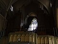 The organ of Saint Patrick Church. Visible in the middle of the image is a stained glass window depicting Saint Patrick Teaching the Chieftains at Tara. Located at 284 Suffolk Street, Lowell, Massachusetts.
 -
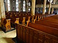 Pews in Saint Patrick Church. Located at 284 Suffolk Street, Lowell, Massachusetts.
 -
 Pews in Saint Patrick Church viewed in parallel. Located at 284 Suffolk Street, Lowell, Massachusetts.
 -
 A stained glass window in Saint Patrick Church depicting "The Presentation of Jesus at the Temple", one of the five Joyful Mysteries of the Roman Catholic rosary. Located at 284 Suffolk Street, Lowell, Massachusetts.
 -
 Repair of The Resurrection stained glass window in south transept wall of Saint Patrick Church. Three craftsmen can be seen on the scaffolding. Located at 284 Suffolk Street, Lowell, Massachusetts.
 -
 Repair of The Resurrection stained glass window in south transept wall of Saint Patrick Church. Located at 284 Suffolk Street, Lowell, Massachusetts.
 -
 Saint Patrick Church, located at 284 Suffolk Street, Lowell, Massachusetts. East (front) side shown.
 -
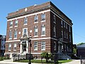 The rectory of Saint Patrick Church, located at 282 Suffolk Street, Lowell, Massachusetts. East (front) and north sides shown.


Mon May 21 23:04:21 EDT 2012[edit]
-
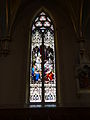 A stained glass window in Saint Patrick Church depicting "Jesus among the doctors", one of the five Joyful Mysteries of the Roman Catholic rosary. Located at 284 Suffolk Street, Lowell, Massachusetts.
 -
 A stained glass window in Saint Patrick Church depicting Jesus appearing as a child to a monk. Located at 284 Suffolk Street, Lowell, Massachusetts.
 -
 "Jesus comforts the women of Jerusalem", station 8 of the Stations of the Cross. Located in Saint Patrick Church at 284 Suffolk Street, Lowell, Massachusetts.
 -
 "Jesus dies on the cross", station 12 of the Stations of the Cross. Located in Saint Patrick Church at 284 Suffolk Street, Lowell, Massachusetts.
 -
 "Jesus falls a second time", station 7 of the Stations of the Cross. Located in Saint Patrick Church at 284 Suffolk Street, Lowell, Massachusetts.
 -
 "Jesus falls the first time", station 3 of the Stations of the Cross. Located in Saint Patrick Church at 284 Suffolk Street, Lowell, Massachusetts.
 -
 "Jesus is condemned to death", station 1 of the Stations of the Cross. Located in Saint Patrick Church at 284 Suffolk Street, Lowell, Massachusetts.
 -
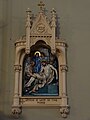 "Jesus is laid in the tomb", station 14 of the Stations of the Cross. Located in Saint Patrick Church at 284 Suffolk Street, Lowell, Massachusetts.
 -
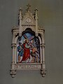 "Jesus is made to bear his cross", station 2 of the Stations of the Cross. Located in Saint Patrick Church at 284 Suffolk Street, Lowell, Massachusetts.
 -
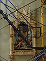 "Jesus is nailed to the cross", station 11 of the Stations of the Cross. Located in Saint Patrick Church at 284 Suffolk Street, Lowell, Massachusetts.
 -
 "Jesus is taken down from the cross", station 13 of the Stations of the Cross. Located in Saint Patrick Church at 284 Suffolk Street, Lowell, Massachusetts.
 -
 "Jesus meets his blessed mother", station 4 of the Stations of the Cross. Located in Saint Patrick Church at 284 Suffolk Street, Lowell, Massachusetts.


Mon May 21 21:12:11 EDT 2012[edit]
-
 The Gothic Revival-style altar of Saint Patrick Church, viewed at a slight angle. Located at 284 Suffolk Street, Lowell, Massachusetts.
 -
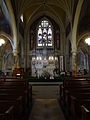 The Gothic Revival-style altar of Saint Patrick Church. Located at 284 Suffolk Street, Lowell, Massachusetts.
 -
 The ceiling of Saint Patrick Church, viewed from near the altar and toward the main entrance. The ceiling is supported by ribbed vaults. Clerestory windows are visible along the both sides of the length of the nave, with murals immediately below. Located at 284 Suffolk Street, Lowell, Massachusetts.
 -
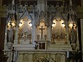 Detailed view of the Gothic Revival-style altar of Saint Patrick Church. Located at 284 Suffolk Street, Lowell, Massachusetts.
 -
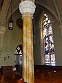 Detailed view of a column in Saint Patrick Church. This column is on the northern half of the church's transept. Located at 284 Suffolk Street, Lowell, Massachusetts.
 -
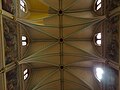 Detailed view of the ceiling of the nave of Saint Patrick Church. Viewed perpendicularly to the ground; straight up toward the ceiling. The ceiling is supported by ribbed vaults. Clerestory windows are visible along the both sides of the length of the nave, with murals immediately below. Located at 284 Suffolk Street, Lowell, Massachusetts.
 -
 Detail of rib vault on the south aisle in Saint Patrick Church. Located at 284 Suffolk Street, Lowell, Massachusetts.
 -
 Early pastors of Saint Patrick Church in Lowell, Massachusetts. Clockwise from top right: Father John O'Brien (of "Father John's Medicine" fame), Father Timothy O'Brien, Father William, and Father William O'Brien.
 -
 A hidden squirrel in the capital of a column in Saint Patrick Church. This column is situated on the south side of the intersection of the transcept and the nave. Located at 284 Suffolk Street, Lowell, Massachusetts.
 -
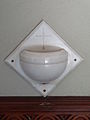 A stoup, i.e. a holy water font, in the narthex of Saint Patrick Church. Located at 284 Suffolk Street, Lowell, Massachusetts.
 -
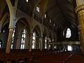 The nave of Saint Patrick Church, viewed from the the edge of the south end of the transcept. Located at 284 Suffolk Street, Lowell, Massachusetts.


Mon Mar 05 23:34:54 EST 2012[edit]
-
 The altar of Saint Anne's Episopal Church. Located at 8 Kirk Street, Lowell, Massachusetts.
 -
 A stained glass window depicting the angel Gabriel's annunciation to Virgin Mary. Installed in 1873. Located on the north end of the east wall of Saint Anne's Episcopal Church at 8 Kirk Street, Lowell, Massachusetts.
 -
 A baptismal font at Saint Anne's Episcopal Church. Located at 8 Kirk Street, Lowell, Massachusetts.
 -
 A stained glass window depicting the birth of Christ. Installed in 1873. Located in the middle of the east wall of Saint Anne's Episcopal Church at 8 Kirk Street, Lowell, Massachusetts.
 -
 Devotion and Charity stained glass window, installed in 1872. Located on at the north end of the west wall of Saint Anne's Episcopal Church at 8 Kirk Street Lowell, Massachusetts.
 -
 The foyer entrance of Saint Anne's Episcopal Church. Located at 8 Kirk Street Lowell, Massachusetts.
 -
 Looking toward altar from entrance of Saint Anne's Episcopal Church. Located at 8 Kirk Street Lowell, Massachusetts.
 -
 Looking toward altar from middle of Saint Anne's Episcopal Church. Located at 8 Kirk Street Lowell, Massachusetts.
 -
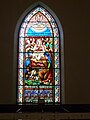 A stained glass window depicting Pentecost. Installed in 1873. Located in the middle of the west wall of Saint Anne's Episcopal Church at 8 Kirk Street Lowell, Massachusetts.
 -
 A stained glass window depicting Saint Luke. Installed in 1893. Located on the south end of the east wall of Saint Anne's Episcopal Church at 8 Kirk Street Lowell, Massachusetts.
 -
 A stained glass window depicting Virgin Mary (right) and Saint Agnes (left). Installed in 1920. Located on the south end of the west wall of Saint Anne's Episcopal Church at 8 Kirk Street Lowell, Massachusetts.
 -
 A stained glass window depicting Saint Peter. Installed in 1892. Located in on the east side of the south wall of Saint Anne's Episcopal Church at 8 Kirk Street Lowell, Massachusetts.
 -
 A stained glass window memorializing all the members of Saint Anne's Episcopal Church who served the country in wartime. Installed in 1950. Located on the west side of the south wall of Saint Anne's Episcopal Church at 8 Kirk Street, Lowell, Massachusetts.


Mon Mar 05 21:14:49 EST 2012[edit]
-
 A summary of Ellen Rothenberg's artwork 'Industry, Not Servitude!' installed at Lucy Larcom Park. Part of the Lowell National Historical Park, located near Merrimack Street in Lowell, Massachusetts.
 -
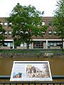 'Life on the Corporation', a panel describing life in company-owned boardinghouses in the first half of the 1800's. Located in Lucy Larcom Park, part of the Lowell National Historical Park, near Merrimack Street in Lowell, Massachusetts. The Merrimack Canal and Lowell High School are visible in the background.
 -
 Detailed view of 'Life on the Corporation', a panel describing life in company-owned boardinghouses in the first half of the 1800's. Located in Lucy Larcom Park, part of the Lowell National Historical Park, near Merrimack Street in Lowell, Massachusetts. The Merrimack Canal and Lowell High School are visible in the background.
 -
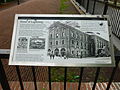 'Street of Lightning', a panel describing early railroad operations of the Boston and Lowell Railroad and the Boston and Maine Railroad in Lowell in the 1800's. The panel is scribbled with vandalism.
 -
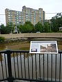 'The Birth of an Industrial City', a panel describing the opening and significance of the mills of the Merrimack Manufacturing Company. Located immediately north of 1 Father Morissette Boulevard, Lowell, Massachusetts.
 -
 Detailed view of 'The Birth of an Industrial City', a panel describing the opening and significance of the mills of the Merrimack Manufacturing Company. Located immediately north of 1 Father Morissette Boulevard, Lowell, Massachusetts.
 -
 The back side of a 14 hour clock monument at Lucy Larcom Park, made by Ellen Rothenberg in 1996. The work memorializes the "10 hour movement" of the early 1800's, spearheaded by female workers in Lowell. An inscription that circles along the clock's perimeter reads: PETITION TO THE MASSACHUSETTS LEGISLATURE "THE UNDERSIGNED PEACEABLE, INDUSTRIOUS AND HARDWORKING MEN AND WOMEN OF LOWELL, IN VIEW OF OUR CONDITION, THE EVILS ALREADY COME UPON US, BY TOILING FROM 13 TO 14 HOURS PER DAY, CONFINED IN UNHEALTHY APARTMENTS, EXPOSED TO THE POISONOUS CONTAGION OF AIR, VEGETABLE, ANIMAL AND MINERAL PROPERTIES, DEBARRED FROM PROPER PHYSICAL EXERCISE, MENTAL DISCIPLINE AND MASTICATION CRUELLY LIMITED, AND THEREBY HASTENING US ON THROUGH PAIN, DISEASE AND PRIVATION, DOWN TO A PREMATURE GRAVE, PRAY THE LEGISLATURE TO INSTITUTE A 10 HOUR WORKING DAY IN ALL OF THE FACTORIES OF THE STATE. SIGNED J.O. ADAMS THAYER SARAH G. BAGLEY JAMES CARLE AND 2,000 OTHERS MOSTLY WOMEN VOICE OF INDUSTRY JANUARY 15, 1845
 -
 The front side of a 14 hour clock monument at Lucy Larcom Park, made by Ellen Rothenberg in 1996. The work memorializes the "10 hour movement" of the early 1800's, spearheaded by female workers in Lowell. An inscription that circles along the clock's perimeter reads: PETITION TO THE MASSACHUSETTS LEGISLATURE "THE UNDERSIGNED PEACEABLE, INDUSTRIOUS AND HARDWORKING MEN AND WOMEN OF LOWELL, IN VIEW OF OUR CONDITION, THE EVILS ALREADY COME UPON US, BY TOILING FROM 13 TO 14 HOURS PER DAY, CONFINED IN UNHEALTHY APARTMENTS, EXPOSED TO THE POISONOUS CONTAGION OF AIR, VEGETABLE, ANIMAL AND MINERAL PROPERTIES, DEBARRED FROM PROPER PHYSICAL EXERCISE, MENTAL DISCIPLINE AND MASTICATION CRUELLY LIMITED, AND THEREBY HASTENING US ON THROUGH PAIN, DISEASE AND PRIVATION, DOWN TO A PREMATURE GRAVE, PRAY THE LEGISLATURE TO INSTITUTE A 10 HOUR WORKING DAY IN ALL OF THE FACTORIES OF THE STATE. SIGNED J.O. ADAMS THAYER SARAH G. BAGLEY JAMES CARLE AND 2,000 OTHERS MOSTLY WOMEN VOICE OF INDUSTRY JANUARY 15, 1845
 -
 The left side of a 14 hour clock monument at Lucy Larcom Park, made by Ellen Rothenberg in 1996. The work memorializes the "10 hour movement" of the early 1800's, spearheaded by female workers in Lowell. An inscription that circles along the clock's perimeter reads: PETITION TO THE MASSACHUSETTS LEGISLATURE "THE UNDERSIGNED PEACEABLE, INDUSTRIOUS AND HARDWORKING MEN AND WOMEN OF LOWELL, IN VIEW OF OUR CONDITION, THE EVILS ALREADY COME UPON US, BY TOILING FROM 13 TO 14 HOURS PER DAY, CONFINED IN UNHEALTHY APARTMENTS, EXPOSED TO THE POISONOUS CONTAGION OF AIR, VEGETABLE, ANIMAL AND MINERAL PROPERTIES, DEBARRED FROM PROPER PHYSICAL EXERCISE, MENTAL DISCIPLINE AND MASTICATION CRUELLY LIMITED, AND THEREBY HASTENING US ON THROUGH PAIN, DISEASE AND PRIVATION, DOWN TO A PREMATURE GRAVE, PRAY THE LEGISLATURE TO INSTITUTE A 10 HOUR WORKING DAY IN ALL OF THE FACTORIES OF THE STATE. SIGNED J.O. ADAMS THAYER SARAH G. BAGLEY JAMES CARLE AND 2,000 OTHERS MOSTLY WOMEN VOICE OF INDUSTRY JANUARY 15, 1845
 -
 The right side of a 14 hour clock monument at Lucy Larcom Park, made by Ellen Rothenberg in 1996. The work memorializes the "10 hour movement" of the early 1800's, spearheaded by female workers in Lowell. An inscription that circles along the clock's perimeter reads: PETITION TO THE MASSACHUSETTS LEGISLATURE "THE UNDERSIGNED PEACEABLE, INDUSTRIOUS AND HARDWORKING MEN AND WOMEN OF LOWELL, IN VIEW OF OUR CONDITION, THE EVILS ALREADY COME UPON US, BY TOILING FROM 13 TO 14 HOURS PER DAY, CONFINED IN UNHEALTHY APARTMENTS, EXPOSED TO THE POISONOUS CONTAGION OF AIR, VEGETABLE, ANIMAL AND MINERAL PROPERTIES, DEBARRED FROM PROPER PHYSICAL EXERCISE, MENTAL DISCIPLINE AND MASTICATION CRUELLY LIMITED, AND THEREBY HASTENING US ON THROUGH PAIN, DISEASE AND PRIVATION, DOWN TO A PREMATURE GRAVE, PRAY THE LEGISLATURE TO INSTITUTE A 10 HOUR WORKING DAY IN ALL OF THE FACTORIES OF THE STATE. SIGNED J.O. ADAMS THAYER SARAH G. BAGLEY JAMES CARLE AND 2,000 OTHERS MOSTLY WOMEN VOICE OF INDUSTRY JANUARY 15, 1845


;_Lowell,_MA;_2011-09-03.JPG)


;_Lowell,_MA;_2011-09-03.JPG)


Sat Jan 07 10:34:19 EST 2012[edit]
-
![Title: "Let us deal generously with Cuba, as befits a great republic" - President Roosevelt, Lowell, Mass. Creator(s): Underwood & Underwood, publisher Date Created/Published: New York, London, Toronto-Canada, Ottawa-Kansas : Underwood & Underwood, publishers, c1902 October 31. Medium: 1 photographic print on stereo card : stereograph. Summary: Stereograph showing Roosevelt addressing a large crowd. Reproduction Number: LC-DIG-stereo-1s01962 (digital file from original) Rights Advisory: No known restrictions on publication. Call Number: STEREO PRES FILE - Roosevelt, Theodore--Tour through New England--1902 [item] c-P&P Repository: Library of Congress Prints and Photographs Division Washington, D.C. 20540 USA http://hdl.loc.gov/loc.pnp/pp.print Notes: H23295 U.S. Copyright Office. On recto: Copyright 1902 by Underwood & Underwood. Title from item.](https://upload.wikimedia.org/wikipedia/commons/thumb/3/3c/Let_us_deal_generously_with_Cuba%2C_as_befits_a_great_republic_-_President_Roosevelt%2C_Lowell%2C_Mass%3B_LOC%3B_stereo.1s01962.tif/lossy-page1-120px-Let_us_deal_generously_with_Cuba%2C_as_befits_a_great_republic_-_President_Roosevelt%2C_Lowell%2C_Mass%3B_LOC%3B_stereo.1s01962.tif.jpg) Title: "Let us deal generously with Cuba, as befits a great republic" - President Roosevelt, Lowell, Mass. Creator(s): Underwood & Underwood, publisher Date Created/Published: New York, London, Toronto-Canada, Ottawa-Kansas : Underwood & Underwood, publishers, c1902 October 31. Medium: 1 photographic print on stereo card : stereograph. Summary: Stereograph showing Roosevelt addressing a large crowd. Reproduction Number: LC-DIG-stereo-1s01962 (digital file from original) Rights Advisory: No known restrictions on publication. Call Number: STEREO PRES FILE - Roosevelt, Theodore--Tour through New England--1902 [item] c-P&P Repository: Library of Congress Prints and Photographs Division Washington, D.C. 20540 USA http://hdl.loc.gov/loc.pnp/pp.print Notes: H23295 U.S. Copyright Office. On recto: Copyright 1902 by Underwood & Underwood. Title from item.
Title: "Let us deal generously with Cuba, as befits a great republic" - President Roosevelt, Lowell, Mass. Creator(s): Underwood & Underwood, publisher Date Created/Published: New York, London, Toronto-Canada, Ottawa-Kansas : Underwood & Underwood, publishers, c1902 October 31. Medium: 1 photographic print on stereo card : stereograph. Summary: Stereograph showing Roosevelt addressing a large crowd. Reproduction Number: LC-DIG-stereo-1s01962 (digital file from original) Rights Advisory: No known restrictions on publication. Call Number: STEREO PRES FILE - Roosevelt, Theodore--Tour through New England--1902 [item] c-P&P Repository: Library of Congress Prints and Photographs Division Washington, D.C. 20540 USA http://hdl.loc.gov/loc.pnp/pp.print Notes: H23295 U.S. Copyright Office. On recto: Copyright 1902 by Underwood & Underwood. Title from item.
Sun Jan 01 21:19:24 EST 2012[edit]
-
 Detail of the central column of Meyer Mill, located at 1449 Middlesex Street, Lowell, Massachusetts.
 -
 Meyer Mill, located at 1449 Middlesex Street, Lowell, Massachusetts.
 -
 Gravestones in the middle north lawn of School Street Cemetery. Located at 460 School Street, Lowell, Massachusetts.
 -
 Gravestones in the middle south lawn of School Street Cemetery. Located at 460 School Street, Lowell, Massachusetts.
 -
 Middlesex County Sheriff's office, located at 291 Summer Street, Lowell, Massachusetts. Eliot Presbyterian Church is in the background.
 -
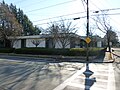 Montefiore Synagogue, located at 460 Westford Street Lowell, Massachusetts. North and west sides of building shown.
 -
 Montefiore Synagogue, located at 460 Westford Street Lowell, Massachusetts. North side of building shown.
 -
 Montefiore Synagogue, located at 460 Westford Street Lowell, Massachusetts. Shown is the west side of the building, as viewed from the south. Saint George Greek Orthodox Church is visible in the background.
 -
 A multilingual sign for the Kingdom Hall of Jehovah's Witnesses located at 559 Pine Street, Lowell, Massachusetts.
 -
 New International Life Church, located at 57 Powell Street, Lowell, Massachusetts.
 -
 Pailin Plaza, a small Cambodian mall located at 716 Middlesex Street, Lowell, Massachusetts. More information: http://library.uml.edu/clh/cam/Cambw4.htm.
 -
 A memorial bench to Lieutenant Lawrence Sullivan (1926 - 2004), adjacent to the Pine Street fire station of the Lowell Fire Department. Located at 273 Stevens Street, Lowell, Massachusetts.
 -
 Pine Street fire station of the Lowell Fire Department, located at 273 Stevens Street, Lowell, Massachusetts. East (front) and north sides of building shown.
 -
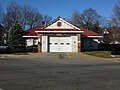 Pine Street fire station of the Lowell Fire Department, located at 273 Stevens Street, Lowell, Massachusetts. East (front) side of building shown.
 -
 Pine Street fire station of the Lowell Fire Department, located at 273 Stevens Street, Lowell, Massachusetts. South and east (front) sides of building shown.
 -
 Insignia and dedication plaque on the Pine Street fire station of the Lowell Fire Department. Located at 273 Stevens Street, Lowell, Massachusetts.
 -
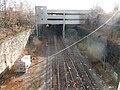 Railroad tracks under the Rourge Parking Garage. Picture taken from the bridge at Chelmsford Street that overpasses the Lowell MBTA Line railroad tracks.
 -
 A residential building in need of stairs at intersection of School Street and Middlesex Street in Lowell, Massachusetts.
 -
 A distant picture of the Rourke Bridge and the Vandenberg Esplanade in Lowell, Massachusetts. Taken from across the Merrimack River.
 -
 Saint George Greek Orthodox Church, located at Located at 44 Princeton Boulevard. East and north (front) sides of building shown.
 -
 The main entrance of Saint George Greek Orthodox Church, located at Located at 44 Princeton Boulevard.
 -
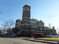 Saint George Greek Orthodox Church, located at Located at 44 Princeton Boulevard. North (front) and west sides of building shown.
 -
 Saint George Greek Orthodox Church, located at Located at 44 Princeton Boulevard. West and south (back) sides of building shown.
 -
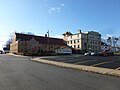 Saint Margaret's Church, located at 374 Stevens Street, Lowell, Massachusetts. East and north sides of building shown. This Roman Catholic church, formally named the Parish of Saint Margaret of Scotland, was founded in 1910. More information: http://www.stmargaretlowell.org/our-history/.
 -
 Saint Margaret's Church, located at 374 Stevens Street, Lowell, Massachusetts. North and west (front) sides of building shown. This Roman Catholic church, formally named the Parish of Saint Margaret of Scotland, was founded in 1910. More information: http://www.stmargaretlowell.org/our-history/.
 -
 Saint Margaret's Church, located at 374 Stevens Street, Lowell, Massachusetts. South and east sides of building shown. This Roman Catholic church, formally named the Parish of Saint Margaret of Scotland, was founded in 1910. More information: http://www.stmargaretlowell.org/our-history/.
 -
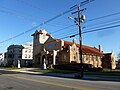 Saint Margaret's Church, located at 374 Stevens Street, Lowell, Massachusetts. West (front) and south sides of building shown. This Roman Catholic church, formally named the Parish of Saint Margaret of Scotland, was founded in 1910. More information: http://www.stmargaretlowell.org/our-history/.
 -
 A statue of the Virgin Mary on the west (front) lawn of Saint Margaret's Church. Located at 374 Stevens Street, Lowell, Massachusetts.
 -
 The front sign for Saint Margaret's Church, located at 374 Stevens Street, Lowell, Massachusetts.
 -
 Saint Margaret's Parish Center, located at or immediately nearby 373 Stevens Street, Lowell, Massachusetts.
 -
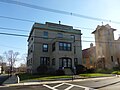 The rectory of Saint Margaret's church, located at 374 Stevens Street, Lowell, Massachusetts. North and west (front) sides of building shown. The corner stone on the bottom of the northwest side of the building indicates that it was built in 1927.
 -
 The rectory of Saint Margaret's church, located at 374 Stevens Street, Lowell, Massachusetts. West (front) side of building shown. The corner stone on the bottom of the northwest side of the building indicates that it was built in 1927.


_and_north_sides;_Lowell,_MA;_2011-12-08.JPG)
_side;_Lowell,_MA;_2011-12-08.JPG)
_sides;_Lowell,_MA;_2011-12-08.JPG)


_sides;_Lowell,_MA;_2011-12-08.JPG)

_and_west_sides;_Lowell,_MA;_2011-12-08.JPG)
_sides;_Lowell,_MA;_2011-12-08.JPG)

_sides;_Lowell,_MA;_2011-12-08.JPG)

_and_south_sides;_Lowell,_MA;_2011-12-08.JPG)
_side_detail;_Lowell,_MA;_2011-12-08.JPG)


_sides;_Lowell,_MA;_2011-12-08.JPG)
_side;_Lowell,_MA;_2011-12-08.JPG)
Sun Jan 01 14:57:49 EST 2012[edit]
-
 The Lowell Humane Society shelter, located at 951 Broadway Street, Lowell, Massachusetts. South side of building shown.
 -
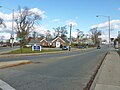 The Lowell Humane Society shelter and UMass Lowell South Campus. Photo taken at the intersection of Pawtucket Street and Broadway Street, Lowell, Massachusetts; looking east.
 -
 Ladder 4 fire truck of the Lowell Fire Department, turning onto Middlesex Street from Wilder Street in Lowell, Massachusetts.
 -
 Lowell Police Mobile Operations Unit vehicle, parked in the John F. Kennedy Civic Center located at 50 Arcand Drive, Lowell, Massachusetts.
 -
 Lowell Police Fleet Services Sign Division building, located at 500 Middlesex Street, Lowell, Massachusetts.
 -
 A bus of Lowell Public Schools, driving west on Middlesex Street, Lowell, Massachusetts.
 -
 Security Station Number 3 of the Lowell Regional Transit Authority. Located on the south corner of the intersection of Chelmsford Street and Appleton Street, Lowell, Massachusetts.
 -
 A delivery box for The Lowell Sun newspaper, situated beside front stairs of a house on Stevens Street, Lowell, Massachusetts.
 -
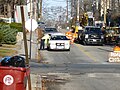 A Lowell police officer on traffic detail talking with a patrol car on Wilder Street just north of its intersection with Westford Street in Lowell, Massachusetts.
 -
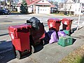 City-issued trash barrels and trash bags placed on the curb of a sidewalk at the intersection of Stevens Street and Pine Street, Lowell, Massachusetts.
 -
 Lower Highlands precinct station of the Lowell Police Department. South and east sides of building shown.
 -
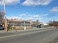 Lower Highlands precinct station of the Lowell Police Department. West and south sides of building shown. The Boys & Girls Club of Greater Lowell is visible in the background.
 -
 Meetinghouse of The Church of Jesus Christ of Latter-day Saints, located at 421 Princeton Boulevard, Lowell, Massachusetts. South (front) and east sides of building shown.
 -
 Meetinghouse of The Church of Jesus Christ of Latter-day Saints, located at 421 Princeton Boulevard, Lowell, Massachusetts. South (front) side of building shown.
 -
 Meetinghouse of The Church of Jesus Christ of Latter-day Saints, located at 421 Princeton Boulevard, Lowell, Massachusetts. South side west entrance shown.
 -
 Meetinghouse of The Church of Jesus Christ of Latter-day Saints, located at 421 Princeton Boulevard, Lowell, Massachusetts. West and south (front) sides of building shown.
 -
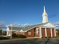 Meetinghouse of The Church of Jesus Christ of Latter-day Saints, located at 421 Princeton Boulevard, Lowell, Massachusetts. West and south (front) sides of building shown.
 -
 Meetinghouse of The Church of Jesus Christ of Latter-day Saints, located at 421 Princeton Boulevard, Lowell, Massachusetts. West side of building shown.


_and_east_sides;_Lowell,_MA;_2011-12-08.JPG)
_side;_Lowell,_MA;_2011-12-08.JPG)

_sides;_Lowell,_MA;_2011-12-08.JPG)
_sides_2;_Lowell,_MA;_2011-12-08.JPG)

Thu Dec 29 00:00:16 EST 2011[edit]
-
 Iglesia Pentecostal Soldadas en Marcha, a Hispanic Pentecostal church located at 1224 Middlesex Street, Lowell, Massachusetts. East and north (front) sides of building shown.
 -
 Iglesia Pentecostal Soldadas en Marcha, a Hispanic Pentecostal church located at 1224 Middlesex Street, Lowell, Massachusetts. North (front) and west sides of building shown.
 -
 Iglesia Pentecostal Soldadas en Marcha, a Hispanic Pentecostal church located at 1224 Middlesex Street, Lowell, Massachusetts. North (front) side of building shown.
 -
 A Kingdom Hall of Jehovah's Witnesses, located at 559 Pine Street, Lowell, Massachusetts. West and south sides of building shown.
 -
 A Kingdom Hall of Jehovah's Witnesses, located at 559 Pine Street, Lowell, Massachusetts. West side of building shown.
 -
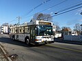 A bus of the Lowell Regional Transit Authority driving south on Stevens Street. Picture taken immediately nearby the intersection of Stevens Street and Light Avenue, Lowell, Massachusetts.
 -
 A green bus of the Lowell Regional Transit Authority at the intersection of Merrimack Stret and Cardinal O'Connell Parkway. Back and right sides of bus shown.
 -
 A green bus of the Lowell Regional Transit Authority with its door closed. Picture taken at the intersection of Merrimack Stret and Cardinal O'Connell Parkway.
 -
 A green bus of the Lowell Regional Transit Authority with its door open and a passenger about to enter. Picture taken at the intersection of Merrimack Stret and Cardinal O'Connell Parkway.
 -
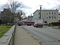 An fire truck from Lawrence Fire Department driving east on Branch Street. Taken at the intersection of Branch Street and School Street, Lowell, Massachusetts.
 -
 Looking down Shaw Street near its intersection with Powell Street in Lowell, Massachusetts. The one-story building in the foreground at right houses New Life International Church, located at 57 Powell Street, Lowell, Massachusetts.
 -
 Looking east along Branch Street onto Middlesex Street in Lowell, Massachusetts. The building in the center of the image is 21 Branch Street, and contains several Cambodian businesses.
 -
 Looking east on Westford Street at its intersection with Stevens Street in Lowell, Massachusetts.
 -
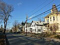 Looking north along Wilder Street from Princeton Boulevard intersection in Lowell, Massachusetts. The properties at right are near the south end of Wilder Street Historic District, a historic district located at 284 through 360 Wilder Street that was added to the National Register of Historic Places in 1995.
 -
 Looking north from 359 Stevens Street. The maroon trash bin in the foreground bears the Lowell city seal.
 -
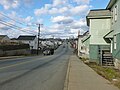 Looking north on School Street near Middlesex Street in Lowell, Massachusetts.
 -
 Looking south along Wilder Street from Princeton Boulevard intersection in Lowell, Massachusetts.
 -
 Looking south on Canton Street toward Saint George Greek Orthodox Church in Lowell, Massachusetts.
 -
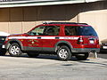 The truck of the Deputy Chief of the Lowell Fire Department. The truck is a Ford Explorer.
_sides;_Lowell,_MA;_2011-12-08.JPG)
_and_west_sides;_Lowell,_MA;_2011-12-08.JPG)
_side;_Lowell,_MA;_2011-12-08.JPG)


Fri Dec 23 11:24:27 EST 2011[edit]
-
 Detailed view of a menorah adorning the north wall of Montefiore Synagogue. Located at 460 Westford Street Lowell, Massachusetts.
 -
 Looking east at Dover Square. At the intersection of Middlesex Street and Branch Street, Lowell, Massachusetts.
 -
 Entrance of the demolished Merrimack Valley Hebrew Academy. West wall viewed from north. Located at 18 Academy Drive, Lowell, Massachusetts.
 -
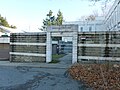 Entrance of the demolished Merrimack Valley Hebrew Academy. West wall viewed from southwest. Located at 18 Academy Drive, Lowell, Massachusetts.
 -
 Entrance of the demolished Merrimack Valley Hebrew Academy. West wall viewed fromwest. Located at 18 Academy Drive, Lowell, Massachusetts.
 -
 The far north lawn of School Street Cemetery. Located at 460 School Street, Lowell, Massachusetts.
 -
 The far south lawn of School Street Cemetery. Located at 460 School Street, Lowell, Massachusetts.
 -
 The northwest side of the Gallagher LRTA Transportation Terminal station. Taken at the intersection of Westford Street and Chelmsford Street, Lowell, Massachusetts.
 -
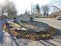 Glacial Oval monument, located immediately nearby 68 Glacial Avenue, Lowell, Massachusetts.
 -
 The grave of two infants at School Street Cemetery. Located at 460 School Street, Lowell, Massachusetts.
 -
 Graves along the north wall of School Street Cemetery. Located at 460 School Street, Lowell, Massachusetts.
 -
 The Boys & Girls Club of Greater Lowell. Located at 657 Middlesex Street, Lowell, Massachusetts.
 -
 Iglesia Cristiana Ebenezer, a Spanish-speaking Assembly of God church located at 27 Loring Street, Lowell, Massachusetts. The building also hosts the Portuguese-language Assembleia de Deus Missao. Both congregations are Assembly of God churches. East (front) side of building shown.
 -
 Iglesia Cristiana Ebenezer, a Spanish-speaking Assembly of God church located at 27 Loring Street, Lowell, Massachusetts. The building also hosts the Portuguese-language Assembleia de Deus Missao. Both congregations are Assembly of God churches. East (front) side of building shown.
 -
 Signs for Spanish- and Portuguese-language congregations at Iglesia Cristiana Ebenezer, located at 27 Loring Street, Lowell, Massachusetts. Iglesia Cristiana Ebenezer is a Spanish-speaking Assembly of God church. The building also hosts the Portuguese-language Assembleia de Deus Missao. Both congregations are Assembly of God churches. East (front) side of building shown.


_side;_Lowell,_MA;_2011-12-08.JPG)


Wed Dec 21 23:37:51 EST 2011[edit]
-
 The main entrance of Christ Jubilee International Ministries Church, located at 101 Smith Street, Lowell, Massachusetts. The building also hosts Ministerio Mundial Assembly of God Church.
 -
 Christ Jubilee International Ministries Church, located at 101 Smith Street, Lowell, Massachusetts. The building also hosts Ministerio Mundial Assembly of God Church. East (front) and north sides of building shown.
 -
 Christ Jubilee International Ministries Church, located at 101 Smith Street, Lowell, Massachusetts. The building also hosts Ministerio Mundial Assembly of God Church. South and east (front) sides of building shown.
 -
 A Christmas nativity scene in front of Lowell City Hall, located at 375 Merrimack Street Lowell, Massachusetts.
 -
 Clemente Park, located at 803 Middlesex Street, Lowell, Massachusetts. East side of park shown.
 -
 A close view of the front Branch Street station of the Lowell Fire Department. Located at 45 Branch Street, Lowell, Massachusetts. South (front) side of building shown.
 -
 Community Christian Fellowship Church, located at 105 Princeton Boulevard, Lowell, Massachusetts. The building also serves as the campus for Community Christian Academy, and was the former site of Temple Beth El, a conservative Jewish synagogue. East and north (back) sides of building shown.
 -
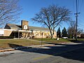 The main entrance of Community Christian Fellowship Church, located at 105 Princeton Boulevard, Lowell, Massachusetts. The building also serves as the campus for Community Christian Academy, and was the former site of Temple Beth El, a conservative Jewish synagogue.
 -
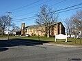 Community Christian Fellowship Church, located at 105 Princeton Boulevard, Lowell, Massachusetts. The building also serves as the campus for Community Christian Academy, and was the former site of Temple Beth El, a conservative Jewish synagogue. South (front) and east sides of building shown.
 -
 Community Christian Fellowship Church, located at 105 Princeton Boulevard, Lowell, Massachusetts. The building also serves as the campus for Community Christian Academy, and was the former site of Temple Beth El, a conservative Jewish synagogue. West and south (front) sides of building shown.
 -
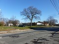 Community Christian Fellowship Church, located at 105 Princeton Boulevard, Lowell, Massachusetts. The building also serves as the campus for Community Christian Academy, and was the former site of Temple Beth El, a conservative Jewish synagogue. West and south (front) sides of building shown.
 -
 A sign for Community Christian Fellowship Church, located at 105 Princeton Boulevard, Lowell, Massachusetts. The building also serves as the campus for Community Christian Academy, and was the former site of Temple Beth El, a conservative Jewish synagogue.
 -
 Looking east along Cupples Square. In the center of the image is Captain John's restaurant and pub, located at 333 Westford Street, Lowell, Massachusetts.
 -
 Thydasour Bridal, a traditional Cambodian bridal store in Cupples Square. Located at 2 Pine Street, Lowell, Massachusetts.
 -
 Looking east toward Cupples Square. In the center of the image is Tony's Convenience Store, located at 349 Westford Street, Lowell, Massachusetts.
 -
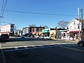 Looking west at Cupples Square. The building behind the American flag slightly at left is 350 Westford Street, Lowell, Massachusetts.
 -
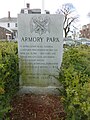 Detailed view of the dedication monument for Armory Park. The monument is located on the west end of the park.
 -
 Whole view of the dedication monument for Armory Park. The monument is located on the west end of the park.
 -
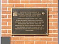 The dedication plaque for the Branch Street fire station of the Lowell Fire Department. Located at 45 Branch Street, Lowell, Massachusetts. South (front) side of building shown.
 -
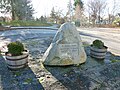 Detailed view of Glacial Oval memorial dedication rock. Located immediately nearby 68 Glacial Avenue, Lowell, Massachusetts.

_and_north_sides;_Lowell,_MA;_2011-12-08.JPG)
_sides;_Lowell,_MA;_2011-12-08.JPG)


_side;_Lowell,_MA;_2011-12-08.JPG)
_sides;_Lowell,_MA;_2011-12-08.JPG)

_and_east_sides;_Lowell,_MA;_2011-12-08.JPG)
_sides,_building_only;_Lowell,_MA;_2011-12-08.JPG)
_sides;_Lowell,_MA;_2011-12-08.JPG)


Mon Dec 19 21:05:03 EST 2011[edit]
-
 Armory Park, located around 60 Westford Street, Lowell, Massachusetts. Viewed from north. The park is land occupied by the Lowell Armory, before it was demolished in the 1970's.
 -
 Armory Park, located around 60 Westford Street, Lowell, Massachusetts. Viewed from northwest. The park is land occupied by the Lowell Armory, before it was demolished in the 1970's.
 -
 Branch Street station of the Lowell Fire Department. Located at 45 Branch Street, Lowell, Massachusetts. South (front) and east sides of building shown.
 -
 Branch Street station of the Lowell Fire Department. Located at 45 Branch Street, Lowell, Massachusetts. South (front) and east sides of building shown.
 -
 Callery Park, located at 200 B Street, Lowell, Massachusetts. Viewed from northwest.
 -
 The dedication plaque for Callery Park. Located at 200 B Street, Lowell, Massachusetts.
 -
 The Hastings Street entrance of Calvary Baptist Church. Located at 60 Hastings Street, Lowell, Massachusetts.
 -
 A bilingual sign -- in English and Khmer -- on the side of the Hastings Street entrance of Calvary Baptist Church. Located at 60 Hastings Street, Lowell, Massachusetts.
 -
 Calvary Baptist Church, located at 60 Hastings Street, Lowell, Massachusetts. East and north sides of building shown.
 -
 Calvary Baptist Church, located at 60 Hastings Street, Lowell, Massachusetts. North and west sides of building shown.
 -
 Calvary Baptist Church, located at 60 Hastings Street, Lowell, Massachusetts. West and south sides of building shown.
 -
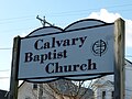 A sign for Calvary Baptist Church, located at 60 Hastings Street, Lowell, Massachusetts.
 -
 Chelmsford Glass Works Long House, located at 139-141 Baldwin Street, Lowell, Massachusetts. East and north (back) sides of building shown. The building is listed on the National Register of Historic Places.
 -
 Chelmsford Glass Works Long House, located at 139-141 Baldwin Street, Lowell, Massachusetts. South (front) and east sides of building shown. The building is listed on the National Register of Historic Places.
 -
 Chelmsford Glass Works Long House, located at 139-141 Baldwin Street, Lowell, Massachusetts. South (front) side of building shown. The building is listed on the National Register of Historic Places.


_and_east_sides;_Lowell,_MA;_2011-12-08.JPG)
_sides;_Lowell,_MA;_2011-12-08.JPG)


_sides;_Lowell,_MA;_2011-12-08.JPG)
_and_east_sides;_Lowell,_MA;_2011-12-08.JPG)
_side;_Lowell,_MA;_2011-12-08.JPG)
Fri Dec 09 17:40:45 EST 2011[edit]
-
 A truck holding a canvasser's signs for a city council candidate in Lowell's municipal elections.
 -
 A new grave in Saint Patrick Cemetery, located at 1251 Gorham Street, Lowell, Massachusetts. This grave was near the northwest end of Yard 4.
 -
 A park at Flanagan Village, located near 91 Plain Street, Lowell, Massachusetts.
 -
 Paul Tsongas's gravestone. Gravestone is among a series of Tsongas family gravestones along Woodbine Path along the Lawrence Street side Lowell Cemetery, located near 1020 Lawrence Street, Lowell, Massachusetts. Wamesit Falls is visible in the background.
 -
 A plaque on the front of Saint Bridget's Chapeal in Saint Patrick Cemetery, located at 1251 Gorham Street, Lowell, Massachusetts.
 -
 Ramahlos West End Gym at the former Hockmeyer family Waterhead Mill. North and west sides of building shown. Ramhalos Gym was featured in the 2010 film 'The Fighter'.
 -
 The former Sacred Heart Church, located near 177 Moore Street, Lowell, Massachusetts. North (front) and west sides of building shown.
 -
 The former Sacred Heart Church, located near 177 Moore Street, Lowell, Massachusetts. South (back) and east sides of building shown.
 -
 The former Sacred Heart Church, located near 177 Moore Street, Lowell, Massachusetts. South (back) side of building shown.
 -
 The former Sacred Heart Church, located near 177 Moore Street, Lowell, Massachusetts. West and south (back) sides of building shown.
 -
 The sign of the former Sacred Heart Church, located near 177 Moore Street, Lowell, Massachusetts.
 -
 Sacred Heart School, located at 122 Andrews Street, Lowell, Massachusetts. North and east (front) sides of building shown.
 -
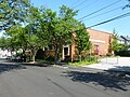 Sacred Heart School, located at 122 Andrews Street, Lowell, Massachusetts. North and east (front) sides of building shown.
 -
 Sacred Heart School, located at 122 Andrews Street, Lowell, Massachusetts. South side of building shown.
 -
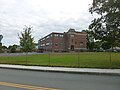 Saint Margaret's School, located at 486 Stevens Street, Lowell, Massachusetts. East (back) and north sides of building shown.
 -
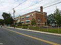 Saint Margaret's School, located at 486 Stevens Street, Lowell, Massachusetts. South and west (front) sides of building shown.
 -
 Saint Margaret's School, located at 486 Stevens Street, Lowell, Massachusetts. South and west (front) sides of building shown.
 -
 The main entrance gate to Saint Patrick Cemetery, located at 1251 Gorham Street, Lowell, Massachusetts.
 -
 John J. Shaughnessy Elementary School, located at 1158 Gorham Street, Lowell, Massachusetts. East and south (front) sides of building shown.
 -
 John J. Shaughnessy Elementary School, located at 1158 Gorham Street, Lowell, Massachusetts. North (back) side of building shown.
 -
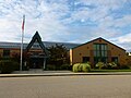 John J. Shaughnessy Elementary School, located at 1158 Gorham Street, Lowell, Massachusetts. South (front) side of building shown.
 -
 North mill building of the former Shaw Stocking Company. Located at 48 Shaw Street, Lowell, Massachusetts. North and west sides of building shown.
 -
 North mill building of the former Shaw Stocking Company. Located at 48 Shaw Street, Lowell, Massachusetts. West and south sides of building shown.
 -
 South and north mill buildings of the former Shaw Stocking Company, at left and right respectively. Located at 48 Shaw Street, Lowell, Massachusetts. Viewed from east.
 -
 A Prince Spaghettiville Bridge and Trolley Pizzeria, two landmarks in South Lowell. Located near 984 Gorham Street, Lowell, Massachusetts.
 -
 Temple Emanuel of the Merrimack Valley, a reform Jewish congregation located at 101 West Forest Street, Lowell, Massachusetts. Northwest (back) and southwest sides of building shown.
 -
 Temple Emanuel of the Merrimack Valley, a reform Jewish congregation located at 101 West Forest Street, Lowell, Massachusetts. Southeast (front) and northeast sides of building shown.
 -
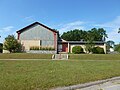 Temple Emanuel of the Merrimack Valley, a reform Jewish congregation located at 101 West Forest Street, Lowell, Massachusetts. Southeast (front) side of building shown.
 -
 Temple Emanuel of the Merrimack Valley, a reform Jewish congregation located at 101 West Forest Street, Lowell, Massachusetts. Southwest and southeast (front) side of building shown.
 -
 Tennis courts and pool at Butler Middle School, located at 1140 Gorham Street, Lowell, Massachusetts.
 -
 Cairn sculpture with a quote from US Senator Paul Tsongas, located at the south end of the Concord River Greenway near 1000 Lawrence Street, Lowell, Massachusetts. North side of sculpture shown.
 -
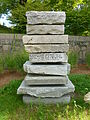 Cairn sculpture with a quote from US Senator Paul Tsongas, located at the south end of the Concord River Greenway near 1000 Lawrence Street, Lowell, Massachusetts. West side of sculpture shown.
 -
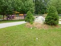 The Upper Highlands Community Playground, located on the southeast side of Bailey Elementary School at 175 Campbell Drive, Lowell, Massachusetts.
 -
 Wamesit Falls Overlook, located at the southern end of the Concord River Greenway near 1000 Lawrence Street, Lowell, Massachusetts. Looking northwest.
 -
 Wamesit Falls Overlook, located at the southern end of the Concord River Greenway near 1000 Lawrence Street, Lowell, Massachusetts. Looking west.
 -
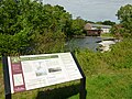 Wamesit Falls Overlook, located at the southern end of the Concord River Greenway near 1000 Lawrence Street, Lowell, Massachusetts. The plaque in the foreground gives historical information about the surrounding area.
 -
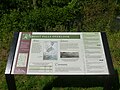 Detailed view of a sign at Wamesit Falls Overlook, located at the southern end of the Concord River Greenway near 1000 Lawrence Street, Lowell, Massachusetts. The plaque gives information about the surrounding area.
 -
 A grass sign saying 'Welcome to Lowell' in large letters, looking at the intersection of the Lowell Connector highway and Thorndike Street. Looking northwest along Thorndike Street, near 325 Thorndike Street, Lowell, Massachusetts. Tower steeples of the former Keith Academy are visible in the far background at left.
 -
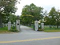 An entrance gate to Westlawn Cemetery on Boston Road in Lowell, Massachusetts.
 -
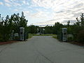 The entrance gate to Westlawn II Cemetery, located around 2 Swan Street, Lowell, Massachusetts


_and_west_sides;_Lowell,_MA;_2011-09-11.JPG)
_and_east_sides;_Lowell,_MA;_2011-09-11.JPG)
_side;_Lowell,_MA;_2011-09-11.JPG)
_sides;_Lowell,_MA;_2011-09-11.JPG)

_sides;_Lowell,_MA;_2011-09-11.JPG)
_and_north_sides;_Lowell,_MA;_2011-09-11.JPG)

_and_north_sides;_Lowell,_MA;_2011-09-11.JPG)
_side;_Lowell,_MA;_2011-09-11.JPG)


_sides;_Lowell,_MA;_2011-09-11.JPG)
_side;_Lowell,_MA;_2011-09-11.JPG)
_side;_Lowell,_MA;_2011-09-11.JPG)


_and_southwest_sides;_Lowell,_MA;_2011-09-11.JPG)
_and_northeast_sides;_Lowell,_MA;_2011-09-11.JPG)
_side;_Lowell,_MA;_2011-09-11.JPG)
_sides;_Lowell,_MA;_2011-09-11.JPG)


Tue Dec 06 08:12:32 EST 2011[edit]
-
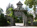 The Lawrence Street gate of Lowell Cemetery, located near 1020 Lawrence Street, Lowell, Massachusetts. Northeast (back) side of gate shown.
 -
 The Lawrence Street gate of Lowell Cemetery, located near 1020 Lawrence Street, Lowell, Massachusetts. Northeast (back) side of gate shown.
 -
 Lowell Cemetary, looking west over Range section. Located at 77 Knapp Avenue, Lowell, Massachusetts.
 -
 A flag pole and informative plaque in Lowell Cemetery, about 100 feet east of the Lawrence Street gate near 1020 Lawrence Street, Lowell, Massachusetts.
 -
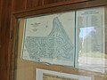 Map of Lowell Cemetery, posted on an outside wall of the old office close to the Lawrence Street gate near 2010 Lawrence Street, Lowell, Massachusetts.
 -
 An old office near the Lawrence Street gate of Lowell Cemetery. Located near 1020 Lawrence Street, Lowell, Massachusetts.
 -
 An old office near the Lawrence Street gate of Lowell Cemetery. Located near 1020 Lawrence Street, Lowell, Massachusetts.
 -
 A facilities building of Lowell Housing Authority at Flanagan Village. Located at the intersection of Quimby Avenue and Plain Street in Lowell, Massachusetts.
 -
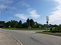 Micky Ward Circle, dedicated November 2010. Located near 30 Industrial Avenue, Lowell, Massachusetts.
 -
 Micky Ward Circle, dedicated November 2010. Detailed view shown. Located near 30 Industrial Avenue, Lowell, Massachusetts.
_side;_Lowell,_MA;_2011-09-11.jpg)
_side;_Lowell,_MA;_2011-09-11.jpg)


_side;_Lowell,_MA;_2011-09-11.jpg)
_side;_Lowell,_MA;_2011-09-11.jpg)


Mon Dec 05 01:13:29 EST 2011[edit]
-
 Gravestone of Harriet Bancroft (1802 - 1879), wife of Jefferson Bancroft, the 9th mayor of Lowell, Massachusetts. Located along Woodbine Path in Lowell Cemetery at 77 Knapp Avenue, Lowell, Massachusetts.
 -
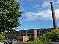 Hockmeyer family Waterhead mills, 900 Lawrence Street, Lowell, Massachusetts.
 -
 Iglesia Adventista del Septimo Dia, a Hispanic Seventh Day Adventist Church located at 20 Meadowcroft Street, Lowell, Massachusetts. West (front) and south sides of building shown.
 -
 Iglesia Adventista del Septimo Dia, a Hispanic Seventh Day Adventist Church located at 20 Meadowcroft Street, Lowell, Massachusetts. West (front) side of building shown.
 -
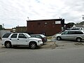 Iglesia Pentecostal Unidos en Santidad, located at 200 Powell Street, Lowell, Massachusetts. North side of building shown.
 -
 Iglesia Pentecostal Unidos en Santidad, located at 200 Powell Street, Lowell, Massachusetts. West (front) side of building shown.
 -
 Detail of the gravestone of Jefferson Bancroft (1803 - 1890), the 9th mayor of Lowell. Located along Woodbine Path in Lowell Cemetery at 77 Knapp Avenue, Lowell, Massachusetts.
 -
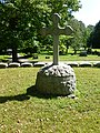 Central gravestone of the family lot of Jefferson Bancroft, the 9th mayor of Lowell. Located along Woodbine Path in Lowell Cemetery at 77 Knapp Avenue, Lowell, Massachusetts.
 -
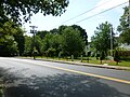 Joseph D. Sweeney Park, located near 947 Lawrence Street, Lowell, Massachusetts.
 -
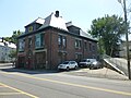 Lawrence Street fire station, located at 745 Lawrence Street, Lowell, Massachusetts. Northeast (front) and northwest sides of building shown.
 -
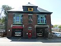 Lawrence Street fire station, located at 745 Lawrence Street, Lowell, Massachusetts. Northeast (front) side of building shown.
 -
 Lawrence Street fire station, located at 745 Lawrence Street, Lowell, Massachusetts. Southeast and northeast (front) sides of building shown.
 -
 Lawrence Street fire station, located at 745 Lawrence Street, Lowell, Massachusetts. Southeast side of building shown.
 -
 Lincoln Elementary School, located at 300 Chelmsford Street, Lowell, Massachusetts. Northwest (front) side of building shown.
 -
 Lincoln Elementary School, located at 300 Chelmsford Street, Lowell, Massachusetts. West side of building shown.
 -
 The main entrance Lincoln Elementary School, located at 300 Chelmsford Street, Lowell, Massachusetts. Northwest side of building shown.
 -
 Look to the Word and Live church, located at 142 Moore Street, Lowell, Massachusetts. South and east sides of building shown.
 -
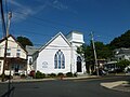 Look to the Word and Live church, located at 142 Moore Street, Lowell, Massachusetts. South side of building shown.
 -
 Lowell Catholic High School, located at 530 Stevens Street, Lowell, Massachusetts. Gym and main academic building of campus shown, as viewed from north.
 -
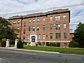 Main building of Lowell Catholic High School, located at 530 Stevens Street, Lowell, Massachusetts.
 -
 South building of Lowell Catholic High School, located at 530 Stevens Street, Lowell, Massachusetts.
 -
 Lowell Catholic High School campus, located at 530 Stevens Street, Lowell, Massachusetts. Viewed from south.


_and_south_sides;_Lowell,_MA;_2011-09-11.JPG)
_side;_Lowell,_MA;_2011-09-11.JPG)

_side;_Lowell,_MA;_2011-09-11.JPG)


_and_northwest_sides;_Lowell,_MA;_2011-09-11.JPG)
_side;_Lowell,_MA;_2011-09-11.JPG)
_sides;_Lowell,_MA;_2011-09-11.JPG)

_side;_Lowell,_MA;_2011-09-11.JPG)

_side;_Lowell,_MA;_2011-09-11.JPG)


Sun Dec 04 21:25:53 EST 2011[edit]
-
 Dedication plaque of Westlawn II Cemetery, located around 2 Swan Street, Lowell, Massachusetts.
 -
 Durkin Memorial Field, a baseball field immediately north of Lincoln Elementary School. Located at 300 Chelmsford Street, Lowell, Massachusetts.
 -
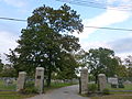 An entrance to Edson Cemetery. Located on Boston Road in Lowell, Massachusetts.
 -
 Eirwin Playground, located around 881 Lawrence Street, Lowell, Massachusetts.
 -
 Lawrence and Faulkner Street Apartments, an affordable housing apartment complex near 873 Lawrence Street, Lowell, Massachusetts. North and west sides of complex shown.
 -
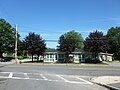 Lawrence and Faulkner Street Apartments, an affordable housing apartment complex near 873 Lawrence Street, Lowell, Massachusetts. West side of complex shown.
 -
 Flanagan Village, located in and around Avenue C, Lowell, Massachusetts.
 -
 Glory Buddhist Temple, located at 24 Cambridge Street, Lowell, Massachusetts. Southwest (front) and southeast sides of building shown.
 -
 Glory Buddhist Temple, located at 24 Cambridge Street, Lowell, Massachusetts. Southwest (front) side of building shown.
 -
 Glory Buddhist Temple Federal Hall, located at 153 Hale Street, Lowell, Massachusetts. Southeast (front) side of building shown, as viewed from east.
 -
 Glory Buddhist Temple Federal Hall, located at 153 Hale Street, Lowell, Massachusetts. Southeast (front) side of building shown, as viewed from south.
 -
 Sign on top of Glory Buddhist Temple Federal Hall, located at 153 Hale Street, Lowell, Massachusetts.
 -
 Gorham Street fire station, located at 795 Gorham Street, Lowell, Massachusetts. East (front) and north sides of building shown.
 -
 Gorham Street fire station, located at 795 Gorham Street, Lowell, Massachusetts. South and east (front) sides of building shown.
 -
 Gorham Street fire station, located at 795 Gorham Street, Lowell, Massachusetts. South side of building shown.
 -
 Gravestone of John McFarland (1840 - 1881), a Medal of Honor recipient. Located at Saint Patrick Cemetery, 1251 Gorham Street, Lowell, Massachusetts. Gravestone is in the Flag Pole section, immediately south of the cemetery chapel.
 -
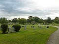 Gravestones in Saint Patrick Cemetery, located at 1251 Gorham Street, Lowell, Massachusetts. Looking west over the western portion of Yard 5 D.
 -
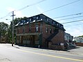 Greenwood Brothers store, located at 573 Lawrence Street, Lowell, Massachusetts. East (front) and north sides of building shown.
 -
 Greenwood Brothers store, located at 573 Lawrence Street, Lowell, Massachusetts. East (front) side of building shown.
 -
 Greenwood Brothers store, located at 573 Lawrence Street, Lowell, Massachusetts. South and east (front) sides of building shown.


_and_southeast_sides;_Lowell,_MA;_2011-09-11.JPG)
_side;_Lowell,_MA;_2011-09-11.JPG)
_side_viewed_from_east;_Lowell,_MA;_2011-09-11.JPG)
_side_viewed_from_south,_Lowell,_MA,_2011-09-11.jpg)

_and_north_sides;_Lowell,_MA;_2011-09-11.JPG)
_sides;_Lowell,_MA;_2011-09-11.JPG)

_gravestone,_Saint_Patrick_Cemetery;_Lowell,_MA;_2011-09-11.JPG)

_and_north_sides;_Lowell,_MA;_2011-09-11.JPG)
_side;_Lowell,_MA;_2011-09-11.JPG)
_sides;_Lowell,_MA;_2011-09-11.JPG)
Sun Dec 04 15:59:07 EST 2011[edit]
-
 Dr. Gertrude Bailey Elementary School, located at 175 Campbell Drive, Lowell, Massachusetts. Northeast (front) side of building shown.
 -
 A group of gravestones for members of the Bancroft family. Jefferson Bancroft (1803 – 1890) was the 9th mayor of Lowell. Located along Woodbine Path in Lowell Cemetery at 77 Knapp Avenue, Lowell, Massachusetts.
 -
 The former Butler School, located at 812 Gorham Street, Lowell, Massachusetts. West (front) side of building shown.
 -
 The former Butler School, located at 812 Gorham Street, Lowell, Massachusetts. North side of building shown.
 -
 The former Butler School, located at 812 Gorham Street, Lowell, Massachusetts. South side of building shown.
 -
 Butler Middle School, located at 1140 Gorham Street, Lowell, Massachusetts. West (front) side of building shown.
 -
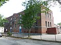 McHugh Alternative Middle School at Cardinal O'Connell School. Located at 21 Carter Street, Lowell, Massachusetts. North (front) and west sides of building shown.
 -
 McHugh Alternative Middle School at Cardinal O'Connell School. Located at 21 Carter Street, Lowell, Massachusetts. West and south (back) and west sides of building shown.
 -
 Saint Bridget Chapel in Saint Patrick Cemetery, located at 1251 Gorham Street, Lowell, Massachusetts. East (front) and south sides of building shown.
 -
 Saint Bridget Chapel in Saint Patrick Cemetery, located at 1251 Gorham Street, Lowell, Massachusetts. East (front) side of building shown.
 -
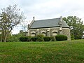 Saint Bridget Chapel in Saint Patrick Cemetery, located at 1251 Gorham Street, Lowell, Massachusetts. North side of building shown.
 -
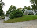 Saint Bridget Chapel in Saint Patrick Cemetery, located at 1251 Gorham Street, Lowell, Massachusetts. South and west (back) sides of building shown.
 -
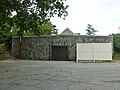 Saint Bridget Chapel in Saint Patrick Cemetery, located at 1251 Gorham Street, Lowell, Massachusetts. West (back) sides of building shown.
 -
 Chelmsford Street Baptist Church, located at 524 Chelmsford Street, Lowell, Massachusetts. East and north sides of building shown.
 -
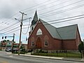 Chelmsford Street Baptist Church, located at 524 Chelmsford Street, Lowell, Massachusetts. West (front) and south sides of building shown.
 -
 Chelmsford Street Baptist Church, located at 524 Chelmsford Street, Lowell, Massachusetts. West side of building shown.
 -
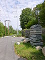 The southern end of the Concord River Greenway Park trail. Located around 1000 Lawrence Street, Lowell, Massachusetts.
 -
 Cross Point Towers, located at 900 Chelmsford Street, Lowell, Massachusetts. Northeast side of building shown.
 -
 Cross Point Towers, located at 900 Chelmsford Street, Lowell, Massachusetts. Northwest and northeast sides of building shown.
 -
 Cross Point Towers, located at 900 Chelmsford Street, Lowell, Massachusetts. Southeast and southwest sides of building shown.
 -
 Cross Point Towers, located at 900 Chelmsford Street, Lowell, Massachusetts. Southwest and southeast sides of building shown.
 -
 Cross Point Towers, located at 900 Chelmsford Street, Lowell, Massachusetts. Southwest side of building shown.
 -
 James S. Daley Middle School, located at 150 Fleming Street, Lowell, Massachusetts. Main entrance on north (front) side of building shown.
 -
 James S. Daley Middle School, located at 150 Fleming Street, Lowell, Massachusetts. North (front) side of building shown.
_side;_Lowell,_MA;_2011-09-11.JPG)

_side;_Lowell,_MA;_2011-09-11.JPG)


_side;_Lowell,_MA;_2011-09-11.JPG)
_and_west_sides;_Lowell,_MA;_2011-09-11.JPG)
_sides;_Lowell,_MA;_2011-09-11.JPG)
_and_south_sides;_Lowell,_MA;_2011-09-11.JPG)
_side;_Lowell,_MA;_2011-09-11.JPG)

_sides;_Lowell,_MA;_2011-09-11.JPG)
_side;_Lowell,_MA;_2011-09-11.JPG)

_and_south_sides;_Lowell,_MA;_2011-09-11.JPG)
_side;_Lowell,_MA;_2011-09-11.JPG)


_side;_Lowell,_MA;_2011-09-11.JPG)
_side;_Lowell,_MA;_2011-09-11.JPG)
Sat Dec 03 11:33:38 EST 2011[edit]
-
 Dr. Gertrude Bailey Elementary School, located at 175 Campbell Drive, Lowell, Massachusetts. Northeast (front) and northwest sides of building shown.
_and_northwest_sides;_Lowell,_MA;_2011-09-11.JPG)
Sat Dec 03 11:16:03 EST 2011[edit]
-
 Abraham Lincoln memorial, located at the intersection of Chelmsford Street and Lincoln Street, Lowell, Massachusetts. South (back) side of memorial shown.
_side;_Lowell,_MA;_2011-09-11.JPG)
Sat Dec 03 10:59:36 EST 2011[edit]
-
 Abraham Lincoln memorial, located at the intersection of Chelmsford Street and Lincoln Street, Lowell, Massachusetts. South (back) side of memorial shown.
_side;_Lowell,_MA;_2011-09-11.JPG)
Fri Dec 02 12:56:30 EST 2011[edit]
-
 Appleton Mills, located at 219 Jackson Street, Lowell, Massachusetts. North and west sides of building shown.
 -
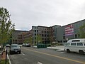 Appleton Mills, located at 219 Jackson Street, Lowell, Massachusetts. Shown is the north side of the building, angled from the west.
 -
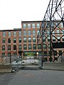 Appleton Mills, located at 219 Jackson Street, Lowell, Massachusetts. South side of building shown.
 -
 Another mill of Appleton Mills, located at 240 Jackson Street, Lowell Massachusetts. North side of building shown, as viewed from a sharp angle from the east.
 -
 Appleton Mills, located at 219 Jackson Street, Lowell, Massachusetts. West and south sides of building shown. The building at right was another mill in the Appleton Mills complex.
 -
 The main gate of the recently constructed Appleton Mills Apartments, located at 219 Jackson Street, Lowell, Massachusetts. The view if toward Jackson Street; the building in the background was another mill in the Appleton Mill complex.
 -
 Appleton Mills, located at 219 Jackson Street, Lowell, Massachusetts. North side of building shown. The first floor of another mill in the Appleton Mills complex (240 Jackson Street) is visible through the main gate in this view.
 -
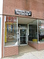 Deliverance Temple of Church of God in Christ, located at 216 Central Street, Lowell, Massachusetts.
 -
 The street entrance of Gallagher LRTA Tranportation Terminal, part of the MBTA Commuter Rail Lowell Line and the LRTA bus service. Located at 101 Thorndike Street, Lowell, Massachusetts.
 -

-
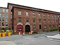 Hamilton Mill, located near 165 Jackson Street, Lowell, Massachusetts. West and south (front) sides of building shown.
 -
 Hamilton Mill, located near 165 Jackson Street, Lowell, Massachusetts. West and south (front) sides of building shown.
 -
 Hamilton Mill, located near 165 Jackson Street, Lowell, Massachusetts. Detailed view of south (front) side of building shown.
 -
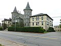 The former Keith Academy -- itself the former Middlesex County Jail -- located at 201 Thorndike Street, Lowell, Massachusetts.
 -
 The former Keith Academy -- itself the former Middlesex County Jail -- located at 201 Thorndike Street, Lowell, Massachusetts. West (front) side of The smoke-stack of the Thorndike Factory Outlet is visible at right.
 -
 Looking down Jackson Street from across its (very crowded) intersection with Central Street. In Lowell, Massachusetts.
 -
 Looking east along the canal between Appleton and Hamilton Mills. Photograph taken from the foot bridge at the main gate of Appleton Mills Apartments, located at 219 Jackson Street, Lowell, Massachusetts.
 -
 The historic Lowell Post Office, located at 89 Appleton Street, Lowell, Massachusetts. South and west (front) sides of building shown.
 -
 Lowell police and fire officers after a 9-11 decennial ceremony in front of Lowell City Hall.
 -
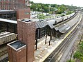 MBTA Lowell line boarding platform at Gallagher station, part of the MBTA Commuter Rail Lowell Line. Located at 101 Thorndike Street, Lowell, Massachusetts.
 -
 A plaque for the former site of Washington House and Tavern. Located in front of Dunkin' Donuts restaurant at 290 Central Street, Lowell, Massachusetts.
 -
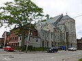 Saint Jean-Baptiste Church, located at 741 Merrimack Street, Lowell, Massachusetts. Southeast and northeast (back) sides of building shown. Information: http://www.doorsopenlowell.org/buildings-1/st-jean-baptiste-church
 -
 Saint Jean-Baptiste Church, located at 741 Merrimack Street, Lowell, Massachusetts. Southwest (front) and southeast sides of building shown. Information: http://www.doorsopenlowell.org/buildings-1/st-jean-baptiste-church
 -
 Thorndike Factory Outlet, located at 145 Thorndike Street, Lowell, Massachusetts.


_sides;_Lowell,_MA;_2011-09-09.JPG)
_sides_2;_Lowell,_MA;_2011-09-09.JPG)
_side;_Lowell,_MA;_2011-09-09.jpg)
_and_north_sides;_Lowell,_MA;_2011-09-09.JPG)
_side;_Lowell,_MA;_2011-09-09.JPG)


_sides;_Lowell,_MA;_2011-09-09.JPG)


_sides;_Lowell,_MA;_2011-09-09.JPG)
_and_southeast_sides;_Lowell,_MA;_2011-09-09.JPG)

Wed Nov 23 00:13:44 EST 2011[edit]
errors[edit]
-
 Purtell Field memorial stone, located on the east side of South Common along Thorndike Street, Lowell, Massachusetts.
 -
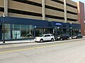 A Registry of Motor Vehicles office located at 77 Middlesex Street, Lowell, Massachusetts.
 -
 Replica of the front arches of the Merrimack Street depot of the Boston and Maine railroad. Located on the southeast corner of the intersection of Merrimack Street and Dutton Street in Lowell, Massachusetts.
 -
 Saint Jean-Baptiste Church, located at 741 Merrimack Street, Lowell, Massachusetts. Northeast (back) and northwest sides of building shown. Information: http://www.doorsopenlowell.org/buildings-1/st-jean-baptiste-church
 -
 Saint Jean-Baptiste Church, located at 741 Merrimack Street, Lowell, Massachusetts. Northwest and southwest (front) sides of building shown. Information: http://www.doorsopenlowell.org/buildings-1/st-jean-baptiste-church
 -
 Saint Jean-Baptiste Church, located at 741 Merrimack Street, Lowell, Massachusetts. Southwest (front) side of building shown. Information: http://www.doorsopenlowell.org/buildings-1/st-jean-baptiste-church
 -
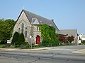 Saint John's Episcopal Church, located at 260 Gorham Street, Lowell, Massachusetts. West (front) and south sides of building shown.
 -
 The former Saint Joseph's High School, now known as 'Acre High School Apartments', located at 760 Merrimack Street, Lowell, Massachusetts. Southwest (back) side of building shown.
 -
 The former Saint Joseph's School, located at 511 Moody Street, Lowell, Massachusetts.
 -
 Saint Joseph Hall at right. At left, the former Saint Joseph's High School, now known as 'Acre High School Apartments', located at 760 Merrimack Street, Lowell, Massachusetts.
 -
Saint Patrick Church sign, located on the front lawn at 282 Suffolk Street, Lowell, Massachusetts.
-
 The former Saint Peter's School, located at 230 Gorham Street, Lowell, Massachusetts. West (front) and south sides of building shown.
 -
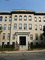 The main entrance of the former Saint Peter's School, located at 230 Gorham Street, Lowell, Massachusetts. West (front) and south sides of building shown.
 -
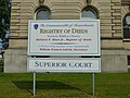 Sign for Middlesex Superior Court, located at 360 Gorham Street, Lowell, Massachusetts.
 -
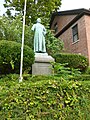 Statue of Reverend André-Marie Garin, priest of Saint Jean-Baptiste Church. Located at 741 Merrimack Street, Lowell, Massachusetts
 -
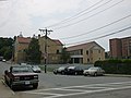 Transfiguration Greek Orthodox Church, located at 25 Friar John Sarantos Way, Lowell, Massachusetts. Northeast (back) side of building shown.
 -
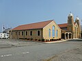 Transfiguration Greek Orthodox Church, located at 25 Friar John Sarantos Way, Lowell, Massachusetts. Northwest and southwest (front) sides of building shown.
 -
 Transfiguration Greek Orthodox Church, located at 25 Friar John Sarantos Way, Lowell, Massachusetts. West spire on southwest (front) side of building shown.
 -
 University Avenue bridge in Lowell, Massachusetts. The yellow building in the background is Pasteur Hall of the University of Massachusetts, Lowell.
 -
 University Crossing (former Saint Joseph's Hospital), a building of the University of Massachusetts, Lowell. Located at 220 Pawtucket Street, Lowell, Massachusetts. Northwest (front) and southwest sides of building shown.
 -
 University Crossing (former Saint Joseph's Hospital), a building of the University of Massachusetts, Lowell. Located at 220 Pawtucket Street, Lowell, Massachusetts. Southwest and southeast (back) sides of building shown. A university police vehicle is visible in the foreground at right.
 -
 Main entrance of University Crossing (former Saint Joseph's Hospital), a building of the University of Massachusetts, Lowell. Located at 220 Pawtucket Street, Lowell, Massachusetts.
 -
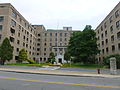 Detail of main entrance of University Crossing (former Saint Joseph's Hospital), a building of the University of Massachusetts, Lowell. Located at 220 Pawtucket Street, Lowell, Massachusetts.
 -
 World War I memorial to "the gallant sons of the Acre", located immediately nearby the Lowell Firefighter's Club at 362 Fletcher Street in Lowell, Massachusetts. East and north (front) sides of statue shown.
 -
 World War I memorial to "the gallant sons of the Acre", located immediately nearby the Lowell Firefighter's Club at 362 Fletcher Street in Lowell, Massachusetts. North (front) and west sides of statue shown.
 -
 World War I memorial to "the gallant sons of the Acre", located immediately nearby the Lowell Firefighter's Club at 362 Fletcher Street in Lowell, Massachusetts. North (front) side of statue shown.
 -
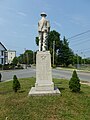 World War I memorial to "the gallant sons of the Acre", located immediately nearby the Lowell Firefighter's Club at 362 Fletcher Street in Lowell, Massachusetts. South (back) side of statue shown.
 -
 World War I memorial to "the gallant sons of the Acre", located immediately nearby the Lowell Firefighter's Club at 362 Fletcher Street in Lowell, Massachusetts.


_and_northwest_sides;_2011-09-03.JPG)
_sides;_2011-09-03.JPG)
_side;_2011-09-03.JPG)
_and_south_sides;_2011-09-03.JPG)
_side;_2011-09-03.JPG)

_and_Saint_Joseph_High_School;_Lowell,_MA;_2011-09-03.JPG)
_and_south_sides;_2011-09-03.JPG)


_side_2011-09-03.JPG)
_sides;_2011-09-03.JPG)


;_Lowell,_MA;_northwest_(front)_and_southwest_sides;_2011-09-03.JPG)
;_Lowell,_MA;_southwest_and_southeast_(back)_sides_2011-09-03.JPG)
_main_entrance;_Lowell,_MA;_2011-09-03.JPG)
_main_entrance_detail;_Lowell,_MA;_2011-09-03.JPG)
_sides;_2011-09-03.JPG)
_and_west_sides;_2011-09-03.JPG)
_side;_2011-09-03.JPG)
_side;_2011-09-03.JPG)

Tue Nov 22 19:47:57 EST 2011[edit]
-
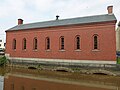 The Moody Street Feeder Gatehouse, built in 1848. Located on the north side of the intersection of Suffolk Street and Merrimack Street, on the west side of the canal.
 -
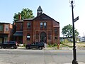 New Life Christian Community Church (and Iglesia de Dios Pentecostal M.I.), located at 150 Middlesex Street, Lowell, Massachusetts. West (front) side of building shown.
 -
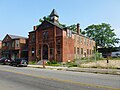 New Life Christian Community Church (and Iglesia de Dios Pentecostal M.I.), located at 150 Middlesex Street, Lowell, Massachusetts. North and west (front) sides of building shown.
 -
 A sewer in Lowell, Massachusetts with a sign reading 'NO DUMPING FLOWS TO RIVER' in English in Khmer. Located along Veteran's Way near its intersection with Bents Court.
 -
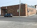 Portuguese American Center, located at 59 Charles Street, Lowell, Massachusetts. Founded in 1954: http://portugueseamericancenter.com/.
 -
 Portuguese Colonial Wars and Carnation Revolution memorial, located near the Portuguese American Center at 59 Charles Street, Lowell, Massachusetts. East (Portuguese) and north sides of memorial shown.
 -
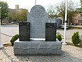 Portuguese Colonial Wars and Carnation Revolution memorial, located near the Portuguese American Center at 59 Charles Street, Lowell, Massachusetts. East (Portuguese) side of memorial shown.
 -
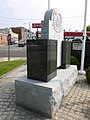 Portuguese Colonial Wars and Carnation Revolution memorial, located near the Portuguese American Center at 59 Charles Street, Lowell, Massachusetts. North and west (English) side of memorial shown.
 -
 Portuguese Colonial Wars and Carnation Revolution memorial, located near the Portuguese American Center at 59 Charles Street, Lowell, Massachusetts. South and east (Portuguese) sides of memorial shown.
 -
 Portuguese Colonial Wars and Carnation Revolution memorial, located near the Portuguese American Center at 59 Charles Street, Lowell, Massachusetts. West (English) and south (Portuguese) sides of memorial shown.
 -
 Portuguese Colonial Wars and Carnation Revolution memorial, located near the Portuguese American Center at 59 Charles Street, Lowell, Massachusetts. West (English) side of memorial shown.
 -
 Portuguese Colonial Wars and Carnation Revolution memorial, located near the Portuguese American Center at 59 Charles Street, Lowell, Massachusetts. Detailed view of west (English) side of memorial shown.
 -
 Public swimming pool at North Common. Located on the northeast side of the intersection of Cross Street and Fletcher Street in Lowell, Massachusetts.

_side.JPG)
_sides;_2011-09-03.JPG)


_and_north_sides;_2011-09-03.jpg)
_side;_2011-09-03.JPG)
_sides;_2011-09-03.JPG)
_sides;_2011-09-03.JPG)
_and_south_sides;_2011-09-03.JPG)
_side;_2011-09-03.JPG)
_side_detail;_2011-09-03.JPG)

Tue Nov 22 01:40:20 EST 2011[edit]
-
 Lowell Police Training Division station, located at 99 Middlesex Street, Lowell, Massachusetts.
 -
 Memorial tablet for Reverend Ronan of Saint Peter's Parish, located near 361 Gorham Street, Lowell, Massachusetts.
 -
 Memorial tablet for deceased pastors of Saint Peter's Parish, located near 361 Gorham Street, Lowell, Massachusetts.
 -
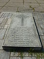 Memorial to Reverends O'Brien of Saint Patrick Church, located at 282 Suffolk Street, Lowell, Massachusetts. Memorial positioned in front of church's east entrance. From top to bottom, the memorial reads: IN MEMORIAM REV. TIMOTHY O'BRIEN 1791 - 1855 REV. JOHN O'BRIEN 1800 - 1874 REV. MICHAEL O'BRIEN 1825 - 1900 NATIVES OF BALLINA COUNTY TIPPERARY, IRELAND REQUIESCANT IN PACE
 -
 Armand Mercier Center, located at 21 Salem Street, Lowell, Masschusetts. South (front) and east sides of building shown. The building is a precinct station for the Lowell Housing Authority.
 -
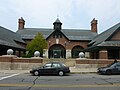 Armand Mercier Center, located at 21 Salem Street, Lowell, Masschusetts. South (front) side of building shown. The building is a precinct station for the Lowell Housing Authority.
 -
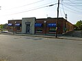 Middlesex County Sheriff's Office (Lowell Community Counseling Center), located at 291 Summer Street, Lowell, Massachusetts; north (front) and west sides of building shown.
 -
 Middlesex County Sheriff's Office (Lowell Community Counseling Center), located at 291 Summer Street, Lowell, Massachusetts; east and north (front) sides of building shown.
 -
 Middlesex Superior Court, located at 360 Gorham Street, Lowell, Massachusetts. North and west (front) sides of building shown.
 -
 Middlesex Superior Court, located at 360 Gorham Street, Lowell, Massachusetts. South and east (back) sides of building shown. The Court consists of two attached buildings. The original Lowell Courthouse, designed by Amni Young and completed in 1850, is towards the east (in the foreground at right in this photograph). The frontal addition, which is at the west (background toward left in photo), was designed by Olin Cutler and finished in 1897. More information: http://www.doorsopenlowell.org/buildings-1/middlesex-county-superior-courthouse.
 -
 Middlesex Superior Court, located at 360 Gorham Street, Lowell, Massachusetts. South side of building shown. The Court consists of two attached buildings. The original Lowell Courthouse, designed by Amni Young and completed in 1850, is towards the east (in the foreground at right in this photograph). The frontal addition, which is at the west (background toward left in photo), was designed by Olin Cutler and finished in 1897. More information: http://www.doorsopenlowell.org/buildings-1/middlesex-county-superior-courthouse.
 -
 Middlesex Superior Court, located at 360 Gorham Street, Lowell, Massachusetts. West (front) and south sides of building shown.
 -
 Middlesex Superior Court main entrance. Located at 360 Gorham Street, Lowell, Massachusetts.


_and_east_sides;_2011-09-03.JPG)

;_Lowell,_MA;_north_(front)_and_west_sides;_2011-09-03.JPG)

_sides;_2011-09-03.JPG)
_sides;_2011-09-03.JPG)

_and_south_sides;_2011-09-03.JPG)

Mon Sep 12 18:31:15 EDT 2011[edit]
errors[edit]
-
 The former Saint Joseph's High School, now known as 'Acre High School Apartments', located at 760 Merrimack Street, Lowell, Massachusetts.
 -
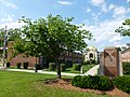 A memorial of the Greek-American Legion of Lowell, to brothers in arms. Located at the intersection of Broadway Street and Dummer Street in Lowell, Massachusetts.
 -
 Harmony Park, a small park located at the intersection of Cross Street and Cork Street in Lowell, Massachusetts.
 -
 A memorial to Humberto M. Correia, President of Lowell's Portuguese American Club. Located in the memorial to the Carnation Revolution and the Portuguese Colonial Wars, bounded by Veterians Way, Charles Street, and Chapel Street in Lowell, Massachusetts.
 -
Iglesia Pentecostal Getzemani Defenders, a Hispanic Pentecostal church located at 170 Gorham Street, Lowell, Massachusetts.
-
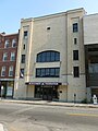 Kun Khmer Federation Kickboxing building, located at 74 Middlesex Street, Lowell, Massachusetts.
 -
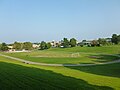 Looking east over South Commons. Visible from left to right are Bishop Markham Village, Middlesex Superior Court, and Edith Nourse Rogers School.
 -
 Lowell City Hall, located at 375 Merrimack Street Lowell, Massachusetts. Close view of south side of building shown.
 -
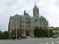 Lowell City Hall, located at 375 Merrimack Street Lowell, Massachusetts. South side of building shown.
 -
 The Lowell City Senior Center, located at 276 Broadway Street, Lowell, Massachusetts. A stone plaque near the top of the entrance notes that the building originally served as the city stable, and was built in 1877.
 -
 The Lowell City Senior Center (at right, in background), located at 276 Broadway Street, Lowell, Massachusetts.
 -
 The George D. Kouloheras Wing of Lowell High School. Located at 50 Father Morissette Boulevard, Lowell, Massachusetts. Shown are the shown and east sides of the building.
 -
 The George D. Kouloheras Wing of Lowell High School. Located at 50 Father Morissette Boulevard, Lowell, Massachusetts. Shown are the south and east side of the building, as viewed from Kirk Street.
 -
 The iconic clock of Lowell High School, gift of the classes of 1937, 1938 and 1939. Located at 50 Father Morissette Boulevard, Lowell, Massachusetts.
_sides;_2011-09-03.JPG)


;_Lowell,_MA;_west_side;_2011-09-03.JPG)


Thu Sep 08 22:56:22 EDT 2011[edit]
-
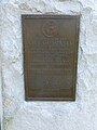 City's dedication of Spanish-American War memorial at Lowell Memorial Auditorium. Located at 50 East Merrimack Street, Lowell, Massachusetts.
 -
 Club LaFayette, located at 465 Fletcher Street Lowell, Massachusetts.
 -
 A condemned building at intersection of Lewis Street and Market Street, in Lowell, Massachusetts.
 -
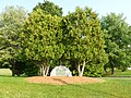 A memorial to George C. Crotty, a World War I veteran. Located immediately nearby the intersection of Summer Street and Thordike Street in Lowell, Massachusetts.
 -
 Dedication plaque for on east side of French Street entrance of McDonough City Magnet School. Notes the 1939 acceptance of the building, formerly known as the Lowell Trade School, by the city mayor and school committee. Located at located at 40 Pagie Street, Lowell, Massachusetts.
 -
 Dedication plaque for on west side of French Street entrance of McDonough City Magnet School. Notes the building is a product of the Public Works Administration, and was built in 1939 under the original name of the Lowell Trade School.
 -
 Detailed view of a memorial to George C. Crotty, a World War I veteran. Located immediately nearby the intersection of Summer Street and Thordike Street in Lowell, Massachusetts.
 -
 Detail of the back side a large bell built in 1860 by Naylor Vickers & Co. Located at the intersection of Prescott Street and Central Street in Lowell, Massachusetts.
 -
 Located at the intersection of Prescott Street and Central Street in Lowell, Massachusetts.
 -
 Located at the intersection of Prescott Street and Central Street in Lowell, Massachusetts.
 -
 The main entrance of the Edith Nourse Rogers School. Located at 43 Highland Street, Lowell, Massachusetts.
 -
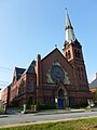 Eliot Presbyterian Church, located at 273 Summer Street, Lowell, Massachusetts. East and north (front) sides of building shown.
 -
 Eliot Presbyterian Church, located at 273 Summer Street, Lowell, Massachusetts. North (front) and west sides of building shown.
 -
 Eliot Presbyterian Church, located at 273 Summer Street, Lowell, Massachusetts, as viewed from across South Common.
 -
 First United Baptist Church, located at 99 Church Street, Lowell, Massachusetts. East (front) and south sides of building shown.
 -
 First United Baptist Church, located at 99 Church Street, Lowell, Massachusetts. East (front) side of original building shown.
 -

-
 First United Baptist Church, located at 99 Church Street, Lowell, Massachusetts. North and east (front) sides of building shown.


;_Lowell,_MA;_2011-08-20.JPG)
;_Lowell,_MA;_2011-08-20.JPG)
;_Lowell,_MA;_2011-08-20.JPG)

_sides;_2011-09-03.JPG)
_and_west_sides;_2011-09-03.JPG)

_and_south_sides;_2011-09-03.JPG)
_side,_original_building;_2011-09-03.JPG)
_side;_2011-09-03.JPG)
_sides;_2011-09-03.JPG)
Thu Sep 08 21:31:09 EDT 2011[edit]
-
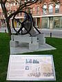 'Bell City' historical plaque and Naylor Vickers & Co. 1860 bell. Front and right side of bell shown. Located at the intersection of Prescott Street and Central Street in Lowell, Massachusetts.
 -
 'Merrimack Street Depot' historical plaque, located at the southeast corner of the intersection of Merrimack Street and Dutton Street in Lowell, Massachusetts.
 -
 'Unsafe Mills' historical plaque near the Lower Locks Gate House in Lowell, Massachusetts.
 -
 An affordable housing apartment complex in Bishop Markham Village. Located at 183 Gorham Street, Lowell, Massachusetts.
 -
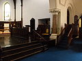 The left (east) side of the alter in Saint Anne's Episcopal Church. Located at 8 Kirk Street, Lowell, Massachusetts.
 -
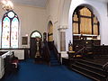 The right (west) side of the alter in Saint Anne's Episcopal Church. Located at 8 Kirk Street, Lowell, Massachusetts.
 -
 Appleton Mills. Located at 219 Jackson Street, Lowell, Massachusetts. Viewed from the top of Edward Early Jr. Garage.
 -
 A monument to Lowell's Armenians, located on Veterans Way near its intersection with Gorham Street in Lowell, Massachusetts.
 -
 A memorial to Athanasios Michapoulos, an American soldier killed during World War I in France. Located at the intersection of Market Street and Suffolk Street in Lowell, Massachusetts.
 -
 A row of affordable housing apartment complexes in Bishop Markham Village. Located around 130 South Street, Lowell, Massachusetts.
 -
 A depot of Boston and Maine Railroad, built in 1876 and since restored by the Lowell National Historical Park. Located at 240 Central Street, Lowell, Massachusetts.
 -
 Carney Field at North Common. A group of people is playing baseball in the background.
 -
 A memorial plaque for Charles Hovey, in the east interior wall of Saint Anne's Episcopal Church. Located at 8 Kirk Street, Lowell, Massachusetts.
 -
 Church Street Plaza, also known as Central Street Plaza. Located at and around 55 Church Street, Lowell, Massachusetts.
;_Lowell,_MA;_2011-08-20.JPG)


_side;_Lowell,_MA;_2011-09-03.JPG)
_side;_Lowell,_MA;_2011-09-03.JPG)


_memorial;_Lowell,_MA;_2011-09-03.JPG)


;_Lowell,_MA;_2011-09-03.JPG)
Thu Sep 01 18:51:15 EDT 2011[edit]
-
 Saint Anne's Episcopal Church, located at 8 Kirk Street, Lowell, Massachusetts. South entrance to church plot shown.
 -
 Saint Patrick Church, located at 282 Suffolk Street, Lowell, Massachusetts. East (front) side of building shown, as viewed from a slight angle from south.
 -
 Saint Patrick Church, located at 282 Suffolk Street, Lowell, Massachusetts. North side of building shown.
 -
 Saint Patrick Church, located at 282 Suffolk Street, Lowell, Massachusetts. North and east (front) sides of building shown.
 -
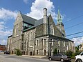 Saint Patrick Church, located at 282 Suffolk Street, Lowell, Massachusetts. West (back) and south sides of building shown.
 -
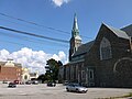 Saint Patrick Church, located at 282 Suffolk Street, Lowell, Massachusetts. West (back) and south sides of building shown.
 -
 Saint Patrick School, located at 311 Adams Street, Lowell, Massachusetts. South and west (front) sides of building shown.
 -
 Saint Patrick School, located at 311 Adams Street, Lowell, Massachusetts. West (front) side of building shown.
 -
 Saint Medical Center, located at 1 Hospital Drive, Lowell, Massachusetts. East side of building shown.
 -
 Saint Medical Center, located at 1 Hospital Drive, Lowell, Massachusetts. East side entrance shown.
 -
 A stained glass window on the east side of the chapel of Saint Anne's Episcopal Church. Located at 8 Kirk Street, Lowell, Massachusetts.
 -
 Tablet commemorating the centennial of the Boston & Lowell Railroad Corporation. Located in Lucy Larcom Park, near the Merrimack Street end, in Lowell, Massachusetts.
 -
 The Lowell Sun building, located at 491 Dutton Street, Lowell, Massachusetts. East and north sides of building shown, as viewed from the east along East Merrimack Street.
 -
 The Lowell Sun building, located at 491 Dutton Street, Lowell, Massachusetts. Viewed from Merrimack Street; north and west sides of building shown.
 -
 The Lowell Sun building, located at 491 Dutton Street, Lowell, Massachusetts. Shown are the south and east sides of building, as viewed from Dutton Street.

_side;_2011-08-20.JPG)

_side;_2011-08-20.JPG)
_and_south_sides;_2011-08-20.JPG)

_sides;_2011-08-20.JPG)
_side;_2011-08-20.JPG)


Tue Aug 30 00:39:49 EDT 2011[edit]
-
 A monument to early Greek immigrants in Lowell. Located in a raised island bounded by Merrimack Street, Dummer Street, Market Street and Cardinal O'Connell Parkway in Lowell, Massachusetts. Lowell City Hall is visible in the background.
 -
 The back of a monument to early Greek immigrants in Lowell. Located in a raised island bounded by Merrimack Street, Dummer Street, Market Street and Cardinal O'Connell Parkway in Lowell, Massachusetts.
 -
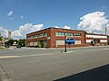 The Hellenic Cultural Center and Hellenic American Academy, located at 41 Broadway Street, Lowell, Massachusetts. Northeast and southeast (front) sides shown. Lowell City Hall is visible in the background at left.
 -
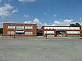 The Hellenic Cultural Center and Hellenic American Academy, located at 41 Broadway Street, Lowell, Massachusetts. Southeast (front) sides shown. Lowell City Hall is visible in the background at left.
 -
 Looking north near the intersection of Broadway Street and Dummer Street in Lowell, Massachusetts. The Hellenic Cultural Center is visible at left; at right, the Greek Orthodox Holy Trinity Church.
 -
 A panel describing the history of locomotives in Lowell, Massachusetts, and the history of Boston and Maine locomotive No. 410 (partially visible at left) in particular.
 -
 Holy Trinity Church, a Greek Orthodox Church located at 62 Lewis Street, Lowell, Massachusetts. Shown are the west and south (front) sides of the building, as viewed from a distance.
 -
 Holy Trinity Church, a Greek Orthodox Church located at 62 Lewis Street, Lowell, Massachusetts. West and south (front) sides shown.
 -
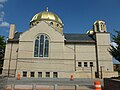 Holy Trinity Church, a Greek Orthodox Church located at 62 Lewis Street, Lowell, Massachusetts. West side shown.
 -
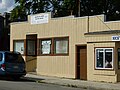 Iglesia El Lirios De Los Vallos (Church Lily of the Valley), a Hispanic Pentecostal church located at 571 Market Street, Lowell, Massachusetts.
 -
 Immaculate Conception Church, a Roman Catholic Church located at 144 East Merrimack Street, Lowell, Massachusetts. East side of building shown.
 -
 Immaculate Conception Church, a Roman Catholic Church located at 144 East Merrimack Street, Lowell, Massachusetts. South (front) side of building shown, as viewed from East Merrimack Street.
 -
 Immaculate Conception Church, a Roman Catholic Church located at 144 East Merrimack Street, Lowell, Massachusetts. West and south (front) side of building shown.
 -
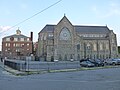 Immaculate Conception Church, a Roman Catholic Church located at 144 East Merrimack Street, Lowell, Massachusetts. West side of buildings shown.
 -
 Immaculate Conception Church, a Roman Catholic Church located at 144 East Merrimack Street, Lowell, Massachusetts. East and north sides of building shown.
 -
 Immaculate Conception School, a Catholic parochial school located at 218 East Merrimack Street, Lowell, Massachusetts.
 -
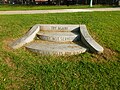 Inscribed steps in Lucy Larcom Park. The steps read: "TRY AGAIN! INDUSTRY, NOT SERVITUDE! AS IS WOMAN, SO IS THE RACE."
 -
 A monument to the Irish-American community in Lowell, Massachusetts. Located in a raised island bounded by Merrimack Street, Dummer Street, Market Street and Cardinal O'Connell Parkway in Lowell, Massachusetts.
 -
 The back of a monument to the Irish-American community in Lowell, Massachusetts. Located in a raised island bounded by Merrimack Street, Dummer Street, Market Street and Cardinal O'Connell Parkway in Lowell, Massachusetts.
 -
 The John F. Kennedy Center, located at 50 Arcand Drive, Lowell, Massachusetts. The Christos G. Rouses memorial is visible in a small depression. Behind that is a Lowell Police Department station.
 -
 Entrance to Merrimack Repertory Theatre, located at 50 East Merrimack Street, Lowell, Massachusetts. The Lowell Memorial Auditorium is adjoined at left.
 -
 Looking north at intersection of Central Street (left) and Prescott Street (right). The Lowell Sun building is visible towards the right.
 -
 Looking souteast along Merrimack Street near the intersection with Dutton Street. At left is a canal building from 1848; behind that, Saint Anne's Episcopal Church is visible. At right is a trolley used to transport visitors throughout the Lowell National Historic Park area.
 -
 The Lowell Adult Education Center, located at 408 Merrimack Street, Lowell, Massachusetts. The west side of the Smith Baker Center is visible at left.
 -
 Lowell City Hall, located at 375 Merrimack Street Lowell, Massachusetts. Southwest side of building shown. Visible in the foreground is a raised island containing monuments to the city's early Greek immigrants, Cardinal O'Connell, and the city's Irish-American Community.
 -
 Lowell City Hall, located at 375 Merrimack Street Lowell, Massachusetts. West (back) side of building shown.
 -
 The John F. Kennedy Civic Center as viewed from the north, with the north side of Lowell City Hall in the background.
 -
 JFK Civic Center fire station of the Lowell Fire Department. Located at 99 Moody Street, Lowell, Massachusetts.
 -
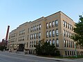 The George D. Kouloheras Wing of Lowell High School. Located at 50 Father Morissette Boulevard, Lowell, Massachusetts. North (front) and west sides of building shown.
 -
 The George D. Kouloheras Wing of Lowell High School. Located at 50 Father Morissette Boulevard, Lowell, Massachusetts. North (front) and side of building shown.
 -
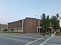 The Raymond E. Riddick field house of Lowell High School. Located at 50 Father Morissette Boulevard, Lowell, Massachusetts.
 -
 The main entrance of Lowell High School. Located at 50 Father Morissette Boulevard, Lowell, Massachusetts.
 -
 Lowell High School, with walkways over Merrimack Canal connecting the old Kouloheras Wing with the school's newer addition.
 -
 Lowell High School, with walkways connecting the old Kouloheras Wing with the school's newer addition.
 -
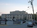 The east (back) side of Lowell Memorial Auditorium and Merrimack Repertory Theatre. Located at 50 East Merrimack Street, Lowell, Massachusetts.
 -
 Lowell Memorial Auditorium, located at 50 East Merrimack Street, Lowell, Massachusetts. North and west (front) sides of building shown.
 -
 Lowell Memorial Auditorium, located at 50 East Merrimack Street, Lowell, Massachusetts. North and west (front) sides of building shown.
 -
 Lowell Memorial Auditorium, located at 50 East Merrimack Street, Lowell, Massachusetts. Shown is the west (front) side of the building as viewed from the nearby bridge on East Merrimack Street.
 -
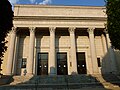 The main entrance of Lowell Memorial Auditorium. Located at 50 East Merrimack Street, Lowell, Massachusetts.

;_Lowell,_MA;_2011-08-20.JPG)
_sides;_2011-08-20.JPG)
_side;_2011-08-20.JPG)


_side_viewed_from_a_distance_on_Lewis_Street;_2011-08-20.JPG)
_sides;_2011-08-20.JPG)

;_Lowell_MA;_2011-08-20.JPG)

_side;_2011-08-20.JPG)
_side;_2011-08-20.JPG)


;_Lowell,_MA;_2011-08-20.JPG)


_side;_2011-08-20.JPG)


_and_west_sides;_2011-08-20.JPG)
_side;_2011-08-20.JPG)


_side;_2011-08-20.JPG)
_sides;_2011-08-20.JPG)
_and_south_sides;_2011-08-20.JPG)
_side_viewed_from_East_Merrimack_Street_Bridge;_2011-08-20.JPG)
_side;_2011-08-20.JPG)
Sun Aug 28 21:50:26 EDT 2011[edit]
-
 A memorial to William Henry O'Connell, a Cardinal of the Roman Catholic Church born in Lowell. Located in an raised island bounded by Merrimack Street, Dummer Street, Market Street and Cardinal O'Connell Parkway in Lowell, Massachusetts.
 -
 Christ Church United, a church located at 180 East Merrimack Street, Lowell, Massachusetts. South (front) side of building shown.
 -
 The Christos G. Rouses memorial, a monument to Lowell police officers who died in the line of duty. Located in the John F. Kennedy Civic Center at 50 Arcand Drive, Lowell, Massachusetts.
 -
 The Smith Baker Center, formerly the First Congregational Church. Located at 400 Merrimack Street, Lowell, Massachusetts. East and north (front) sides of building shown.
 -
 The Smith Baker Center, formerly the First Congregational Church. Located at 400 Merrimack Street, Lowell, Massachusetts. North (front) and west sides of building shown.
 -
 Dedication plaque for the Pollard Memorial Library. Located at 401 Merrimack Street, Lowell, Massachusetts.
 -
 Dedication plaque of 1984 renovation of Lowell Memorial Auditorium. Located on west (front) side of the building, at 50 East Merrimack Street, Lowell, Massachusetts.
 -
 Dedication plaque of Lowell Memorial Auditorium. Located on west (front) side of the building, at 50 East Merrimack Street, Lowell, Massachusetts.
 -
 The F. Bradford Morse Federal Building, located at 50 Kearney Square, Lowell, Massachusetts. South (front) and east sides of building shown.
 -
 The F. Bradford Morse Federal Building, located at 50 Kearney Square, Lowell, Massachusetts. Entrance of building shown.

_side;_2011-08-20.JPG)

;_Lowell,_MA;_east_and_north_(front)_sides;_2011-08-20.JPG)
;_Lowell,_MA;_north_(front)_and_west_sides;_2011-08-20.JPG)


_and_east_sides;_2011-08-20.JPG)

Sun Aug 28 20:53:36 EDT 2011[edit]
-
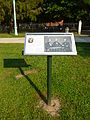 "Debating Slavery", a panel describing divided political opinions on slavery in Lowell in the 1830s and 1840s. Frederick Douglass is depicted in the upper left. In the picture at right, from left to right, are Wendell Phillips, William Lloyd Garrisonn and George Thompson. Located in Lucy Larcom Park, part of the Lowell National Historical Park, near Merrimack Street in Lowell, Massachusetts.
 -
 "Irish Labor", a panel describing the role of Irish laborers in digging and maintaining the Lowell canal system. Located in Lucy Larcom Park, part of the Lowell National Historical Park, near Merrimack Street in Lowell, Massachusetts.
 -
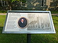 "Saint Anne's Church", a panel describing the early history and politics of Saint Anne's Church and the roles played by mill owner Kirk Boott and Reverend Theodore Edson. Located in Lucy Larcom Park, part of the Lowell National Historical Park, near Merrimack Street in Lowell, Massachusetts.
 -
 A stone panel reading "WE SAY 'STICK TO YOUR TEXT'". Located in Lucy Larcom Park, part of the Lowell National Historical Park, near Merrimack Street in Lowell, Massachusetts.
 -
 A pavillion for a performance in the Lowell Summer Music Series at Boarding House Park. Located at 40 French Street, Lowell, Massachusetts.
 -
 The front of Boston and Maine locomotive No. 410. Located on the east side of Dutton Street near the intersection with Merrimack Street in Lowell, Massachusetts.
 -
 The front and left sides of Boston and Maine locomotive No. 410. Located on the east side of Dutton Street near the intersection with Merrimack Street in Lowell, Massachusetts.
 -
 The right side of Boston and Maine locomotive No. 410. Located on the east side of Dutton Street near the intersection with Merrimack Street in Lowell, Massachusetts.
 -
 The right side of Boston and Maine locomotive No. 410, with a red caboose. Located on the east side of Dutton Street near the intersection with Merrimack Street in Lowell, Massachusetts.
 -
 Boston and Maine locomotive No. 410, with a red caboose, viewed from the front-right Located on the east side of Dutton Street near the intersection with Merrimack Street in Lowell, Massachusetts.


;_Lowell,_MA;_2011-08-20.JPG)
_with_Lowell_City_Hall_in_background;_Lowell,_MA;_2011-08-20.jpg)
;_Lowell,_MA;_2011-08-20.JPG)

;_Lowell,_MA;_2011-08-20.JPG)
Sun Aug 14 14:34:45 EDT 2011[edit]
errors[edit]
- File:Bethany_Congregational_Church_Quincy,_MA;_north_and_west_sides;_2011-06-05.JPG aborted: exists: File:Bethany_Congregational_Church_Quincy,_MA;_north_and_west_sides;_2011-06-05.JPG
- File:Quincy_College_(Saville_Hall);_Quincy,_MA;_2011-06-05.JPG empty-file
-
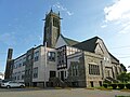 Bethany Congregational Church, located at 18 Spear Street, Quincy, Massachusetts. West and south (front) sides shown.
 -
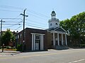 Central Baptist Church, located at 67 Washington Street, Quincy, Massachusetts. East and north (front) sides shown.
 -
 Central Baptist Church, located at 67 Washington Street, Quincy, Massachusetts. North (front) and west sides of building shown.
 -
 Central Baptist Church, located at 67 Washington Street, Quincy, Massachusetts. North (front) side of building shown.
 -
 The Coddington School, located at 34 Coddington Street, Quincy, Massachusetts. East (front) side of building shown.
 -
 The Coddington School, located at 34 Coddington Street, Quincy, Massachusetts. Detail of east (front) side of building shown.
 -
 The Coddington School, located at 34 Coddington Street, Quincy, Massachusetts. North and west (back) sides of building shown.
 -
 Construction along the west side of 1585 Hancock Street, just south of Quincy center. Viewed from the top of Ross Garage.
 -
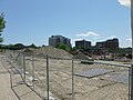 Construction along the west side of 1585 Hancock Street, just south of Quincy center. Viewed from the top of Ross Garage.
 -
 A fountain at Mount Wollaston Cemetery, located at 20 Sea Steet, Quincy, Massachusetts. The plaque on the fountain reads: THE GIFT OF INHABITANTS OF QUINCY 1891
 -
 George F. Bryan, the first person from Quincy to die in World War I. The gravestone reads: GEORGE F. BRYAN BORN DEC. 3, 1901 ENLISTED MARCH 30, 1917 KILLED IN ACTION WHEN U.S.S. JACOB JONES WAS TORPEDOED AT SEA DEC. 6, 1917 FIRST QUINCY BOY KILLED IN THE WORLD WAR
 -
 Gravestones at Mount Wollaston Cemetery, located at 20 Sea Street, Quincy, Massachusetts.
 -
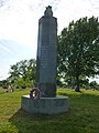 Korean War Memorial at Mount Wollaston Cemetery, located at 20 Sea Street, Quincy, Massachusetts.
 -
 List of killed or missing soldiers on the west side of the Vietnam War Memorial at Mount Wollaston Cemetery. Located at 20 Sea Street, Quincy, Massachusetts.
 -
 List of soldiers killed in battle on the east side of the Civil War Memorial at Mount Wollaston Cemetery. Located at 20 Sea Street, Quincy, Massachusetts.
 -
 List of soldiers who died in prison camps, on the south side of the Civil War Memorial at Mount Wollaston Cemetery. Located at 20 Sea Street, Quincy, Massachusetts.
 -
 List of soldiers who died of disease contracted in battle, on the west side of the Civil War Memorial at Mount Wollaston Cemetery. Located at 20 Sea Street, Quincy, Massachusetts.
 -
 List of soldiers who died of wounded from battle, on the north side of the Civil War Memorial at Mount Wollaston Cemetery. Located at 20 Sea Street, Quincy, Massachusetts.
 -
 Looking north at the southern intersection of Hancock Street and Granite Street in Quincy, Massachusetts.
 -
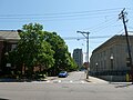 Looking south down Maple Street from Washington Street in Quincy, Massachusetts
 -
 Looking west down Cottage Avenue from Hancock Street in Quincy, Massachusetts. The ALBA restaurant at left occupies the building of the former Quincy Trust Company (it was constructed in 1918).
 -
 The main entrance of the former Quincy High School building, located at 52 Coddington Street, Quincy, Massachusetts.
 -
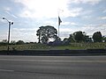 A view from across Sea Street of Mount Wollaston Cemetary. Located at 20 Sea Street, Quincy, Massachusetts.
 -
 The veterans and police section of Mount Wollaston Cemetary, with Quincy Police Headquarters visible in the background. Located at 20 Sea Street, Quincy, Massachusetts.
 -
 The former Quincy High School building, located at 54 Coddington Street, Quincy, Massachusetts.
 -
 A view looking south from central Quincy, Massachusetts, from the top of Ross Garage. The roadway in the foreground is Parking Way; beyond that are back of buildings along Bergin Parkway.
 -
 The Quincy Access Television building, located at 88 Washington Street, Quincy, Massachusetts. The adjoined building at left is the CBT section of the Thomas Crane Public Library.
 -
 Quincy American Legion (Post 95), located at 2 Mechanic Street, Quincy, Massachusetts.
 -
Saville Hall, the main campus building of Quincy College. Located at 24 Saville Avenue, Quincy, Massachusetts.
-
 Quincy District Court, also known as District Court of Eastern Norfolk. Located at 1 Dennis Ryan Parkway, Quincy, Massachusetts. South (front) and east sides of building shown.
 -
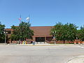 Quincy District Court, also known as District Court of Eastern Norfolk. Located at 1 Dennis Ryan Parkway, Quincy, Massachusetts. South (front) side of building shown.
 -
 Quincy High School, located at 100 Coddington Street, Quincy, Massachusetts.
 -
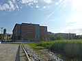 Quincy High School, located at 100 Coddington Street, Quincy, Massachusetts. North side of building shown.
 -
 Quincy High School, located at 100 Coddington Street, Quincy, Massachusetts. Shown is the building's main entrance as viewed from Newcomb Street.
 -
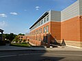 Quincy High School, located at 100 Coddington Street, Quincy, Massachusetts. West (back) side of building shown.
 -
 The automative technology shop at Quincy High School. Located at 20 Sea Street, Quincy, Massachusetts.
 -
 The Quincy Patriot Ledger building, located at 13 Temple Street, Quincy, Massachusetts. Offices for Quincy College at left and Bay State Community Services at right.
 -
 Quincy Police Headquarters, located at 1 Sea Street, Quincy, Massachusetts. North side of building shown.
 -
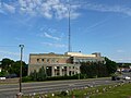 Quincy Police Headquarters, located at 1 Sea Street, Quincy, Massachusetts. West side of building shown.
 -
 Quincy Police Headquarters, located at 1 Sea Street, Quincy, Massachusetts. South side of building shown.
 -
 Quincy Police Memorial at Mount Wollaston Cemetery. Located at 20 Sea Street, Quincy, Massachusetts.
 -
 Quincy Police Memorial at Mount Wollaston Cemetery with Quincy Police Headquarters in background.
 -
 Rooftops in the center of Quincy, Massachusetts, viewed from Ross Garage. The high rooftop at left is1400 Hancock Street -- a Bank of America building.
 -
 South Shore YMCA, located at 79 Coddington Street, Quincy, Massachusetts.
 -
 Spanish-American War Memorial at Mount Wollaston Cemetary. Located at 20 Sea Street, Quincy, Massachusetts.
 -
 The spire of Bethany Congregational Church, a congregationalist church, showing gargoyles at each corner. Located at 18 Spear Street, Quincy, Massachusetts
 -
 A view of Quincy center showing the Stone Temple, the Quincy Patriot Ledger building and Stop and Shop Headquaters.
 -
 The Fours Bar and Grille, located at 15 Cottage Avenue, Quincy, Massachusetts.
 -
 The main entrance to the Childs Bertman Tseckares (CBT) section of the Thomas Crane Public Library. Located at 40 Washington Street, Quincy, Massachusetts.
 -
 The main entrance to the Coletti section of the Thomas Crane Public Library. Located at 40 Washington Street, Quincy, Massachusetts.
 -
 The main entrance to the H. H. Richardson section of the Thomas Crane Public Library. Located at 40 Washington Street, Quincy, Massachusetts.
 -
 The Thomas Crane Public Library, with the Quincy Access Television Station attached at right. Located at 40 Washington Street, Quincy, Massachusetts.
 -
 The north (back) side of the H. H. Richardson section of the Thomas Crane Public Library, with the Coletti section of the library attached at left. Located at 40 Washington Street, Quincy, Massachusetts.
 -
 The west side of the H. H. Richardson section of Thomas Crane Public Library, located at 40 Washington Street, Quincy, Massachusetts. The portion of the library visible at right is the west side of the Coletti section of the library.
 -
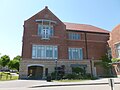 The east side of the CBT section of the Thomas Crane Public Library. Located at 40 Washington Street, Quincy, Massachusetts.
 -
 The Colleti (left) and CBT (right) sections of the Thomas Crane Public Library. Shown is the south side of the library, viewed from the west at a sharp angle.
 -
 Thomas Morton dedication at Mount Wollaston Cemetery, located at 20 Sea Street, Quincy, Massachusetts.
 -
 US Post Office located near Quincy center, at 47 Washington Street, Quincy, Massachusetts. North (front) and west sides of building shown.
 -
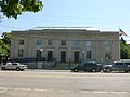 US Post Office located near Quincy center, at 47 Washington Street, Quincy, Massachusetts. North (front) side of building shown.
 -
 Vietnam War Memorial at Mount Wollaston Cemetery. Located at 20 Sea Street, Quincy, Massachusetts.
 -
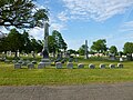 A group of gravestones for the Vogel family at Mount Wollaston Cemetery. Located at 20 Sea Street, Quincy, Massachusetts.
 -
 World War II Memorial at Mount Wollaston Cemetery, viewed from the left. Located at 20 Sea Street, Quincy, Massachusetts.
 -
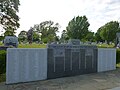 World War II Memorial at Mount Wollaston Cemetery, viewed from the right. Located at 20 Sea Street, Quincy, Massachusetts.
 -
 World War I Memorial at Mount Wollaston Cemetery, located at 20 Sea Street, Quincy, Massachusetts.

_sides;_2011-06-05.JPG)
_and_west_sides;_2011-06-05.JPG)
_side;_2011-06-05.JPG)
_side;_2011-06-05.JPG)
_side_detail;_2011-06-05.JPG)
_sides;_2011-06-05.JPG)


_gravestone,_Mount_Wollaston_Cemetery;_Quincy,_MA;_2011-06-05.JPG)


;_Quincy,_MA;_2011-06-05.JPG)
_and_east_sides.JPG)
_side;_2011-06-05.JPG)


_side.JPG)


;_Quincy,_MA;_south_side;_2011-06-05.JPG)


;_Quincy,_MA;_east_side;_2011-06-05.JPG)
;_Quincy,_MA;_south_side_viewed_from_west;_2011-06-05.JPG)

_and_west_sides;_2011-06-05.JPG)
_side;_2011-06-05.JPG)


;_Quincy,_MA;_2011-06-05.JPG)
;_Quincy,_MA;_2011-06-05.JPG)

Tue Jun 14 07:07:38 EDT 2011[edit]
-
 Igreja Vida Church, a hispanic church located at 407 Mystic Avenue Medford, Massachusetts 02155.
 -
 LaConte Skating Rink, located at 97 Locust Street Medford, Massachusetts 02155-5713.


Tue Jun 14 00:55:09 EDT 2011[edit]
errors[edit]
- File:Igreja_Vida_Church;_Medford,_MA.JPG empty-file
- File:LaConte_Skating_Rink;_Medford,_MA.JPG empty-file
-
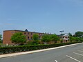 Madeleine Dugger Andrews Middle School, located at 3000 Mystic Valley Parkway Medford, Massachusetts 02155-5715. East (front) side of building shown, as viewed from south.
 -
 Main entrance of Madeleine Dugger Andrews Middle School, located at 3000 Mystic Valley Parkway Medford, Massachusetts 02155-5715.
 -
 Assembléia de Deus: "Restauração e Vida" (Assembly of God: "Restoration and Life"), a Portuguese church located at 39 Commercial Street Medford, Massachusetts 02155-4923.
 -
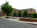 Columbus Elementary School, located at 37 Hicks Avenue, Medford, Massachusetts. South and east sides of building shown.
 -
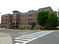 Columbus Elementary School, located at 37 Hicks Avenue, Medford, Massachusetts. West (front) side of building shown.
 -
 Construction at a section of the Wellington Circle Shopping Plaza in Medford, Massachusetts; likely a future retail outlet.
 -
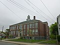 Curtis-Tufts Alternative School, an alternative high school located at 437 Main Street Medford, Massachusetts 02155.
 -
 Curtis-Tufts Alternative School, an alternative high school located at 437 Main Street Medford, Massachusetts 02155.
 -
 Curtis-Tufts Alternative School, an alternative high school located at 437 Main Street Medford, Massachusetts 02155.
 -
 Engine 5 fire truck at the Medford Fire Department firehouse at 0 Medford Street, Medford, Massachusetts.
 -
 First Community United Methodist Church, located at 55 Otis Street Medford, Massachusetts 02155-4017.
 -
 Franklin School residences, a residential complex that functioned as the Franklin School from 1899 to 2003. Located at 68 Central Avenue Medford, Massachusetts 02155-4036. East and north sides of building shown.
 -
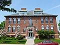 Franklin School residences, a residential complex that functioned as the Franklin School from 1899 to 2003. Located at 68 Central Avenue Medford, Massachusetts 02155-4036. East side of building shown.
 -
 Franklin School residences, a residential complex that functioned as the Franklin School from 1899 to 2003. Located at 68 Central Avenue Medford, Massachusetts 02155-4036. North side of building, which serves as the residents' main entrance, shown.
 -
 Franklin School residences, a residential complex that functioned as the Franklin School from 1899 to 2003. Located at 68 Central Avenue Medford, Massachusetts 02155-4036. South (front) and east sides of building shown.
 -
 Hormel Stadium, located near 97 Locust Street, Medford, Massachusetts 02155 and immediately east of McGlynn Middle School.
 -
Igreja Vida Church, a hispanic church located at 407 Mystic Avenue Medford, Massachusetts 02155.
-
 John Paul Stabile memorial, located on the lawn of the firehouse at 0 Medford Street, Medford, Massachusetts.
 -
LaConte Skating Rink, located at 97 Locust Street Medford, Massachusetts 02155-5713.
-
 The Lincoln-Kennedy residential complex, which functioned as a junior high school until the 1980's. Located at 215 Harvard Street Medford, Massachusetts 02155.
 -
 The Lincoln-Kennedy residential complex, which functioned as a junior high school until the 1980's. Located at 215 Harvard Street Medford, Massachusetts 02155.
 -
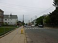 Looking north along Main Street near intersection with Medford Street; Medford, Massachusetts.
 -
 Main entrance of John J. McGlynn Sr. Elementary School, located at 3002 Mystic Valley Parkway Medford, Massachusetts 02155.
 -
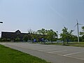 McGlynn Elementary School and McGlynn Middle School, located at 3002 Mystic Valley Parkway Medford, Massachusetts 02155.
 -
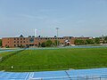 McGlynn Elementary School (entrance on right of building) and McGlynn Middle School (entrance on center-left of building), located at 3002 Mystic Valley Parkway Medford, Massachusetts 02155.
 -
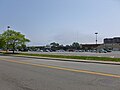 Meadow Glen Mall, a retail plaza located at the intersection of Locust Street and Mystic Valley Parkway in Medford, Massachusetts. Southern portion of east side of plaza, as viewed from Locust Street, shown.
 -
 Bell for Medford Fire Department firehouse at 0 Medford Street, Medford, Massachusetts.
 -
 Medford Fire Department firehouse, located at 0 Medford Street, Medford, Massachusetts. East (back) side -- the Main Street side -- of firehouse shown.
 -
 Medford Fire Department firehouse, located at 0 Medford Street, Medford, Massachusetts. North side of building shown.
 -
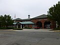 Medford Fire Department firehouse, located at 0 Medford Street, Medford, Massachusetts. West (front) side of building shown.
 -
 Medford Fire Department firehouse, located near 435 Riverside Avenue, Medford, Massachusetts.
 -
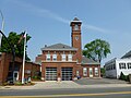 Medford Fire Department firehouse, located near 284 Salem Street, Medford, Massachusetts.
 -
 Morrison Park, a park in Medford, Massachusetts bounded by Linwood Street, Central Avenue, Yeoman's Avenue and Carney Street.
 -
 The Potter Building, a building at the intersection of Salem Street and Park Street in Medford, Massachusetts.
 -
 Roberts Elementary School, located at 35 Court Street, Medford, Massachusetts 02155. East and north sides of building shown.
 -
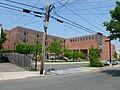 Roberts Elementary School, located at 35 Court Street, Medford, Massachusetts 02155. East side of building shown.
 -
 Roberts Elementary School, located at 35 Court Street, Medford, Massachusetts 02155. North and west (front) sides of building shown.
 -
 Roberts Elementary School, located at 35 Court Street, Medford, Massachusetts 02155. West (front) and south sides of building shown.
 -
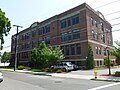 Former site of the Swan School, now a residential complex at 75 Park Street Medford, Massachusetts 02155-3925.
 -
 North portion of the Wellington Circle Shopping Plaza, located along Fellsway between Riverside Avenue and Mystic Valley Parkway in Medford, Massachusetts.
 -
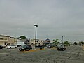 South portion of the Wellington Circle Shopping Plaza, located along Fellsway between Riverside Avenue and Mystic Valley Parkway in Medford, Massachusetts.
 -
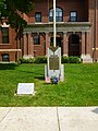 World War II memorial and 1999 time capsule site on the front lawn of the former Franklin School. Located at 68 Central Avenue Medford, Massachusetts 02155-4036.
 -
 World War II memorial for residents of Ward Five of Medford, Massachusetts who died in service. Located on the front lawn of Curtis-Tufts School; at 437 Main Street Medford, Massachusetts 02155.
_side_viewed_from_south.JPG)


_side.JPG)

_and_north_sides.JPG)
_side.JPG)
_sides.JPG)


;_Medford,_MA;_east_and_north_sides.JPG)
;_Medford,_MA;_east_side.JPG)
;_Medford,_MA;_north_side_(main_resident_entrance).JPG)
;_Medford,_MA;_south_(front)_and_east_sides.JPG)


;_Medford,_MA;_south_(front)_and_east_sides.JPG)
;_Medford,_MA;_west_and_south_(front)_sides.JPG)


_side.JPG)
_side.JPG)


_side.JPG)

_side.JPG)


_sides.JPG)
_and_south_sides.JPG)
;_Medford,_MA.JPG)


Sat Jun 11 19:56:59 EDT 2011[edit]
-
 Gravestone of Abigail Sears, who died in 1828 at age 69. She was the wife of Reuben Sears. Located at Red Top Cemetery at the intersection of Stony Brook Road and Red Top Road in Brewster, Massachusetts.
 -
 Gravestone of Arthur E. Coakley (1914-1982) and Emily P. Coakley (1921-1993). Located at Red Top Cemetery at the intersection of Stony Brook Road and Red Top Road in Brewster, Massachusetts.
 -
 A memorial commemorating the Battle of the Bulge in World War II. Located on the front lawn of the Council on Aging building at 1673 Main Street Brewster, Massachusetts 02631.
 -
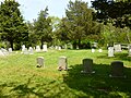 A group of gravestones of the Black family. Located at Red Top Cemetery at the intersection of Stony Brook Road and Red Top Road in Brewster, Massachusetts.
 -
 Side of Brewster Baptist Church, located at 1848 Main Street Brewster, MA 02631-1827. East side and tree-obstructed north (front) side of building shown.
 -
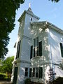 Brewster Baptist Church, located at 1848 Main Street Brewster, MA 02631-1827. North (front) and west sides of building shown.
 -
 Brewster Council on Aging (old Town Hall) building, with war memorials in foreground. Located at 1673 Main Street Brewster, Massachusetts 02631.
 -
 Brewster Council on Aging (old Town Hall) building. Located at 1673 Main Street Brewster, Massachusetts 02631.
 -
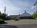 Brewster Fire Department firehouse, located at 1657 Main Street Brewster, Massachusetts 02631.
 -
 Brewster Ladies' Library, a private instution that serves as a free public for the town of Brewster. Located at 1822 Main Street Brewster, Massachusetts 02631-1892.
 -
 Brewster Ladies' Library, a private instution that serves as a free public for the town of Brewster. Located at 1822 Main Street Brewster, Massachusetts 02631-1892. North (front) side viewed from west.
 -
 Brewster Town Offices, located at 2198 Main Street Brewster, Massachusetts 02631-1846. East and north sides of building shown.
 -
 Brewster Town Offices, located at 2198 Main Street Brewster, Massachusetts 02631-1846. North side of building shown.
 -
 Dillingham Cemetery, located on Stony Brook Road in Brewster, Massachusetts.
 -
 Dillingham Cemetery, located on Stony Brook Road in Brewster, Massachusetts. Viewed from southeast.
 -
 Eddy Elementary School, located at 2298 Main Street, Brewster, Massachusetts.
 -
 Gravestone of Ella B. Ellis (1876-1909). Located at Red Top Cemetery at the intersection of Stony Brook Road and Red Top Road in Brewster, Massachusetts.
 -
 First Parish Brewster Unitarian Universalist and Brewster Meeting House undergoing renovation. Located at 1969 Main Street Brewster, Massachusetts 02631. North (front) and east sides shown.
 -
 First Parish Brewster Unitarian Universalist undergoing renovation. Located at 1969 Main Street Brewster, Massachusetts 02631. North (front) and east sides and church sign shown.
 -
 First Parish Brewster Unitarian Universalist undergoing renovation. Located at 1969 Main Street Brewster, Massachusetts 02631. North (front) side shown.
 -
 James Chapman (lost at sea 1816, age 30) and Polly his wife (died 1830, age 40). Located at Red Top Cemetery at the intersection of Stony Brook Road and Red Top Road in Brewster, Massachusetts.
 -
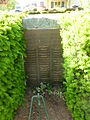 Korean and Vietnam Wars memorial. Located on the front lawn of the Council on Aging building at 1673 Main Street Brewster, Massachusetts 02631.
 -
 Gravestone of Lot Sears (1805-1829). Located at Red Top Cemetery at the intersection of Stony Brook Road and Red Top Road in Brewster, Massachusetts.
 -
 Gravestone of Nancy Sears, who died in 1877 at age 72. She was a wife of Reuben Sears. Located at Red Top Cemetery at the intersection of Stony Brook Road and Red Top Road in Brewster, Massachusetts.
 -
 Our Lady of the Cape Catholic Church, located at 468 Stony Brook Road Brewster, Massachusetts 02631-1021. North (front) and east sides of building shown.
 -
 Our Lady of the Cape Catholic Church, located at 468 Stony Brook Road Brewster, Massachusetts 02631-1021. West and north (front) sides of building shown.
 -
 Red Top Cemetery, located at the intersection of Stony Brook Road and Red Top Road in Brewster, Massachusetts.
 -
 Gravestone of Reuben Sears, who died in 1844 at age 91. Located at Red Top Cemetery at the intersection of Stony Brook Road and Red Top Road in Brewster, Massachusetts.
 -
 Gravestone of Reuben Sears, who died in 1845 at age 54. Located at Red Top Cemetery at the intersection of Stony Brook Road and Red Top Road in Brewster, Massachusetts.
 -
 Gravestone of Ruth L. Ellis, who died in 1912. She was the wife of J.P. Ellis. Located at Red Top Cemetery at the intersection of Stony Brook Road and Red Top Road in Brewster, Massachusetts.
 -
 Seagulls gathering at the Herring Run Site, across the street from Stony Brook Grist Mill and Museum on Stony Brook Road in Brewster, Masschusetts.
 -
 Trinity Lutheran Church, located at 1883 Main Street Brewster, Massachusetts 02631-1826. South (front) and east sides of building shown.
 -
 Trinity Lutheran Church, located at 1883 Main Street Brewster, Masschusetts 02631-1826. South (front) and west sides of building shown.
 -
 A US Post Offce building at 260 Underpass Road, Brewster, Massachusetts 02631-9998.
 -
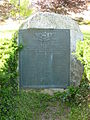 World War II memorial. Located on the front lawn of the Council on Aging building at 1673 Main Street Brewster, Massachusetts 02631.
 -
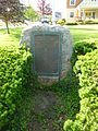 World War I memorial. Located on the front lawn of the Council on Aging building at 1673 Main Street Brewster, Massachusetts 02631.
_gravestone;_Red_Top_Cemetery;_Brewster,_MA.jpg)
_and_Emily_P._Coakley_(1921-1993)_gravestone;_Red_Top_Cemetery;_Brewster,_MA.JPG)


_sides.JPG)
_and_west_sides.JPG)
_with_war_memorials_in_foreground;_Brewster,_MA.JPG)
;_Brewster,_MA;_west_and_south_(front)_sides_viewed_from_street.JPG)


_side_viewed_from_west.JPG)


_gravestone;_Red_Top_Cemetery;_Brewster,_MA.JPG)
_and_east_sides.JPG)
_and_east_sides,_with_sign.JPG)
_side.JPG)
_and_Polly_his_wife_(died_1830,_age_40)_gravestone;_Red_Top_Cemetery;_Brewster,_MA.JPG)

_gravestone;_Red_Top_Cemetery;_Brewster,_MA.JPG)
_gravestone;_Red_Top_Cemetery;_Brewster,_MA.JPG)
_and_east_sides.JPG)
_sides.JPG)

_gravestone;_Red_Top_Cemetery;_Brewster,_MA.JPG)
_gravestone;_Red_Top_Cemetery;_Brewster,_MA.JPG)
_gravestone;_Red_Top_Cemetery;_Brewster,_MA.JPG)

_and_east_sides.JPG)
_and_west_sides.JPG)


Fri Jun 10 07:56:42 EDT 2011[edit]
-
![Original description from Flickr (http://www.flickr.com/photos/massdep/5805176572/): "Aerial views of tornado damage in Western Massachusetts following the June 1, 2011 tornados. MassDEP staff, flying with the massachusetts Civil Air Patrol, documented the paths of the tornados to locate the damage on GIS maps and better coordinate emergency response." flickr-Review: flickr/\{\{[Ff]lickr[Rr]?eview.*?\}\}/{{Flickrreview|{{subst:REVISIONUSER}}|{{subst:#time: Y-m-d }}}}{{Flickrreview|{{subst:REVISIONUSER}}|{{subst:#time: Y-m-d }}|%LICENSE%}}> Launch EasyReview+ Passx Remove template- Fail This image, originally posted to Flickr, has not yet been reviewed by an administrator or reviewer to confirm that the stated license is valid. See Category:Flickr review needed for further instructions.](https://upload.wikimedia.org/wikipedia/commons/thumb/2/21/Aerial_view_of_houses_destroyed_by_2011_tornado%3B_Western_MA%3B_%28DSC02639%29.jpg/120px-Aerial_view_of_houses_destroyed_by_2011_tornado%3B_Western_MA%3B_%28DSC02639%29.jpg) Original description from Flickr (http://www.flickr.com/photos/massdep/5805176572/): "Aerial views of tornado damage in Western Massachusetts following the June 1, 2011 tornados. MassDEP staff, flying with the massachusetts Civil Air Patrol, documented the paths of the tornados to locate the damage on GIS maps and better coordinate emergency response."
Original description from Flickr (http://www.flickr.com/photos/massdep/5805176572/): "Aerial views of tornado damage in Western Massachusetts following the June 1, 2011 tornados. MassDEP staff, flying with the massachusetts Civil Air Patrol, documented the paths of the tornados to locate the damage on GIS maps and better coordinate emergency response."
This image, originally posted to Flickr, has not yet been reviewed by an administrator or reviewer to confirm that the stated license is valid. See Category:Flickr review needed for further instructions. -
![Original description from Flickr (http://www.flickr.com/photos/massdep/5804620983/): "Aerial views of tornado damage in Western Massachusetts following the June 1, 2011 tornados. MassDEP staff, flying with the massachusetts Civil Air Patrol, documented the paths of the tornados to locate the damage on GIS maps and better coordinate emergency response." flickr-Review: flickr/\{\{[Ff]lickr[Rr]?eview.*?\}\}/{{Flickrreview|{{subst:REVISIONUSER}}|{{subst:#time: Y-m-d }}}}{{Flickrreview|{{subst:REVISIONUSER}}|{{subst:#time: Y-m-d }}|%LICENSE%}}> Launch EasyReview+ Passx Remove template- Fail This image, originally posted to Flickr, has not yet been reviewed by an administrator or reviewer to confirm that the stated license is valid. See Category:Flickr review needed for further instructions.](https://upload.wikimedia.org/wikipedia/commons/thumb/1/18/Aerial_view_of_houses_destroyed_by_2011_tornado%3B_Western_MA%3B_%28DSC02645%29.jpg/120px-Aerial_view_of_houses_destroyed_by_2011_tornado%3B_Western_MA%3B_%28DSC02645%29.jpg) Original description from Flickr (http://www.flickr.com/photos/massdep/5804620983/): "Aerial views of tornado damage in Western Massachusetts following the June 1, 2011 tornados. MassDEP staff, flying with the massachusetts Civil Air Patrol, documented the paths of the tornados to locate the damage on GIS maps and better coordinate emergency response."
Original description from Flickr (http://www.flickr.com/photos/massdep/5804620983/): "Aerial views of tornado damage in Western Massachusetts following the June 1, 2011 tornados. MassDEP staff, flying with the massachusetts Civil Air Patrol, documented the paths of the tornados to locate the damage on GIS maps and better coordinate emergency response."
This image, originally posted to Flickr, has not yet been reviewed by an administrator or reviewer to confirm that the stated license is valid. See Category:Flickr review needed for further instructions. -
![Original description from Flickr (http://www.flickr.com/photos/massdep/5804610313/): "Aerial views of tornado damage in Western Massachusetts following the June 1, 2011 tornados. MassDEP staff, flying with the massachusetts Civil Air Patrol, documented the paths of the tornados to locate the damage on GIS maps and better coordinate emergency response." flickr-Review: flickr/\{\{[Ff]lickr[Rr]?eview.*?\}\}/{{Flickrreview|{{subst:REVISIONUSER}}|{{subst:#time: Y-m-d }}}}{{Flickrreview|{{subst:REVISIONUSER}}|{{subst:#time: Y-m-d }}|%LICENSE%}}> Launch EasyReview+ Passx Remove template- Fail This image, originally posted to Flickr, has not yet been reviewed by an administrator or reviewer to confirm that the stated license is valid. See Category:Flickr review needed for further instructions.](https://upload.wikimedia.org/wikipedia/commons/thumb/5/5e/Aerial_view_path_of_destruction_by_2011_tornado%3B_Western_MA%3B_%28DSC02645%29.jpg/120px-Aerial_view_path_of_destruction_by_2011_tornado%3B_Western_MA%3B_%28DSC02645%29.jpg) Original description from Flickr (http://www.flickr.com/photos/massdep/5804610313/): "Aerial views of tornado damage in Western Massachusetts following the June 1, 2011 tornados. MassDEP staff, flying with the massachusetts Civil Air Patrol, documented the paths of the tornados to locate the damage on GIS maps and better coordinate emergency response."
Original description from Flickr (http://www.flickr.com/photos/massdep/5804610313/): "Aerial views of tornado damage in Western Massachusetts following the June 1, 2011 tornados. MassDEP staff, flying with the massachusetts Civil Air Patrol, documented the paths of the tornados to locate the damage on GIS maps and better coordinate emergency response."
This image, originally posted to Flickr, has not yet been reviewed by an administrator or reviewer to confirm that the stated license is valid. See Category:Flickr review needed for further instructions. -
![Damaged heating oil tank at a demolished residence. Original description from Flickr (http://www.flickr.com/photos/massdep/5793904239/): "Tornado and storm damage in Brimfield, Massachusetts. MassDEP Emergency Response June 1, 2011" flickr-Review: flickr/\{\{[Ff]lickr[Rr]?eview.*?\}\}/{{Flickrreview|{{subst:REVISIONUSER}}|{{subst:#time: Y-m-d }}}}{{Flickrreview|{{subst:REVISIONUSER}}|{{subst:#time: Y-m-d }}|%LICENSE%}}> Launch EasyReview+ Passx Remove template- Fail This image, originally posted to Flickr, has not yet been reviewed by an administrator or reviewer to confirm that the stated license is valid. See Category:Flickr review needed for further instructions.](https://upload.wikimedia.org/wikipedia/commons/thumb/5/54/Another_house_destroyed_by_2011_tornado%3B_Brimfield%2C_MA.jpg/120px-Another_house_destroyed_by_2011_tornado%3B_Brimfield%2C_MA.jpg) Damaged heating oil tank at a demolished residence. Original description from Flickr (http://www.flickr.com/photos/massdep/5793904239/): "Tornado and storm damage in Brimfield, Massachusetts. MassDEP Emergency Response June 1, 2011"
Damaged heating oil tank at a demolished residence. Original description from Flickr (http://www.flickr.com/photos/massdep/5793904239/): "Tornado and storm damage in Brimfield, Massachusetts. MassDEP Emergency Response June 1, 2011"
This image, originally posted to Flickr, has not yet been reviewed by an administrator or reviewer to confirm that the stated license is valid. See Category:Flickr review needed for further instructions. -
![Original description from Flickr (http://www.flickr.com/photos/massdep/5793904857/) "Damaged electrical transformer on the ground and leaking oil. Original description from Flickr (http://www.flickr.com/photos/massdep/5793904857/): "Tornado and storm damage in Brimfield, Massachusetts. MassDEP Emergency Response June 1, 2011" flickr-Review: flickr/\{\{[Ff]lickr[Rr]?eview.*?\}\}/{{Flickrreview|{{subst:REVISIONUSER}}|{{subst:#time: Y-m-d }}}}{{Flickrreview|{{subst:REVISIONUSER}}|{{subst:#time: Y-m-d }}|%LICENSE%}}> Launch EasyReview+ Passx Remove template- Fail This image, originally posted to Flickr, has not yet been reviewed by an administrator or reviewer to confirm that the stated license is valid. See Category:Flickr review needed for further instructions.](https://upload.wikimedia.org/wikipedia/commons/thumb/8/81/Electrical_transformer_damaged_by_2011_tornado%3B_Brimfield%2C_MA.jpg/120px-Electrical_transformer_damaged_by_2011_tornado%3B_Brimfield%2C_MA.jpg) Original description from Flickr (http://www.flickr.com/photos/massdep/5793904857/) "Damaged electrical transformer on the ground and leaking oil. Original description from Flickr (http://www.flickr.com/photos/massdep/5793904857/): "Tornado and storm damage in Brimfield, Massachusetts. MassDEP Emergency Response June 1, 2011"
Original description from Flickr (http://www.flickr.com/photos/massdep/5793904857/) "Damaged electrical transformer on the ground and leaking oil. Original description from Flickr (http://www.flickr.com/photos/massdep/5793904857/): "Tornado and storm damage in Brimfield, Massachusetts. MassDEP Emergency Response June 1, 2011"
This image, originally posted to Flickr, has not yet been reviewed by an administrator or reviewer to confirm that the stated license is valid. See Category:Flickr review needed for further instructions. -
![Original description from Flickr (http://www.flickr.com/photos/massdep/5794463056/): "Tornado and storm damage in Brimfield, Massachusetts. MassDEP Emergency Response June 1, 2011" flickr-Review: flickr/\{\{[Ff]lickr[Rr]?eview.*?\}\}/{{Flickrreview|{{subst:REVISIONUSER}}|{{subst:#time: Y-m-d }}}}{{Flickrreview|{{subst:REVISIONUSER}}|{{subst:#time: Y-m-d }}|%LICENSE%}}> Launch EasyReview+ Passx Remove template- Fail This image, originally posted to Flickr, has not yet been reviewed by an administrator or reviewer to confirm that the stated license is valid. See Category:Flickr review needed for further instructions.](https://upload.wikimedia.org/wikipedia/commons/thumb/3/3e/Felled_trees_and_property_damage_from_2011_tornado%3B_Brimfield%2C_MA.jpg/120px-Felled_trees_and_property_damage_from_2011_tornado%3B_Brimfield%2C_MA.jpg) Original description from Flickr (http://www.flickr.com/photos/massdep/5794463056/): "Tornado and storm damage in Brimfield, Massachusetts. MassDEP Emergency Response June 1, 2011"
Original description from Flickr (http://www.flickr.com/photos/massdep/5794463056/): "Tornado and storm damage in Brimfield, Massachusetts. MassDEP Emergency Response June 1, 2011"
This image, originally posted to Flickr, has not yet been reviewed by an administrator or reviewer to confirm that the stated license is valid. See Category:Flickr review needed for further instructions. -
![Original description from Flickr (http://www.flickr.com/photos/massdep/5793905577/): "Tornado and storm damage in Brimfield, Massachusetts. MassDEP Emergency Response June 1, 2011" flickr-Review: flickr/\{\{[Ff]lickr[Rr]?eview.*?\}\}/{{Flickrreview|{{subst:REVISIONUSER}}|{{subst:#time: Y-m-d }}}}{{Flickrreview|{{subst:REVISIONUSER}}|{{subst:#time: Y-m-d }}|%LICENSE%}}> Launch EasyReview+ Passx Remove template- Fail This image, originally posted to Flickr, has not yet been reviewed by an administrator or reviewer to confirm that the stated license is valid. See Category:Flickr review needed for further instructions.](https://upload.wikimedia.org/wikipedia/commons/thumb/5/56/Felled_trees_from_2011_tornado%3B_Brimfield%2C_MA.jpg/120px-Felled_trees_from_2011_tornado%3B_Brimfield%2C_MA.jpg) Original description from Flickr (http://www.flickr.com/photos/massdep/5793905577/): "Tornado and storm damage in Brimfield, Massachusetts. MassDEP Emergency Response June 1, 2011"
Original description from Flickr (http://www.flickr.com/photos/massdep/5793905577/): "Tornado and storm damage in Brimfield, Massachusetts. MassDEP Emergency Response June 1, 2011"
This image, originally posted to Flickr, has not yet been reviewed by an administrator or reviewer to confirm that the stated license is valid. See Category:Flickr review needed for further instructions. -
![Original description from Flickr (http://www.flickr.com/photos/massdep/5793904057/): "Tornado and storm damage in Brimfield, Massachusetts. MassDEP Emergency Response June 1, 2011" flickr-Review: flickr/\{\{[Ff]lickr[Rr]?eview.*?\}\}/{{Flickrreview|{{subst:REVISIONUSER}}|{{subst:#time: Y-m-d }}}}{{Flickrreview|{{subst:REVISIONUSER}}|{{subst:#time: Y-m-d }}|%LICENSE%}}> Launch EasyReview+ Passx Remove template- Fail This image, originally posted to Flickr, has not yet been reviewed by an administrator or reviewer to confirm that the stated license is valid. See Category:Flickr review needed for further instructions.](https://upload.wikimedia.org/wikipedia/commons/thumb/0/00/House_damaged_by_2011_tornado%3B_Brimfield%2C_MA.jpg/120px-House_damaged_by_2011_tornado%3B_Brimfield%2C_MA.jpg) Original description from Flickr (http://www.flickr.com/photos/massdep/5793904057/): "Tornado and storm damage in Brimfield, Massachusetts. MassDEP Emergency Response June 1, 2011"
Original description from Flickr (http://www.flickr.com/photos/massdep/5793904057/): "Tornado and storm damage in Brimfield, Massachusetts. MassDEP Emergency Response June 1, 2011"
This image, originally posted to Flickr, has not yet been reviewed by an administrator or reviewer to confirm that the stated license is valid. See Category:Flickr review needed for further instructions. -
![Original description from Flickr (http://www.flickr.com/photos/massdep/5794461518/): "Tornado and storm damage in Brimfield, Massachusetts. MassDEP Emergency Response June 1, 2011" flickr-Review: flickr/\{\{[Ff]lickr[Rr]?eview.*?\}\}/{{Flickrreview|{{subst:REVISIONUSER}}|{{subst:#time: Y-m-d }}}}{{Flickrreview|{{subst:REVISIONUSER}}|{{subst:#time: Y-m-d }}|%LICENSE%}}> Launch EasyReview+ Passx Remove template- Fail This image, originally posted to Flickr, has not yet been reviewed by an administrator or reviewer to confirm that the stated license is valid. See Category:Flickr review needed for further instructions.](https://upload.wikimedia.org/wikipedia/commons/thumb/b/b8/House_destroyed_by_2011_tornado%3B_Brimfield%2C_MA.jpg/120px-House_destroyed_by_2011_tornado%3B_Brimfield%2C_MA.jpg) Original description from Flickr (http://www.flickr.com/photos/massdep/5794461518/): "Tornado and storm damage in Brimfield, Massachusetts. MassDEP Emergency Response June 1, 2011"
Original description from Flickr (http://www.flickr.com/photos/massdep/5794461518/): "Tornado and storm damage in Brimfield, Massachusetts. MassDEP Emergency Response June 1, 2011"
This image, originally posted to Flickr, has not yet been reviewed by an administrator or reviewer to confirm that the stated license is valid. See Category:Flickr review needed for further instructions. -
![A damaged log cabin in Brimfield, Massachusetts among felled trees and other wreckage from the 2011 New England tornado outbreak. Original description from Flickr (http://www.flickr.com/photos/massdep/5793904905/): "Tornado and storm damage in Brimfield, Massachusetts. MassDEP Emergency Response June 1, 2011" flickr-Review: flickr/\{\{[Ff]lickr[Rr]?eview.*?\}\}/{{Flickrreview|{{subst:REVISIONUSER}}|{{subst:#time: Y-m-d }}}}{{Flickrreview|{{subst:REVISIONUSER}}|{{subst:#time: Y-m-d }}|%LICENSE%}}> Launch EasyReview+ Passx Remove template- Fail This image, originally posted to Flickr, has not yet been reviewed by an administrator or reviewer to confirm that the stated license is valid. See Category:Flickr review needed for further instructions.](https://upload.wikimedia.org/wikipedia/commons/thumb/b/bb/Log_cabin_damaged_by_2011_tornado%3B_Brimfield%2C_MA.jpg/120px-Log_cabin_damaged_by_2011_tornado%3B_Brimfield%2C_MA.jpg) A damaged log cabin in Brimfield, Massachusetts among felled trees and other wreckage from the 2011 New England tornado outbreak. Original description from Flickr (http://www.flickr.com/photos/massdep/5793904905/): "Tornado and storm damage in Brimfield, Massachusetts. MassDEP Emergency Response June 1, 2011"
A damaged log cabin in Brimfield, Massachusetts among felled trees and other wreckage from the 2011 New England tornado outbreak. Original description from Flickr (http://www.flickr.com/photos/massdep/5793904905/): "Tornado and storm damage in Brimfield, Massachusetts. MassDEP Emergency Response June 1, 2011"
This image, originally posted to Flickr, has not yet been reviewed by an administrator or reviewer to confirm that the stated license is valid. See Category:Flickr review needed for further instructions. -
![A man and woman sitting among destructed property in the Forest Park section of Springfield, Massachusetts. Original description from Flickr (http://www.flickr.com/photos/thenationalguard/5793095299/): "Forest Park Section of Springfield, Mass., the day after a tornady touched down in the area, June 2, 2011 . (U.S. Army photo bt Sgt. Jerry Saslav, Massachusetts National Guard Public Affairs)" flickr-Review: flickr/\{\{[Ff]lickr[Rr]?eview.*?\}\}/{{Flickrreview|{{subst:REVISIONUSER}}|{{subst:#time: Y-m-d }}}}{{Flickrreview|{{subst:REVISIONUSER}}|{{subst:#time: Y-m-d }}|%LICENSE%}}> Launch EasyReview+ Passx Remove template- Fail This image, originally posted to Flickr, has not yet been reviewed by an administrator or reviewer to confirm that the stated license is valid. See Category:Flickr review needed for further instructions.](https://upload.wikimedia.org/wikipedia/commons/thumb/d/dc/Man_and_woman_sitting_among_destructed_property_in_Forest_Park%2C_Springfield%2C_MA%3B_2011_tornado_outbreak.jpg/120px-Man_and_woman_sitting_among_destructed_property_in_Forest_Park%2C_Springfield%2C_MA%3B_2011_tornado_outbreak.jpg) A man and woman sitting among destructed property in the Forest Park section of Springfield, Massachusetts. Original description from Flickr (http://www.flickr.com/photos/thenationalguard/5793095299/): "Forest Park Section of Springfield, Mass., the day after a tornady touched down in the area, June 2, 2011 . (U.S. Army photo bt Sgt. Jerry Saslav, Massachusetts National Guard Public Affairs)"
A man and woman sitting among destructed property in the Forest Park section of Springfield, Massachusetts. Original description from Flickr (http://www.flickr.com/photos/thenationalguard/5793095299/): "Forest Park Section of Springfield, Mass., the day after a tornady touched down in the area, June 2, 2011 . (U.S. Army photo bt Sgt. Jerry Saslav, Massachusetts National Guard Public Affairs)"
This image, originally posted to Flickr, has not yet been reviewed by an administrator or reviewer to confirm that the stated license is valid. See Category:Flickr review needed for further instructions. -
![Original description from Flickr (http://www.flickr.com/photos/thenationalguard/5804141429/): "Soldiers of the 747th MP Battalion of the Massachusetts national Guard, work with Springfield and State Police to secure Main Street of Springfield Massachusetts. A Mass. National Guard helicopter also fly's overhead surveying damage from the tornado on June 2nd 2011 a day after it hit Springfield. (Air Force Photo by Senior Airman Eric Kolesnikovas, Mass. National Guard Public Affairs)" flickr-Review: flickr/\{\{[Ff]lickr[Rr]?eview.*?\}\}/{{Flickrreview|{{subst:REVISIONUSER}}|{{subst:#time: Y-m-d }}}}{{Flickrreview|{{subst:REVISIONUSER}}|{{subst:#time: Y-m-d }}|%LICENSE%}}> Launch EasyReview+ Passx Remove template- Fail This image, originally posted to Flickr, has not yet been reviewed by an administrator or reviewer to confirm that the stated license is valid. See Category:Flickr review needed for further instructions.](https://upload.wikimedia.org/wikipedia/commons/thumb/b/b5/National_Guard_and_state_police_secure_Main_Street_in_Springfield%2C_MA%3B_2011_tornado_outbreak.jpg/120px-National_Guard_and_state_police_secure_Main_Street_in_Springfield%2C_MA%3B_2011_tornado_outbreak.jpg) Original description from Flickr (http://www.flickr.com/photos/thenationalguard/5804141429/): "Soldiers of the 747th MP Battalion of the Massachusetts national Guard, work with Springfield and State Police to secure Main Street of Springfield Massachusetts. A Mass. National Guard helicopter also fly's overhead surveying damage from the tornado on June 2nd 2011 a day after it hit Springfield. (Air Force Photo by Senior Airman Eric Kolesnikovas, Mass. National Guard Public Affairs)"
Original description from Flickr (http://www.flickr.com/photos/thenationalguard/5804141429/): "Soldiers of the 747th MP Battalion of the Massachusetts national Guard, work with Springfield and State Police to secure Main Street of Springfield Massachusetts. A Mass. National Guard helicopter also fly's overhead surveying damage from the tornado on June 2nd 2011 a day after it hit Springfield. (Air Force Photo by Senior Airman Eric Kolesnikovas, Mass. National Guard Public Affairs)"
This image, originally posted to Flickr, has not yet been reviewed by an administrator or reviewer to confirm that the stated license is valid. See Category:Flickr review needed for further instructions. -
![Original description from Flickr (http://www.flickr.com/photos/massdep/5793905023/): "Tornado and storm damage in Brimfield, Massachusetts. MassDEP Emergency Response June 1, 2011" flickr-Review: flickr/\{\{[Ff]lickr[Rr]?eview.*?\}\}/{{Flickrreview|{{subst:REVISIONUSER}}|{{subst:#time: Y-m-d }}}}{{Flickrreview|{{subst:REVISIONUSER}}|{{subst:#time: Y-m-d }}|%LICENSE%}}> Launch EasyReview+ Passx Remove template- Fail This image, originally posted to Flickr, has not yet been reviewed by an administrator or reviewer to confirm that the stated license is valid. See Category:Flickr review needed for further instructions.](https://upload.wikimedia.org/wikipedia/commons/thumb/0/05/Property_and_tree_damaged_by_2011_tornado%3B_Brimfield%2C_MA.jpg/120px-Property_and_tree_damaged_by_2011_tornado%3B_Brimfield%2C_MA.jpg) Original description from Flickr (http://www.flickr.com/photos/massdep/5793905023/): "Tornado and storm damage in Brimfield, Massachusetts. MassDEP Emergency Response June 1, 2011"
Original description from Flickr (http://www.flickr.com/photos/massdep/5793905023/): "Tornado and storm damage in Brimfield, Massachusetts. MassDEP Emergency Response June 1, 2011"
This image, originally posted to Flickr, has not yet been reviewed by an administrator or reviewer to confirm that the stated license is valid. See Category:Flickr review needed for further instructions. -
![Original description from Flickr (http://www.flickr.com/photos/massdep/5790156105/): "Massachusetts Vehicle Check Program Motorist Assistance Center in West Springfield, Massachusetts, destroyed by a tornado on June 1, 2011. Photo courtesy of Walter J. Moran, Belchertown, Massachusetts." flickr-Review: flickr/\{\{[Ff]lickr[Rr]?eview.*?\}\}/{{Flickrreview|{{subst:REVISIONUSER}}|{{subst:#time: Y-m-d }}}}{{Flickrreview|{{subst:REVISIONUSER}}|{{subst:#time: Y-m-d }}|%LICENSE%}}> Launch EasyReview+ Passx Remove template- Fail This image, originally posted to Flickr, has not yet been reviewed by an administrator or reviewer to confirm that the stated license is valid. See Category:Flickr review needed for further instructions.](https://upload.wikimedia.org/wikipedia/commons/thumb/c/cd/West_Springfield_2011_tornado_damage_at_MAC_1.jpg/120px-West_Springfield_2011_tornado_damage_at_MAC_1.jpg) Original description from Flickr (http://www.flickr.com/photos/massdep/5790156105/): "Massachusetts Vehicle Check Program Motorist Assistance Center in West Springfield, Massachusetts, destroyed by a tornado on June 1, 2011. Photo courtesy of Walter J. Moran, Belchertown, Massachusetts."
Original description from Flickr (http://www.flickr.com/photos/massdep/5790156105/): "Massachusetts Vehicle Check Program Motorist Assistance Center in West Springfield, Massachusetts, destroyed by a tornado on June 1, 2011. Photo courtesy of Walter J. Moran, Belchertown, Massachusetts."
This image, originally posted to Flickr, has not yet been reviewed by an administrator or reviewer to confirm that the stated license is valid. See Category:Flickr review needed for further instructions. -
![Original description from Flickr (http://www.flickr.com/photos/massdep/5790713614/): "Massachusetts Vehicle Check Program Motorist Assistance Center in West Springfield, Massachusetts, destroyed by a tornado on June 1, 2011. Photo courtesy of Walter J. Moran, Belchertown, Massachusetts." flickr-Review: flickr/\{\{[Ff]lickr[Rr]?eview.*?\}\}/{{Flickrreview|{{subst:REVISIONUSER}}|{{subst:#time: Y-m-d }}}}{{Flickrreview|{{subst:REVISIONUSER}}|{{subst:#time: Y-m-d }}|%LICENSE%}}> Launch EasyReview+ Passx Remove template- Fail This image, originally posted to Flickr, has not yet been reviewed by an administrator or reviewer to confirm that the stated license is valid. See Category:Flickr review needed for further instructions.](https://upload.wikimedia.org/wikipedia/commons/thumb/9/91/West_Springfield_2011_tornado_damage_at_MAC_10.jpg/120px-West_Springfield_2011_tornado_damage_at_MAC_10.jpg) Original description from Flickr (http://www.flickr.com/photos/massdep/5790713614/): "Massachusetts Vehicle Check Program Motorist Assistance Center in West Springfield, Massachusetts, destroyed by a tornado on June 1, 2011. Photo courtesy of Walter J. Moran, Belchertown, Massachusetts."
Original description from Flickr (http://www.flickr.com/photos/massdep/5790713614/): "Massachusetts Vehicle Check Program Motorist Assistance Center in West Springfield, Massachusetts, destroyed by a tornado on June 1, 2011. Photo courtesy of Walter J. Moran, Belchertown, Massachusetts."
This image, originally posted to Flickr, has not yet been reviewed by an administrator or reviewer to confirm that the stated license is valid. See Category:Flickr review needed for further instructions. -
![Original description from Flickr (http://www.flickr.com/photos/massdep/5790156711/): "Massachusetts Vehicle Check Program Motorist Assistance Center in West Springfield, Massachusetts, destroyed by a tornado on June 1, 2011. Photo courtesy of Walter J. Moran, Belchertown, Massachusetts." flickr-Review: flickr/\{\{[Ff]lickr[Rr]?eview.*?\}\}/{{Flickrreview|{{subst:REVISIONUSER}}|{{subst:#time: Y-m-d }}}}{{Flickrreview|{{subst:REVISIONUSER}}|{{subst:#time: Y-m-d }}|%LICENSE%}}> Launch EasyReview+ Passx Remove template- Fail This image, originally posted to Flickr, has not yet been reviewed by an administrator or reviewer to confirm that the stated license is valid. See Category:Flickr review needed for further instructions.](https://upload.wikimedia.org/wikipedia/commons/thumb/8/87/West_Springfield_2011_tornado_damage_at_MAC_11.jpg/120px-West_Springfield_2011_tornado_damage_at_MAC_11.jpg) Original description from Flickr (http://www.flickr.com/photos/massdep/5790156711/): "Massachusetts Vehicle Check Program Motorist Assistance Center in West Springfield, Massachusetts, destroyed by a tornado on June 1, 2011. Photo courtesy of Walter J. Moran, Belchertown, Massachusetts."
Original description from Flickr (http://www.flickr.com/photos/massdep/5790156711/): "Massachusetts Vehicle Check Program Motorist Assistance Center in West Springfield, Massachusetts, destroyed by a tornado on June 1, 2011. Photo courtesy of Walter J. Moran, Belchertown, Massachusetts."
This image, originally posted to Flickr, has not yet been reviewed by an administrator or reviewer to confirm that the stated license is valid. See Category:Flickr review needed for further instructions. -
![Original description from Flickr (http://www.flickr.com/photos/massdep/5790713668/): "Massachusetts Vehicle Check Program Motorist Assistance Center in West Springfield, Massachusetts, destroyed by a tornado on June 1, 2011. Photo courtesy of Walter J. Moran, Belchertown, Massachusetts." flickr-Review: flickr/\{\{[Ff]lickr[Rr]?eview.*?\}\}/{{Flickrreview|{{subst:REVISIONUSER}}|{{subst:#time: Y-m-d }}}}{{Flickrreview|{{subst:REVISIONUSER}}|{{subst:#time: Y-m-d }}|%LICENSE%}}> Launch EasyReview+ Passx Remove template- Fail This image, originally posted to Flickr, has not yet been reviewed by an administrator or reviewer to confirm that the stated license is valid. See Category:Flickr review needed for further instructions.](https://upload.wikimedia.org/wikipedia/commons/thumb/8/84/West_Springfield_2011_tornado_damage_at_MAC_12.jpg/120px-West_Springfield_2011_tornado_damage_at_MAC_12.jpg) Original description from Flickr (http://www.flickr.com/photos/massdep/5790713668/): "Massachusetts Vehicle Check Program Motorist Assistance Center in West Springfield, Massachusetts, destroyed by a tornado on June 1, 2011. Photo courtesy of Walter J. Moran, Belchertown, Massachusetts."
Original description from Flickr (http://www.flickr.com/photos/massdep/5790713668/): "Massachusetts Vehicle Check Program Motorist Assistance Center in West Springfield, Massachusetts, destroyed by a tornado on June 1, 2011. Photo courtesy of Walter J. Moran, Belchertown, Massachusetts."
This image, originally posted to Flickr, has not yet been reviewed by an administrator or reviewer to confirm that the stated license is valid. See Category:Flickr review needed for further instructions. -
![Original description from Flickr (http://www.flickr.com/photos/massdep/5790156525/): "Massachusetts Vehicle Check Program Motorist Assistance Center in West Springfield, Massachusetts, destroyed by a tornado on June 1, 2011. Photo courtesy of Walter J. Moran, Belchertown, Massachusetts." flickr-Review: flickr/\{\{[Ff]lickr[Rr]?eview.*?\}\}/{{Flickrreview|{{subst:REVISIONUSER}}|{{subst:#time: Y-m-d }}}}{{Flickrreview|{{subst:REVISIONUSER}}|{{subst:#time: Y-m-d }}|%LICENSE%}}> Launch EasyReview+ Passx Remove template- Fail This image, originally posted to Flickr, has not yet been reviewed by an administrator or reviewer to confirm that the stated license is valid. See Category:Flickr review needed for further instructions.](https://upload.wikimedia.org/wikipedia/commons/thumb/4/4f/West_Springfield_2011_tornado_damage_at_MAC_13.jpg/120px-West_Springfield_2011_tornado_damage_at_MAC_13.jpg) Original description from Flickr (http://www.flickr.com/photos/massdep/5790156525/): "Massachusetts Vehicle Check Program Motorist Assistance Center in West Springfield, Massachusetts, destroyed by a tornado on June 1, 2011. Photo courtesy of Walter J. Moran, Belchertown, Massachusetts."
Original description from Flickr (http://www.flickr.com/photos/massdep/5790156525/): "Massachusetts Vehicle Check Program Motorist Assistance Center in West Springfield, Massachusetts, destroyed by a tornado on June 1, 2011. Photo courtesy of Walter J. Moran, Belchertown, Massachusetts."
This image, originally posted to Flickr, has not yet been reviewed by an administrator or reviewer to confirm that the stated license is valid. See Category:Flickr review needed for further instructions. -
![Original description from Flickr (http://www.flickr.com/photos/massdep/5790713978/): "Massachusetts Vehicle Check Program Motorist Assistance Center in West Springfield, Massachusetts, destroyed by a tornado on June 1, 2011. Photo courtesy of Walter J. Moran, Belchertown, Massachusetts." flickr-Review: flickr/\{\{[Ff]lickr[Rr]?eview.*?\}\}/{{Flickrreview|{{subst:REVISIONUSER}}|{{subst:#time: Y-m-d }}}}{{Flickrreview|{{subst:REVISIONUSER}}|{{subst:#time: Y-m-d }}|%LICENSE%}}> Launch EasyReview+ Passx Remove template- Fail This image, originally posted to Flickr, has not yet been reviewed by an administrator or reviewer to confirm that the stated license is valid. See Category:Flickr review needed for further instructions.](https://upload.wikimedia.org/wikipedia/commons/thumb/8/89/West_Springfield_2011_tornado_damage_at_MAC_14.jpg/120px-West_Springfield_2011_tornado_damage_at_MAC_14.jpg) Original description from Flickr (http://www.flickr.com/photos/massdep/5790713978/): "Massachusetts Vehicle Check Program Motorist Assistance Center in West Springfield, Massachusetts, destroyed by a tornado on June 1, 2011. Photo courtesy of Walter J. Moran, Belchertown, Massachusetts."
Original description from Flickr (http://www.flickr.com/photos/massdep/5790713978/): "Massachusetts Vehicle Check Program Motorist Assistance Center in West Springfield, Massachusetts, destroyed by a tornado on June 1, 2011. Photo courtesy of Walter J. Moran, Belchertown, Massachusetts."
This image, originally posted to Flickr, has not yet been reviewed by an administrator or reviewer to confirm that the stated license is valid. See Category:Flickr review needed for further instructions. -
![Original description from Flickr (http://www.flickr.com/photos/massdep/5790713546/): "Massachusetts Vehicle Check Program Motorist Assistance Center in West Springfield, Massachusetts, destroyed by a tornado on June 1, 2011. Photo courtesy of Walter J. Moran, Belchertown, Massachusetts." flickr-Review: flickr/\{\{[Ff]lickr[Rr]?eview.*?\}\}/{{Flickrreview|{{subst:REVISIONUSER}}|{{subst:#time: Y-m-d }}}}{{Flickrreview|{{subst:REVISIONUSER}}|{{subst:#time: Y-m-d }}|%LICENSE%}}> Launch EasyReview+ Passx Remove template- Fail This image, originally posted to Flickr, has not yet been reviewed by an administrator or reviewer to confirm that the stated license is valid. See Category:Flickr review needed for further instructions.](https://upload.wikimedia.org/wikipedia/commons/thumb/f/f6/West_Springfield_2011_tornado_damage_at_MAC_15.jpg/120px-West_Springfield_2011_tornado_damage_at_MAC_15.jpg) Original description from Flickr (http://www.flickr.com/photos/massdep/5790713546/): "Massachusetts Vehicle Check Program Motorist Assistance Center in West Springfield, Massachusetts, destroyed by a tornado on June 1, 2011. Photo courtesy of Walter J. Moran, Belchertown, Massachusetts."
Original description from Flickr (http://www.flickr.com/photos/massdep/5790713546/): "Massachusetts Vehicle Check Program Motorist Assistance Center in West Springfield, Massachusetts, destroyed by a tornado on June 1, 2011. Photo courtesy of Walter J. Moran, Belchertown, Massachusetts."
This image, originally posted to Flickr, has not yet been reviewed by an administrator or reviewer to confirm that the stated license is valid. See Category:Flickr review needed for further instructions. -
![Original description from Flickr (http://www.flickr.com/photos/massdep/5790713736/): "Massachusetts Vehicle Check Program Motorist Assistance Center in West Springfield, Massachusetts, destroyed by a tornado on June 1, 2011. Photo courtesy of Walter J. Moran, Belchertown, Massachusetts." flickr-Review: flickr/\{\{[Ff]lickr[Rr]?eview.*?\}\}/{{Flickrreview|{{subst:REVISIONUSER}}|{{subst:#time: Y-m-d }}}}{{Flickrreview|{{subst:REVISIONUSER}}|{{subst:#time: Y-m-d }}|%LICENSE%}}> Launch EasyReview+ Passx Remove template- Fail This image, originally posted to Flickr, has not yet been reviewed by an administrator or reviewer to confirm that the stated license is valid. See Category:Flickr review needed for further instructions.](https://upload.wikimedia.org/wikipedia/commons/thumb/3/3a/West_Springfield_2011_tornado_damage_at_MAC_2.jpg/120px-West_Springfield_2011_tornado_damage_at_MAC_2.jpg) Original description from Flickr (http://www.flickr.com/photos/massdep/5790713736/): "Massachusetts Vehicle Check Program Motorist Assistance Center in West Springfield, Massachusetts, destroyed by a tornado on June 1, 2011. Photo courtesy of Walter J. Moran, Belchertown, Massachusetts."
Original description from Flickr (http://www.flickr.com/photos/massdep/5790713736/): "Massachusetts Vehicle Check Program Motorist Assistance Center in West Springfield, Massachusetts, destroyed by a tornado on June 1, 2011. Photo courtesy of Walter J. Moran, Belchertown, Massachusetts."
This image, originally posted to Flickr, has not yet been reviewed by an administrator or reviewer to confirm that the stated license is valid. See Category:Flickr review needed for further instructions. -
![Original description from Flickr (http://www.flickr.com/photos/massdep/5790156217/): "Massachusetts Vehicle Check Program Motorist Assistance Center in West Springfield, Massachusetts, destroyed by a tornado on June 1, 2011. Photo courtesy of Walter J. Moran, Belchertown, Massachusetts." flickr-Review: flickr/\{\{[Ff]lickr[Rr]?eview.*?\}\}/{{Flickrreview|{{subst:REVISIONUSER}}|{{subst:#time: Y-m-d }}}}{{Flickrreview|{{subst:REVISIONUSER}}|{{subst:#time: Y-m-d }}|%LICENSE%}}> Launch EasyReview+ Passx Remove template- Fail This image, originally posted to Flickr, has not yet been reviewed by an administrator or reviewer to confirm that the stated license is valid. See Category:Flickr review needed for further instructions.](https://upload.wikimedia.org/wikipedia/commons/thumb/b/b6/West_Springfield_2011_tornado_damage_at_MAC_3.jpg/120px-West_Springfield_2011_tornado_damage_at_MAC_3.jpg) Original description from Flickr (http://www.flickr.com/photos/massdep/5790156217/): "Massachusetts Vehicle Check Program Motorist Assistance Center in West Springfield, Massachusetts, destroyed by a tornado on June 1, 2011. Photo courtesy of Walter J. Moran, Belchertown, Massachusetts."
Original description from Flickr (http://www.flickr.com/photos/massdep/5790156217/): "Massachusetts Vehicle Check Program Motorist Assistance Center in West Springfield, Massachusetts, destroyed by a tornado on June 1, 2011. Photo courtesy of Walter J. Moran, Belchertown, Massachusetts."
This image, originally posted to Flickr, has not yet been reviewed by an administrator or reviewer to confirm that the stated license is valid. See Category:Flickr review needed for further instructions. -
![Original description from Flickr (http://www.flickr.com/photos/massdep/5790714134/): "Massachusetts Vehicle Check Program Motorist Assistance Center in West Springfield, Massachusetts, destroyed by a tornado on June 1, 2011. Photo courtesy of Walter J. Moran, Belchertown, Massachusetts." flickr-Review: flickr/\{\{[Ff]lickr[Rr]?eview.*?\}\}/{{Flickrreview|{{subst:REVISIONUSER}}|{{subst:#time: Y-m-d }}}}{{Flickrreview|{{subst:REVISIONUSER}}|{{subst:#time: Y-m-d }}|%LICENSE%}}> Launch EasyReview+ Passx Remove template- Fail This image, originally posted to Flickr, has not yet been reviewed by an administrator or reviewer to confirm that the stated license is valid. See Category:Flickr review needed for further instructions.](https://upload.wikimedia.org/wikipedia/commons/thumb/4/44/West_Springfield_2011_tornado_damage_at_MAC_4.jpg/120px-West_Springfield_2011_tornado_damage_at_MAC_4.jpg) Original description from Flickr (http://www.flickr.com/photos/massdep/5790714134/): "Massachusetts Vehicle Check Program Motorist Assistance Center in West Springfield, Massachusetts, destroyed by a tornado on June 1, 2011. Photo courtesy of Walter J. Moran, Belchertown, Massachusetts."
Original description from Flickr (http://www.flickr.com/photos/massdep/5790714134/): "Massachusetts Vehicle Check Program Motorist Assistance Center in West Springfield, Massachusetts, destroyed by a tornado on June 1, 2011. Photo courtesy of Walter J. Moran, Belchertown, Massachusetts."
This image, originally posted to Flickr, has not yet been reviewed by an administrator or reviewer to confirm that the stated license is valid. See Category:Flickr review needed for further instructions. -
![Original description from Flickr (http://www.flickr.com/photos/massdep/5790156783/): "Massachusetts Vehicle Check Program Motorist Assistance Center in West Springfield, Massachusetts, destroyed by a tornado on June 1, 2011. Photo courtesy of Walter J. Moran, Belchertown, Massachusetts." flickr-Review: flickr/\{\{[Ff]lickr[Rr]?eview.*?\}\}/{{Flickrreview|{{subst:REVISIONUSER}}|{{subst:#time: Y-m-d }}}}{{Flickrreview|{{subst:REVISIONUSER}}|{{subst:#time: Y-m-d }}|%LICENSE%}}> Launch EasyReview+ Passx Remove template- Fail This image, originally posted to Flickr, has not yet been reviewed by an administrator or reviewer to confirm that the stated license is valid. See Category:Flickr review needed for further instructions.](https://upload.wikimedia.org/wikipedia/commons/thumb/e/e7/West_Springfield_2011_tornado_damage_at_MAC_5.jpg/120px-West_Springfield_2011_tornado_damage_at_MAC_5.jpg) Original description from Flickr (http://www.flickr.com/photos/massdep/5790156783/): "Massachusetts Vehicle Check Program Motorist Assistance Center in West Springfield, Massachusetts, destroyed by a tornado on June 1, 2011. Photo courtesy of Walter J. Moran, Belchertown, Massachusetts."
Original description from Flickr (http://www.flickr.com/photos/massdep/5790156783/): "Massachusetts Vehicle Check Program Motorist Assistance Center in West Springfield, Massachusetts, destroyed by a tornado on June 1, 2011. Photo courtesy of Walter J. Moran, Belchertown, Massachusetts."
This image, originally posted to Flickr, has not yet been reviewed by an administrator or reviewer to confirm that the stated license is valid. See Category:Flickr review needed for further instructions. -
![Original description from Flickr (http://www.flickr.com/photos/massdep/5790713418/): "Massachusetts Vehicle Check Program Motorist Assistance Center in West Springfield, Massachusetts, destroyed by a tornado on June 1, 2011. Photo courtesy of Walter J. Moran, Belchertown, Massachusetts." flickr-Review: flickr/\{\{[Ff]lickr[Rr]?eview.*?\}\}/{{Flickrreview|{{subst:REVISIONUSER}}|{{subst:#time: Y-m-d }}}}{{Flickrreview|{{subst:REVISIONUSER}}|{{subst:#time: Y-m-d }}|%LICENSE%}}> Launch EasyReview+ Passx Remove template- Fail This image, originally posted to Flickr, has not yet been reviewed by an administrator or reviewer to confirm that the stated license is valid. See Category:Flickr review needed for further instructions.](https://upload.wikimedia.org/wikipedia/commons/thumb/e/ef/West_Springfield_2011_tornado_damage_at_MAC_6.jpg/120px-West_Springfield_2011_tornado_damage_at_MAC_6.jpg) Original description from Flickr (http://www.flickr.com/photos/massdep/5790713418/): "Massachusetts Vehicle Check Program Motorist Assistance Center in West Springfield, Massachusetts, destroyed by a tornado on June 1, 2011. Photo courtesy of Walter J. Moran, Belchertown, Massachusetts."
Original description from Flickr (http://www.flickr.com/photos/massdep/5790713418/): "Massachusetts Vehicle Check Program Motorist Assistance Center in West Springfield, Massachusetts, destroyed by a tornado on June 1, 2011. Photo courtesy of Walter J. Moran, Belchertown, Massachusetts."
This image, originally posted to Flickr, has not yet been reviewed by an administrator or reviewer to confirm that the stated license is valid. See Category:Flickr review needed for further instructions. -
![Original description from Flickr (http://www.flickr.com/photos/massdep/5790156575/): "Massachusetts Vehicle Check Program Motorist Assistance Center in West Springfield, Massachusetts, destroyed by a tornado on June 1, 2011. Photo courtesy of Walter J. Moran, Belchertown, Massachusetts." flickr-Review: flickr/\{\{[Ff]lickr[Rr]?eview.*?\}\}/{{Flickrreview|{{subst:REVISIONUSER}}|{{subst:#time: Y-m-d }}}}{{Flickrreview|{{subst:REVISIONUSER}}|{{subst:#time: Y-m-d }}|%LICENSE%}}> Launch EasyReview+ Passx Remove template- Fail This image, originally posted to Flickr, has not yet been reviewed by an administrator or reviewer to confirm that the stated license is valid. See Category:Flickr review needed for further instructions.](https://upload.wikimedia.org/wikipedia/commons/thumb/b/bb/West_Springfield_2011_tornado_damage_at_MAC_7.jpg/120px-West_Springfield_2011_tornado_damage_at_MAC_7.jpg) Original description from Flickr (http://www.flickr.com/photos/massdep/5790156575/): "Massachusetts Vehicle Check Program Motorist Assistance Center in West Springfield, Massachusetts, destroyed by a tornado on June 1, 2011. Photo courtesy of Walter J. Moran, Belchertown, Massachusetts."
Original description from Flickr (http://www.flickr.com/photos/massdep/5790156575/): "Massachusetts Vehicle Check Program Motorist Assistance Center in West Springfield, Massachusetts, destroyed by a tornado on June 1, 2011. Photo courtesy of Walter J. Moran, Belchertown, Massachusetts."
This image, originally posted to Flickr, has not yet been reviewed by an administrator or reviewer to confirm that the stated license is valid. See Category:Flickr review needed for further instructions. -
![Original description from Flickr (http://www.flickr.com/photos/massdep/5790714206/): "Massachusetts Vehicle Check Program Motorist Assistance Center in West Springfield, Massachusetts, destroyed by a tornado on June 1, 2011. Photo courtesy of Walter J. Moran, Belchertown, Massachusetts." flickr-Review: flickr/\{\{[Ff]lickr[Rr]?eview.*?\}\}/{{Flickrreview|{{subst:REVISIONUSER}}|{{subst:#time: Y-m-d }}}}{{Flickrreview|{{subst:REVISIONUSER}}|{{subst:#time: Y-m-d }}|%LICENSE%}}> Launch EasyReview+ Passx Remove template- Fail This image, originally posted to Flickr, has not yet been reviewed by an administrator or reviewer to confirm that the stated license is valid. See Category:Flickr review needed for further instructions.](https://upload.wikimedia.org/wikipedia/commons/thumb/b/b8/West_Springfield_2011_tornado_damage_at_MAC_8.jpg/120px-West_Springfield_2011_tornado_damage_at_MAC_8.jpg) Original description from Flickr (http://www.flickr.com/photos/massdep/5790714206/): "Massachusetts Vehicle Check Program Motorist Assistance Center in West Springfield, Massachusetts, destroyed by a tornado on June 1, 2011. Photo courtesy of Walter J. Moran, Belchertown, Massachusetts."
Original description from Flickr (http://www.flickr.com/photos/massdep/5790714206/): "Massachusetts Vehicle Check Program Motorist Assistance Center in West Springfield, Massachusetts, destroyed by a tornado on June 1, 2011. Photo courtesy of Walter J. Moran, Belchertown, Massachusetts."
This image, originally posted to Flickr, has not yet been reviewed by an administrator or reviewer to confirm that the stated license is valid. See Category:Flickr review needed for further instructions. -
![Original description from Flickr (http://www.flickr.com/photos/massdep/5790713940/): "Massachusetts Vehicle Check Program Motorist Assistance Center in West Springfield, Massachusetts, destroyed by a tornado on June 1, 2011. Photo courtesy of Walter J. Moran, Belchertown, Massachusetts." flickr-Review: flickr/\{\{[Ff]lickr[Rr]?eview.*?\}\}/{{Flickrreview|{{subst:REVISIONUSER}}|{{subst:#time: Y-m-d }}}}{{Flickrreview|{{subst:REVISIONUSER}}|{{subst:#time: Y-m-d }}|%LICENSE%}}> Launch EasyReview+ Passx Remove template- Fail This image, originally posted to Flickr, has not yet been reviewed by an administrator or reviewer to confirm that the stated license is valid. See Category:Flickr review needed for further instructions.](https://upload.wikimedia.org/wikipedia/commons/thumb/c/cd/West_Springfield_2011_tornado_damage_at_MAC_9.jpg/120px-West_Springfield_2011_tornado_damage_at_MAC_9.jpg) Original description from Flickr (http://www.flickr.com/photos/massdep/5790713940/): "Massachusetts Vehicle Check Program Motorist Assistance Center in West Springfield, Massachusetts, destroyed by a tornado on June 1, 2011. Photo courtesy of Walter J. Moran, Belchertown, Massachusetts."
Original description from Flickr (http://www.flickr.com/photos/massdep/5790713940/): "Massachusetts Vehicle Check Program Motorist Assistance Center in West Springfield, Massachusetts, destroyed by a tornado on June 1, 2011. Photo courtesy of Walter J. Moran, Belchertown, Massachusetts."
This image, originally posted to Flickr, has not yet been reviewed by an administrator or reviewer to confirm that the stated license is valid. See Category:Flickr review needed for further instructions. -
![flickr-Review: flickr/\{\{[Ff]lickr[Rr]?eview.*?\}\}/{{Flickrreview|{{subst:REVISIONUSER}}|{{subst:#time: Y-m-d }}}}{{Flickrreview|{{subst:REVISIONUSER}}|{{subst:#time: Y-m-d }}|%LICENSE%}}> Launch EasyReview+ Passx Remove template- Fail This image, originally posted to Flickr, has not yet been reviewed by an administrator or reviewer to confirm that the stated license is valid. See Category:Flickr review needed for further instructions.](https://upload.wikimedia.org/wikipedia/commons/thumb/3/3c/Wilbraham%2C_MA_2011_tornado_outbreak_response_by_National_Guard.jpg/120px-Wilbraham%2C_MA_2011_tornado_outbreak_response_by_National_Guard.jpg)
This image, originally posted to Flickr, has not yet been reviewed by an administrator or reviewer to confirm that the stated license is valid. See Category:Flickr review needed for further instructions.
![Original description from Flickr (http://www.flickr.com/photos/massdep/5805176572/): "Aerial views of tornado damage in Western Massachusetts following the June 1, 2011 tornados. MassDEP staff, flying with the massachusetts Civil Air Patrol, documented the paths of the tornados to locate the damage on GIS maps and better coordinate emergency response." flickr-Review: flickr/\{\{[Ff]lickr[Rr]?eview.*?\}\}/{{Flickrreview|{{subst:REVISIONUSER}}|{{subst:#time: Y-m-d }}}}{{Flickrreview|{{subst:REVISIONUSER}}|{{subst:#time: Y-m-d }}|%LICENSE%}}> Launch EasyReview+ Passx Remove template- Fail This image, originally posted to Flickr, has not yet been reviewed by an administrator or reviewer to confirm that the stated license is valid. See Category:Flickr review needed for further instructions.](/wiki/File:Aerial_view_of_houses_destroyed_by_2011_tornado;_Western_MA;_(DSC02639).jpg)
![Original description from Flickr (http://www.flickr.com/photos/massdep/5804620983/): "Aerial views of tornado damage in Western Massachusetts following the June 1, 2011 tornados. MassDEP staff, flying with the massachusetts Civil Air Patrol, documented the paths of the tornados to locate the damage on GIS maps and better coordinate emergency response." flickr-Review: flickr/\{\{[Ff]lickr[Rr]?eview.*?\}\}/{{Flickrreview|{{subst:REVISIONUSER}}|{{subst:#time: Y-m-d }}}}{{Flickrreview|{{subst:REVISIONUSER}}|{{subst:#time: Y-m-d }}|%LICENSE%}}> Launch EasyReview+ Passx Remove template- Fail This image, originally posted to Flickr, has not yet been reviewed by an administrator or reviewer to confirm that the stated license is valid. See Category:Flickr review needed for further instructions.](/wiki/File:Aerial_view_of_houses_destroyed_by_2011_tornado;_Western_MA;_(DSC02645).jpg)
![Original description from Flickr (http://www.flickr.com/photos/massdep/5804610313/): "Aerial views of tornado damage in Western Massachusetts following the June 1, 2011 tornados. MassDEP staff, flying with the massachusetts Civil Air Patrol, documented the paths of the tornados to locate the damage on GIS maps and better coordinate emergency response." flickr-Review: flickr/\{\{[Ff]lickr[Rr]?eview.*?\}\}/{{Flickrreview|{{subst:REVISIONUSER}}|{{subst:#time: Y-m-d }}}}{{Flickrreview|{{subst:REVISIONUSER}}|{{subst:#time: Y-m-d }}|%LICENSE%}}> Launch EasyReview+ Passx Remove template- Fail This image, originally posted to Flickr, has not yet been reviewed by an administrator or reviewer to confirm that the stated license is valid. See Category:Flickr review needed for further instructions.](/wiki/File:Aerial_view_path_of_destruction_by_2011_tornado;_Western_MA;_(DSC02645).jpg)
![Damaged heating oil tank at a demolished residence. Original description from Flickr (http://www.flickr.com/photos/massdep/5793904239/): "Tornado and storm damage in Brimfield, Massachusetts. MassDEP Emergency Response June 1, 2011" flickr-Review: flickr/\{\{[Ff]lickr[Rr]?eview.*?\}\}/{{Flickrreview|{{subst:REVISIONUSER}}|{{subst:#time: Y-m-d }}}}{{Flickrreview|{{subst:REVISIONUSER}}|{{subst:#time: Y-m-d }}|%LICENSE%}}> Launch EasyReview+ Passx Remove template- Fail This image, originally posted to Flickr, has not yet been reviewed by an administrator or reviewer to confirm that the stated license is valid. See Category:Flickr review needed for further instructions.](/wiki/File:Another_house_destroyed_by_2011_tornado;_Brimfield,_MA.jpg)
![Original description from Flickr (http://www.flickr.com/photos/massdep/5793904857/) "Damaged electrical transformer on the ground and leaking oil. Original description from Flickr (http://www.flickr.com/photos/massdep/5793904857/): "Tornado and storm damage in Brimfield, Massachusetts. MassDEP Emergency Response June 1, 2011" flickr-Review: flickr/\{\{[Ff]lickr[Rr]?eview.*?\}\}/{{Flickrreview|{{subst:REVISIONUSER}}|{{subst:#time: Y-m-d }}}}{{Flickrreview|{{subst:REVISIONUSER}}|{{subst:#time: Y-m-d }}|%LICENSE%}}> Launch EasyReview+ Passx Remove template- Fail This image, originally posted to Flickr, has not yet been reviewed by an administrator or reviewer to confirm that the stated license is valid. See Category:Flickr review needed for further instructions.](/wiki/File:Electrical_transformer_damaged_by_2011_tornado;_Brimfield,_MA.jpg)
![Original description from Flickr (http://www.flickr.com/photos/massdep/5794463056/): "Tornado and storm damage in Brimfield, Massachusetts. MassDEP Emergency Response June 1, 2011" flickr-Review: flickr/\{\{[Ff]lickr[Rr]?eview.*?\}\}/{{Flickrreview|{{subst:REVISIONUSER}}|{{subst:#time: Y-m-d }}}}{{Flickrreview|{{subst:REVISIONUSER}}|{{subst:#time: Y-m-d }}|%LICENSE%}}> Launch EasyReview+ Passx Remove template- Fail This image, originally posted to Flickr, has not yet been reviewed by an administrator or reviewer to confirm that the stated license is valid. See Category:Flickr review needed for further instructions.](/wiki/File:Felled_trees_and_property_damage_from_2011_tornado;_Brimfield,_MA.jpg)
![Original description from Flickr (http://www.flickr.com/photos/massdep/5793905577/): "Tornado and storm damage in Brimfield, Massachusetts. MassDEP Emergency Response June 1, 2011" flickr-Review: flickr/\{\{[Ff]lickr[Rr]?eview.*?\}\}/{{Flickrreview|{{subst:REVISIONUSER}}|{{subst:#time: Y-m-d }}}}{{Flickrreview|{{subst:REVISIONUSER}}|{{subst:#time: Y-m-d }}|%LICENSE%}}> Launch EasyReview+ Passx Remove template- Fail This image, originally posted to Flickr, has not yet been reviewed by an administrator or reviewer to confirm that the stated license is valid. See Category:Flickr review needed for further instructions.](/wiki/File:Felled_trees_from_2011_tornado;_Brimfield,_MA.jpg)
![Original description from Flickr (http://www.flickr.com/photos/massdep/5793904057/): "Tornado and storm damage in Brimfield, Massachusetts. MassDEP Emergency Response June 1, 2011" flickr-Review: flickr/\{\{[Ff]lickr[Rr]?eview.*?\}\}/{{Flickrreview|{{subst:REVISIONUSER}}|{{subst:#time: Y-m-d }}}}{{Flickrreview|{{subst:REVISIONUSER}}|{{subst:#time: Y-m-d }}|%LICENSE%}}> Launch EasyReview+ Passx Remove template- Fail This image, originally posted to Flickr, has not yet been reviewed by an administrator or reviewer to confirm that the stated license is valid. See Category:Flickr review needed for further instructions.](/wiki/File:House_damaged_by_2011_tornado;_Brimfield,_MA.jpg)
![Original description from Flickr (http://www.flickr.com/photos/massdep/5794461518/): "Tornado and storm damage in Brimfield, Massachusetts. MassDEP Emergency Response June 1, 2011" flickr-Review: flickr/\{\{[Ff]lickr[Rr]?eview.*?\}\}/{{Flickrreview|{{subst:REVISIONUSER}}|{{subst:#time: Y-m-d }}}}{{Flickrreview|{{subst:REVISIONUSER}}|{{subst:#time: Y-m-d }}|%LICENSE%}}> Launch EasyReview+ Passx Remove template- Fail This image, originally posted to Flickr, has not yet been reviewed by an administrator or reviewer to confirm that the stated license is valid. See Category:Flickr review needed for further instructions.](/wiki/File:House_destroyed_by_2011_tornado;_Brimfield,_MA.jpg)
![A damaged log cabin in Brimfield, Massachusetts among felled trees and other wreckage from the 2011 New England tornado outbreak. Original description from Flickr (http://www.flickr.com/photos/massdep/5793904905/): "Tornado and storm damage in Brimfield, Massachusetts. MassDEP Emergency Response June 1, 2011" flickr-Review: flickr/\{\{[Ff]lickr[Rr]?eview.*?\}\}/{{Flickrreview|{{subst:REVISIONUSER}}|{{subst:#time: Y-m-d }}}}{{Flickrreview|{{subst:REVISIONUSER}}|{{subst:#time: Y-m-d }}|%LICENSE%}}> Launch EasyReview+ Passx Remove template- Fail This image, originally posted to Flickr, has not yet been reviewed by an administrator or reviewer to confirm that the stated license is valid. See Category:Flickr review needed for further instructions.](/wiki/File:Log_cabin_damaged_by_2011_tornado;_Brimfield,_MA.jpg)
![A man and woman sitting among destructed property in the Forest Park section of Springfield, Massachusetts. Original description from Flickr (http://www.flickr.com/photos/thenationalguard/5793095299/): "Forest Park Section of Springfield, Mass., the day after a tornady touched down in the area, June 2, 2011 . (U.S. Army photo bt Sgt. Jerry Saslav, Massachusetts National Guard Public Affairs)" flickr-Review: flickr/\{\{[Ff]lickr[Rr]?eview.*?\}\}/{{Flickrreview|{{subst:REVISIONUSER}}|{{subst:#time: Y-m-d }}}}{{Flickrreview|{{subst:REVISIONUSER}}|{{subst:#time: Y-m-d }}|%LICENSE%}}> Launch EasyReview+ Passx Remove template- Fail This image, originally posted to Flickr, has not yet been reviewed by an administrator or reviewer to confirm that the stated license is valid. See Category:Flickr review needed for further instructions.](/wiki/File:Man_and_woman_sitting_among_destructed_property_in_Forest_Park,_Springfield,_MA;_2011_tornado_outbreak.jpg)
![Original description from Flickr (http://www.flickr.com/photos/thenationalguard/5804141429/): "Soldiers of the 747th MP Battalion of the Massachusetts national Guard, work with Springfield and State Police to secure Main Street of Springfield Massachusetts. A Mass. National Guard helicopter also fly's overhead surveying damage from the tornado on June 2nd 2011 a day after it hit Springfield. (Air Force Photo by Senior Airman Eric Kolesnikovas, Mass. National Guard Public Affairs)" flickr-Review: flickr/\{\{[Ff]lickr[Rr]?eview.*?\}\}/{{Flickrreview|{{subst:REVISIONUSER}}|{{subst:#time: Y-m-d }}}}{{Flickrreview|{{subst:REVISIONUSER}}|{{subst:#time: Y-m-d }}|%LICENSE%}}> Launch EasyReview+ Passx Remove template- Fail This image, originally posted to Flickr, has not yet been reviewed by an administrator or reviewer to confirm that the stated license is valid. See Category:Flickr review needed for further instructions.](/wiki/File:National_Guard_and_state_police_secure_Main_Street_in_Springfield,_MA;_2011_tornado_outbreak.jpg)
![Original description from Flickr (http://www.flickr.com/photos/massdep/5793905023/): "Tornado and storm damage in Brimfield, Massachusetts. MassDEP Emergency Response June 1, 2011" flickr-Review: flickr/\{\{[Ff]lickr[Rr]?eview.*?\}\}/{{Flickrreview|{{subst:REVISIONUSER}}|{{subst:#time: Y-m-d }}}}{{Flickrreview|{{subst:REVISIONUSER}}|{{subst:#time: Y-m-d }}|%LICENSE%}}> Launch EasyReview+ Passx Remove template- Fail This image, originally posted to Flickr, has not yet been reviewed by an administrator or reviewer to confirm that the stated license is valid. See Category:Flickr review needed for further instructions.](/wiki/File:Property_and_tree_damaged_by_2011_tornado;_Brimfield,_MA.jpg)
![Original description from Flickr (http://www.flickr.com/photos/massdep/5790156105/): "Massachusetts Vehicle Check Program Motorist Assistance Center in West Springfield, Massachusetts, destroyed by a tornado on June 1, 2011. Photo courtesy of Walter J. Moran, Belchertown, Massachusetts." flickr-Review: flickr/\{\{[Ff]lickr[Rr]?eview.*?\}\}/{{Flickrreview|{{subst:REVISIONUSER}}|{{subst:#time: Y-m-d }}}}{{Flickrreview|{{subst:REVISIONUSER}}|{{subst:#time: Y-m-d }}|%LICENSE%}}> Launch EasyReview+ Passx Remove template- Fail This image, originally posted to Flickr, has not yet been reviewed by an administrator or reviewer to confirm that the stated license is valid. See Category:Flickr review needed for further instructions.](/wiki/File:West_Springfield_2011_tornado_damage_at_MAC_1.jpg)
![Original description from Flickr (http://www.flickr.com/photos/massdep/5790713614/): "Massachusetts Vehicle Check Program Motorist Assistance Center in West Springfield, Massachusetts, destroyed by a tornado on June 1, 2011. Photo courtesy of Walter J. Moran, Belchertown, Massachusetts." flickr-Review: flickr/\{\{[Ff]lickr[Rr]?eview.*?\}\}/{{Flickrreview|{{subst:REVISIONUSER}}|{{subst:#time: Y-m-d }}}}{{Flickrreview|{{subst:REVISIONUSER}}|{{subst:#time: Y-m-d }}|%LICENSE%}}> Launch EasyReview+ Passx Remove template- Fail This image, originally posted to Flickr, has not yet been reviewed by an administrator or reviewer to confirm that the stated license is valid. See Category:Flickr review needed for further instructions.](/wiki/File:West_Springfield_2011_tornado_damage_at_MAC_10.jpg)
![Original description from Flickr (http://www.flickr.com/photos/massdep/5790156711/): "Massachusetts Vehicle Check Program Motorist Assistance Center in West Springfield, Massachusetts, destroyed by a tornado on June 1, 2011. Photo courtesy of Walter J. Moran, Belchertown, Massachusetts." flickr-Review: flickr/\{\{[Ff]lickr[Rr]?eview.*?\}\}/{{Flickrreview|{{subst:REVISIONUSER}}|{{subst:#time: Y-m-d }}}}{{Flickrreview|{{subst:REVISIONUSER}}|{{subst:#time: Y-m-d }}|%LICENSE%}}> Launch EasyReview+ Passx Remove template- Fail This image, originally posted to Flickr, has not yet been reviewed by an administrator or reviewer to confirm that the stated license is valid. See Category:Flickr review needed for further instructions.](/wiki/File:West_Springfield_2011_tornado_damage_at_MAC_11.jpg)
![Original description from Flickr (http://www.flickr.com/photos/massdep/5790713668/): "Massachusetts Vehicle Check Program Motorist Assistance Center in West Springfield, Massachusetts, destroyed by a tornado on June 1, 2011. Photo courtesy of Walter J. Moran, Belchertown, Massachusetts." flickr-Review: flickr/\{\{[Ff]lickr[Rr]?eview.*?\}\}/{{Flickrreview|{{subst:REVISIONUSER}}|{{subst:#time: Y-m-d }}}}{{Flickrreview|{{subst:REVISIONUSER}}|{{subst:#time: Y-m-d }}|%LICENSE%}}> Launch EasyReview+ Passx Remove template- Fail This image, originally posted to Flickr, has not yet been reviewed by an administrator or reviewer to confirm that the stated license is valid. See Category:Flickr review needed for further instructions.](/wiki/File:West_Springfield_2011_tornado_damage_at_MAC_12.jpg)
![Original description from Flickr (http://www.flickr.com/photos/massdep/5790156525/): "Massachusetts Vehicle Check Program Motorist Assistance Center in West Springfield, Massachusetts, destroyed by a tornado on June 1, 2011. Photo courtesy of Walter J. Moran, Belchertown, Massachusetts." flickr-Review: flickr/\{\{[Ff]lickr[Rr]?eview.*?\}\}/{{Flickrreview|{{subst:REVISIONUSER}}|{{subst:#time: Y-m-d }}}}{{Flickrreview|{{subst:REVISIONUSER}}|{{subst:#time: Y-m-d }}|%LICENSE%}}> Launch EasyReview+ Passx Remove template- Fail This image, originally posted to Flickr, has not yet been reviewed by an administrator or reviewer to confirm that the stated license is valid. See Category:Flickr review needed for further instructions.](/wiki/File:West_Springfield_2011_tornado_damage_at_MAC_13.jpg)
![Original description from Flickr (http://www.flickr.com/photos/massdep/5790713978/): "Massachusetts Vehicle Check Program Motorist Assistance Center in West Springfield, Massachusetts, destroyed by a tornado on June 1, 2011. Photo courtesy of Walter J. Moran, Belchertown, Massachusetts." flickr-Review: flickr/\{\{[Ff]lickr[Rr]?eview.*?\}\}/{{Flickrreview|{{subst:REVISIONUSER}}|{{subst:#time: Y-m-d }}}}{{Flickrreview|{{subst:REVISIONUSER}}|{{subst:#time: Y-m-d }}|%LICENSE%}}> Launch EasyReview+ Passx Remove template- Fail This image, originally posted to Flickr, has not yet been reviewed by an administrator or reviewer to confirm that the stated license is valid. See Category:Flickr review needed for further instructions.](/wiki/File:West_Springfield_2011_tornado_damage_at_MAC_14.jpg)
![Original description from Flickr (http://www.flickr.com/photos/massdep/5790713546/): "Massachusetts Vehicle Check Program Motorist Assistance Center in West Springfield, Massachusetts, destroyed by a tornado on June 1, 2011. Photo courtesy of Walter J. Moran, Belchertown, Massachusetts." flickr-Review: flickr/\{\{[Ff]lickr[Rr]?eview.*?\}\}/{{Flickrreview|{{subst:REVISIONUSER}}|{{subst:#time: Y-m-d }}}}{{Flickrreview|{{subst:REVISIONUSER}}|{{subst:#time: Y-m-d }}|%LICENSE%}}> Launch EasyReview+ Passx Remove template- Fail This image, originally posted to Flickr, has not yet been reviewed by an administrator or reviewer to confirm that the stated license is valid. See Category:Flickr review needed for further instructions.](/wiki/File:West_Springfield_2011_tornado_damage_at_MAC_15.jpg)
![Original description from Flickr (http://www.flickr.com/photos/massdep/5790713736/): "Massachusetts Vehicle Check Program Motorist Assistance Center in West Springfield, Massachusetts, destroyed by a tornado on June 1, 2011. Photo courtesy of Walter J. Moran, Belchertown, Massachusetts." flickr-Review: flickr/\{\{[Ff]lickr[Rr]?eview.*?\}\}/{{Flickrreview|{{subst:REVISIONUSER}}|{{subst:#time: Y-m-d }}}}{{Flickrreview|{{subst:REVISIONUSER}}|{{subst:#time: Y-m-d }}|%LICENSE%}}> Launch EasyReview+ Passx Remove template- Fail This image, originally posted to Flickr, has not yet been reviewed by an administrator or reviewer to confirm that the stated license is valid. See Category:Flickr review needed for further instructions.](/wiki/File:West_Springfield_2011_tornado_damage_at_MAC_2.jpg)
![Original description from Flickr (http://www.flickr.com/photos/massdep/5790156217/): "Massachusetts Vehicle Check Program Motorist Assistance Center in West Springfield, Massachusetts, destroyed by a tornado on June 1, 2011. Photo courtesy of Walter J. Moran, Belchertown, Massachusetts." flickr-Review: flickr/\{\{[Ff]lickr[Rr]?eview.*?\}\}/{{Flickrreview|{{subst:REVISIONUSER}}|{{subst:#time: Y-m-d }}}}{{Flickrreview|{{subst:REVISIONUSER}}|{{subst:#time: Y-m-d }}|%LICENSE%}}> Launch EasyReview+ Passx Remove template- Fail This image, originally posted to Flickr, has not yet been reviewed by an administrator or reviewer to confirm that the stated license is valid. See Category:Flickr review needed for further instructions.](/wiki/File:West_Springfield_2011_tornado_damage_at_MAC_3.jpg)
![Original description from Flickr (http://www.flickr.com/photos/massdep/5790714134/): "Massachusetts Vehicle Check Program Motorist Assistance Center in West Springfield, Massachusetts, destroyed by a tornado on June 1, 2011. Photo courtesy of Walter J. Moran, Belchertown, Massachusetts." flickr-Review: flickr/\{\{[Ff]lickr[Rr]?eview.*?\}\}/{{Flickrreview|{{subst:REVISIONUSER}}|{{subst:#time: Y-m-d }}}}{{Flickrreview|{{subst:REVISIONUSER}}|{{subst:#time: Y-m-d }}|%LICENSE%}}> Launch EasyReview+ Passx Remove template- Fail This image, originally posted to Flickr, has not yet been reviewed by an administrator or reviewer to confirm that the stated license is valid. See Category:Flickr review needed for further instructions.](/wiki/File:West_Springfield_2011_tornado_damage_at_MAC_4.jpg)
![Original description from Flickr (http://www.flickr.com/photos/massdep/5790156783/): "Massachusetts Vehicle Check Program Motorist Assistance Center in West Springfield, Massachusetts, destroyed by a tornado on June 1, 2011. Photo courtesy of Walter J. Moran, Belchertown, Massachusetts." flickr-Review: flickr/\{\{[Ff]lickr[Rr]?eview.*?\}\}/{{Flickrreview|{{subst:REVISIONUSER}}|{{subst:#time: Y-m-d }}}}{{Flickrreview|{{subst:REVISIONUSER}}|{{subst:#time: Y-m-d }}|%LICENSE%}}> Launch EasyReview+ Passx Remove template- Fail This image, originally posted to Flickr, has not yet been reviewed by an administrator or reviewer to confirm that the stated license is valid. See Category:Flickr review needed for further instructions.](/wiki/File:West_Springfield_2011_tornado_damage_at_MAC_5.jpg)
![Original description from Flickr (http://www.flickr.com/photos/massdep/5790713418/): "Massachusetts Vehicle Check Program Motorist Assistance Center in West Springfield, Massachusetts, destroyed by a tornado on June 1, 2011. Photo courtesy of Walter J. Moran, Belchertown, Massachusetts." flickr-Review: flickr/\{\{[Ff]lickr[Rr]?eview.*?\}\}/{{Flickrreview|{{subst:REVISIONUSER}}|{{subst:#time: Y-m-d }}}}{{Flickrreview|{{subst:REVISIONUSER}}|{{subst:#time: Y-m-d }}|%LICENSE%}}> Launch EasyReview+ Passx Remove template- Fail This image, originally posted to Flickr, has not yet been reviewed by an administrator or reviewer to confirm that the stated license is valid. See Category:Flickr review needed for further instructions.](/wiki/File:West_Springfield_2011_tornado_damage_at_MAC_6.jpg)
![Original description from Flickr (http://www.flickr.com/photos/massdep/5790156575/): "Massachusetts Vehicle Check Program Motorist Assistance Center in West Springfield, Massachusetts, destroyed by a tornado on June 1, 2011. Photo courtesy of Walter J. Moran, Belchertown, Massachusetts." flickr-Review: flickr/\{\{[Ff]lickr[Rr]?eview.*?\}\}/{{Flickrreview|{{subst:REVISIONUSER}}|{{subst:#time: Y-m-d }}}}{{Flickrreview|{{subst:REVISIONUSER}}|{{subst:#time: Y-m-d }}|%LICENSE%}}> Launch EasyReview+ Passx Remove template- Fail This image, originally posted to Flickr, has not yet been reviewed by an administrator or reviewer to confirm that the stated license is valid. See Category:Flickr review needed for further instructions.](/wiki/File:West_Springfield_2011_tornado_damage_at_MAC_7.jpg)
![Original description from Flickr (http://www.flickr.com/photos/massdep/5790714206/): "Massachusetts Vehicle Check Program Motorist Assistance Center in West Springfield, Massachusetts, destroyed by a tornado on June 1, 2011. Photo courtesy of Walter J. Moran, Belchertown, Massachusetts." flickr-Review: flickr/\{\{[Ff]lickr[Rr]?eview.*?\}\}/{{Flickrreview|{{subst:REVISIONUSER}}|{{subst:#time: Y-m-d }}}}{{Flickrreview|{{subst:REVISIONUSER}}|{{subst:#time: Y-m-d }}|%LICENSE%}}> Launch EasyReview+ Passx Remove template- Fail This image, originally posted to Flickr, has not yet been reviewed by an administrator or reviewer to confirm that the stated license is valid. See Category:Flickr review needed for further instructions.](/wiki/File:West_Springfield_2011_tornado_damage_at_MAC_8.jpg)
![Original description from Flickr (http://www.flickr.com/photos/massdep/5790713940/): "Massachusetts Vehicle Check Program Motorist Assistance Center in West Springfield, Massachusetts, destroyed by a tornado on June 1, 2011. Photo courtesy of Walter J. Moran, Belchertown, Massachusetts." flickr-Review: flickr/\{\{[Ff]lickr[Rr]?eview.*?\}\}/{{Flickrreview|{{subst:REVISIONUSER}}|{{subst:#time: Y-m-d }}}}{{Flickrreview|{{subst:REVISIONUSER}}|{{subst:#time: Y-m-d }}|%LICENSE%}}> Launch EasyReview+ Passx Remove template- Fail This image, originally posted to Flickr, has not yet been reviewed by an administrator or reviewer to confirm that the stated license is valid. See Category:Flickr review needed for further instructions.](/wiki/File:West_Springfield_2011_tornado_damage_at_MAC_9.jpg)
![flickr-Review: flickr/\{\{[Ff]lickr[Rr]?eview.*?\}\}/{{Flickrreview|{{subst:REVISIONUSER}}|{{subst:#time: Y-m-d }}}}{{Flickrreview|{{subst:REVISIONUSER}}|{{subst:#time: Y-m-d }}|%LICENSE%}}> Launch EasyReview+ Passx Remove template- Fail This image, originally posted to Flickr, has not yet been reviewed by an administrator or reviewer to confirm that the stated license is valid. See Category:Flickr review needed for further instructions.](/wiki/File:Wilbraham,_MA_2011_tornado_outbreak_response_by_National_Guard.jpg)
Tue May 31 02:46:26 EDT 2011[edit]
-
 Agape Church, a non-denominational and evangelical church located at 1002 Broadway, Raynham, Massachuestts 02767-1743. East (front) and north sides of building shown.
 -
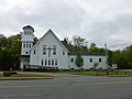 Agape Church, a non-denominational and evangelical church located at 1002 Broadway, Raynham, Massachuestts 02767-1743. East (front) side of building shown.
 -
 Agape Church, a non-denominational and evangelical church located at 1002 Broadway, Raynham, Massachuestts 02767-1743. South and east (front) sides of building shown.
 -
 Athletics fields at Merrill Elementary School, located near 687 Pleasant Street Raynham, Massachusetts 02767-1534.
 -
 Gravestones of Benjamin and Harmony Winkley. Located at King and Williams Cemetery, immediately north of the intersection of South Street East and Pine Street Lane, Raynham, Massachusetts.
 -
 Gravestone of Captain John King, who died in 1814 at age 83. Located at King and Williams Cemetery, immediately north of the intersection of South Street East and Pine Street Lane, Raynham, Massachusetts.
 -
 Central Oil Corporation, located at 728 Broadway Raynham, Massachusettes 02767-1797. Viewed from north.
 -
 Central Oil Corporation, located at 728 Broadway Raynham, Massachusetts 02767-1797. Viewed from south.
 -
 Obelisk gravestone of Charles and Thomas Robinson and their families. Side of Charles and family is shown. Located at King and Williams Cemetery, immediately north of the intersection of South Street East and Pine Street Lane, Raynham, Massachusetts.
 -
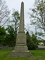 Obelisk gravestone of Charles and Thomas Robinson and their families. Side of Thomas and family is shown. Located at King and Williams Cemetery, immediately north of the intersection of South Street East and Pine Street Lane, Raynham, Massachusetts.
 -
 Civil War memorial at Raynham Public Library, located at 760 South Main Street, Raynham, Massachusetts.
 -
 Obelisk gravestone of Enoch Robinson and family. Located at King and Williams Cemetery, immediately north of the intersection of South Street East and Pine Street Lane, Raynham, Massachusetts.
 -
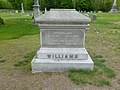 Gravestone of Enoch Williams (1807-1890) and Mary Ann Williams (1811-1891). Located at King and Williams Cemetery, immediately north of the intersection of South Street East and Pine Street Lane, Raynham, Massachusetts.
 -
 First Congregational Church, located at 785 South Main Street Raynham, Massachusetts 02767. Northwest (front) and southwest sides of building shown.
 -
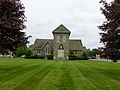 First Congregational Church, located at 785 South Main Street Raynham, Massachusetts 02767. Northwest (front) side of building shown.
 -
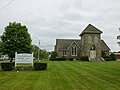 First Congregational Church, located at 785 South Main Street Raynham, Massachusetts 02767. Church sign and northwest (front) side of building shown.
 -
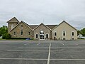 First Congregational Church, located at 785 South Main Street Raynham, Massachusetts 02767. Southwest side of building shown.
 -
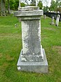 Gravestone of George, Bathsheba and Narcissus Williams family. Shown is the side of Bathsheba Williams, who died on September 11, 1847 at age 72. Also listed on this side is Enoch Williams, who died on August 6, 1846 at age 62; and his wife, Hannah, who died on May 26, 1830 at age 44. Located at King and Williams Cemetery, immediately north of the intersection of South Street East and Pine Street Lane, Raynham, Massachusetts.
 -
 Gravestone of George, Bathsheba and Narcissus Williams family. Shown is the side of George Williams, who died on February 25, 1814 at age 69. Also listed on this side is Bathsheba Williams, who died on May 26, 1839 at age 93. Located at King and Williams Cemetery, immediately north of the intersection of South Street East and Pine Street Lane, Raynham, Massachusetts.
 -
 Gravestone of George, Bathsheba and Narcissus Williams family. Shown is the side of Narcissus Williams, who died on December 30, 1867 at age 86; and his wife Hasadiah, who died on October 21, 1868 at age 88. Located at King and Williams Cemetery, immediately north of the intersection of South Street East and Pine Street Lane, Raynham, Massachusetts.
 -
 Gravestone of George Bassett Williams (1844-1907) and Caroline B. Williams (1852-1914). Located at King and Williams Cemetery, immediately north of the intersection of South Street East and Pine Street Lane, Raynham, Massachusetts.
 -
 The Hannant House, built in 1773. Located at 6 Pleasant Street, Raynham, Massachusetts. Southeast (front) side of building shown.
 -
 The Hannant House, built in 1773. Located at 6 Pleasant Street, Raynham, Massachusetts. Southwest and southeast (front) sides of building shown.
 -
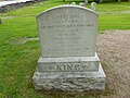 Gravestone of Jesse King and family. Listed on the gravestone are Jesse King (1836-1916), his wife Caroline R. Hathaway (1843-1943), their son Francis Calvin (1863-1912) and his wife Henrietta J. Remington (1861-1955). Located at King and Williams Cemetery, immediately north of the intersection of South Street East and Pine Street Lane, Raynham, Massachusetts.
 -
 Johnson's Pond in Raynham, Massachuesetts. Viewed from the southeast near the intersection of North Main Street and Kenny Road.
 -
 Johnson's Pond in Raynham, Massachuesetts. Viewed from the southeast near the intersection of North Main Street and Lordan Road.
 -
 A memorial for those who served in the Korean and Vietnam Wars. Located in Bruce E. Johnston, III Memorial Park, abutting Johnson's Pond in Raynham, Massachusetts.
 -
 Bruce E. Johnston, III Memorial Park, abutting Johnson's Pond in Raynham, Massachusetts. Viewed from east.
 -
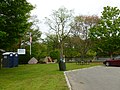 Bruce E. Johnston, III Memorial Park, abutting Johnson's Pond in Raynham, Massachusetts. Detailed view from east.
 -
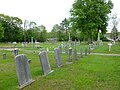 Located at King and Williams Cemetery, immediately north of the intersection of South Street East and Pine Street Lane, Raynham, Massachusetts.
 -
 King and Williams Cemetery, immediately north of the intersection of South Street East and Pine Street Lane, Raynham, Massachusetts. Viewed from south.
 -
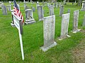 A group of gravestones for the King Family. Located at King and Williams Cemetery, immediately north of the intersection of South Street East and Pine Street Lane, Raynham, Massachusetts.
 -
 LaLiberte Elementary School, located at 777 Pleasant Street Raynham, Massachusetts. North (front) and west sides shown.
 -
 LaLiberte Elementary School, located at 777 Pleasant Street Raynham, Massachusetts. West and north (front) sides shown.
 -
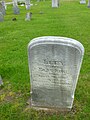 Gravestone of Lucy King, who died in 1862 at age 66. Located at King and Williams Cemetery, immediately north of the intersection of South Street East and Pine Street Lane, Raynham, Massachusetts.
 -
 Lutheran Church of the Way, located at 110 Robinson Street Raynham, Massachusetts 02767-1921. North and west (front) sides shown.
 -
 Lutheran Church of the Way, located at 110 Robinson Street Raynham, Massachusetts 02767-1921. West (front) and south sides shown.
 -
 Lutheran Church of the Way, located at 110 Robinson Street Raynham, Massachusetts 02767-1921. West (front) side shown.
 -
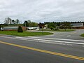 Merrill Elementary School, located at 687 Pleasant Street Raynham, Massachusetts 02767-1534. Northwest (front) side of building shown.
 -
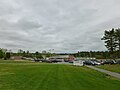 Merrill Elementary School, located at 687 Pleasant Street Raynham, Massachusetts 02767-1534. Northwest (front) side, as viewed from southwest, shown.
 -
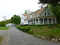 NMR Meditation, Thai American Cultural Center, a Thai Theravada Buddhist temple also known as Wat Nawamintararachutis. Located at 382 South Street East Raynham, Massachusetts 02767.
 -
 North Raynham Water District office building, located at 80 Baker Road Raynham, Massachusetts 02767. South and east sides of building shown.
 -
 North Raynham Water District office building, located at 80 Baker Road Raynham, Massachusetts 02767. West and south sides of building shown.
 -
 Northbook Academy, a private school for grades 6 through 8, located at 53 Baker Road Raynham, Massachusetts 02767. Close view of east and north (front) sides of building shown.
 -
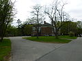 Northbook Academy, a private school for grades 6 through 8, located at 53 Baker Road Raynham, Massachusetts 02767. East and north (front) sides of building shown.
 -
 Northbook Academy, a private school for grades 6 through 8, located at 53 Baker Road Raynham, Massachusetts 02767. North (front) and west sides of building shown.
 -
 Northbook Academy, a private school for grades 6 through 8, located at 53 Baker Road Raynham, Massachusetts 02767. North (front) side of building shown.
 -
 Pleasant Street Cemetery, located near 178 Pleasant Street Raynham, Massachusetts 02767.
 -
 Pleasant Street Cemetery, located near 178 Pleasant Street Raynham, Massachusetts 02767. Viewed from north.
 -
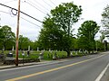 Pleasant Street Cemetery, located near 178 Pleasant Street Raynham, Massachusetts 02767. Viewed from south.
 -
 East side of Raynham-Taunton Park clubhouse, with neon outlines of racing greyhound dogs along top of wall. Located at 1958 Broadway Raynham, MA 02767.
 -
 South side of Raynham-Taunton Park clubhouse. Located at 1958 Broadway Raynham, MA 02767.
 -
 Detailed view of Raynham-Taunton Park clubhouse. Located at 1958 Broadway Raynham, MA 02767.
 -
 Construction at Raynham-Taunton Park. Located at 1958 Broadway Raynham, MA 02767.
 -
 View of grandstand at Raynham-Taunton Park. Located at 1958 Broadway Raynham, MA 02767.
 -
 Sign for Raynham-Taunton Park, with the park complex in the background. Located at 1958 Broadway Raynham, MA 02767.
 -
 Raynham Building and Planning Departments office building, located at 964 Broadway Raynham, Massachusetts. South (front) and east sides of building shown. The top horizontal banner along the east side of the building reads "GILMORE HALL".
 -
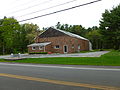 Raynham Center Water District office building. Located at 280 Pleasant Street, Raynham, Massachusetts 02767-1636. Southeast (front) and northeast sides of building shown.
 -
 Raynham Center Water District office building. Located at 280 Pleasant Street, Raynham, Massachusetts 02767-1636. Southwest and southeast (front) sides of building shown.
 -
 Raynham Depot, a retail plaza located 770 Broadway Raynham, Massachusetts.
 -
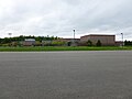 Raynham Middle School, located at 420 Titicut Road, Raynham, Massachusetts 02767-1571. Southeast side of building shown.
 -
 Raynham Middle School, located at 420 Titicut Road, Raynham, Massachusetts 02767-1571. Southwest (front) side of building shown.
 -
 Raynham Police and Fire Departments building, located at 53 Orchard Street, Raynham, Massachusetts. Shown is the northeast (front) side of building, as viewed from the north.
 -
 Raynham Police and Fire Departments building, located at 53 Orchard Street, Raynham, Massachusetts. Shown is the northeast (front) side of building, as viewed from the sourth.
 -
 Raynham Public Library, located at 760 South Main Street, Raynham, Massachusetts 02767. Northeast side of building shown.
 -
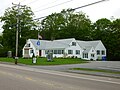 Raynham Public Library, located at 760 South Main Street, Raynham, Massachusetts 02767. Southeast (front) and northeast sides of building shown.
 -
 Raynham Public Library, located at 760 South Main Street, Raynham, Massachusetts 02767. Southeast (front) side of building shown.
 -
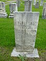 Gravestone of Rebecca King, who died in 1850 at age 78. Located at King and Williams Cemetery, immediately north of the intersection of South Street East and Pine Street Lane, Raynham, Massachusetts.
 -
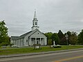 Saint Ann's Catholic Church, located at 660 North Main Street Raynham, Massachusetts 02767. North and west (front) sides of building shown.
 -
 Saint Ann's Catholic Church, located at 660 North Main Street Raynham, Massachusetts 02767. North side of building shown.
 -
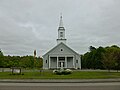 Saint Ann's Catholic Church, located at 660 North Main Street Raynham, Massachusetts 02767. West side of building shown.
 -
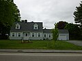 Saint Ann's Rectory, located across the street from Saint Ann's Catholic Church in Raynham, Massachusetts.
 -
 Gravestone of Sally King, who died in 1791 at age 23. Located at King and Williams Cemetery, immediately north of the intersection of South Street East and Pine Street Lane, Raynham, Massachusetts.
 -
 Gravestone of Silas King, who died in 1851 at age 86. Located at King and Williams Cemetery, immediately north of the intersection of South Street East and Pine Street Lane, Raynham, Massachusetts.
 -
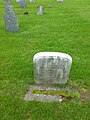 Gravestone of Silas King, who died in 1879 at age 33. Located at King and Williams Cemetery, immediately north of the intersection of South Street East and Pine Street Lane, Raynham, Massachusetts.
 -
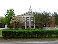 South School, located at 305 South Street East, Raynham, Massachusetts. East (front) side of building shown.
 -
 South School, located at 305 South Street East, Raynham, Massachusetts. North and east (front) sides of building shown.
 -
 US Post Office, located at 681 Broadway Raynham, Massachusetts 02767-1734. North and west (front) sides of building shown.
 -
 US Post Office, located at 681 Broadway Raynham, Massachusetts 02767-1734. West (front) side of building shown.
 -
 Unknown, broken gravestone among King family gravestone group. Located at King and Williams Cemetery, immediately north of the intersection of South Street East and Pine Street Lane, Raynham, Massachusetts.
 -
 Gravestone of William H. Gilmore, who died in 1836 at age 1. Located at King and Williams Cemetery, immediately north of the intersection of South Street East and Pine Street Lane, Raynham, Massachusetts.
 -
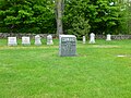 Gravestone of the Wilson family. Located at King and Williams Cemetery, immediately north of the intersection of South Street East and Pine Street Lane, Raynham, Massachusetts.
 -
 World War II memorial at Raynham Public Library, located at 760 South Main Street, Raynham, Massachusetts 02767.
 -
 World War I memorial at Raynham Public Library, located at 760 South Main Street, Raynham, Massachusetts 02767.
_and_north_sides.JPG)
_side.JPG)
_sides.JPG)


_gravestone;_King_and_Williams_Cemetery;_Raynham,_MA.JPG)


_and_Mary_Ann_Williams_(1811-1891)_gravestone;_King_and_Williams_Cemetery;_Raynham,_MA.JPG)
_and_southwest_sides.JPG)
_side.JPG)
_side_with_sign.JPG)


_and_Caroline_B._Williams_(1852-1914)_gravestone;_King_and_Williams_Cemetery;_Raynham,_MA.JPG)
_side.JPG)
_sides.JPG)


_and_west_sides.JPG)
_sides.JPG)
_gravestone;_King_and_Williams_Cemetery;_Raynham,_MA.JPG)
_sides.JPG)
_and_south_sides.JPG)
_side.JPG)
_side.JPG)
_side_viewed_from_southwest.JPG)


_sides,_close.JPG)
_sides.JPG)
_and_west_sides.JPG)
_side.JPG)


_and_east_sides.JPG)
_and_northeast_sides.JPG)
_sides.JPG)


_side.JPG)
_side,_viewed_from_north.JPG)
_side,_viewed_from_south.JPG)

_and_northeast_sides.JPG)
_side.JPG)
_gravestone;_King_and_Williams_Cemetery;_Raynham,_MA.JPG)
_sides.JPG)

_side.JPG)

_gravestone;_King_and_Williams_Cemetery;_Raynham,_MA.JPG)
_gravestone;_King_and_Williams_Cemetery;_Raynham,_MA.JPG)
_gravestone;_King_and_Williams_Cemetery;_Raynham,_MA.JPG)
_side.JPG)
_sides.JPG)
_sides.JPG)
_side.JPG)

_gravestone;_King_and_Williams_Cemetery;_Raynham,_MA.JPG)


Mon May 30 23:14:27 EDT 2011[edit]
-
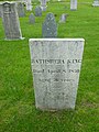 Gravestone of Bathsheba King, who died in 1850 at age 76. Located at King and Williams Cemetery, immediately north of the intersection of South Street East and Pine Street Lane, Raynham, Massachusetts.
;_King_and_Williams_Cemetery;_Raynham,_MA.JPG)
Mon May 16 03:45:19 EDT 2011[edit]
-
 Burlington Fire Department headquarters, located at 21 Center Street Burlington, Massachusetts 01803-3014.
 -
 Burlington Heritage Trail plaque in Burlington Town Common; Burlington, Massachusetts. The plaque reads: BURLINGTON HERITAGE TRAIL DEDICATED APRIL 19 1976 IN RECOGNITION OF BURLINGTON'S CONTRIBUTION TO THE FREEDOM OUR NATION NOW ENJOYS AND THE REALIZATION THAT THIS TOWN HAS HELPED PRESERVE THAT FREEDOM ORGANIZED BY BURLINGTON GARDEN CLUB COOPERATION OF BURLINGTON HISTORIC COMMISSION
 -
 Burlington Montessori school, attached to United Church of Christ Congregational. Located at 6 Lexington Street, Burlington, Massachusetts.
 -
 Burlington Police Department station, located at 45 Center Street Burlington, Massachusetts 01803-3099. Northeast side of building shown.
 -
 Burlington Police Department station, located at 45 Center Street Burlington, Massachusetts 01803-3099. Front side of building (on the southeast) shown.
 -
 United States Post Office for the 01803 ZIP code. Located at 5 Bedford Street Burlington, Massachusetts 01803-3702. East side and north (front) side of building shown.
 -
 United States Post Office for the 01803 ZIP code. Located at 5 Bedford Street Burlington, Massachusetts 01803-3702. North (front) and west sides of building shown.
 -
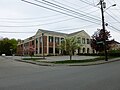 Burlington Public Library, located at 22 Sears Street Burlington, Massachusetts 01803-3032. North and west (front) sides of building shown.
 -
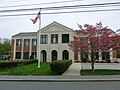 Burlington Public Library, located at 22 Sears Street Burlington, Massachusetts 01803-3032. West (front) side of building shown.
 -
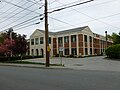 Burlington Public Library, located at 22 Sears Street Burlington, Massachusetts 01803-3032. West (front) and south sides of building shown.
 -
 Town Common of Burlington, Massachusetts. Viewed from the west on Cambridge Street.
 -
 Plaque commerorating athletes from Burlington who competed in the Olympic Games. Participants listed: Gary Piantedosi: Rowing, 1976 Mark Fusco: Hockey, 1984 Scott Fusco: Hockey, 1984 Peter Carruthers: Silver Medal, Figure Skating 1984 Kitty Carruthers: Silver Medal, Figure Skating 1984
 -
 A memorial to John Fitzgerald Kennedy in the Town Common in Burlington, Massachusetts
 -
 The north side of the Town Common in Burlington, Massachusetts.
 -

-
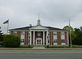 Burlington Town Hall, located at 29 Center Street, Burlington, Massachusetts. Front side of building shown.
 -
 Burlington Town Hall, located at 29 Center Street, Burlington, Massachusetts. Northwest and southwest (front) sides shown.
 -
 Burlington Town Hall, located at 29 Center Street, Burlington, Massachusetts. Southwest (front) and southeast sides shown.
 -
 Burlington Town Hall Annex, located at 25 Center Street Burlington, Massachusetts 01803-3058. Front side of building shown.
 -
 Burlington Town Hall Annex, located at 25 Center Street Burlington, Massachusetts 01803-3058. Northwest and southwest (front) sides
 -
 Fellowship Bible Church, located at 71 Center Street, Burlington, Massachusetts.
 -
 Fox Hill Elementary School, located at the intersection of Fox Hill Road and Westwood Street in Burlington, Massachusetts. North side of building shown.
 -
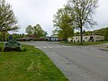 Fox Hill Elementary School, located at the intersection of Fox Hill Road and Westwood Street in Burlington, Massachusetts. West side of building, as viewed from intersection, shown.
 -
 The gazebo in the Town Common in Burlington, Massachusetts.
 -
 Heritage Park Baptist Church, located at 129 Lexington Street Burlington, Massachusetts 01803-4506.
 -
 Heritage Park Baptist Church, located at 129 Lexington Street Burlington, Massachusetts 01803-4506. Viewed from Lexington Street.
 -
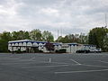 Islamic Center of Burlington, located at 130 Lexington Street Burlington, Massachusetts 01803-4504. South and east sides of building shown.
 -
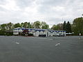 Islamic Center of Burlington, located at 130 Lexington Street Burlington, Massachusetts 01803-4504. South and east sides of building shown.
 -
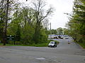 Islamic Center of Burlington, located at 130 Lexington Street Burlington, Massachusetts 01803-4504. Viewed from Lexington Street.
 -
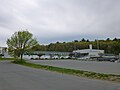 Memorial Elementary School, located at 119 Winn Street Burlington, Massachusetts 01803-3124.
 -
 Memorial Elementary School, located at 119 Winn Street Burlington, Massachusetts 01803-3124.
 -
 Memorial Elementary School, located at 119 Winn Street Burlington, Massachusetts 01803-3124. Main entrance shown.
 -
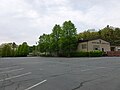 Mount Hope Christian Center, located at 3 McGinnis Drive Burlington, Massachusetts 01803-3719. South side of building shown.
 -
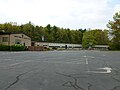 Mount Hope Christian Center, located at 3 McGinnis Drive Burlington, Massachusetts 01803-3719. Back entrance of building shown.
 -
 Future site of expansion for Mount Hope Christian Center. Located at 3 McGinnis Drive Burlington, Massachusetts 01803-3719.
 -
 Mount Hope Christian Center, located at 3 McGinnis Drive Burlington, Massachusetts 01803-3719. Viewed from McGinnis Drive.
 -
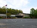 Mount Hope Christian Center, located at 3 McGinnis Drive Burlington, Massachusetts 01803-3719. Side entrance of building shown.
 -
 New building of the Memorial Elementary School, located at located at 119 Winn Street Burlington, Massachusetts 01803-3124. Site under construction at time when photograph was taken. East (front) side of building shown.
 -
 New building of the Memorial Elementary School, located at located at 119 Winn Street Burlington, Massachusetts 01803-3124. Site under construction at time when photograph was taken. South side of building shown.
 -
 Gravestone of Abigail Blanchard (died 1792) gravestone, in Old Second Parish Burial Ground, in Burlington, Massachusetts.
 -
 Betsey Jame (died 1852) gravestone, in Old Second Parish Burial Ground, in Burlington, Massachusetts.
 -
 Gravestone of Betsey and Sally Kindall (died 1801), in Old Second Parish Burial Ground, in Burlington, Massachusetts.
 -
 Gravestone of Charles Marion (died 1833), in Old Second Parish Burial Ground, in Burlington, Massachusetts
 -
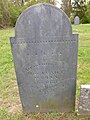 Gravestone of Eunice Wyman (died 1834), in Old Second Parish Burial Ground, in Burlington, Massachusetts.
 -
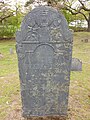 Gravestone of Hannah Peters (died 1782), in Old Second Parish Burial Ground, in Burlington, Massachusetts.
 -
 Gravestone of Jane Carter (died 1892), in Old Second Parish Burial Ground; Burlington, Massachusetts.
 -
 Jennison family gravestone group in Old Second Parish Burial Ground; Burlington, Massachusetts.
 -
 Gravestone of Joseph Butters (died 1839), in Old Second Parish Burial Ground; Burlington, Massachusetts.
 -
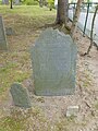 Gravestone of Lydia Twist (died 1776), in Old Second Parish Burial Ground; Burlington, Massachusetts.
 -
 Gravestone of Miss Lucy Walker (died 1806), in Old Second Parish Burial Ground; Burlington, Massachusetts.
 -
 Gravestone of Mrs. Lucy Walker (1834), in Old Second Parish Burial Ground; Burlington, Massachusetts.
 -
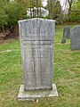 Gravestone of Redford Morse (died 1843) and Rhoda Morse (died 1867), in Old Second Parish Burial Ground; Burlington, Massachusetts.
 -
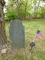 Gravestone of Thomas Skelton (1815), in Old Second Parish Burial Ground; Burlington, Massachusetts.
 -
 Unreadable veteran's gravestone with Masonic square and compass, in Old Second Parish Burial Ground; Burlington, Massachusetts.
 -
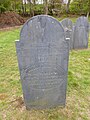 Gravestone of Maria Munroe (died 1833), in Old Second Parish Burial ground; Burlington, Massachusetts.
 -
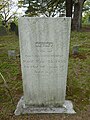 Gravestone of Betsey Munroe (died 1855), in Ole Second Parish Burial Ground; Burlington, Massachusetts.
 -
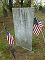 Gravestone of Captain Ishmael Munroe (1848), in Ole Second Parish Burial Ground; Burlington, Massachusetts.
 -
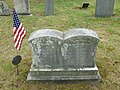 Captain James Cutler (died 1848) and Mary Cutler (died 1850), in Ole Second Parish Burial Ground; Burlington, Massachusetts.
 -
 Gravestone of Ebenezer Cummings (died 1845), in Ole Second Parish Burial Ground; Burlington, Massachusetts.
 -
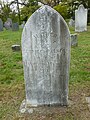 Gravestone of Eunice Walker (died 1863), in Ole Second Parish Burial Ground; Burlington, Massachusetts.
 -
 Gravestone of James Bennett (died 1842), in Ole Second Parish Burial Ground; Burlington, Massachusetts.
 -
 Gravestone of James Bennett (died 1856) and Dorcas Nevers (died 1860), in Ole Second Parish Burial Ground; Burlington, Massachusetts.
 -
 Gravestone of James C. McPherson (1840), in Ole Second Parish Burial Ground; Burlington, Massachusetts.
 -
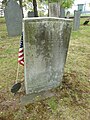 Gravestone of John Cutler (died 1848), in Ole Second Parish Burial Ground; Burlington, Massachusetts.
 -
 Lucreta Jennison (died 1855), in Ole Second Parish Burial Ground; Burlington, Massachusetts.
 -
 Gravestone of Lydia Trull (died 1817), in Ole Second Parish Burial Ground; Burlington, Massachusetts.
 -
 Partially sunken gravestone of Martha Marion, in Ole Second Parish Burial Ground; Burlington, Massachusetts.
 -
 Gravestone of Mary Bennett (died 1853), in Ole Second Parish Burial Ground; Burlington, Massachusetts.
 -
 Gravestone of Mary Walker (died 1852), in Ole Second Parish Burial Ground; Burlington, Massachusetts.
 -
 Gravestone of Nahum Jennison (1892), in Ole Second Parish Burial Ground; Burlington, Massachusetts.
 -
 Gravestone of Reuel Goodwin (died 1816) and Rhoda Goodwin (died 1812), in Ole Second Parish Burial Ground; Burlington, Massachusetts.
 -
 Gravestone of Ruth Cummings (died 1852), in Ole Second Parish Burial Ground; Burlington, Massachusetts.
 -
 Gravestone of Samuel Walker (died 1807), Mary Reed (died 1850), and Samuel Walker Jr. (died 1855), in Ole Second Parish Burial Ground; Burlington, Massachusetts.
 -
 Gravestone of William Wyman (died 1835), in Ole Second Parish Burial Ground; Burlington, Massachusetts.
 -
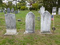 Wyman-Walker family gravestone group, in Ole Second Parish Burial Ground; Burlington, Massachusetts.
 -
 Entrance of the Ole Second Parish Burial Ground, in Burlington, Massachusetts. Burial ground established in 1732.
 -
 Ole Second Parish Burial Ground, in Burlington, Massachusetts. Viewed from Bedford Street.
 -
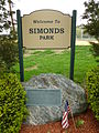 Sign and plaque on the south side of Simonds Park, in Burlington, Massachusetts.
 -
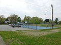 Basketball courts in Simonds Park, in Burlington, Massachusetts.
 -
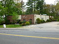 Temple Shalom Emeth Reform Jewish Congregation, located in 16 Lexington Street Burlington, MA 01803.east (front) and north sides
 -
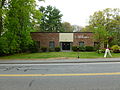 Temple Shalom Emeth Reform Jewish Congregation, located in 16 Lexington Street Burlington, MA 01803.
 -
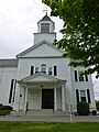 Main entrance of United Church of Christ Congregational, located at 6 Lexington Street Burlington, MA 01803-3734.
 -
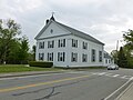 Main entrance of United Church of Christ Congregational, located at 6 Lexington Street Burlington, MA 01803-3734. Northeast side of building shown.
 -
 Main entrance of United Church of Christ Congregational, located at 6 Lexington Street Burlington, MA 01803-3734.
 -
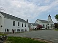 Main entrance of United Church of Christ Congregational, located at 6 Lexington Street Burlington, MA 01803-3734.
 -
 A water tank across the street from 71 Center Street in Burlington, Massachusetts.
 -
 Woburn Second Parish Meeting House plaque, on the east lawn in front of United Church of Christ Congregational. The plaque reads: WOBURN SECOND PARISH MEETING HOUSE BUILT 1732 HERE THE MINUTEMEN OF THIS PARISH ASSEMBLED ON THE MORNING OF APRIL 19, 1775 TO MARCH TO LEXINGTON AND CONCORD UNDER THE COMMAND OF CAPTAIN JOSHUA WALKER. PLAQUE THE BURLINGTON BICENTENNIAL COMMISSION APRIL 19, 1976
 -
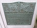 World War II Honor Roll memorial in the Town Common in Burlington, Massachusetts. The plaque reads: ERECTED TO COMMEMORATE THE MEN AND WOMEN OF BURLINGTON WHO SERVED IN WORLD WAR II AND TO PERPETUATE THE NAMES OF THESE WHO GAVE THEIR LIVES JAMES L. BRIDGEO HENRY CROGAN ERNEST J. EVERETT HAROLD D. GIVEN ALAN D. HANN ROBERT J. HARRON EVERETT L. LOVEJOY, SR. ROBERT P. MILLER WALLACE L. OLDFORD JAMES PLUMMER LENNART A. RABENIUS EDWARD RONAYNE LAURENCE G. WHITE MERCHANT MARINE MARVIN LOYDEN
 -
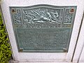 World War I Honor Roll memorial in the Town Common in Burlington, Massachusetts. The plaque reads: DEDICATED TO THOSE WHO OFFERED THEIR LIVES IN HUMANITY'S DEFENSE IN THE GREAT WORLD WAR AND IN MEMORY OF THOSE WHO GAVE THE LAST FULL MEASURE OF THEIR DEVOTION BREWER, J. GORDON BAMBERG, CARL FREDERICK BOSTON, JOHN LLOYD BROCHU, JOHN CHAPMAN, MALCOM COMLEY, JAMES H. DECKER, NORMAN R. FOSTER, A. ELLSWORTH FOSTER, PHILLIP GRAHAM, FRED R. HOLDEN, LESLIE B. JOHNSON, EDWIN V. LYNDS, STANLEY ROY McARDLE, CHARLES O. McARDLE, EDWARD W. McGANN, HAROLD E. * McKENZIE, KENNETH A. * MILLICAN, LEONARD L. MOGLIA, FRANK J. PEARSONS, MAITLAND PEARSONS, WILMOT L. POCUS, HOLLIS REED, CHARLES E. SULLIVAN, JAMES F. TWINING, RAYMOND WALKER, WILFORD A. WALKER, JAY A. WALKER, WM. HENRY YEOMAN F. WALKER, EDITH MILLARD ERECTED BY THE TOWN OF BURLINGTON, MASSACHUSETTS 1919
 -
 World War I and World War II memorial in the Town Common in Burlington, Massachusetts.


_side.JPG)
_sides.JPG)
_and_west_sides.JPG)
_sides.JPG)
_side.JPG)
_and_south_sides.JPG)


_sides.JPG)
_and_southeast_sides.JPG)

_sides.JPG)


_side.JPG)

_gravestone.JPG)
_gravestone.JPG)
_gravestone.JPG)
_gravestone.JPG)
_gravestone.JPG)
_gravestone.JPG)
_gravestone.JPG)

_gravestone.JPG)
_gravestone.JPG)
_gravestone.JPG)
_gravestone.JPG)
_and_Rhoda_Morse_(1867)_gravestone.JPG)
_gravestone.JPG)

_gravestone.JPG)
_gravestone.JPG)
_gravestone.JPG)
_and_Mary_Cutler_(1850)_gravestone.JPG)
_gravestone.JPG)
_gravestone.JPG)
_gravestone.JPG)
_and_Dorcas_Nevers_(1860)_gravestone.JPG)
_gravestone.JPG)
_gravestone.JPG)
_gravestone.JPG)
_gravestone.JPG)

_gravestone.JPG)
_gravestone.JPG)
_gravestone.JPG)
_and_Rhoda_Goodwin_(1812)_gravestone.JPG)
_gravestone.JPG)
,_Mary_Reed_(1850),_and_Samuel_Walker_Jr._(1855)_gravestone.JPG)
_gravestone.JPG)


_and_north_sides.JPG)


Wed May 04 18:15:59 EDT 2011[edit]
-
 Looking north down 3rd Street at the intersection of Washington Street and Berry Street.
 -
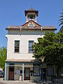 Calistoga City Hall, located at 1232 Washington Street in Calistoga, California 94515-1440. Front side, facing south, shown.
 -
 Looking west on Washington Street in Calistoga, California. Calistoga City Hall visible.
 -
 Calistoga City Hall, located at 1232 Washington Street in Calistoga, California 94515-1440. South (front) and east sides shown.
 -
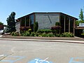 Calistoga Elementary School, located at 1327 Berry Street in Calistoga, CA 94515. Front view shown.
 -
 Calistoga Elementary School, located at 1327 Berry Street in Calistoga, CA 94515. Full view shown, looking southwest.
 -
 Calistoga Fire Department located at 1113 Washington Street in Calistoga, CA 94515-1437. View of front (south) and east sides of building shown.
 -
 Calistoga Fire Department located at 1113 Washington Street in Calistoga, CA 94515-1437. Direct view of front side of building, which faces south, shown.
 -
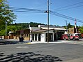 Calistoga Fire Department located at 1113 Washington Street in Calistoga, CA 94515-1437. View of front (south) and east sides of building shown.
 -
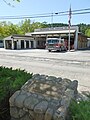 Monument to the San Francisco, Napa, and Calistoga electric railroad. The monument reads: THE S.F., N., AND C. ELECTRIC RAIL-ROAD THE RAIL-ROAD TRACK YOU SEE IN THE MIDDLE OF THE STREET IS THE LAST REMAINING TRACK OF THE SAN FRANCISCO, NAPA AND CALISTOGA ELECTRIC RAIL-ROAD. THE CALISTOGA DEPOT STOOF ON THE SITE OF THE PRESENT DAY FIREHOUSE. DEDICATED OCTOBER 15, 1999 BY CALISTOGA PARLOR NO. 86 NATIVE SONS OF THE GOLDEN WEST
 -
 Calistoga Junior/Senior High School, located at 1608 Lake Street Calistoga, CA 94515-1359
 -
 Calistoga National Bank, now Bella Tootsie Shoe Store. Located at 1373 Lincoln Avenue Calistoga, CA 94515-1701. View from
 -
 Calistoga Police Department, located at 1234 Washington Street Calistoga, CA 94515. Main entrance on north side of building shown.
 -
 Calistoga Police Department, located at 1234 Washington Street Calistoga, CA 94515. East side of building shown.
 -
 Calistoga US Post Office, located at 1013 Washington Street Calistoga, CA 94515-9998.
 -
 Calistoga Public Library, located at 1108 Myrtle Street Calistoga, CA 94515-1730. Viewed from the intersection of Myrtle Street and Lincoln Avenue.
 -
 Calistoga Public Library, located at 1108 Myrtle Street Calistoga, CA 94515-1730. Front entrance shown.
 -
 View of business store fronts and mountain background in Calistoga near 1277 Lincoln Avenue, looking north.
 -
 Community Presbyterian Church, located at 1407 3rd Street Calistoga, CA 94515-1421. South side of building shown.
 -
 Mount View Hotel, a building on the National Register of Historic Landmarks. Located at 1457 Lincoln Avenue Calistoga, CA 94515.
 -
 The Sharpsteen Museum of Calistoga History, located at 1311 Washington Street Calistoga, CA 94515-1441.
 -
 Vermeil Wines/On The Edge Winery, one of several wine stores along Lincoln Avenue in Calistoga, CA. Located at 1255 Lincoln Avenue Calistoga, CA 94515-1742.


.JPG)


Tue May 03 02:03:38 EDT 2011[edit]
-
 Sculpture of Adam by Auguste Rodin at the B. Gerald Cantor Rodin Sculpture Garden at Stanford University. Left side shown.
 -
 Sculpture of Adam by Auguste Rodin at the B. Gerald Cantor Sculpture Garden at Stanford University. Front side shown.
 -
 Sculpture of Adam by Auguste Rodin at the B. Gerald Cantor Sculpture Garden at Stanford University. Left side shown.
 -
 Sculpture of Adam by Auguste Rodin at the B. Gerald Cantor Sculpture Garden at Stanford University. Right side shown.
 -
 North entrance of the B. Gerald Cantor Rodin Sculpture Gerald at Stanford University
 -
 Sculpture of Claude Lorrain by Auguste Rodin. Located at the B. Gerald Cantor Rodin Sculpture Garden at Stanford University. Back side shown.
 -
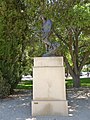 Sculpture of Claude Lorrain by Auguste Rodin. Located at the B. Gerald Cantor Rodin Sculpture Garden at Stanford University. Front side shown.
 -
 Sculpture of Claude Lorrain by Auguste Rodin. Located at the B. Gerald Cantor Rodin Sculpture Garden at Stanford University. Left side shown.
 -
 Sculpture of Claude Lorrain by Auguste Rodin. Located at the B. Gerald Cantor Rodin Sculpture Garden at Stanford University. Right side shown.
 -
 Sculpture of Eve by Auguste Rodin. Located at the B. Gerald Cantor Rodin Sculpture Garden at Stanford University. Back side shown.
 -
 Sculpture of Eve by Auguste Rodin. Located at the B. Gerald Cantor Rodin Sculpture Garden at Stanford University. Front side shown.
 -
 Sculpture of Eve by Auguste Rodin. Located at the B. Gerald Cantor Rodin Sculpture Garden at Stanford University. Left side shown.
 -
 Sculpture of Eve by Auguste Rodin. Located at the B. Gerald Cantor Rodin Sculpture Garden at Stanford University. Back side shown.
 -
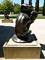 'Fallen Caryatid with Stone', a sculpture by Auguste Rodin. Located at the B. Gerald Cantor Rodin Sculpture Garden at Stanford University. Back side shown.
 -
 'Fallen Caryatid with Stone', a sculpture by Auguste Rodin. Located at the B. Gerald Cantor Rodin Sculpture Garden at Stanford University. Detail of front and right sides shown.
 -
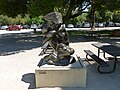 'Fallen Caryatid with Stone', a sculpture by Auguste Rodin. Located at the B. Gerald Cantor Rodin Sculpture Garden at Stanford University. Front side shown.
 -
 'Fallen Caryatid with Stone', a sculpture by Auguste Rodin. Located at the B. Gerald Cantor Rodin Sculpture Garden at Stanford University. Left side shown.
 -
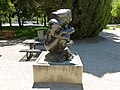 'Fallen Caryatid with Stone', a sculpture by Auguste Rodin. Located at the B. Gerald Cantor Rodin Sculpture Garden at Stanford University. Right side shown.
 -
 'Fallen Caryatid with Urn', a sculpture by Auguste Rodin. Located at the B. Gerald Cantor Rodin Sculpture Garden at Stanford University. Back side shown.
 -
 'Fallen Caryatid with Urn', a sculpture by Auguste Rodin. Located at the B. Gerald Cantor Rodin Sculpture Garden at Stanford University. Front side shown.
 -
 'Fallen Caryatid with Urn', a sculpture by Auguste Rodin. Located at the B. Gerald Cantor Rodin Sculpture Garden at Stanford University. Left side shown.
 -
 'Fallen Caryatid with Urn', a sculpture by Auguste Rodin. Located at the B. Gerald Cantor Rodin Sculpture Garden at Stanford University. Right side shown.
 -
 Dedication to Albert E. Elsen of the 'Gates of Hell' sculpture by Auguste Rodin at the B. Gerald Cantor Rodin Sculpture Garden at Stanford University.
 -
 Gates of Hell sculpture by Auguste Rodin. Located at the B. Gerald Cantor Rodin Sculpture Garden at Stanford University.
 -
 Gates of Hell sculpture by Auguste Rodin. Located at the B. Gerald Cantor Rodin Sculpture Garden at Stanford University. Viewed from the right of the sculpture at an angle.
 -
 Gates of Hell sculpture by Auguste Rodin. Located at the B. Gerald Cantor Rodin Sculpture Garden at Stanford University. Viewed from the left of the sculpture at an angle.
 -
 Gates of Hell sculpture by Auguste Rodin. Located at the B. Gerald Cantor Rodin Sculpture Garden at Stanford University. Viewed from the right of the sculpture to show miniature figures projecting forward from the sculpture.
 -
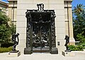 Gates of Hell sculpture by Auguste Rodin. Located at the B. Gerald Cantor Rodin Sculpture Garden at Stanford University. Sculpture of Adam at left of the photograph; sculpture of Eve at right.
 -
 Gates of Hell sculpture by Auguste Rodin. Located at the B. Gerald Cantor Rodin Sculpture Garden at Stanford University. Details of top of sculpture shown.
 -
 Head of Jean D'Aire, Burgher of Calais; a sculpture by Auguste Rodin. Located at the B. Gerald Cantor Rodin Sculpture Garden at Stanford University. Detail of front side shown.
 -
 Head of Jean D'Aire, Burgher of Calais; a sculpture by Auguste Rodin. Located at the B. Gerald Cantor Rodin Sculpture Garden at Stanford University. Front side shown.
 -
 Head of Jean D'Aire, Burgher of Calais; a sculpture by Auguste Rodin. Located at the B. Gerald Cantor Rodin Sculpture Garden at Stanford University. Left side shown.
 -
 Head of Pierre De Wissant, Burgher of Calais; a sculpture by Auguste Rodin. Located at the B. Gerald Cantor Rodin Sculpture Garden at Stanford University. Front side shown.
 -
 Head of Pierre De Wissant, Burgher of Calais; a sculpture by Auguste Rodin. Located at the B. Gerald Cantor Rodin Sculpture Garden at Stanford University. Right side shown.
 -
 Jean D'Aire, Burgher of Calais; a nude study sculpture by Auguste Rodin. Located at the B. Gerald Cantor Rodin Sculpture Garden at Stanford University. Back side shown.
 -
 Jean D'Aire, Burgher of Calais; a nude study sculpture by Auguste Rodin. Located at the B. Gerald Cantor Rodin Sculpture Garden at Stanford University. Front side shown.
 -
 Jean D'Aire, Burgher of Calais; a nude study sculpture by Auguste Rodin. Located at the B. Gerald Cantor Rodin Sculpture Garden at Stanford University. Left side shown.
 -
 Sculpture of Jules Bastien-Lepage by Auguste Rodin. Located at the B. Gerald Cantor Rodin Sculpture Garden at Stanford University. Front and left sides shown.
 -
 Sculpture of Jules Bastien-Lepage by Auguste Rodin. Located at the B. Gerald Cantor Rodin Sculpture Garden at Stanford University. Front side shown.
 -
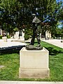 Sculpture of Jules Bastien-Lepage by Auguste Rodin. Located at the B. Gerald Cantor Rodin Sculpture Garden at Stanford University. Left side shown.
 -
 Map of the B. Gerald Cantor Sculpture Garden at Stanford University.
 -
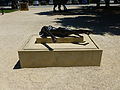 Martyr, a sculpture by Auguste Rodin. Located at the B. Gerald Cantor Rodin Sculpture Garden at Stanford University. Back side shown.
 -
 Martyr, a sculpture by Auguste Rodin. Located at the B. Gerald Cantor Rodin Sculpture Garden at Stanford University. Front side shown.
 -
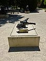 Martyr, a sculpture by Auguste Rodin. Located at the B. Gerald Cantor Rodin Sculpture Garden at Stanford University. Left side shown.
 -
 Martyr, a sculpture by Auguste Rodin. Located at the B. Gerald Cantor Rodin Sculpture Garden at Stanford University. Right side shown.
 -
 Meditation with Arms, a sculpture by Auguste Rodin. Located at the B. Gerald Cantor Rodin Sculpture Garden at Stanford University. Back side shown.
 -
 Meditation with Arms, a sculpture by Auguste Rodin. Located at the B. Gerald Cantor Rodin Sculpture Garden at Stanford University. Front side shown.
 -
 Meditation with Arms, a sculpture by Auguste Rodin. Located at the B. Gerald Cantor Rodin Sculpture Garden at Stanford University. Left side shown.
 -
 Meditation with Arms, a sculpture by Auguste Rodin. Located at the B. Gerald Cantor Rodin Sculpture Garden at Stanford University. Right side shown.
 -
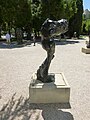 Meditation without Arms, a sculpture by Auguste Rodin. Located at the B. Gerald Cantor Rodin Sculpture Garden at Stanford University. Back side shown.
 -
 Meditation without Arms, a sculpture by Auguste Rodin. Located at the B. Gerald Cantor Rodin Sculpture Garden at Stanford University. Front side shown.
 -
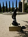 Meditation without Arms, a sculpture by Auguste Rodin. Located at the B. Gerald Cantor Rodin Sculpture Garden at Stanford University. Left side shown.
 -
 Meditation without Arms, a sculpture by Auguste Rodin. Located at the B. Gerald Cantor Rodin Sculpture Garden at Stanford University. Right side shown.
 -
 Orpheus, a sculpture by Auguste Rodin. Located at the B. Gerald Cantor Rodin Sculpture Garden at Stanford University. Back side shown.
 -
 Orpheus, a sculpture by Auguste Rodin. Located at the B. Gerald Cantor Rodin Sculpture Garden at Stanford University. Front side shown.
 -
 Orpheus, a sculpture by Auguste Rodin. Located at the B. Gerald Cantor Rodin Sculpture Garden at Stanford University. Left side shown.
 -
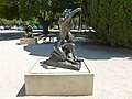 Orpheus, a sculpture by Auguste Rodin. Located at the B. Gerald Cantor Rodin Sculpture Garden at Stanford University. Right side shown.
 -
 Prayer, a sculpture by Auguste Rodin. Located at the B. Gerald Cantor Rodin Sculpture Garden at Stanford University. Back side shown.
 -
 Prayer, a sculpture by Auguste Rodin. Located at the B. Gerald Cantor Rodin Sculpture Garden at Stanford University. Front side shown.
 -
 Prayer, a sculpture by Auguste Rodin. Located at the B. Gerald Cantor Rodin Sculpture Garden at Stanford University. Left side shown.
 -
 Prayer, a sculpture by Auguste Rodin. Located at the B. Gerald Cantor Rodin Sculpture Garden at Stanford University. Right side shown.
 -
 Seated Woman, a sculpture of the goddess Cybele by Auguste Rodin. Located at the B. Gerald Cantor Rodin Sculpture Garden at Stanford University. Back side shown.
 -
 Seated Woman, a sculpture of the goddess Cybele by Auguste Rodin. Located at the B. Gerald Cantor Rodin Sculpture Garden at Stanford University. Front side shown.
 -
 Seated Woman, a sculpture of the goddess Cybele by Auguste Rodin. Located at the B. Gerald Cantor Rodin Sculpture Garden at Stanford University. Left side shown.
 -
 Seated Woman, a sculpture of the goddess Cybele by Auguste Rodin. Located at the B. Gerald Cantor Rodin Sculpture Garden at Stanford University. Right side shown.
 -
 Spirit of Eternal Repose, a sculpture by Auguste Rodin. Located at the B. Gerald Cantor Rodin Sculpture Garden at Stanford University. Back side shown.
 -
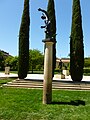 Spirit of Eternal Repose, a sculpture by Auguste Rodin. Located at the B. Gerald Cantor Rodin Sculpture Garden at Stanford University. Front side shown.
 -
 Spirit of Eternal Repose, a sculpture by Auguste Rodin. Located at the B. Gerald Cantor Rodin Sculpture Garden at Stanford University. Left side shown.
 -
 Spirit of Eternal Repose, a sculpture by Auguste Rodin. Located at the B. Gerald Cantor Rodin Sculpture Garden at Stanford University. Right side shown.
 -
 West entrance of the B. Gerald Cantor Rodin Sculpture Gerald at Stanford University
 -
 The Gates of Hell, by Auguste Rodin. Details shown.
 -
 Detailed view of The Three Shades, a sculpture by Auguste Rodin. Located at the B. Gerald Cantor Rodin Sculpture Garden at Stanford University.
 -
 The Three Shades, a sculpture by Auguste Rodin. Located at the B. Gerald Cantor Rodin Sculpture Garden at Stanford University. Back side shown.
 -
 The Three Shades, a sculpture by Auguste Rodin. Located at the B. Gerald Cantor Rodin Sculpture Garden at Stanford University. Front side shown.
 -
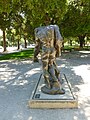 The Three Shades, a sculpture by Auguste Rodin. Located at the B. Gerald Cantor Rodin Sculpture Garden at Stanford University. Left side shown.
 -
 The Three Shades, a sculpture by Auguste Rodin. Located at the B. Gerald Cantor Rodin Sculpture Garden at Stanford University. Right side shown.


_sculpture_by_Rodin;_back_side.JPG)
_sculpture_by_Rodin;_front_side.JPG)
_sculpture_by_Rodin;_left_side.JPG)
_sculpture_by_Rodin;_right_side.JPG)


Sat Apr 23 19:49:33 EDT 2011[edit]
-
 First Baptist Church, located at 633 Centre Street in Jamaica Plain, Boston MA 02130.
 -
 Fuel station at Boston Fire Department Firehouse for Engine 28 and Ladder 10 (District 9) at 746 Centre Street in Jamaica Plain, Boston.
 -
 Hope Central Congregation Church, located at 85 Seaverns Avenue in Jamaica Plain, Boston, MA 02130.
 -
 Soldier's Monument in Jamaica Plain, Boston. The monument is bounded by South Street on the west, and Centre Street on the northeast and south. Viewed from the west.


Sat Apr 23 18:28:35 EDT 2011[edit]
-
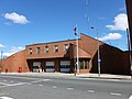 Boston Fire Department Firehouse for Engine 28 and Ladder 10 (District 9) at 746 Centre Street in Jamaica Plain, Boston.
 -
 2011 Boston Marathon finishing line pavillion on Boylston Street. Looking west; runners would be coming from the east.
 -
 Boston Police Department District E-13 Station at 3347 Washington Street in Jamaica Plain, Boston. East side of the building shown.
 -
 Boston Police Department District E-13 Station at 3347 Washington Street in Jamaica Plain, Boston. South and east sides of the building shown.
 -
 The Connolly Branch of the Boston Public Library at 433 Centre Street in Jamaica Plain, Boston, MA 02130.
 -
 Jamaica Plain Branch of the Boston Public Library at 12 Sedgwick Street in Jamaica Plain, Boston, MA 02130. South and east sides of the building shown.
 -
 Jamaica Plain Branch of the Boston Public Library at 12 Sedgwick Street in Jamaica Plain, Boston, MA 02130. West and south sides of the building shown.
 -
 Jamaica Plain Branch of the Boston Public Library at 12 Sedgwick Street in Jamaica Plain, Boston, MA 02130. West side of building shown.
 -
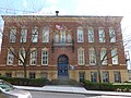 Community Academy, a public school of Boston, at 25 Glen Road in Jamaica Plain, Boston MA 02130. North side of building shown.
 -
 Community Academy, a public school of Boston located at 25 Glen Road in Jamaica Plain, Boston MA 02130. West side of building shown.
 -
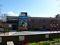 James M. Curley Elementary School, a public school of Boston located at 40 Pershing Road in Jamaica Plain, Boston 02130.
 -
 Mary Curley Middle School, a public school of Boston located at 493 Centre Street in Jamaica Plain, Boston 02130. Main entrance shown.
 -
 Mary Curley Middle School, a public school of Boston located at 493 Centre Street in Jamaica Plain, Boston 02130. Main entrance shown. South and east sides of building shown.
 -
 Curtis Hall Community Center Municipal Building. Located at 20 South Street in Jamaica Plain, Boston, MA 02130. West and south sides of building shown. Building was under renovation when this photograph was taken.
 -
 Curtis Hall Community Center Municipal Building. Located at 20 South Street in Jamaica Plain, Boston, MA 02130. West side of building shown. Building was under renovation when this photograph was taken.
 -
 First Church Cemetery in Jamaica Plain Boston, located at 6 Eliot Street in Jamaica Plain, Boston MA 02130. Viewed from the east.
 -
 First Church Cemetery in Jamaica Plain Boston, located near 6 Eliot Street in Jamaica Plain, Boston MA 02130. Viewed from the north. Visible in the background is the back of First Church in Jamaica Plain Unitarian Universalist.
 -
 Back entrance of First Church in Jamaica Plain Unitarian Universalist. Located at 6 Eliot Street in Jamaica Plain, Boston MA 02130.
 -
 Hi-Lo Foods grocery and household goods store, located at 415 Centre Street in Jamaica Plain, Boston 02130. The grocery store, which sold Latin American food to the neighboorhood's Latino community, closed in Februrary 2011. A Whole Foods grocery store is planned to open on this site.
 -
 Hi-Lo Foods grocery and household goods store, located at 415 Centre Street in Jamaica Plain, Boston 02130. The grocery store, which sold Latin American food to the neighboorhood's Latino community, closed in Februrary 2011. A Whole Foods grocery store is planned to open on this site.
 -
 Iglesia Adventista del Septimo-dia, a Hispanic Seventh Day Adventist Church located at 40 Elm Street in Jamaica Plain, Boston, MA 02130.
 -
 Joseph W. Murphy Square in Jamaica Plain, Boston. South Street Courts, containing tennis and basketball courts, is visible in the background.
 -
 Louis Agassiz Elementary School at 20 Child Street, Jamaica Plain, Boston, MA 02130. Main entrance shown.
 -
 Outdoor classroom of the Louis Agassiz Elementary School in Jamaica Plain, Boston. Viewed from the west across Centre Street.
 -
 Mosaic School, a small early childhood education program located at 85 Seaverns Street in Jamaica Plain, Boston MA 02130. The steeple visible in that background is that of Hope Central Congregational Church, to which the school is attached.
 -
 Murphy Playground in Jamaica Plain, Boston. The playground is bounded by Carolina Avenue on the north, Verona Street on the east, Child Street on the south and the Agassiz School on the west.
 -
 Primera Iglesia Bautista, a Hispanic Baptist church located at 10 Kingsboro Park in Jamaica Plain, Boston MA 02130. South and east sides shown.
 -
 Primera Iglesia Bautista, a Hispanic Baptist church located at 10 Kingsboro Park in Jamaica Plain, Boston MA 02130. South and east sides shown.
 -
 Soldier's Monument in Jamaica Plain, Boston. The monument is bounded by South Street on the west, and Centre Street on the northeast and south. View from the west.
 -
 Soldier's Monument in Jamaica Plain, Boston. The monument is bounded by South Street on the west, and Centre Street on the northeast and south. Viewed from the north.
 -
 Southern Jamaica Plain Health Center, a community health center licensed by Brigham and Women's Hospital. Located at 640 Centre Street in Jamaica Plain, Boston, MA 02130. West and south sides shown.
 -
 Southern Jamaica Plain Health Center, a community health center licensed by Brigham and Women's Hospital. Located at 640 Centre Street in Jamaica Plain, Boston, MA 02130. West and south sides shown. North and west sides shown.
 -
 St John's Episcopal Church, located at 1 Roanoke Avenue in Jamaica Plain, Boston, MA 02130-2817. Viewed from the east.
 -
 Side entrance of St John's Episcopal Church, located at 1 Roanoke Avenue in Jamaica Plain, Boston, MA 02130-2817. North side of building shown.
 -
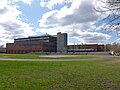 The English High School, a public school of Boston. Located at 144 McBride Street in Jamaica Plain, Boston, MA 02130. East side of building shown, as viewed from Washington Street. Part of the athletic running track and field is visible.
 -
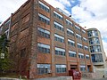 The English High School, a public school of Boston. Located at 144 McBride Street in Jamaica Plain, Boston, MA 02130. South side of building shown, as viewed from McBridge Street.
 -
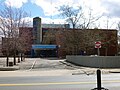 The English High School, a public school of Boston. Located at 144 McBride Street in Jamaica Plain, Boston, MA 02130. Main entrance and north side of building shown, as viewed from Williams Street.
 -
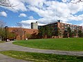 The English High School, a public school of Boston. Located at 144 McBride Street in Jamaica Plain, Boston, MA 02130. West side of building shown, as viewed from the field along Call Street.


_side,_far_view;_Washington,_DC;_2013-10-06.JPG)
;_Quincy,_MA;_2011-06-05.JPG&action=edit&redlink=1)
;_Quincy,_MA;_2011-06-05.JPG)