Transport in Greater Manchester
Jump to navigation
Jump to search

Maps[edit]
Main categories: Public transport maps of Greater Manchester and Manchester Metrolink maps
-
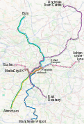
 Rail network map
 -
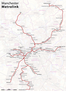
 Metrolink network map
 -
 Metrolink geographical map
 -
 Metrolink geographical map


Logos and symbols[edit]
-
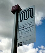 TfGM 'M' symbol
 -
 Metrolink symbol
 -
 National Rail
.jpg)


Bus[edit]
Main category: Bus transport in Greater Manchester

,_3_September_2010.jpg)
Rail[edit]
-
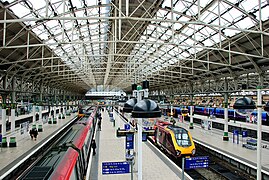 Piccadilly Station
 -
 Piccadilly Station
 -
 Piccadilly Station
 -
 Victoria Station
 -
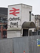
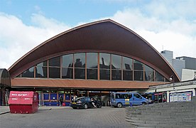 Oxford Road Station
 -
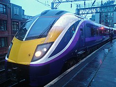
 TransPennine Express
 -
 Northern Rail
 -
 Northern Rail
 -
 Manchester Airport station
 -
 Burnage suburban station sign


.jpg)

.jpg)
.jpg)
.JPG)
Metrolink[edit]
-
 St Peter's Square Metrolink station
 -
 Victoria Metrolink station
 -
 Piccadilly Gardens Metrolink station
 -
 Central Park station
 -
 Shaw and Crompton Metrolink station
 -
 The front facade of an M5000 tram
 -
 Tram at Shudehill Interchange
 -
 Metrolink tram
 -
 Tram interior
 -

-
 Ticket machine
.JPG)


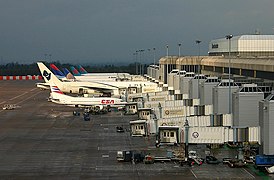
Manchester Airport[edit]
-
 Terminal 1
 -
 Terminal 2
 -
 Terminal 3
 -

-
-

-


.JPG)


Cycle routes[edit]
-

-
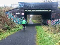
 Cyclists on the Fallowfield Loop
 -
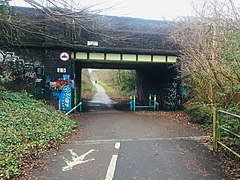
 Fallowfield Loop near Kingsway
 -
 Fallowfield Loop near Kingsway
 -
 Fallowfield Loop near Kingsway


History[edit]
-
 Manchester railways in 1914
 -
 London Road station
 -
 Manchester Exchange station
 -
 Manchester Exchange station
 -
 Manchester Corporation Tramways
 -
 Manchester Corporation Tramways
 -
 The Kingsway tram route
 -
 Manchester Central station
 -
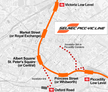 The Picc-Vic Line plan
 -
 Piccadilly station
 -
 SELNEC
 -
 SELNEC Central
 -
 Greater Manchester Transport
 -
 Greater Manchester Transport
 -
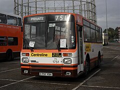 Centreline
 -
 Network Northwest
 -
 Construction of Metrolink
 -
 T-68 trams


_(14574356378).jpg)
_(2).jpg)


,_SELNEC_40_event.jpg)
,_SELNEC_40_event_(3).jpg)
,_Museum_of_Transport_in_Manchester,_4_October_2008_(4).jpg)
_1971_Daimler_Fleetline_Park_Royal,_10_April_2010_(2).jpg)
,_SELNEC_40_rally.jpg)


.jpg)