Streets in Varennes-lès-Mâcon

From Wikimedia Commons, the free media repository
Jump to navigation Jump to search

This list is periodically updated by a bot. Manual changes to the list will be removed on the next update!

WQS | PetScan | Find images | Recent Changes
Nom Code Fantoir Identifiant OSM Coordonnées Panneau Image
impasse Cadot Laborier 17577095 46°16′17″N 4°48′06″E / 46.27141003333333°N 4.801659433333334°E / 46.27141003333333; 4.801659433333334
impasse Verchère Bourdon 17577092 46°16′20″N 4°48′03″E / 46.27223905°N 4.80086195°E / 46.27223905; 4.80086195
impasse de la Croix 7105560007J 3815239 46°16′23″N 4°47′48″E / 46.273024633333335°N 4.796726616666667°E / 46.273024633333335; 4.796726616666667
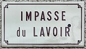
impasse du Lavoir 7105560010M 3815238 46°16′15″N 4°48′15″E / 46.270896879999995°N 4.8041065000000005°E / 46.270896879999995; 4.8041065000000005
lotissement Le Clos 710556A005B 3815237 46°16′24″N 4°48′07″E / 46.27323870666667°N 4.801875333333333°E / 46.27323870666667; 4.801875333333333
lotissement des Essards 710556A070X 3815234 46°16′32″N 4°47′38″E / 46.27545223333333°N 4.793812188888889°E / 46.27545223333333; 4.793812188888889
lotissement du Champ de l'Église 17577100 46°16′07″N 4°48′10″E / 46.268621305555556°N 4.802870038888889°E / 46.268621305555556; 4.802870038888889
place du 19 Mars 1962 17577096 46°16′15″N 4°48′17″E / 46.270759766666664°N 4.8047192333333335°E / 46.270759766666664; 4.8047192333333335
place du 27 Août 17577094 46°16′22″N 4°47′55″E / 46.27277959166667°N 4.798571616666667°E / 46.27277959166667; 4.798571616666667
route Champ de la Lié 7105560002D 3815233 46°16′12″N 4°47′50″E / 46.269976796969694°N 4.797093766666666°E / 46.269976796969694; 4.797093766666666
route de Juliénas 17577093 46°16′38″N 4°47′22″E / 46.27716970218428°N 4.789560130517144°E / 46.27716970218428; 4.789560130517144
route des Combes 17577170 46°16′02″N 4°48′00″E / 46.26717°N 4.80009°E / 46.26717; 4.80009
rue Cadot Laborier 7105560001C 3815232 46°16′19″N 4°48′02″E / 46.27194922857143°N 4.800680728571429°E / 46.27194922857143; 4.800680728571429
rue d'Arbigny 17577101 46°15′56″N 4°47′46″E / 46.26557235°N 4.796077666666666°E / 46.26557235; 4.796077666666666
rue de Varennes 7105560015T 17577099 46°16′13″N 4°48′14″E / 46.27021055833333°N 4.803961683333333°E / 46.27021055833333; 4.803961683333333
rue de l'Église 7105560008K 17577097 46°16′13″N 4°48′21″E / 46.27032264285714°N 4.805790442857143°E / 46.27032264285714; 4.805790442857143
rue de la Condemine 7105560005G 3815231 46°16′09″N 4°47′56″E / 46.2690375°N 4.79884798°E / 46.2690375; 4.79884798
rue de la Prairie 7105560014S 3814394 46°16′14″N 4°48′21″E / 46.27061782941176°N 4.805702394117647°E / 46.27061782941176; 4.805702394117647
rue des Combes 17577102 46°16′01″N 4°47′49″E / 46.266927284615385°N 4.797008884615384°E / 46.266927284615385; 4.797008884615384
rue des Courots 7105560006H 3814385 46°16′15″N 4°48′01″E / 46.27085515333333°N 4.800404706666667°E / 46.27085515333333; 4.800404706666667
rue des Essards et des Arts 7105560009L 3814384 46°16′29″N 4°47′42″E / 46.27473581785715°N 4.795050578571429°E / 46.27473581785715; 4.795050578571429
rue des Maraichers 7105560012P 3814383 46°16′11″N 4°48′07″E / 46.2697742°N 4.8019310125°E / 46.2697742; 4.8019310125
rue des Morats 7105560013R 3814382 46°16′05″N 4°48′14″E / 46.26818372°N 4.80387904°E / 46.26818372; 4.80387904
rue du Bourg 7105560003E 17577098 46°16′14″N 4°48′17″E / 46.2704255°N 4.80470535°E / 46.2704255; 4.80470535
rue du Clos 7105560004F 3814381 46°16′19″N 4°48′10″E / 46.27204802°N 4.8028718°E / 46.27204802; 4.8028718
rue du Manoir 7105560011N 3814379 46°16′12″N 4°48′21″E / 46.26992293333333°N 4.805942233333333°E / 46.26992293333333; 4.805942233333333

∑ 26 items.

End of auto-generated list.