Green River Trail
Jump to navigation
Jump to search
The images on this page run roughly north to south along the Green River Trail, South King County (Washington). This is heading upstream and away from the City of Seattle.
Upper Duwamish River[edit]
Turning Basin[edit]
-
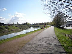
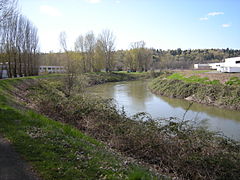
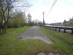 The north end of the trail in northern Tukwila, just south of Seattle, photographed in 2009.
 -
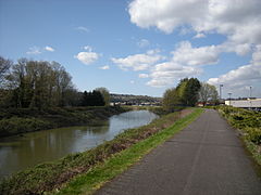
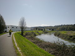
 In 2020, there is a more precise marking of the official north end of the trail (although a small gravel and dirt path continues north to the riverbank).
 -
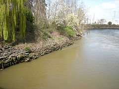
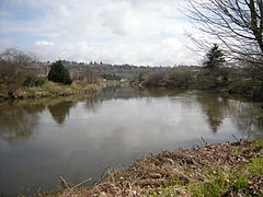
 Just off the trail: the Turning Basin of the Duwamish River.
 -
 Here's a view toward Downtown.
 -
 Entrance from the trail to the habitat restoration site at the Turning Basin.
 -
 Habitat restoration site.
 -
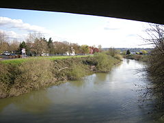
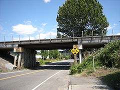
 Looking west across Washington State Route 509 to the hillside, near S 112th Street.
 -
 And looking toward Mount Rainier.


Cecil Moses Memorial Park & North Wind's Weir[edit]
-
 Approaching Cecil Moses Memorial Park.
 -
 Cecil Moses Memorial Park.
 -
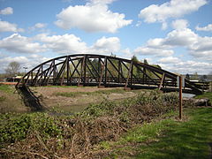
 Bicycle/pedestrian bridge, seen from Cecil Moses Memorial Park, west of the Duwamish. The trail crosses over this bridge and, for a short distance, runs along the east bank of the river.
 -
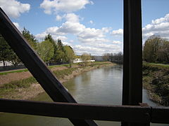
 Bicycle/pedestrian bridge, seen from upstream, east of the Duwamish.
 -
 The shore of Cecil Moses Memorial Park, held in place by old tires. This is looking downstream from the bridge.
 -
 Looking slightly to the right, you can see North Wind's Weir.
 -
 North Wind's Weir, by tradition the remnant of an ice weir the North Wind used to dam the river in a war with the Chinook Wind.
 -
 The bicycle/pedestrian bridge can be seen in this panoramic view. North Wind's Weir is at right, with a good bit of vegetation and some grazing waterfowl. The wooded land at left is part of Cecil Moses Memorial Park.


Link Light Rail and Tukwila International Boulevard[edit]
-
 Trail sign behind the Boeing offices on Tukwila International Boulevard. This is looking north ("downstream").
 -
 Looking downstream from Tukwila International Boulevard, where the trail crosses the river…
 -
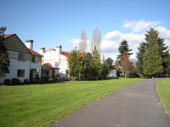
 …this house is prominently visible on the far side of Washington State Route 99.
 -
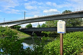
 Looking upstream from Tukwila International Boulevard to where Sound Transit Link Light Rail and (on the low bridge) East Marginal Way S. cross the river.
 -
 Another trail sign, a bit upriver, also looking downstream. Boeing offices on Tukwila International Boulevard can be seen in the background.
 -
 The other side of that sign, and Sound Transit Link Light Rail crossing the river. This is looking upstream.


Allentown and the former Riverton[edit]
Allentown (on the right bank) and the former Riverton (on the left bank).
-
 A small research barge moored just east of East Marginal Way.
 -
 Piers of another former bridge on 38th Avenue S just north of S. 116th Street.
 -
 The trail itself diverges from the river here. This view looks north (backward from the sequence of these photos).
 -
 Again, the trail comes near the line of Link Light Rail.
 -
 South 119th Street pedestrian bridge, a block or so east of the trail, seen here from the east bank of the Duwamish.
 -
 Looking downstream (north) from the pedestrian bridge.
 -
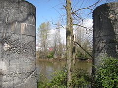
 Looking upstream to Tukwila's Allentown Bridge from the pedestrian bridge. The small island you can see here and in the next two photos is the mid-river pier of the former Riverton Bridge (1903–1927). More at HistoryLink.org.
 -
 A more zoomed-in view of the Allentown Bridge and the remnant of the Riverton Bridge.
 -
 Looking back to the pedestrian bridge from under the Allentown Bridge.
 -
 Looking upstream from the Allentown Bridge.
 -
 City of Tukwila Community Center just upstream of the Allentown Bridge.


Codiga Farms and Tukwila Commerce Park[edit]
The following three images are take from roughly the same location.
-
 Looking downstream. Buildings at left are part of the Tukwila Commerce Park.
 -
 Across the river, Codiga Farms, now a salmon and osprey restoration area, was the last working farm this far north on the Duwamish.
 -
 Looking upstream. Interstate 5 crosses the river, as S. 159 Street vaults over the Interstate.


-
 Just upstream, looking under Interstate 5.

Foster[edit]
-
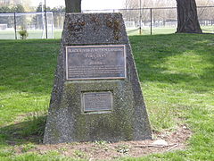
 Plaque memorializing Foster Station of the Interurban (the Puget Sound Electric Railway).
 -
 View downstream from just below that plaque.
 -
 Upstream, on the other side of South 56th Street, this plaque memorializes the even earlier Foster Landing, used by 19th century riverboats.


Extreme Upper Duwamish[edit]
-
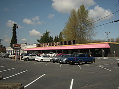 The Riverside Casino on Interurban Ave. S. is about half a mile (0.8 km) downstream of where the Black River once joined the Duwamish.
 -
 This portion of the Foster Golf Links lies on the far side of the river and can be reached only by a private bridge.


Confluence of the Green and Black Rivers[edit]
At Fort Dent, the Black River (now little more than a stream and storm drainage) joins the Green River to form the Duwamish. The Fort Dent Pedestrian Bridge crosses just above the junction.
-
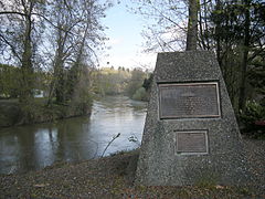
 A plaque in Fort Dent Park memorializes 19th century riverboat service and the Black River Junction.
 -
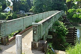
 Fort Dent Pedestrian Bridge seen from left bank of the Duwamish.
 -
 Entering the Fort Dent Pedestrian Bridge from left bank of the Green River.
 -
 View from Fort Dent Pedestrian Bridge: looking downstream on the Duwamish River and, at right, upstream on the Black River
 -
 Entering the Fort Dent Pedestrian Bridge from right bank of the Green River.
 -
 Fort Dent Pedestrian Bridge seen from right bank of the Green River.


Green River[edit]
Fort Dent Park to Bicentennial Park[edit]
-
 Bicycle approaching from "upstream" on the right bank of the Green River in Fort Dent Park.
 -
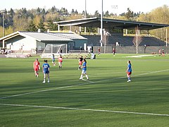 Starfire Sports Complex, just off of the trail in Fort Dent Park.
 -
 The Interurban Trail branches off.
 -
 Plaque memorializing historic Nelson Landing.
 -
 A view from near that plaque.
 -
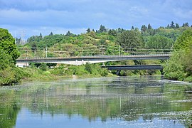
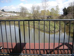
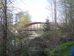
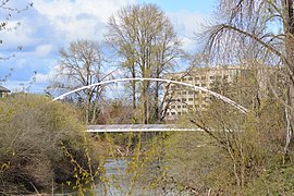 The new (2018) Tukwila Urban Center Pedestrian Bridge, seen from upriver.
 -
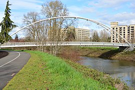 Closer view of the same bridge.
 -
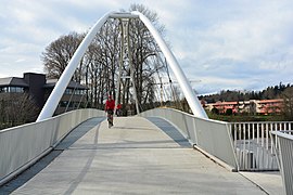 Tukwila Urban Center Pedestrian Bridge, seen from West Valley Highway.
 -
 Picnic shed in Bicentennial Park, in the form of a log cabin.


Bicentennial Park to Minkler Pond[edit]
-
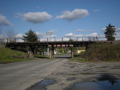
 Looking upriver at the Union Pacific rail bridge over the Green River somewhat south of Strander Boulevard.
 -
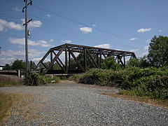
 Another view of the same bridge.
 -
 And a view looking downriver.
 -
 Rail switch across the trail from that bridge.
 -
 Looking farther that direction, with the Hotel Interurban in the distance.
 -
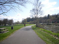
 Looking upriver just before Minkler Pond.
 -
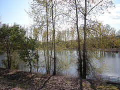 Minkler Pond is on the west side of the trail; the river is on the right.


Minkler Pond to Briscoe Park[edit]
-
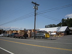
 The trail passes behind the Tukwila Costco.
 -

-
 After rounding a small peninsula, you head northwest approaching a trail bridge…
 -
 …seen more clearly here.
 -
 Bicycle approaching on bridge.
 -
 Looking downriver from bridge.
 -
 Looking back downriver to bridge after crossing.
 -
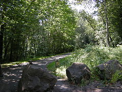
 Along the Desimone Levee.
 -
 Approaching Briscoe Park. This is the first of these images in Kent, not Tukwila, (though across the river here is still Tukwila).
 -
 Briscoe Park.


Briscoe Levee, Three Friends Fishing Hole, and south[edit]
-
 South of Briscoe Park, along the Briscoe Levee.
 -
 Trees in a parking lot.
 -
 At Three Friends Fishing Hole, a path leads down to a good fishing spot on the river.
 -
 Heritage Farm Training Center - horse boarding, etc.


Green River Natural Resources Area[edit]
-
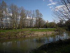
 Looking from Anderson Park along the trail to North Observation Tower of Green River Natural Resources Area.
 -
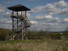 Closeup of North Observation Tower.
 -
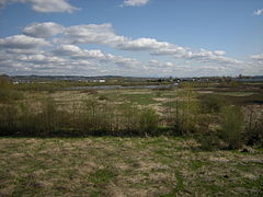 View southeast from North Observation Tower. Ponds in middle distance.
 -
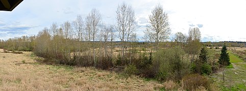 Panoramic view southeast from the North Observation Tower.
 -
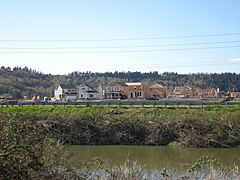 Housing under construction on the far (west) side of the river, 2009.
 -
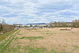 View from North Observation Tower toward KOA and the Amazon Fulfillment Center, 2020.


Green River Natural Resources Area to Riverbend Golf Complex[edit]
-
 In Van Doren's Landing Park (across Russell Road S from the Green River Natural Resources Area) looking south toward the Puget Power Trail Green River Footbridge.
 -
 The Puget Power Trail Green River Footbridge, roughly even with the south boundary of the Green River Natural Resources Area, is the west end of the The Puget Power (PSE) Trail. Seen here looking south, looking upriver, the Russell Road side. You can see the trail on the Frager Road side.
 -
 This looks downstream on the left (Frager Rd.) bank at the new S. 231st Way bridge. The Trail goes under the bridge on the far (right) bank.
 -
 Another view from Frager Road, looking toward Russell Woods Park.
 -
 Still on Frager Road: the gate closing off this part of the road. The trail is on the far (right) bank.
 -
 Pedestrians & bicyclists on trail as it passes Riverbend Golf Complex (seen from Frager Road).
 -
 Meeker Street bridge (from Frager Road) and in front of that a pedestrian bridge…
 -
 …which golfers are crossing here.

_of_Van_Doren%27s_Landing_Park_02.jpg)


Riverbend Golf Complex to Foster Park[edit]
-
 Signature Pointe housing complex seen from pedestrian bridge under the Kent-Des Moines Road bridge…
 -
 … whose viewing platform is a popular teen hang-out.
 -
 Part of the Signature Pointe housing complex.
 -
 Fishing shack
 -
 Farmer out working his field.
 -
 Riverview Park
 -
 Approaching the south junction with the Interurban Trail; Foster Park is on the left.
 -
 South junction of Green River Trail and Interurban Trail; Foster Park is on the right.
 -
 Foster Park.


Foster Park to Central Street[edit]
-
 There is a break in the Green River Trail as such here, but the official route continues on S. 259th St. under this rail bridge.
 -
 On the left, S. 259th St. passes this pallet factory.
 -
 On the right, 3rd Avenue crosses the river.
 -
 After rounding a corner to the right, the levee continues on the right bank; a sign (not shown) indicates the intent to continue the trail here.
 -
 The paved trail resumes behind a business park near S. 266th
 -
 The segment is short, but well constructed.
 -
 The trail then reverts to gravel and breaks to the left to get around this rail bridge...
 -
 ... passes under the tracks, on S. 266th...
 -
 ... heads back to the river...
 -
 ... and soon passes under Center Street as that street crosses the river.


Kent upriver of Central Street[edit]

-
 Worker can be seen doing hand labor in a field across the river.
 -
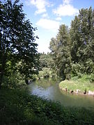 A bend in the river.
 -
 The paved trail ends on Green River Road near 94th Place S. This is looking back at the trail from the road.
 -
 Continuing south (upriver) on Green River Road, one soon comes to these soccer fields...
 -
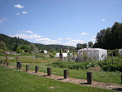 ... and, just to their south, allotment gardens.


Auburn[edit]
-
 Just across the line into Auburn, this pedestrian bridge (presumably a former rail bridge) crosses the river.
 -
 Looking downriver (north), S. 277th St. crosses the river.
 -
 Looking upriver
 -
 The trail resumes briefly through Isaac Evans Park.
 -
 A small beach in the park…
 -
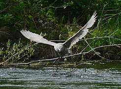 …is a good place to watch wildlife on the river.
 -
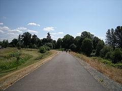
 Trail continues through Isaac Evans Park.
 -
 Beyond this point there is really no trail upriver, but this suspension footbridge crosses the river in Isaac Evans Park to Dykstra Park.
 -
 Looking downriver from the suspension bridge.
 -
 Looking upriver.
 -
 Closeup on the suspension bridge.


